


MODIS Airborne Simulator (MAS)
CAMPAIGN SUMMARY INFORMATION
|
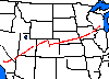
Wisconsin Snow and Cloud - Terra 2000 Dates: 15 March - 04 April 1999 Location: Northern Midwest, Great Lakes, & Canada Principal Investigators: Dr. Chris Moeller (UWisc) Additional Sensors: AirMISR, Camera (RC-10), CLS, & S-HIS Objective: To validate cloud detection, cloud height, and cloud particle characteristics measured by MODIS on TERRA. These flights took place over the DOE ARM CART site in Oklahoma where many ground-based instruments also made cloud measurements. MAS data was used to map the spatial variability of the snow fields to be compared with MODIS. MAS and S-HIS measurements over the DOE ARM CART site will be compared to those from MODIS to measure clear atmospheric temperature and moisture structure, in addtion to validating the radiometric calibration of MODIS. |
||||||||||||||||||||||||||||
|
Processing Information Flights Processed: 10 of 10 Total Flight Tracks: Total Scanlines: Level-1B Version: #1 Calibration Type: Final Calibration Version: WISC-T2000 1.0 Level-1B Configuration: Temperature Adjustment: None Status: Level-1B Data in HDF format is available. |
||||||||||||||||||||||||||||
|
Spectral Information Spectral Band Configuration Spectral Response Function Table |
||||||||||||||||||||||||||||
|
Level-1B Data Distribution Level 1 / Atmosphere Archive and Distribution System (LAADS) NASA Distributive Active Archive Centers (DAACs) |
||||||||||||||||||||||||||||
|
||||||||||||||||||||||||||||
|
Related Web Sites Official WISC-T2000 Home Page AirMISR Home Page CLS Home Page S-HIS Home Page NASA Airborne Science Program |
||||||||||||||||||||||||||||
 Flight: 00-062
 Flight: 00-063
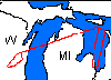 Flight: 00-064
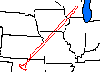 Flight: 00-065
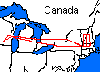 Flight: 00-068
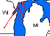 Flight: 00-069
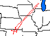 Flight: 00-070
 Flight: 00-071
WISC-T2000


| Sample Imagery |
| Click image for full resolution |
|
Flight: 00-062, Track #04 Southern Utah |


|
|
R: 2.15µm G: 1.64µm B: 0.55µm |
- NASA Official: Matt Fladeland
- Project Manager: James Jacobson
- Website Editor: Eric Fraim
- Last Updated: March 21, 2024


