


MODIS Airborne Simulator (MAS)
CAMPAIGN SUMMARY INFORMATION
|
Alaska April-95 Dates: 31 March - 25 April 1995 Location: Central to Northern Alaska & Bering Sea Principal Investigators: Hall (NASA GSFC) Objective: Use remotely sensed data to map snow and ice and make measurements of first-year and multi-year sea ice. |
||||||||||||||||||||||||||||||||
|
Processing Information Flights Processed: 10 of 10 Total Flight Tracks: 159 Total Scanlines: 718247 Level-1B Version: #09 Calibration Type: Final Calibration Version: ALASKA_King 1.0 Temperature Adjustment: 36C Status: Level-1B Data in HDF format is available. |
||||||||||||||||||||||||||||||||
|
Spectral Information Spectral Band Configuration Spectral Response Function Table | ||||||||||||||||||||||||||||||||
|
Level-1B Data Distribution Level 1 / Atmosphere Archive and Distribution System (LAADS) NASA Distributive Active Archive Centers (DAACs) |
||||||||||||||||||||||||||||||||
|
||||||||||||||||||||||||||||||||
|
Related Web Sites NASA Airborne Science Program |
||||||||||||||||||||||||||||||||
 Flight: 95-070
 Flight: 95-071
 Flight: 95-072
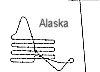 Flight: 95-073
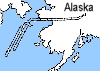 Flight: 95-074
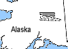 Flight: 95-075
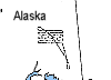 Flight: 95-076
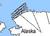 Flight: 95-077
 Flight: 95-078
 Flight: 95-079
Alaska April-95


| Sample Imagery |
| Click image for full resolution |
|
Flight: 95-070, Track #17 Mt. Churchill, Alaska |


|
|
R: 2.14µm G: 0.95µm B: 0.65µm |
- NASA Official: Matt Fladeland
- Project Manager: James Jacobson
- Website Editor: Eric Fraim
- Last Updated: March 21, 2024


