
|
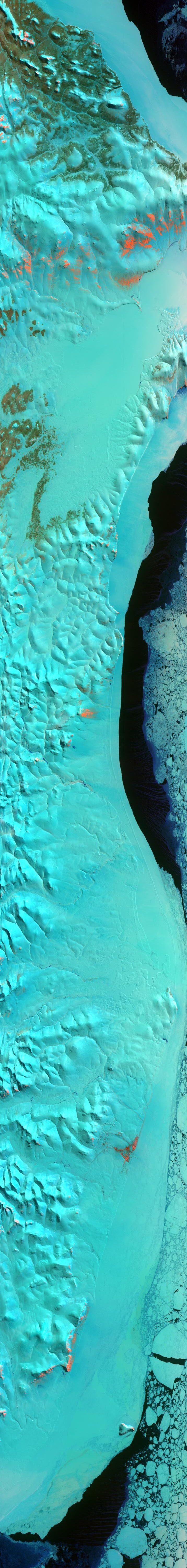
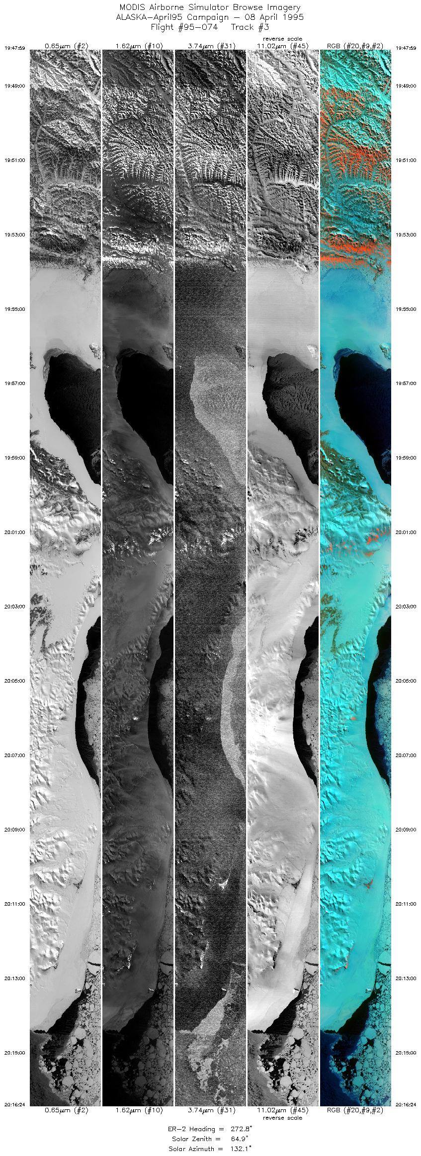
Sample Image

8 April 1995
Track #03


"Ice encrusted Nome, Alaska on the southern coast of the Seward Peninsula"
R: 2.14 microns
G: 0.95 microns
B: 0.65 microns
|
|
Summary Information
Date: April 8, 1995
ER-2 Flight Number: 95-074
Location: Bering Sea, Alaska
Principle Investigator: Dr. Dorothy Hall (NASA GSFC)
Additional Sensors: Dual_B&W_6"_RC-10, MIR
Level-1B Processing Information
Level-1B Data Version: #09
Calibration Type: Final
Calibration Version: ALASKA_King 1.0
Temperature Adjustment: Yes (36C)
Status: Done!
|
|
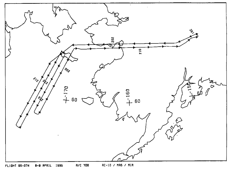
Flight Track Map

|
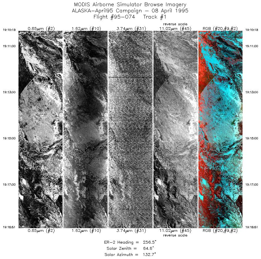
Level-1B Browse Imagery
Straight Line Flight Tracks: 21
Scanlines Processed: 110375
Solar Azimuth and Zenith Angles
|
Browse Images
|
Click on the Flight Track number to load images.
Lat/Lon ranges are for the BEG-END scanline nadir pixels.
|
Flight
Track |
Time_Span
(GMT) |
Heading
(Deg) |
Lat_Range
(Deg_N) |
Lon_Range
(Deg_W) |
Length
(Scanlines) |
Altitude
(Meters) |
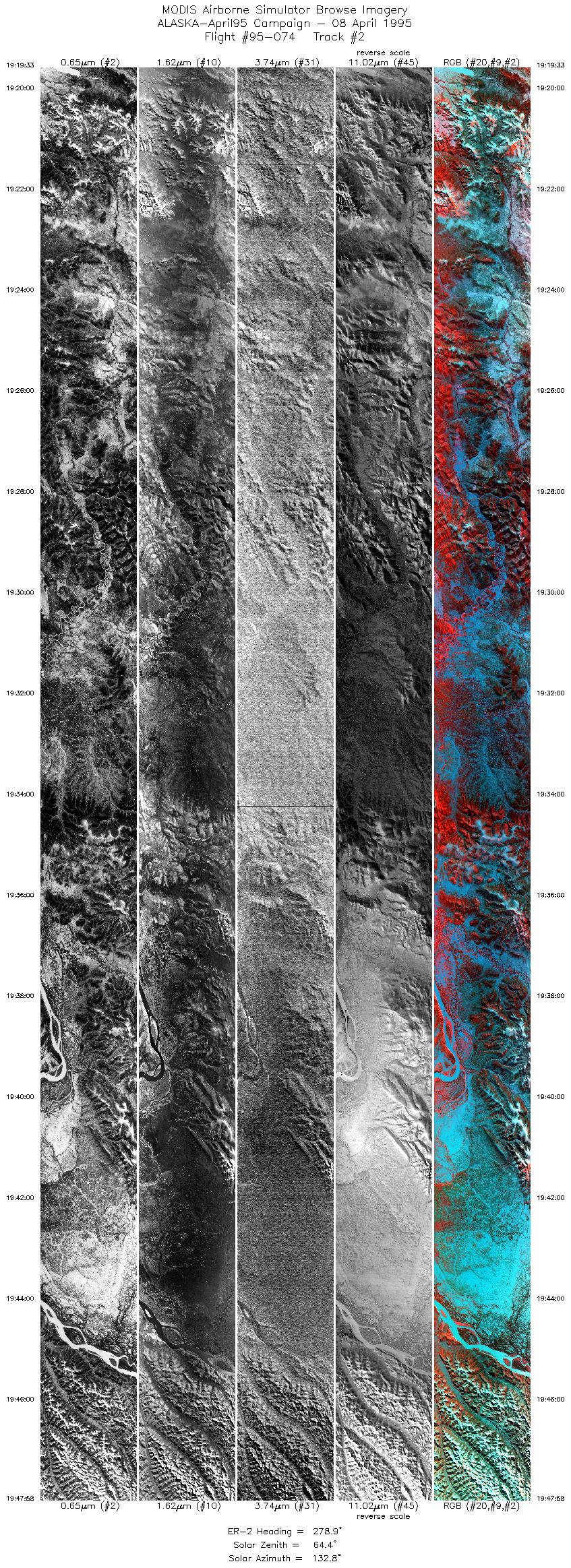
| 1 |
19:10-19:18 |
256 |
64.52-64.31 |
149.03-151.09 |
3201 |
~20000 |
| 2 |
19:19-19:47 |
279 |
64.34-64.65 |
151.26-159.12 |
10639 |
~20000 |
| 3 |
19:47-20:16 |
273 |
64.65-64.53 |
159.15-167.10 |
10639 |
~20000 |
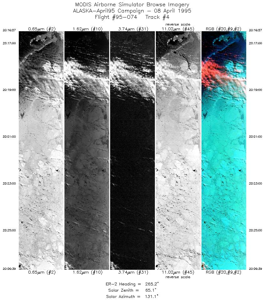
| 4 |
20:16-20:26 |
265 |
64.50-64.35 |
167.10-169.93 |
3820 |
~20000 |
| 5 |
20:27-20:44 |
225 |
64.28-62.81 |
170.22-173.41 |
6395 |
~20000 |
| 6 |
20:45-21:04 |
198 |
62.72-60.62 |
173.48-174.97 |
7032 |
~20000 |
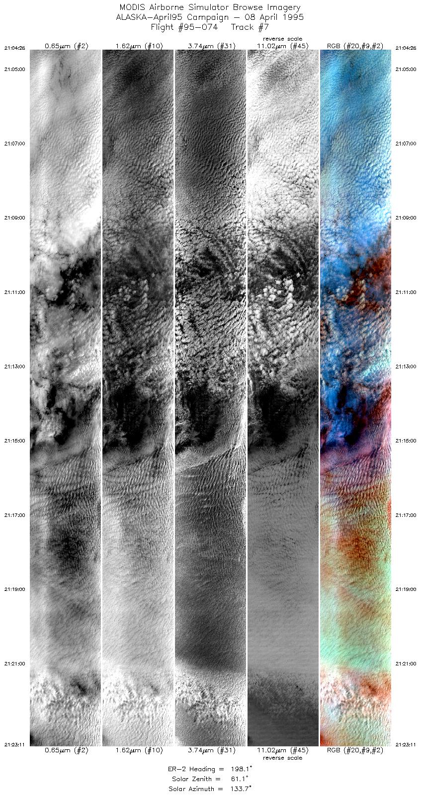
| 7 |
21:04-21:23 |
198 |
60.62-58.52 |
174.97-176.27 |
7019 |
~20000 |
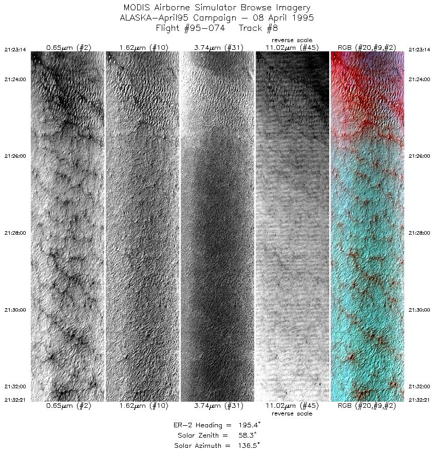
| 8 |
21:23-21:32 |
195 |
58.52-57.49 |
176.26-176.84 |
3413 |
~20000 |
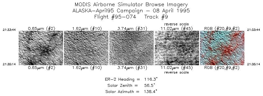
| 9 |
21:33-21:35 |
116 |
57.36-57.28 |
176.73-176.45 |
563 |
~20000 |
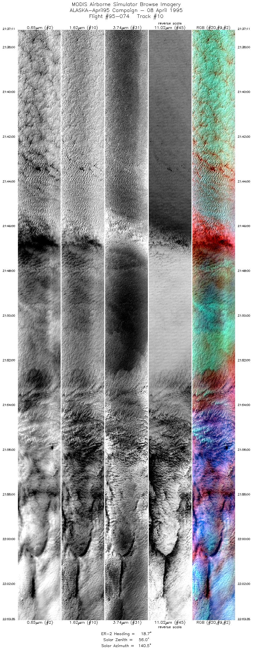
| 10 |
21:37-22:03 |
19 |
57.38-60.31 |
176.18-174.41 |
9883 |
~20000 |
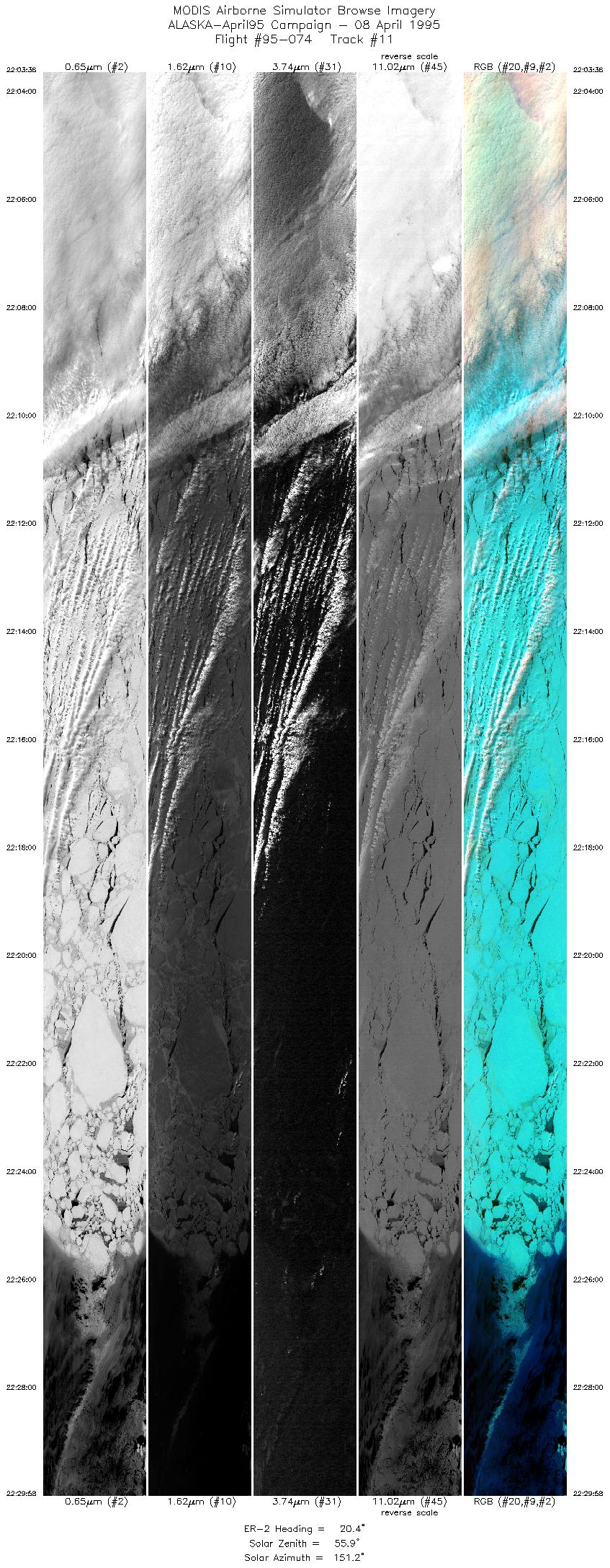
| 11 |
22:03-22:29 |
20 |
60.30-63.21 |
174.42-172.30 |
9870 |
~20000 |
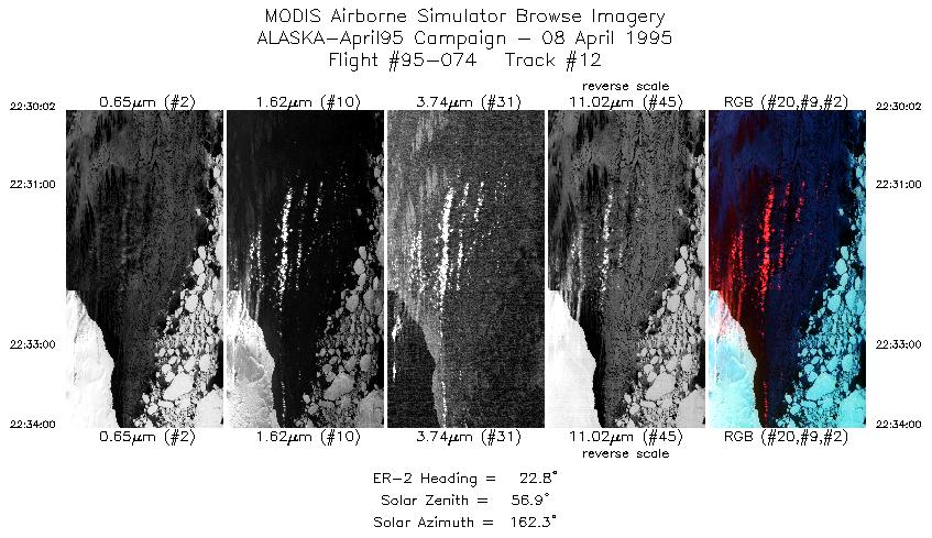
| 12 |
22:30-22:34 |
23 |
63.21-63.64 |
172.27-171.91 |
1445 |
~20000 |
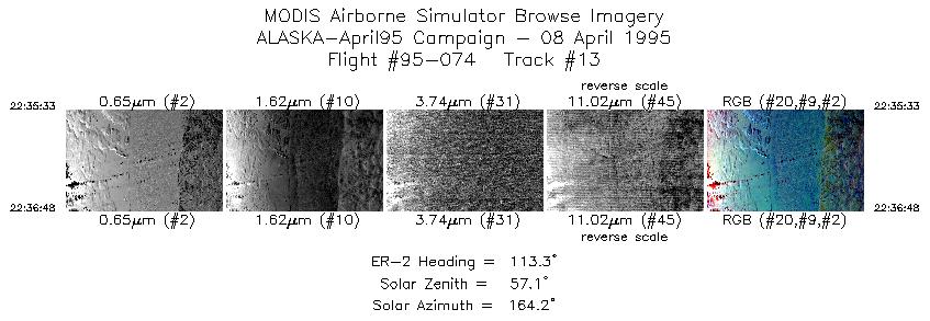
| 13 |
22:35-22:36 |
113 |
63.70-63.64 |
171.60-171.31 |
469 |
~20000 |
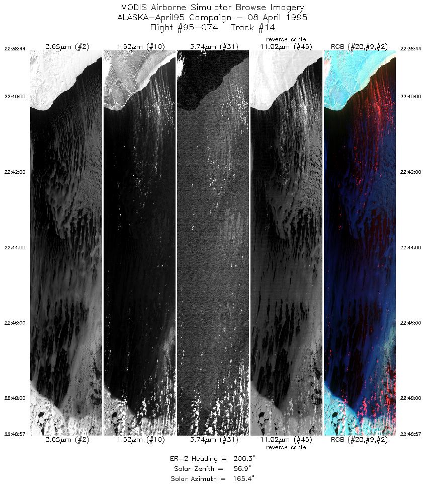
| 14 |
22:38-22:48 |
200 |
63.45-62.31 |
171.19-172.13 |
3826 |
~20000 |
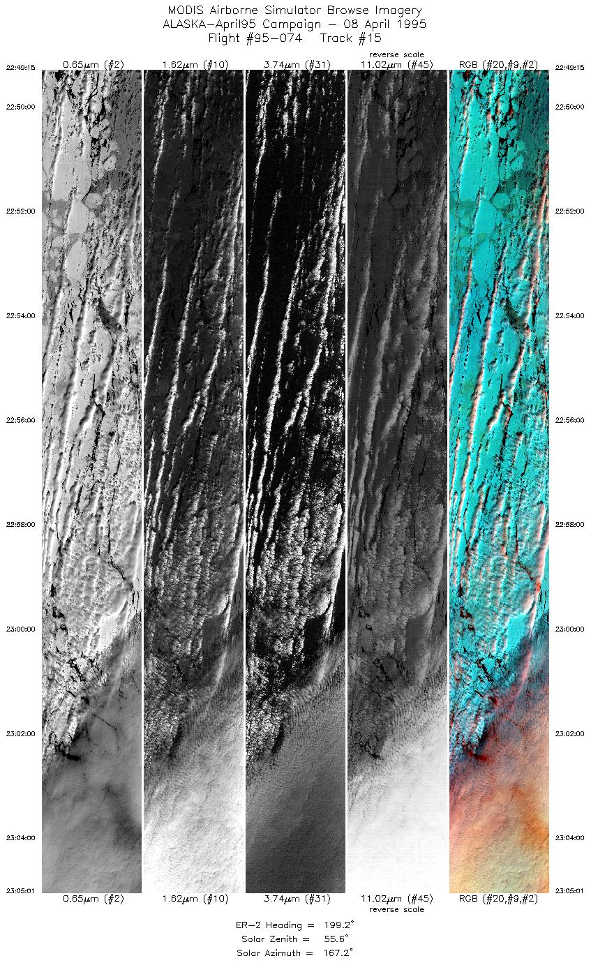
| 15 |
22:49-23:05 |
199 |
62.28-60.54 |
172.16-173.44 |
5903 |
~20000 |
| 16 |
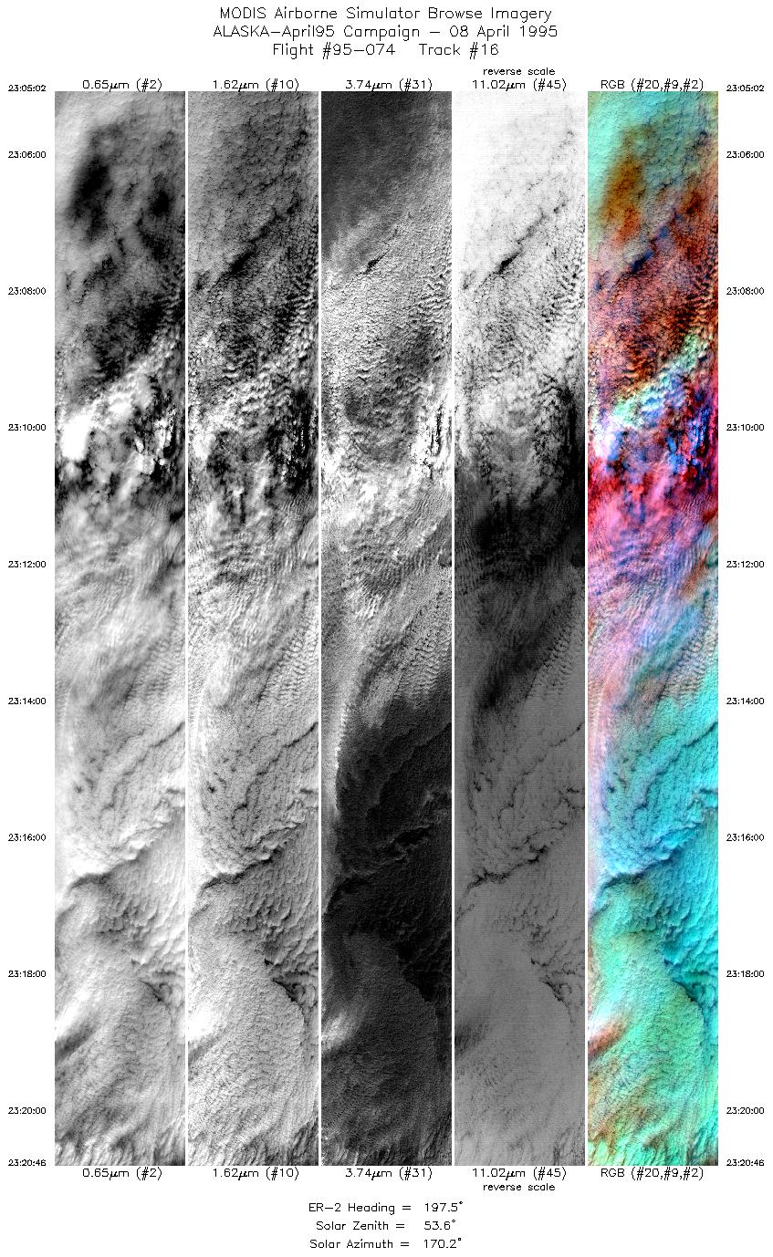
23:05-23:20 |
197 |
60.53-58.78 |
173.45-174.59 |
5891 |
~20000 |
| 17 |
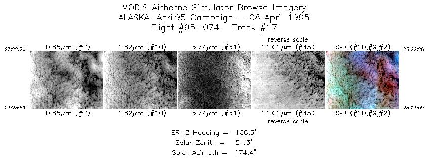
23:22-23:23 |
107 |
58.62-58.58 |
174.44-174.12 |
580 |
~20000 |
| 18 |
23:25-23:40 |
22 |
58.69-60.36 |
173.81-172.68 |
5628 |
~20000 |
| 19 |
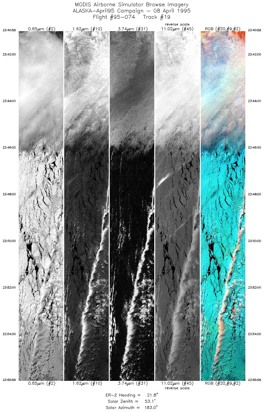
23:40-23:55 |
22 |
60.36-61.99 |
172.68-171.46 |
5616 |
~20000 |
| 20 |
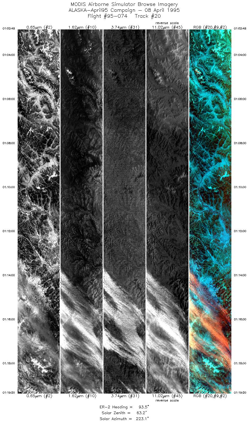
01:02-01:19 |
93 |
64.29-64.17 |
157.22-152.90 |
6190 |
~20000 |
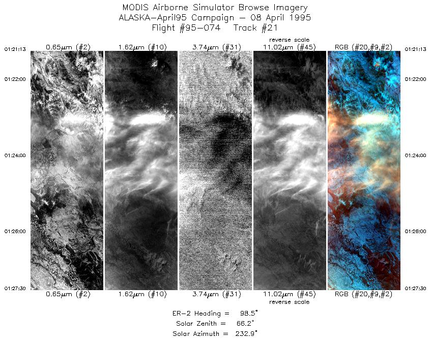
| 21 |
01:21-01:27 |
98 |
64.12-64.01 |
152.43-150.83 |
2353 |
~20000 |
|
Images 01 through 21 in sequence |
Level-1B HDF Data Distribution Point
NASA GSFC Earth Sciences (GES) Data Center
NASA DAAC's
|
|