
|
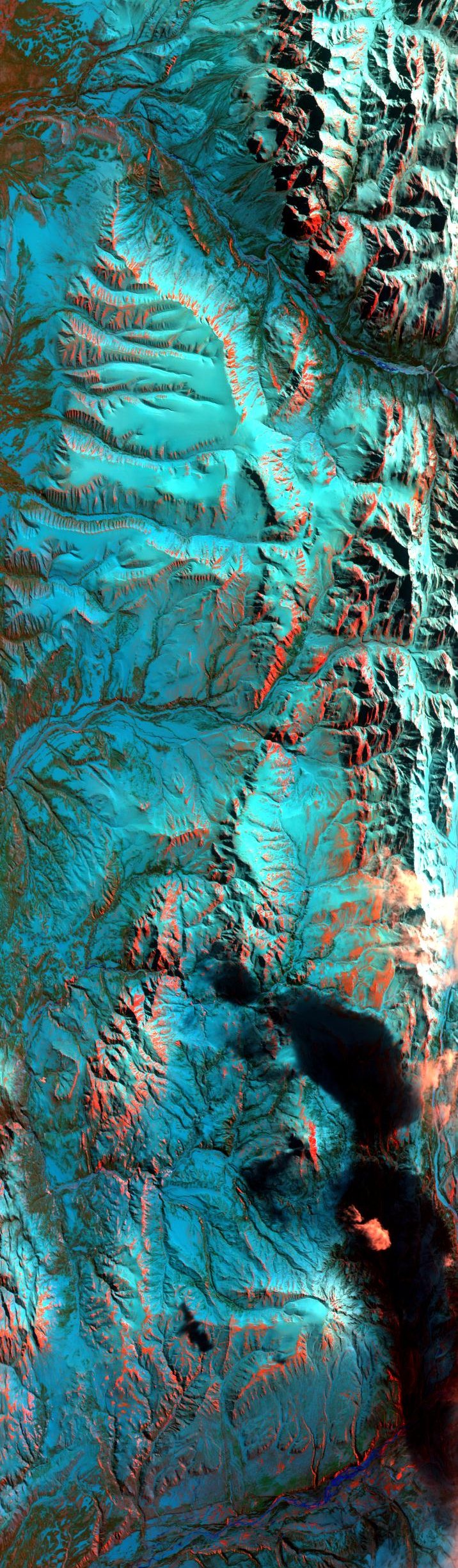
Sample Image

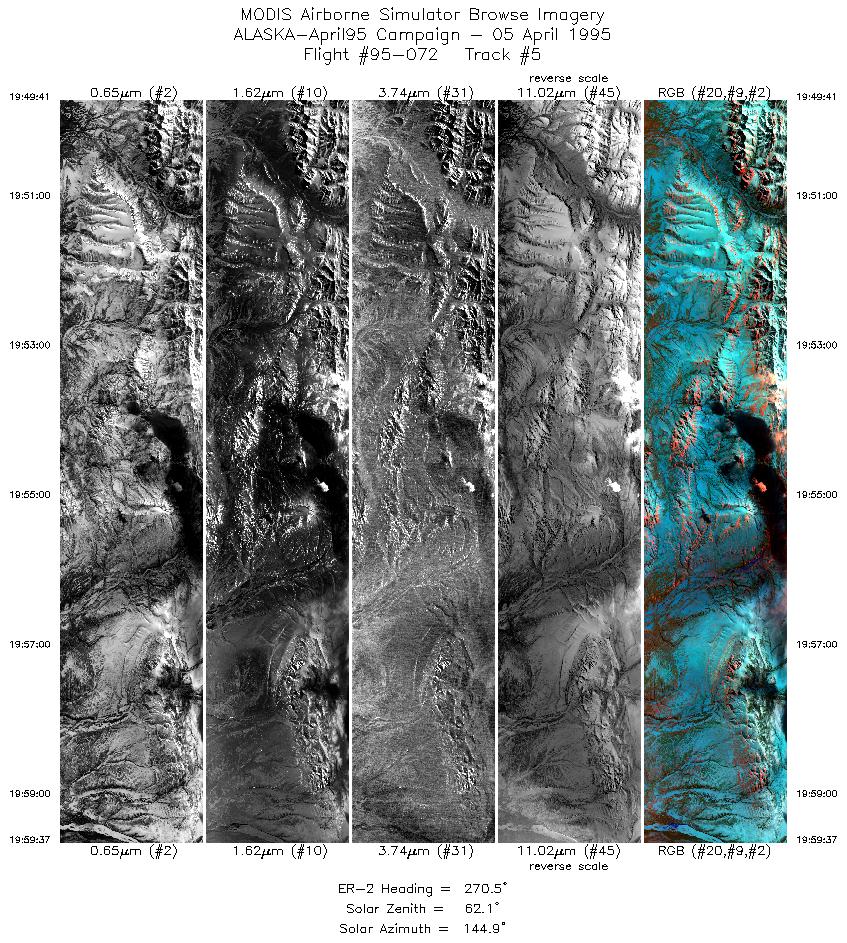
5 April 1995
Track #05
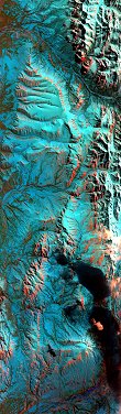

"Snow covered ridges just north of Mount Hayes, Alaska"
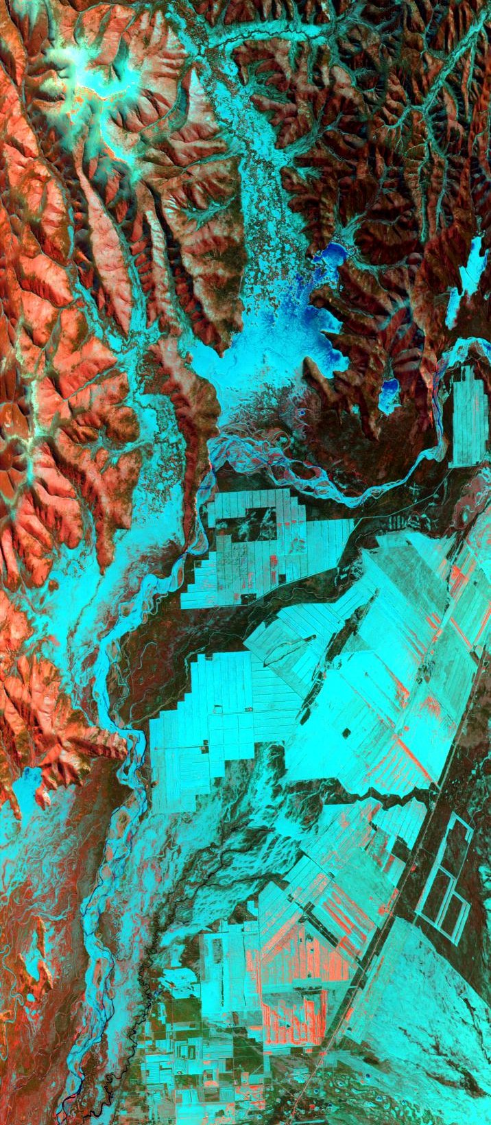
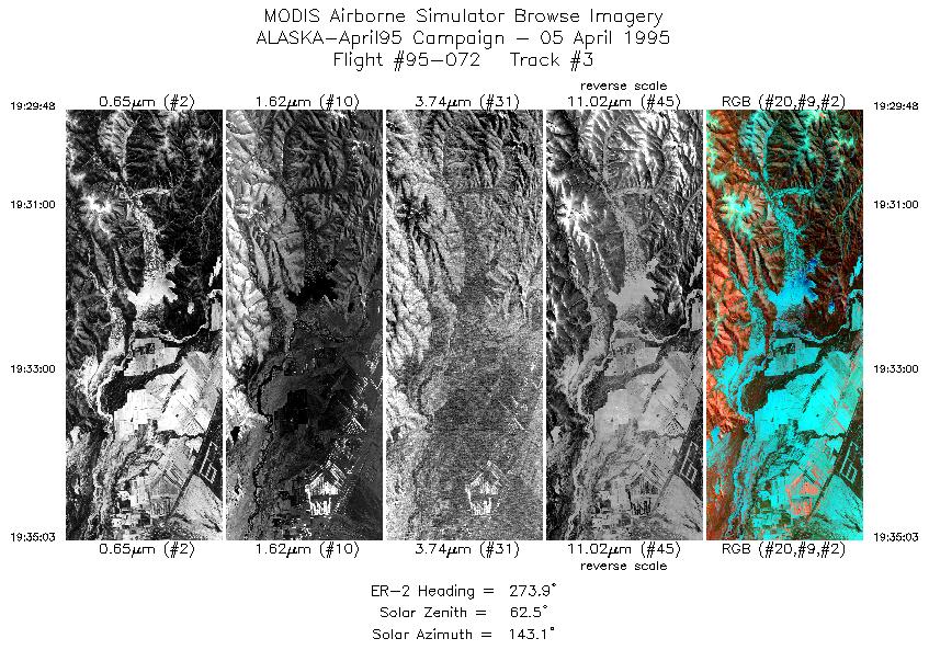
5 April 1995
Track #03
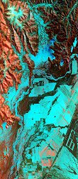
"Fort Greely Military Reservation in the Delta River Basin, Alaska"
R: 2.14 microns
G: 0.95 microns
B: 0.65 microns
|
|
Summary Information
Date: April 5, 1995
ER-2 Flight Number: 95-072
Location: North Slope, Alaska
Principle Investigator: Dr. Dorothy Hall (NASA GSFC)
Additional Sensors: B&W_6"_RC-10, MIR
Level-1B Processing Information
Level-1B Data Version: #09
Calibration Type: Final
Calibration Version: ALASKA_King 1.0
Temperature Adjustment: Yes (36C)
Status: Done!
|
|
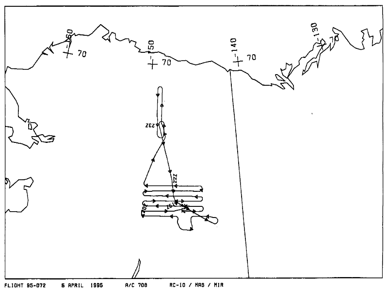
Flight Track Map

|
Level-1B Browse Imagery
Straight Line Flight Tracks: 23
Scanlines Processed: 65882
Solar Azimuth and Zenith Angles
|
Browse Images
|
Click on the Flight Track number to load images.
Lat/Lon ranges are for the BEG-END scanline nadir pixels.
|
Flight
Track |
Time_Span
(GMT) |
Heading
(Deg) |
Lat_Range
(Deg_N) |
Lon_Range
(Deg_W) |
Length
(Scanlines) |
Altitude
(Meters) |
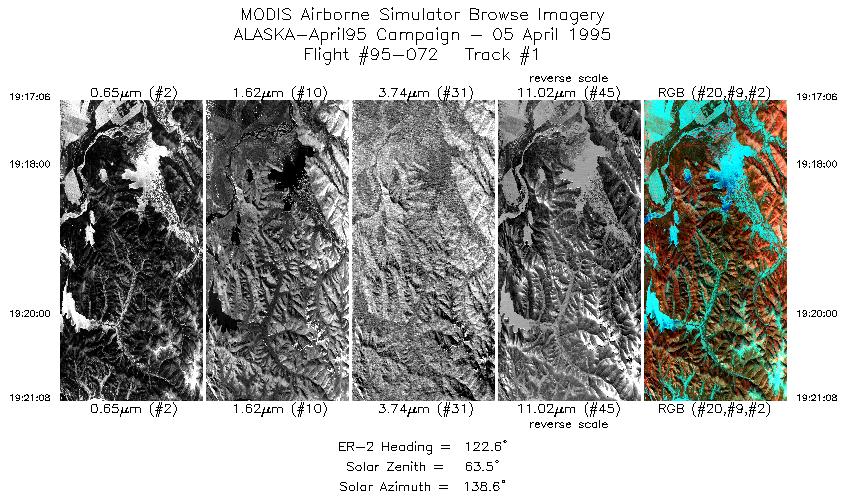
| 1 |
19:17-19:21 |
123 |
64.01-63.81 |
144.96-144.21 |
1509 |
~20000 |
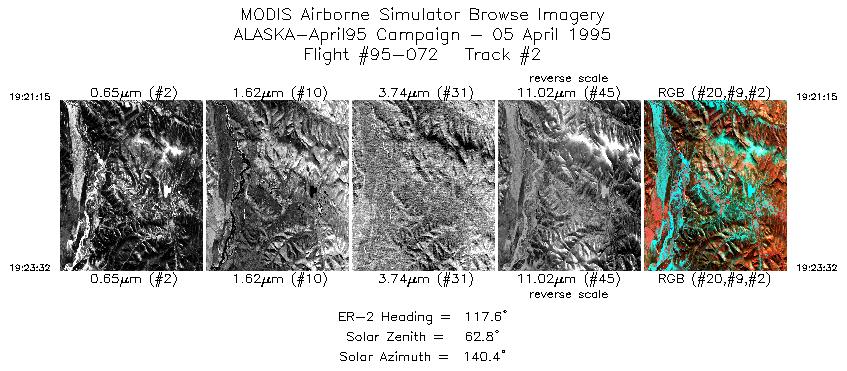
| 2 |
19:21-19:23 |
118 |
63.81-63.70 |
144.19-143.74 |
855 |
~20000 |
| 3 |
19:29-19:35 |
274 |
63.98-64.01 |
144.15-145.55 |
1965 |
~20000 |
| 4 |
19:41-19:42 |
275 |
63.47-63.48 |
146.05-146.44 |
563 |
~20000 |
| 5 |
19:49-19:59 |
270 |
64.02-64.00 |
147.43-150.05 |
3719 |
~20000 |
| 6 |
20:03-20:12 |
87 |
64.20-64.22 |
149.83-147.45 |
3388 |
~20000 |
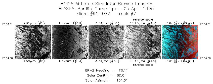
| 7 |
20:13-20:14 |
76 |
64.23-64.27 |
147.34-146.88 |
680 |
~20000 |
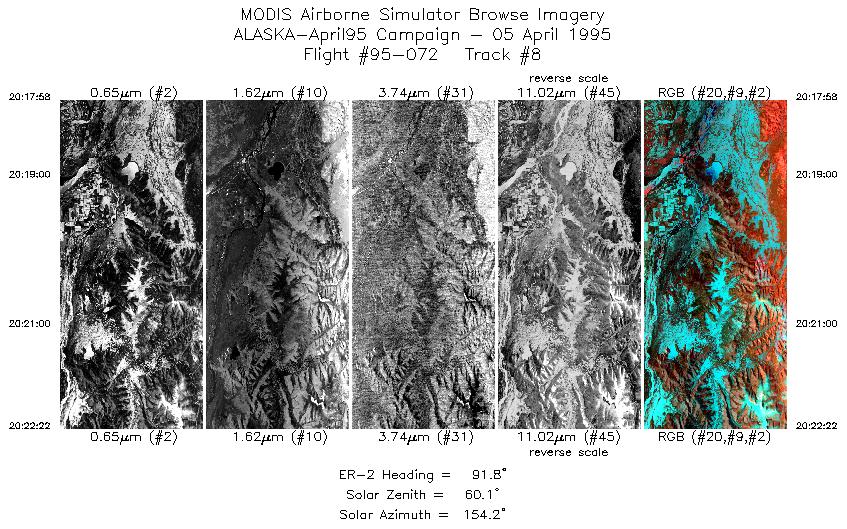
| 8 |
20:17-20:22 |
92 |
64.22-64.20 |
146.07-144.92 |
1648 |
~20000 |
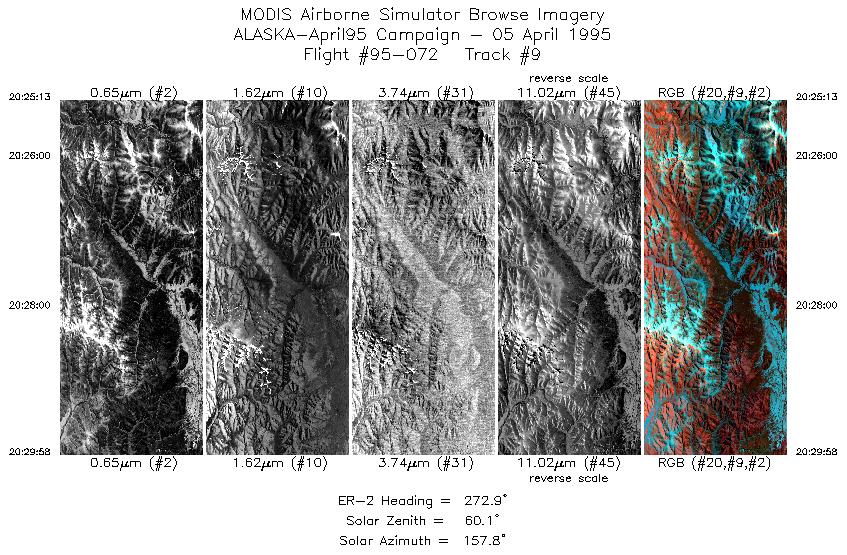
| 9 |
20:25-20:29 |
273 |
64.40-64.42 |
144.86-146.15 |
1779 |
~20000 |
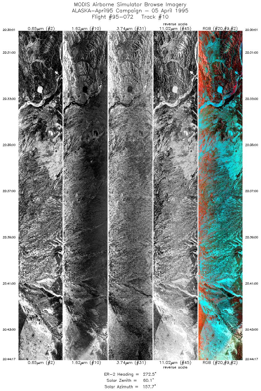
| 10 |
20:30-20:44 |
273 |
64.42-64.41 |
146.16-150.02 |
5340 |
~20000 |
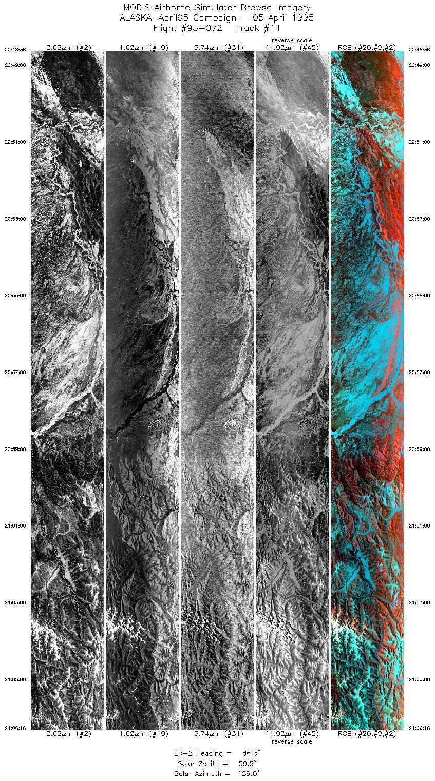
| 11 |
20:48-21:06 |
86 |
64.61-64.61 |
149.64-144.97 |
6614 |
~20000 |
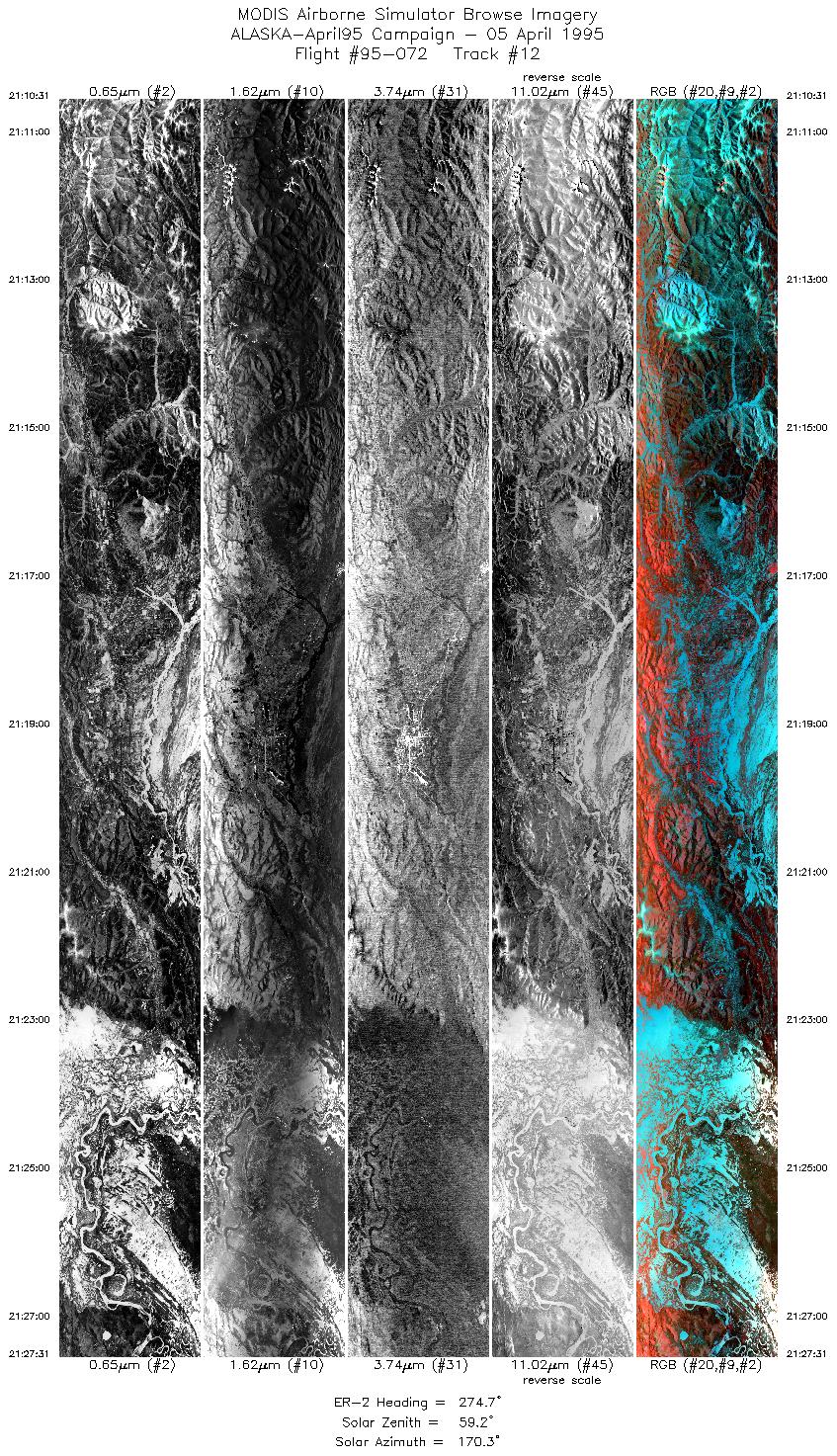
| 12 |
21:10-21:27 |
275 |
64.82-64.81 |
145.32-150.03 |
6365 |
~20000 |
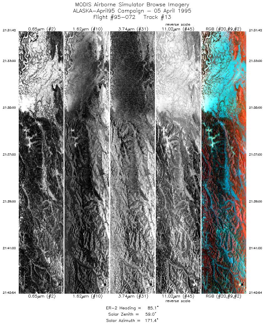
| 13 |
21:31-21:42 |
85 |
65.00-65.03 |
149.66-146.67 |
4192 |
~20000 |
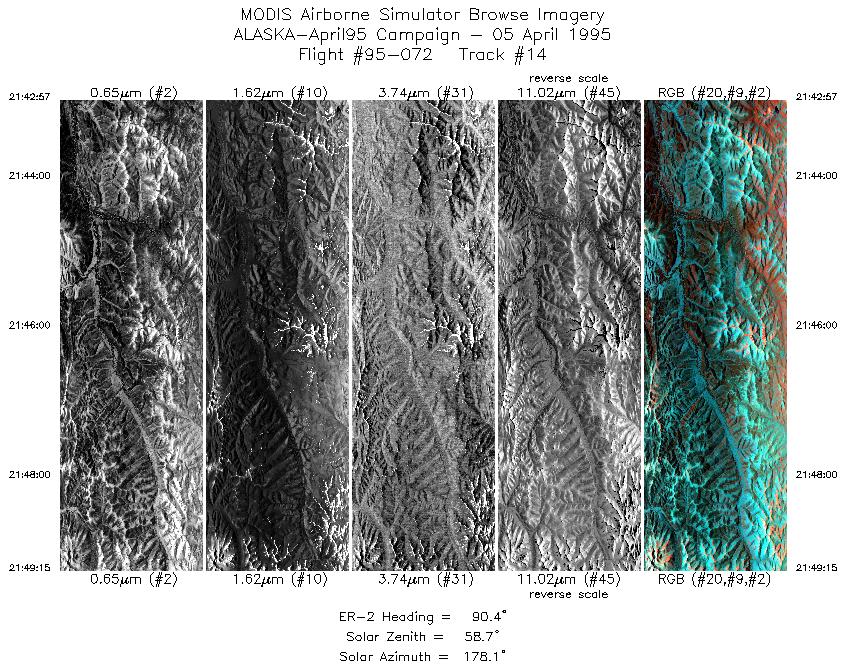
| 14 |
21:42-21:49 |
90 |
65.02-65.00 |
146.65-144.97 |
2359 |
~20000 |
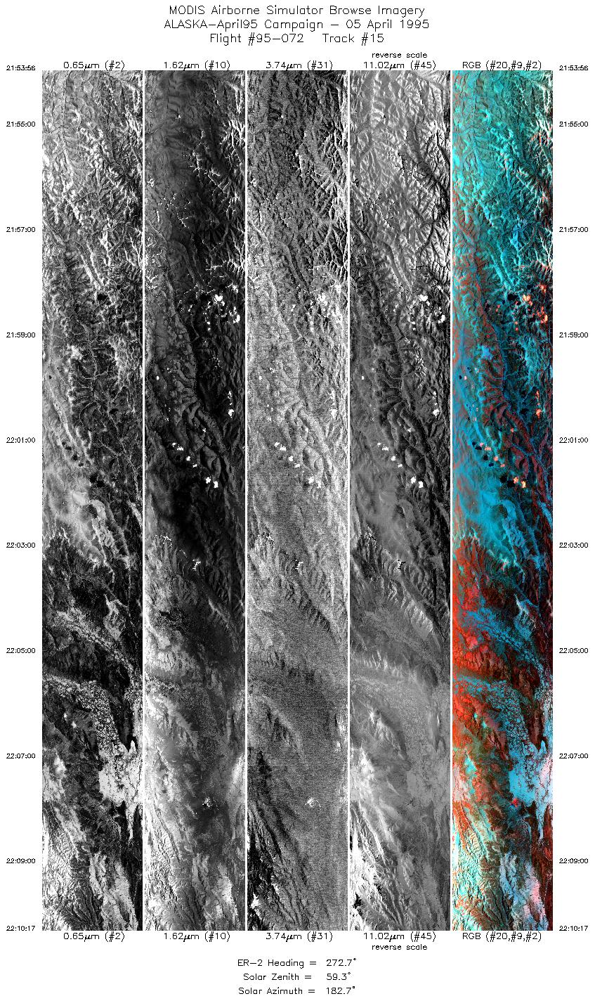
| 15 |
21:53-22:10 |
273 |
65.22-65.21 |
145.43-150.02 |
6121 |
~20000 |
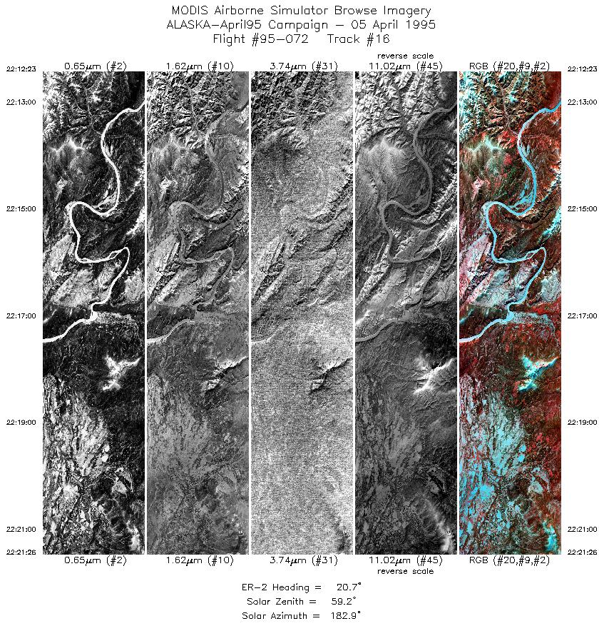
| 16 |
22:12-22:21 |
21 |
65.38-66.36 |
150.21-149.35 |
3388 |
~20000 |
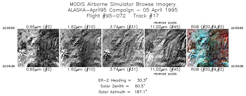
| 17 |
22:22-22:24 |
30 |
66.51-66.69 |
149.16-148.92 |
663 |
~20000 |
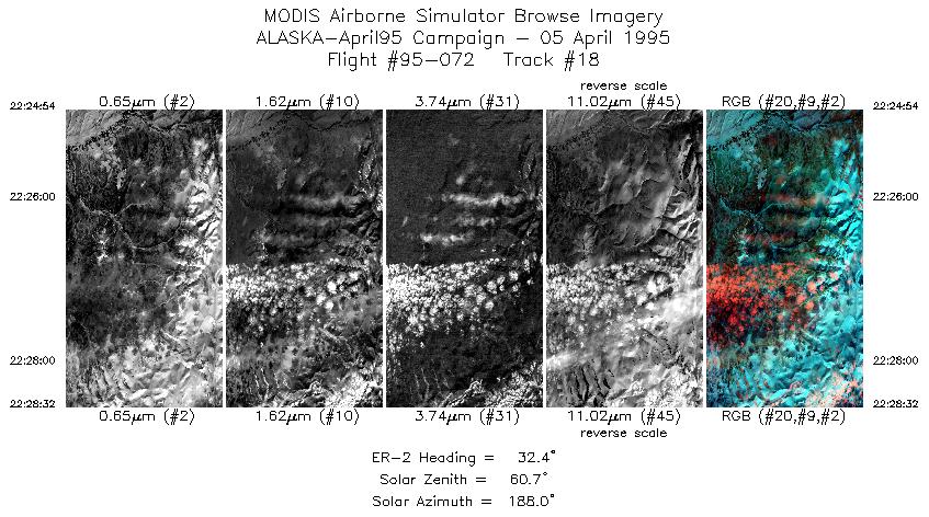
| 18 |
22:24-22:28 |
32 |
66.72-67.08 |
148.88-148.36 |
1361 |
~20000 |
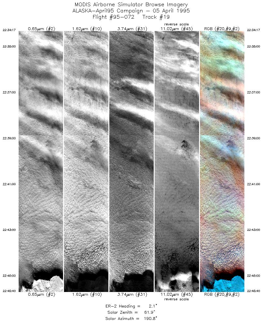
| 19 |
22:34-22:45 |
2 |
67.71-69.02 |
148.75-148.75 |
4206 |
~20000 |
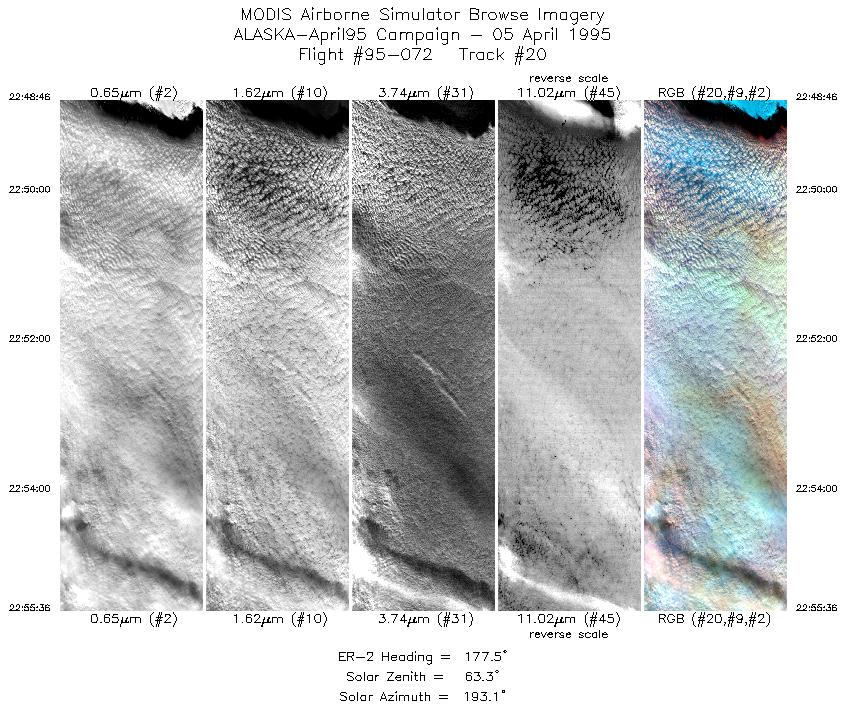
| 20 |
22:48-22:55 |
178 |
68.97-68.16 |
149.26-149.25 |
2559 |
~20000 |
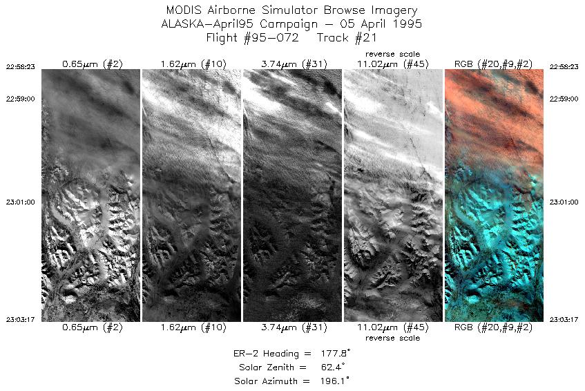
| 21 |
22:58-23:03 |
178 |
67.84-67.26 |
149.17-149.17 |
1834 |
~20000 |
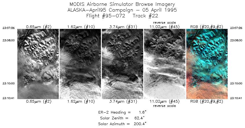
| 22 |
23:07-23:10 |
2 |
67.27-67.65 |
148.46-148.47 |
1217 |
~20000 |
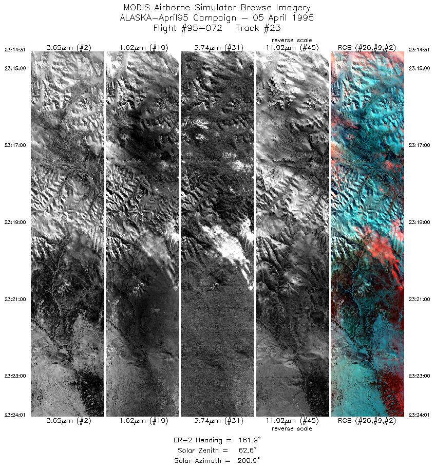
| 23 |
23:14-23:23 |
162 |
67.54-66.47 |
148.93-148.19 |
3557 |
~20000 |
|
Images 01 through 23 in sequence |
Level-1B HDF Data Distribution Point
NASA GSFC Earth Sciences (GES) Data Center
NASA DAAC's
|
|