
|
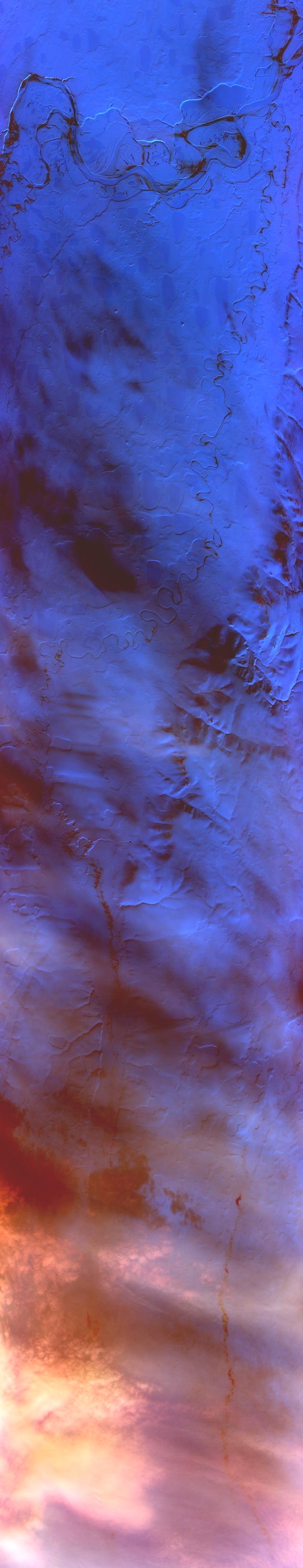
Sample Image

23 April 1995
Track #01
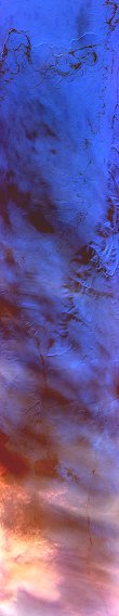

"North Slope ice sheets near the Itkillik River"
R: 2.14 microns
G: 0.95 microns
B: 0.65 microns
|
|
Summary Information
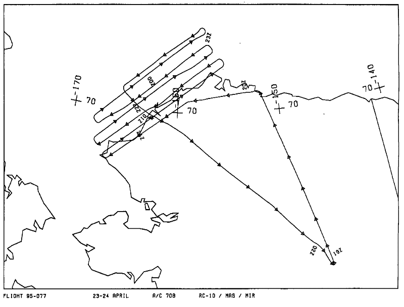
Date: April 23, 1995
ER-2 Flight Number: 95-077
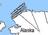
Location: Arctic Ocean
Principle Investigator: Dr. Dorothy Hall (NASA GSFC)
Additional Sensors: Dual_B&W_6"_RC-10, MIR
Level-1B Processing Information
Level-1B Data Version: #09
Calibration Type: Final
Calibration Version: ALASKA_King 1.0
Temperature Adjustment: Yes (36C)
Status: Done!
|
|
Flight Track Map

|
Level-1B Browse Imagery
Straight Line Flight Tracks: 16
Scanlines Processed: 72824
Solar Azimuth and Zenith Angles
|
Browse Images
|
Click on the Flight Track number to load images.
Lat/Lon ranges are for the BEG-END scanline nadir pixels.
|
Flight
Track |
Time_Span
(GMT) |
Heading
(Deg) |
Lat_Range
(Deg_N) |
Lon_Range
(Deg_W) |
Length
(Scanlines) |
Altitude
(Meters) |
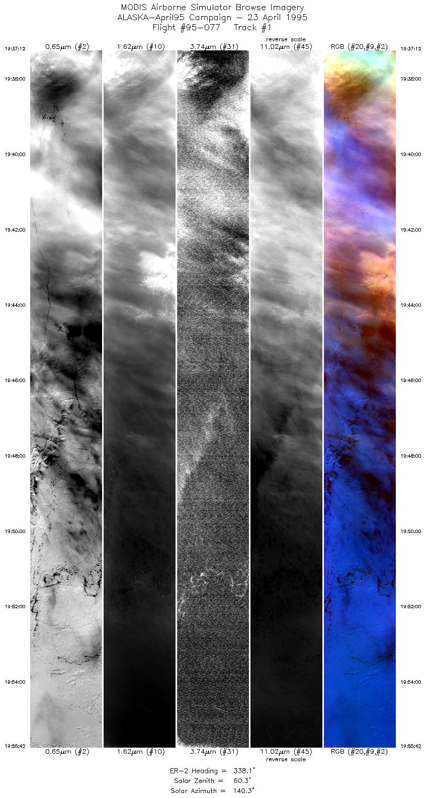
| 1 |
19:37-19:55 |
338 |
68.53-70.57 |
149.75-151.66 |
6926 |
~20000 |
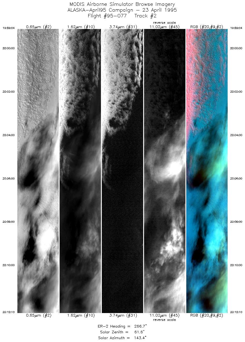
| 2 |
19:59-20:12 |
267 |
70.65-70.48 |
152.72-157.10 |
4907 |
~20000 |
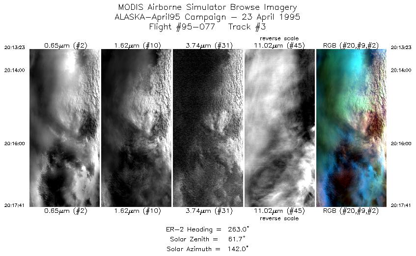
| 3 |
20:13-20:17 |
263 |
70.45-70.38 |
157.49-158.90 |
1611 |
~20000 |
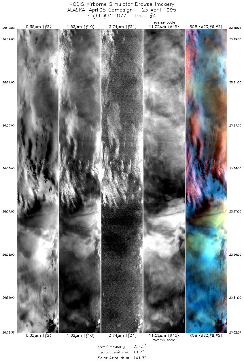
| 4 |
20:18-20:32 |
234 |
70.34-69.38 |
159.16-162.82 |
5299 |
~20000 |
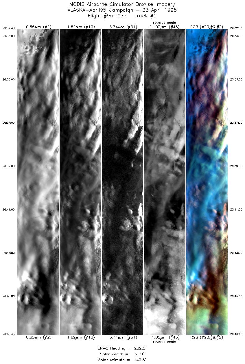
| 5 |
20:32-20:46 |
232 |
69.38-68.34 |
162.83-166.18 |
5286 |
~20000 |
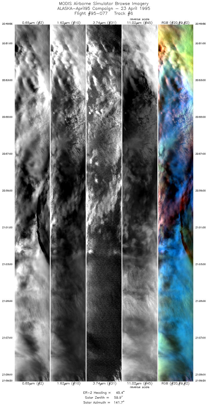
| 6 |
20:49-21:09 |
45 |
68.53-70.09 |
166.52-161.46 |
7271 |
~20000 |
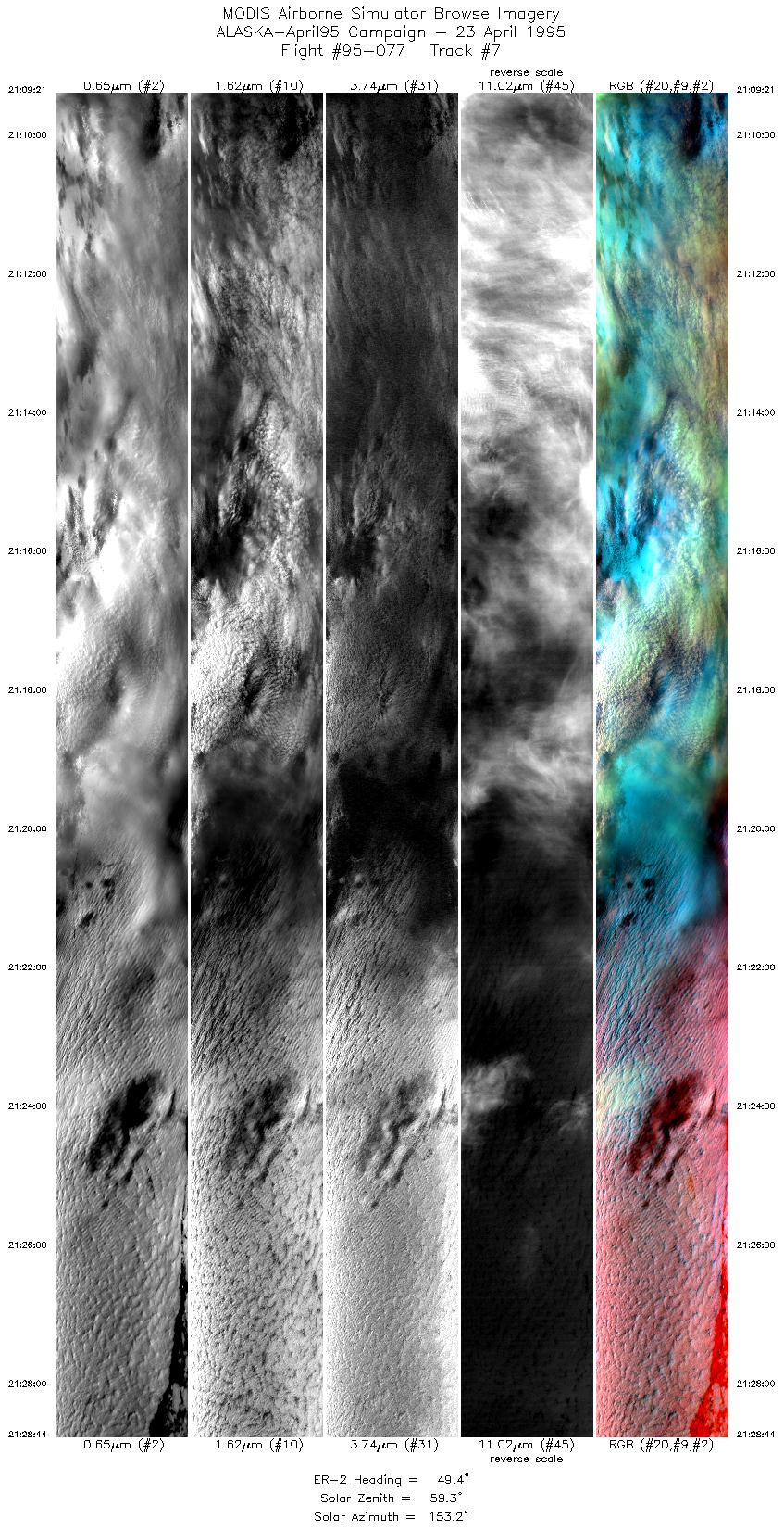
| 7 |
21:09-21:28 |
49 |
70.10-71.52 |
161.48-155.56 |
7258 |
~20000 |
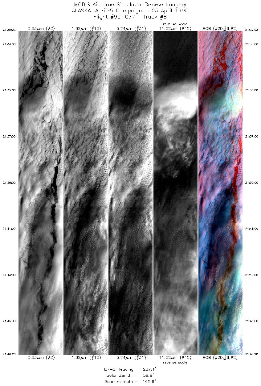
| 8 |
21:32-21:46 |
237 |
71.75-70.86 |
155.98-159.94 |
5262 |
~20000 |
| 9 |
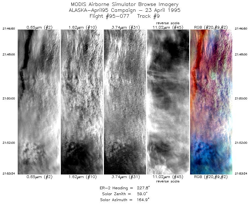
21:46-21:53 |
228 |
70.85-70.37 |
160.07-161.75 |
2459 |
~20000 |
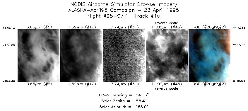
| 10 |
21:54-21:56 |
241 |
70.23-70.11 |
161.82-162.53 |
899 |
~20000 |
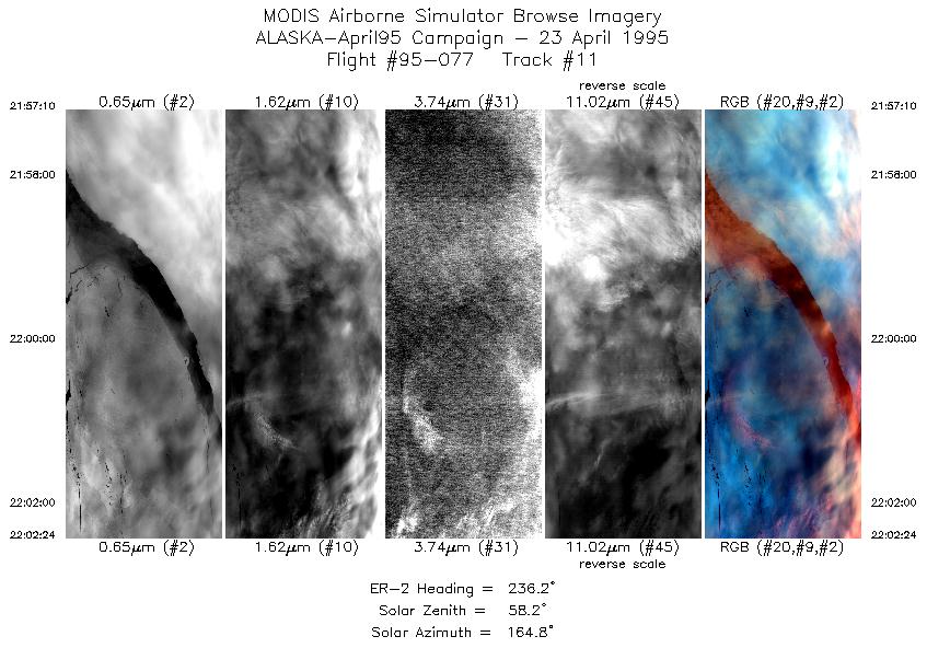
| 11 |
21:57-22:02 |
236 |
70.09-69.72 |
162.71-164.04 |
1960 |
~20000 |
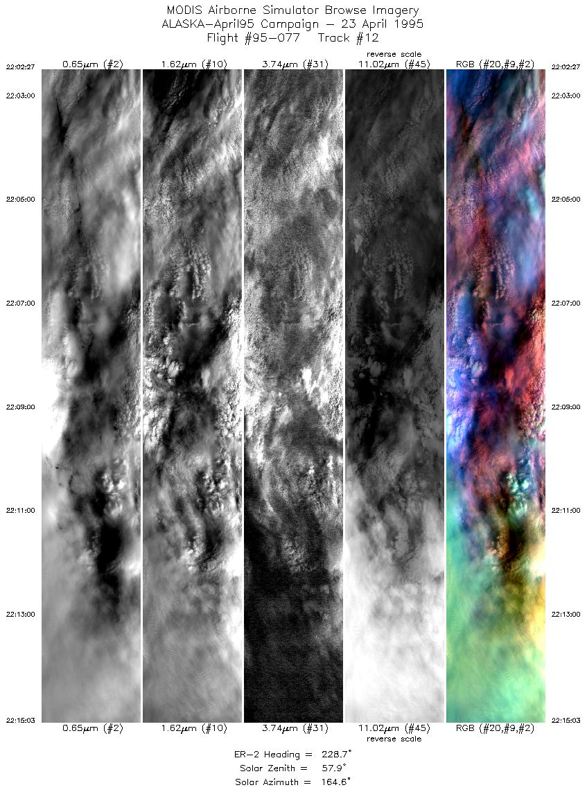
| 12 |
22:02-22:15 |
229 |
69.72-68.75 |
164.06-167.03 |
4719 |
~20000 |
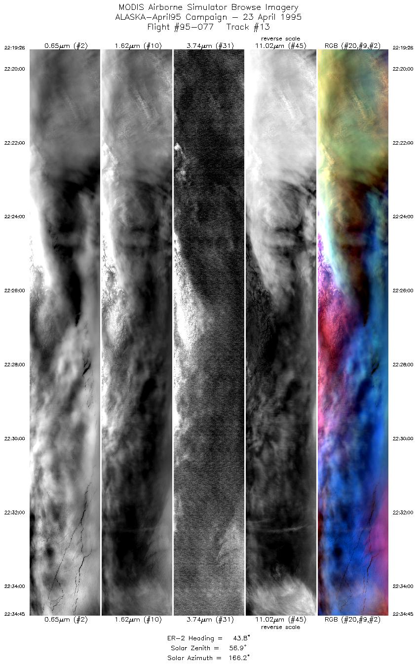
| 13 |
22:19-22:34 |
44 |
69.04-70.24 |
167.40-163.62 |
5735 |
~20000 |
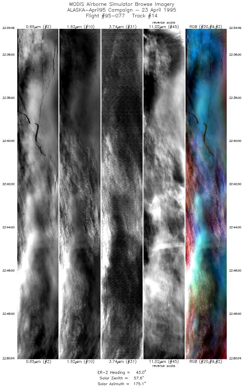
| 14 |
22:34-22:50 |
43 |
70.20-71.51 |
163.76-158.95 |
5730 |
~20000 |
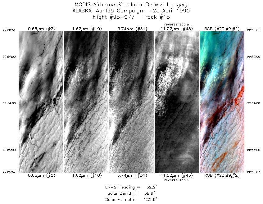
| 15 |
22:50-22:56 |
53 |
71.51-71.95 |
158.56-156.66 |
2285 |
~20000 |
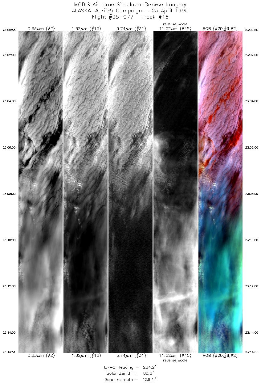
| 16 |
23:00-23:14 |
234 |
72.22-71.31 |
157.29-161.20 |
5217 |
~20000 |
|
Images 01 through 16 in sequence |
Level-1B HDF Data Distribution Point
NASA GSFC Earth Sciences (GES) Data Center
NASA DAAC's
|
|