ENHANCED MODIS AIRBORNE SIMULATOR
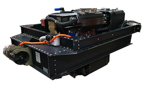
The Enhanced MODIS Airborne Simulator (eMAS) is a multispectral scanner configured to approximate the Moderate-Resolution Imaging Spectrometer (MODIS), an instrument orbiting on the NASA Terra satellite. MODIS is designed to measure terrestrial and atmospheric processes. The eMAS was a joint development project of Daedalus Enterprises, Berkeley Camera Engineering, and Ames Research Center. The eMAS system acquires 50-meter spatial resolution imagery, in 38 spectral bands, of cloud and surface features from the vantage point of the NASA ER-2 high-altitude research aircraft.
The principal scientific investigator for eMAS is Dr. Steven Platnick, EOS Senior Project Scientist.

Specifications
SPECIFICATIONS
| Type: | Optical Imaging Line Scanner |
|---|---|
| Platform: | NASA ER-2 |
| Ground Speed: | 400 Kts (206 M/second) |
| Altitude: | 20 Km (65,000 Ft) |
| Pixel Spatial Resolution: | 50 Meters (@ 20 Km altitude) |
| Pixels per Scan Line: | 716 (roll corrected) |
| Scan Rate: | 6.25 Hz (scans/second) |
| Swath width: | 37.25 Km (22.9 Nm, @ 20 Km altitude) |
| Field of View: | 85.92° |
| Instantaneous Field of View: | 2.5 mrad |
| Roll Correction: | +/- 15° |
| Data Channels: | 38 |
| Spectral Bands: | 38 (digitized to 16-bit resolution) |
| Port 1 (Vis): | 9 bands, 445nm - 967nm |
| Port 2 (SWIR): | 16 bands, 1.616µm - 2.425µm |
| Port 3 (MWIR): | 1 band, 3.647µm - 3.830µm |
| Port 4 (LWIR): | 12 bands, 6.589µm - 14.062µm |
| Bits per Channel: | 12 |
| Data Rate: | 246 Mb/hour |
| Visible Calibration: | Integrating Sphere (ground-based) |
| Infrared Calibration: | 2 Black Bodies (on-board) |
| Scientific Publication: | View the MAS White Paper (PDF) |


