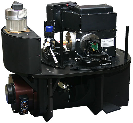
AUTONOMOUS MODULAR SENSOR
The Autonomous Modular Sensor (AMS) is a multi-configurable airborne scanning spectrometer that acquires high spatial resolution imagery of the Earth's features from its vantage point on-board low and medium altitude research aircraft. Data acquired by AMS is helping to define, develop, and test algorithms for use in a variety of scientific programs that emphasize the use of remotely sensed data to monitor variation in environmental conditions, assess global change, and respond to natural disasters.
The AMS is no longer maintained and operated by the Airborne Sensor Facility.
AMS was transferred to the United States Forest Service (USFS) under a 2012 agreement between NASA and the Department of Agriculture. The USFS plans to use it in operational fire imaging and measurement aboard their Cessna Citation aircraft during the active fire season. AMS will also support other agency objectives, such as vegetation inventory analysis and water resource mapping.

Specifications
SPECIFICATIONS
| Type: | Optical Imaging Line Scanner |
|---|---|
| Platform: | NASA ER-2, DC-8, B-200, & Ikhana |
| Ground Speed: | Variable (depending on altitude) |
| Altitude: | 1 - 20 Km (5,000 - 65,000 Ft) |
| Pixel Spatial Resolution: | 1 - 50 Meters (depending on altitude) |
| Pixels per Scan Line: | 716 (roll corrected) |
| Scan Rate: | 6.25 - 33 Hz (scans/second) |
| Swath width: | 1.87 - 37.25 Km (depending on altitude) |
| Field of View: | 42.46° & 85.92° |
| Instantaneous Field of View: | 1.25 & 2.5 mrad |
| Roll Correction: | +/- 15° |
| Data Channels: | 16 (depending on configuration) |
| Spectral Bands: | 16 (digitized to 16-bit resolution) |
| Spectral Range: | 11 bands, 457nm - 12.49µm |
| Bits per Channel: | 12 |
| Visible Calibration: | Integrating Sphere (ground-based) |
| Infrared Calibration: | 2 Black Bodies (on-board) |


