
|
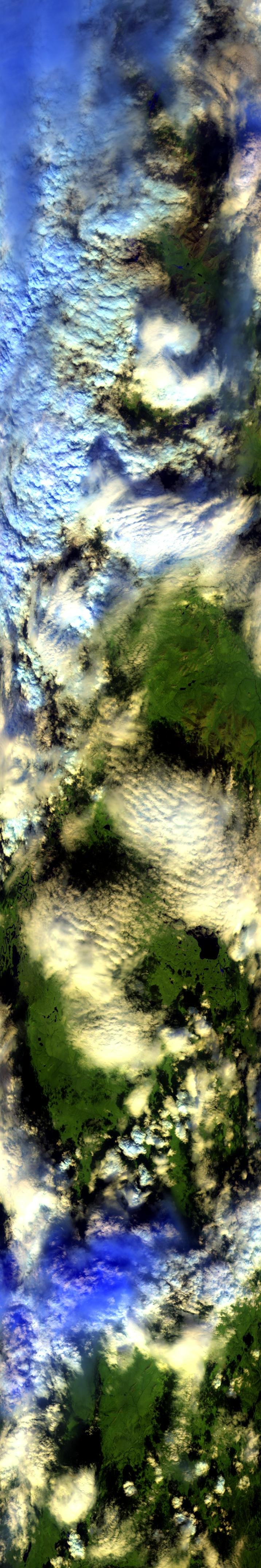
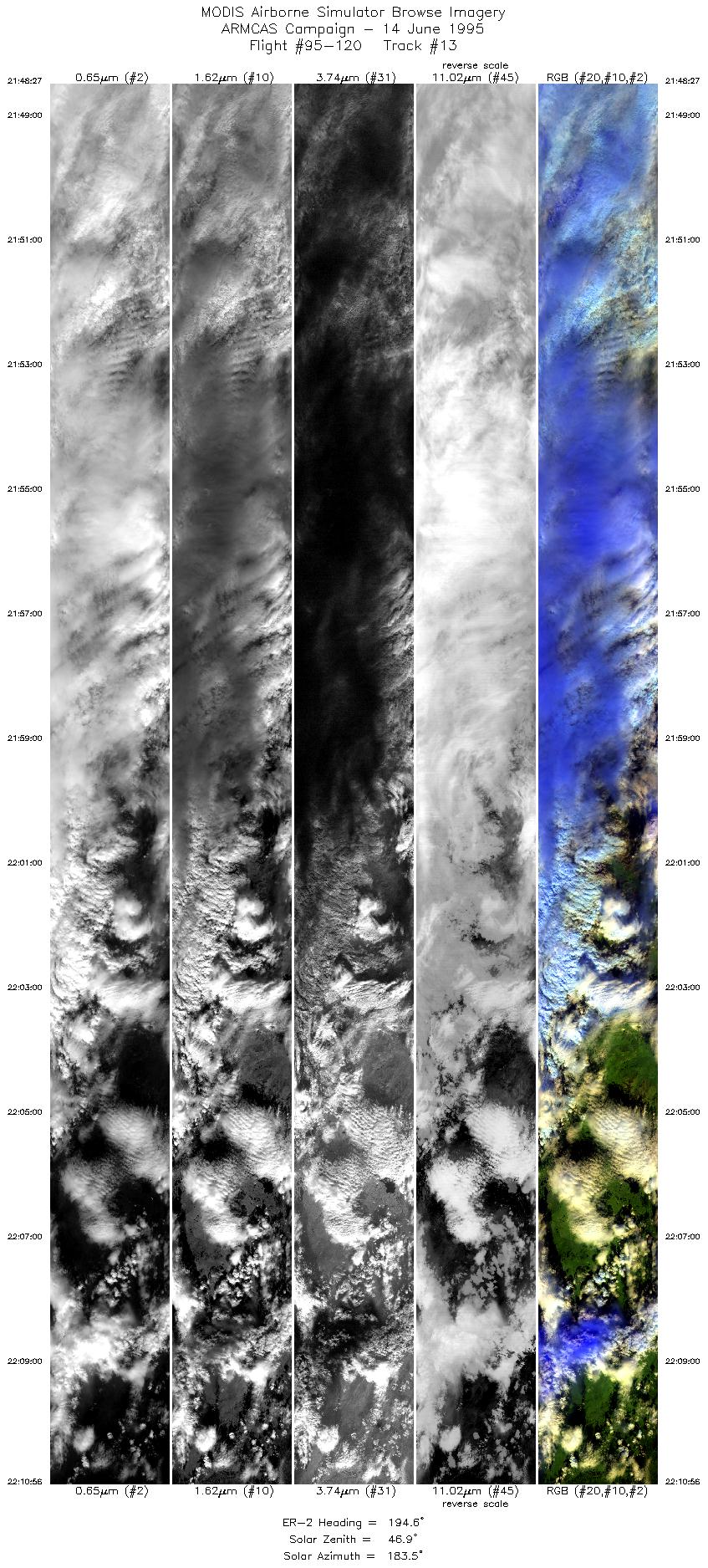
Sample Image

14 June 1995
Track #13


"Developing convection near Arctic Village, Alaska"
R: 2.14 microns
G: 1.68 microns
B: 0.65 microns
|
|
Summary Information
Date: June 14, 1995
ER-2 Flight Number: 95-120
Location: North Slope, Alaska
Principle Investigator: Dr. Michael King (NASA GSFC)
Additional Sensors: CIR_12"_RC-10, AVIRIS, APS, CLS
Level-1B Processing Information
Level-1B Data Version: #09
Calibration Type: Final
Calibration Version: ARMCAS_King 1.1
Temperature Adjustment: Yes (35C)
Status: Done!
|
|
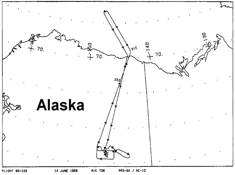
Flight Track Map

|
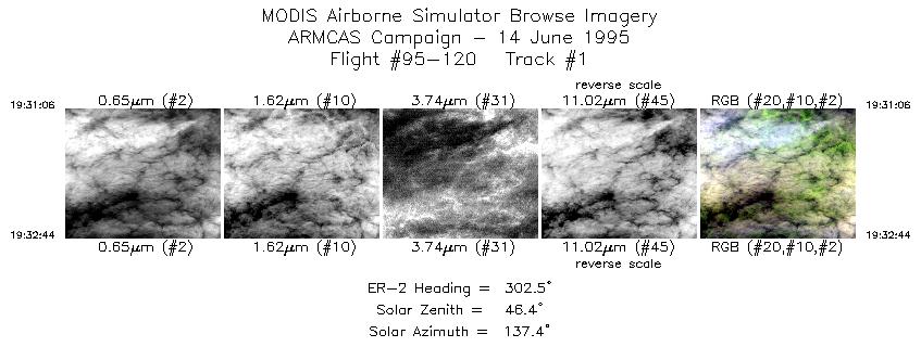
Level-1B Browse Imagery
Straight Line Flight Tracks: 13
Scanlines Processed: 51983
Solar Azimuth and Zenith Angles
|
Browse Images
|
Click on the Flight Track number to load images.
Lat/Lon ranges are for the BEG-END scanline nadir pixels.
|
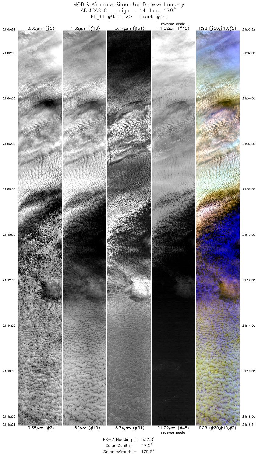
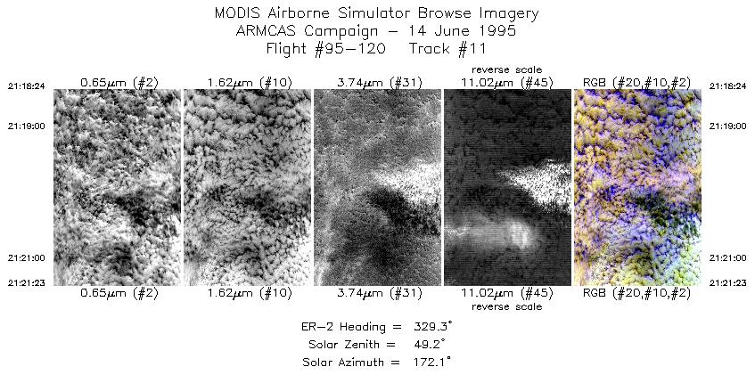
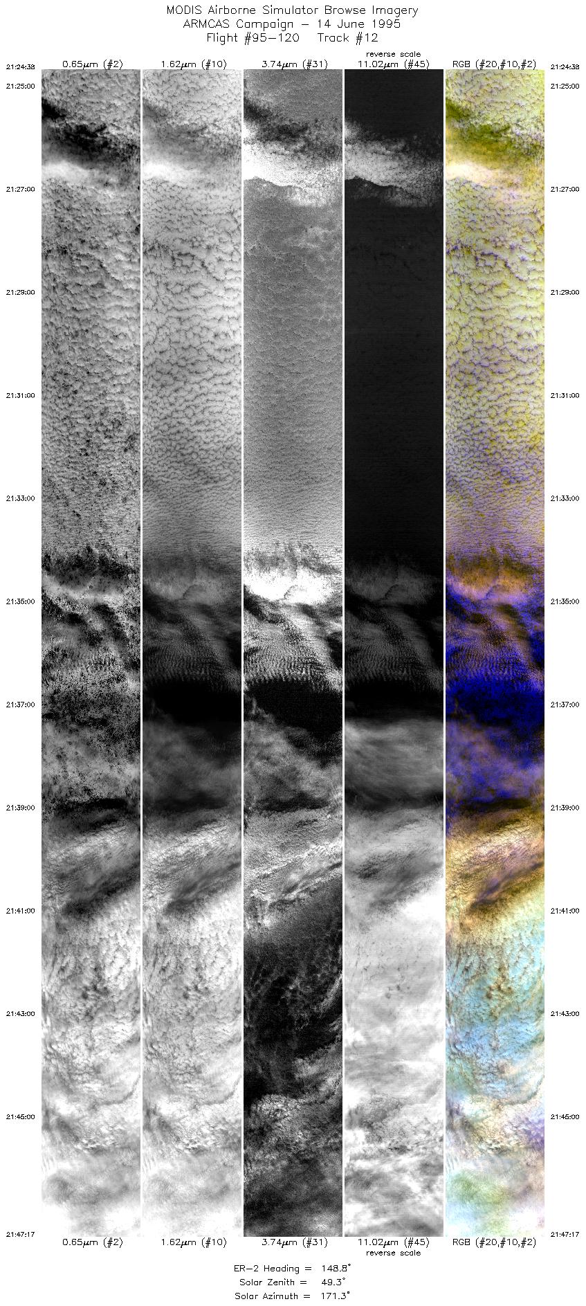
Flight
Track |
Time_Span
(GMT) |
Heading
(Deg) |
Lat_Range
(Deg_N) |
Lon_Range
(Deg_W) |
Length
(Scanlines) |
Altitude
(Meters) |
| 1 |
19:31-19:32 |
303 |
64.55-64.65 |
145.24-145.61 |
600 |
~20000 |
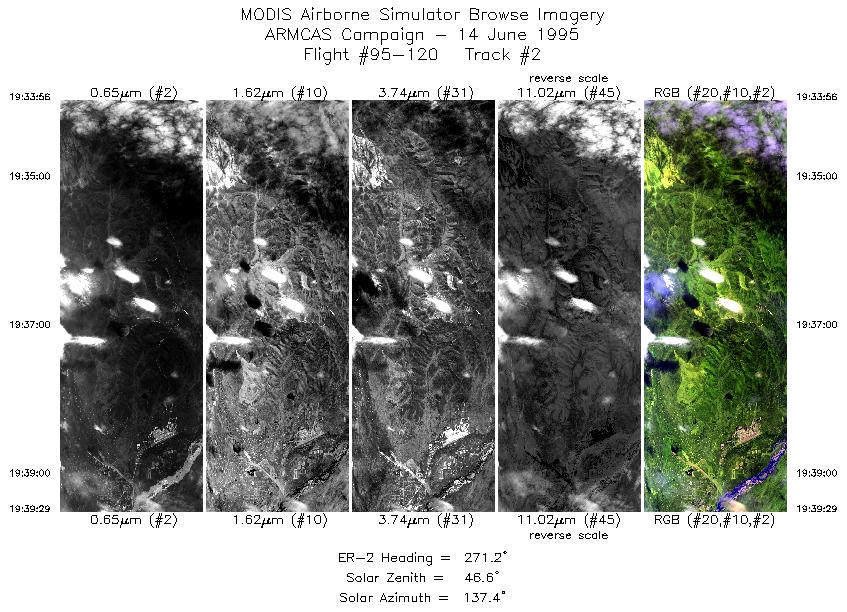
| 2 |
19:33-19:39 |
271 |
64.72-64.72 |
145.89-147.37 |
2064 |
~20000 |
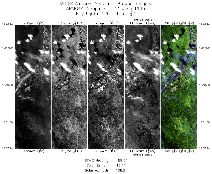
| 3 |
19:45-19:52 |
89 |
64.71-64.72 |
148.00-146.23 |
2479 |
~20000 |
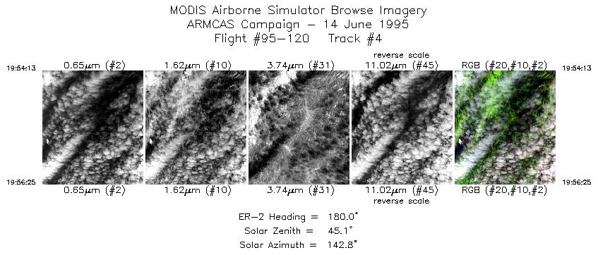
| 4 |
19:54-19:56 |
180 |
64.58-64.33 |
145.96-145.96 |
814 |
~20000 |
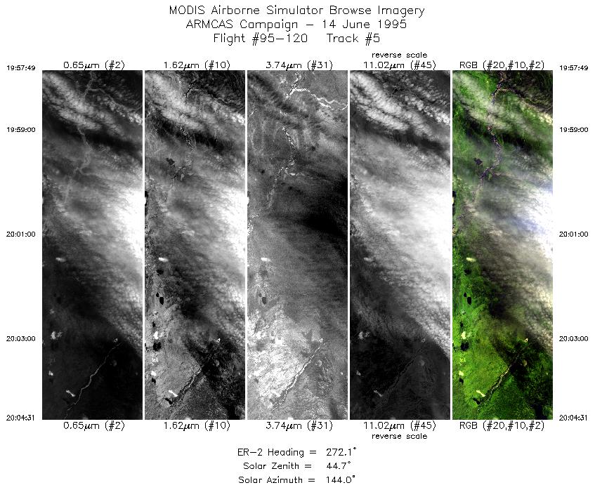
| 5 |
19:57-20:04 |
272 |
64.24-64.25 |
146.20-147.98 |
2491 |
~20000 |
| 6 |
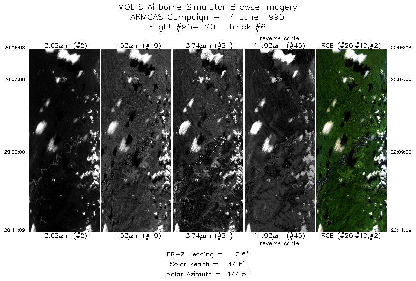
20:06-20:11 |
1 |
64.37-64.95 |
148.25-148.24 |
1863 |
~20000 |
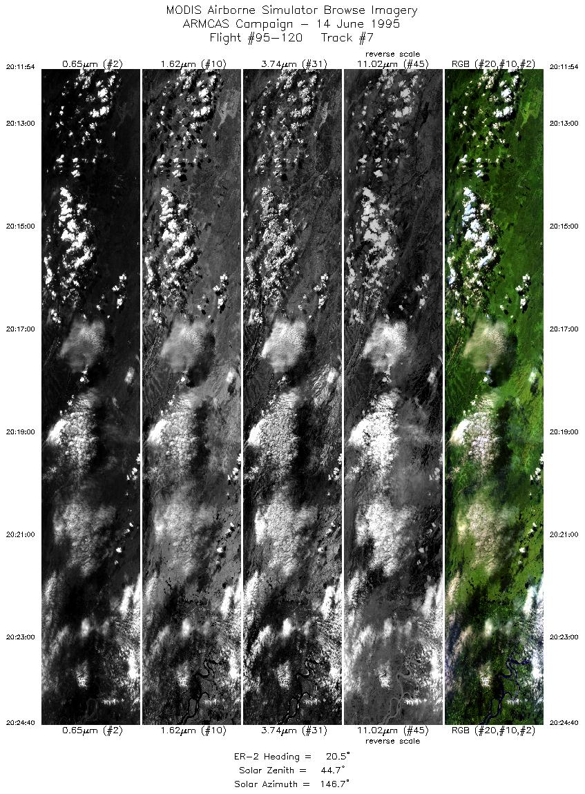
| 7 |
20:11-20:24 |
20 |
65.04-66.46 |
148.18-147.04 |
4753 |
~20000 |
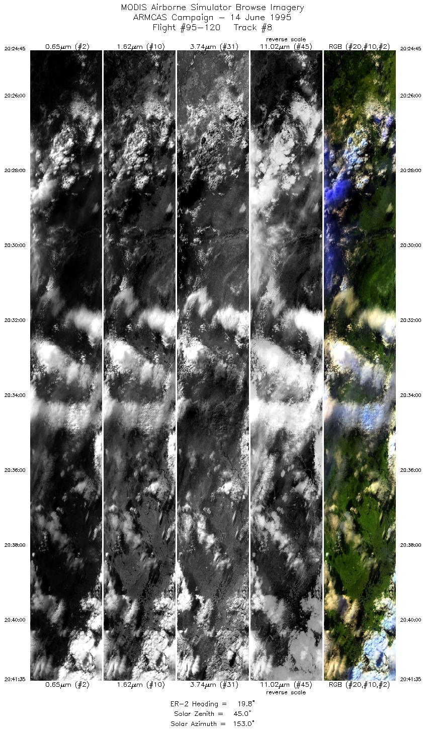
| 8 |
20:24-20:41 |
20 |
66.47-68.35 |
147.05-145.35 |
6268 |
~20000 |
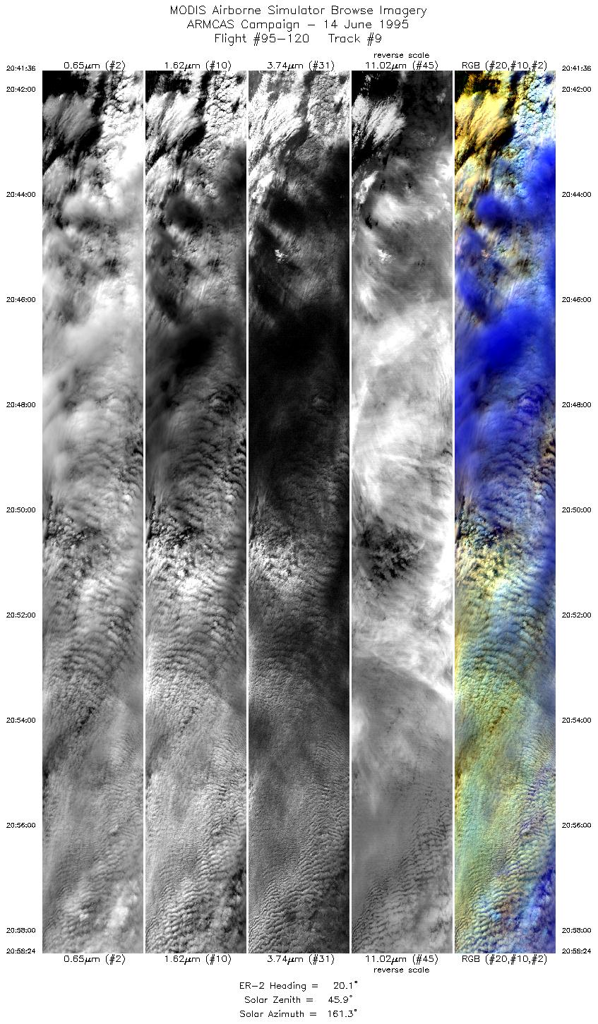
| 9 |
20:41-20:58 |
20 |
68.36-70.23 |
145.34-143.33 |
6257 |
~20000 |
| 10 |
21:00-21:18 |
333 |
70.51-72.30 |
143.30-146.48 |
6475 |
~20000 |
| 11 |
21:18-21:21 |
329 |
72.31-72.61 |
146.55-147.15 |
1106 |
~20000 |
| 12 |
21:24-21:47 |
149 |
72.51-70.21 |
147.83-143.72 |
8438 |
~20000 |
| 13 |
21:48-22:10 |
195 |
70.07-67.53 |
143.82-145.59 |
8375 |
~20000 |
|
Images 01 through 13 in sequence |
Level-1B HDF Data Distribution Point
NASA GSFC Earth Sciences (GES) Data Center
NASA DAAC's
|
|