
|
Sample Image

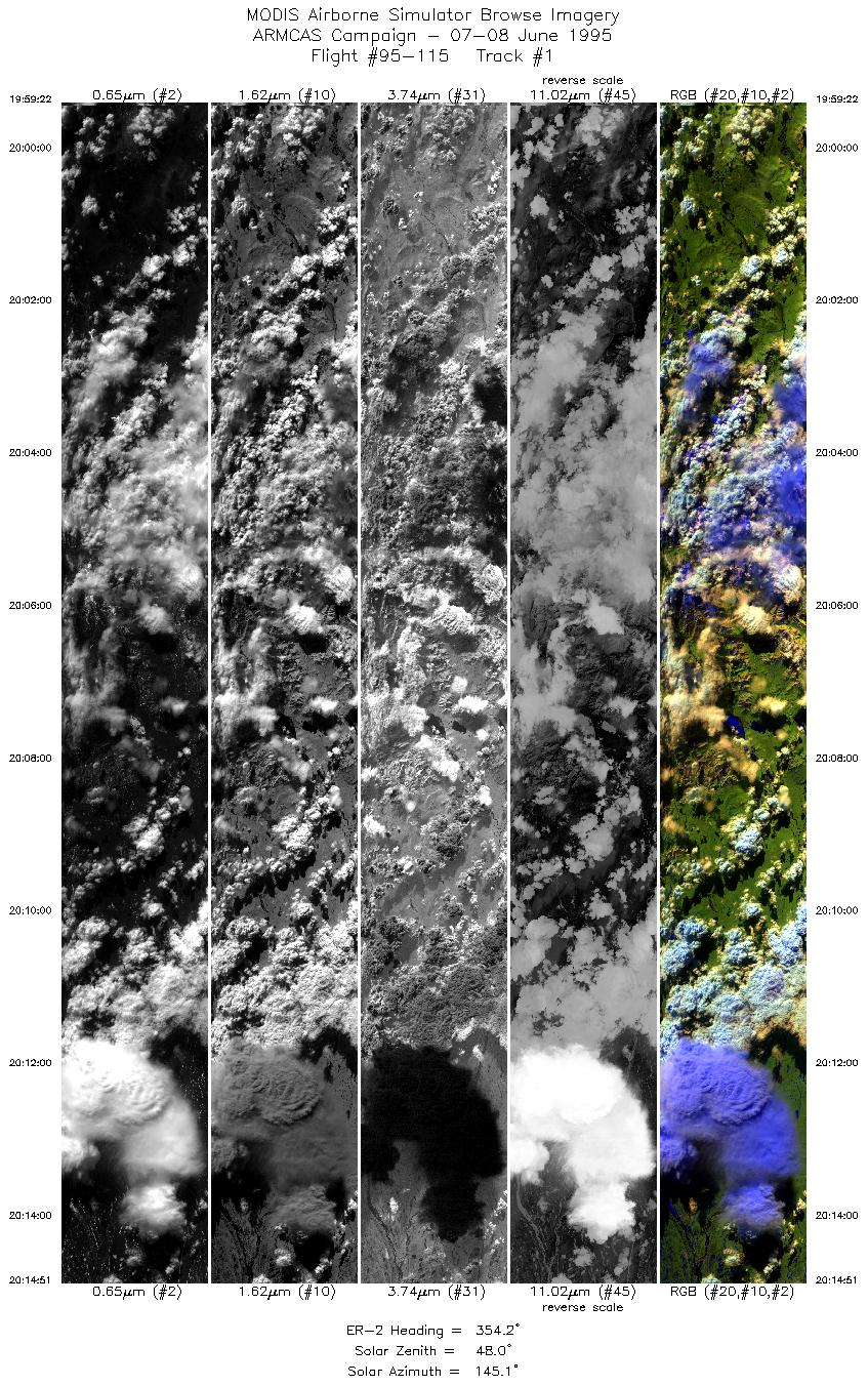
07 June 1995
Track #01
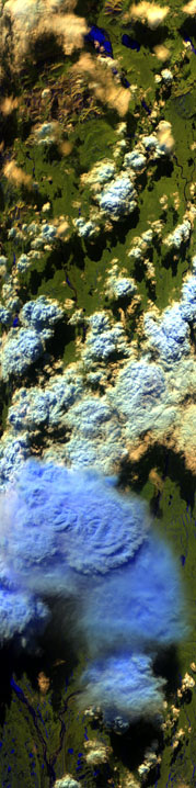

"Severe thunderstorm over the Brooks Range, Alaska"
R: 2.14 microns
G: 1.68 microns
B: 0.65 microns
|
|
Summary Information
Date: June 7/8, 1995
ER-2 Flight Number: 95-115
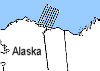
Location: North Slope, Alaska
Principle Investigator: Dr. Michael King (NASA GSFC)
Additional Sensors: CIR_12"_RC-10, CLS, APS, AVIRIS
Level-1B Processing Information
Level-1B Data Version: #09
Calibration Type: Final
Calibration Version: ARMCAS_King 1.1
Temperature Adjustment: Yes (35C)
Status: Done!
|
|
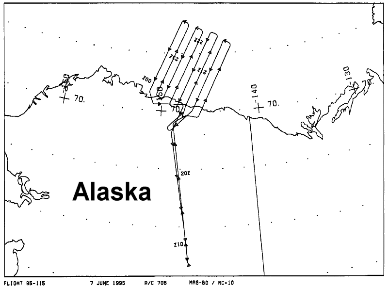
Flight Track Map

|
Level-1B Browse Imagery
Straight Line Flight Tracks: 19
Scanlines Processed: 91603
Solar Azimuth and Zenith Angles
|
Browse Images
|
Click on the Flight Track number to load images.
Lat/Lon ranges are for the BEG-END scanline nadir pixels.
|
Flight
Track |
Time_Span
(GMT) |
Heading
(Deg) |
Lat_Range
(Deg_N) |
Lon_Range
(Deg_W) |
Length
(Scanlines) |
Altitude
(Meters) |
| 1 |
19:59-20:14 |
354 |
67.68-69.51 |
148.05-148.71 |
5761 |
~20000 |
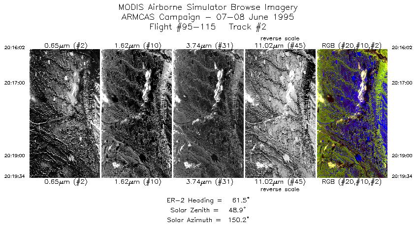
| 2 |
20:16-20:19 |
61 |
69.64-69.84 |
148.57-147.56 |
1311 |
~20000 |
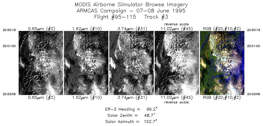
| 3 |
20:20-20:23 |
99 |
69.86-69.81 |
147.32-146.43 |
1038 |
~20000 |
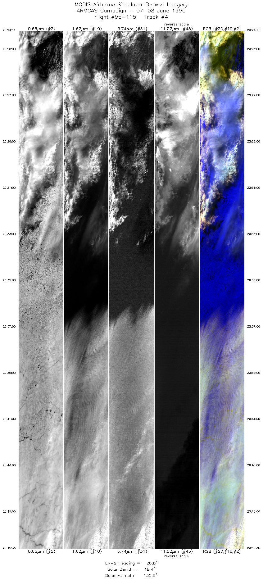
| 4 |
20:24-20:46 |
27 |
69.86-72.21 |
146.19-142.56 |
8342 |
~20000 |
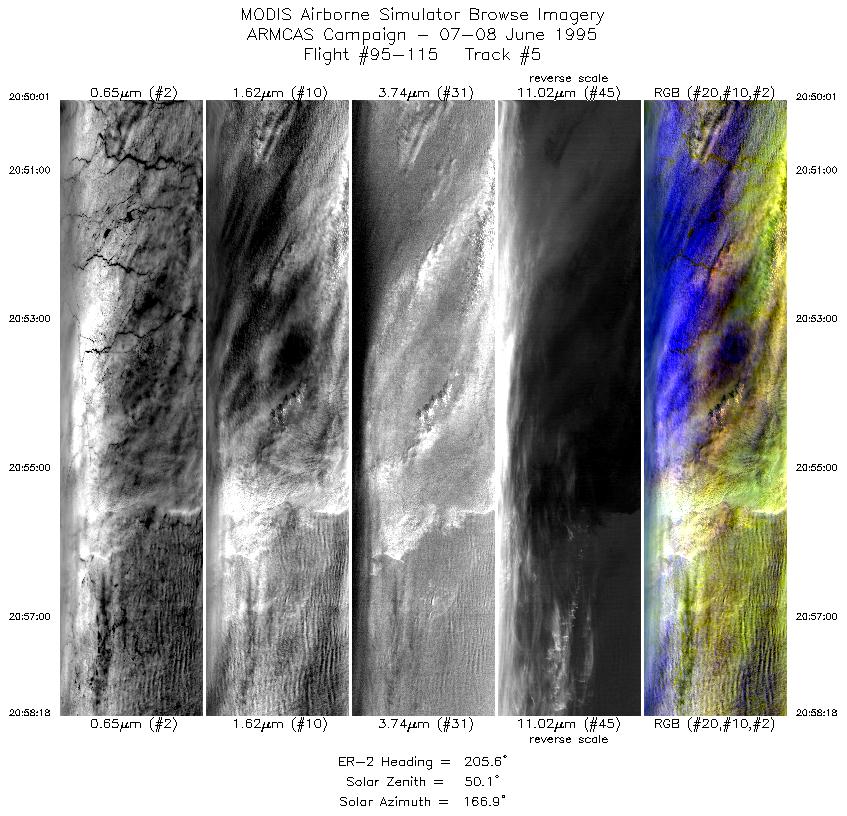
| 5 |
20:50-20:58 |
206 |
72.38-71.53 |
143.27-144.65 |
3080 |
~20000 |
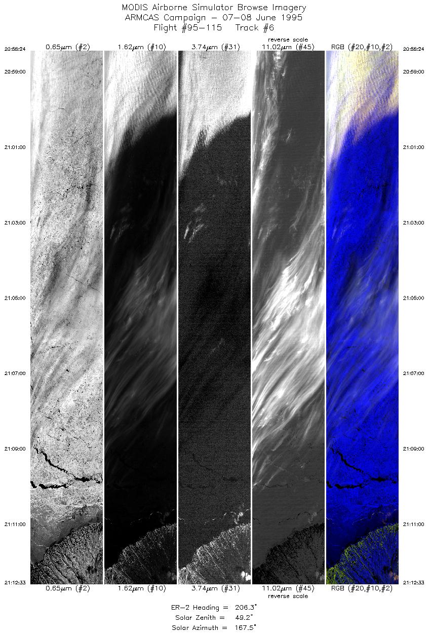
| 6 |
20:58-21:12 |
206 |
71.51-70.05 |
144.69-146.80 |
5266 |
~20000 |
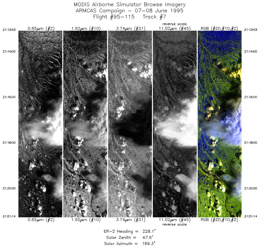
| 7 |
21:13-21:21 |
228 |
70.01-69.36 |
146.88-148.89 |
3043 |
~20000 |
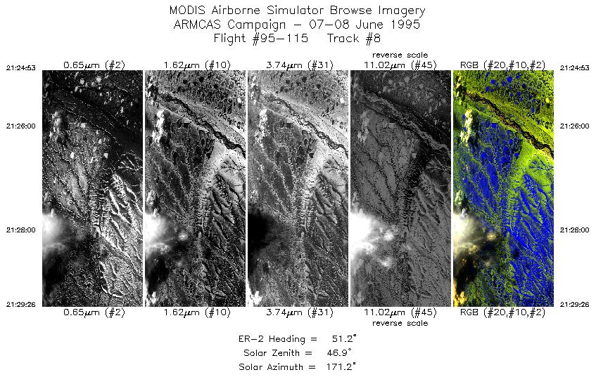
| 8 |
21:24-21:29 |
51 |
69.60-69.95 |
148.87-147.75 |
1689 |
~20000 |
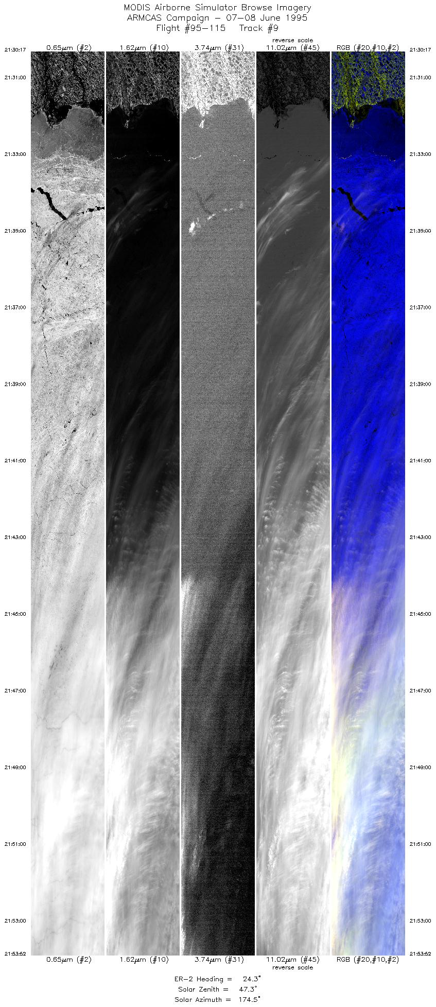
| 9 |
21:30-21:53 |
24 |
70.06-72.53 |
147.75-144.01 |
8782 |
~20000 |
| 10 |
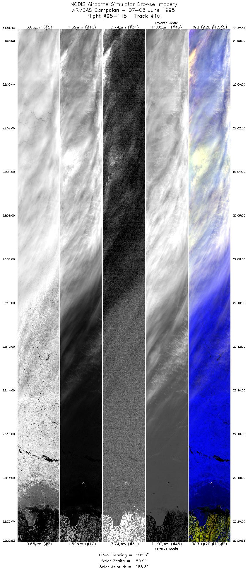
21:57-22:20 |
205 |
72.65-70.22 |
144.83-148.42 |
8732 |
~20000 |
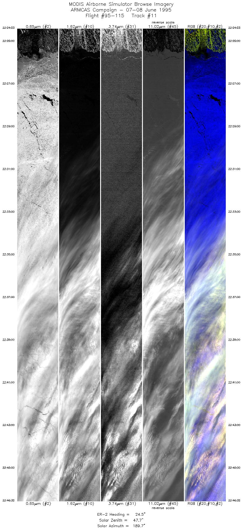
| 11 |
22:24-22:46 |
25 |
70.33-72.69 |
149.14-145.69 |
8247 |
~20000 |
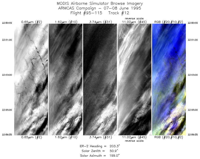
| 12 |
22:50-22:56 |
203 |
72.82-72.17 |
146.43-147.46 |
2361 |
~20000 |
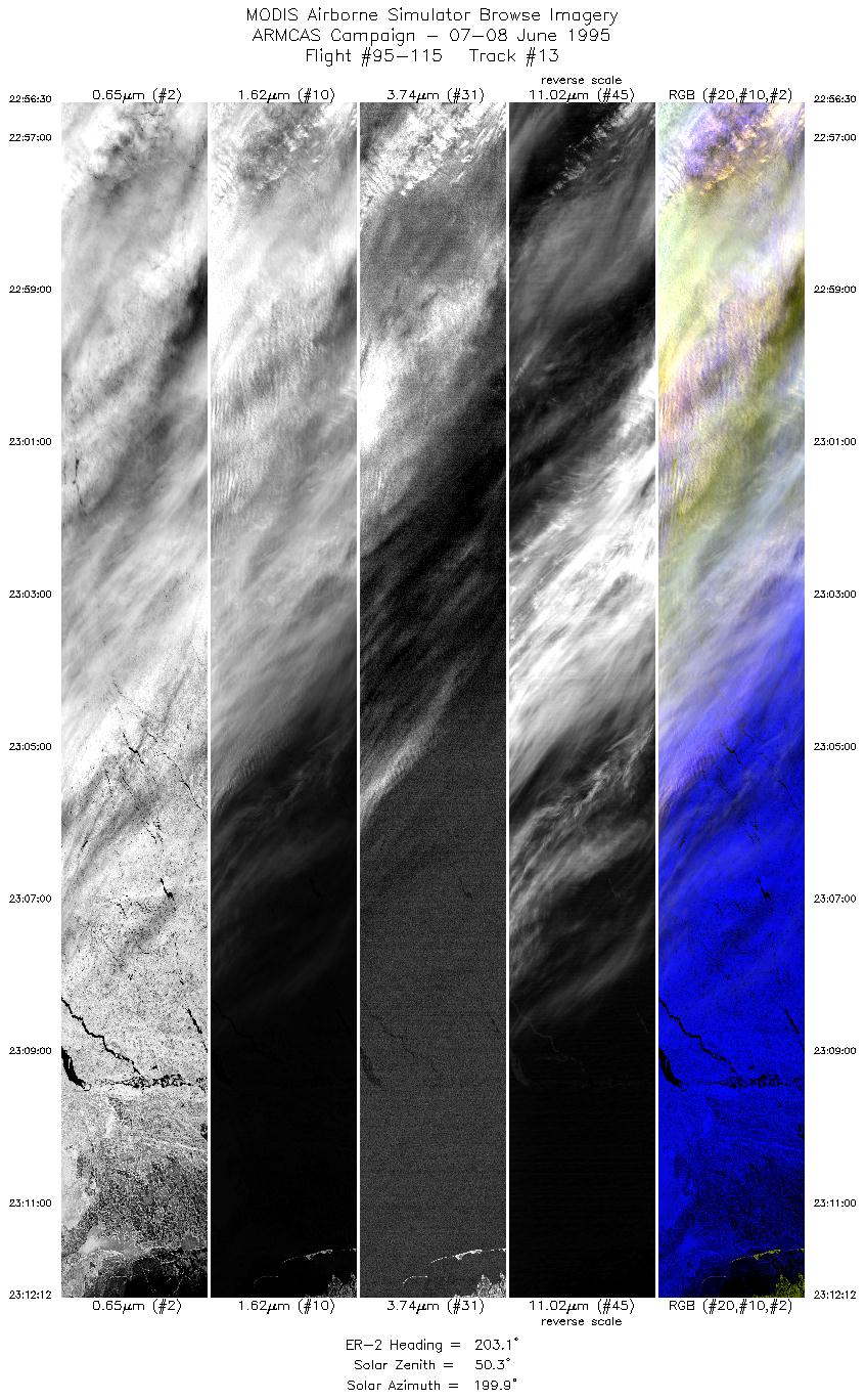
| 13 |
22:56-23:12 |
203 |
72.17-70.52 |
147.50-149.79 |
5844 |
~20000 |
| 14 |
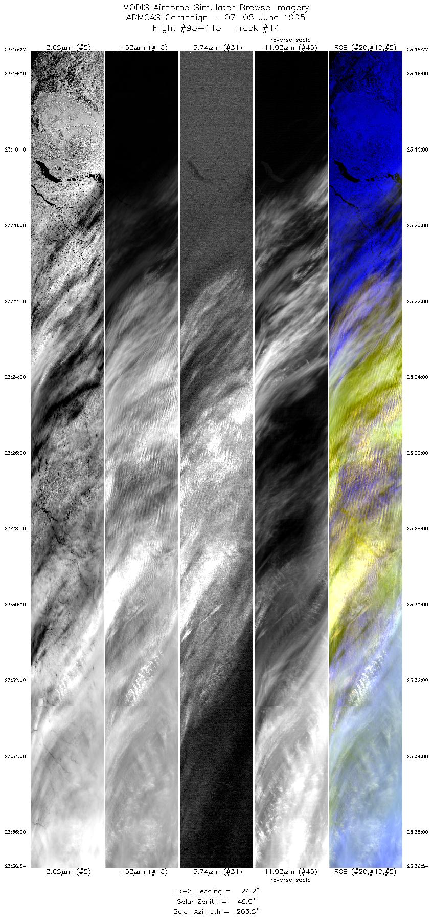
23:15-23:36 |
24 |
70.60-72.91 |
150.57-147.32 |
7975 |
~20000 |
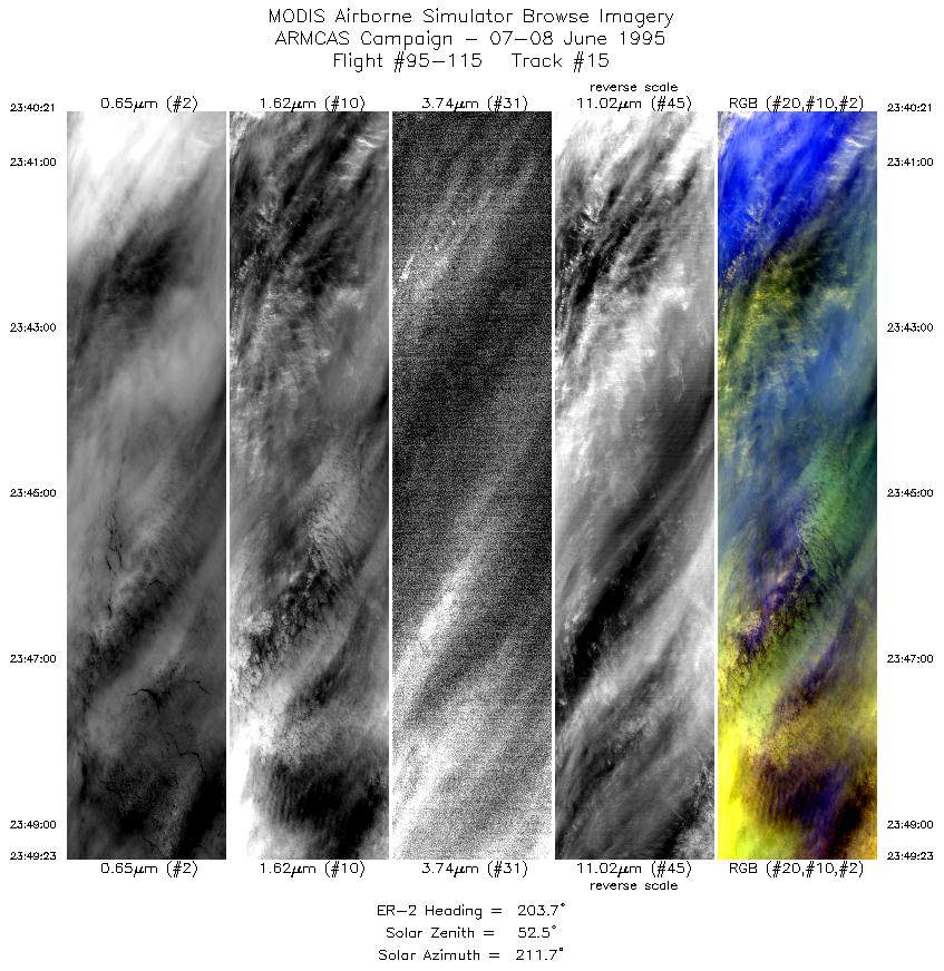
| 15 |
23:40-23:49 |
204 |
73.05-72.12 |
148.07-149.45 |
3361 |
~20000 |
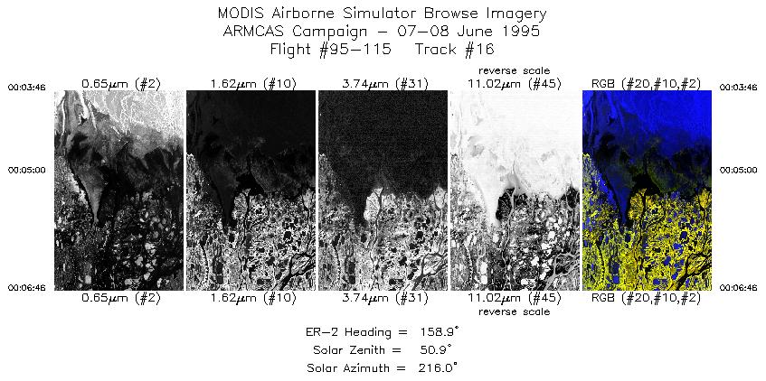
| 16 |
00:03-00:06 |
159 |
70.60-70.29 |
151.26-150.91 |
1111 |
~20000 |
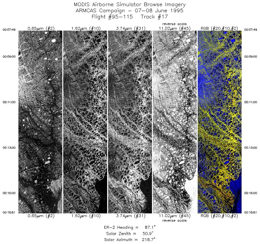
| 17 |
00:07-00:15 |
87 |
70.24-70.25 |
150.63-147.99 |
2987 |
~20000 |
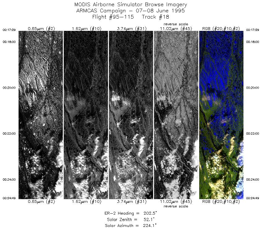
| 18 |
00:17-00:24 |
202 |
70.11-69.34 |
147.82-148.80 |
2727 |
~20000 |
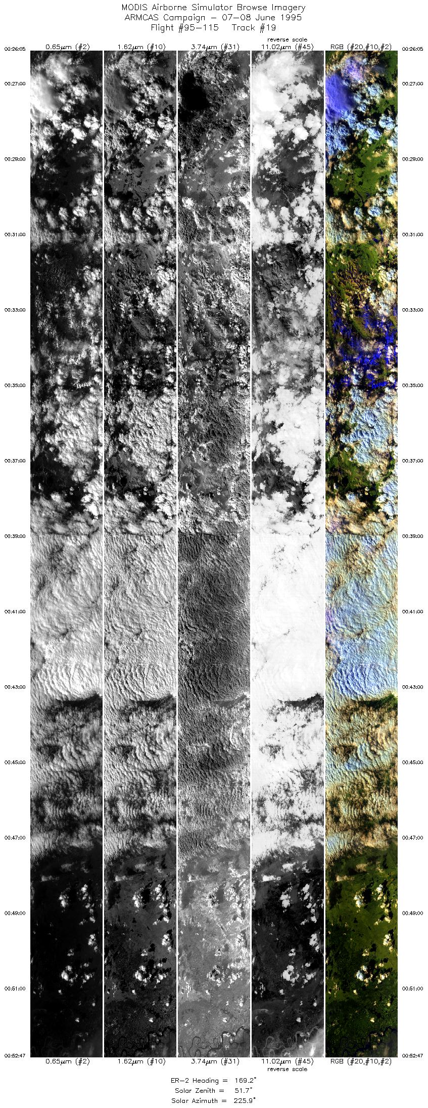
| 19 |
00:26-00:52 |
169 |
69.20-66.25 |
148.84-147.62 |
9946 |
~20000 |
|
Images 01 through 19 in sequence |
Level-1B HDF Data Distribution Point
NASA GSFC Earth Sciences (GES) Data Center
NASA DAAC's
|
|
