
|
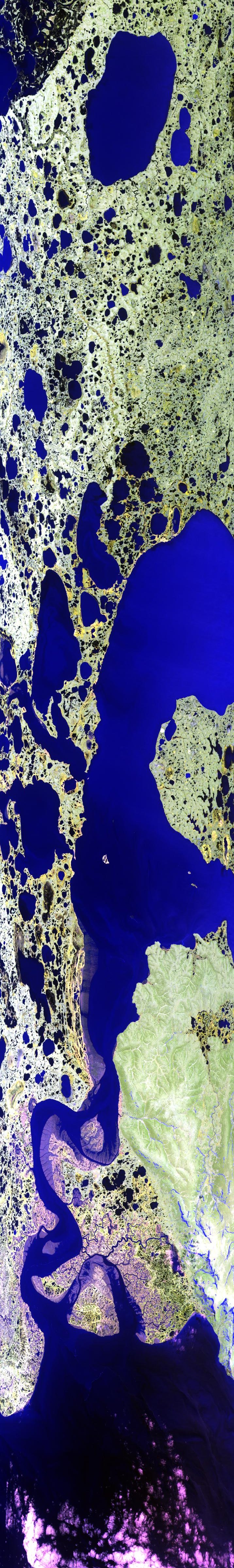
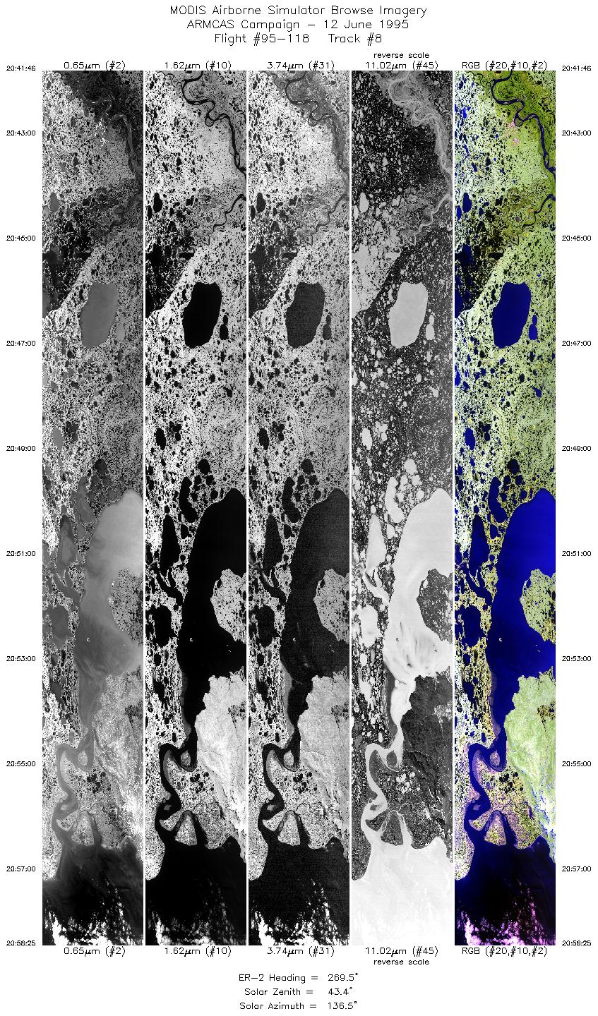
Sample Image

12 June 1995
Track #08
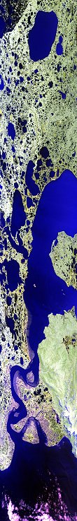

"Baird Inlet meets the Bering Sea"
R: 2.14 microns
G: 1.68 microns
B: 0.65 microns
|
|
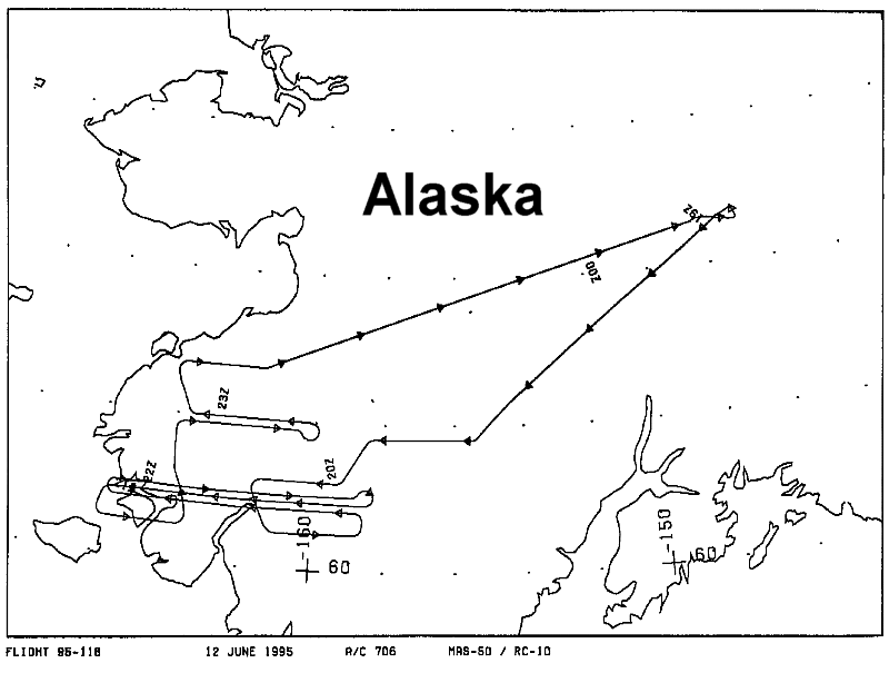
Summary Information
Date: June 12, 1995
ER-2 Flight Number: 95-118
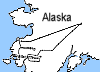
Location: Yukon Delta, Alaska
Principle Investigator: Dr. Michael King (NASA GSFC)
Additional Sensors: CIR_12"_RC-10, AVIRIS, APS
Level-1B Processing Information
Level-1B Data Version: #09
Calibration Type: Final
Calibration Version: ARMCAS_King 1.1
Temperature Adjustment: Yes (35C)
Status: Done!
|
|
Flight Track Map

|
Level-1B Browse Imagery
Straight Line Flight Tracks: 23
Scanlines Processed: 84398
Solar Azimuth and Zenith Angles
|
Browse Images
|
Click on the Flight Track number to load images.
Lat/Lon ranges are for the BEG-END scanline nadir pixels.
|
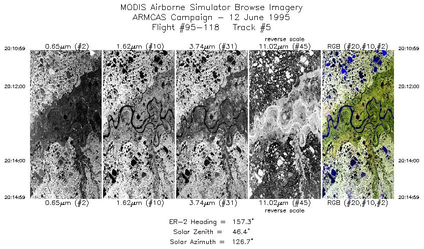
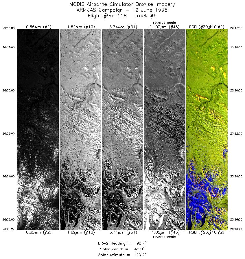
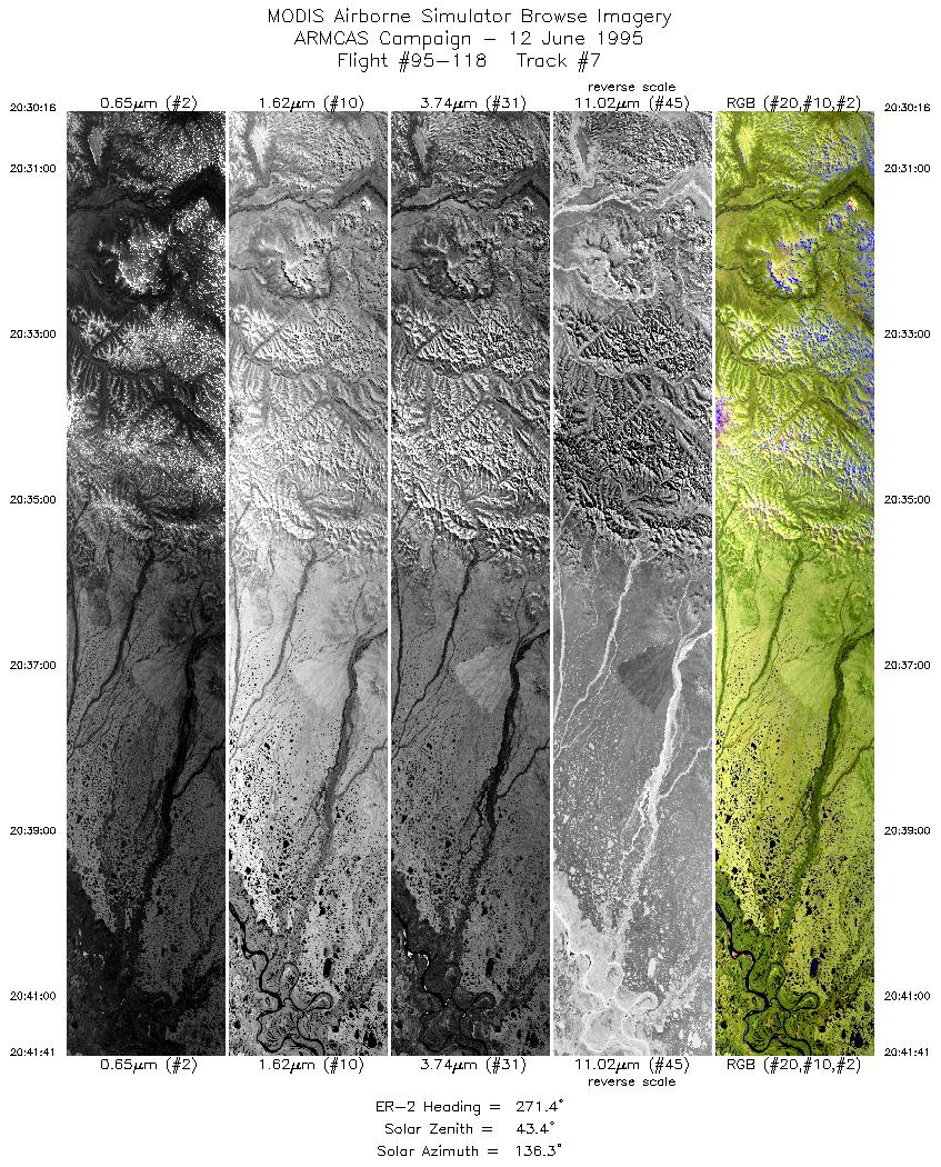
Flight
Track |
Time_Span
(GMT) |
Heading
(Deg) |
Lat_Range
(Deg_N) |
Lon_Range
(Deg_W) |
Length
(Scanlines) |
Altitude
(Meters) |
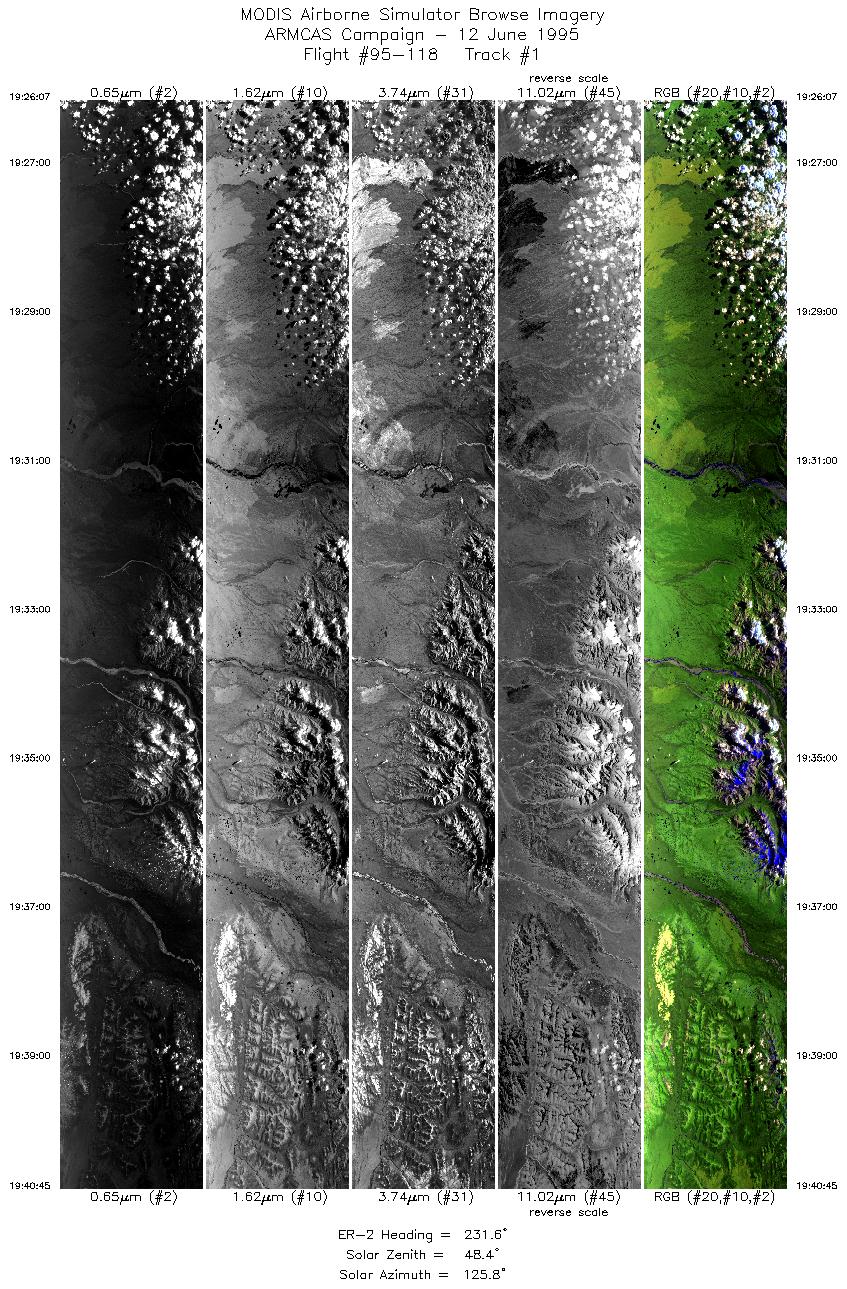
| 1 |
19:26-19:40 |
232 |
62.96-61.86 |
152.72-155.34 |
5448 |
~20000 |
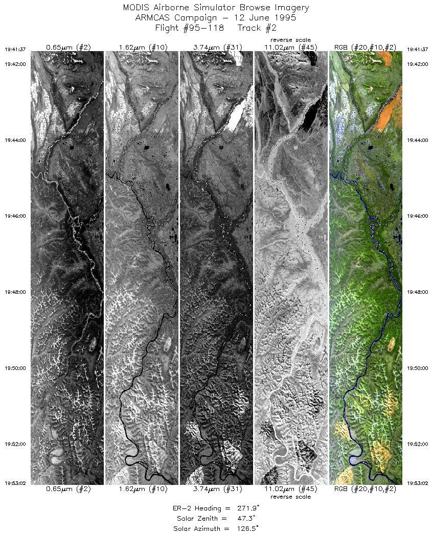
| 2 |
19:41-19:52 |
272 |
61.80-61.81 |
155.48-158.24 |
4249 |
~20000 |
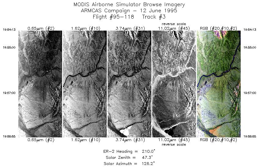
| 3 |
19:54-19:58 |
210 |
61.74-61.26 |
158.51-159.08 |
1746 |
~20000 |
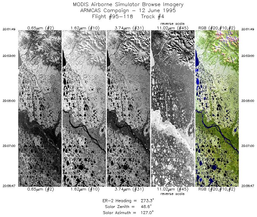
| 4 |
20:01-20:08 |
273 |
61.19-61.20 |
159.72-161.42 |
2590 |
~20000 |
| 5 |
20:10-20:14 |
157 |
61.02-60.62 |
161.66-161.31 |
1486 |
~20000 |
| 6 |
20:17-20:26 |
90 |
60.49-60.50 |
160.92-158.80 |
3479 |
~20000 |
| 7 |
20:30-20:41 |
271 |
60.80-60.81 |
158.78-161.50 |
4250 |
~20000 |
| 8 |
20:41-20:58 |
269 |
60.81-60.81 |
161.53-165.48 |
6200 |
~20000 |
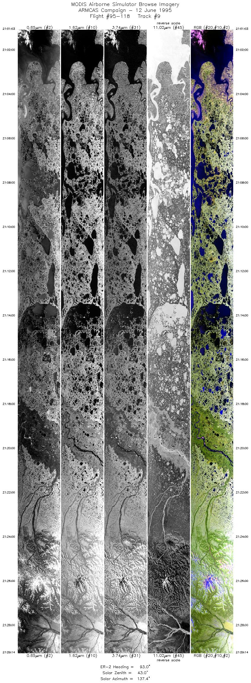
| 9 |
21:01-21:29 |
93 |
61.01-61.00 |
165.54-158.92 |
10497 |
~20000 |
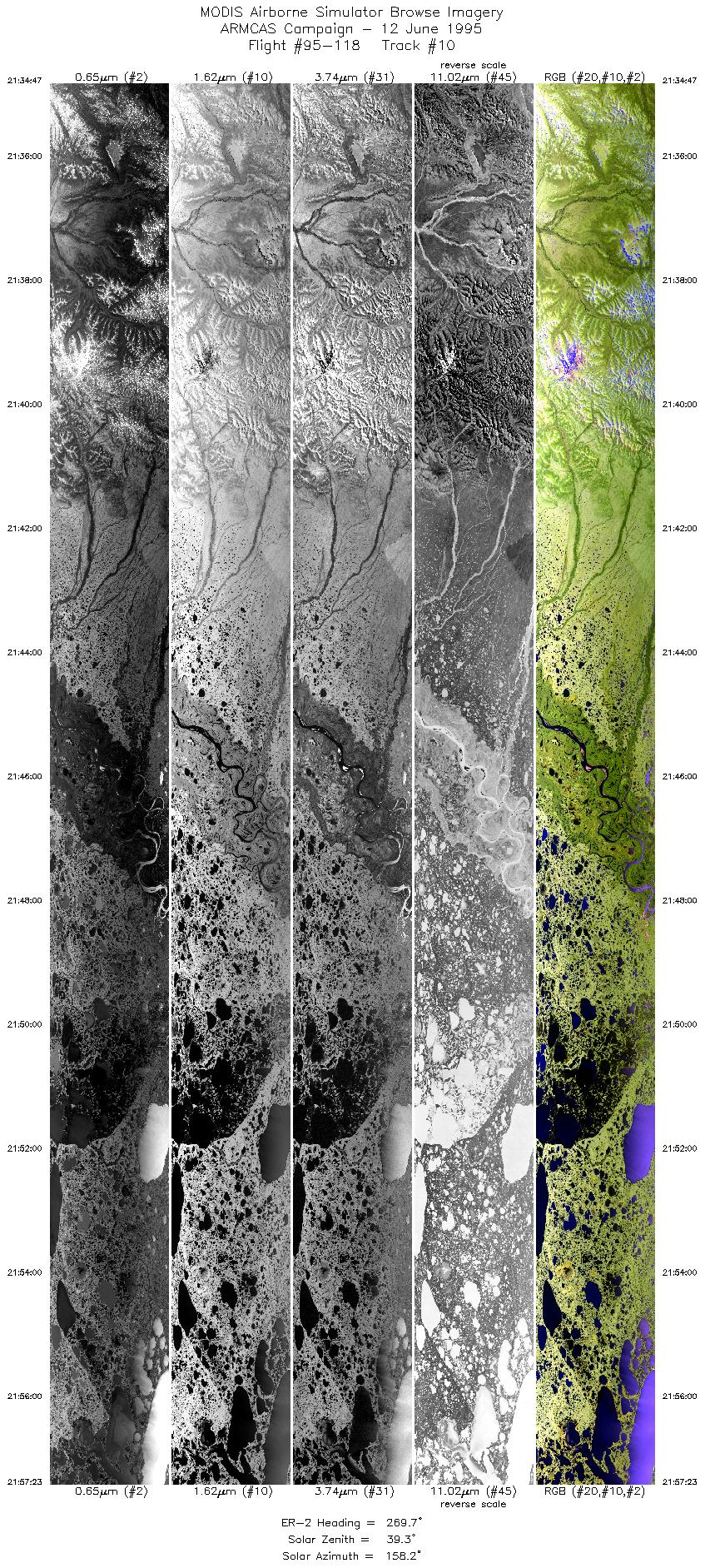
| 10 |
21:34-21:57 |
270 |
60.90-60.91 |
158.62-163.92 |
8417 |
~20000 |
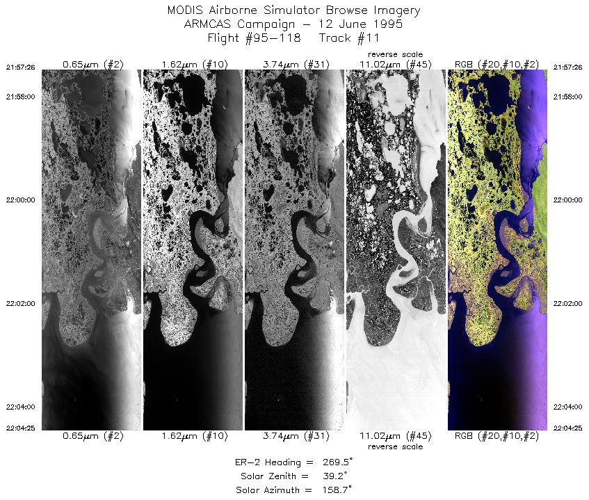
| 11 |
21:57-22:04 |
270 |
60.92-60.91 |
163.93-165.58 |
2597 |
~20000 |
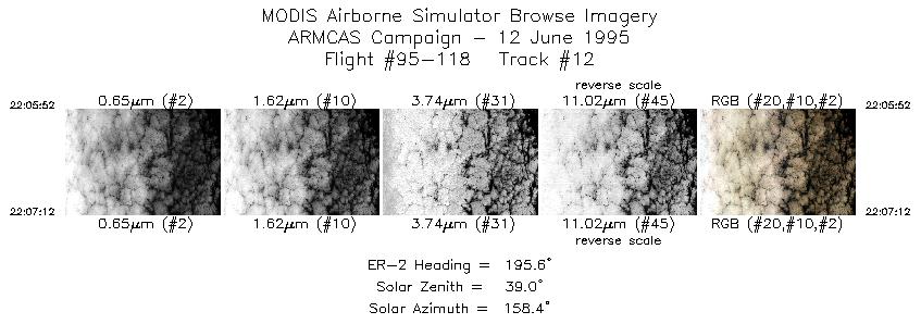
| 12 |
22:05-22:07 |
196 |
60.81-60.67 |
165.84-165.91 |
491 |
~20000 |
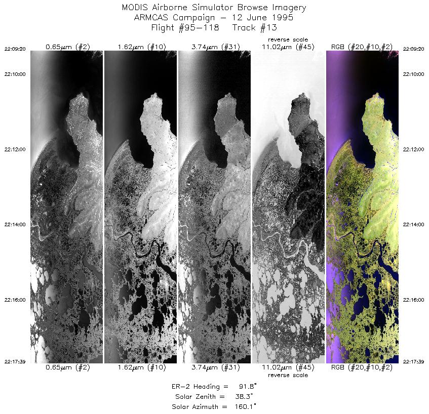
| 13 |
22:09-22:17 |
92 |
60.50-60.50 |
165.68-163.78 |
3093 |
~20000 |
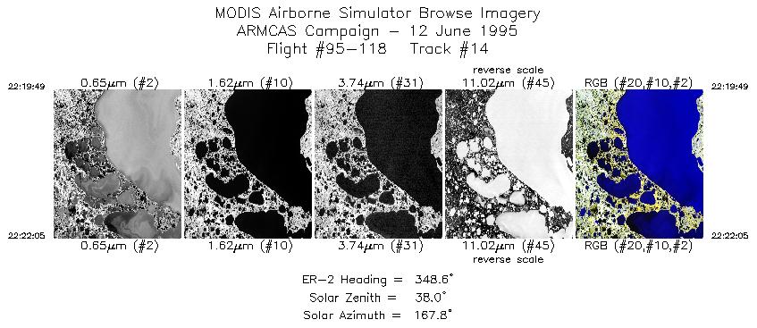
| 14 |
22:19-22:22 |
349 |
60.67-60.93 |
163.51-163.62 |
839 |
~20000 |
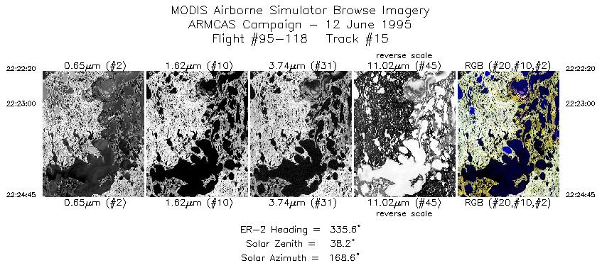
| 15 |
22:22-22:24 |
336 |
60.96-61.21 |
163.65-163.88 |
894 |
~20000 |
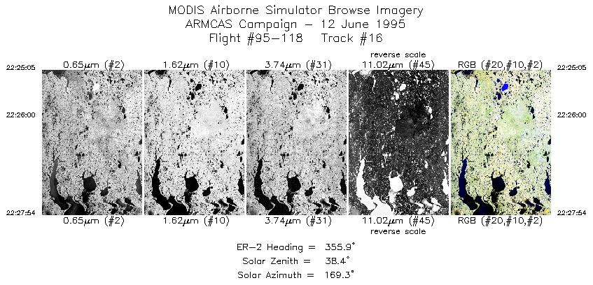
| 16 |
22:25-22:27 |
356 |
61.25-61.57 |
163.90-163.95 |
1044 |
~20000 |
| 17 |
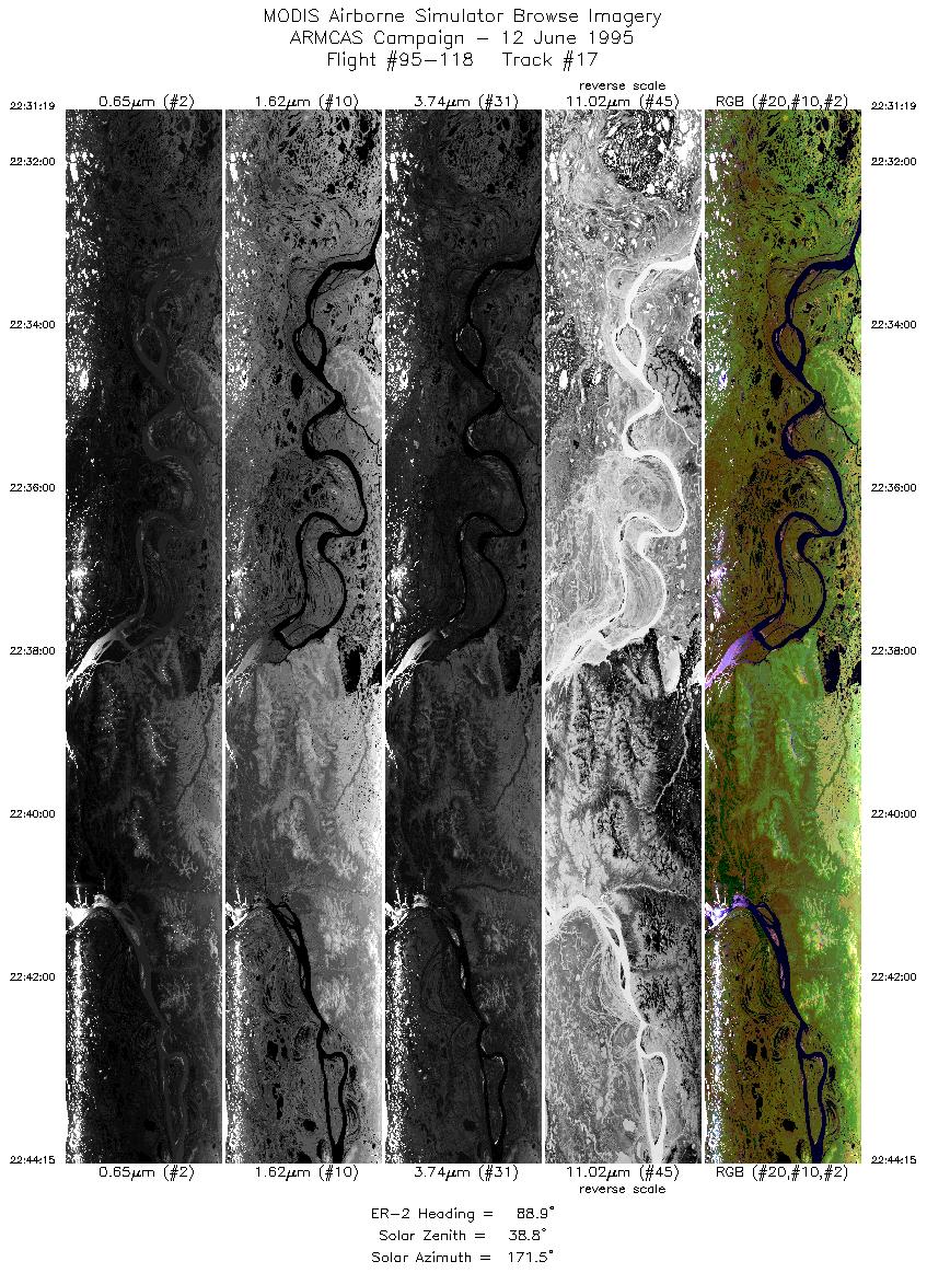
22:31-22:44 |
89 |
61.90-61.90 |
163.70-160.56 |
4815 |
~20000 |
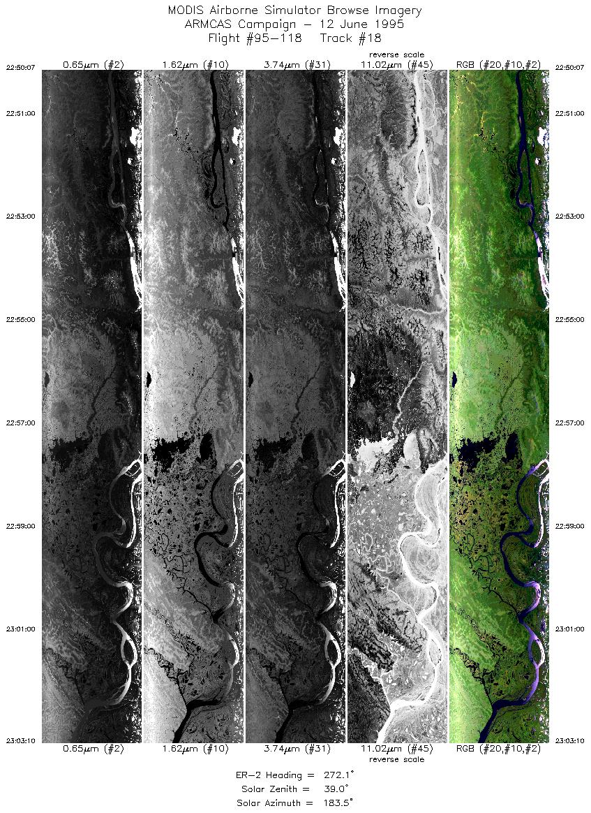
| 18 |
22:50-23:03 |
272 |
62.01-62.01 |
160.23-163.42 |
4820 |
~20000 |
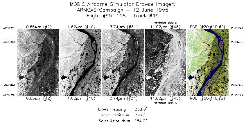
| 19 |
23:04-23:07 |
339 |
62.07-62.39 |
163.65-163.96 |
1161 |
~20000 |
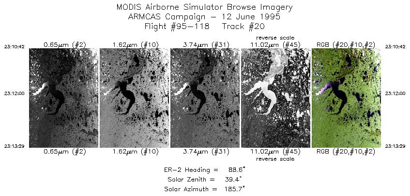
| 20 |
23:10-23:13 |
89 |
62.70-62.70 |
163.84-163.15 |
1031 |
~20000 |
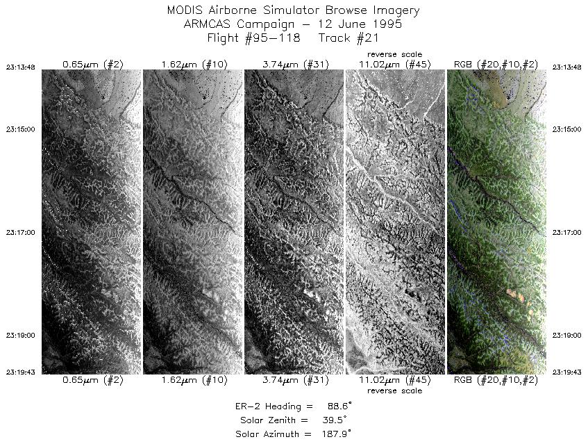
| 21 |
23:13-23:19 |
89 |
62.70-62.70 |
163.08-161.62 |
2199 |
~20000 |
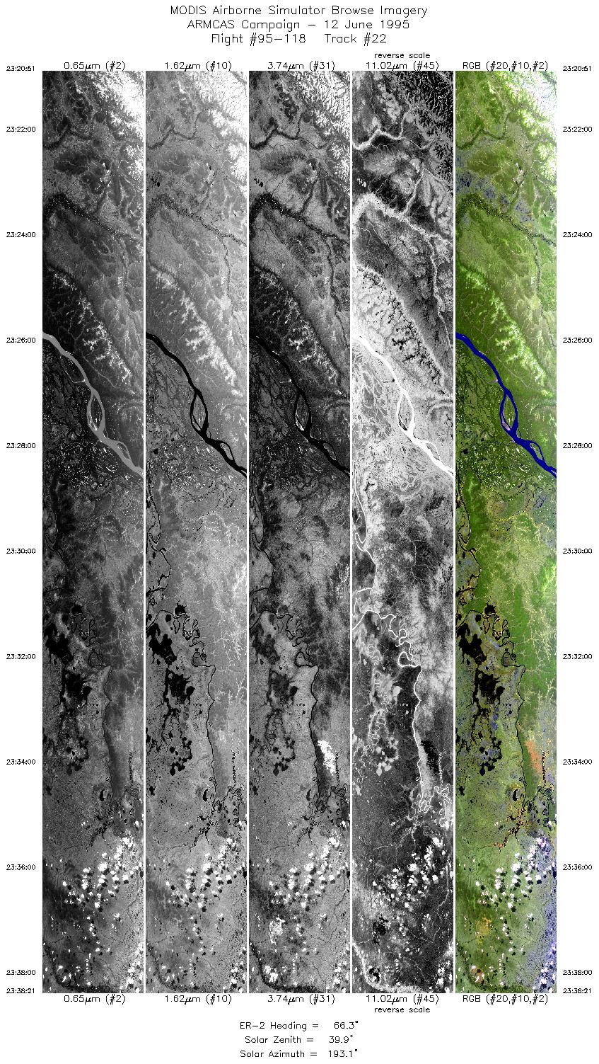
| 22 |
23:20-23:38 |
66 |
62.74-63.48 |
161.38-157.28 |
6517 |
~20000 |
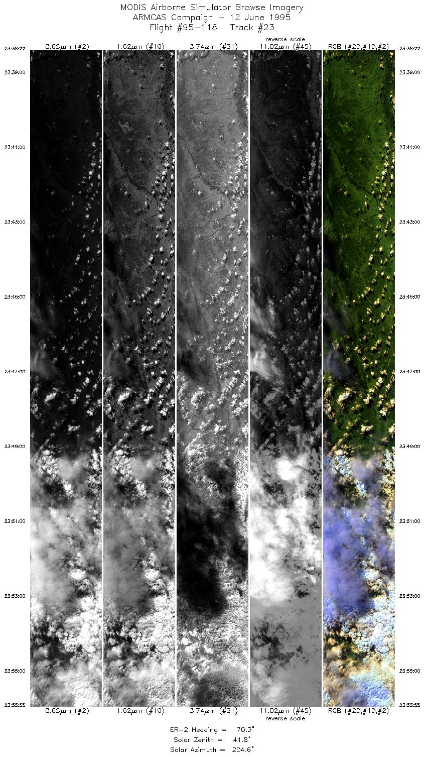
| 23 |
23:38-23:55 |
70 |
63.48-64.10 |
157.26-152.92 |
6535 |
~20000 |
|
Images 01 through 23 in sequence |
Level-1B HDF Data Distribution Point
NASA GSFC Earth Sciences (GES) Data Center
NASA DAAC's
|
|