
|
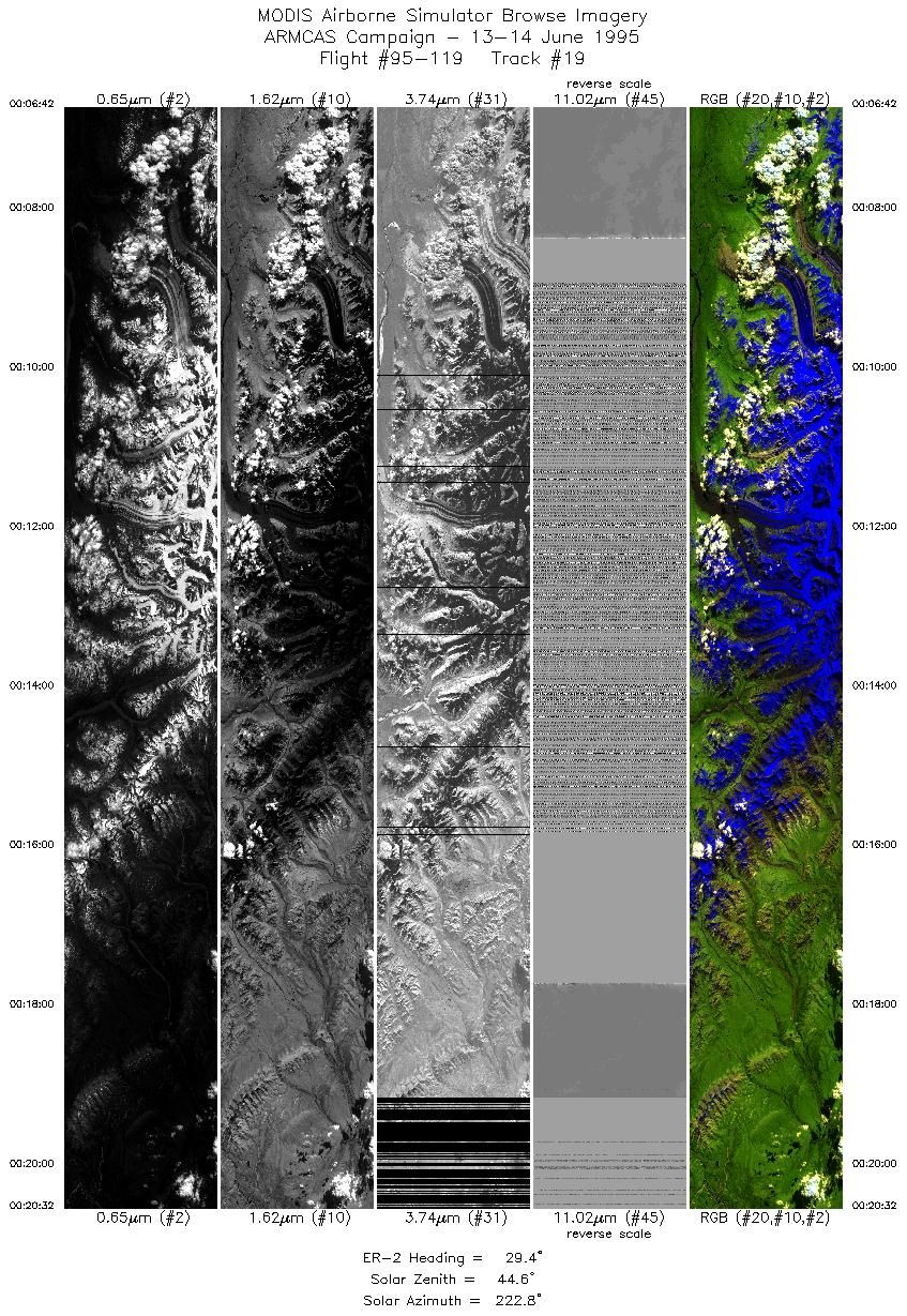
Sample Image

13 June 1995
Track #19
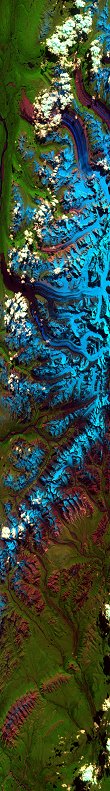

"Glaciers crawl down the east face of Mount Brooks
in Denali National Park"
R: 2.14 microns
G: 0.95 microns
B: 0.65 microns
|
|
Summary Information
Date: June 13/14, 1995
ER-2 Flight Number: 95-119
Location: North Slope, Alaska
Principle Investigator: Dr. Michael King (NASA GSFC)
Additional Sensors: CIR_12"_RC-10, AVIRIS, CLS, APS
Level-1B Processing Information
Level-1B Data Version: #09
Calibration Type: Final
Calibration Version: ARMCAS_King 1.1
Temperature Adjustment: Yes (35C)
Status: Done!
|
|
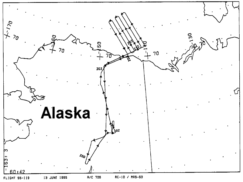
Flight Track Map

|
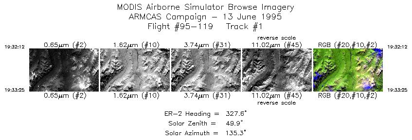
Level-1B Browse Imagery
Straight Line Flight Tracks: 21
Scanlines Processed: 93514
Solar Azimuth and Zenith Angles
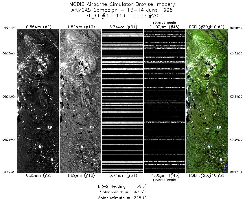
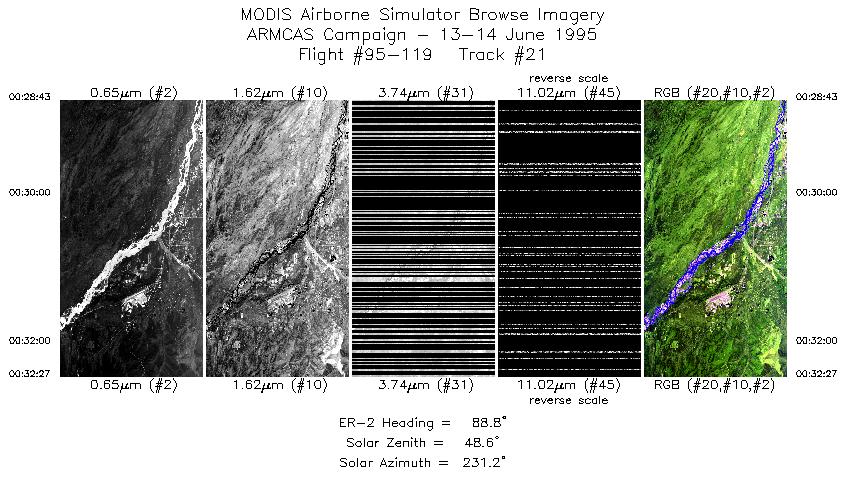
Note: IR bands after 00GMT (tracks #19-#21) were uncalibratable
|
Browse Images
|
Click on the Flight Track number to load images.
Lat/Lon ranges are for the BEG-END scanline nadir pixels.
|
Flight
Track |
Time_Span
(GMT) |
Heading
(Deg) |
Lat_Range
(Deg_N) |
Lon_Range
(Deg_W) |
Length
(Scanlines) |
Altitude
(Meters) |
| 1 |
19:32-19:33 |
328 |
67.92-68.04 |
149.30-149.51 |
448 |
~20000 |
| 2 |
19:34-19:36 |
360 |
68.20-68.38 |
149.55-149.56 |
572 |
~20000 |
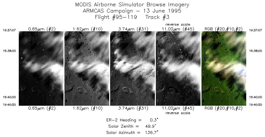
| 3 |
19:37-19:40 |
0 |
68.46-68.83 |
149.56-149.56 |
1194 |
~20000 |
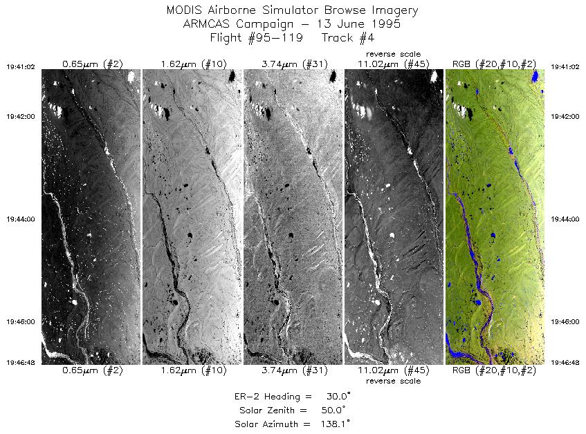
| 4 |
19:41-19:46 |
30 |
68.92-69.50 |
149.50-148.57 |
2144 |
~20000 |
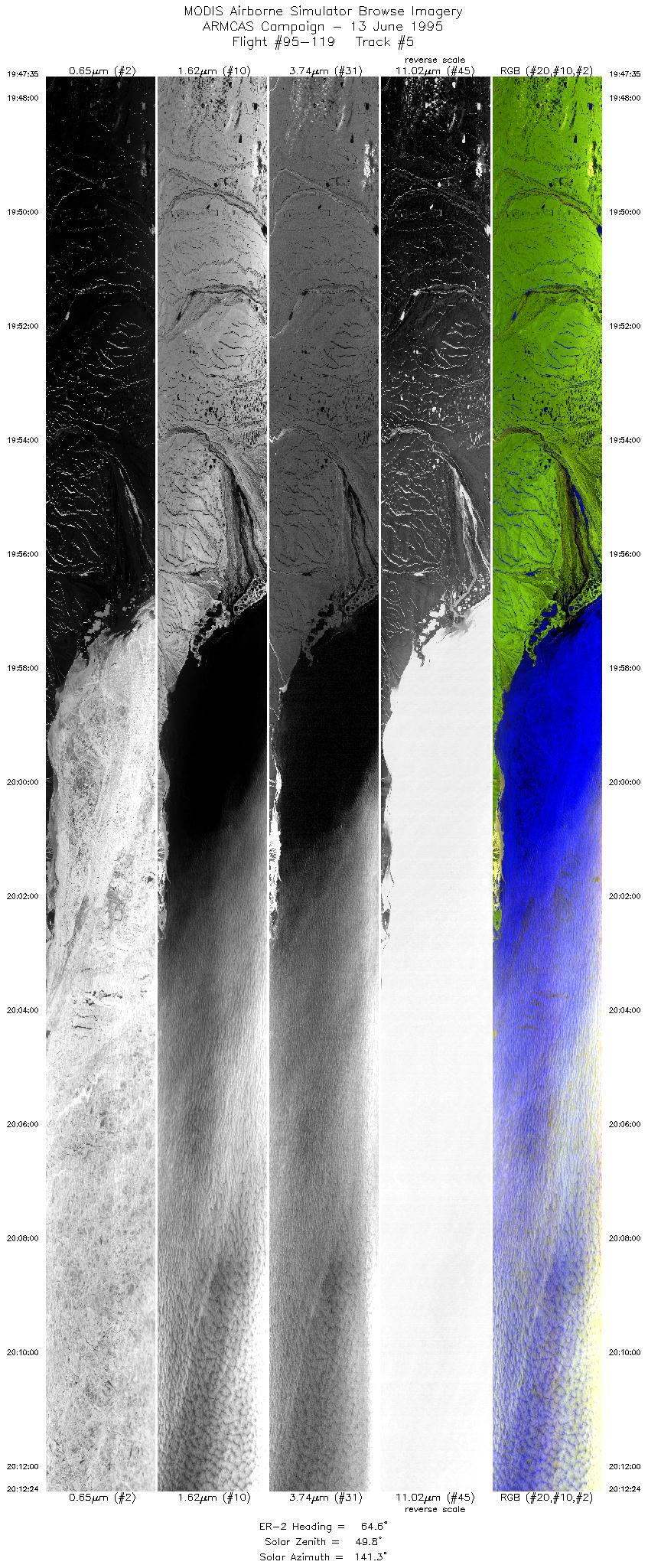
| 5 |
19:47-20:12 |
65 |
69.59-70.70 |
148.45-140.65 |
9248 |
~20000 |
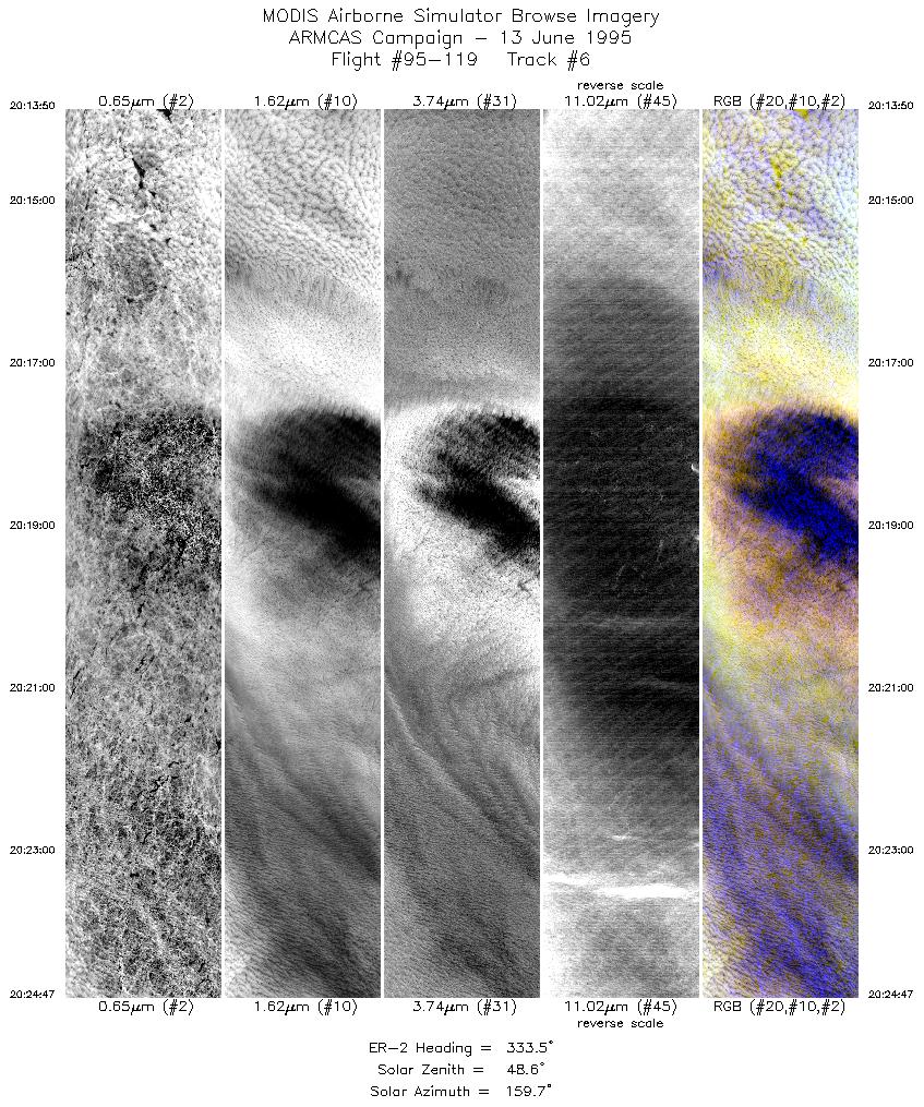
| 6 |
20:13-20:24 |
334 |
70.81-71.95 |
140.44-142.27 |
4077 |
~20000 |
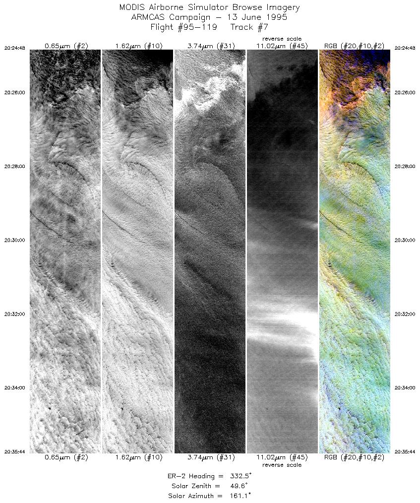
| 7 |
20:24-20:35 |
333 |
71.96-73.08 |
142.27-144.34 |
4070 |
~20000 |
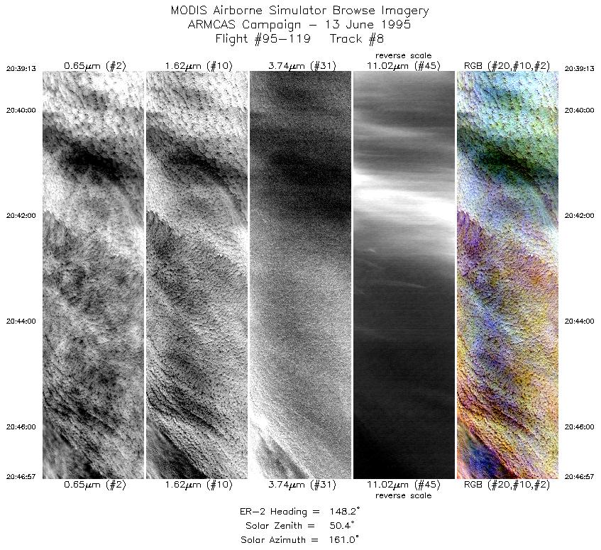
| 8 |
20:39-20:46 |
148 |
72.95-72.19 |
145.20-143.71 |
2876 |
~20000 |
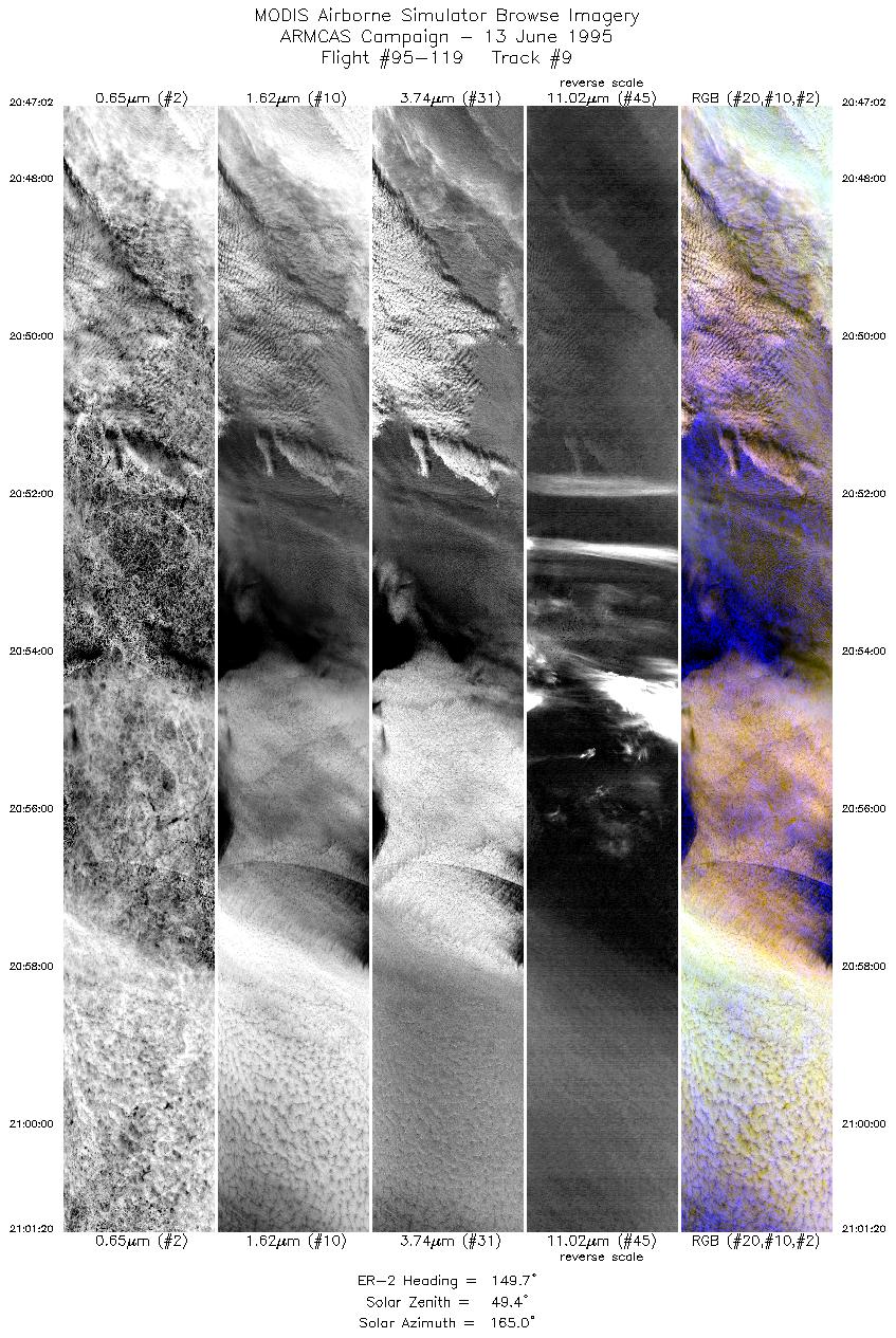
| 9 |
20:47-21:01 |
150 |
72.18-70.73 |
143.66-141.22 |
5325 |
~20000 |
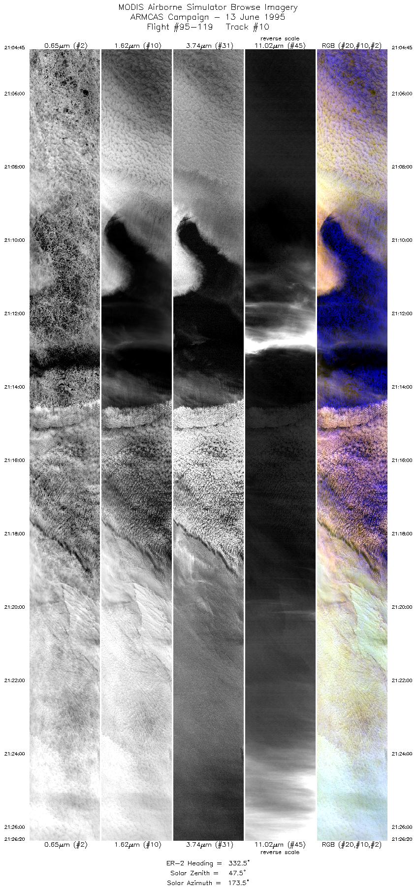
| 10 |
21:04-21:26 |
333 |
70.59-72.83 |
141.92-145.87 |
8039 |
~20000 |
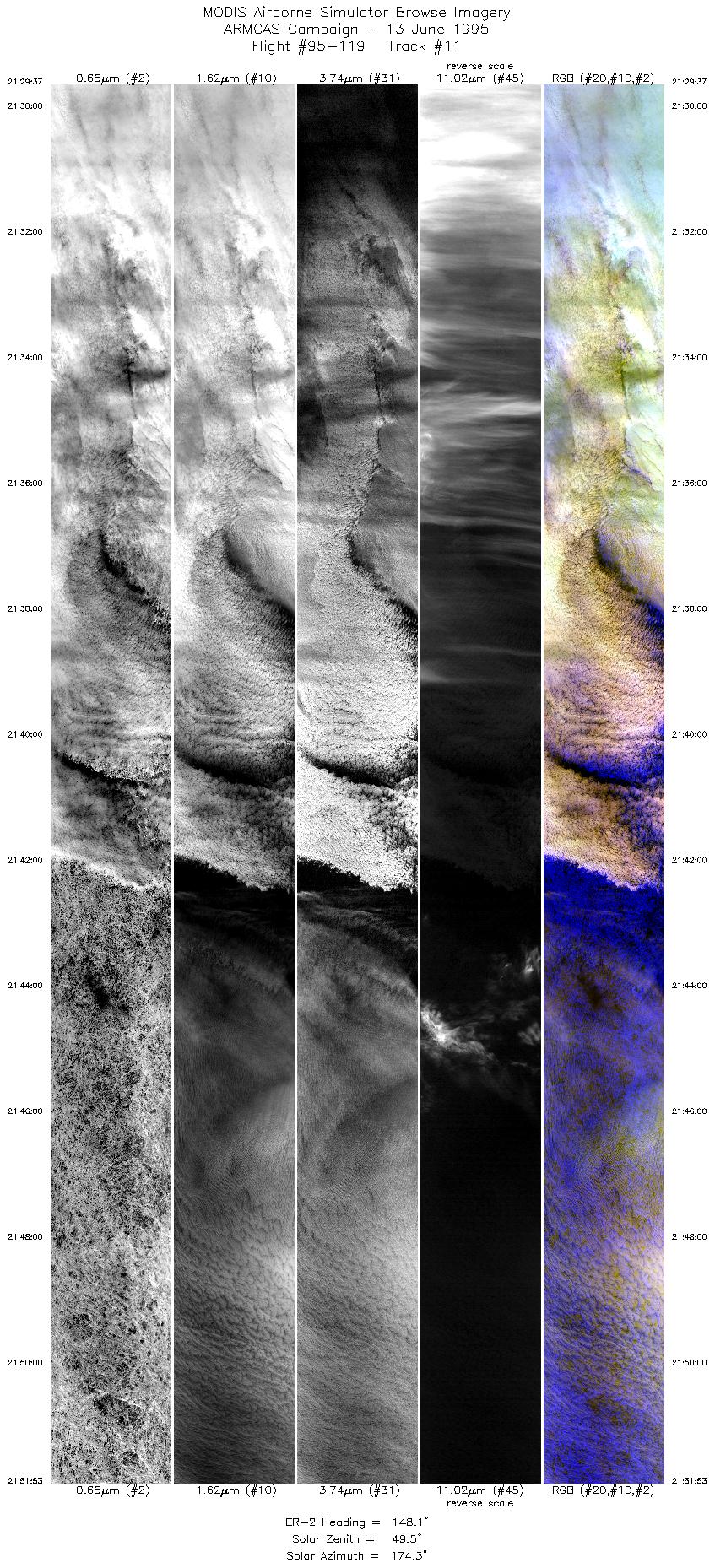
| 11 |
21:29-21:51 |
148 |
72.72-70.50 |
146.73-142.69 |
8293 |
~20000 |
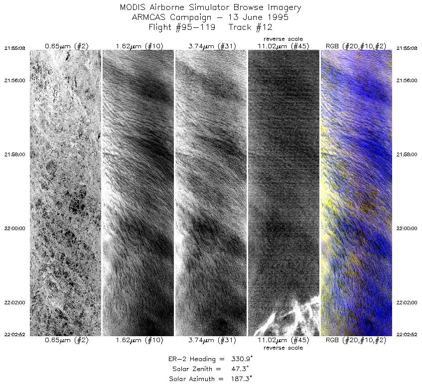
| 12 |
21:55-22:02 |
331 |
70.34-71.11 |
143.41-144.74 |
2876 |
~20000 |
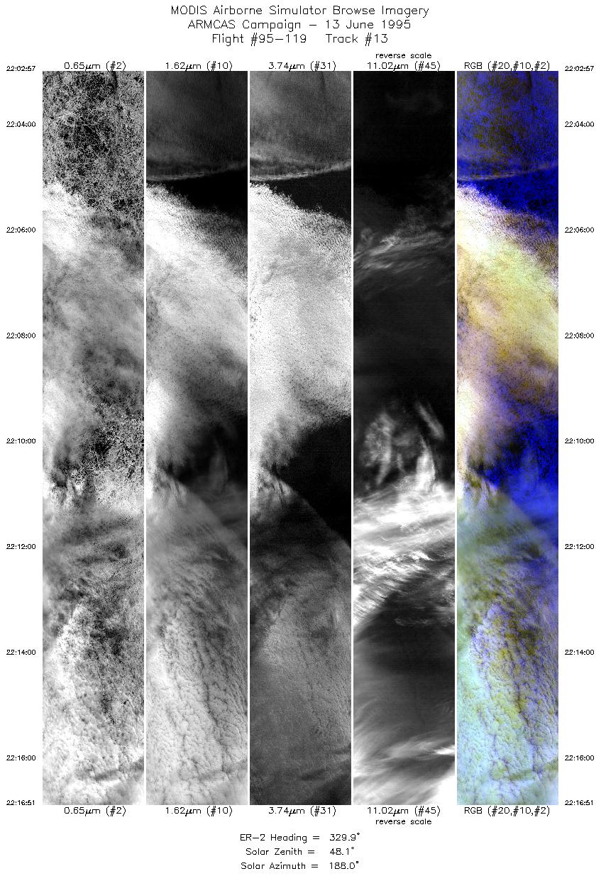
| 13 |
22:02-22:16 |
330 |
71.12-72.54 |
144.73-147.46 |
5176 |
~20000 |
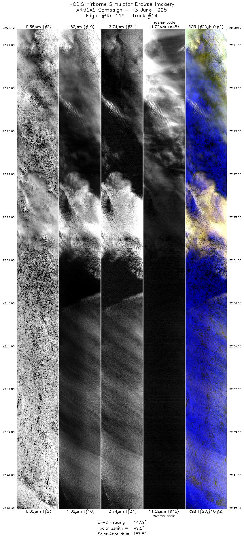
| 14 |
22:20-22:42 |
148 |
72.42-70.21 |
148.18-144.07 |
8318 |
~20000 |
| 15 |
22:44-22:58 |
249 |
70.05-69.40 |
144.51-148.94 |
5287 |
~20000 |
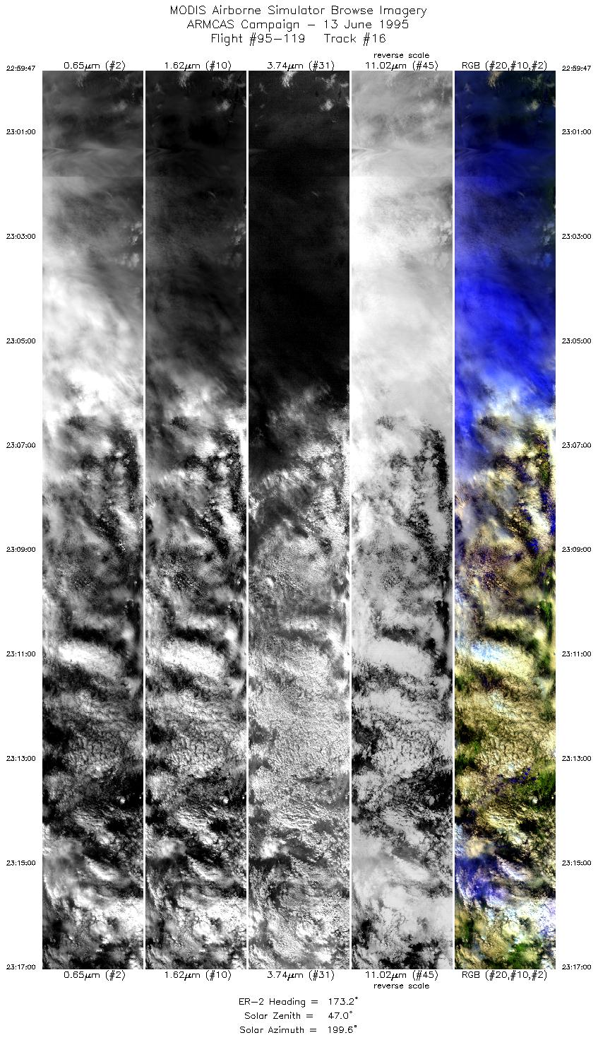
| 16 |
22:59-23:16 |
173 |
69.29-67.27 |
149.06-148.54 |
6364 |
~20000 |
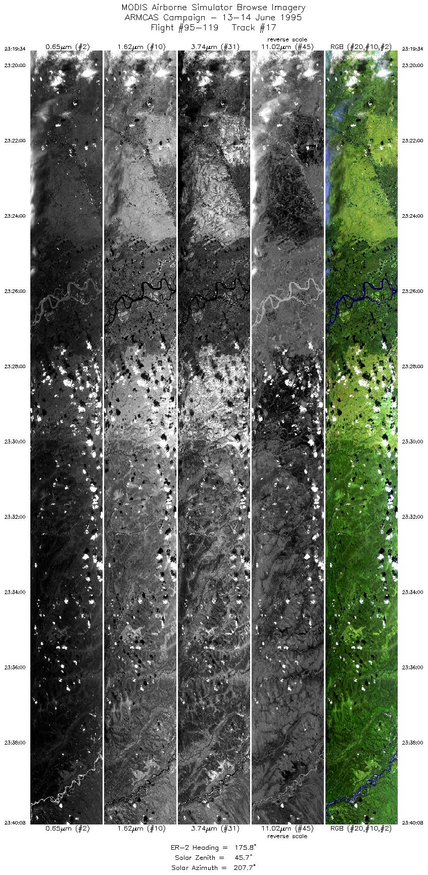
| 17 |
23:19-23:39 |
176 |
66.96-64.58 |
148.32-148.22 |
7660 |
~20000 |
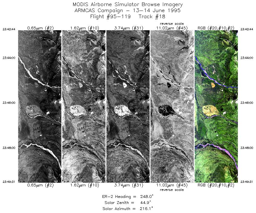
| 18 |
23:42-23:49 |
248 |
64.35-64.06 |
148.68-150.40 |
2522 |
~20000 |
| 19 |
00:06-00:20 |
29 |
62.54-63.95 |
150.84-149.17 |
5149 |
~20000 |
| 20 |
00:20-00:27 |
36 |
63.98-64.61 |
149.12-148.07 |
2491 |
~20000 |
| 21 |
00:28-00:32 |
89 |
64.67-64.67 |
147.79-146.81 |
1385 |
~20000 |
|
Images 01 through 21 in sequence |
Level-1B HDF Data Distribution Point
NASA GSFC Earth Sciences (GES) Data Center
NASA DAAC's
|
|
