


CAMPAIGN SUMMARY INFORMATION
|
GEMx Spring 2024 Dates: 2 April - 24 June, 2024 Location: California / Arizona / Nevada Principal Investigators: Kokaly (USGS) Aircraft: NASA 806 ER-2 (Armstrong Flight Research Center) Additional Sensors: AVIRIS Objective: The Geological Earth Mapping Experiment (GEMx) research project will use NASA's Airborne Visible/Infrared Imaging Spectrometer (AVIRIS), Hyperspectral Thermal Emission Spectrometer (HyTES), and MODIS/ASTER Airborne Simulator (MASTER) instruments flown on NASA's ER-2 and Gulfstream V aircraft to collect the measurements over the country's arid and semi-arid regions, including parts of California, Nevada, Arizona, and New Mexico. |
||||||||||||||||||||||||||||||||||||
|
Processing Information Flights Processed: 26 Total Flight Tracks: 235 Total Scanlines: 1,641,917 Status: Level-1B Data available |
||||||||||||||||||||||||||||||||||||
|
MASTER Spectral Information Spectral Band Configuration Spectral Response Function Table |
||||||||||||||||||||||||||||||||||||
|
Related Web Sites GEMx / Earth MRI Campaign Mission List GEMX Press Release USGS Earth MRI NASA Airborne Science Program Airborne Visible-Infrared Imaging Spectrometer (AVIRIS) |
||||||||||||||||||||||||||||||||||||
|
||||||||||||||||||||||||||||||||||||
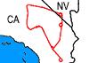 Flight: 24-934-00
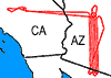 Flight: 24-935-00
 Flight: 24-936-00
 Flight: 24-937-00
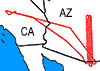 Flight: 24-938-00
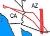 Flight: 24-939-00
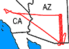 Flight: 24-940-00
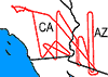 Flight: 24-941-00
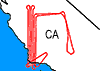 Flight: 24-942-00
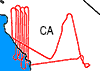 Flight: 24-943-00
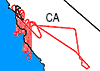 Flight: 24-944-00
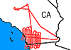 Flight: 24-945-00
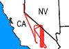 Flight: 24-946-00
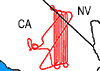 Flight: 24-947-00
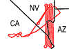 Flight: 24-948-00
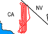 Flight: 24-949-00
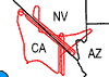 Flight: 24-950-00
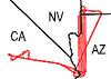 Flight: 24-951-00
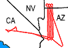 Flight: 24-952-00
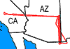 Flight: 24-953-00
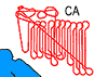 Flight: 24-954-00
 Flight: 24-956-00
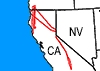 Flight: 24-957-00
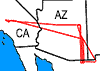 Flight: 24-958-00
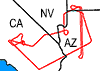 Flight: 24-959-00
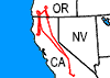 Flight: 24-961-00
GEMx Spring 2024


| Sample Imagery |
| Click image for full resolution |
|
Flight 24-952-00 Western Arizona |


|
|
R: 2.13µm G: 1.61µm B: 0.47µm |


