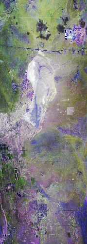
Flight: 24-949-00
Date: 16 May 2024
Aircraft: ER-2 #809
Deployment: GEMx Spring 2024
Flight Location: Southern California (CA05)
Principal Investigators: Kokaly (USGS)
Additional Sensors: AVIRIS
|
Data Evaluation
Overall quality is good
Channel 11 pin not fully seated
|
Processing Information
Level-1B Data in HDF format is available
Flight Line Summary
Spectral Band Configuration
Spectral Response Function Table
Spectral Response Function (text)
|
Browse Imagery
Flight Tracks: 9
Scanlines: 78502
|
Browse Imagery Table
|
Click a Flight Track number to view a quicklook image
Lat/Lon ranges are for the BEG-END scanline nadir pixels
|
Flight
Track |
Time Span
(UTC) |
Heading
(Deg) |
Lat Range
(Deg N) |
Lon Range
(Deg W) |
Length
(Scanlines) |
Altitude
(Meters) |
| 1 |
16:48 - 17:11 |
0.5 |
34.563 - 37.104 |
118.105 - 118.091 |
8522 |
20010 |
| 2 |
17:17 - 17:42 |
178.9 |
37.181 - 34.423 |
118.005 - 118.003 |
9222 |
20152 |
| 3 |
17:47 - 18:12 |
1.5 |
34.303 - 37.107 |
117.919 - 117.911 |
9418 |
20168 |
| 4 |
18:17 - 18:41 |
178.9 |
37.199 - 34.456 |
117.726 - 117.727 |
9156 |
20155 |
| 5 |
18:46 - 19:11 |
0.5 |
34.303 - 37.091 |
117.650 - 117.630 |
9422 |
20129 |
| 6 |
19:17 - 19:40 |
180.2 |
37.084 - 34.454 |
117.817 - 117.821 |
8788 |
20121 |
| 7 |
19:44 - 20:08 |
2.5 |
34.479 - 37.093 |
117.455 - 117.444 |
8875 |
20143 |
| 8 |
20:23 - 20:39 |
220.5 |
35.681 - 34.396 |
117.060 - 118.479 |
5859 |
20082 |
| 9 |
20:47 - 21:12 |
2.5 |
34.378 - 37.095 |
117.544 - 117.538 |
9240 |
20137 |
|


