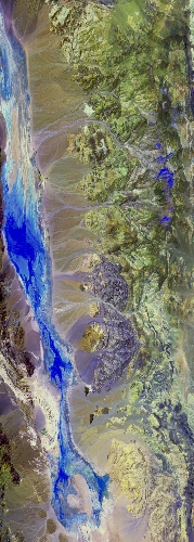
Flight: 24-946-00
Date: 08 May 2024
Aircraft: ER-2 #809
Deployment: GEMx Spring 2024
Flight Location: Southern California (CA06) / Lake Tahoe
Principal Investigators: Kokaly (USGS)
Additional Sensors: AVIRIS
|
Data Evaluation
Overall quality is good
|
Processing Information
Level-1B Data in HDF format is available
Flight Line Summary
Spectral Band Configuration
Spectral Response Function Table
Spectral Response Function (text)
|
Browse Imagery
Flight Tracks: 10
Scanlines: 77776
|
Browse Imagery Table
|
Click a Flight Track number to view a quicklook image
Lat/Lon ranges are for the BEG-END scanline nadir pixels
|
Flight
Track |
Time Span
(UTC) |
Heading
(Deg) |
Lat Range
(Deg N) |
Lon Range
(Deg W) |
Length
(Scanlines) |
Altitude
(Meters) |
| 1 |
16:52 - 17:15 |
181.2 |
37.012 - 34.421 |
117.347 - 117.349 |
8845 |
20026 |
| 2 |
17:18 - 17:43 |
1.0 |
34.418 - 37.230 |
117.170 - 117.157 |
9625 |
20083 |
| 3 |
17:47 - 18:11 |
181.9 |
37.062 - 34.384 |
117.248 - 117.253 |
9094 |
20060 |
| 4 |
18:14 - 18:39 |
358.0 |
34.385 - 37.103 |
116.970 - 116.969 |
9126 |
20158 |
| 5 |
18:50 - 19:14 |
144.4 |
36.647 - 34.386 |
118.270 - 116.409 |
9004 |
20093 |
| 6 |
19:19 - 19:40 |
357.8 |
34.416 - 36.766 |
116.776 - 116.776 |
7878 |
19994 |
| 7 |
19:48 - 20:12 |
180.0 |
37.126 - 34.392 |
117.070 - 117.068 |
9049 |
20121 |
| 8 |
20:15 - 20:37 |
0.5 |
34.471 - 36.839 |
116.872 - 116.873 |
8012 |
20178 |
| 9 |
21:06 - 21:14 |
356.1 |
38.929 - 39.927 |
120.029 - 120.034 |
3364 |
20067 |
| 10 |
21:19 - 21:29 |
172.9 |
40.055 - 38.911 |
120.057 - 120.034 |
3779 |
20201 |
|


