Flight: 98-075
Date: 4 June 1998
Location: Alaska / Arctic Ocean
Deployment: FIRE-ACE
Principal Investigator: King (NASA GSFC)
Additional Sensors: AirMISR, AMPR, CLS, MIR, HIS, SSFR
|
Data Evaluation
Overall quality is good
|
Processing Information
Level-1B Data in HDF format is available
Flight Line Summary
Spectral Band Configuration
Spectral Response Function Table
|
Browse Imagery
Flight Tracks: 19
Scanlines: 89110
|
Browse Imagery Table
|
Click a Flight Track number to view a quicklook image
Lat/Lon ranges are for the BEG-END scanline nadir pixels |
Flight
Track |
Time Span
(GMT) |
Heading
(Deg) |
Lat Range
(Deg North) |
Lon Range
(Deg West) |
Length
(scanlines) |
Altitude
(meters) |
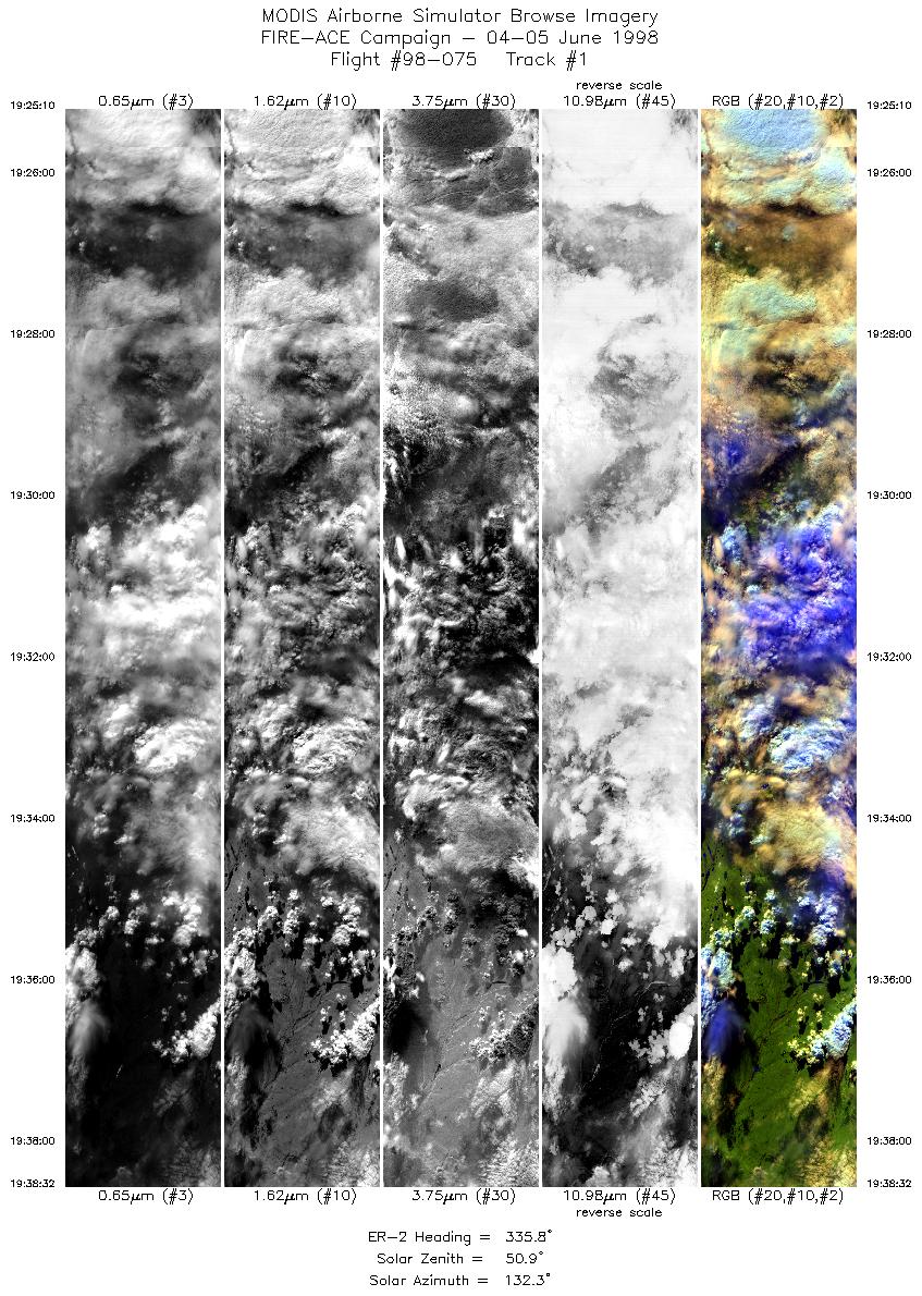
| 1 |
19:25-19:38 |
336 |
67.32-68.72 |
150.54-152.37 |
4952 |
~20000 |
| 2 |
19:38-19:51 |
335 |
68.72-70.10 |
152.37-154.45 |
4995 |
~20000 |
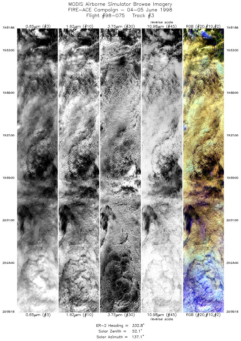
| 3 |
19:51-20:05 |
333 |
70.10-71.46 |
154.45-156.84 |
4994 |
~20000 |
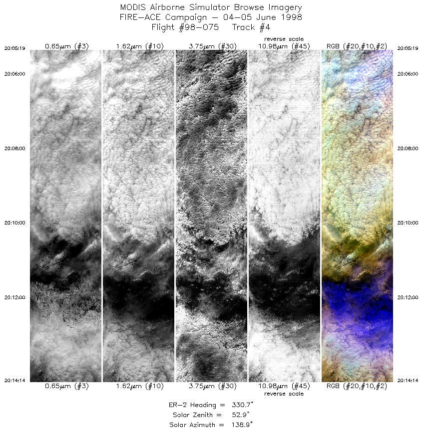
| 4 |
20:05-20:14 |
331 |
71.46-72.34 |
156.85-158.63 |
3332 |
~20000 |
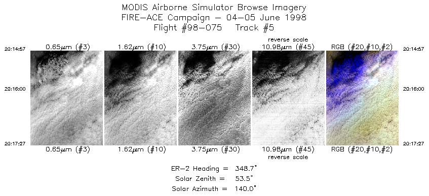
| 5 |
20:14-20:17 |
349 |
72.42-72.70 |
158.75-158.96 |
936 |
~20000 |
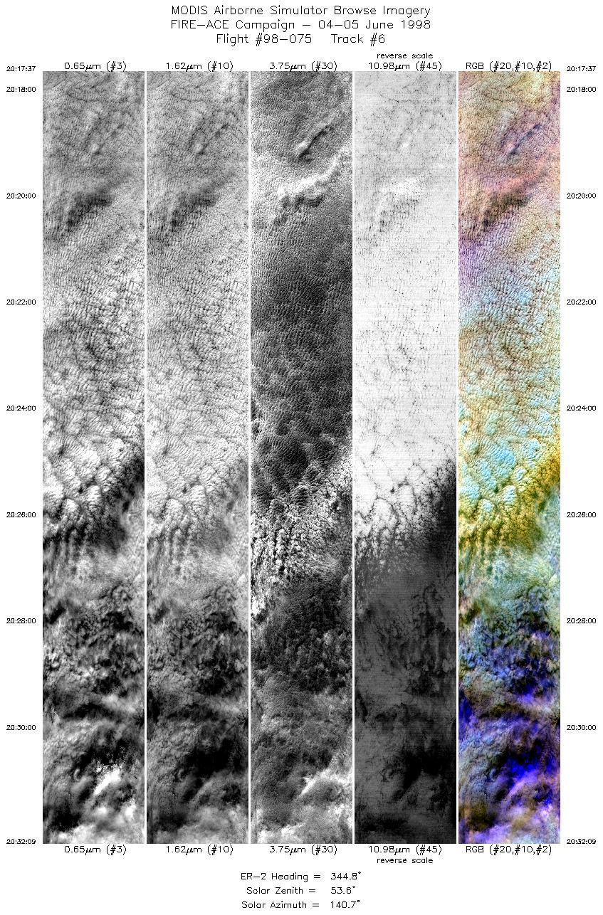
| 6 |
20:17-20:32 |
345 |
72.72-74.35 |
158.95-160.68 |
5430 |
~20000 |
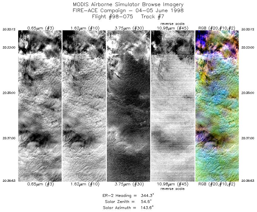
| 7 |
20:32-20:38 |
344 |
74.35-75.10 |
160.70-161.60 |
2497 |
~20000 |
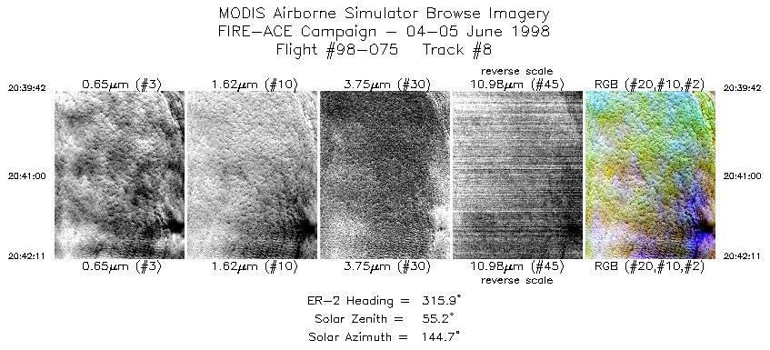
| 8 |
20:39-20:42 |
316 |
75.18-75.38 |
161.82-162.64 |
928 |
~20000 |
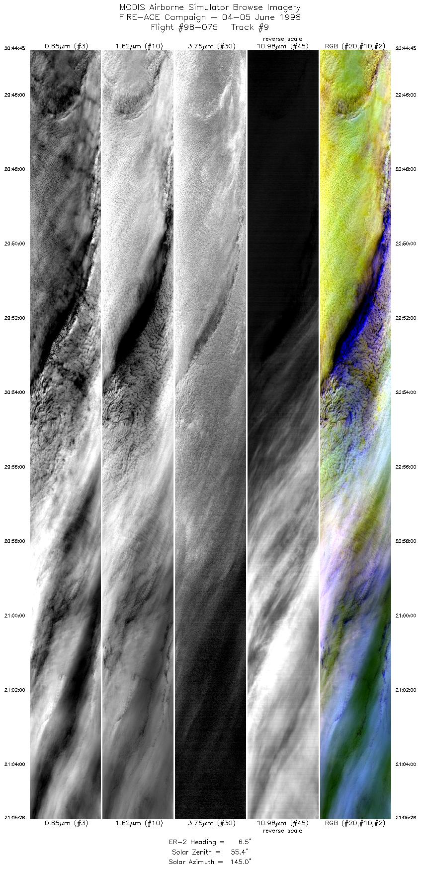
| 9 |
20:44-21:05 |
7 |
75.62-78.03 |
163.09-162.22 |
7726 |
~20000 |
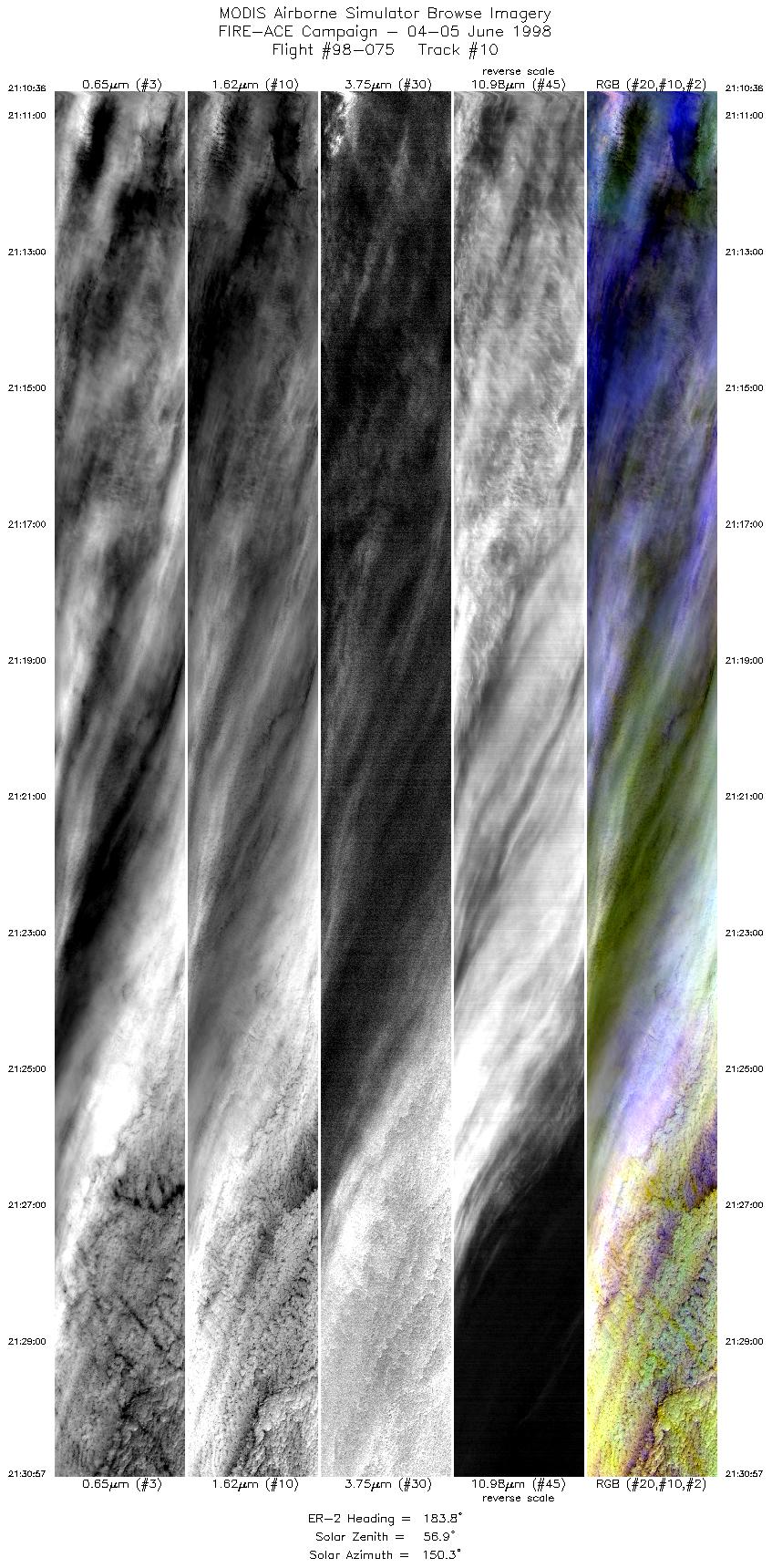
| 10 |
21:10-21:30 |
184 |
77.98-75.65 |
164.00-164.56 |
7603 |
~20000 |
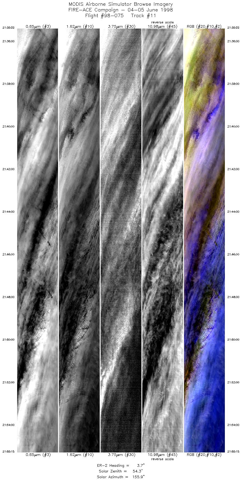
| 11 |
21:35-21:55 |
4 |
75.69-78.03 |
166.02-165.74 |
7427 |
~20000 |
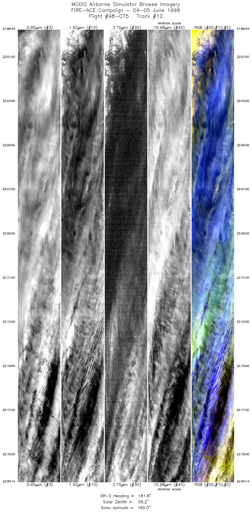
| 12 |
21:59-22:20 |
182 |
78.03-75.69 |
167.50-167.50 |
7616 |
~20000 |
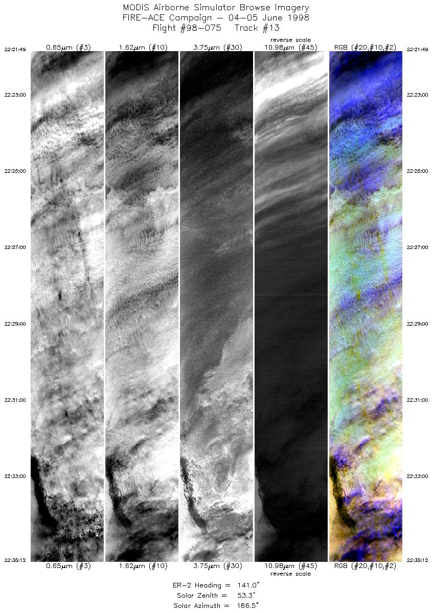
| 13 |
22:21-22:35 |
141 |
75.53-74.33 |
167.11-163.40 |
4999 |
~20000 |
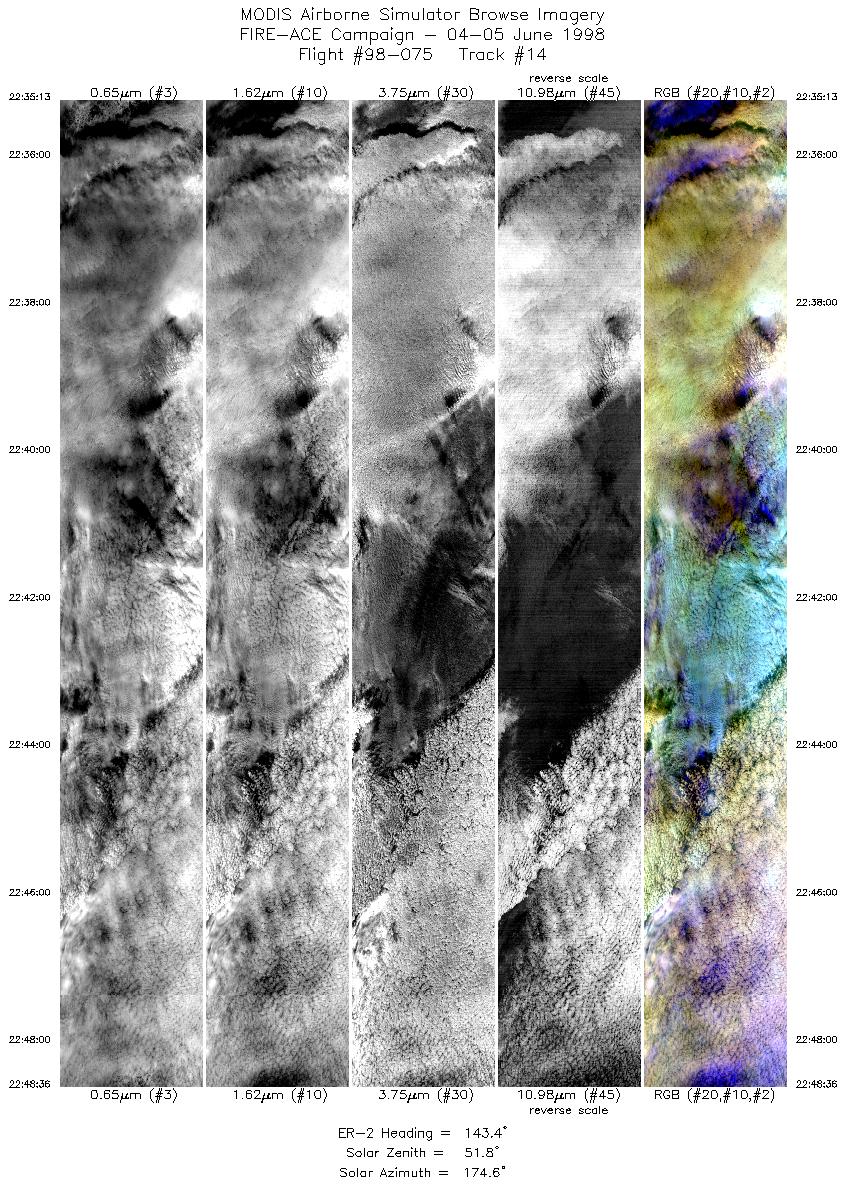
| 14 |
22:35-22:48 |
143 |
74.33-73.09 |
163.39-160.23 |
4936 |
~20000 |
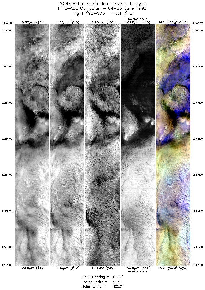
| 15 |
22:48-23:02 |
147 |
73.09-71.81 |
160.24-157.51 |
4999 |
~20000 |
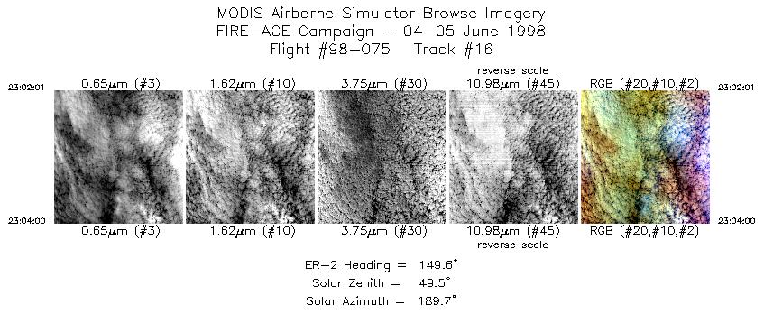
| 16 |
23:02-23:04 |
150 |
71.81-71.61 |
157.54-157.16 |
742 |
~20000 |
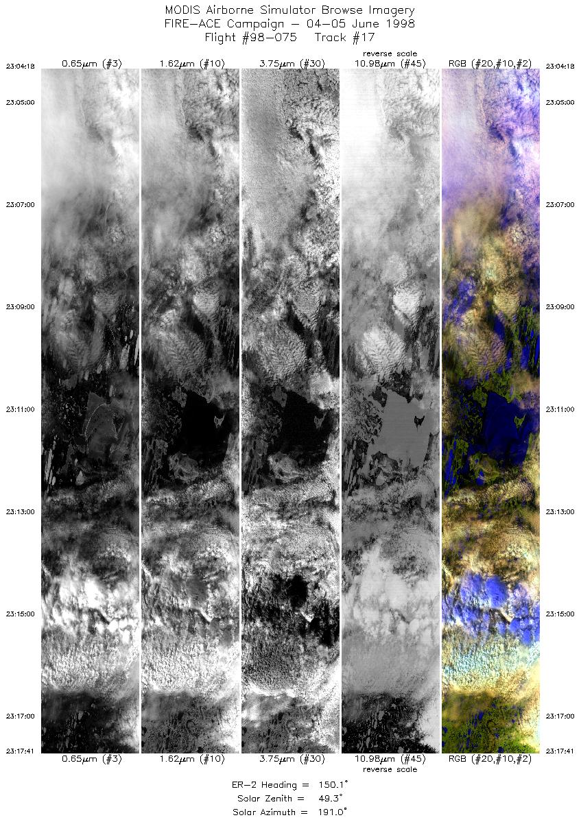
| 17 |
23:04-23:17 |
150 |
71.59-70.27 |
157.08-154.75 |
4999 |
~20000 |
| 18 |
23:17-23:31 |
151 |
70.27-68.93 |
154.77-152.63 |
4999 |
~20000 |
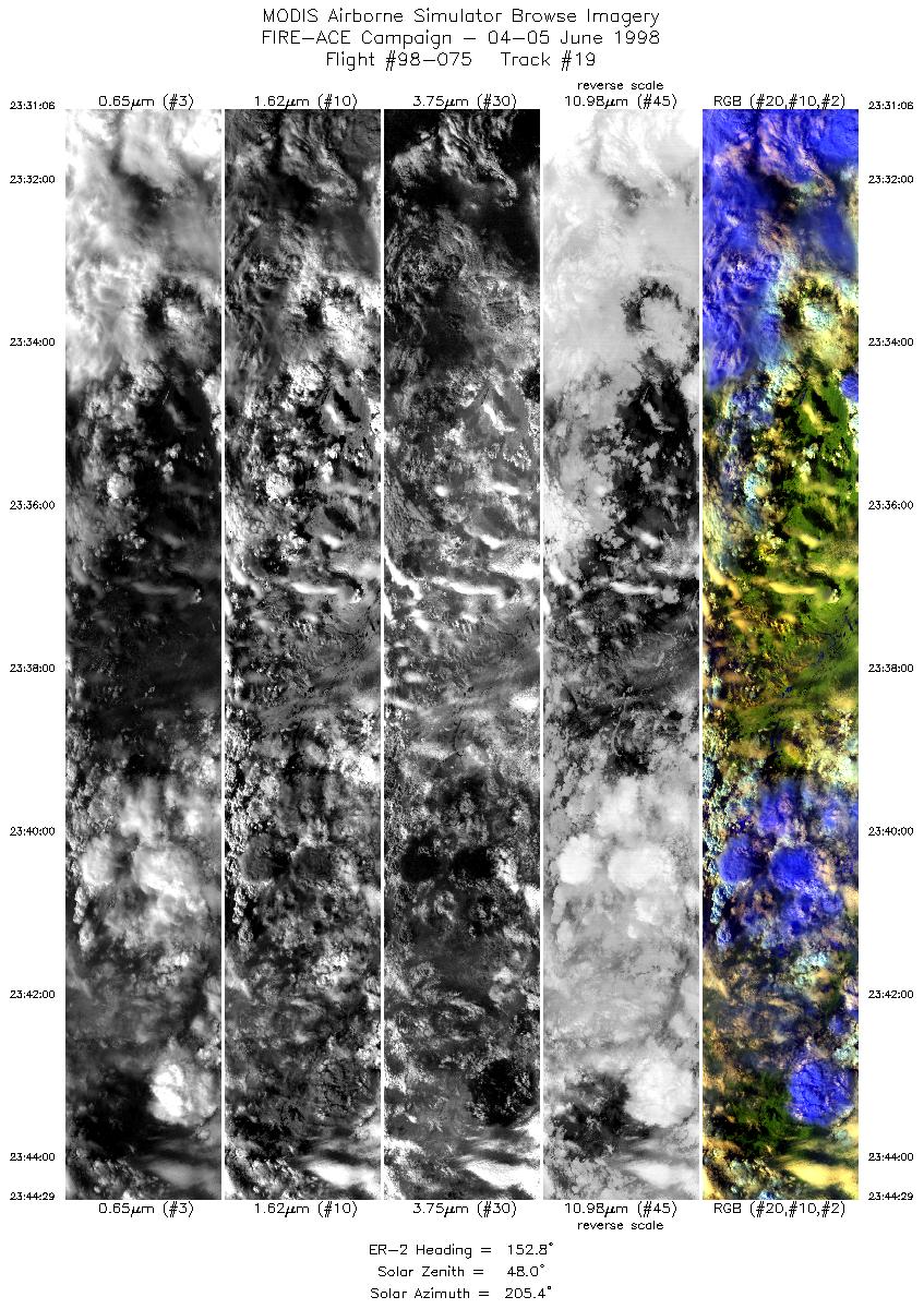
| 19 |
23:31-23:44 |
153 |
68.93-67.58 |
152.63-150.76 |
5000 |
~20000 |
|
Flight Summary Report
Author: Steve Platnick
Mission Scientist: Steve Platnick
ER-2 Pilot: Bill Collette
Takeoff: 1900 (UTC)
Landing: 0030 (UTC)
Duration: 5:30 (h:mm)
Objective and Summary:
- Overfly the region between the SHEBA ice camp (76°51'N, 167°30'W) and an area
about 80km to the East, in order to overfly cirrus being advected over the
region from the Northwest. Flight useful for cloud remote sensing and cloud
masking validation, and sea ice retrievals in the presence of changing cloud
cover.
- Overfly the ARM site on outgoing and incoming flight legs.
Coordinations:
- F-14 satellite (2137 UTC)
Key Flight Legs:
- The ER-2 overflew the ARM site and then headed Northwest towards the SHEBA
ice station. Then flew four parallel North-South flight legs of about 280km
in length, offset by 40km, starting from the East of the ice station
and ending over the station. The ER-2 overflew the ARM site on the return
to Ft. Wainwright.
- The AirMISR was scheduled for six runs, twice over the ice station and four
times during the parallel flight legs. All six runs failed for unknown reasons.
Pilot Report:
- The ER-2 pilot reported solid undercast cloud cover over the entire mission.
Meteorology:
- Extensive clouds cover over the ice station in the
morning report. At 1600 UTC, the radar showed cloud layers at the surface,
0.8-1.0km, and 6.5-8.5km. Satellite imagery showed cloud tops around
3-3.5km. Light surface winds out of the Southwest at 5kts. A band of
cirrus running Southwest to Northeast was expected to move over the ER-2
operations area during the morning, with thinner cirrus likely in the
Eastern flight legs. The cirrus was associated with a low to the Northwest
of the ice station.
- At 2000 UTC (about 45 minutes before the ER-2 began its Eastern most leg), the
ice station reported surface winds at 22 kts, 190° and a ceilometer cloud base
of about 0.2km. Radar showed two cloud layers: a lower one just over the
surface up to 0.5km and a higher layer between 4.5-7km, and intermittently
up to 9km.
Instrument Status:
- AirMISR (Airborne Multi-angle Imaging Spectroradiometer): Failed
- AMPR (Advanced Microwave Precipitation Radiometer): Worked well
- CLS (Cloud Lidar System): Partial failure (only linear channel worked)
- HIS (High-resolution Interferometer Sounder): Worked well
- MAS (MODIS Airborne Simulator): Worked well
- MIR (Millimeter-wave Imaging Radiometer): Intermittent noise in some channels
- SSFR (Solar Spectral Flux Radiometer): Worked well
|


