Flight: 16-928
Date: 13 Dec 2015
Location: Washington / Pacific Ocean
Deployment: RADEX (OLYMPEX)
Principal Investigators: Dr. Steven Platnick (NASA GSFC)
Configuration: 38 Channel
Additional Sensors: AirMSPI-1 / AMPR / CPL / CRS / HiWRAP
|
Data Evaluation
Overall quality is fair
|
Processing Information
Level-1B Data in HDF format is available
Flight Line Summary
Spectral Band Configuration
Spectral Response Function Table
Spectral Response Function (text)
|
Browse Imagery
Flight Tracks: 31
Scanlines: 121291
|
Browse Imagery Table
|
Click a Flight Track number to view a quicklook image
Lat/Lon ranges are for the BEG-END scanline nadir pixels
|
Flight
Track |
Time Span
(UTC) |
Heading
(Deg) |
Lat Range
(Deg N) |
Lon Range
(Deg W) |
Length
(Scanlines) |
Altitude
(Meters) |
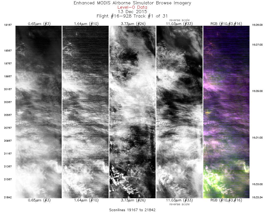
| 1 |
16:26 - 16:33 |
106.0 |
48.135 - 47.876 |
124.704 - 123.455 |
2676 |
18508 |
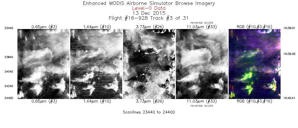
| 2 |
16:35 - 16:37 |
206.2 |
47.683 - 47.473 |
123.376 - 123.542 |
777 |
19163 |
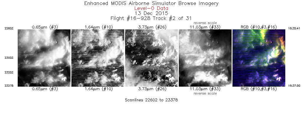
| 3 |
16:38 - 16:40 |
201.8 |
47.456 - 47.176 |
123.553 - 123.716 |
961 |
19208 |
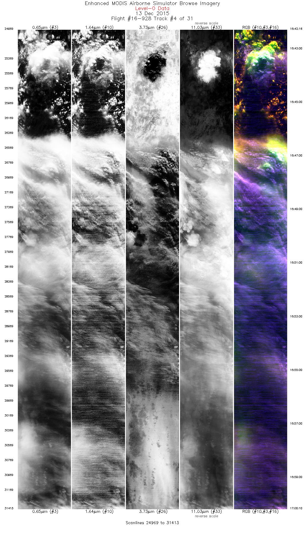
| 4 |
16:42 - 17:00 |
305.0 |
47.122 - 48.319 |
123.919 - 126.205 |
6445 |
19379 |
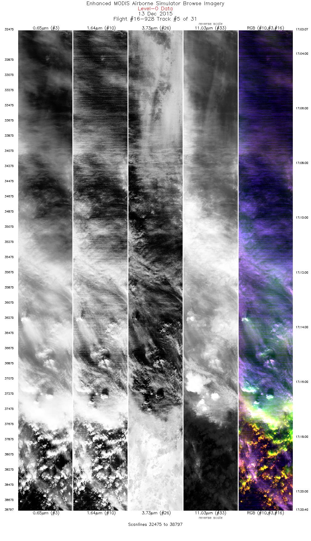
| 5 |
17:03 - 17:20 |
126.8 |
48.153 - 46.895 |
126.371 - 123.982 |
6323 |
19429 |
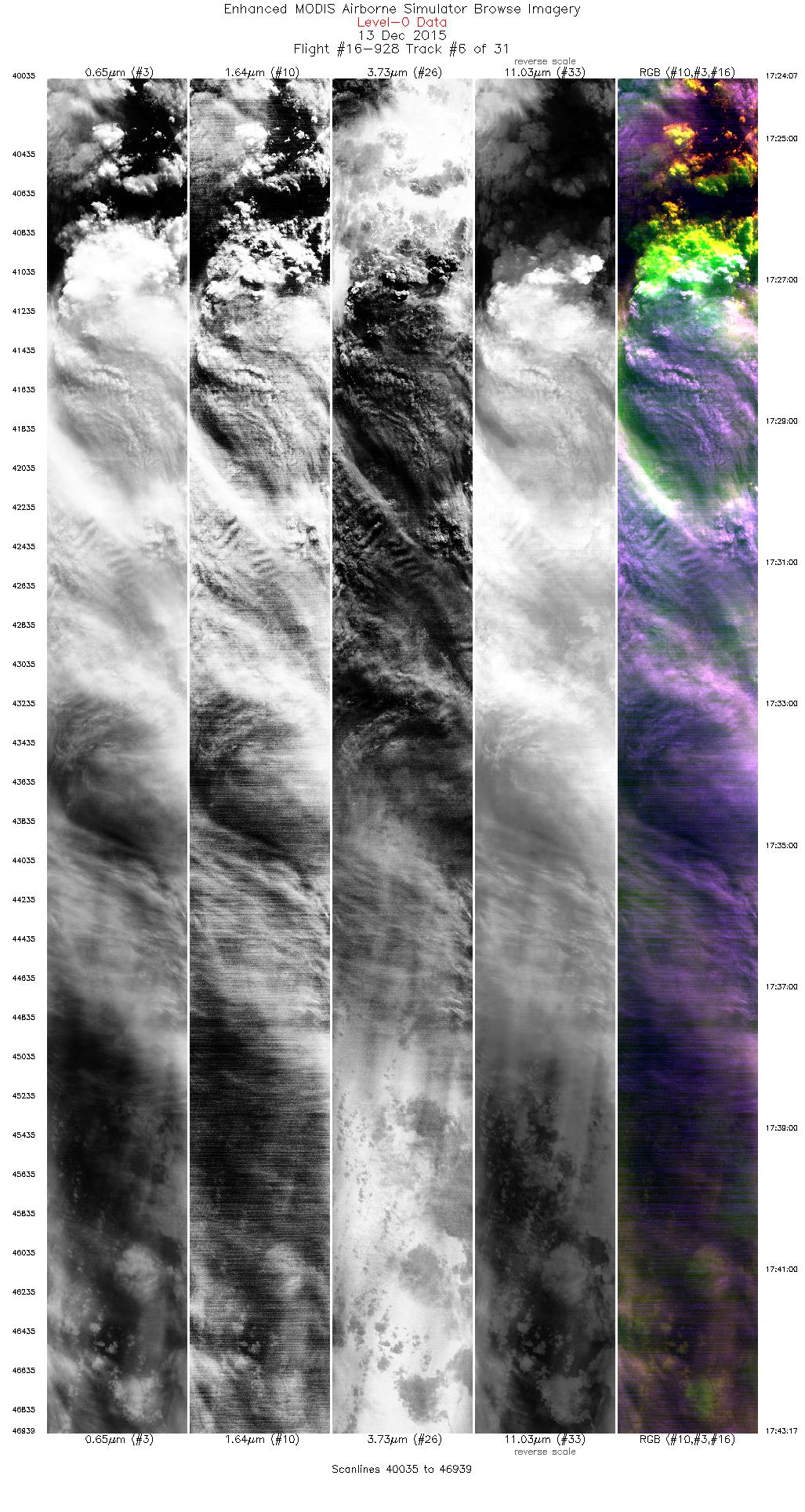
| 6 |
17:24 - 17:43 |
297.7 |
47.080 - 48.135 |
123.740 - 126.405 |
6905 |
19434 |
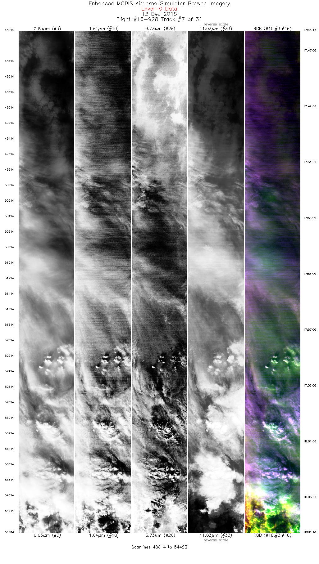
| 7 |
17:46 - 18:04 |
120.4 |
47.957 - 46.909 |
126.538 - 123.885 |
6470 |
19428 |
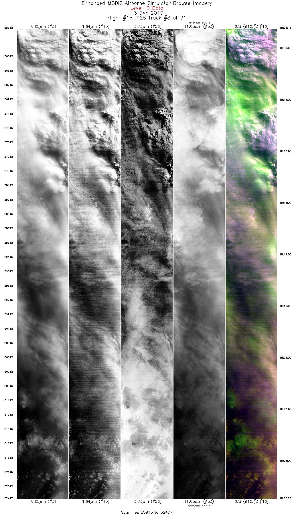
| 8 |
18:08 - 18:26 |
290.1 |
47.153 - 47.802 |
123.714 - 126.439 |
6563 |
19414 |
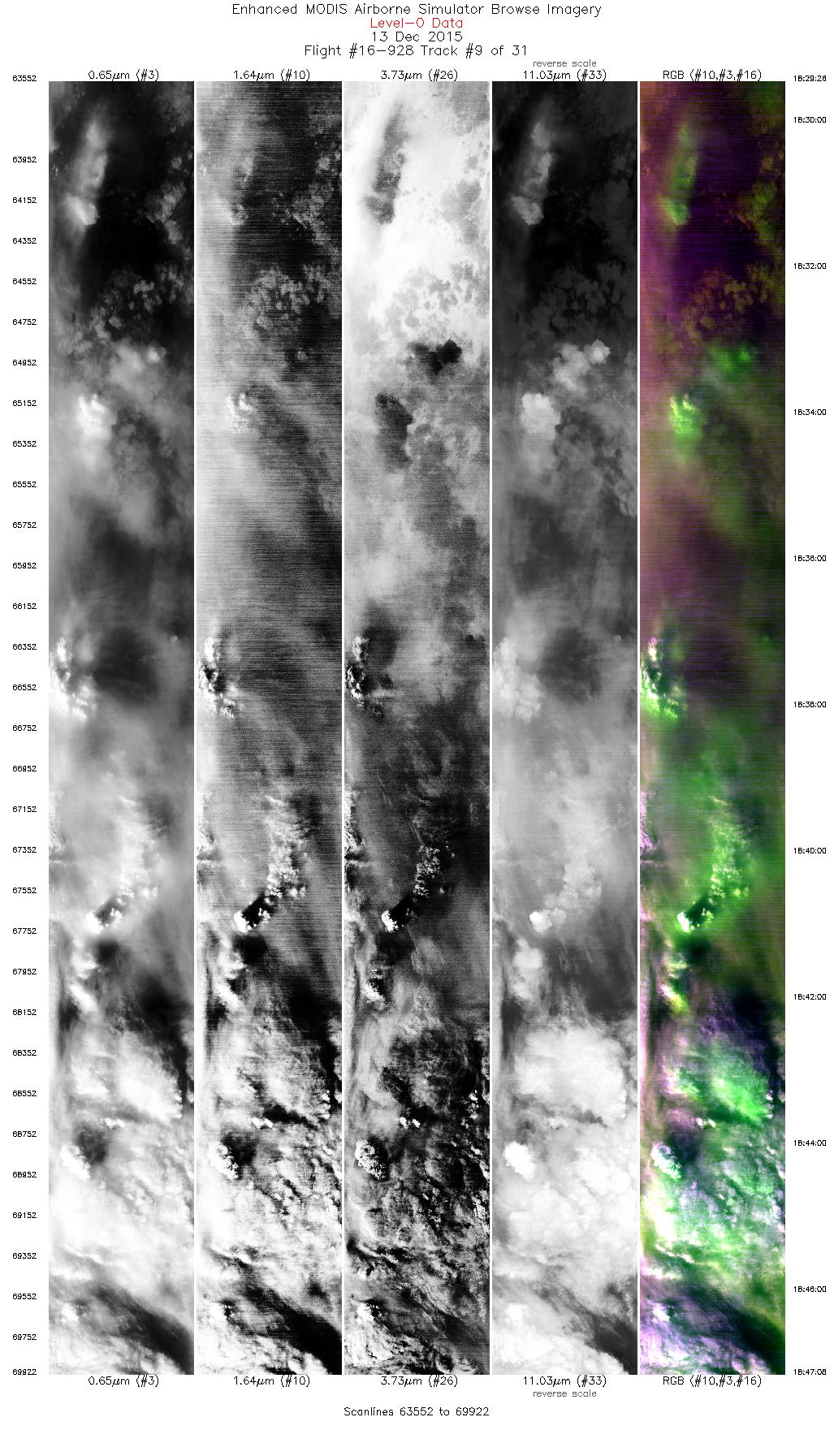
| 9 |
18:29 - 18:47 |
107.5 |
47.613 - 46.938 |
126.557 - 123.714 |
6371 |
19438 |
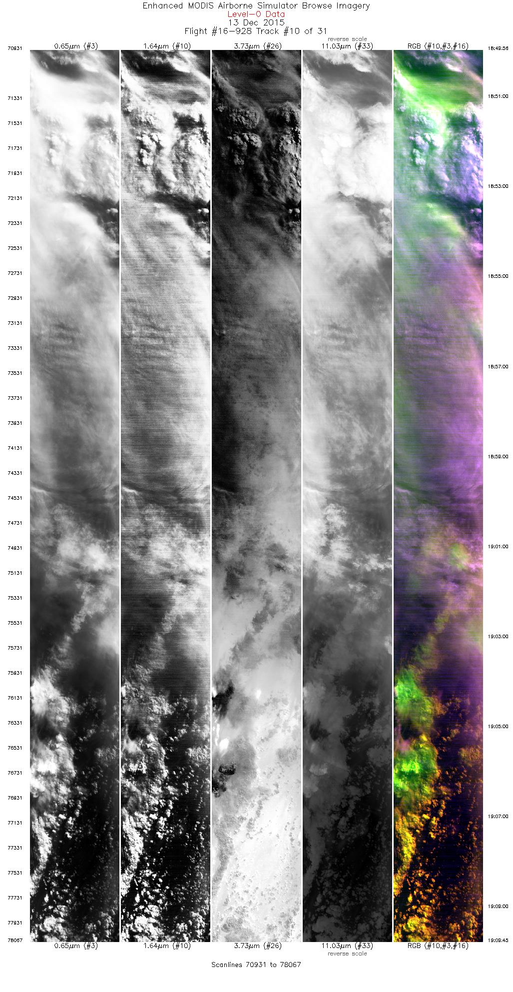
| 10 |
18:49 - 19:09 |
288.3 |
47.119 - 47.821 |
123.593 - 126.524 |
7137 |
19426 |
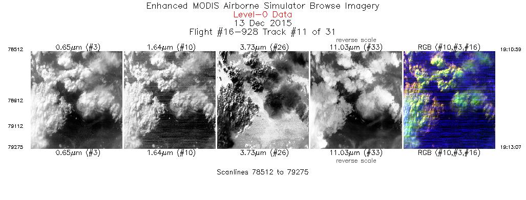
| 11 |
19:10 - 19:13 |
26.1 |
47.929 - 48.138 |
126.591 - 126.420 |
764 |
19557 |
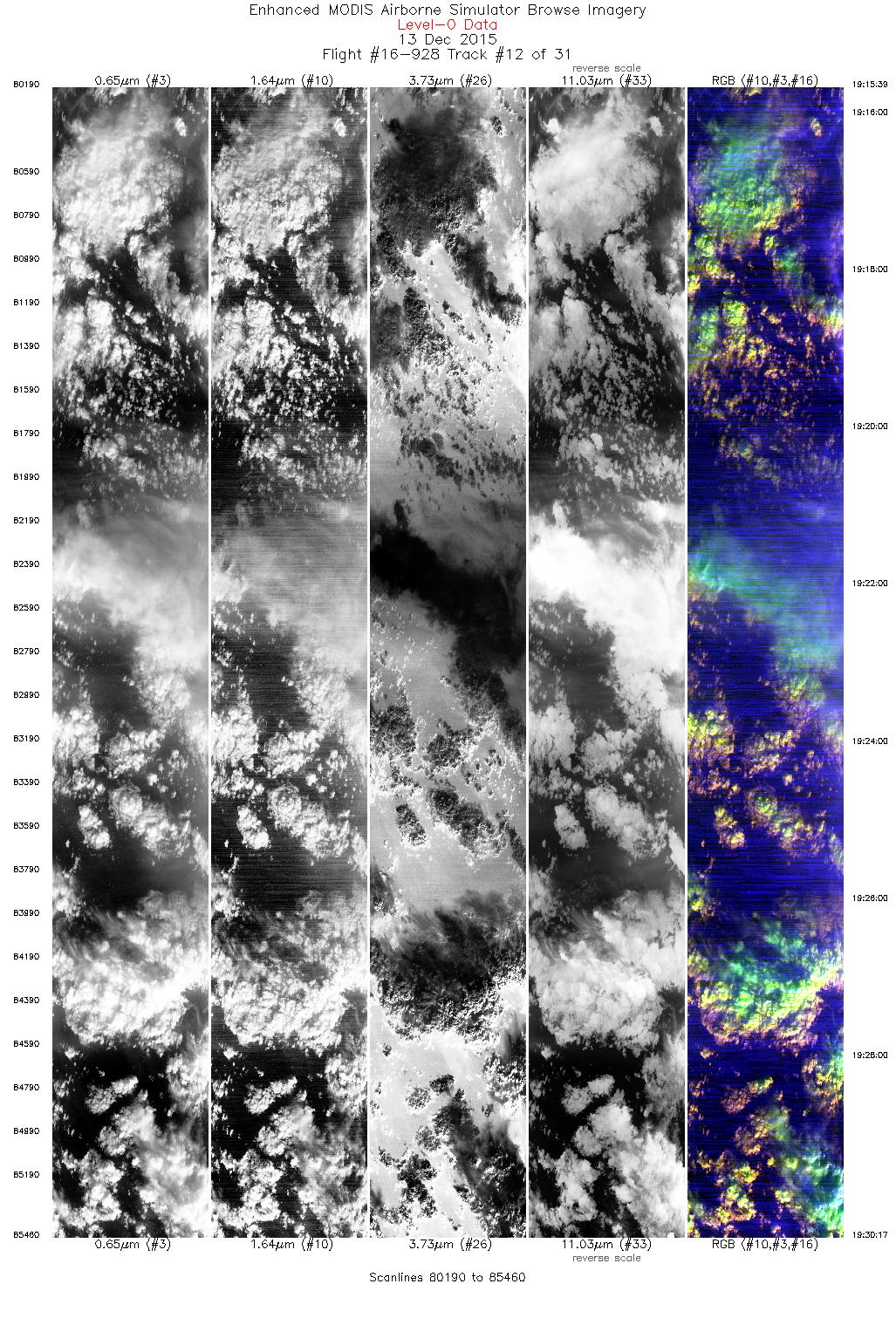
| 12 |
19:15 - 19:30 |
197.2 |
48.093 - 46.567 |
126.119 - 126.718 |
5241 |
19735 |
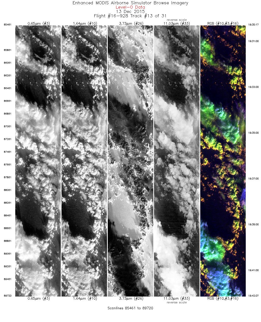
| 13 |
19:30 - 19:42 |
197.5 |
46.567 - 45.286 |
126.718 - 127.193 |
4320 |
19751 |
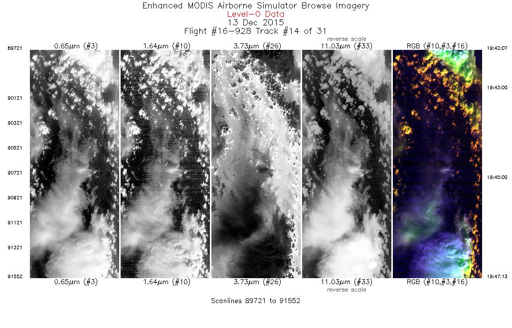
| 14 |
19:42 - 19:47 |
197.1 |
45.285 - 44.743 |
127.194 - 127.388 |
1802 |
19761 |
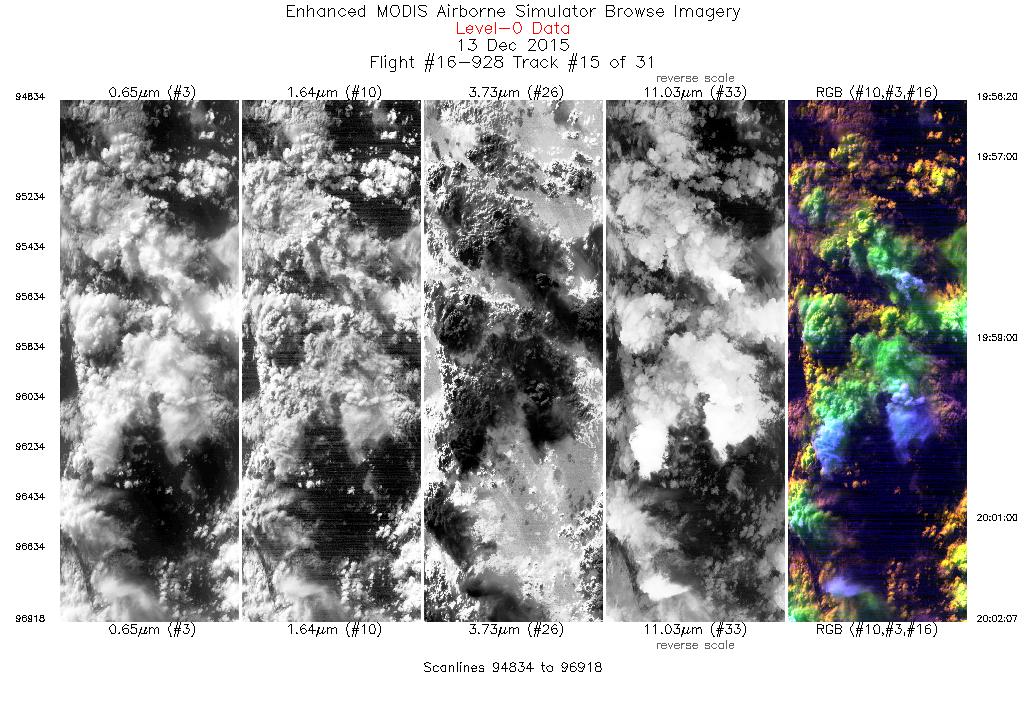
| 15 |
19:56 - 20:02 |
36.5 |
45.199 - 45.705 |
126.596 - 126.017 |
2085 |
19764 |
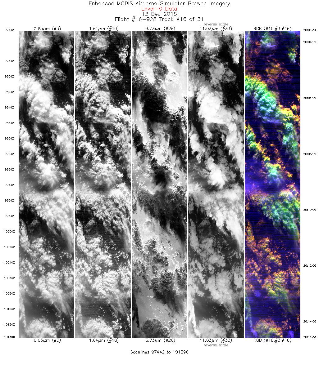
| 16 |
20:03 - 20:14 |
356.2 |
45.856 - 47.041 |
126.002 - 125.999 |
3955 |
19746 |
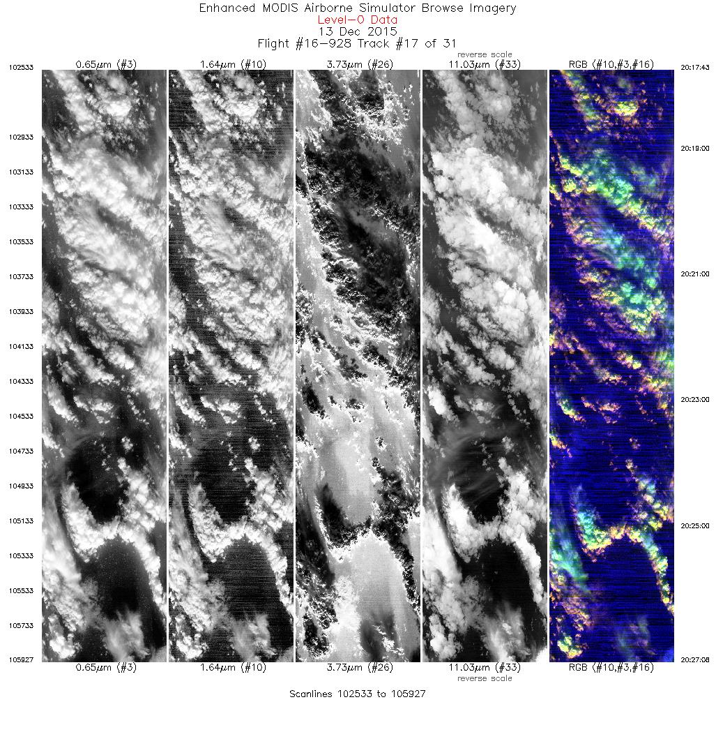
| 17 |
20:17 - 20:27 |
182.7 |
47.009 - 45.937 |
126.291 - 126.287 |
3395 |
19742 |
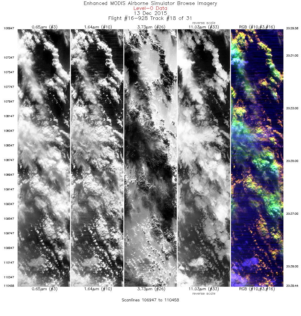
| 18 |
20:29 - 20:39 |
358.5 |
45.935 - 47.018 |
126.000 - 125.998 |
3512 |
19744 |
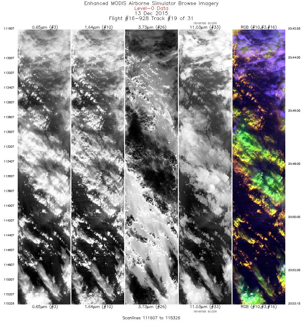
| 19 |
20:42 - 20:53 |
194.7 |
47.046 - 45.931 |
125.754 - 126.172 |
3720 |
19739 |
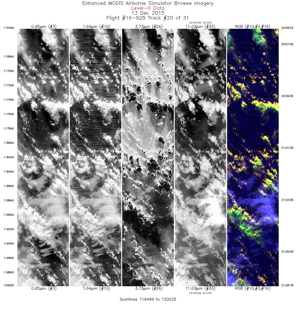
| 20 |
20:56 - 21:06 |
13.8 |
45.987 - 47.037 |
126.444 - 126.059 |
3577 |
19742 |
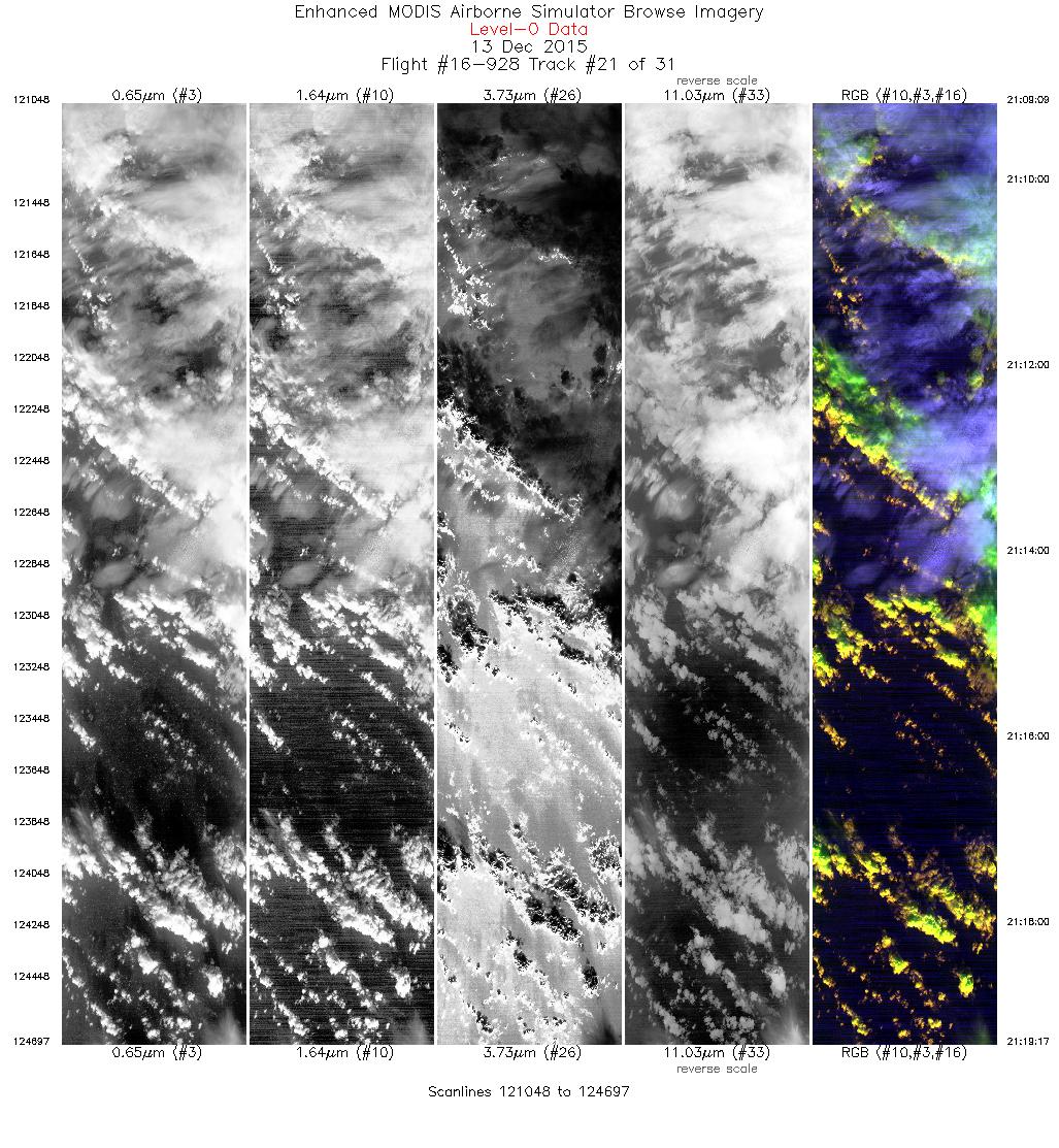
| 21 |
21:09 - 21:19 |
196.9 |
47.029 - 45.933 |
125.760 - 126.172 |
3650 |
19747 |
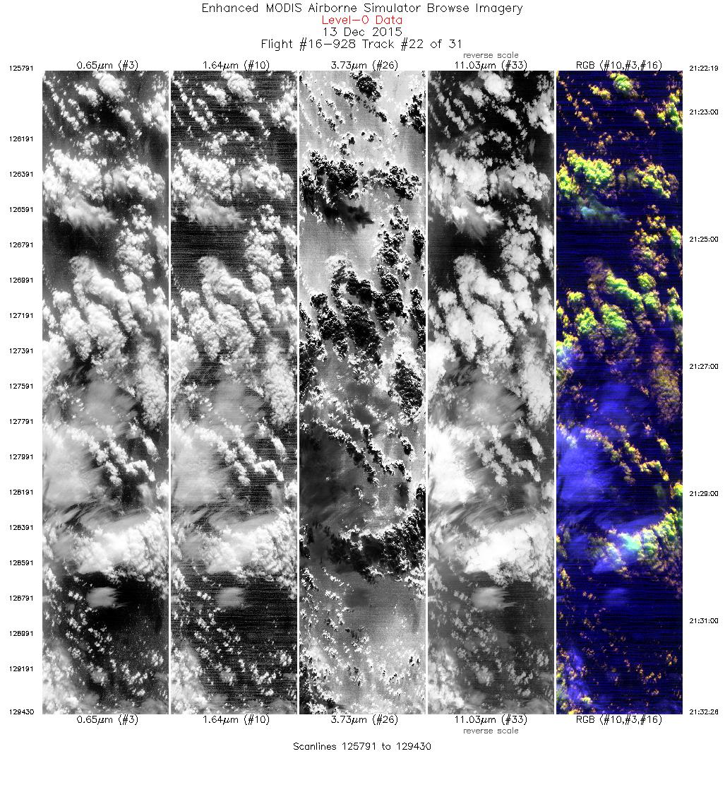
| 22 |
21:22 - 21:32 |
13.1 |
45.988 - 47.049 |
126.445 - 126.053 |
3640 |
19741 |
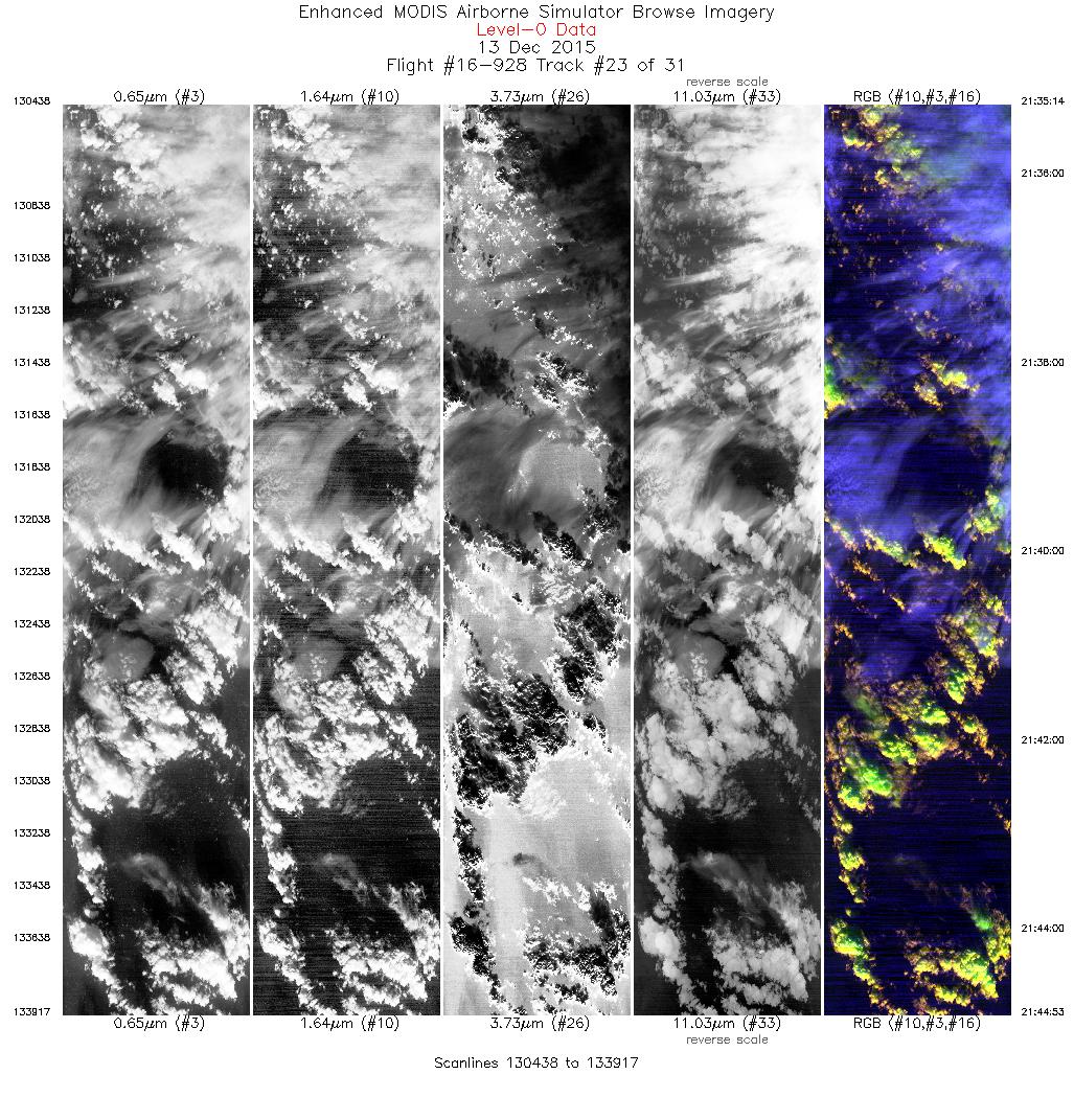
| 23 |
21:35 - 21:44 |
196.5 |
47.000 - 45.937 |
125.772 - 126.168 |
3480 |
19742 |
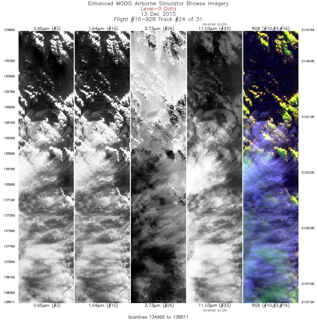
| 24 |
21:47 - 21:57 |
12.5 |
45.896 - 46.952 |
125.885 - 125.483 |
3517 |
19733 |
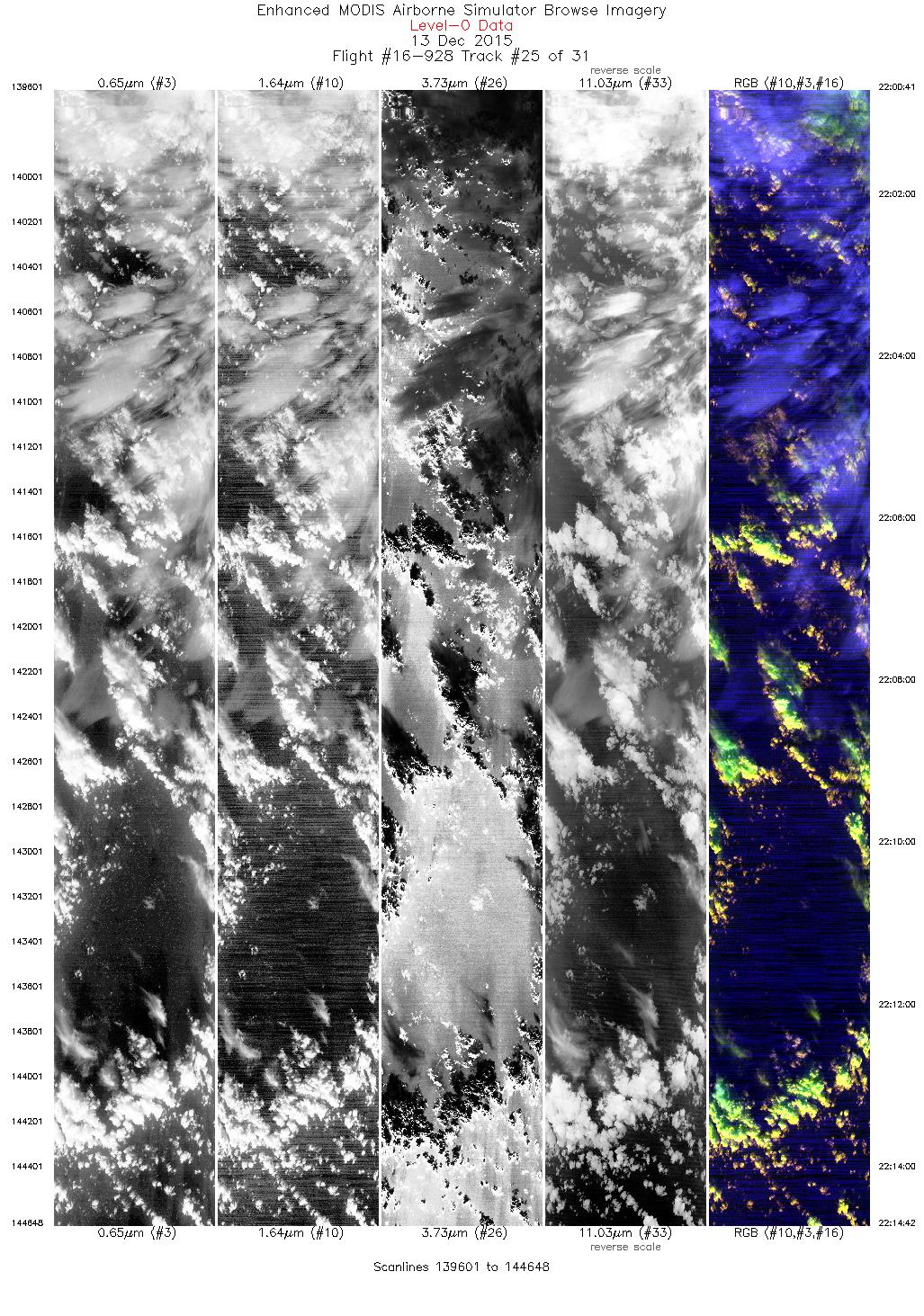
| 25 |
22:00 - 22:14 |
196.5 |
46.991 - 45.465 |
125.771 - 126.341 |
5048 |
19731 |
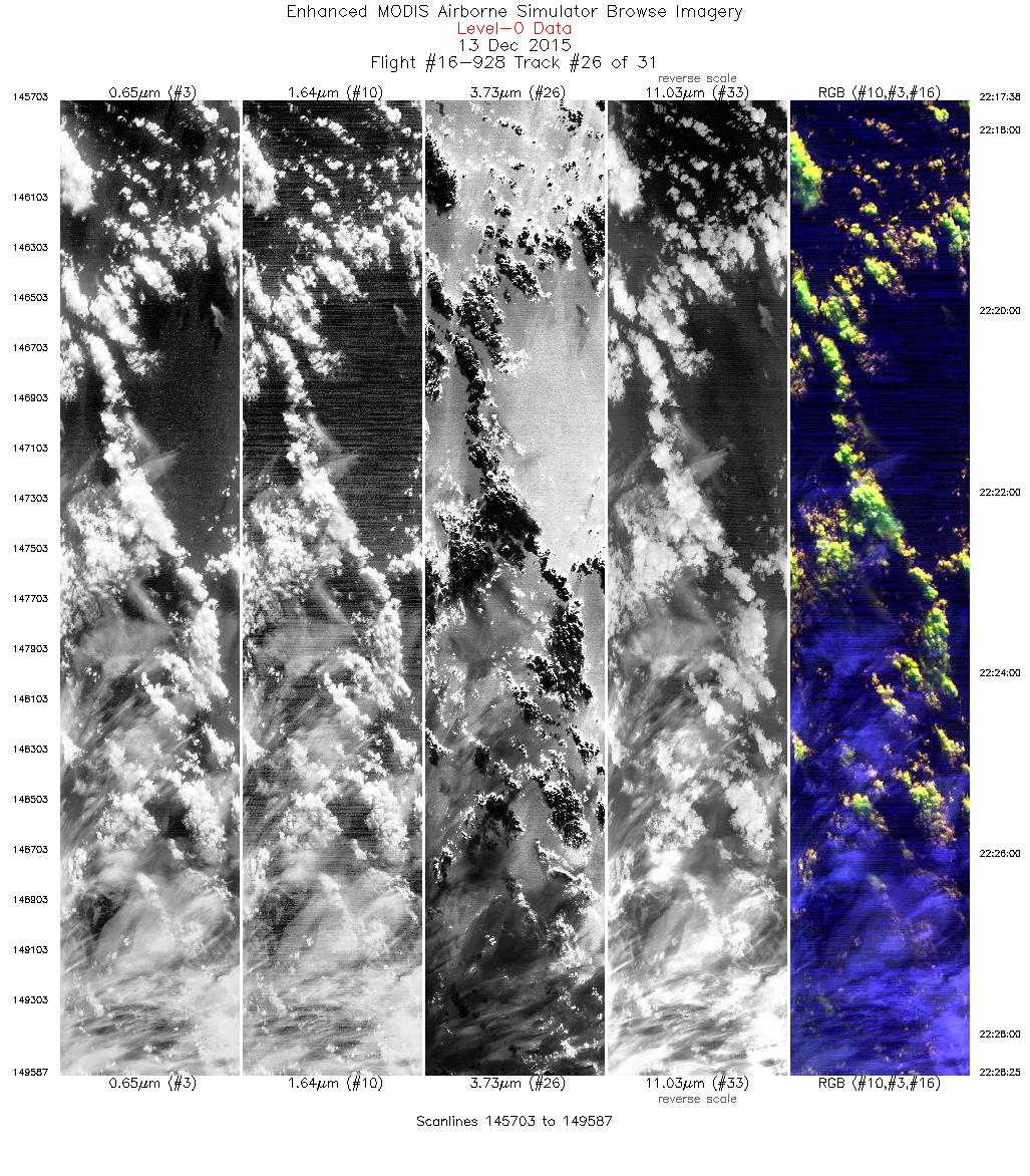
| 26 |
22:17 - 22:28 |
12.7 |
45.405 - 46.567 |
126.070 - 125.634 |
3885 |
19755 |
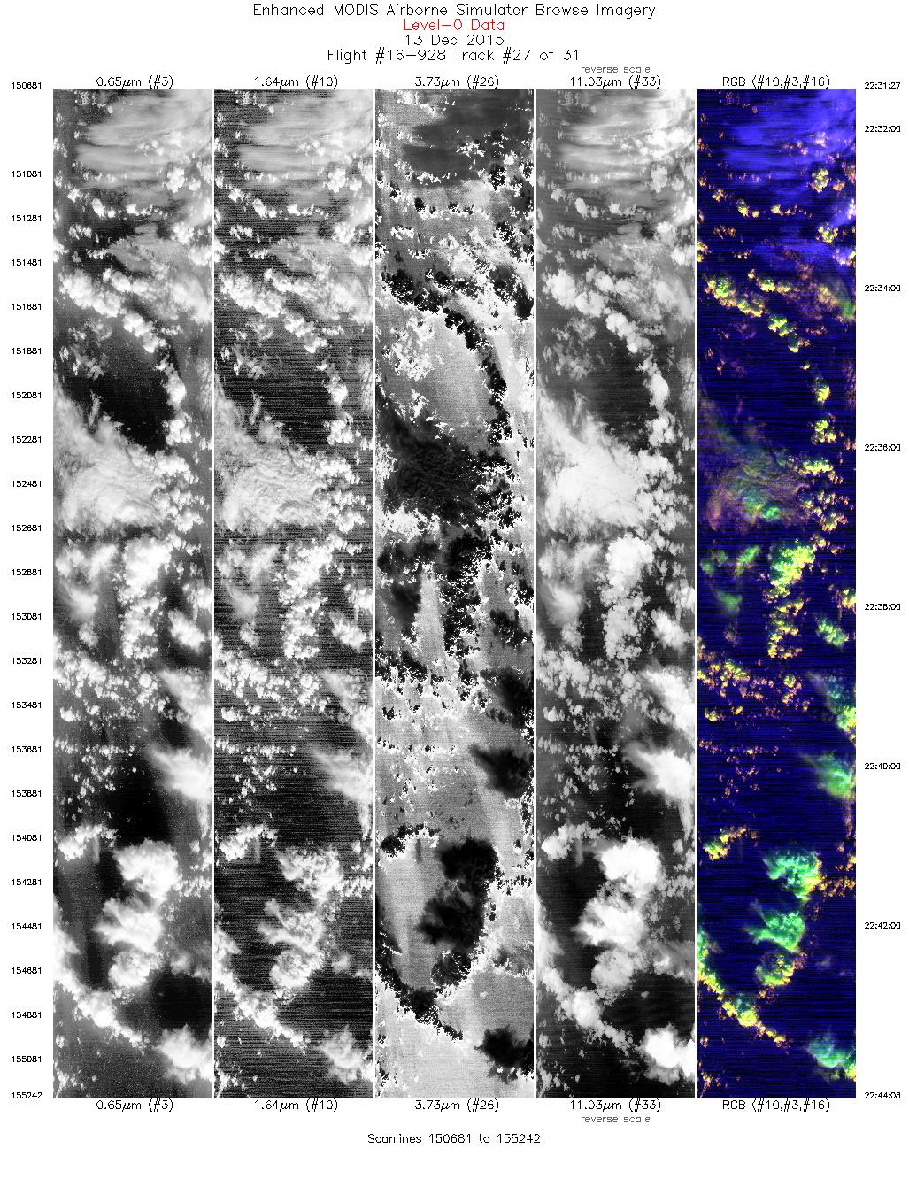
| 27 |
22:31 - 22:44 |
224.4 |
46.641 - 45.598 |
125.945 - 127.271 |
4562 |
19718 |
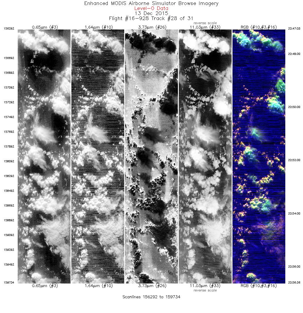
| 28 |
22:47 - 22:56 |
37.7 |
45.457 - 46.269 |
127.064 - 126.035 |
3443 |
19757 |
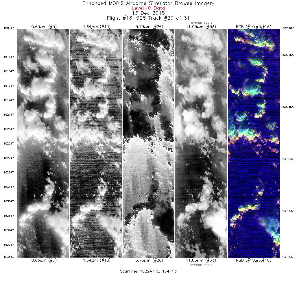
| 29 |
22:59 - 23:08 |
224.9 |
46.367 - 45.642 |
126.295 - 127.213 |
3167 |
19738 |
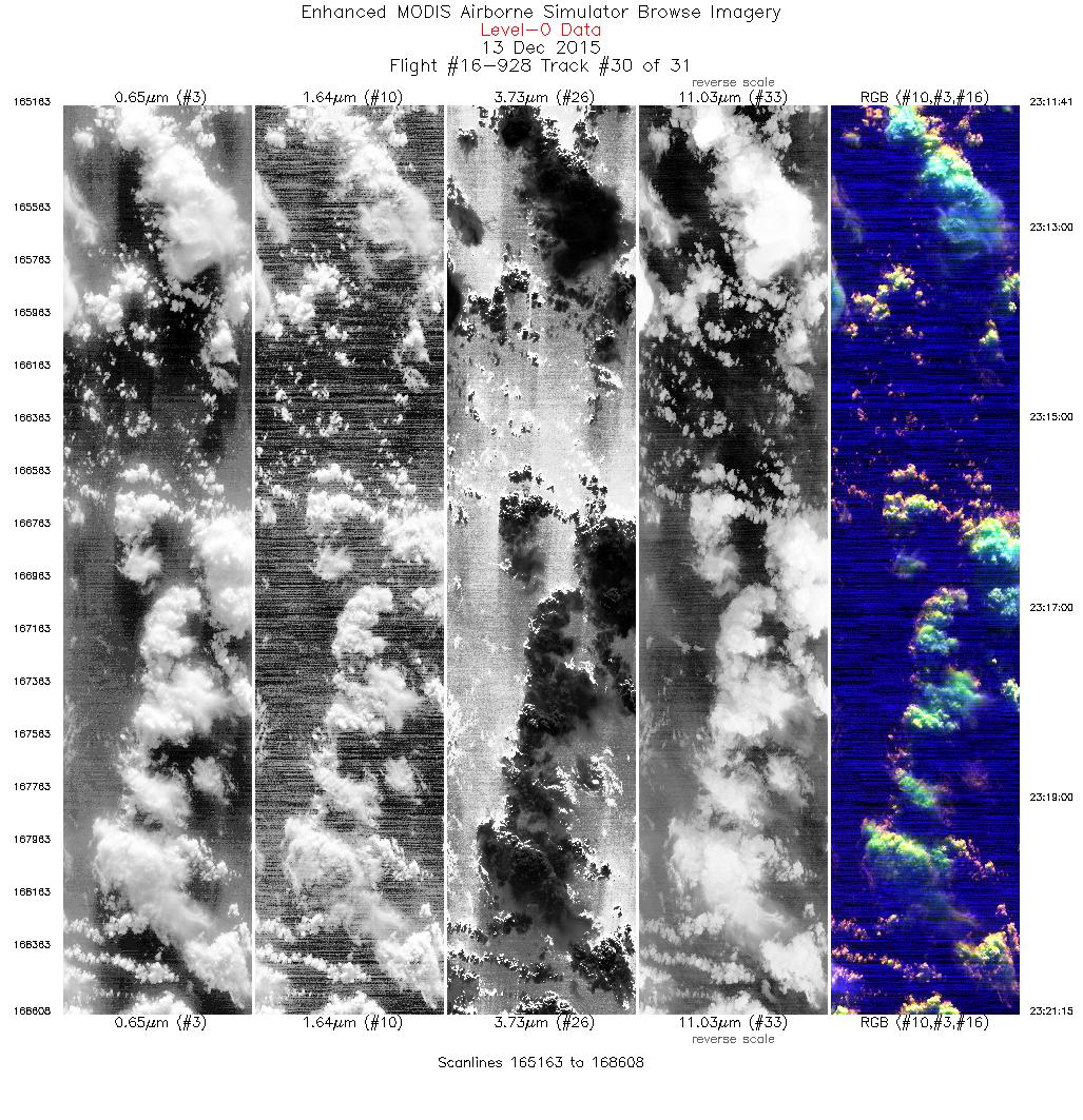
| 30 |
23:11 - 23:21 |
37.9 |
45.505 - 46.322 |
126.997 - 125.965 |
3446 |
19746 |
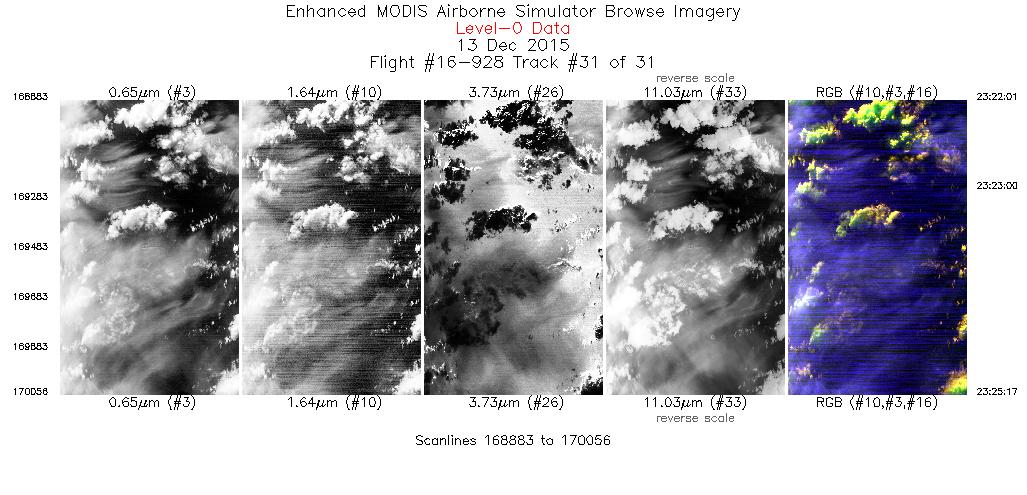
| 31 |
23:22 - 23:23 |
71.3 |
46.369 - 46.411 |
125.856 - 125.649 |
454 |
19729 |
|


