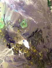
Flight: 25-982-00
Date: 23 Sep 2025
Aircraft: NASA ER-2 #809
Campaign: GEMx 2025
Flight Location: California / Nevada / Utah (NV06+)
Principal Investigators: Kokaly (USGS)
Additional Sensors: AVIRIS-C / AVIRIS-5
|
Data Evaluation
Overall quality is good
BB1 set to ambient
|
Processing Information
Level-1B Data in HDF format is available
Flight Line Summary
Spectral Band Configuration
Spectral Response Function Table
Spectral Response Function (text)
|
Browse Imagery
Flight Tracks: 10
Scanlines: 72070
|
Browse Imagery Table
|
Click a Flight Track number to view a quicklook image
Lat/Lon ranges are for the BEG-END scanline nadir pixels
|
Flight
Track |
Time Span
(UTC) |
Heading
(Deg) |
Lat Range
(Deg N) |
Lon Range
(Deg W) |
Length
(Scanlines) |
Altitude
(Meters) |
| 1 |
17:07 - 17:30 |
142.0 |
36.436 - 34.454 |
117.996 - 116.177 |
8641 |
19814 |
| 2 |
17:35 - 17:54 |
359.5 |
34.430 - 36.557 |
116.484 - 116.485 |
7050 |
20170 |
| 3 |
18:12 - 18:36 |
306.4 |
35.595 - 37.286 |
115.065 - 117.592 |
8866 |
20172 |
| 4 |
18:40 - 19:05 |
130.5 |
37.412 - 35.689 |
117.598 - 115.020 |
9395 |
20101 |
| 5 |
19:18 - 19:38 |
358.5 |
36.825 - 39.084 |
113.974 - 113.974 |
7518 |
20159 |
| 6 |
19:42 - 20:02 |
180.8 |
39.060 - 36.817 |
113.771 - 113.771 |
7783 |
20080 |
| 7 |
20:08 - 20:27 |
0.5 |
36.810 - 39.059 |
113.870 - 113.872 |
7462 |
20052 |
| 8 |
20:42 - 20:46 |
179.7 |
38.801 - 38.371 |
112.054 - 112.054 |
1501 |
20194 |
| 9 |
20:48 - 21:16 |
269.3 |
38.201 - 38.402 |
112.248 - 116.118 |
10304 |
20120 |
| 10 |
21:29 - 21:39 |
177.5 |
39.367 - 38.340 |
115.328 - 115.331 |
3550 |
20112 |
|


