


CAMPAIGN SUMMARY INFORMATION
|
GEMx 2025 Dates: 23 May - 23 September, 2025 Location: Western USA Principal Investigators: Kokaly / Hoefen (USGS) Aircraft: NASA 809 ER-2 (Armstrong Flight Research Center) Additional Sensors: AVIRIS-C / AVIRIS-5 Objective: The Geological Earth Mapping Experiment (GEMx) research project will use NASA's Airborne Visible/Infrared Imaging Spectrometer (AVIRIS), Hyperspectral Thermal Emission Spectrometer (HyTES), and MODIS/ASTER Airborne Simulator (MASTER) instruments flown on NASA's ER-2 and Gulfstream V aircraft to collect the measurements over the country's arid and semi-arid regions, including parts of California, Nevada, Arizona, and New Mexico. |
||||||||||||||||||||||||||||||||||||||||
|
Processing Information Flights Processed: 29 Total Flight Tracks: 267 Total Scanlines: 1,811,274 Status: Level-1B Data available |
||||||||||||||||||||||||||||||||||||||||
|
MASTER Spectral Information Spectral Band Configuration Spectral Response Function Table |
||||||||||||||||||||||||||||||||||||||||
|
NASA Earth Observatory Article Seeing the Monroe Canyon Fire in a New Light |
||||||||||||||||||||||||||||||||||||||||
|
Related Web Sites GEMx / Earth MRI Campaign Mission List GEMX Press Release USGS Earth MRI NASA Airborne Science Program Airborne Visible-Infrared Imaging Spectrometer (AVIRIS) |
||||||||||||||||||||||||||||||||||||||||
|
||||||||||||||||||||||||||||||||||||||||
|
||||||||||||||||||||||||||||||||||||||||
 Flight: 25-945-00
 Flight: 25-948-00
 Flight: 25-950-00
 Flight: 25-951-00
 Flight: 25-952-00
 Flight: 25-954-00
 Flight: 25-955-00
 Flight: 25-956-00
 Flight: 25-957-00
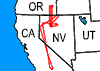 Flight: 25-961-00
 Flight: 25-963-00
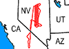 Flight: 25-964-00
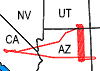 Flight: 25-965-00
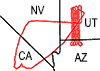 Flight: 25-966-00
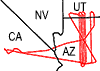 Flight: 25-967-00
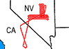 Flight: 25-968-00
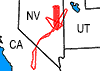 Flight: 25-969-00
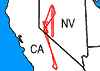 Flight: 25-970-00
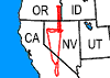 Flight: 25-971-00
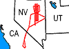 Flight: 25-972-00
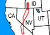 Flight: 25-973-00
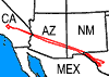 Flight: 25-974-00
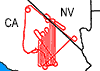 Flight: 25-975-00
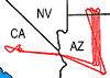 Flight: 25-977-00
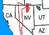 Flight: 25-978-00
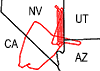 Flight: 25-979-00
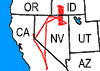 Flight: 25-980-00
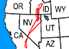 Flight: 25-981-00
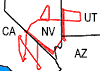 Flight: 25-982-00
GEMx 2025


| Sample Imagery |
| Click image for full resolution |
|
Flight: 25-952-00 Morenci Mine, AZ |


|
|
R: 2.13µm G: 1.61µm B: 0.47µm |
| Sample Imagery |
| Click image for full resolution |
|
Flight: 25-952-00 Dragon Bravo Fire, AZ |

|
|
R: 4.0µm G: 2.2µm B: 1.6µm |


