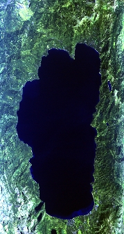
Flight: 25-980-00
Date: 17 Sep 2025
Aircraft: NASA ER-2 #809
Campaign: GEMx 2025
Flight Location: Northern Nevada / Southern Idaho (NV35)
Principal Investigators: Kokaly (USGS)
Additional Sensors: AVIRIS-C / AVIRIS-5
|
Data Evaluation
Overall quality is good
BB1 set to ambient
|
Processing Information
Level-1B Data in HDF format is available
Flight Line Summary
Spectral Band Configuration
Spectral Response Function Table
Spectral Response Function (text)
|
Browse Imagery
Flight Tracks: 11
Scanlines: 69377
|
Browse Imagery Table
|
Click a Flight Track number to view a quicklook image
Lat/Lon ranges are for the BEG-END scanline nadir pixels
|
Flight
Track |
Time Span
(UTC) |
Heading
(Deg) |
Lat Range
(Deg N) |
Lon Range
(Deg W) |
Length
(Scanlines) |
Altitude
(Meters) |
| 1 |
17:20 - 17:24 |
359.5 |
38.815 - 39.256 |
120.033 - 120.033 |
1489 |
20188 |
| 2 |
17:30 - 17:34 |
179.3 |
39.326 - 38.914 |
120.026 - 120.034 |
1357 |
19977 |
| 3 |
18:22 - 18:41 |
115.6 |
42.022 - 41.028 |
117.148 - 114.586 |
7355 |
20072 |
| 4 |
18:51 - 19:10 |
359.5 |
40.958 - 43.060 |
115.732 - 115.733 |
7092 |
20116 |
| 5 |
19:15 - 19:35 |
175.8 |
43.132 - 40.944 |
115.637 - 115.634 |
7311 |
20027 |
| 6 |
19:40 - 19:59 |
359.2 |
40.921 - 43.060 |
115.530 - 115.530 |
7162 |
20027 |
| 7 |
20:03 - 20:23 |
175.7 |
43.032 - 40.789 |
115.237 - 115.228 |
7624 |
20189 |
| 8 |
20:25 - 20:46 |
0.0 |
40.786 - 43.060 |
115.430 - 115.431 |
7612 |
20141 |
| 9 |
20:52 - 21:11 |
177.2 |
43.047 - 40.941 |
115.335 - 115.335 |
7147 |
20037 |
| 10 |
21:14 - 21:34 |
358.6 |
40.822 - 43.059 |
115.135 - 115.133 |
7510 |
20151 |
| 11 |
21:45 - 22:06 |
240.0 |
42.143 - 41.058 |
115.096 - 117.844 |
7718 |
20192 |
|


