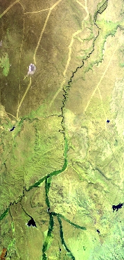
Flight: 25-978-00
Date: 15 Sep 2025
Aircraft: NASA ER-2 #809
Campaign: GEMx 2025
Flight Location: Northern Nevada / Southern Idaho (NV34)
Principal Investigators: Kokaly (USGS)
Additional Sensors: AVIRIS-C / AVIRIS-5
|
Data Evaluation
Overall quality is fair
BB1 temperature oscillates
|
Processing Information
Level-1B Data in HDF format is available
Flight Line Summary
Spectral Band Configuration
Spectral Response Function Table
Spectral Response Function (text)
|
Browse Imagery
Flight Tracks: 9
Scanlines: 58270
|
Browse Imagery Table
|
Click a Flight Track number to view a quicklook image
Lat/Lon ranges are for the BEG-END scanline nadir pixels
|
Flight
Track |
Time Span
(UTC) |
Heading
(Deg) |
Lat Range
(Deg N) |
Lon Range
(Deg W) |
Length
(Scanlines) |
Altitude
(Meters) |
| 1 |
18:06 - 18:32 |
112.1 |
42.637 - 41.435 |
118.963 - 115.456 |
9754 |
20141 |
| 2 |
18:46 - 19:03 |
359.5 |
40.432 - 42.308 |
116.443 - 116.442 |
6250 |
20160 |
| 3 |
19:06 - 19:23 |
177.6 |
42.384 - 40.491 |
116.240 - 116.240 |
6298 |
20174 |
| 4 |
19:26 - 19:40 |
358.6 |
40.563 - 42.212 |
116.041 - 116.038 |
5499 |
20163 |
| 5 |
19:44 - 19:56 |
177.1 |
42.290 - 40.939 |
115.837 - 115.836 |
4508 |
20117 |
| 6 |
20:03 - 20:20 |
359.8 |
40.443 - 42.311 |
116.336 - 116.339 |
6211 |
20160 |
| 7 |
20:23 - 20:40 |
176.4 |
42.349 - 40.488 |
116.135 - 116.138 |
6221 |
20194 |
| 8 |
20:42 - 20:57 |
359.5 |
40.484 - 42.208 |
115.938 - 115.940 |
5717 |
20215 |
| 9 |
21:05 - 21:26 |
240.1 |
42.161 - 41.058 |
115.055 - 117.843 |
7812 |
20149 |
|


