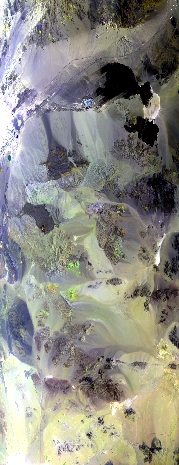
Flight: 25-975-00
Date: 29 Aug 2025
Aircraft: NASA ER-2 #809
Campaign: GEMx 2025
Flight Location: California / Nevada (CALi)
Principal Investigators: Kokaly (USGS)
Additional Sensors: AVIRIS-C / AVIRIS-5
|
Data Evaluation
Overall quality is good
|
Processing Information
Level-1B Data in HDF format is available
Flight Line Summary
Spectral Band Configuration
Spectral Response Function Table
Spectral Response Function (text)
|
Browse Imagery
Flight Tracks: 15
Scanlines: 80777
|
Browse Imagery Table
|
Click a Flight Track number to view a quicklook image
Lat/Lon ranges are for the BEG-END scanline nadir pixels
|
Flight
Track |
Time Span
(UTC) |
Heading
(Deg) |
Lat Range
(Deg N) |
Lon Range
(Deg W) |
Length
(Scanlines) |
Altitude
(Meters) |
| 1 |
17:07 - 17:31 |
130.5 |
37.250 - 35.539 |
117.707 - 115.161 |
9130 |
19782 |
| 2 |
17:37 - 17:52 |
224.3 |
35.670 - 34.440 |
115.248 - 116.804 |
5859 |
20057 |
| 3 |
17:56 - 18:04 |
4.3 |
34.429 - 35.289 |
117.166 - 117.168 |
2918 |
20069 |
| 4 |
18:09 - 18:18 |
177.6 |
35.524 - 34.442 |
117.274 - 117.281 |
3644 |
20073 |
| 5 |
18:22 - 18:34 |
3.0 |
34.341 - 35.687 |
117.081 - 117.069 |
4518 |
20065 |
| 6 |
18:40 - 18:57 |
145.9 |
35.944 - 34.450 |
117.525 - 116.173 |
6263 |
20056 |
| 7 |
19:01 - 19:18 |
357.4 |
34.472 - 36.389 |
116.480 - 116.484 |
6441 |
20048 |
| 8 |
19:24 - 19:31 |
125.7 |
36.600 - 36.100 |
116.609 - 115.828 |
2668 |
20037 |
| 9 |
19:40 - 19:57 |
180.6 |
36.397 - 34.449 |
116.383 - 116.389 |
6521 |
20056 |
| 10 |
20:03 - 20:14 |
358.0 |
34.448 - 35.686 |
116.969 - 116.971 |
4182 |
20038 |
| 11 |
20:20 - 20:32 |
174.9 |
35.829 - 34.438 |
116.884 - 116.872 |
4611 |
20038 |
| 12 |
20:38 - 20:53 |
359.5 |
34.294 - 35.910 |
116.769 - 116.775 |
5475 |
20037 |
| 13 |
20:58 - 21:12 |
176.7 |
36.075 - 34.450 |
116.679 - 116.681 |
5378 |
20032 |
| 14 |
21:17 - 21:35 |
1.0 |
34.491 - 36.541 |
116.286 - 116.285 |
6919 |
20030 |
| 15 |
21:45 - 22:02 |
178.1 |
36.667 - 34.811 |
116.582 - 116.583 |
6250 |
20034 |
|


