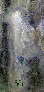
Flight: 25-969-00
Date: 05 Aug 2025
Aircraft: NASA ER-2 #809
Campaign: GEMx 2025
Flight Location: Eastern Nevada (NV15)
Principal Investigators: Kokaly (USGS)
Additional Sensors: AVIRIS-C / AVIRIS-5
|
Data Evaluation
Overall quality is good
|
Processing Information
Level-1B Data in HDF format is available
Flight Line Summary
Spectral Band Configuration
Spectral Response Function Table
Spectral Response Function (text)
|
Browse Imagery
Flight Tracks: 10
Scanlines: 71042
|
Browse Imagery Table
|
Click a Flight Track number to view a quicklook image
Lat/Lon ranges are for the BEG-END scanline nadir pixels
|
Flight
Track |
Time Span
(UTC) |
Heading
(Deg) |
Lat Range
(Deg N) |
Lon Range
(Deg W) |
Length
(Scanlines) |
Altitude
(Meters) |
| 1 |
16:54 - 17:12 |
359.0 |
38.995 - 41.158 |
115.326 - 115.322 |
7055 |
20459 |
| 2 |
17:17 - 17:35 |
178.4 |
41.224 - 39.192 |
115.223 - 115.226 |
7003 |
20192 |
| 3 |
17:51 - 18:06 |
115.2 |
40.195 - 39.488 |
116.084 - 114.210 |
5623 |
20294 |
| 4 |
18:15 - 18:33 |
358.5 |
39.151 - 41.158 |
115.132 - 115.130 |
6504 |
20480 |
| 5 |
18:38 - 18:56 |
176.4 |
41.178 - 39.192 |
115.032 - 115.031 |
6949 |
20311 |
| 6 |
19:02 - 19:19 |
358.2 |
39.159 - 41.158 |
114.930 - 114.935 |
6455 |
20355 |
| 7 |
19:25 - 19:44 |
175.7 |
41.141 - 39.192 |
114.840 - 114.841 |
6873 |
20214 |
| 8 |
19:49 - 20:07 |
359.5 |
39.125 - 41.188 |
114.744 - 114.738 |
6736 |
20306 |
| 9 |
20:12 - 20:31 |
177.6 |
41.281 - 39.192 |
114.643 - 114.644 |
7260 |
20128 |
| 10 |
20:52 - 21:20 |
210.1 |
40.962 - 38.362 |
113.866 - 116.005 |
10584 |
20411 |
|


