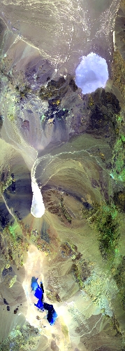
Flight: 25-968-00
Date: 01 Aug 2025
Aircraft: NASA ER-2 #809
Campaign: GEMx 2025
Flight Location: Central Nevada (NV05)
Principal Investigators: Kokaly (USGS)
Additional Sensors: AVIRIS-C / AVIRIS-5
|
Data Evaluation
Overall quality is good
|
Processing Information
Level-1B Data in HDF format is available
Flight Line Summary
Spectral Band Configuration
Spectral Response Function Table
Spectral Response Function (text)
|
Browse Imagery
Flight Tracks: 15
Scanlines: 77172
|
Browse Imagery Table
|
Click a Flight Track number to view a quicklook image
Lat/Lon ranges are for the BEG-END scanline nadir pixels
|
Flight
Track |
Time Span
(UTC) |
Heading
(Deg) |
Lat Range
(Deg N) |
Lon Range
(Deg W) |
Length
(Scanlines) |
Altitude
(Meters) |
| 1 |
16:37 - 16:54 |
87.9 |
37.937 - 37.941 |
117.389 - 115.191 |
6124 |
20064 |
| 2 |
16:57 - 17:13 |
269.5 |
38.017 - 38.015 |
115.013 - 117.313 |
5913 |
20273 |
| 3 |
17:17 - 17:34 |
88.9 |
38.086 - 38.087 |
117.528 - 115.188 |
6386 |
20316 |
| 4 |
17:38 - 17:52 |
270.4 |
38.375 - 38.376 |
115.112 - 117.313 |
5535 |
20329 |
| 5 |
17:56 - 18:12 |
90.1 |
38.158 - 38.161 |
117.444 - 115.191 |
6163 |
20276 |
| 6 |
18:16 - 18:32 |
270.9 |
38.237 - 38.233 |
115.017 - 117.311 |
5801 |
20326 |
| 7 |
18:36 - 18:53 |
88.7 |
38.306 - 38.303 |
117.476 - 115.189 |
6301 |
20257 |
| 8 |
19:01 - 19:10 |
0.0 |
38.312 - 39.309 |
116.001 - 116.002 |
3320 |
20289 |
| 9 |
19:14 - 19:24 |
176.7 |
39.461 - 38.333 |
115.911 - 115.907 |
3873 |
20303 |
| 10 |
19:28 - 19:38 |
1.7 |
38.190 - 39.310 |
115.813 - 115.809 |
3692 |
20343 |
| 11 |
19:42 - 19:52 |
174.8 |
39.440 - 38.334 |
115.713 - 115.710 |
3789 |
20300 |
| 12 |
19:56 - 20:06 |
2.0 |
38.186 - 39.311 |
115.610 - 115.611 |
3692 |
20344 |
| 13 |
20:10 - 20:20 |
176.2 |
39.401 - 38.334 |
115.514 - 115.519 |
3637 |
20281 |
| 14 |
20:24 - 20:34 |
0.0 |
38.180 - 39.308 |
115.427 - 115.426 |
3734 |
20304 |
| 15 |
20:42 - 21:07 |
238.9 |
38.650 - 37.292 |
115.406 - 118.524 |
9212 |
20335 |
|


