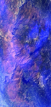
Flight: 20-958-00
Date: 30 Sep 2020
Aircraft: NASA ER-2, #809
Deployment: WDTS Fall 2020
Flight Location: Soda Straw / Creek Fire / Santa Barbara, CA
Principal Investigators: Hook / Green (JPL)
Additional Sensors: PICARD / AVIRIS
|
Data Evaluation
Overall quality is good
|
Processing Information
Level-1B Data in HDF format is available
Flight Line Summary
Spectral Band Configuration
Spectral Response Function Table
Spectral Response Function (text)
|
Browse Imagery
Flight Tracks: 12
Scanlines: 87823
|
Browse Imagery Table
|
Click a Flight Track number to view a quicklook image
Lat/Lon ranges are for the BEG-END scanline nadir pixels
|
Flight
Track |
Time Span
(UTC) |
Heading
(Deg) |
Lat Range
(Deg N) |
Lon Range
(Deg W) |
Length
(Scanlines) |
Altitude
(Meters) |
| 1 |
17:56 - 18:31 |
195.1 |
38.226 - 34.371 |
119.015 - 119.927 |
13119 |
19971 |
| 2 |
18:39 - 18:56 |
32.4 |
34.091 - 35.755 |
120.725 - 119.398 |
6542 |
20139 |
| 3 |
18:59 - 19:17 |
211.4 |
35.790 - 34.099 |
119.247 - 120.594 |
6801 |
20004 |
| 4 |
19:23 - 19:41 |
39.2 |
34.012 - 35.662 |
120.530 - 119.209 |
6557 |
20123 |
| 5 |
19:45 - 20:03 |
212.2 |
35.668 - 33.999 |
119.078 - 120.415 |
6720 |
20061 |
| 6 |
20:08 - 20:27 |
40.1 |
33.773 - 35.556 |
120.475 - 119.033 |
7135 |
20153 |
| 7 |
20:31 - 20:50 |
216.4 |
35.647 - 33.855 |
118.827 - 120.274 |
7216 |
20092 |
| 8 |
20:55 - 21:14 |
39.3 |
33.666 - 35.460 |
120.308 - 118.851 |
7209 |
20139 |
| 9 |
21:18 - 21:36 |
214.1 |
35.552 - 33.807 |
118.652 - 120.059 |
7017 |
20094 |
| 10 |
21:41 - 22:00 |
35.8 |
33.613 - 35.365 |
120.087 - 118.672 |
7061 |
20141 |
| 11 |
22:04 - 22:21 |
212.8 |
35.470 - 33.900 |
118.469 - 119.736 |
6314 |
20156 |
| 12 |
22:24 - 22:41 |
34.5 |
33.778 - 35.284 |
119.709 - 118.484 |
6132 |
20165 |
|


