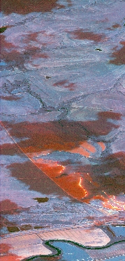
Flight: 19-817-30
Date: August 29, 2019
Aircraft: NASA DC-8, #817
Deployment: FIREX-AQ
Flight Location: Nebraska / Kansas / Oklahoma (Ag Fires)
Principal Investigator: Crawford (NASA), Warneke (CIRES), Schwarz (NOAA)
Additional Sensors: DC-8 Payload
|
Data Evaluation
Overall data quality is good.
All data collected @25Hz; many flight lines underscanned due to low altitude data collection.
Significant VIS/SWIR reponse degradation during campaign.
Saturated fire pixels due to new optics.
|
Processing Information
Level-1B Data in HDF format is available
Flight Line Summary
Spectral Band Configuration
Spectral Response Function Table
Spectral Response Function (text)
|
Browse Imagery
Flight Tracks: 19
Scanlines: 38496
|
Browse Imagery Table
|
Click a Flight Track number to view a quicklook image
Lat/Lon ranges are for the BEG-END scanline nadir pixels
|
Flight
Track |
Time Span
(UTC) |
Heading
(Deg) |
Lat Range
(Deg N) |
Lon Range
(Deg W) |
Length
(Scanlines) |
Altitude
(Meters) |
| 1 |
17:31 - 17:33 |
73.2 |
40.274 - 40.315 |
96.496 - 96.277 |
2451 |
7993 |
| 2 |
17:45 - 17:47 |
287.0 |
40.296 - 40.334 |
96.277 - 96.412 |
2150 |
2474 |
| 3 |
17:52 - 17:53 |
59.5 |
40.292 - 40.327 |
96.416 - 96.332 |
1569 |
705 |
| 4 |
17:59 - 18:00 |
254.8 |
40.329 - 40.309 |
96.287 - 96.387 |
1787 |
710 |
| 5 |
18:37 - 18:38 |
47.0 |
40.303 - 40.346 |
96.372 - 96.308 |
1362 |
820 |
| 6 |
19:06 - 19:09 |
228.5 |
38.524 - 38.372 |
96.429 - 96.634 |
3698 |
7692 |
| 7 |
19:17 - 19:19 |
238.9 |
38.491 - 38.403 |
96.398 - 96.585 |
3117 |
3802 |
| 8 |
19:25 - 19:26 |
235.9 |
38.435 - 38.408 |
96.518 - 96.582 |
1178 |
1069 |
| 9 |
19:30 - 19:31 |
289.5 |
38.398 - 38.417 |
96.534 - 96.586 |
1037 |
710 |
| 10 |
19:35 - 19:36 |
116.1 |
38.429 - 38.410 |
96.593 - 96.529 |
1190 |
667 |
| 11 |
19:57 - 19:58 |
201.2 |
38.454 - 38.393 |
96.534 - 96.565 |
1501 |
1072 |
| 12 |
20:13 - 20:15 |
202.7 |
39.243 - 39.143 |
96.709 - 96.770 |
2204 |
3343 |
| 13 |
20:26 - 20:27 |
201.3 |
39.323 - 39.230 |
96.585 - 96.635 |
2032 |
3342 |
| 14 |
20:33 - 20:35 |
244.2 |
38.975 - 38.915 |
97.125 - 97.300 |
2786 |
3341 |
| 15 |
20:45 - 20:48 |
211.2 |
38.946 - 38.827 |
97.357 - 97.466 |
3485 |
690 |
| 16 |
20:59 - 20:59 |
110.3 |
38.883 - 38.876 |
97.365 - 97.342 |
442 |
624 |
| 17 |
21:28 - 21:29 |
172.5 |
36.865 - 36.693 |
96.365 - 96.349 |
2477 |
4162 |
| 18 |
21:38 - 21:39 |
339.6 |
36.658 - 36.785 |
96.337 - 96.378 |
2717 |
604 |
| 19 |
21:44 - 21:45 |
347.7 |
37.064 - 37.126 |
96.243 - 96.257 |
1313 |
600 |
|


