Flight: 17-623-00
Date: February 21, 2017
Aircraft: NASA ER-2, #806
Deployment: HyspIRI Hawaii
Flight Location: Big Island Hawaii
Principal Investigator: Hook / Green (JPL)
Additional Sensors: AVIRIS
|
Data Evaluation
New Optics and Blackbody Controller
Overall data quality is good; saturated lava pixels.
|
Processing Information
Level-1B Data in HDF format is available
Flight Line Summary
Spectral Band Configuration
Spectral Response Function Table
Spectral Response Function (text)
|
Browse Imagery
Flight Tracks: 14
Scanlines: 51850
|
Browse Imagery Table
|
Click a Flight Track number to view a quicklook image
Lat/Lon ranges are for the BEG-END scanline nadir pixels
|
Flight
Track |
Time Span
(UTC) |
Heading
(Deg) |
Lat Range
(Deg N) |
Lon Range
(Deg W) |
Length
(Scanlines) |
Altitude
(Meters) |
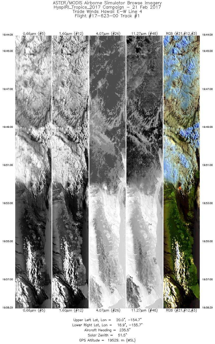
| 1 |
19:44 - 19:58 |
234.7 |
19.886 - 19.013 |
154.590 - 155.816 |
5373 |
19521 |
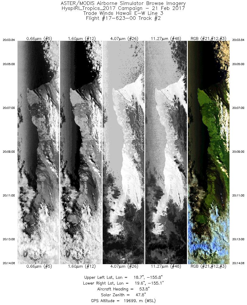
| 2 |
20:03 - 20:14 |
54.1 |
18.823 - 19.510 |
155.932 - 154.957 |
3826 |
19692 |
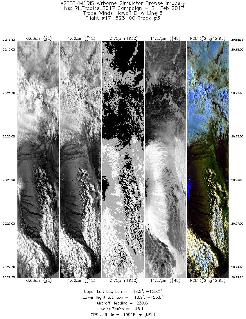
| 3 |
20:18 - 20:29 |
236.7 |
19.745 - 19.079 |
154.923 - 155.875 |
4094 |
19924 |
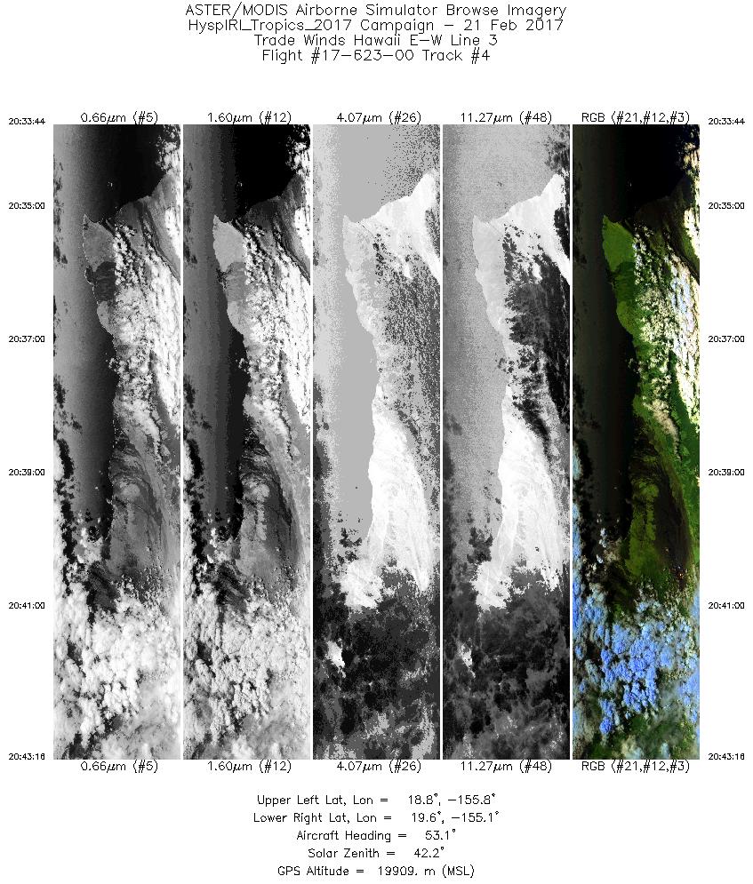
| 4 |
20:33 - 20:43 |
53.3 |
18.878 - 19.509 |
155.855 - 154.960 |
3575 |
19905 |
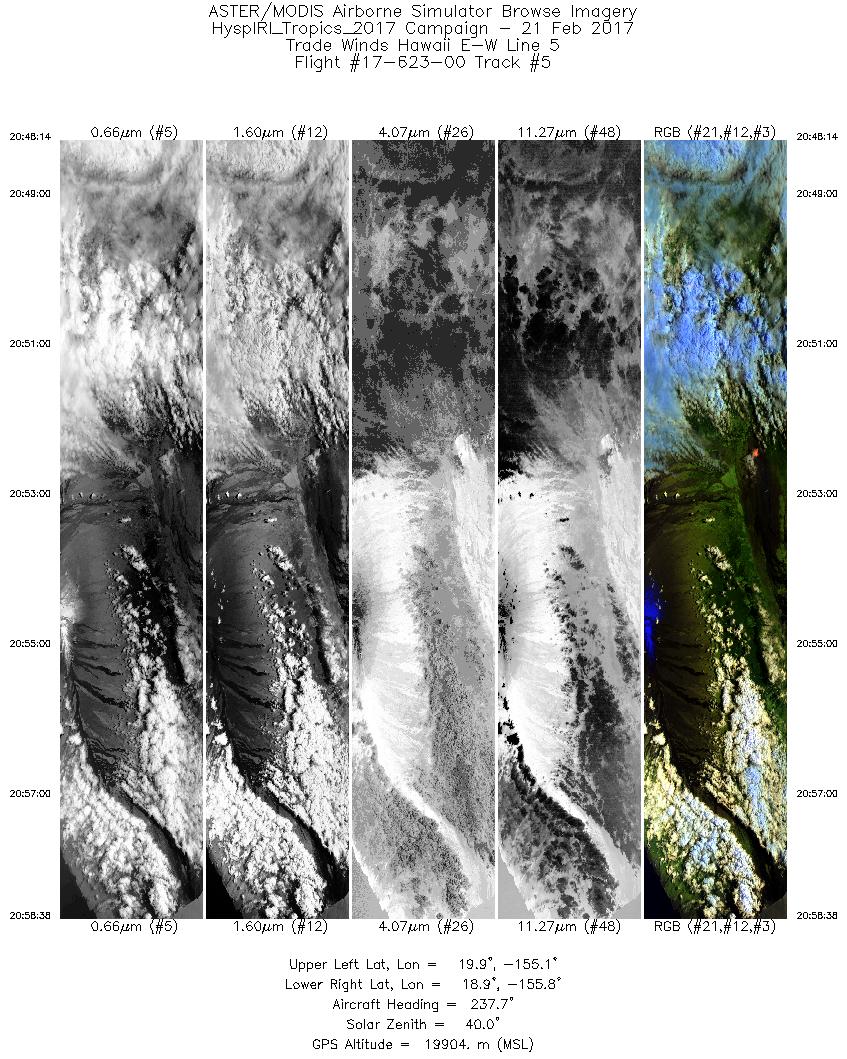
| 5 |
20:48 - 20:58 |
236.0 |
19.725 - 19.080 |
154.957 - 155.874 |
3897 |
19900 |
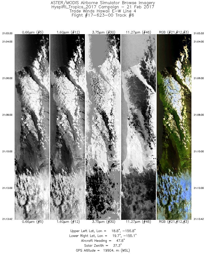
| 6 |
21:03 - 21:13 |
50.3 |
18.903 - 19.579 |
155.967 - 155.013 |
3805 |
19920 |
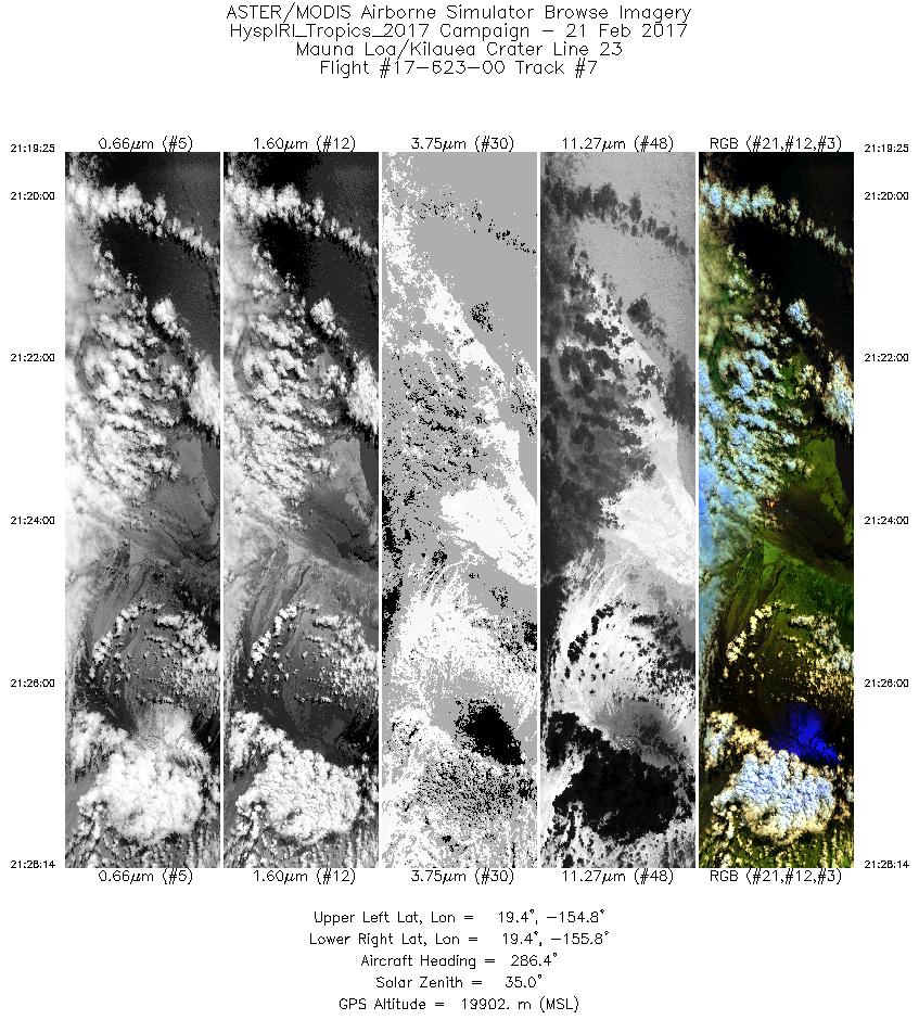
| 7 |
21:19 - 21:28 |
286.2 |
19.269 - 19.529 |
154.820 - 155.751 |
3304 |
19909 |
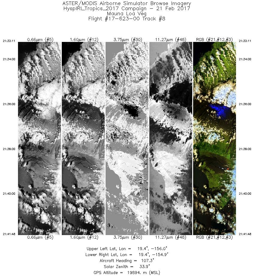
| 8 |
21:33 - 21:41 |
108.3 |
19.508 - 19.230 |
155.957 - 154.976 |
3228 |
19897 |
| 9 |
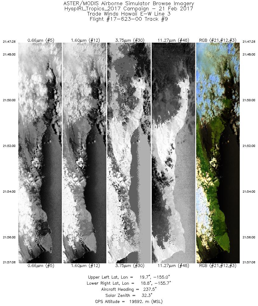
21:47 - 21:57 |
236.5 |
19.531 - 18.940 |
154.920 - 155.768 |
3624 |
19876 |
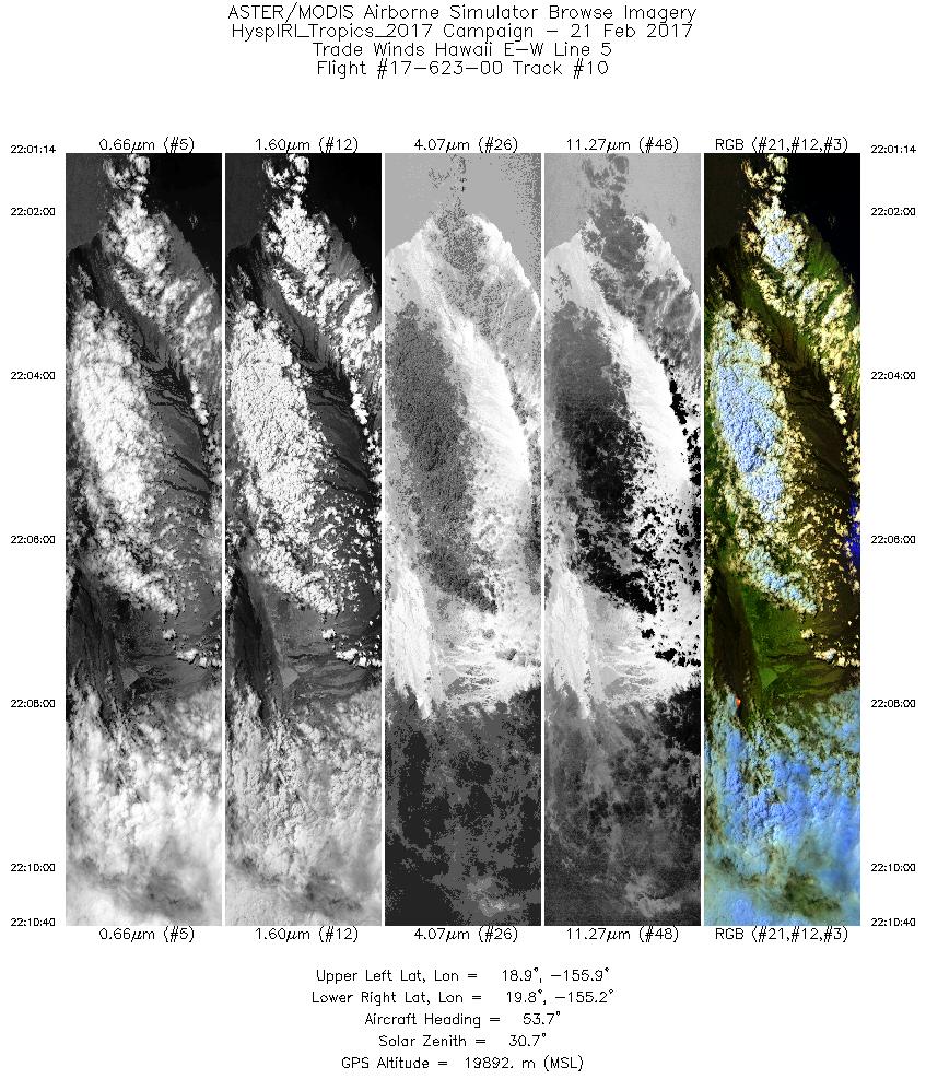
| 10 |
22:01 - 22:10 |
53.2 |
19.016 - 19.646 |
155.965 - 155.070 |
3538 |
19896 |
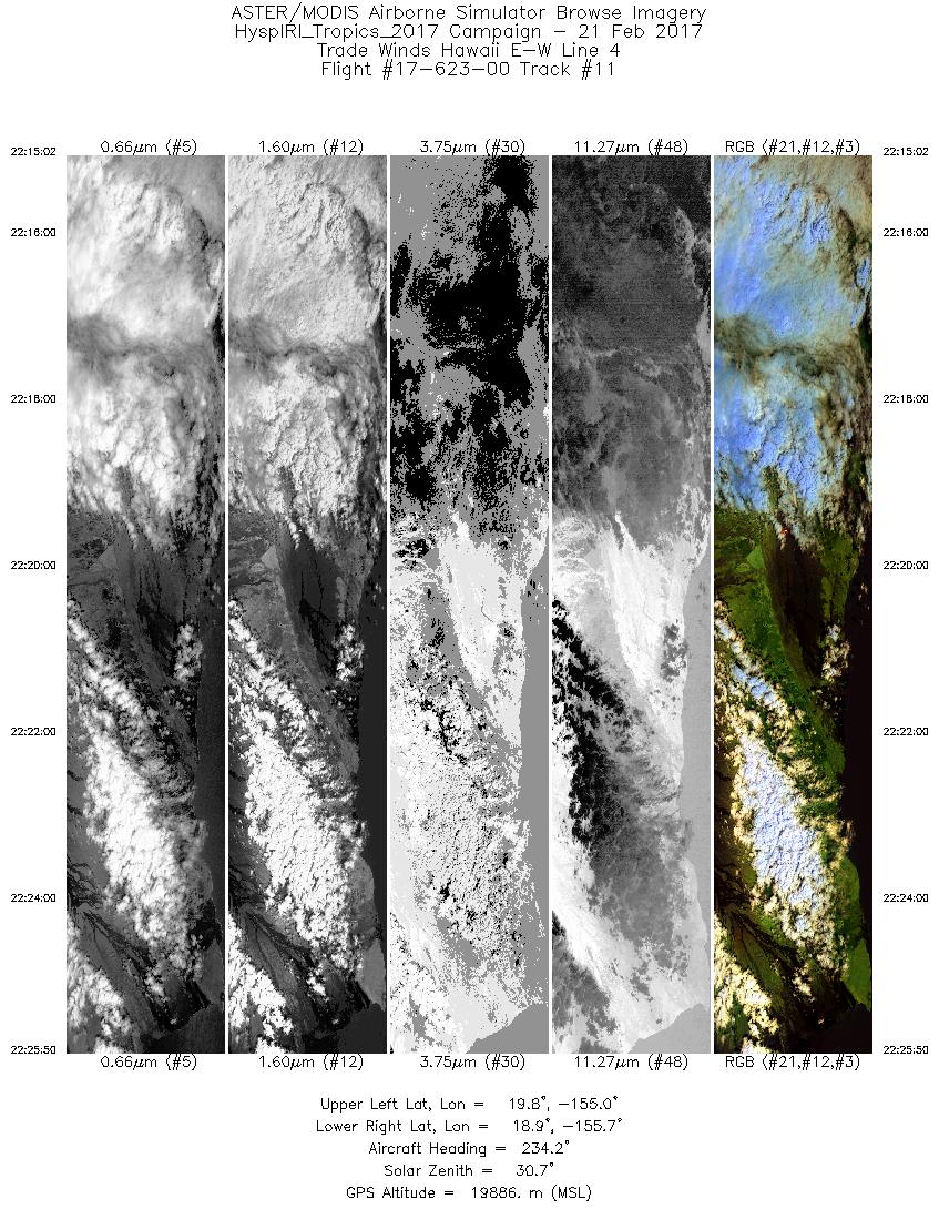
| 11 |
22:15 - 22:25 |
235.1 |
19.678 - 19.009 |
154.872 - 155.821 |
4053 |
19888 |
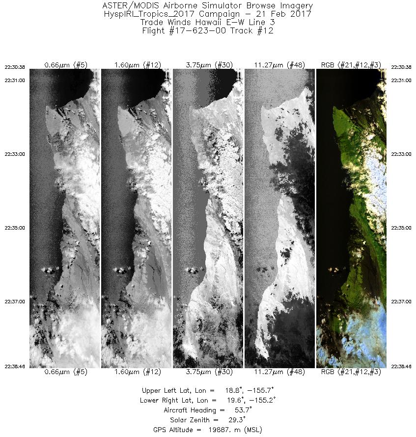
| 12 |
22:30 - 22:38 |
52.8 |
18.899 - 19.448 |
155.823 - 155.045 |
3047 |
19865 |
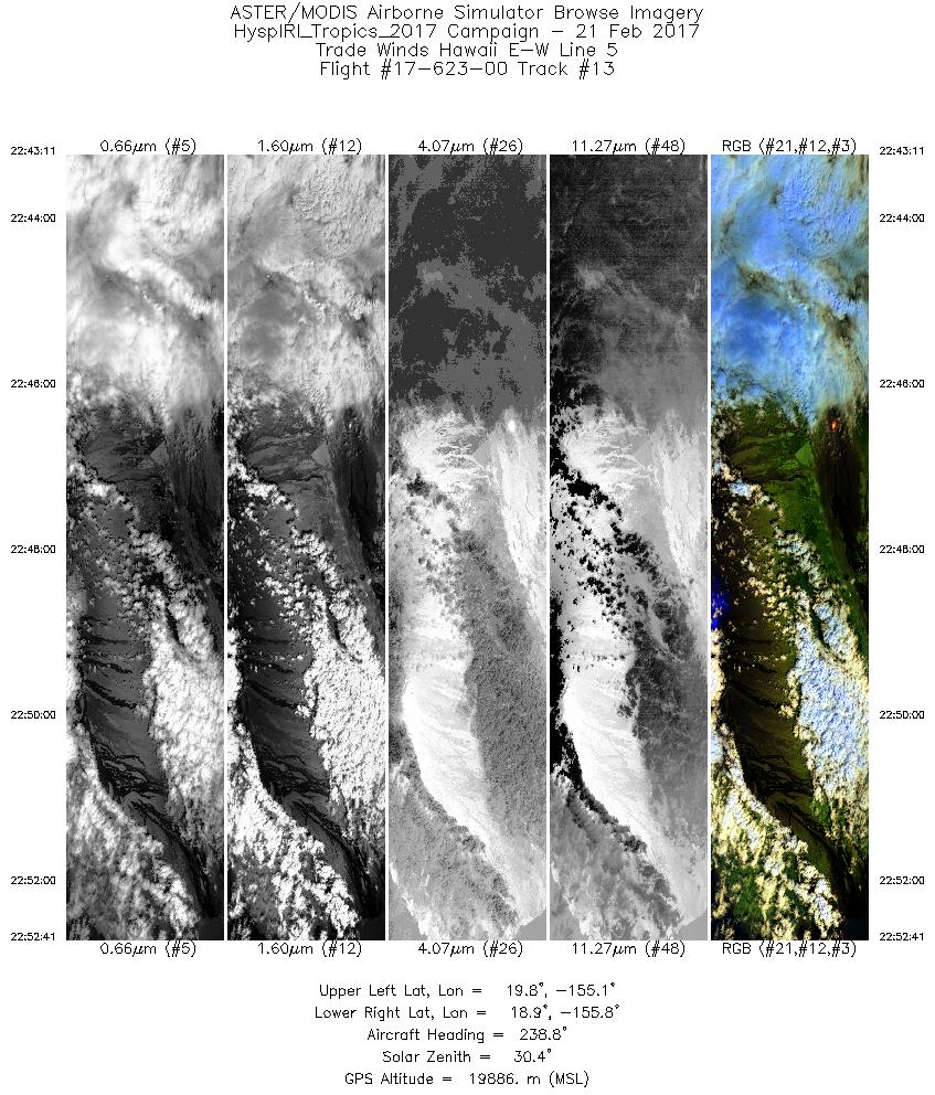
| 13 |
22:43 - 22:52 |
237.6 |
19.668 - 19.080 |
155.034 - 155.872 |
3561 |
19893 |
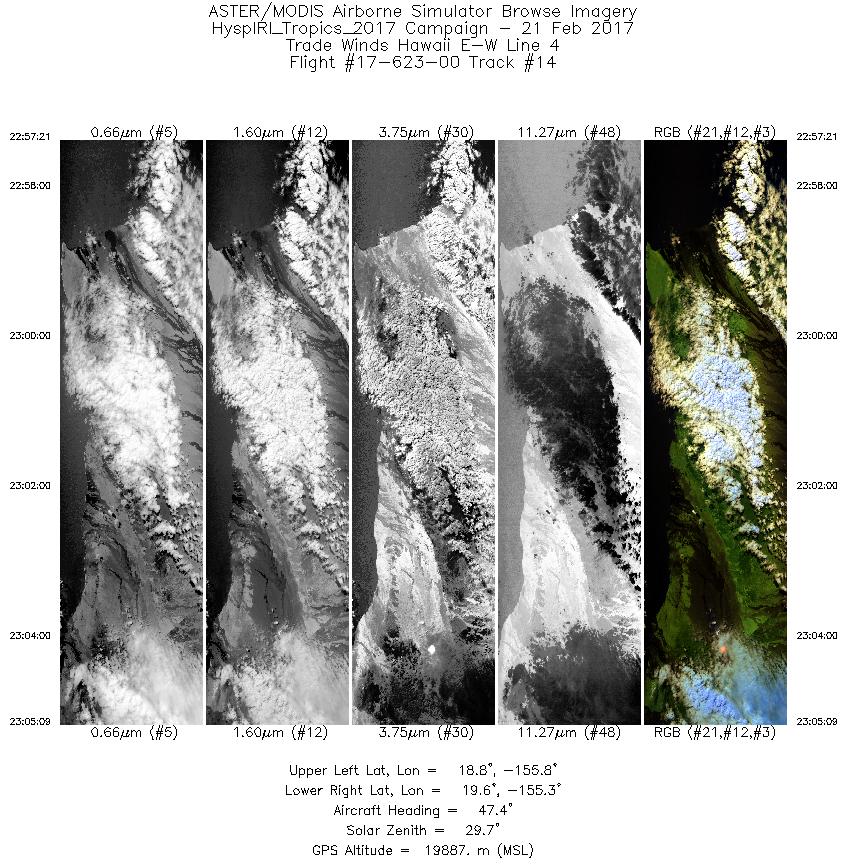
| 14 |
22:57 - 23:05 |
50.1 |
18.937 - 19.462 |
155.912 - 155.177 |
2925 |
19889 |
|


