Flight: 04-006-03
Date: August 19, 2004
Aircraft: DOE B200, #796
Deployment: RSL August 2004
Flight Location: Southern California Faults (day)
Principal Investigator: Peltzer (JPL)
Additional Sensors:
|
Data Evaluation
Weather: Clear to partly cloudy
Haze: Light to moderate
Data quality is good.
|
Processing Information
Level-1B Data in HDF format is available
Flight Line Summary
Spectral Band Configuration
Spectral Response Function Table
Spectral Response Function (text)
|
Browse Imagery
Flight Tracks: 15
Scanlines: 105531
|
Browse Imagery Table
|
Click a Flight Track number to view a quicklook image
Lat/Lon ranges are for the BEG-END scanline nadir pixels
|
Flight
Track |
Time Span
(UTC) |
Heading
(Deg) |
Lat Range
(Deg N) |
Lon Range
(Deg W) |
Length
(Scanlines) |
Altitude
(Meters) |
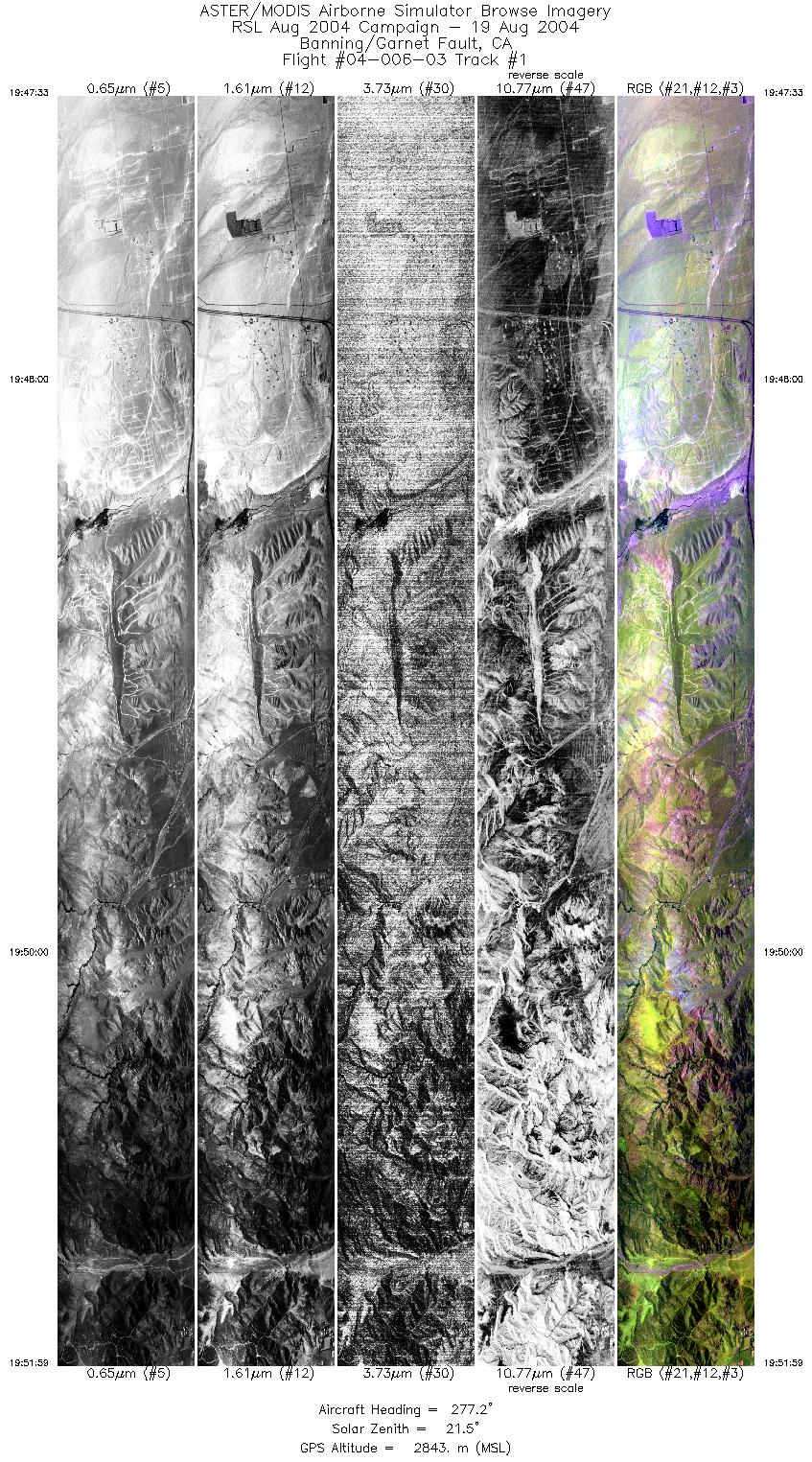
| 1 |
19:47 - 19:51 |
277.5 |
33.928 - 33.967 |
116.550 - 116.822 |
6625 |
2843 |
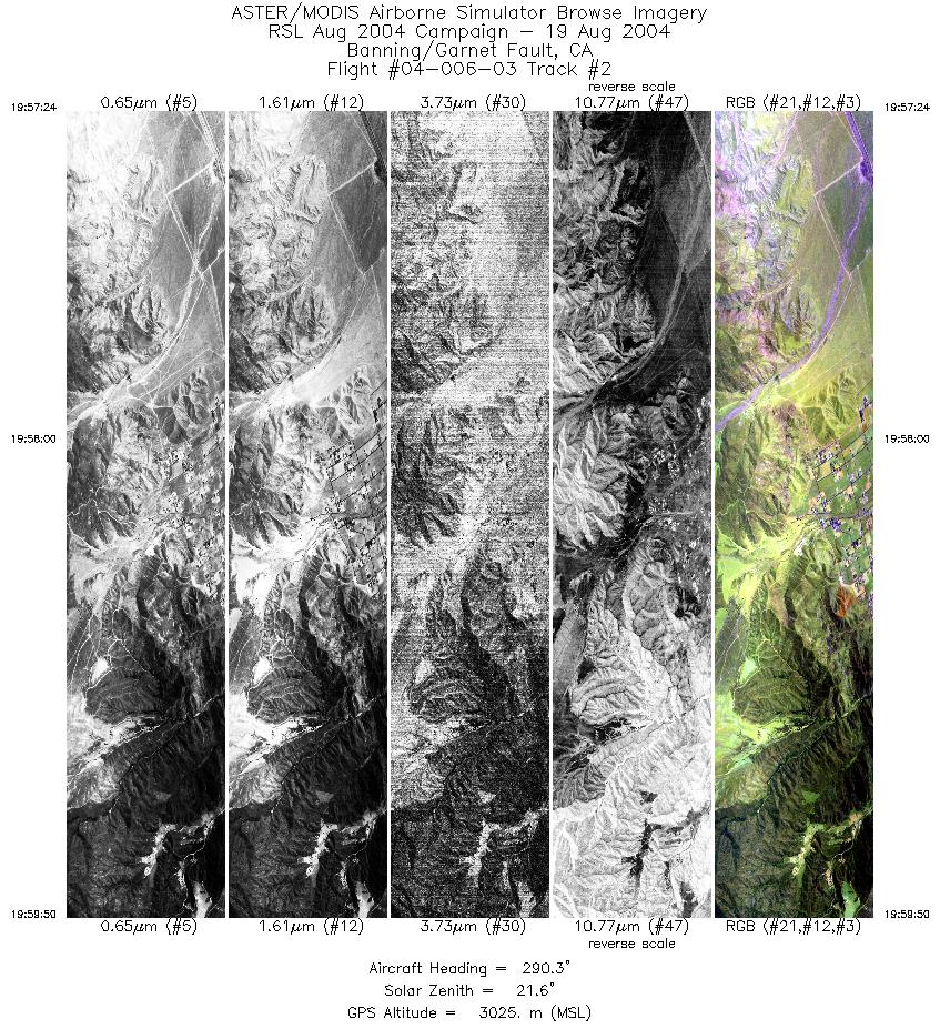
| 2 |
19:57 - 19:59 |
292.8 |
33.932 - 33.989 |
116.756 - 116.893 |
3636 |
3025 |
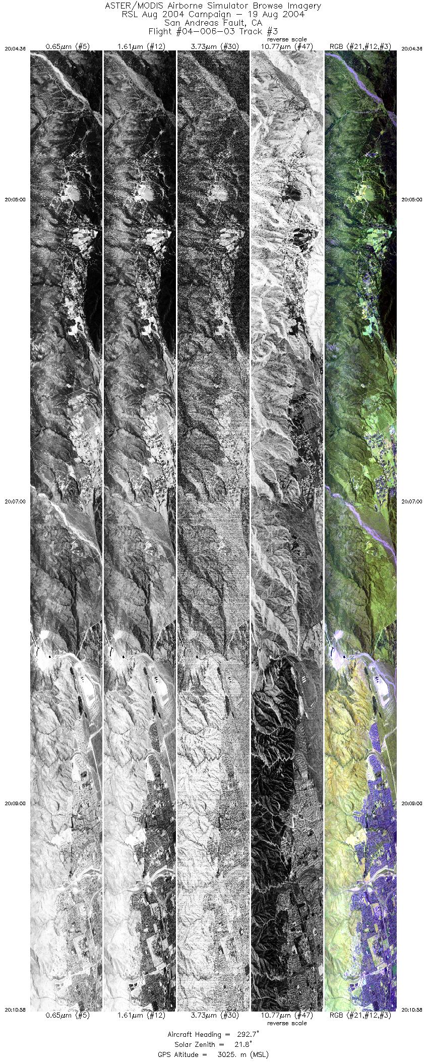
| 3 |
20:04 - 20:10 |
291.4 |
34.021 - 34.156 |
116.866 - 117.241 |
9529 |
3026 |
| 4 |
20:16 - 20:23 |
297.6 |
34.129 - 34.310 |
117.181 - 117.539 |
9999 |
2958 |
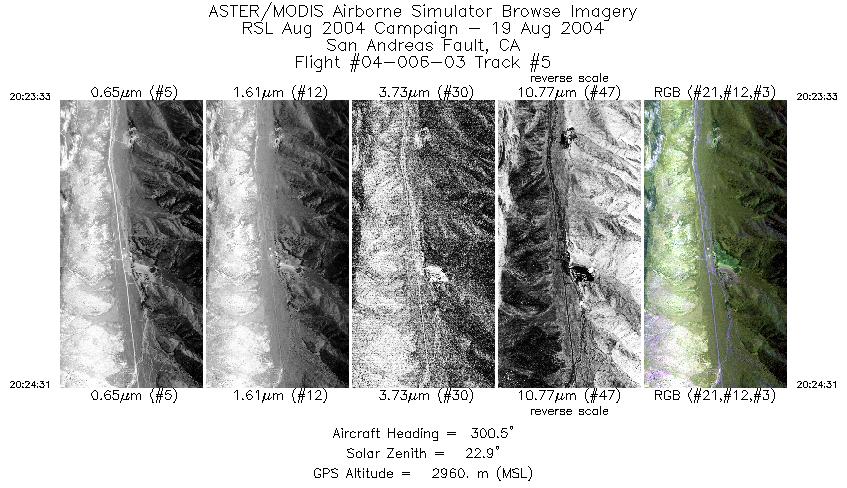
| 5 |
20:23 - 20:24 |
301.1 |
34.310 - 34.335 |
117.539 - 117.587 |
1444 |
2958 |
| 6 |
20:29 - 20:36 |
292.3 |
34.316 - 34.457 |
117.518 - 117.894 |
9999 |
3400 |
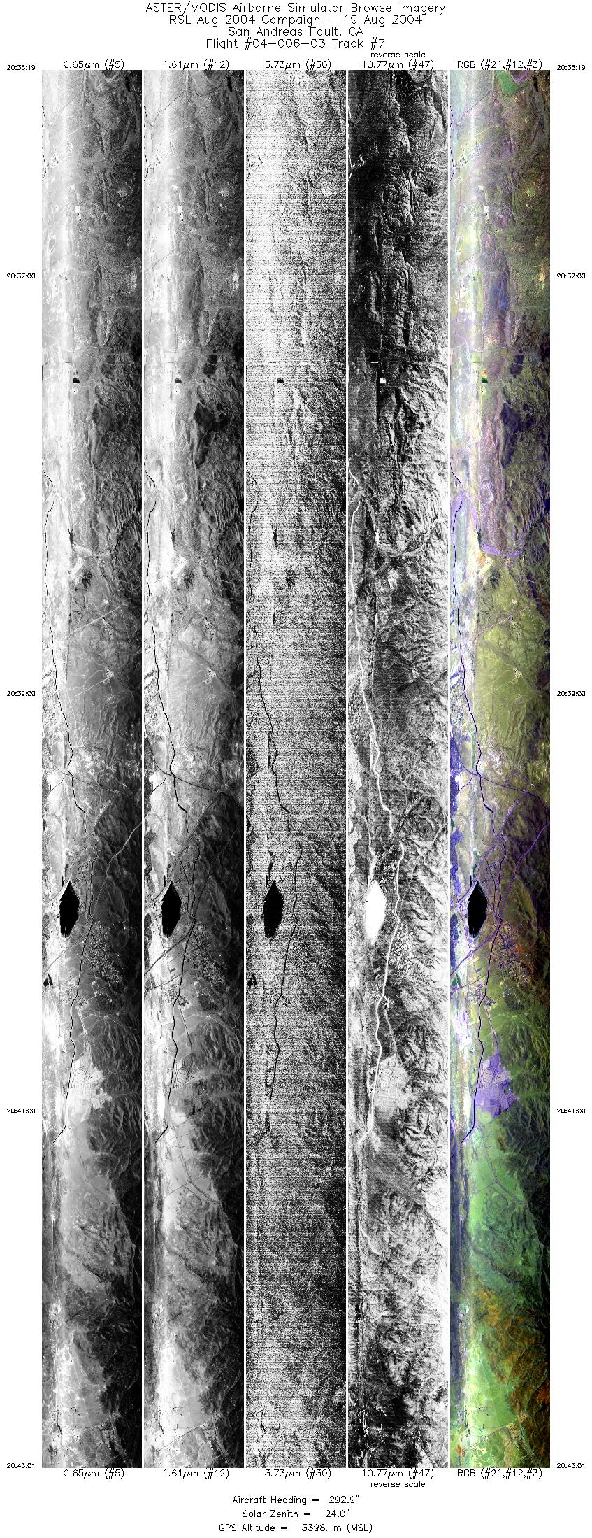
| 7 |
20:36 - 20:43 |
293.2 |
34.457 - 34.602 |
117.894 - 118.283 |
9999 |
3398 |
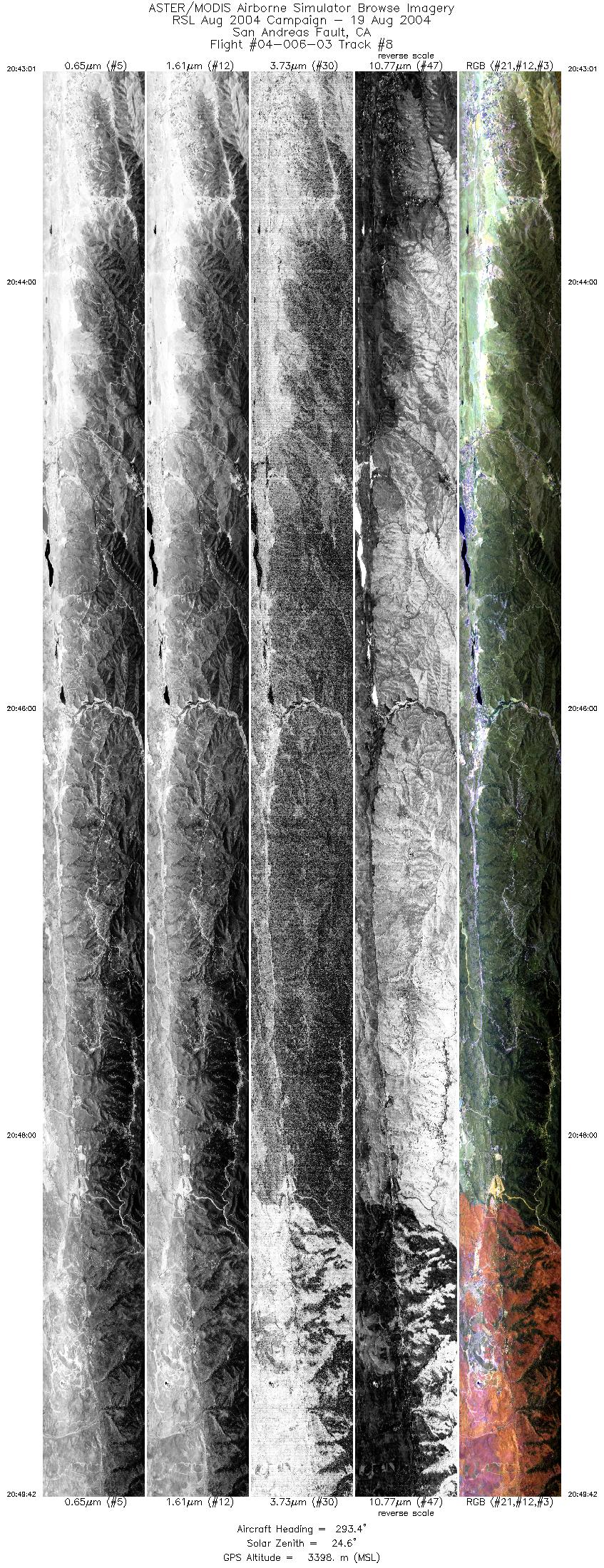
| 8 |
20:43 - 20:49 |
293.1 |
34.602 - 34.746 |
118.283 - 118.666 |
9999 |
3398 |
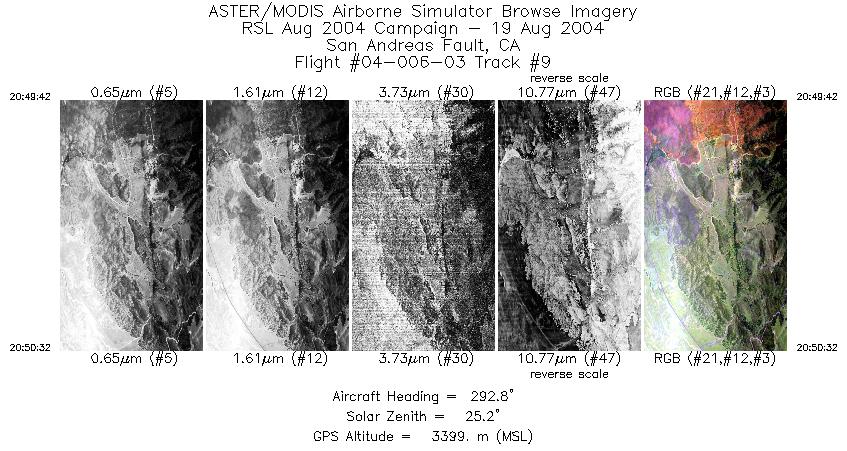
| 9 |
20:49 - 20:50 |
293.1 |
34.746 - 34.763 |
118.666 - 118.714 |
1258 |
3399 |
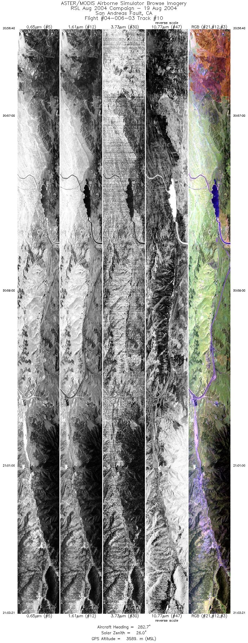
| 10 |
20:56 - 21:03 |
282.4 |
34.754 - 34.832 |
118.624 - 119.037 |
9999 |
3584 |
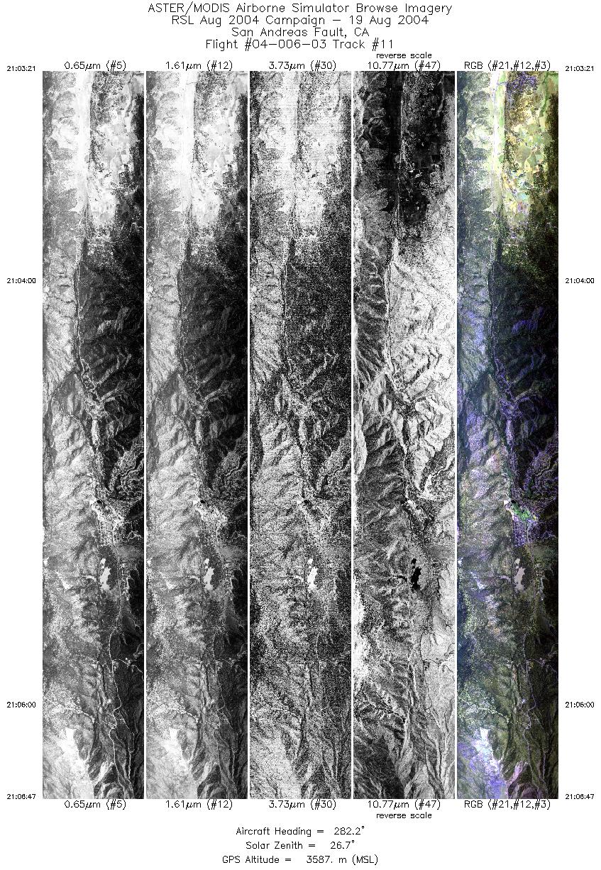
| 11 |
21:03 - 21:06 |
280.2 |
34.832 - 34.873 |
119.037 - 119.250 |
5134 |
3584 |
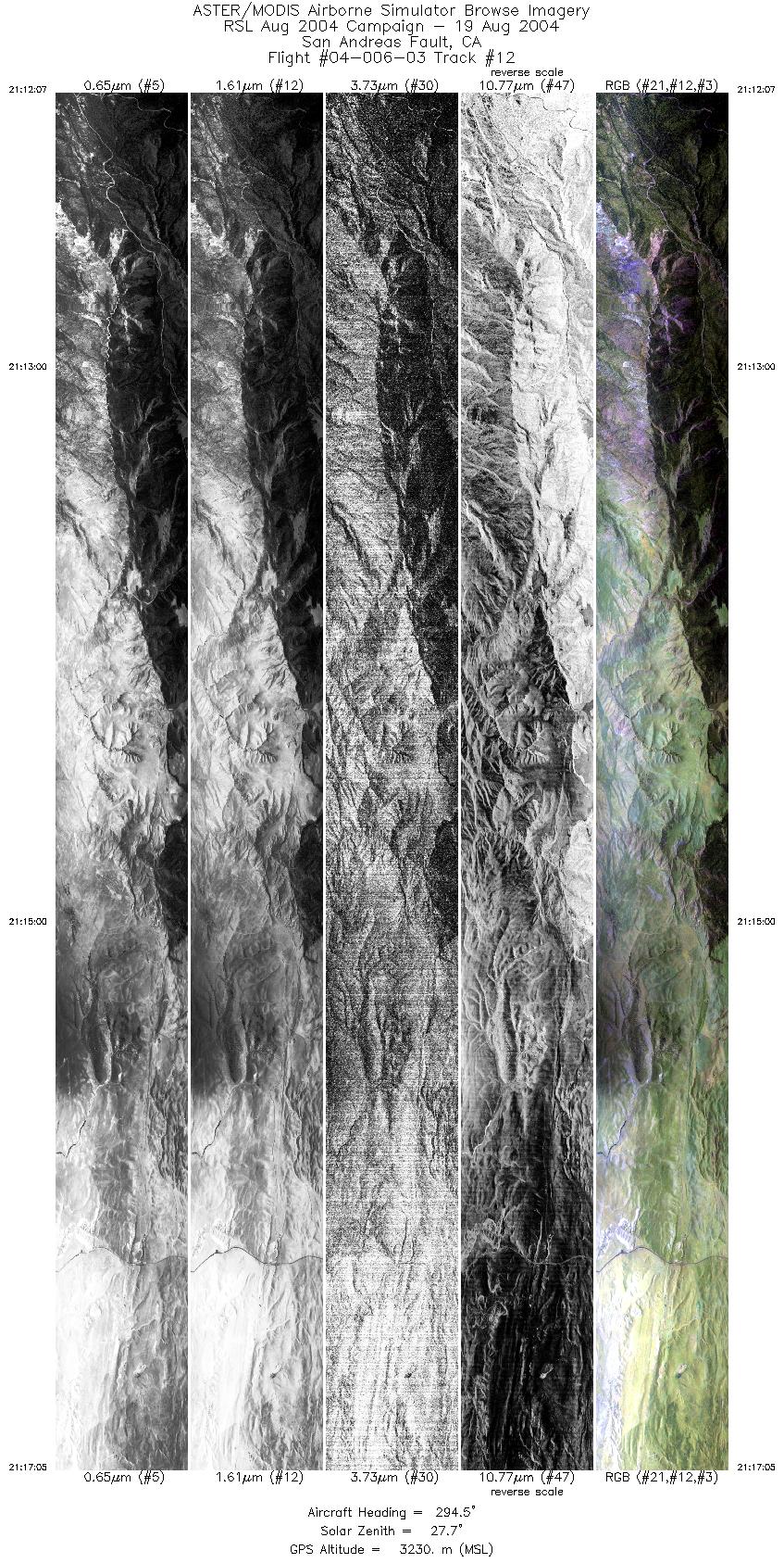
| 12 |
21:12 - 21:17 |
296.5 |
34.854 - 34.986 |
119.212 - 119.486 |
7435 |
3229 |
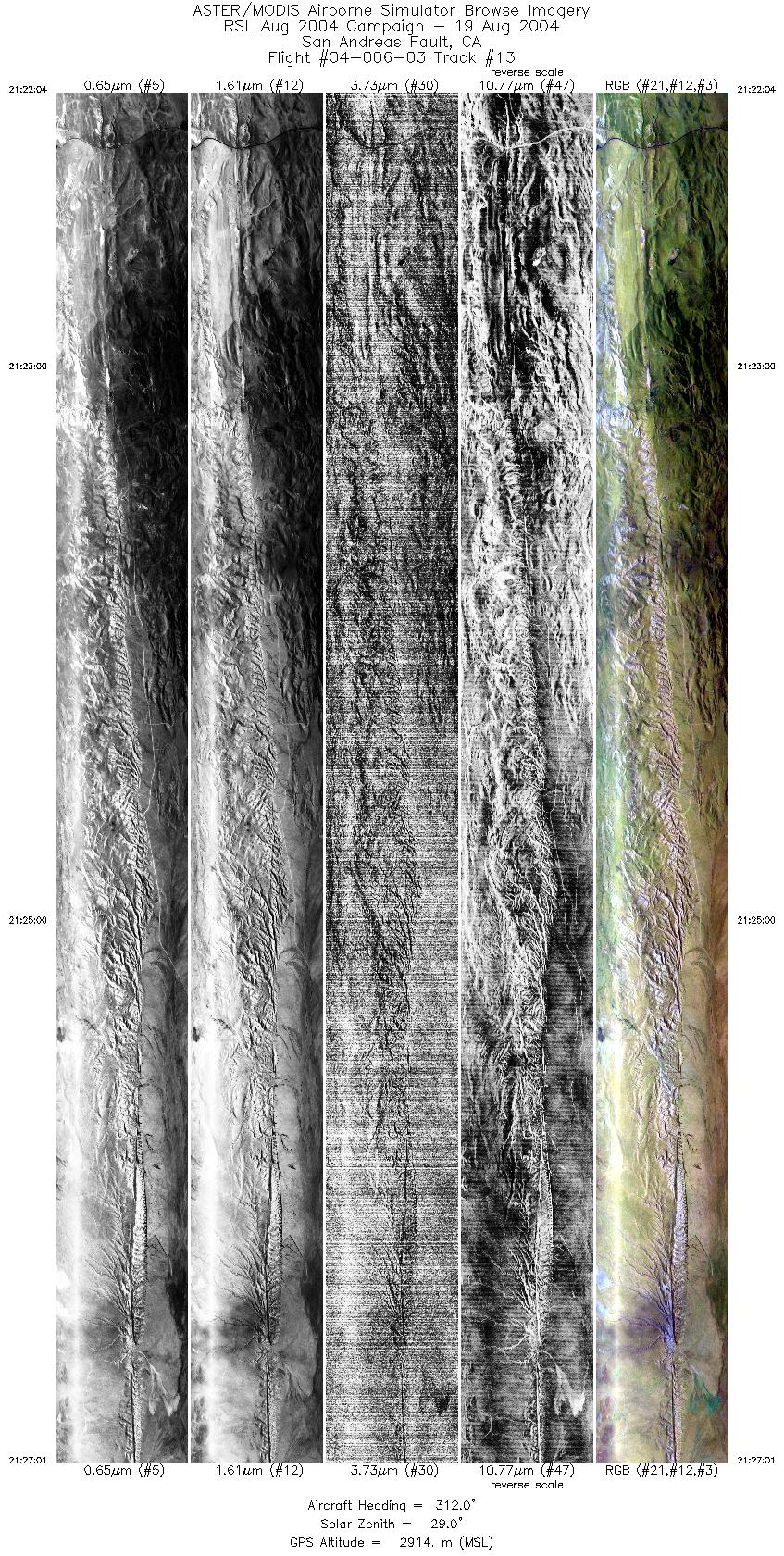
| 13 |
21:22 - 21:27 |
312.3 |
34.954 - 35.131 |
119.440 - 119.663 |
7405 |
2913 |
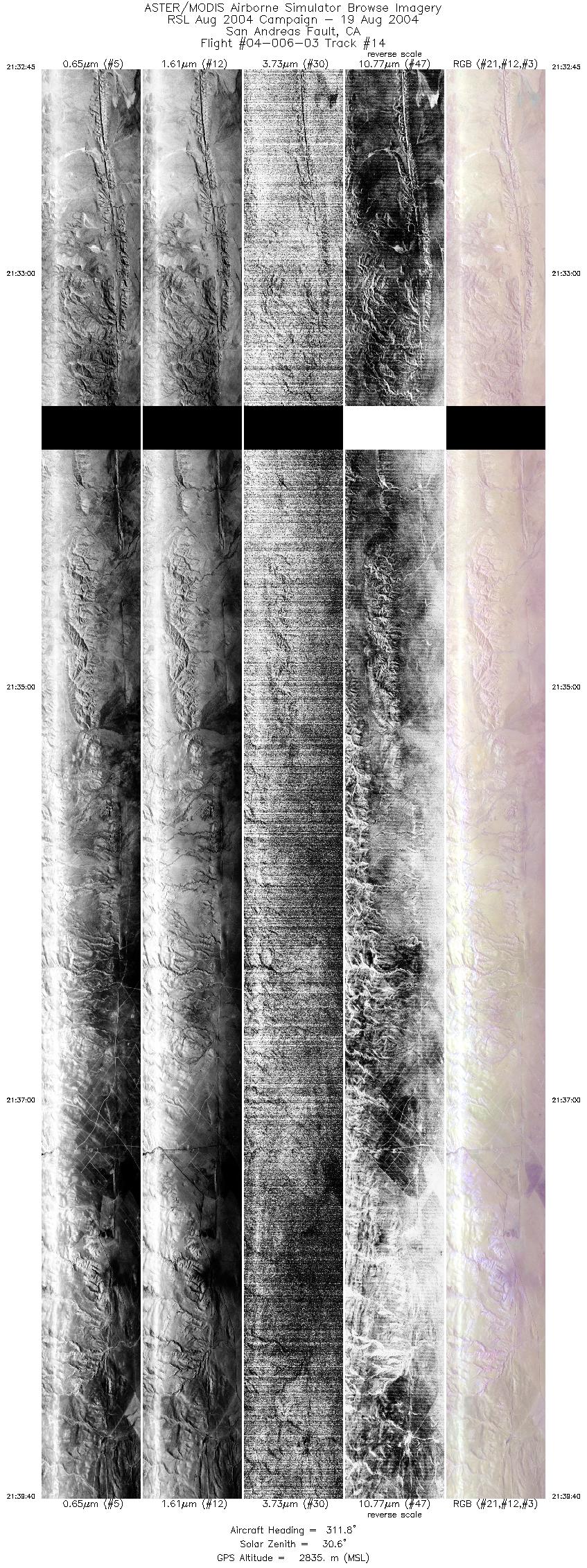
| 14 |
21:32 - 21:39 |
317.2 |
35.119 - 35.381 |
119.647 - 119.932 |
10315 |
2839 |
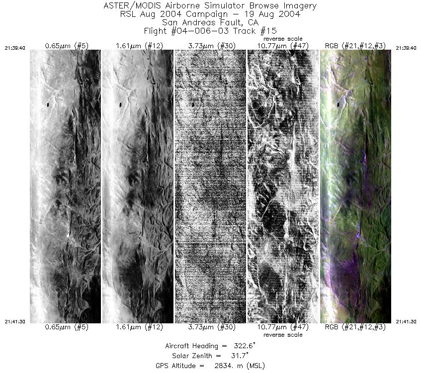
| 15 |
21:39 - 21:41 |
320.7 |
35.381 - 35.451 |
119.932 - 120.007 |
2755 |
2840 |
|


