Flight: 03-003-14
Date: March 26, 2003
Aircraft: NASA WB57, #926
Deployment: CARTA
Flight Location: Costa Rica
Principal Investigator: CENAT (Diaz)
Additional Sensors: RC-10
|
Data Evaluation
Data quality is good.
|
Processing Information
Level-1B Data in HDF format is available
Flight Line Summary
Spectral Band Configuration
Spectral Response Function Table
Spectral Response Function (text)
|
Browse Imagery
Flight Tracks: 14
Scanlines: 44820
|
Browse Imagery Table
|
Click a Flight Track number to view a quicklook image
Lat/Lon ranges are for the BEG-END scanline nadir pixels
|
Flight
Track |
Time Span
(UTC) |
Heading
(Deg) |
Lat Range
(Deg N) |
Lon Range
(Deg W) |
Length
(Scanlines) |
Altitude
(Meters) |
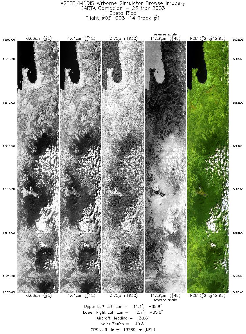
| 1 |
15:09 - 15:20 |
125.9 |
11.153 - 10.649 |
85.792 - 85.043 |
4350 |
13808 |
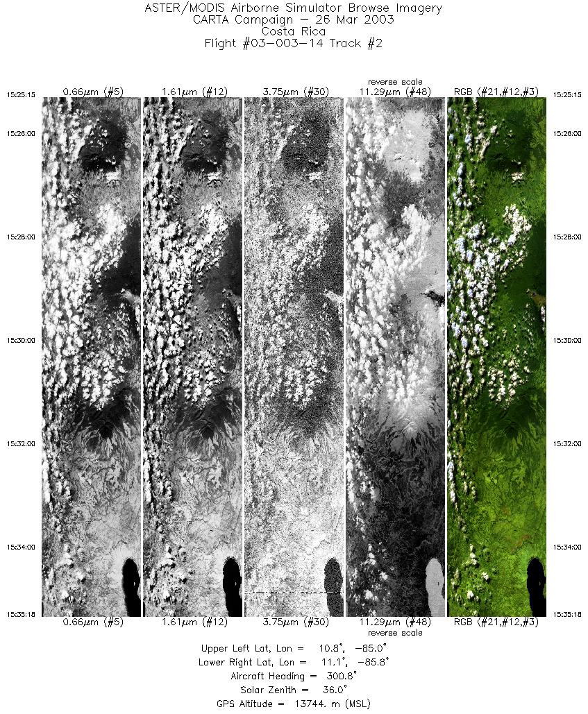
| 2 |
15:25 - 15:35 |
301.4 |
10.720 - 11.154 |
85.046 - 85.693 |
3749 |
13763 |
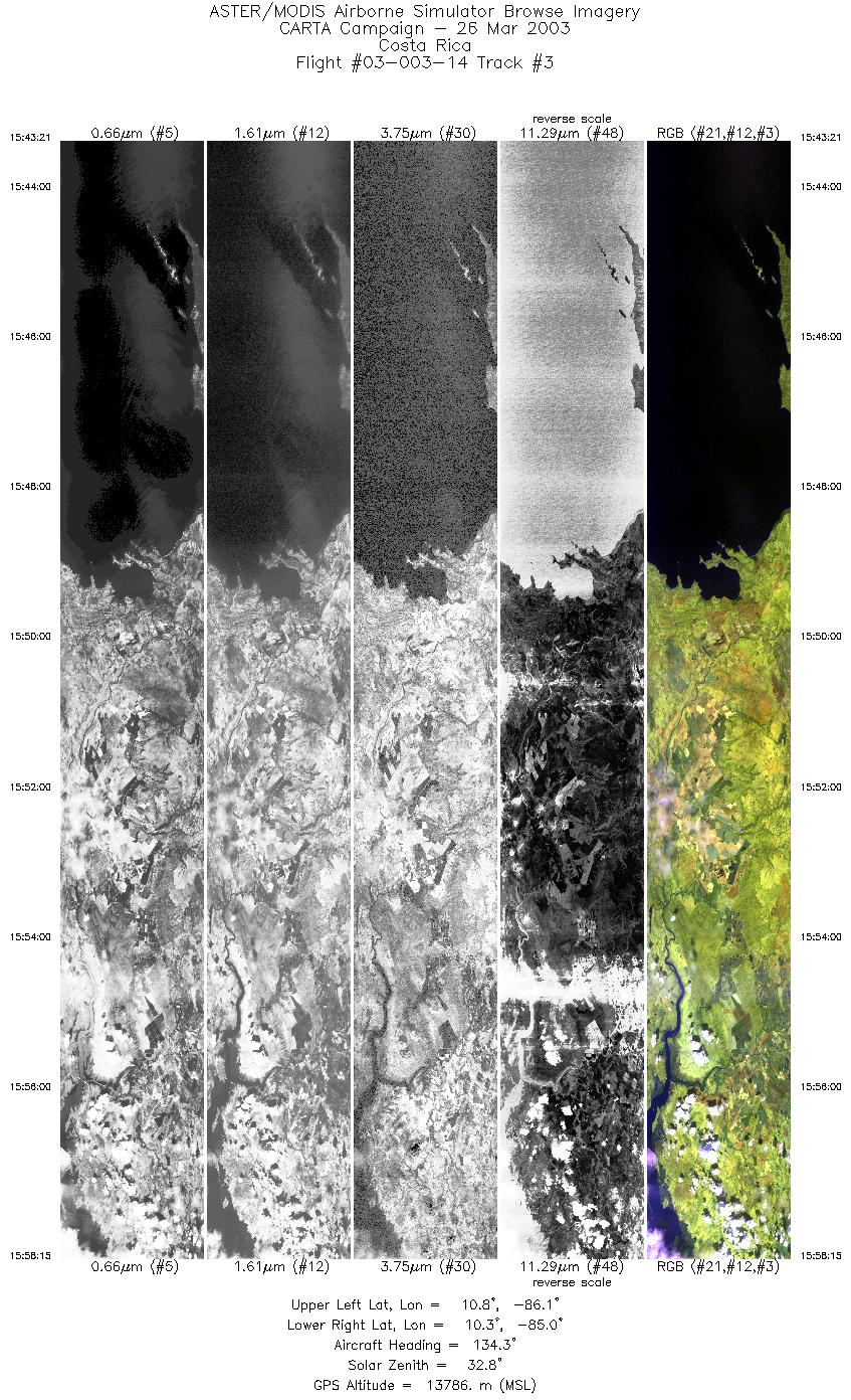
| 3 |
15:43 - 15:58 |
129.4 |
10.893 - 10.204 |
86.072 - 85.043 |
5561 |
13787 |
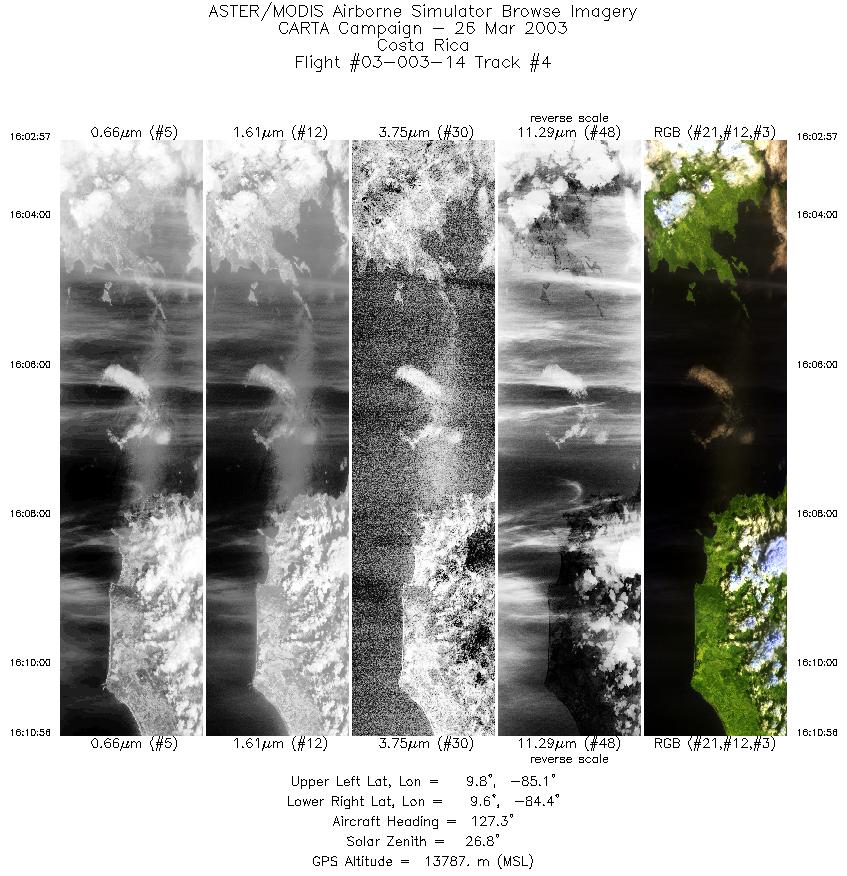
| 4 |
15:43 - 15:58 |
129.4 |
10.893 - 10.204 |
86.072 - 85.043 |
5561 |
13787 |
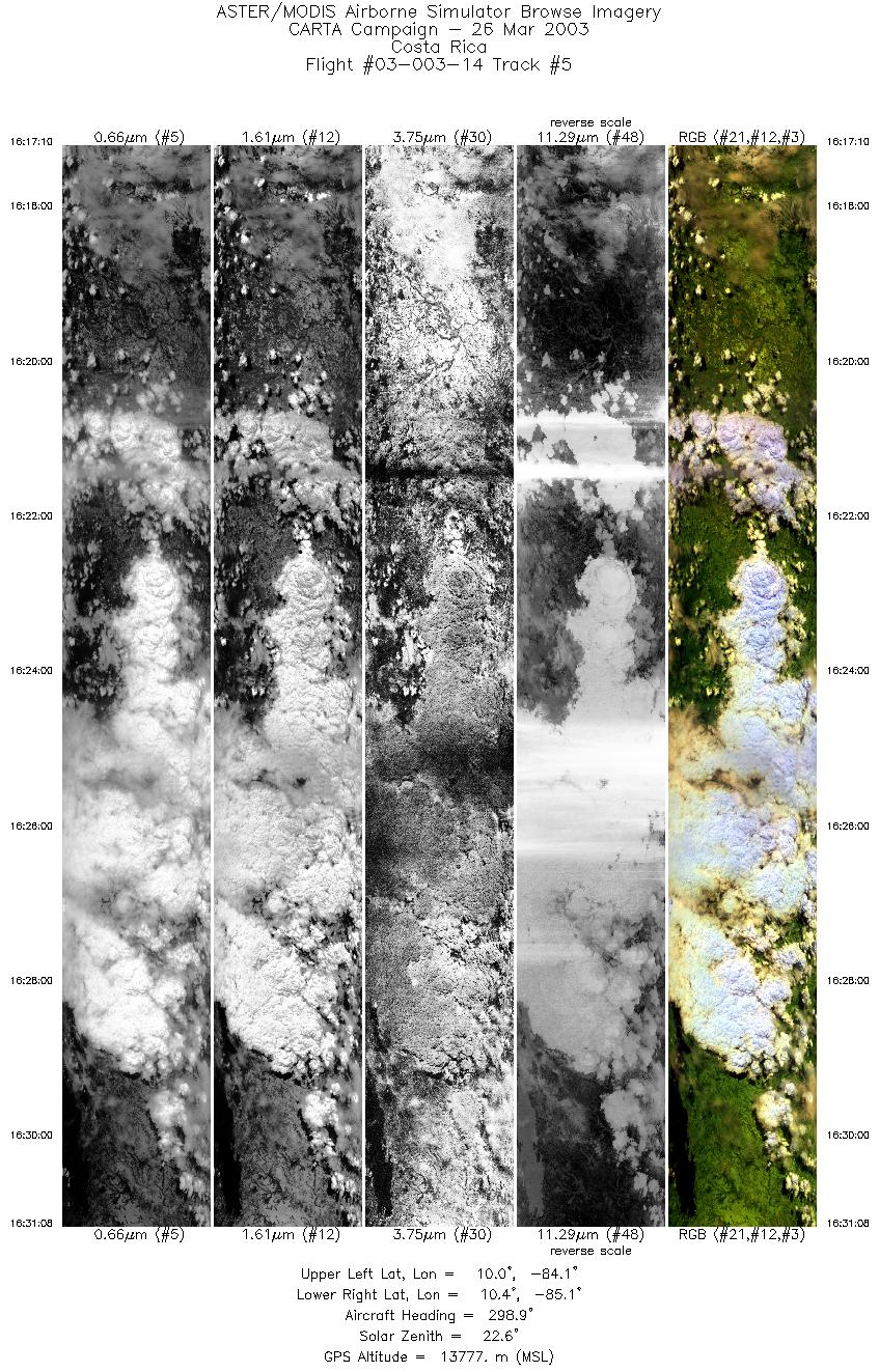
| 5 |
16:17 - 16:31 |
298.8 |
9.911 - 10.482 |
84.181 - 85.021 |
5219 |
13786 |
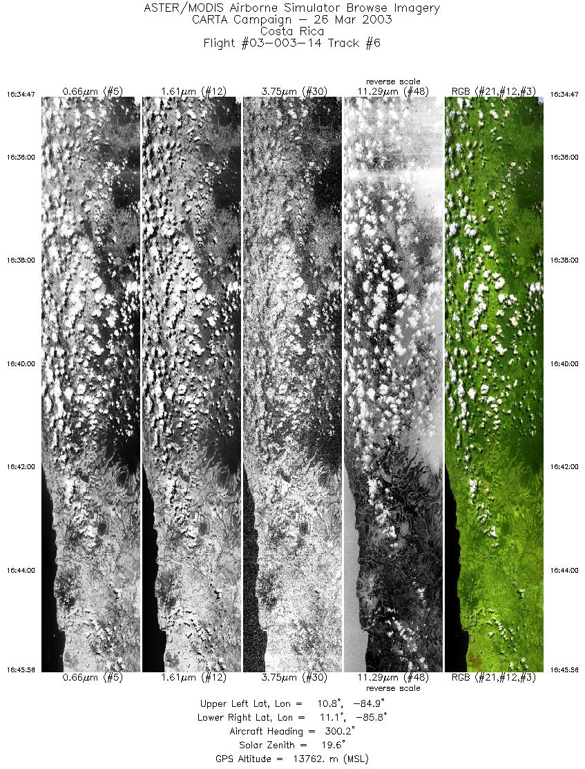
| 6 |
16:34 - 16:45 |
301.0 |
10.740 - 11.231 |
84.967 - 85.696 |
4168 |
13787 |
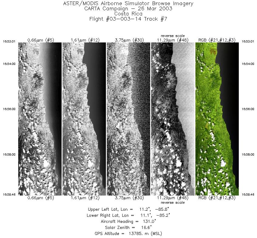
| 7 |
16:53 - 16:59 |
128.0 |
11.297 - 11.000 |
85.685 - 85.235 |
2528 |
13773 |
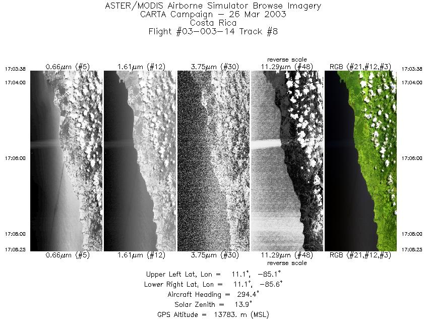
| 8 |
17:03 - 17:08 |
297.7 |
11.035 - 11.244 |
85.185 - 85.495 |
1791 |
13765 |
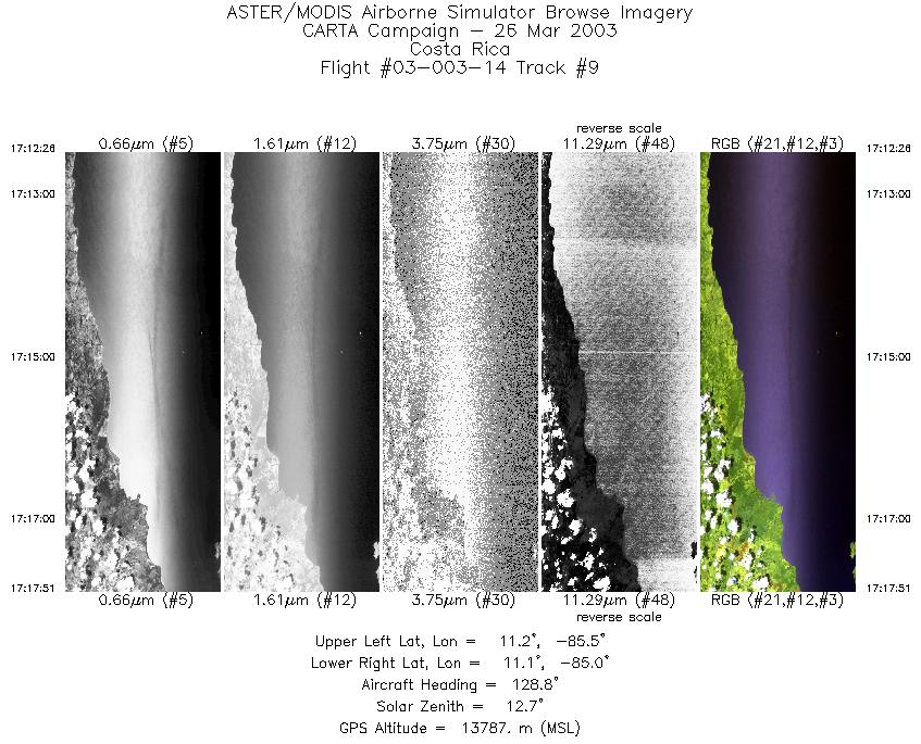
| 9 |
17:12 - 17:17 |
126.9 |
11.306 - 11.059 |
85.481 - 85.101 |
2029 |
13787 |
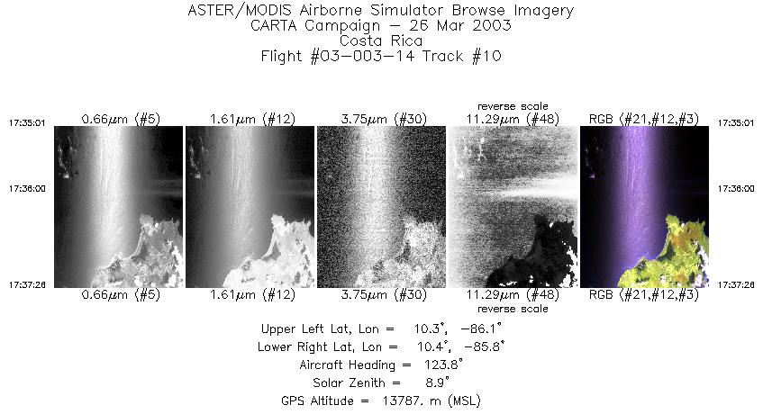
| 10 |
17:35 - 17:37 |
124.5 |
10.395 - 10.276 |
85.995 - 85.819 |
903 |
13788 |
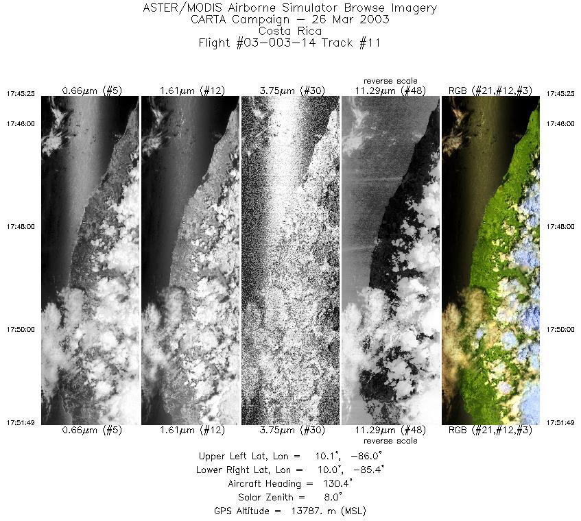
| 11 |
17:45 - 17:51 |
128.1 |
10.209 - 9.908 |
85.935 - 85.492 |
2400 |
13789 |
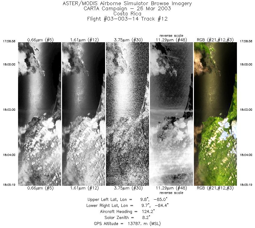
| 12 |
17:58 - 18:05 |
124.7 |
9.876 - 9.576 |
84.896 - 84.448 |
2380 |
13786 |
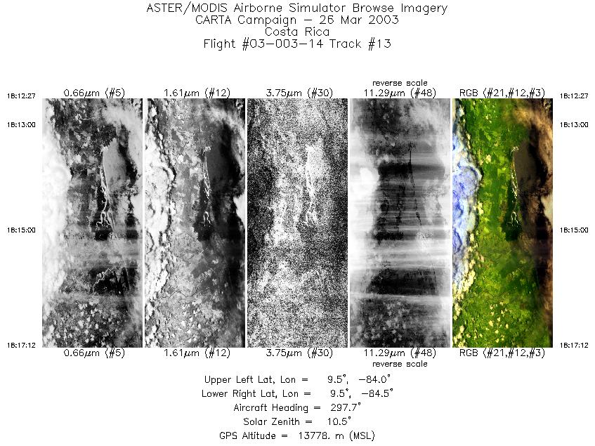
| 13 |
18:12 - 18:17 |
300.4 |
9.407 - 9.617 |
84.091 - 84.400 |
1779 |
13788 |
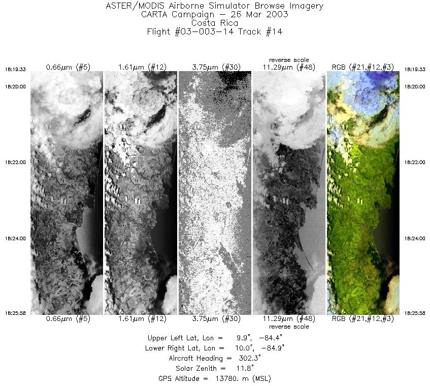
| 14 |
18:19 - 18:25 |
300.8 |
9.795 - 10.085 |
84.440 - 84.874 |
2402 |
13713 |
|


