Flight: 03-003-05
Date: March 12, 2003
Aircraft: NASA WB57, #926
Deployment: CARTA
Flight Location: Costa Rica
Principal Investigator: CENAT (Diaz)
Additional Sensors: AVEMS, RC-10
|
Data Evaluation
Data quality is good.
|
Processing Information
Level-1B Data in HDF format is available
Flight Line Summary
Spectral Band Configuration
Spectral Response Function Table
Spectral Response Function (text)
|
Browse Imagery
Flight Tracks: 13
Scanlines: 108848
|
Browse Imagery Table
|
Click a Flight Track number to view a quicklook image
Lat/Lon ranges are for the BEG-END scanline nadir pixels
|
Flight
Track |
Time Span
(UTC) |
Heading
(Deg) |
Lat Range
(Deg N) |
Lon Range
(Deg W) |
Length
(Scanlines) |
Altitude
(Meters) |
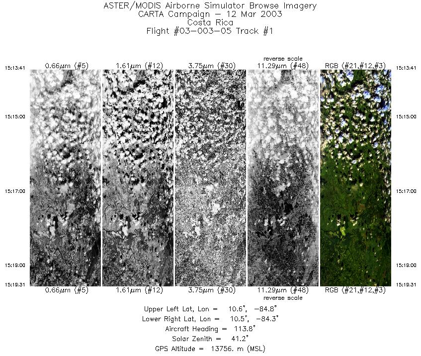
| 1 |
15:13 - 15:19 |
118.4 |
10.663 - 10.424 |
84.743 - 84.381 |
2181 |
13785 |
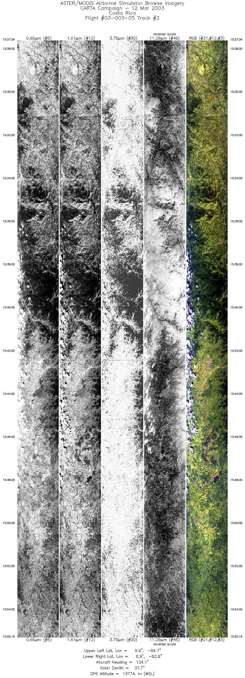
| 2 |
15:27 - 15:55 |
123.2 |
9.995 - 8.793 |
84.653 - 82.860 |
10332 |
13783 |
| 3 |
15:58 - 16:24 |
312.6 |
8.779 - 9.911 |
82.765 - 84.393 |
9683 |
13712 |
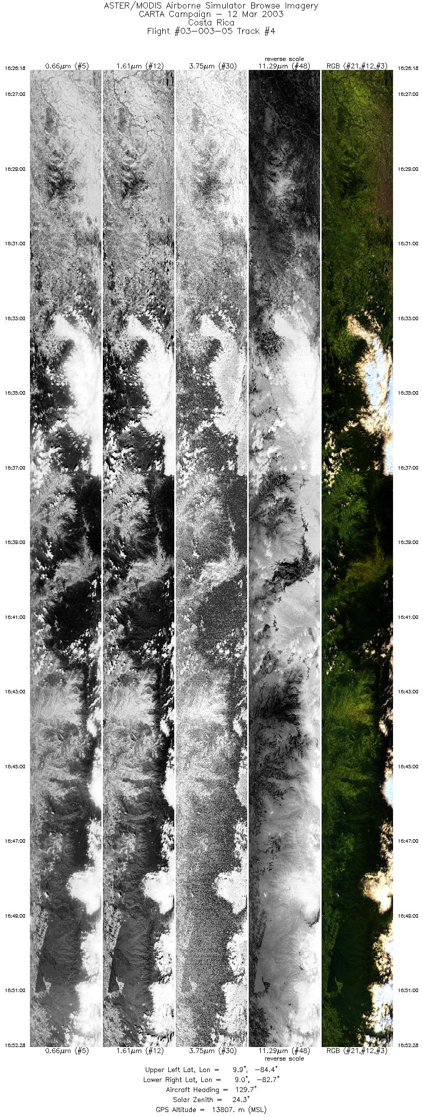
| 4 |
16:26 - 16:52 |
125.4 |
10.004 - 8.922 |
84.347 - 82.722 |
9783 |
13789 |
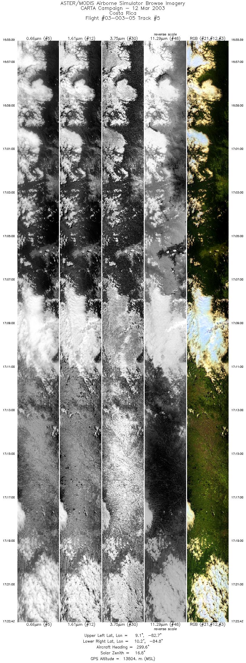
| 5 |
16:55 - 17:22 |
301.4 |
9.024 - 10.331 |
82.766 - 84.683 |
9999 |
13789 |
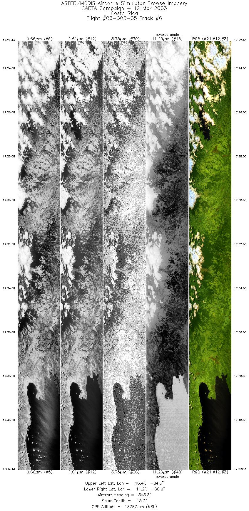
| 6 |
17:22 - 17:42 |
318.1 |
10.331 - 11.220 |
84.683 - 85.903 |
7301 |
13786 |
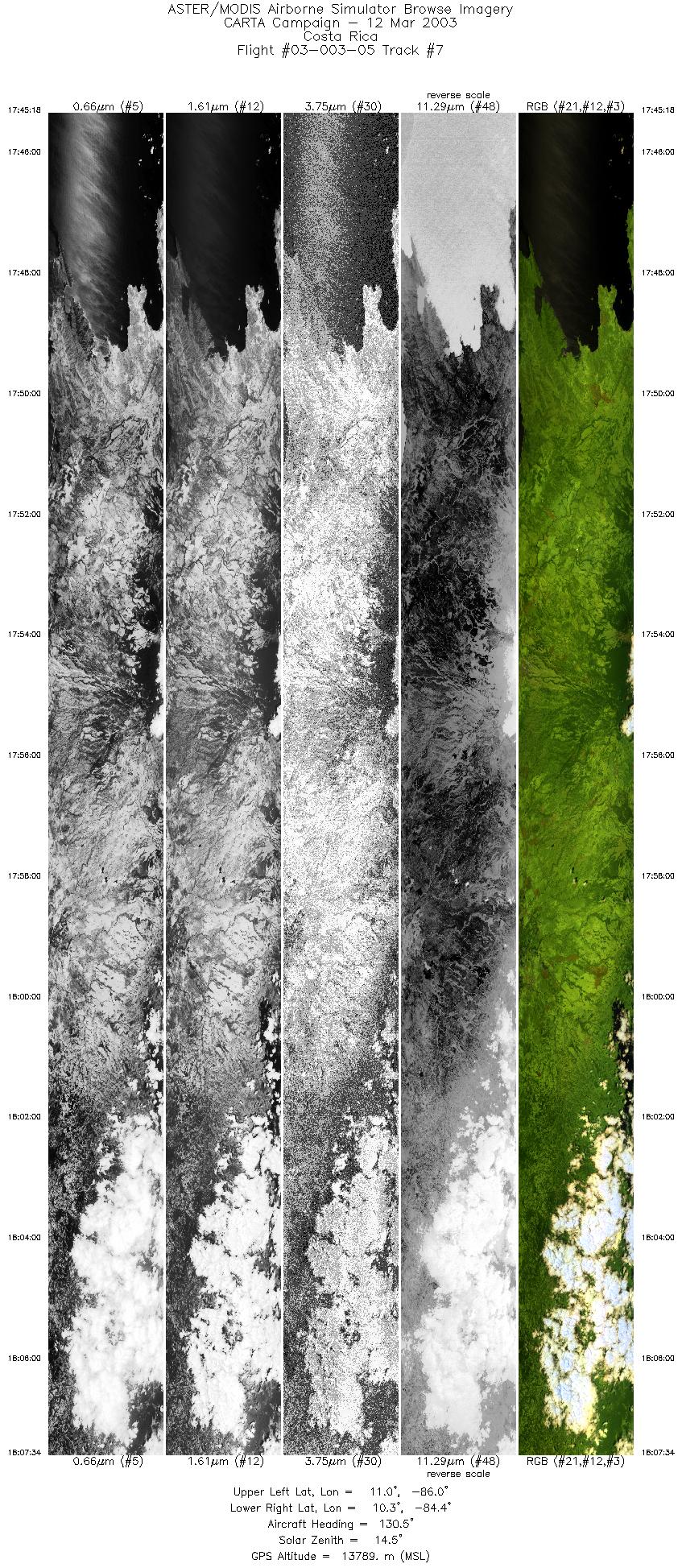
| 7 |
17:45 - 18:07 |
125.4 |
11.124 - 10.163 |
85.970 - 84.513 |
8336 |
13787 |
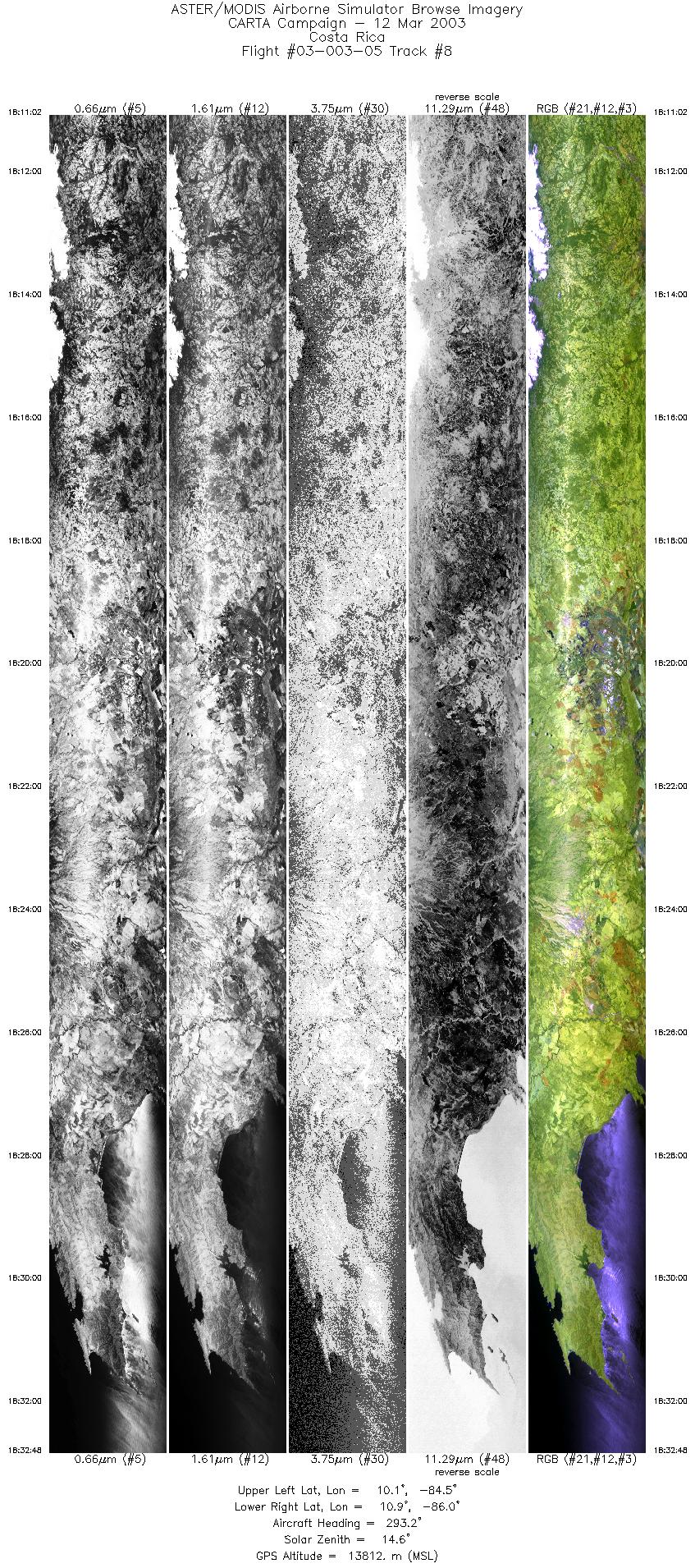
| 8 |
18:11 - 18:32 |
294.9 |
10.035 - 10.977 |
84.574 - 85.980 |
8153 |
13812 |
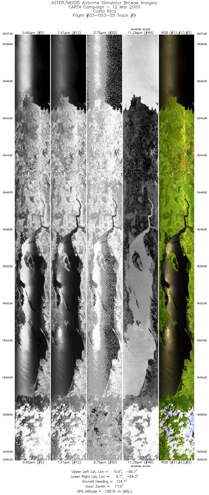
| 9 |
18:37 - 19:00 |
124.2 |
10.704 - 9.614 |
86.016 - 84.381 |
8616 |
13791 |
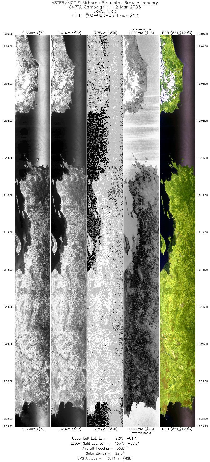
| 10 |
18:37 - 19:00 |
124.2 |
10.704 - 9.614 |
86.016 - 84.381 |
8616 |
13791 |
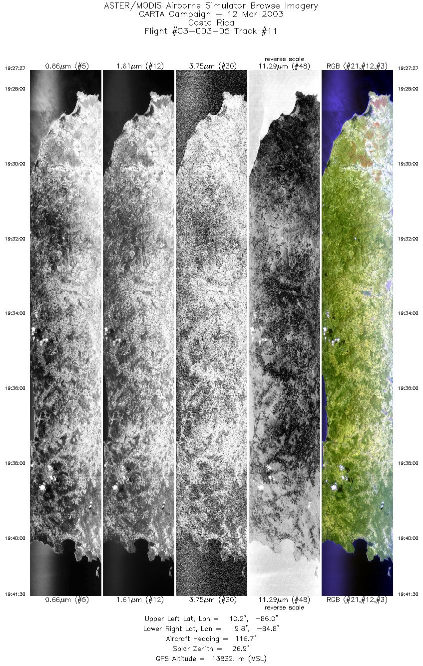
| 11 |
18:37 - 19:00 |
124.2 |
10.704 - 9.614 |
86.016 - 84.381 |
8616 |
13791 |
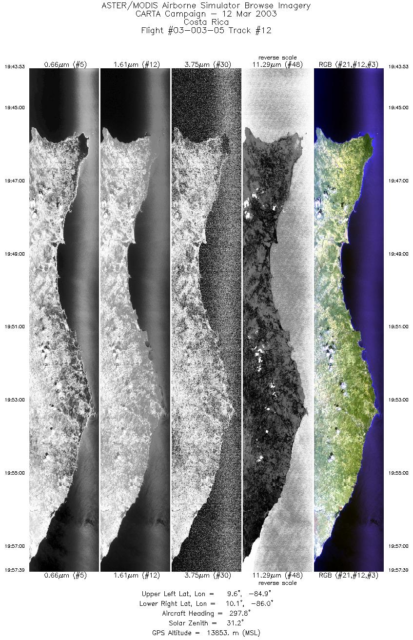
| 12 |
18:37 - 19:00 |
124.2 |
10.704 - 9.614 |
86.016 - 84.381 |
8616 |
13791 |
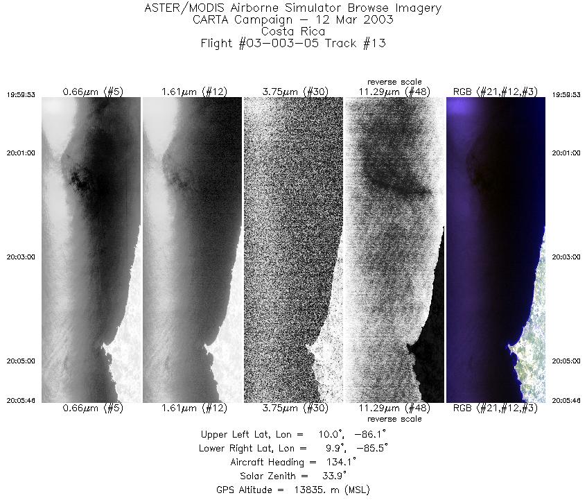
| 13 |
18:37 - 19:00 |
124.2 |
10.704 - 9.614 |
86.016 - 84.381 |
8616 |
13791 |
|


