Flight: 03-003-04
Date: March 11, 2003
Aircraft: NASA WB57, #926
Deployment: CARTA
Flight Location: Costa Rica
Principal Investigator: CENAT (Diaz)
Additional Sensors: AVEMS, RC-10
|
Data Evaluation
Data quality is good.
|
Processing Information
Level-1B Data in HDF format is available
Flight Line Summary
Spectral Band Configuration
Spectral Response Function Table
Spectral Response Function (text)
|
Browse Imagery
Flight Tracks: 12
Scanlines: 61104
|
Browse Imagery Table
|
Click a Flight Track number to view a quicklook image
Lat/Lon ranges are for the BEG-END scanline nadir pixels
|
Flight
Track |
Time Span
(UTC) |
Heading
(Deg) |
Lat Range
(Deg N) |
Lon Range
(Deg W) |
Length
(Scanlines) |
Altitude
(Meters) |
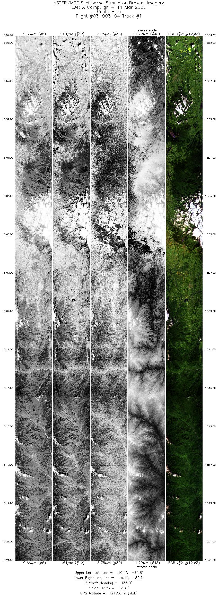
| 1 |
15:54 - 16:21 |
129.9 |
10.472 - 9.274 |
84.545 - 82.801 |
10197 |
12204 |
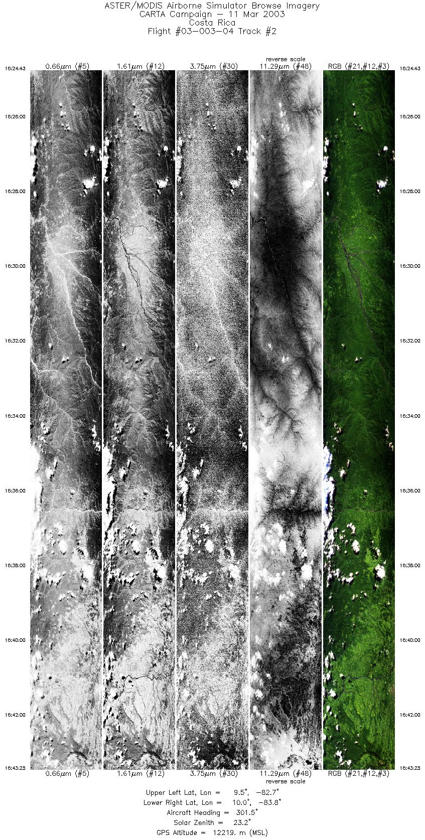
| 2 |
16:24 - 16:43 |
302.4 |
9.362 - 10.063 |
82.711 - 83.746 |
6979 |
12206 |
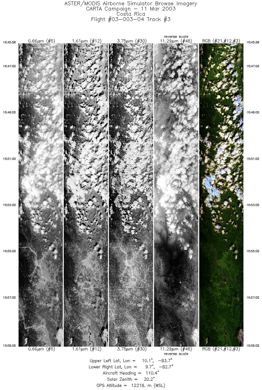
| 3 |
16:45 - 16:59 |
116.0 |
10.169 - 9.575 |
83.683 - 82.806 |
4896 |
12230 |
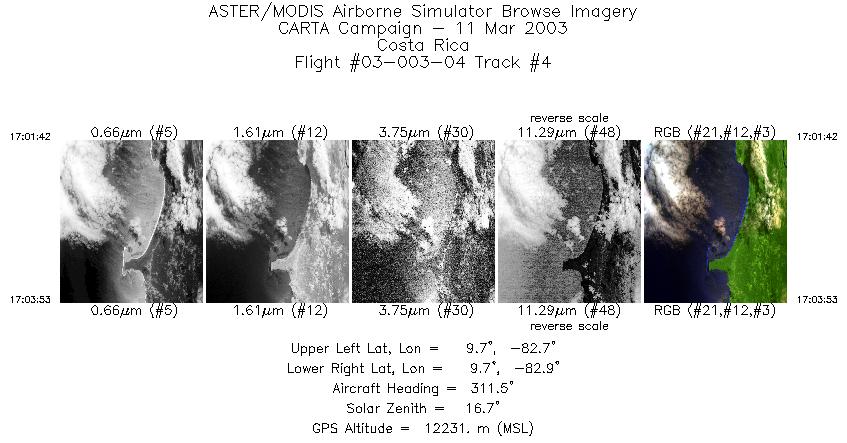
| 4 |
17:01 - 17:03 |
308.2 |
9.664 - 9.761 |
82.717 - 82.848 |
818 |
12232 |
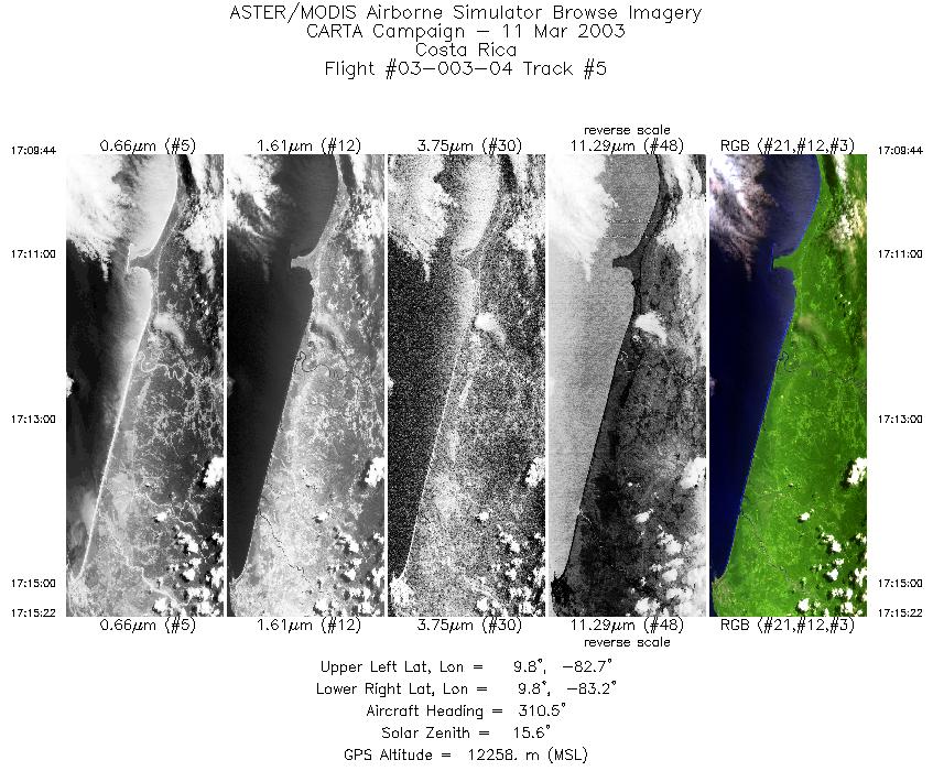
| 5 |
17:09 - 17:15 |
307.5 |
9.673 - 9.930 |
82.737 - 83.112 |
2102 |
12220 |
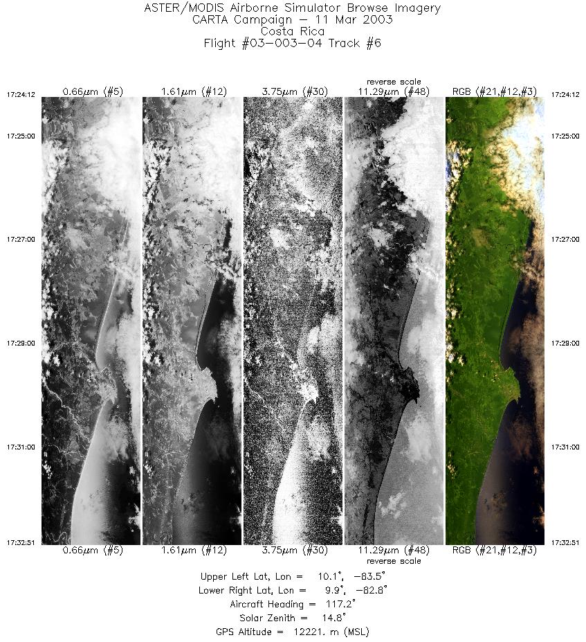
| 6 |
17:24 - 17:32 |
131.0 |
10.226 - 9.815 |
83.462 - 82.861 |
3235 |
12208 |
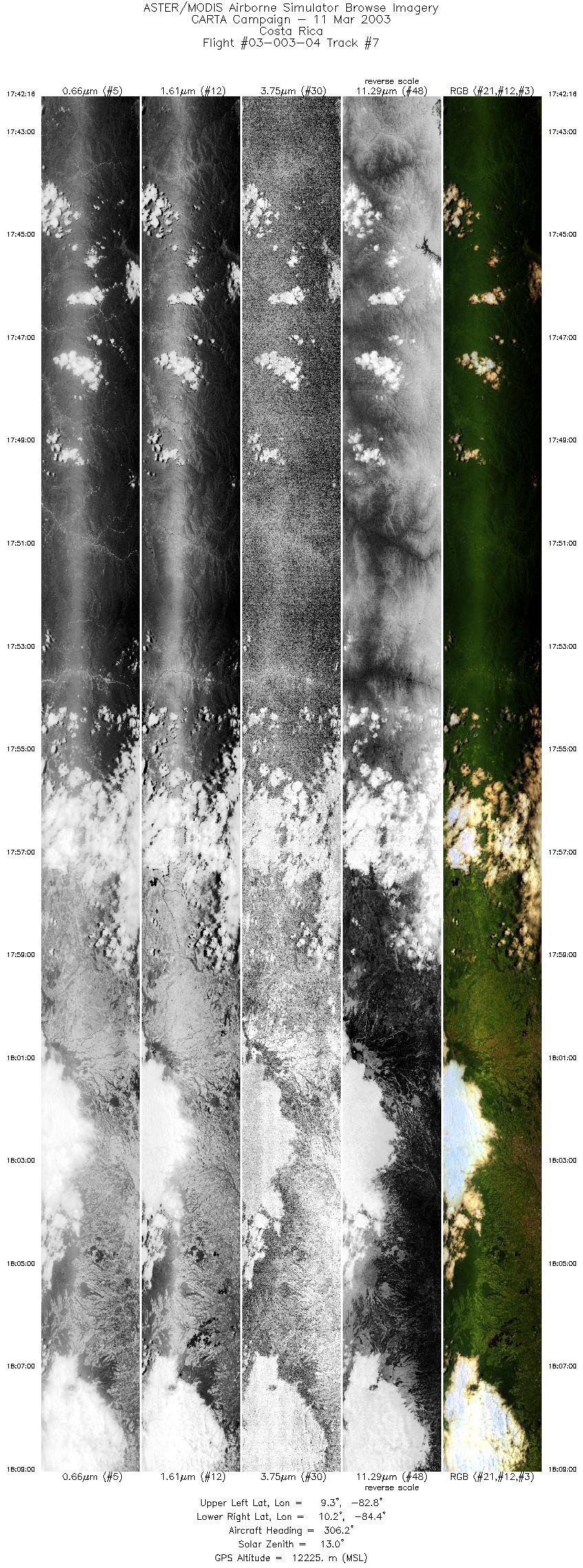
| 7 |
17:42 - 18:09 |
304.1 |
9.189 - 10.238 |
82.813 - 84.335 |
9999 |
12171 |
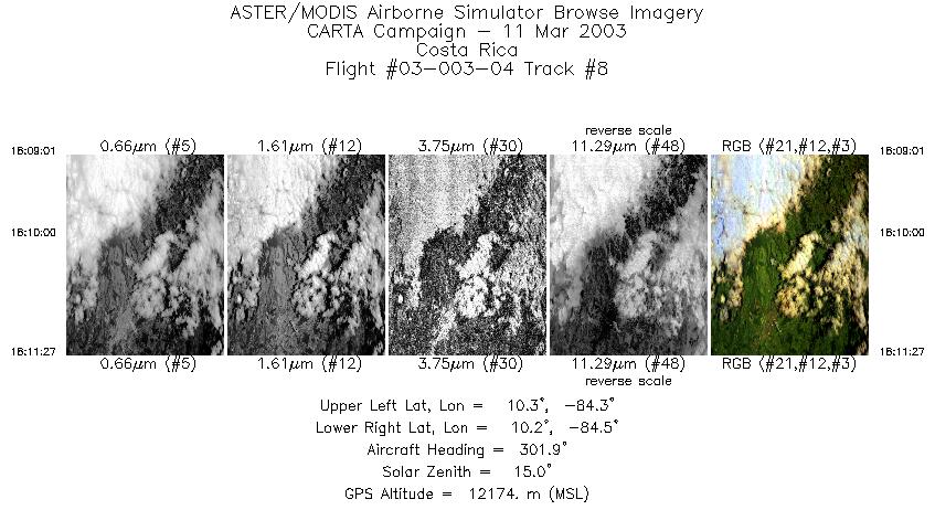
| 8 |
18:09 - 18:11 |
301.3 |
10.238 - 10.317 |
84.335 - 84.453 |
912 |
12172 |
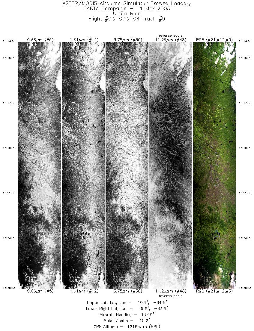
| 9 |
18:14 - 18:25 |
132.1 |
10.209 - 9.749 |
84.495 - 83.824 |
4100 |
12189 |
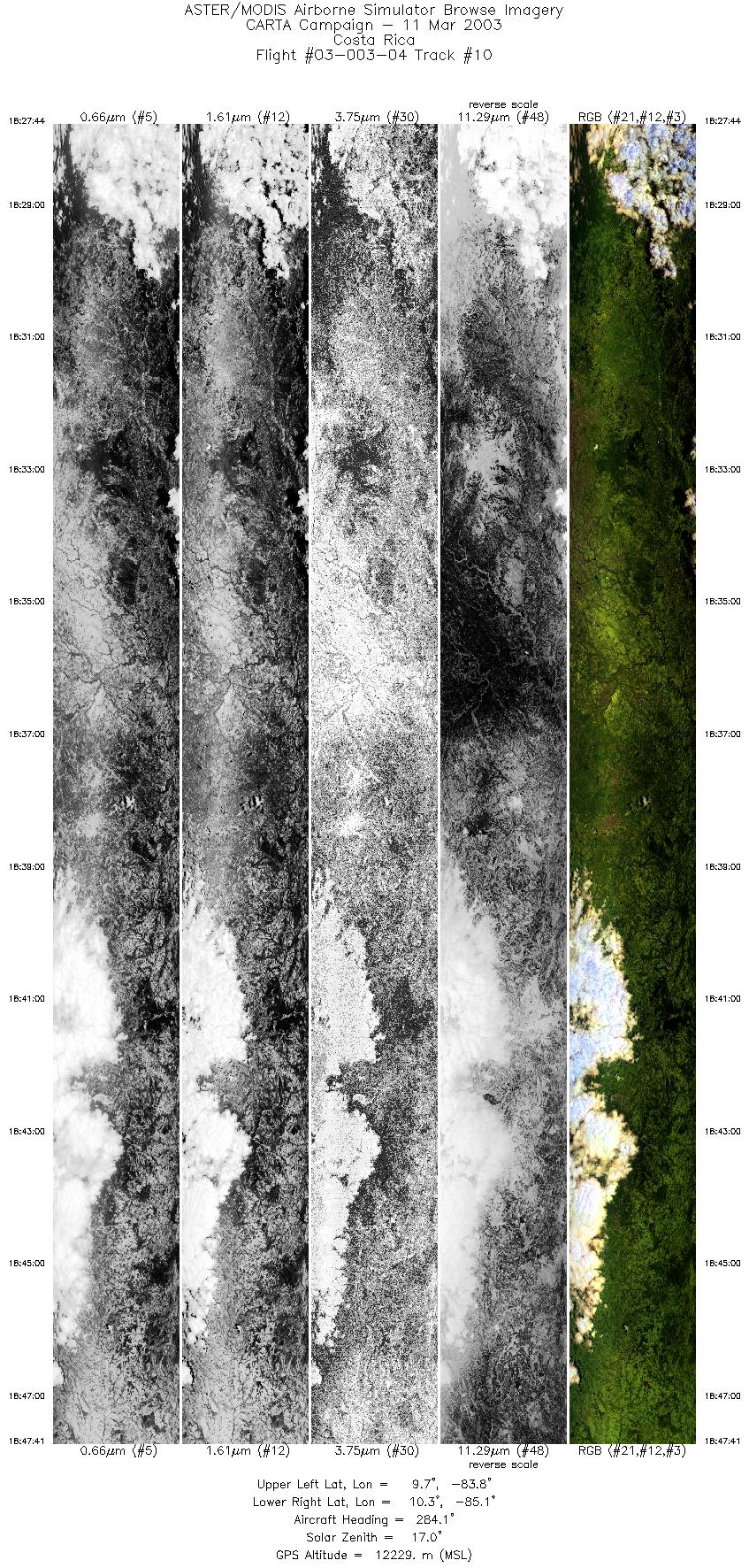
| 10 |
18:27 - 18:47 |
290.4 |
9.642 - 10.420 |
83.865 - 85.025 |
7463 |
12234 |
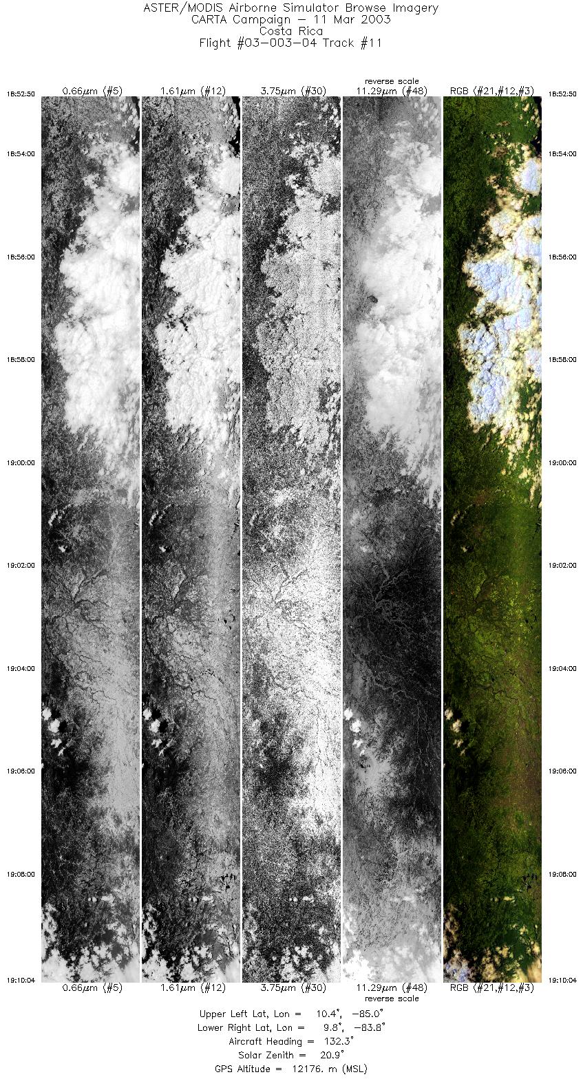
| 11 |
18:52 - 19:10 |
128.3 |
10.439 - 9.718 |
84.952 - 83.888 |
6442 |
12172 |
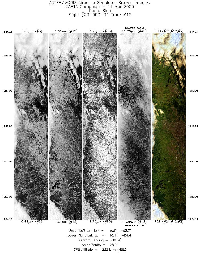
| 12 |
19:13 - 19:24 |
303.1 |
9.754 - 10.170 |
83.724 - 84.342 |
3961 |
12204 |
|


