Flight: 00-020-21
Date: August 30, 2000
Aircraft: DC-8, Aircraft Number 817
Deployment: PACRIM II
Flight Location: Palm Is, Rib Reef, Injune, Daintree, Cooktown, Innisfail, Cowley Beach; Australia
Principal Investigator: CSIRO, Milne, Ticehurst, Hensley (AUS); NIMA
Additional Sensors: AirSAR
|
Data Evaluation
Dropped sacanlines in each flightline.
Fair amount of spikes (bad pixel values) in video data, which correspond to the first band of each QUAD ADC card (channels 1,5,9,11,15,19,24,25).
|
Processing Information
Level-1B Data in HDF format is available
Flight Line Summary
Spectral Band Configuration
Spectral Response Function Table
Spectral Response Function (text)
|
Browse Imagery
Flight Tracks: 16
Scanlines: 112253
|
Browse Imagery Table
|
Click a Flight Track number to view a quicklook image
Lat/Lon ranges are for the BEG-END scanline nadir pixels
|
Flight
Track |
Time Span
(UTC) |
Heading
(Deg) |
Lat Range
(Deg S) |
Lon Range
(Deg E) |
Length
(Scanlines) |
Altitude
(Meters) |
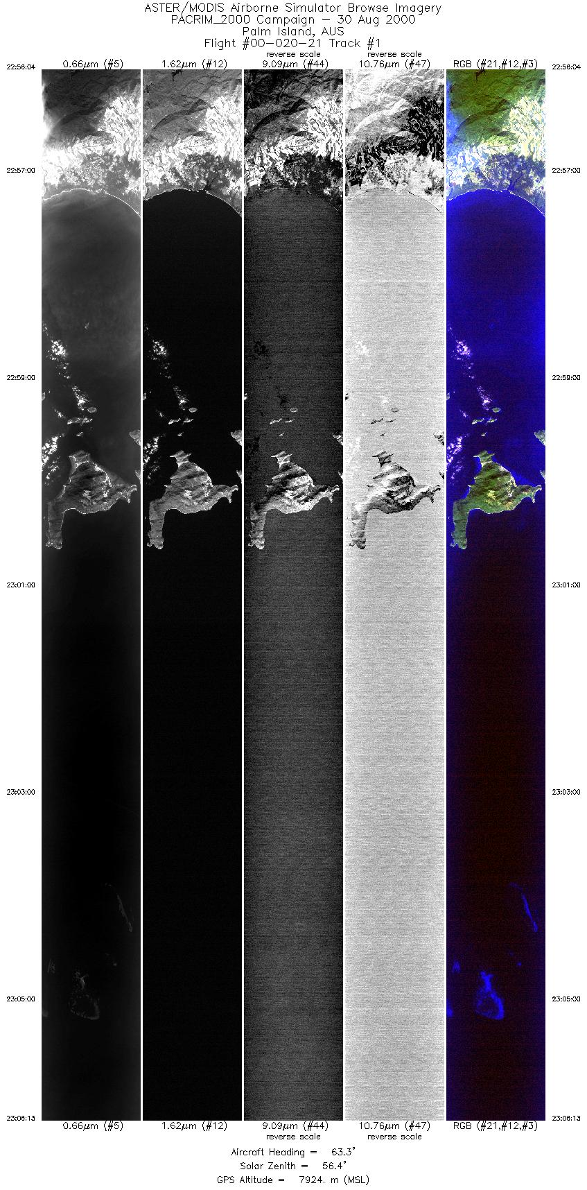
| 1 |
22:56 - 23:06 |
63.9 |
18.933 - 18.444 |
146.144 - 147.286 |
7582 |
7920 |
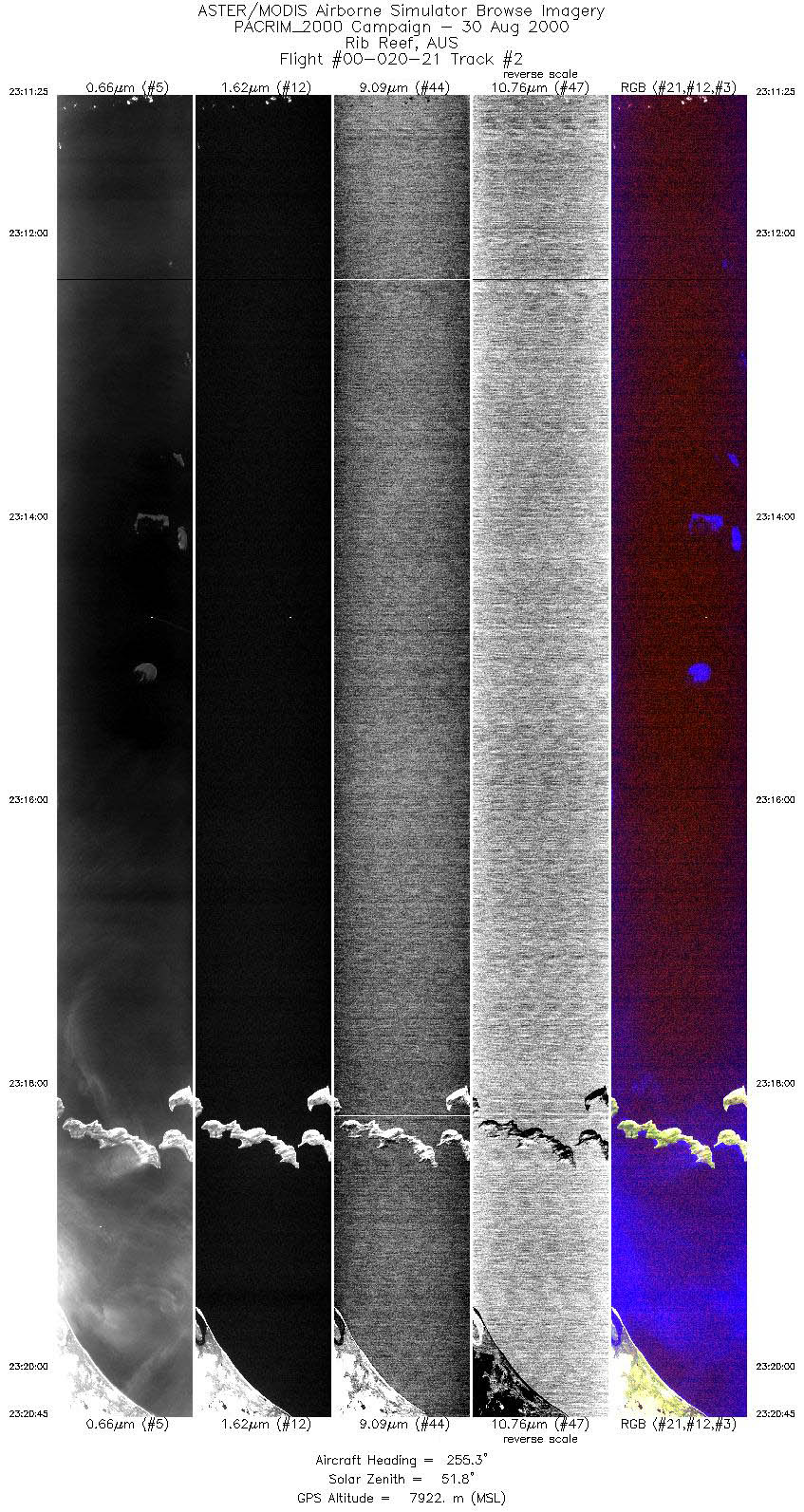
| 2 |
23:11 - 23:20 |
251.4 |
18.267 - 18.724 |
147.329 - 146.284 |
6969 |
7931 |
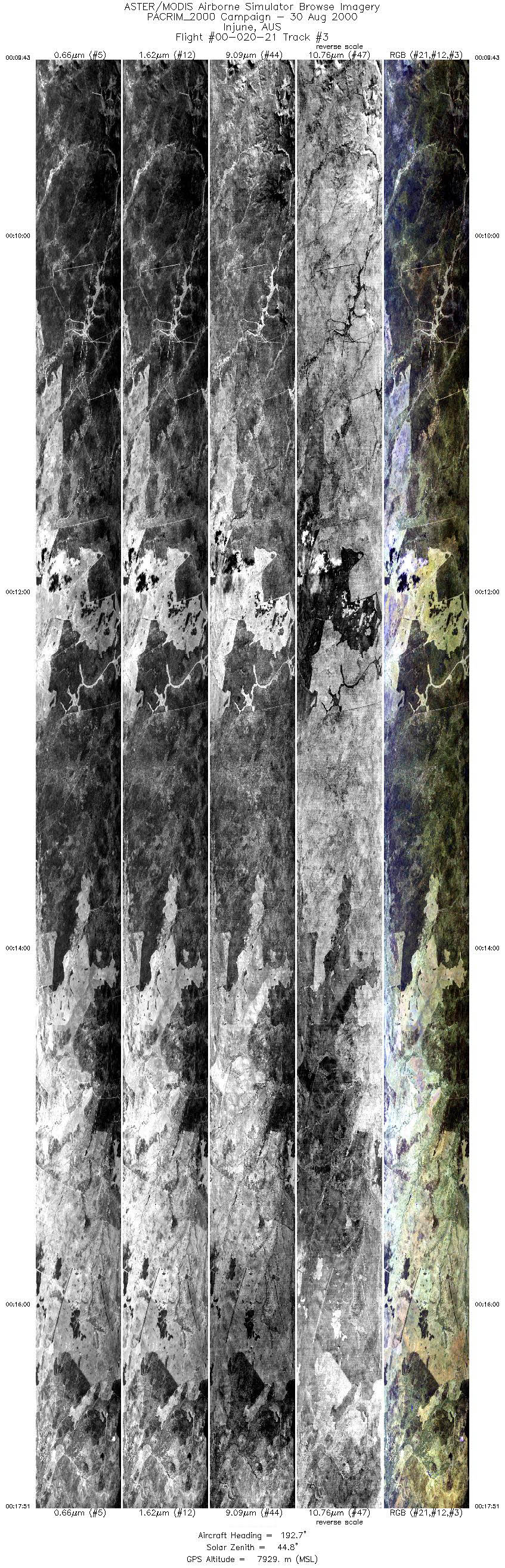
| 3 |
00:09 - 00:17 |
193.1 |
25.053 - 26.049 |
147.383 - 147.383 |
12144 |
7929 |
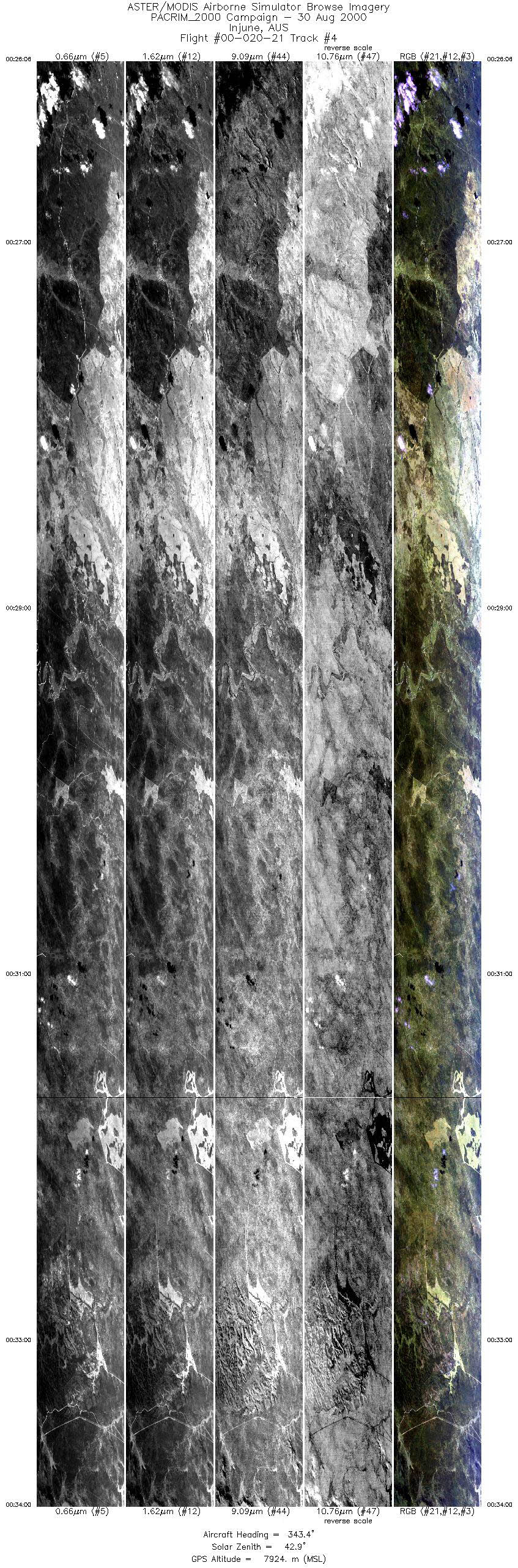
| 4 |
00:26 - 00:33 |
344.3 |
26.170 - 25.199 |
147.474 - 147.474 |
11806 |
7921 |
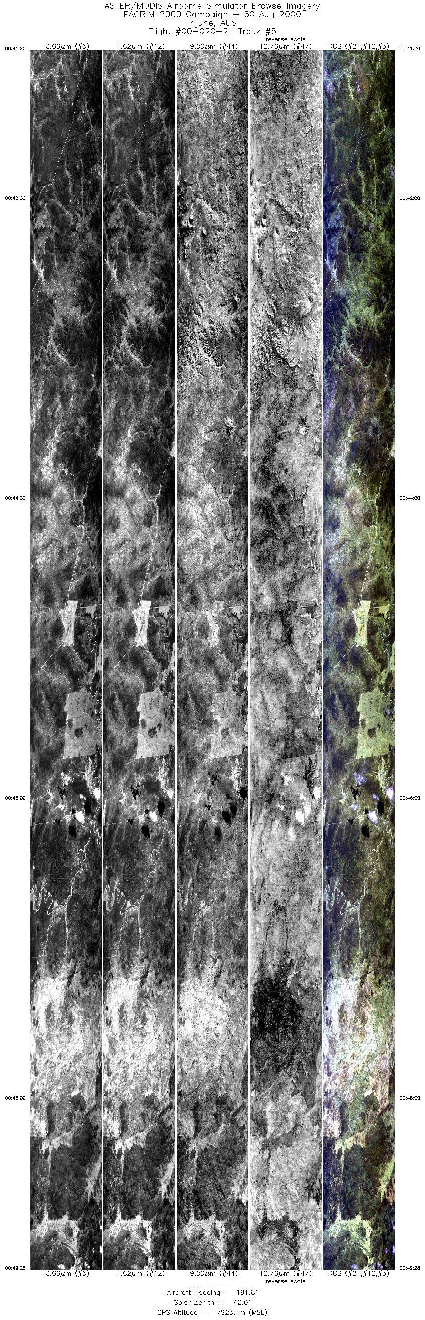
| 5 |
00:41 - 00:49 |
191.7 |
25.049 - 26.050 |
147.566 - 147.572 |
12137 |
7926 |
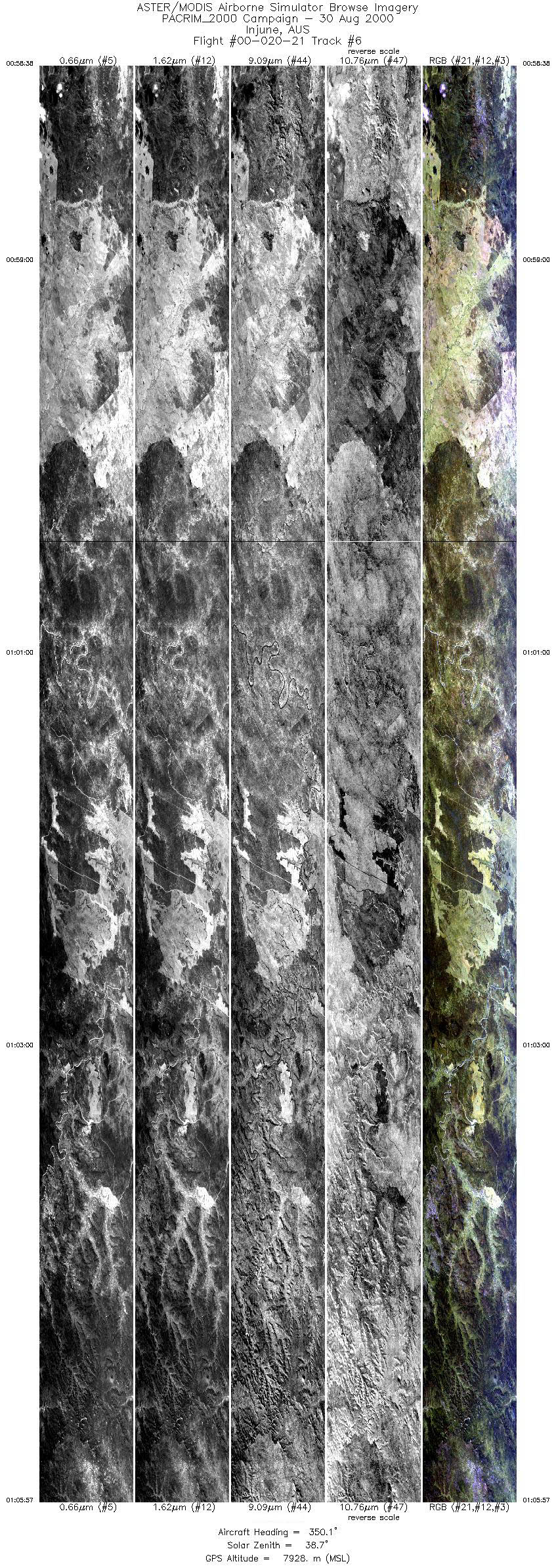
| 6 |
00:58 - 01:05 |
349.8 |
26.106 - 25.205 |
147.665 - 147.670 |
10940 |
7928 |
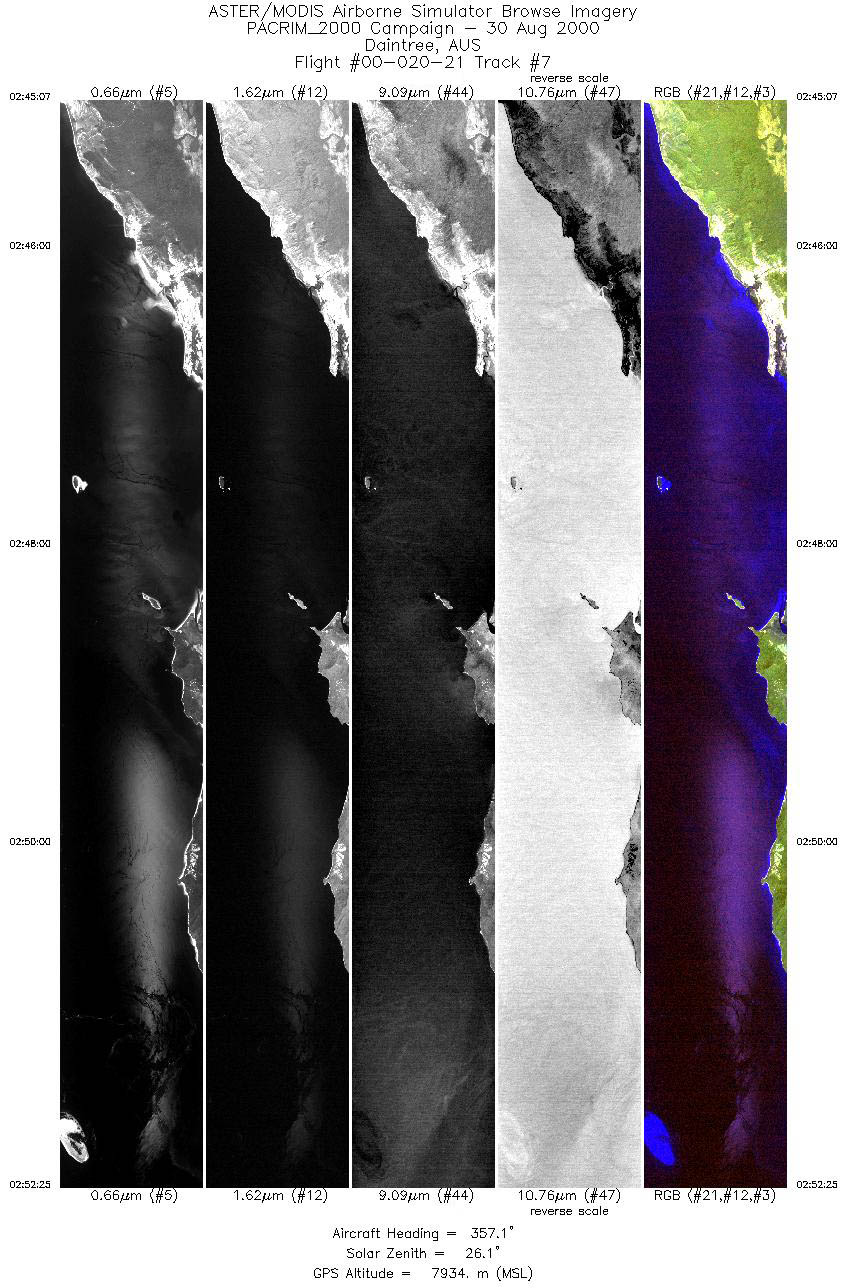
| 7 |
02:45 - 02:52 |
357.6 |
16.699 - 15.840 |
145.515 - 145.515 |
5441 |
7935 |
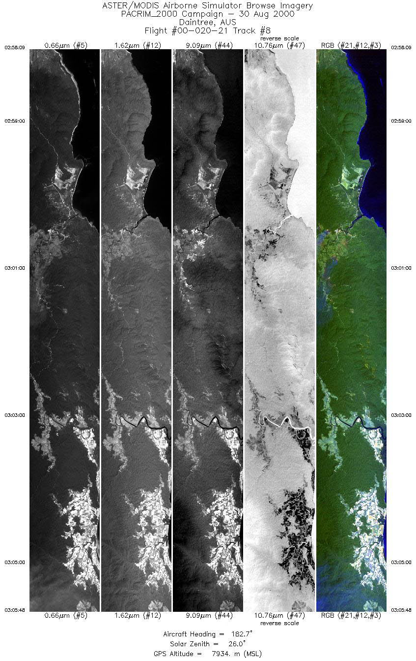
| 8 |
02:58 - 03:05 |
182.4 |
15.655 - 16.548 |
145.344 - 145.344 |
5719 |
7941 |
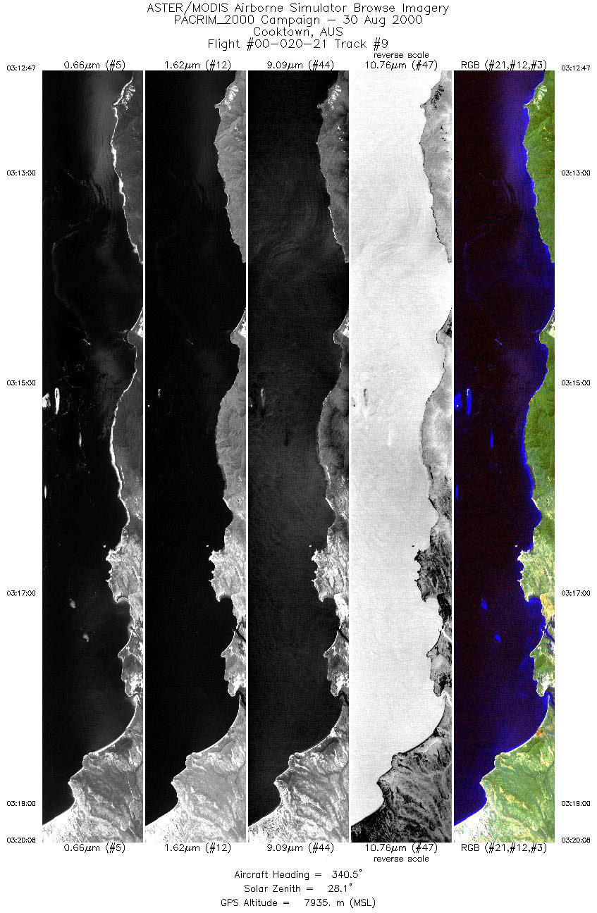
| 9 |
03:12 - 03:20 |
340.9 |
16.112 - 15.292 |
145.511 - 145.252 |
5484 |
7934 |
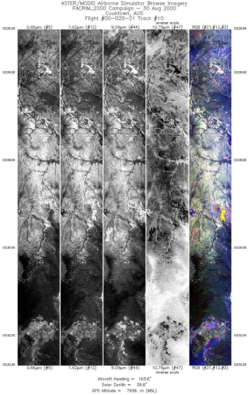
| 10 |
03:25 - 03:33 |
163.8 |
15.191 - 16.058 |
145.043 - 145.318 |
5711 |
7938 |
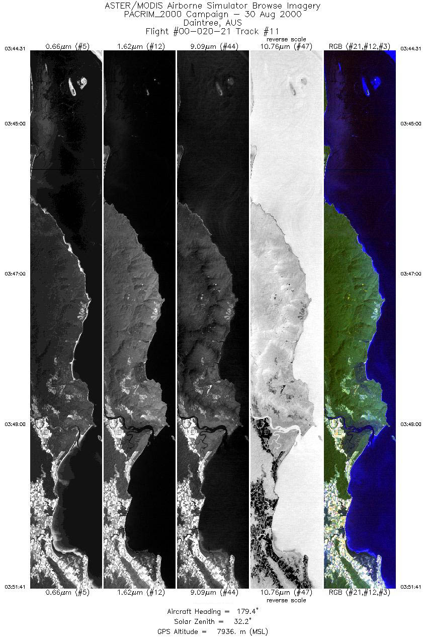
| 11 |
03:44 - 03:51 |
180.7 |
15.680 - 16.526 |
145.430 - 145.431 |
5349 |
7936 |
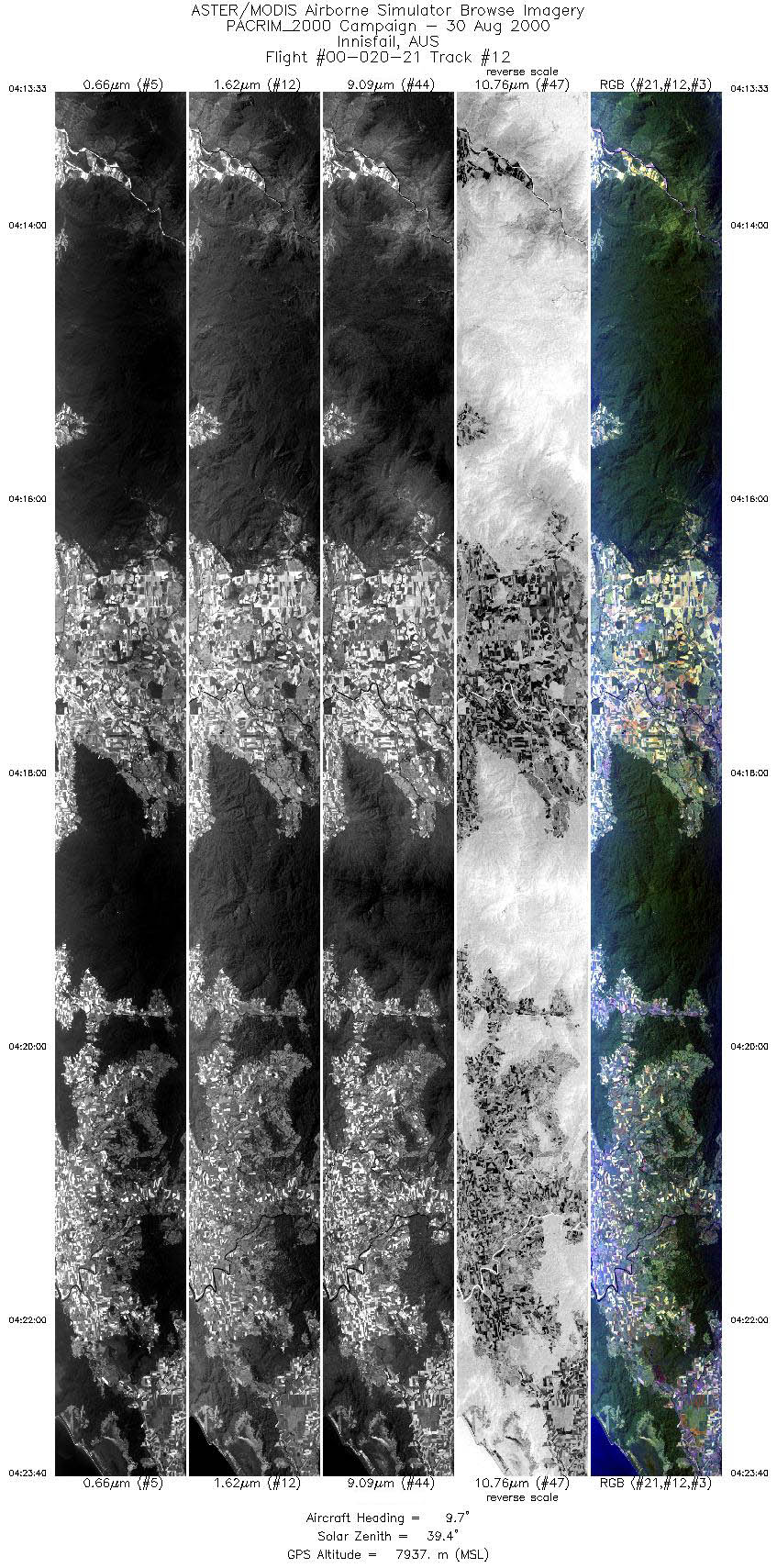
| 12 |
04:13 - 04:23 |
8.6 |
18.503 - 17.333 |
145.758 - 145.996 |
7545 |
7934 |
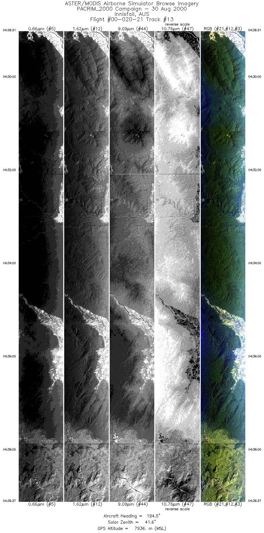
| 13 |
04:29 - 04:39 |
194.3 |
17.137 - 18.305 |
145.859 - 145.623 |
7551 |
7937 |
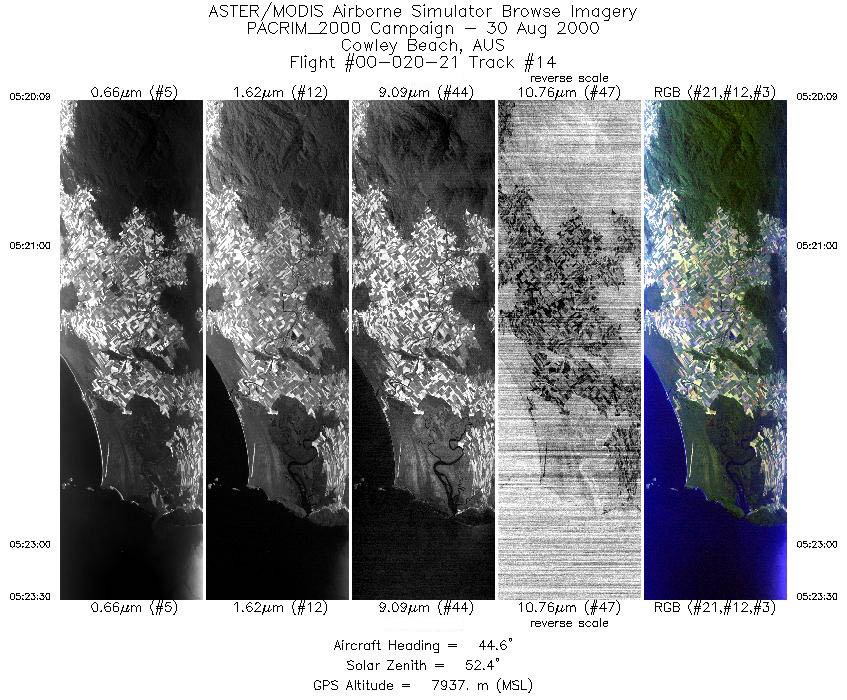
| 14 |
05:20 - 05:23 |
43.2 |
17.846 - 17.572 |
145.898 - 146.192 |
2504 |
7935 |
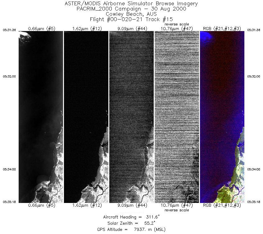
| 15 |
05:31 - 05:35 |
311.4 |
17.774 - 17.471 |
146.376 - 146.049 |
2772 |
7936 |
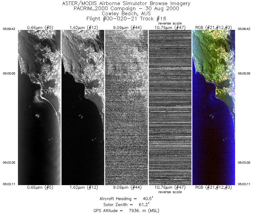
| 16 |
05:59 - 06:03 |
40.6 |
17.902 - 17.610 |
145.988 - 146.283 |
2599 |
7938 |
|


