Flight: 00-020-07
Date: August 04, 2000
Aircraft: DC-8, Aircraft Number 817
Deployment: PACRIM II
Flight Location: Makatea, Moorea, Tahiti, Raiatea, Bora Bora, Rangiroa
Principal Investigator: French Polynesia (Society Is.)
Additional Sensors: AirSAR
|
Data Evaluation
Dropped sacanlines in each flightline.
Fair amount of spikes (bad pixel values) in video data, which correspond to the first band of each QUAD ADC card (channels 1,5,9,11,15,19,24,25).
|
Processing Information
Level-1B Data in HDF format is available
Flight Line Summary
Spectral Band Configuration
Spectral Response Function Table
Spectral Response Function (text)
|
Browse Imagery
Flight Tracks: 18
Scanlines: 70603
|
Browse Imagery Table
|
Click a Flight Track number to view a quicklook image
Lat/Lon ranges are for the BEG-END scanline nadir pixels
|
Flight
Track |
Time Span
(UTC) |
Heading
(Deg) |
Lat Range
(Deg S) |
Lon Range
(Deg W) |
Length
(Scanlines) |
Altitude
(Meters) |
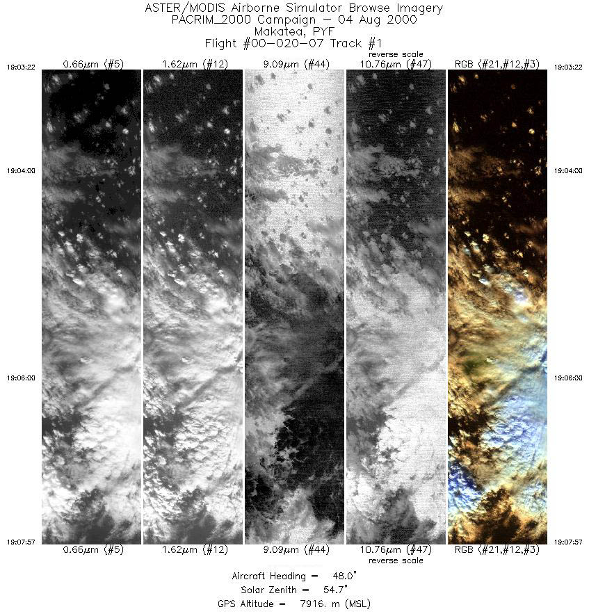
| 1 |
19:03 - 19:07 |
47.9 |
16.047 - 15.712 |
148.542 - 148.111 |
3415 |
7916 |
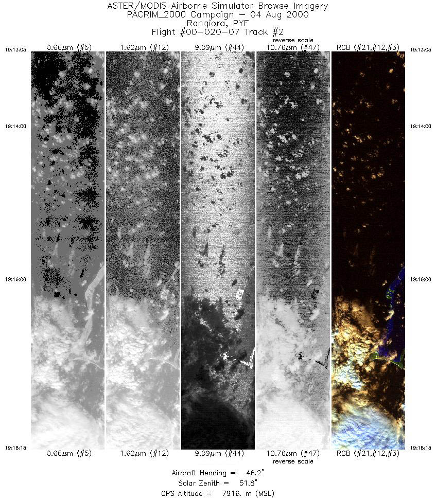
| 2 |
19:13 - 19:18 |
46.2 |
15.588 - 15.191 |
147.577 - 147.105 |
3873 |
7916 |
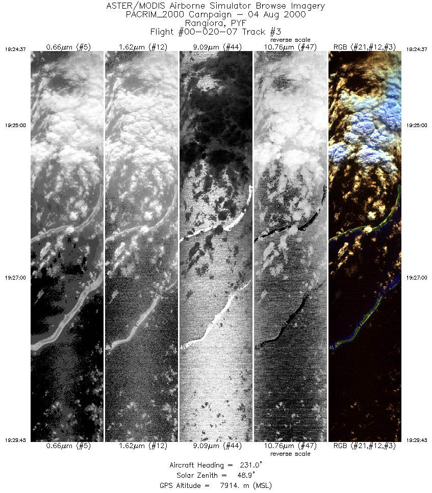
| 3 |
19:24 - 19:29 |
230.8 |
15.037 - 15.432 |
147.118 - 147.587 |
3831 |
7915 |
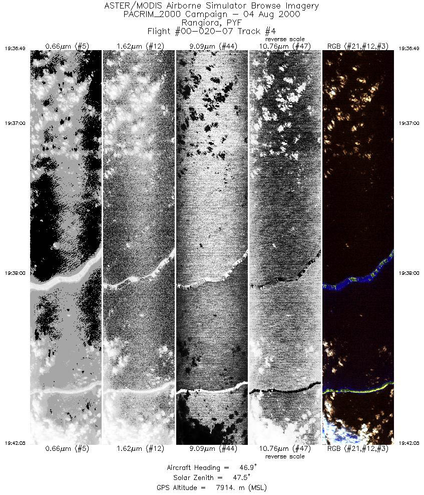
| 4 |
19:36 - 19:42 |
46.5 |
15.490 - 15.084 |
147.857 - 147.375 |
3939 |
7912 |
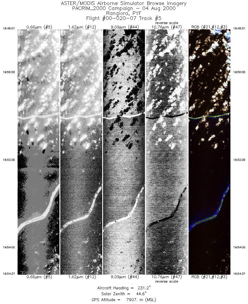
| 5 |
19:49 - 19:54 |
231.1 |
14.903 - 15.330 |
147.352 - 147.862 |
4183 |
7910 |
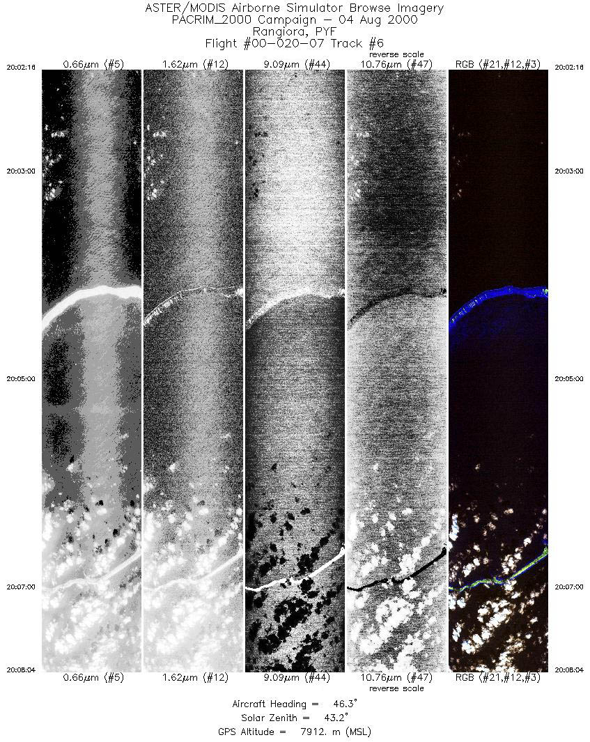
| 6 |
20:02 - 20:08 |
46.2 |
15.348 - 14.902 |
148.087 - 147.558 |
4329 |
7911 |
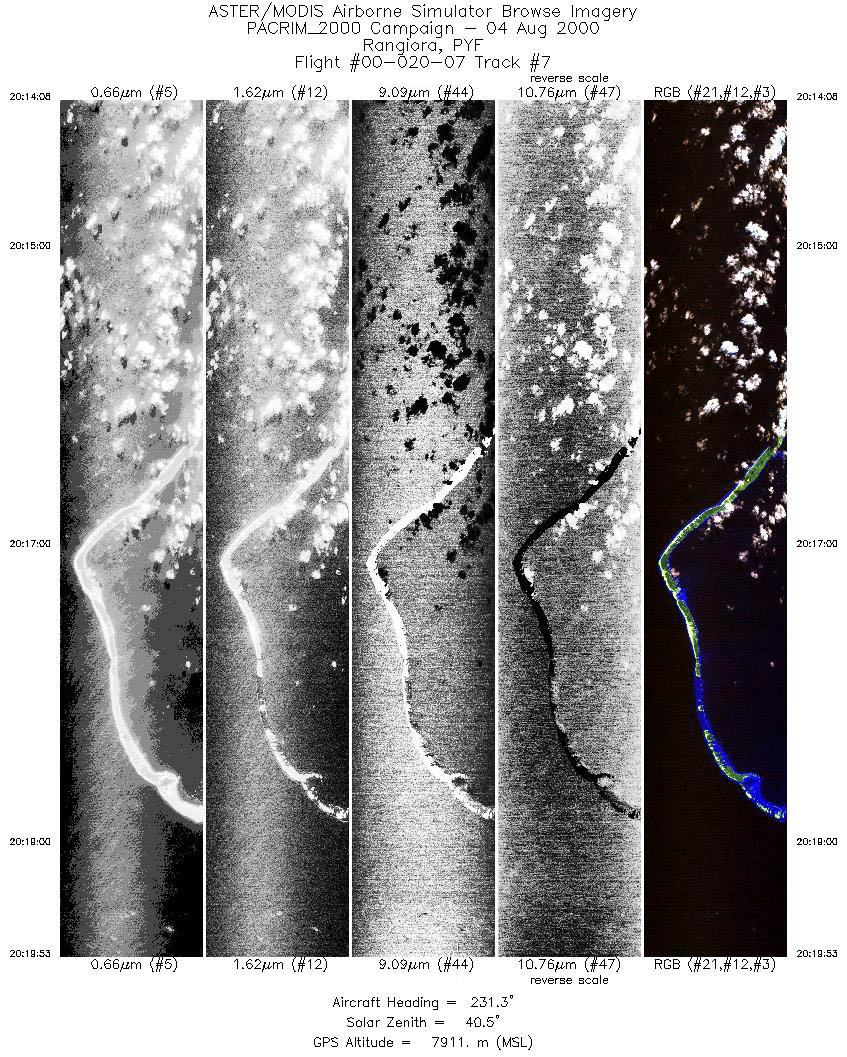
| 7 |
20:14 - 20:19 |
231.1 |
14.717 - 15.157 |
147.532 - 148.055 |
4289 |
7914 |
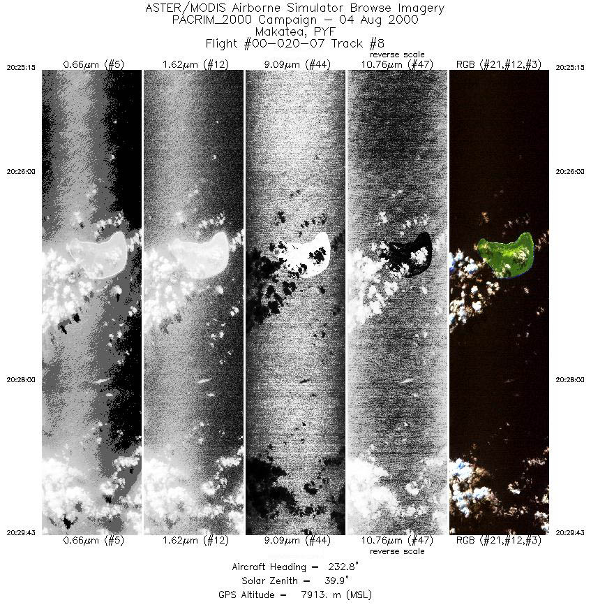
| 8 |
20:25 - 20:29 |
233.3 |
15.698 - 16.029 |
148.090 - 148.512 |
3333 |
7913 |
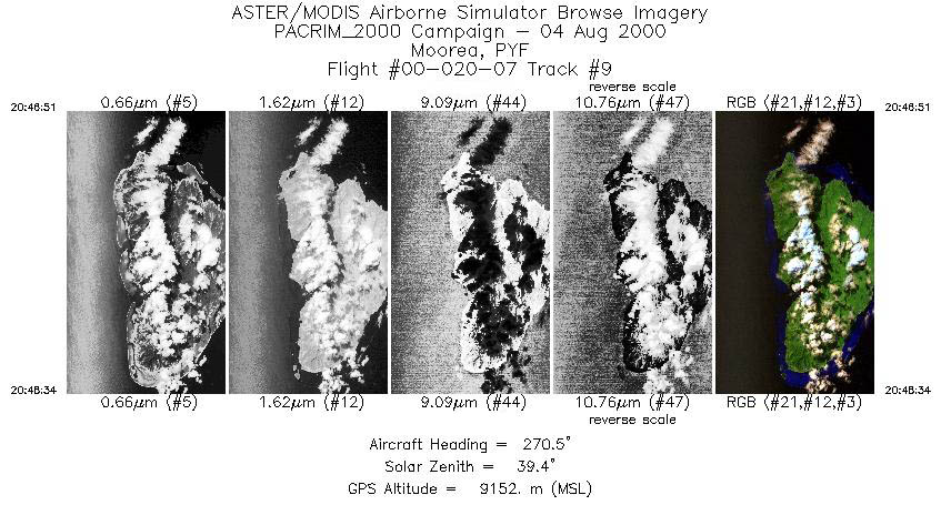
| 9 |
20:46 - 20:48 |
270.5 |
17.499 - 17.499 |
149.715 - 149.926 |
1279 |
9151 |
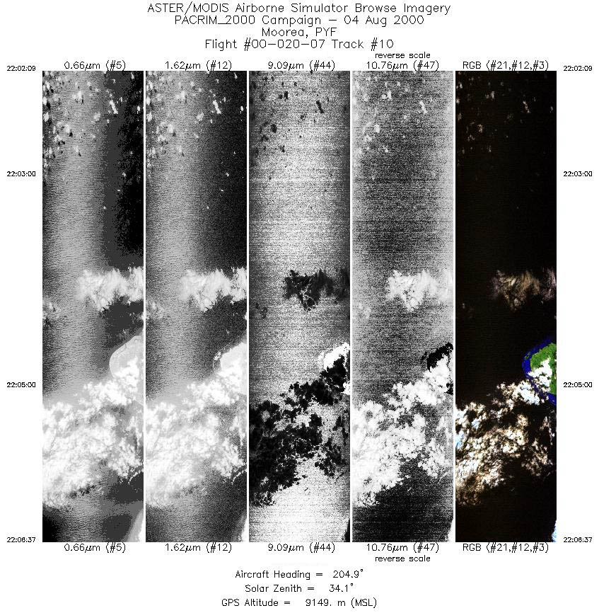
| 10 |
22:02 - 22:06 |
205.2 |
17.179 - 17.662 |
149.811 - 150.023 |
3333 |
9150 |
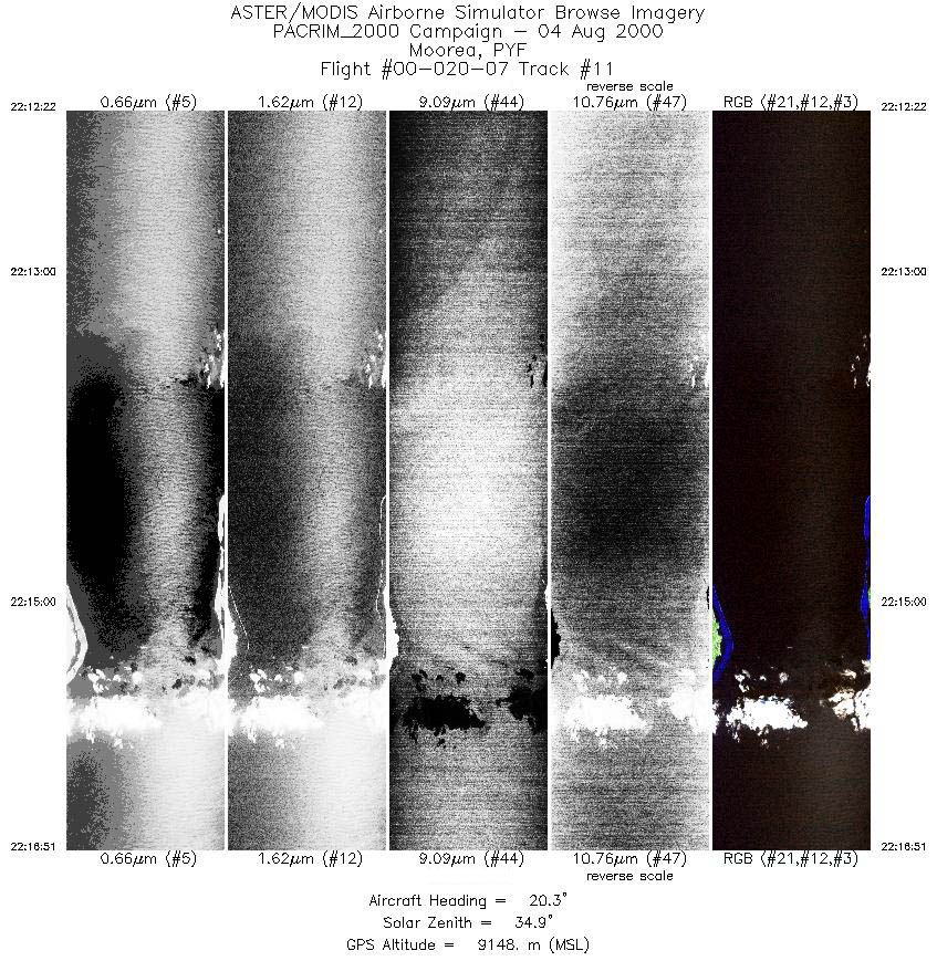
| 11 |
22:12 - 22:16 |
20.2 |
17.890 - 17.405 |
149.844 - 149.627 |
3348 |
9150 |
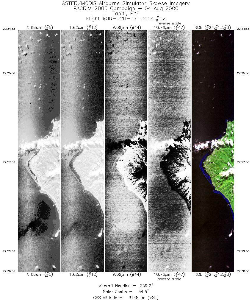
| 12 |
22:24 - 22:30 |
209.7 |
17.254 - 17.819 |
149.415 - 149.726 |
4072 |
9146 |
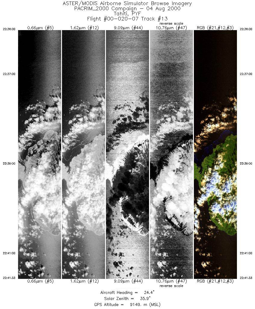
| 13 |
22:36 - 22:41 |
24.8 |
18.046 - 17.472 |
149.559 - 149.241 |
4134 |
9150 |
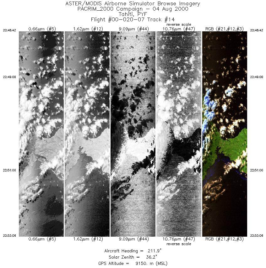
| 14 |
22:48 - 22:53 |
212.1 |
17.486 - 17.932 |
149.154 - 149.422 |
3277 |
9150 |
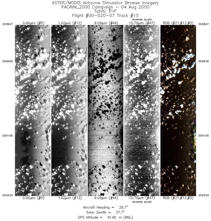
| 15 |
22:58 - 23:03 |
26.7 |
18.190 - 17.725 |
149.271 - 148.991 |
3432 |
9150 |
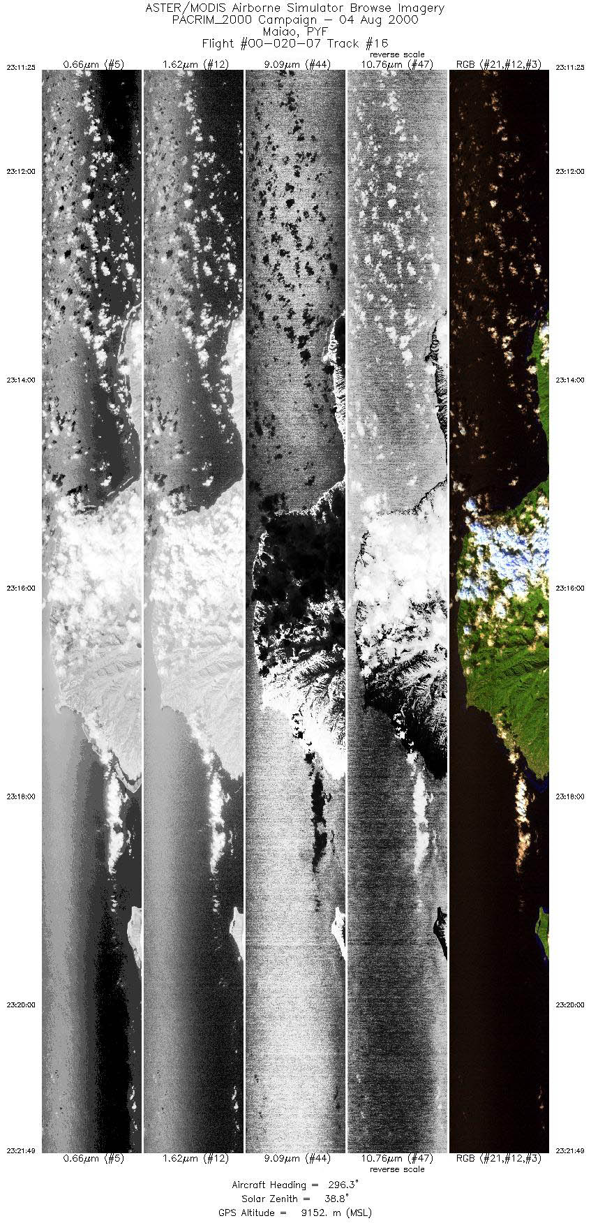
| 16 |
23:11 - 23:21 |
295.8 |
17.854 - 17.317 |
148.832 - 149.979 |
7763 |
9151 |
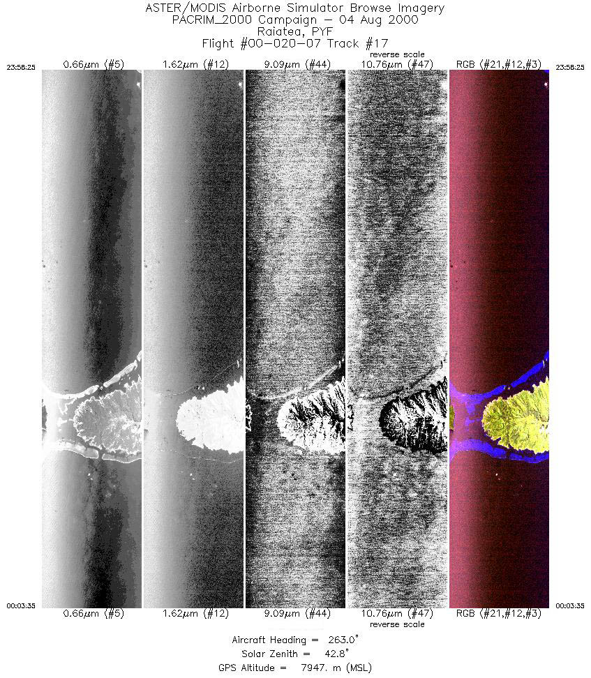
| 17 |
23:58 - 00:03 |
261.8 |
16.674 - 16.777 |
151.058 - 151.674 |
3863 |
7947 |
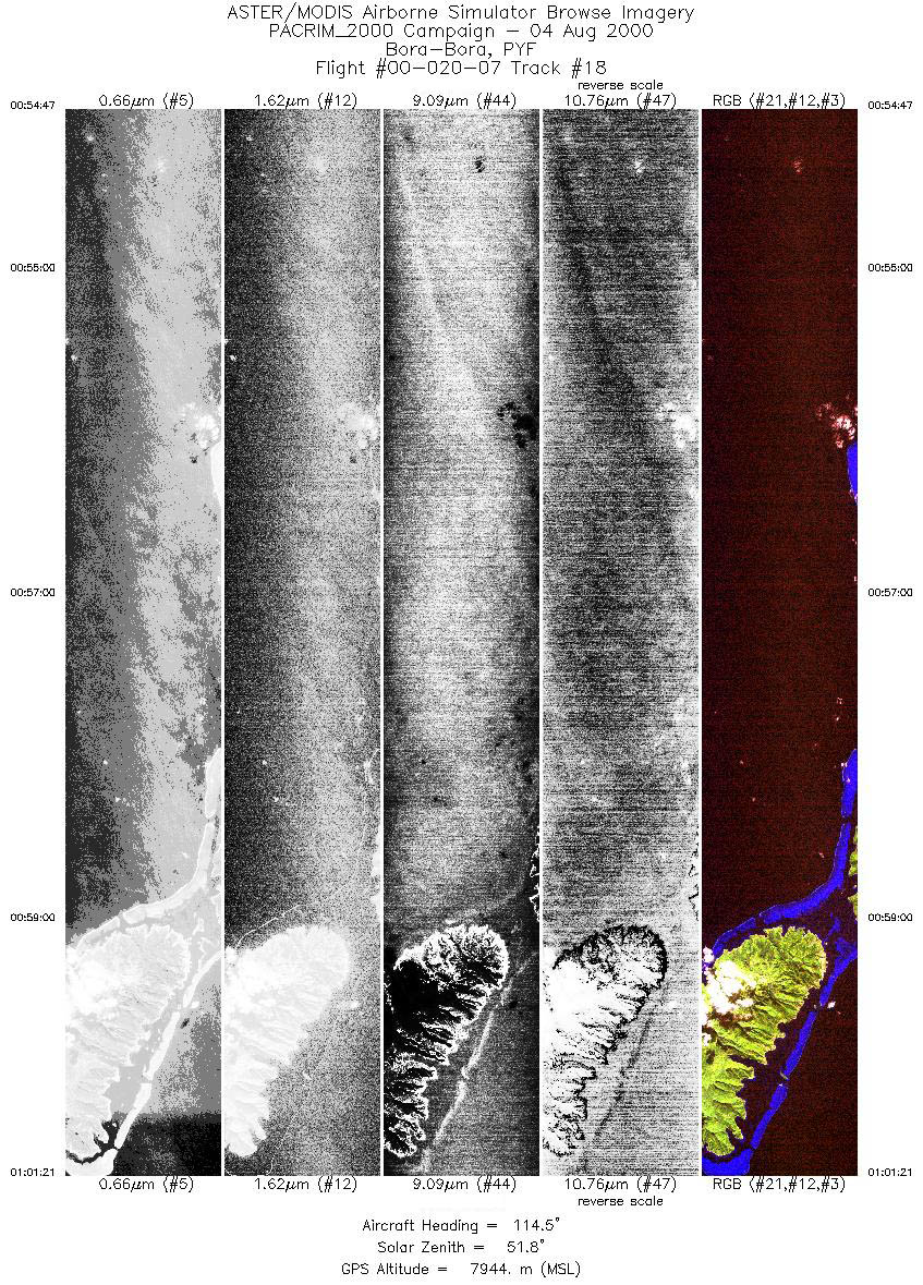
| 18 |
00:54 - 01:01 |
114.5 |
16.493 - 16.818 |
152.052 - 151.327 |
4910 |
7944 |
|


