


OPERATION ICEBRIDGE IMAGERY

- Larsen C Rift (12 November 2017)
- The Larsen C Ice Shelf rift measures about 100 meters (300 feet) wide and cuts about half a kilometer (one-third of a mile) deep.

- Helheim Glacier (5 May 2017)
- The Helheim Glacier is one of Greenland's largest outlet glaciers and is named after the world of the dead in Norse Mythology.

- EGRIP Camp (2 May 2017)
- The East Greenland Ice-core Project camp hosts international scientists drilling ice cores in the Northeast Greenland Ice Stream.

- Jakobshavn Glacier (29 April 2017)
- The local name for this glacier is Sermeq Kujalleq, where "sermeq" is Greenlandic for 'glacier' and "kujalleq" means 'southern'.

- Alert (11 April 2017)
- This Canadian military outpost and civilian weather station is the northernmost permanently inhabited place in the world at latitude 82.5� North.

- Twin Otter Overflight (24 March 2017)
- An Iceland Air Twin Otter is seen below the aircraft during coordinated data collection on the 2017 Spring Operation IceBridge Campaign.

- NOAA "Miss Piggy" (19 May 2016)
- The NOAA P-3 Hurricane Hunter, dubbed "Miss Piggy", taxiing in Kangerlussuaq after the last mission of the 2016 Spring Operation IceBridge Campaign.

- Humbolt Glacier Margin (6 October 2015)
- This image, taken at sunrise, shows exposed rock and proglacial lakes caused by meltwater from the retreating Humbolt Glacier in Northwestern Greenland.

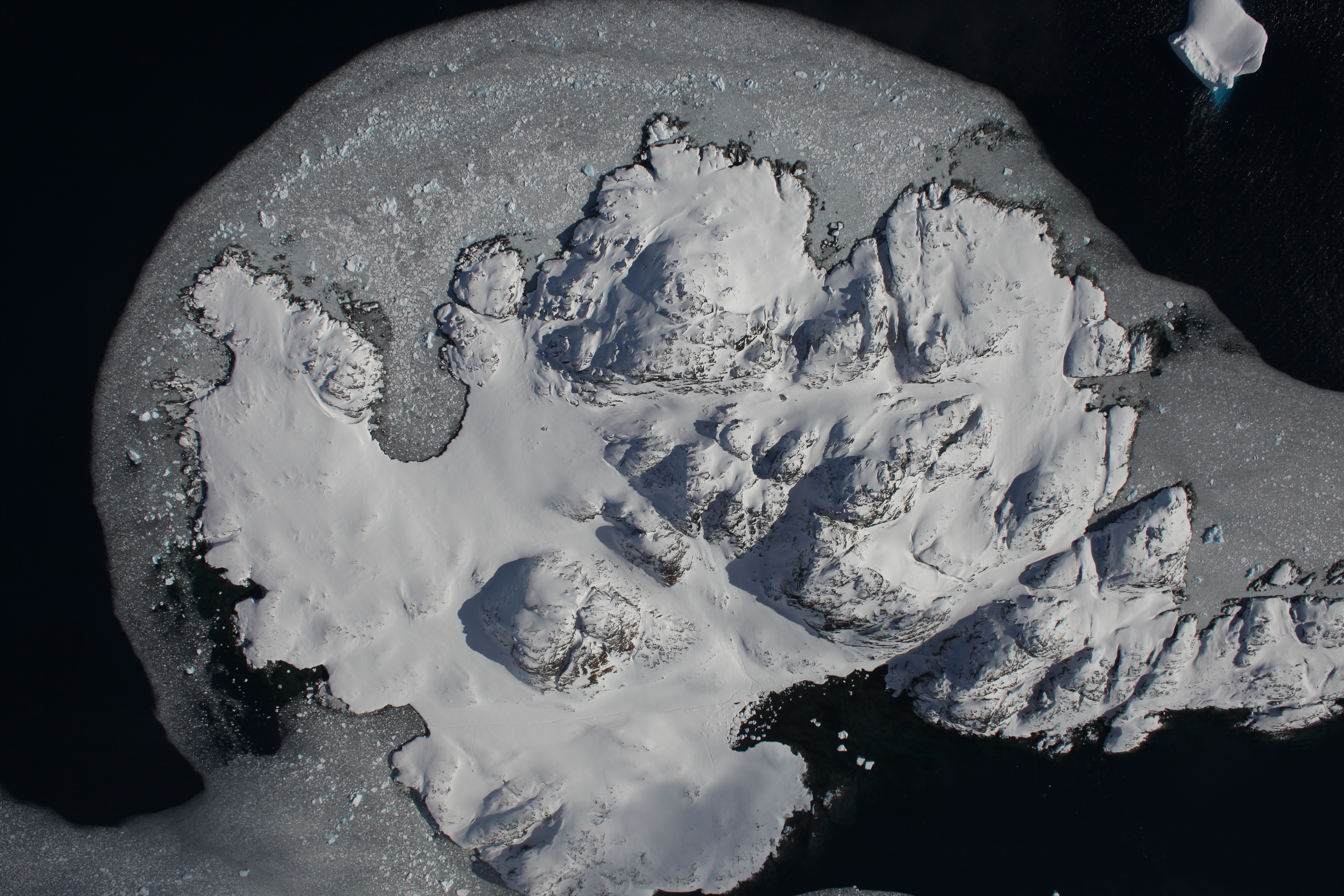
- Traverse Mountains (26 September 2015)
- A group of nearly ice-free mountains located on the Antarctic Peninsula that were an important landmark in overland traverse by early explorers.

- Innuit Sea Ice Hunting Camp (1 May 2015)
- Nomadic Innuit families set up temporary hunting camps on sea ice during Winter and early Spring to hunt for seals.

- ATM T5 Laser (1 April 2015)
- The Airborne Topographic Mapper laser altimeter, scanning at 25Hz, can be seen in this pre-dawn image measuring sea ice elevation in the Arctic Ocean.

- Dual ATM Lasers (1 April 2015)
- Both the narrow-scan and wide-scan Airborne Topographic Mapper laser altimeters can be seen in this pre-dawn image over the Arctic Ocean.

- C-130 Preflight (24 March 2015)
- NASA 439 preparing for an IceBridge mission looking at multi-year sea ice in the Arctic Ocean off the Northern coast of Greenland. (credit J.Harbeck)

- R/V Lance Survey Ship (19 March 2015)
- Ship-based researchers from the Norwegian Polar Institute studying seasonal ice flows collected coicident measurements during several overpasses.

- Bellingshausen Sea Ice (5 November 2014)
- First-year sea ice in the Bellingshausen Sea surrounding an iceberg that separated from one of the many glaciers flowing from Thurston Island.

- Kee Bird B-29 (19 May 2014)
- The destroyed remains of the Kee Bird B-29 Superfortress that made an emergency landing in northwest Greenland on 21 February 1947.

- P-3B & Mt. Erebus (20 November 2013)
- NASA 426 on the McMurdo ice runway preparing for an IceBridge mission over the Ross Sea. Mt. Erebus can be seen erupting in the backgroud.

- Mt. Erebus & McMurdo Station (20 November 2013)
- Taken shortly after takeoff, McMurdo Station can be seen in the shadow of an erupting Mt. Erebus, the southern-most active volcano in the world.

- Jakobshavn Calving Front (4 April 2013)
- The Jakobshavn Glacier drains 6.5% of the Greenland ice sheet and produces around 10% of all Greenland icebergs.

- Vinson Massif (22 November 2012)
- The Vinson Massif lies with the Sentinel Range overlooking the Ronne Ice Shelf and contains the largest mountain in Antarctica. (credit M.Studinger)

- DC-8 Pre-flight (17 November 2011)
- The NASA DC-8 Airborne Laboratory sitting on the tarmac in Punta Arenas, Chile preparing for another mission over Antarctica.

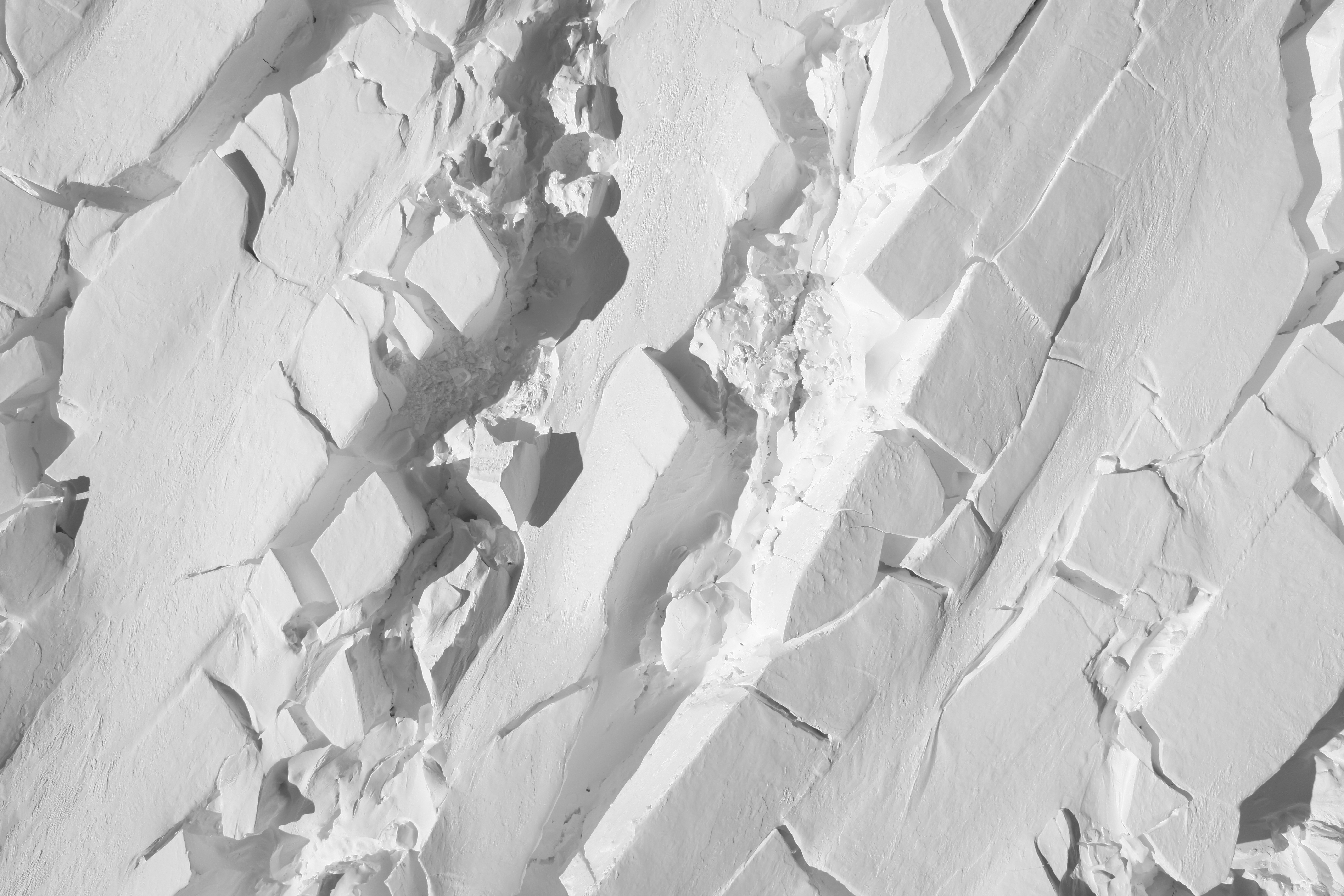
- Pine Island Glacier (12 November 2011)
- This image show's a developing rift in one of Antarctica's five largest glaciers, which drains about 10% of the West Antarctic Ice Sheet.

- Patagonian Vista (7 November 2011)
- This image was captured on a rare clear day over the tip of South America as the DC-8 headed towards Antarctica.

- South Pole (4 November 2010)
- DMS captured this image of the South Pole Research Station as the DC-8 flew overhead, where you can see huge snow drifts around the base.

- Glacial Crossroads (14 April 2010)
- The Helheim Glacier area in Southeastern Greenland features many glaciers intersecting each other before flowing into the sea.

- Rink Isbr� Glacier (9 April 2010)
- The expansive surface of Greenland's largest glacier is clearly visible as it flows West into Baffin Bay.

- Glacial Vista (9 April 2010)
- This image shows what the Rink Isbr� (right) and the Umiamako Isbr� (left) glaciers look like from 35,000 feet aboard the DC-8.

- Thule Airbase (5 April 2010)
- This Danish-American base is home to the Operation IceBridge crew while in Greenland and is locked in ice for most of the year.

- Nares Strait Sea Ice (26 March 2010)
- This image shows the boundary between permanent and seasonal sea ice in the Arctic Ocean, northwest of Greenland.

- Nares Strait Sea Ice Vista (26 March 2010)
- This image shows the boundary between permanent and seasonal sea ice in the Arctic Ocean, northwest of Greenland.

- Petermann Glacier (24 March 2010)
- This image shows frozen lakes and rivers on the surface of the fastest moving glacier in Greenland, which broke off during the Summer of 2010.

- Petermann Glacier Vista (24 March 2010)
- This shot was taken as we flew along the Petermann Glacier and shows what the power of gravity and ice can do to the side of the mountain.

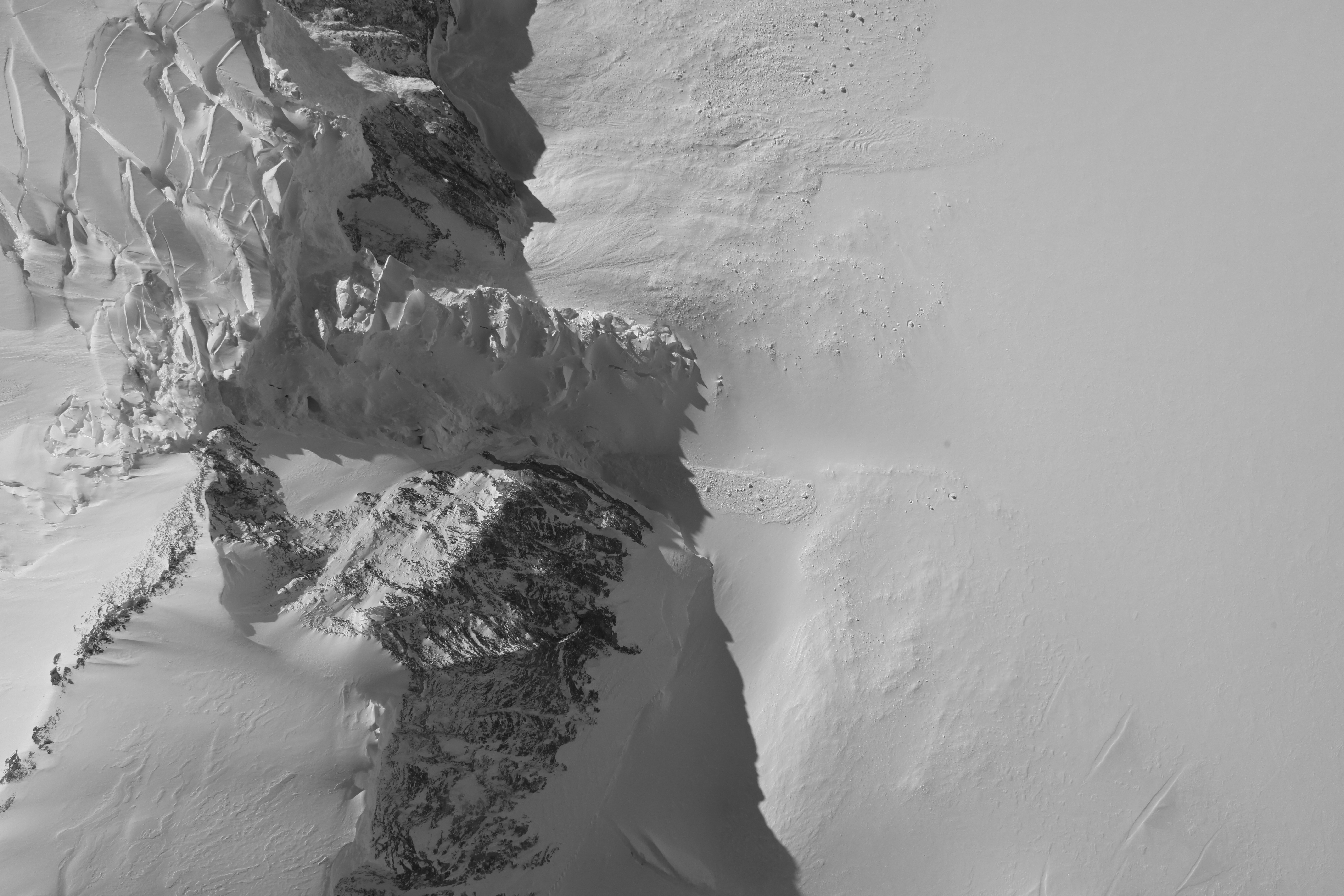
- Thwaites Glacier (2 November 2009)
- The jumbled surface of Antarctica's second largest glacier is clearly visible as it flows north into the Amundsen Sea.

- Litchfield Island (31 October 2009)
- This protected island is unique among the neighboring islands as a breeding place for six species of native birds and several distinct communities of flora.

- Antarctic Penninsula (31 October 2009)
- You can see where an avalance has just occurred (presumably) from the roar of the DC8's engines.

- Iceburgs (31 October 2009)
- This shows iceburgs off the Antarctic Penninsula.

- Sea Ice (29 October 2009)
- Ocean water begins to form ice crystals on the surface once the temperature reaches 28.8° Fahrenheit, eventually solidifying into sea ice.

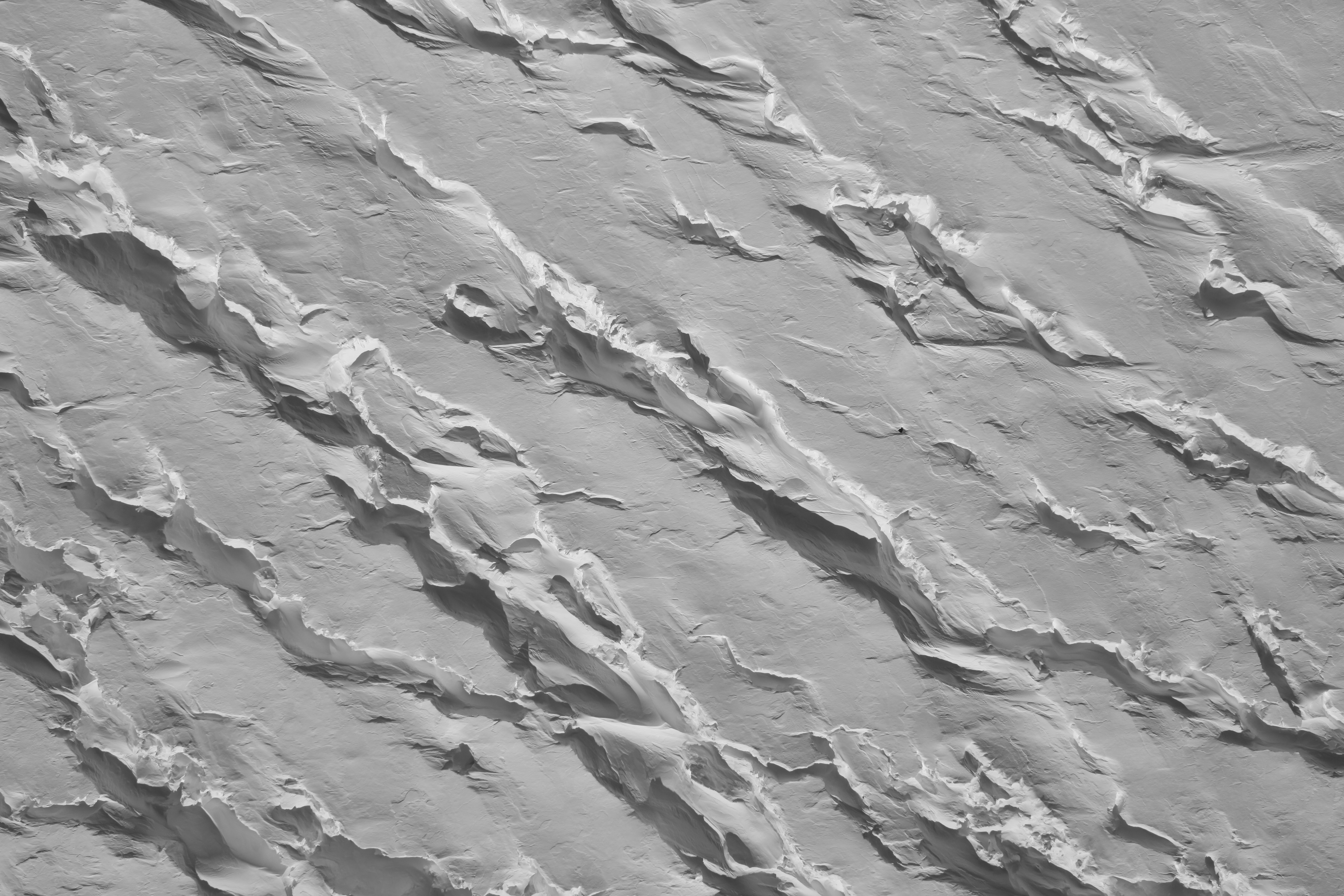
- Pine Island Glacier (27 October 2009)
- Here you can see crevasses filled with deep snow drifts on the surface of the Pine Island Glacier.

- Palmer Station (24 October 2009)
- The Palmer Long-Term Ecological Research study area is one of the three United States research stations located in Antarctica.

- Weddell Sea (24 October 2009)
- A close-up of the previous mosaic.

- Weddell Sea (24 October 2009)
- This mosaic of three photographic frames shows Weddell Sea ice.

- Santa Cruz Island (2 October 2009)
- A color image of California's largest island, a protected preserve in the Channel Islands National Park (located in the Santa Barbara Channel).

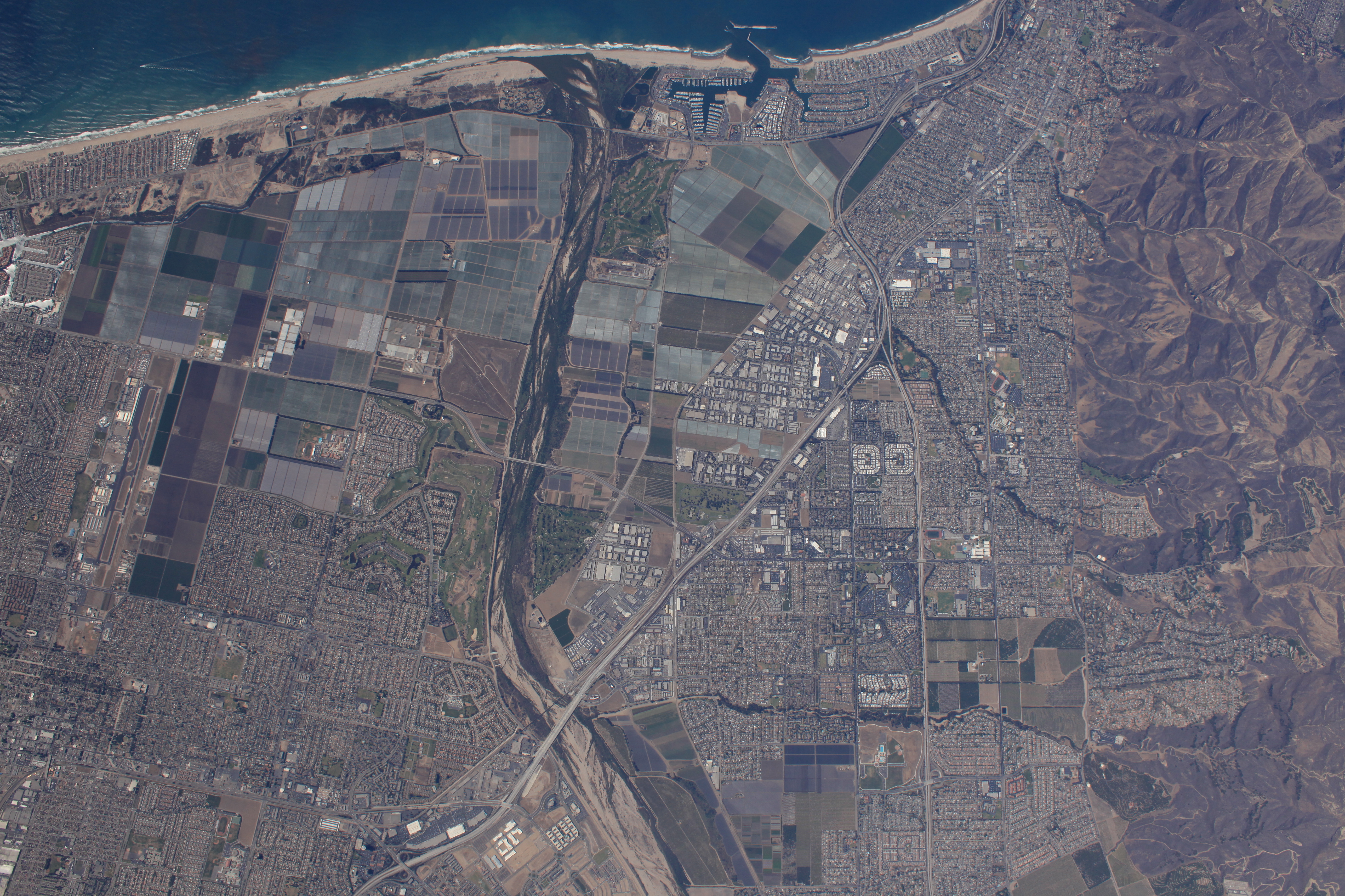
- Ventura, California (2 October 2009)
- This shows the urban and agricultural interface taking place on the Oxnard Plain in Ventura County.
ICEBRIDGE MOVIES

- IceBridge Informational Video (NSERC)
- This piece explains the science and reasoning behind Operation IceBridge with interviews of Project Scientists.

- Flying Low Over The Antarctic Peninsula 1 (4 November 2009)
- This movie looks out the window onto the frozen lanscape below as the DC8 flies low between mountains and glaciers on the Antarctic Penninsula.

- Flying Low Over The Antarctic Peninsula 2 (4 November 2009)
- This movie looks out the window onto the frozen lanscape below as the DC8 flies low between mountains and glaciers on the Antarctic Penninsula.

- Flying Low Over The Antarctic Peninsula 3 (4 November 2009)
- This movie looks out the window onto the frozen lanscape below as the DC8 flies low between mountains and glaciers on the Antarctic Penninsula.

- Flying Low Over The Antarctic Peninsula 4 (4 November 2009)
- This movie looks out the window onto the frozen lanscape below as the DC8 flies low between mountains and glaciers on the Antarctic Penninsula.


Sample Imagery

These images are from Operation IceBridge, collected by DMS in the Fall of 2009.
| Sample Imagery |
| Click image for full resolution |
|
Flight: 16-043-18 Melt Pond |

|
|
R: 0.65µm G: 0.55µm B: 0.45µm |
| Sample Imagery |
| Click image for full resolution |
|
Flight: 12-817-11 Weddell Sea |

|
|
R: 0.65µm G: 0.55µm B: 0.45µm |
| Sample Imagery |
| Click image for full resolution |
|
Flight: 11-426-34 Devon Island Ice Camp |

|
|
R: 0.65µm G: 0.55µm B: 0.45µm |
| Sample Imagery |
| Click image for full resolution |
|
Flight: 11-426-32 Eastern Greenland |

|
|
R: 0.65µm G: 0.55µm B: 0.45µm |
| Sample Imagery |
| Click image for full resolution |
|
Flight: 10-002-10 Thule Airbase, Greenland |
|
|
|
R: 0.65µm G: 0.55µm B: 0.45µm |
| Sample Imagery |
| Click image for full resolution |
|
Flight: 10-001-13 Weddell Sea, Antarctica |

|
|
0.65µm |


