


MODIS Airborne Simulator (eMAS)
SPECTRAL BAND ANIMATION
The images below were created from multispectral MAS data collected on Flight 96-110, Line 28 (SUCCESS Campaign - 5/2/1996).
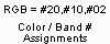
The image on the left is a "false-color" RGB image created by assigning red, green and blue color to calibrated radiance data for 3 specific MAS spectral bands. For the image below, red was assigned to Band 20 (2.15 µm), green was assigned to Band 10 (1.64 µm), and blue was assigned to Band 2 (0.65 µm).
The image on the right is an animation of gray-scaled, contrast-stretched images of calibrated radiances for all 50 MAS spectral bands. Spectral band images are displayed in ascending order, from band 1 to band 50. This corresponds to increasing spectral band wavelengths from the visible (0.55 µm) to the infrared (14.2 µm) portion of the spectrum. All wavelength notations refer to the peak (100%) response wavelength for the band.
Depicted in the scene are several atmospheric features including: cumulus (water droplet) clouds, cirrus (ice crystal) clouds, and aircraft contrails (near the bottom of the image). Also depicted are several land features: open prairie, agricultural areas, lakes, cloud shadows, and several small towns. The scene stretches from Lafayette to Windsor, Colorado (heading NNE over the High Plains just north of Denver, Colorado).
| Click image for full resolution version |

|


|
Click grey-scale image to view spectral bands |

Image Gallery


Earth Scene Imagery

These sample images represent the enormous repository of data from various campaigns collected over the past two decades.
- NASA Official: Matt Fladeland
- Project Manager: James Jacobson
- Website Editor: Eric Fraim
- Last Updated: March 21, 2024


