Flight: 03-934
Date: 13 March 2003
Location: Lanai / Mauai / Hawaii
Deployment: THORPEX
Principal Investigators: Dr. Chris Moeller (UWISC)
Additional Sensors: CPL, MVIS, NAST-I, NAST-M, Ozone, RC10, S-HIS
|
Data Evaluation
Overall quality is good
|
Processing Information
Level-1B Data in HDF format is available
Flight Line Summary
Spectral Band Configuration
Spectral Response Function Table
|
Browse Imagery
Flight Tracks: 26
Scanlines: 49074
|
Browse Imagery Table
|
Click a Flight Track number to view a quicklook image
Lat/Lon ranges are for the BEG-END scanline nadir pixels |
Flight
Track |
Time Span
(GMT) |
Heading
(Deg) |
Lat Range
(Deg North) |
Lon Range
(Deg West) |
Length
(scanlines) |
Altitude
(meters) |
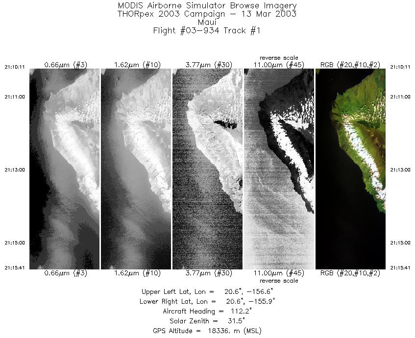
| 1 |
21:10 - 21:15 |
114.1 |
20.715 - 20.484 |
156.504 - 155.931 |
2052 |
18144 |
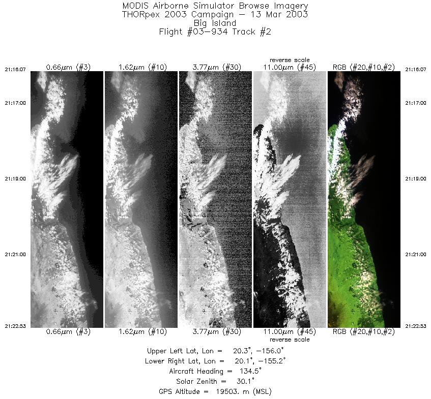
| 2 |
21:16 - 21:22 |
132.6 |
20.458 - 19.953 |
155.889 - 155.312 |
2529 |
19427 |
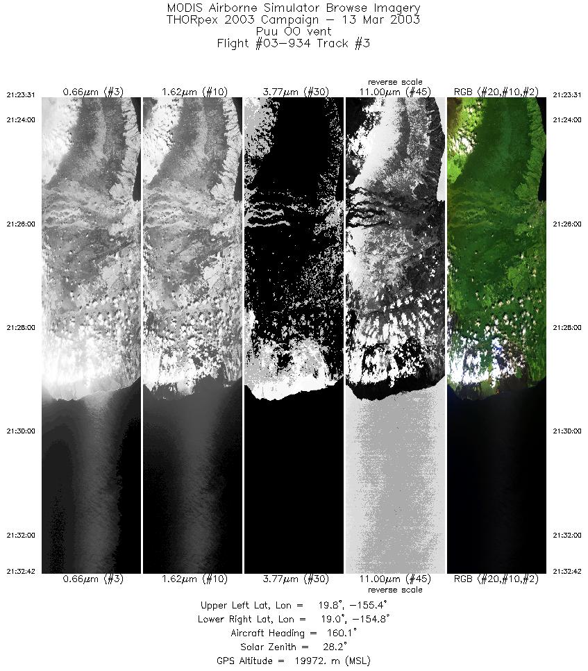
| 3 |
21:23 - 21:32 |
162.8 |
19.897 - 18.942 |
155.272 - 154.968 |
3430 |
19973 |
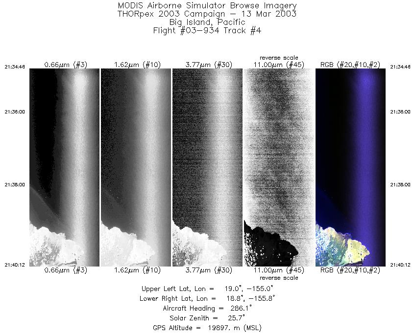
| 4 |
21:34 - 21:40 |
286.4 |
18.810 - 18.991 |
155.097 - 155.702 |
2029 |
19894 |
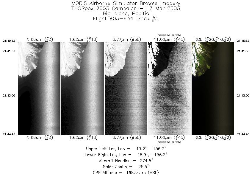
| 5 |
21:40 - 21:44 |
274.2 |
18.998 - 19.038 |
155.740 - 156.230 |
1573 |
19863 |
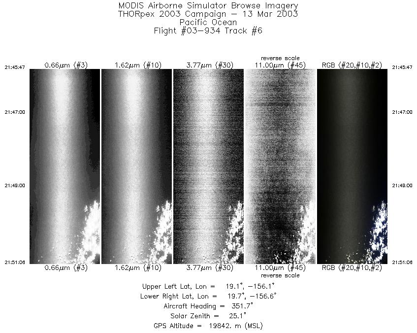
| 6 |
21:45 - 21:51 |
349.3 |
19.109 - 19.700 |
156.317 - 156.457 |
1982 |
19873 |
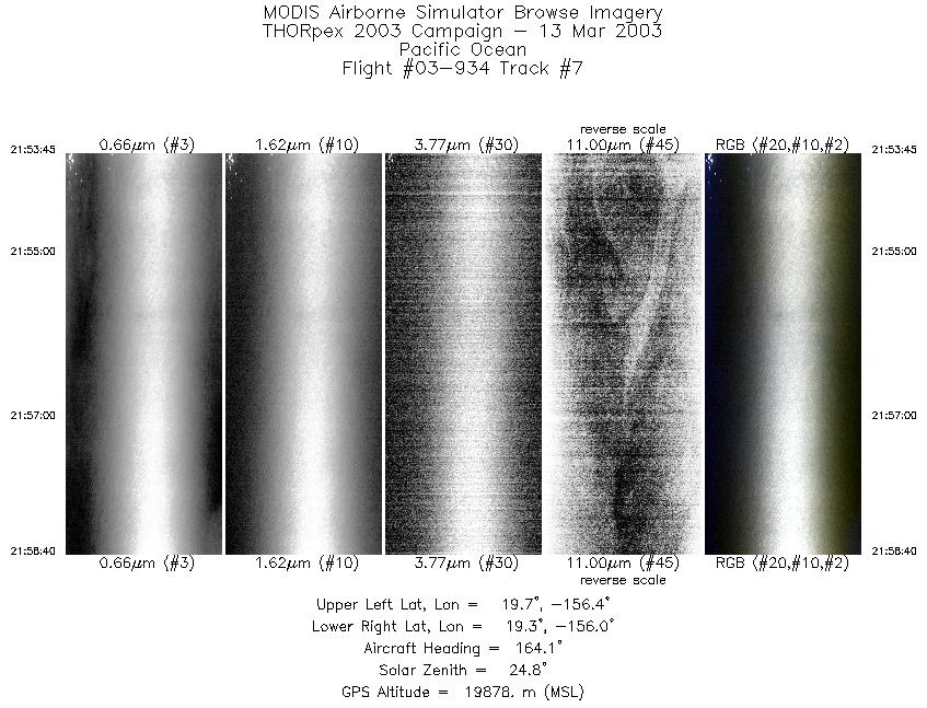
| 7 |
21:53 - 21:58 |
166.3 |
19.737 - 19.221 |
156.271 - 156.141 |
1837 |
19897 |
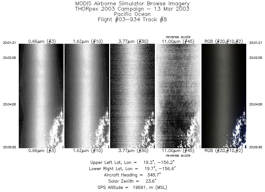
| 8 |
22:01 - 22:05 |
347.7 |
19.206 - 19.699 |
156.335 - 156.456 |
1671 |
19887 |
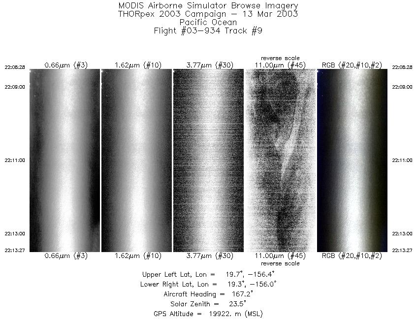
| 9 |
22:08 - 22:13 |
167.8 |
19.748 - 19.221 |
156.273 - 156.142 |
1862 |
19934 |
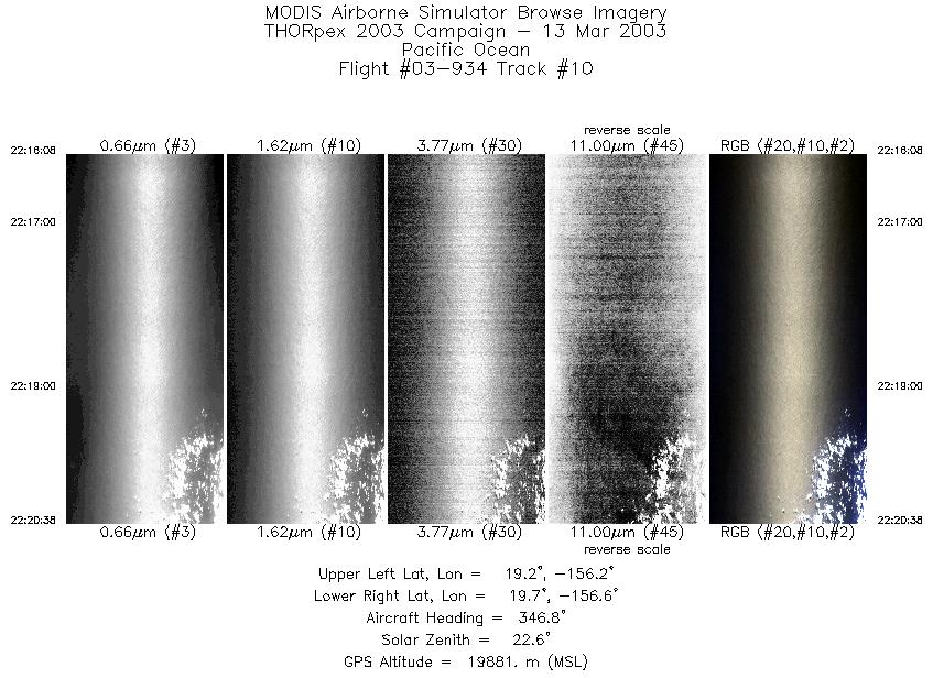
| 10 |
22:16 - 22:20 |
346.8 |
19.205 - 19.699 |
156.337 - 156.458 |
1683 |
19875 |
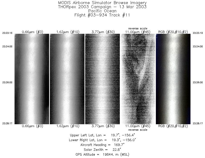
| 11 |
22:23 - 22:28 |
168.4 |
19.751 - 19.221 |
156.273 - 156.144 |
1876 |
19839 |
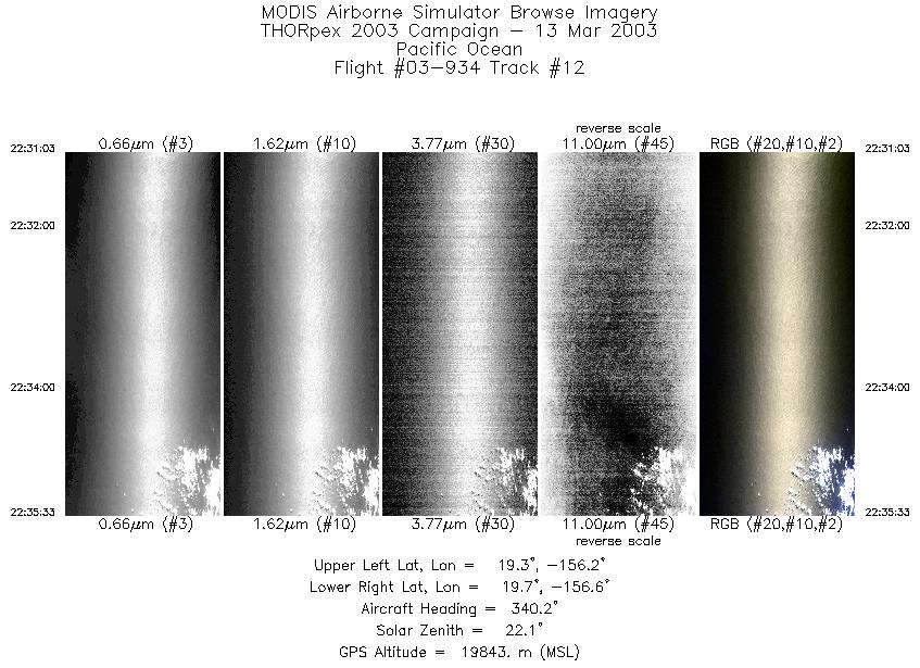
| 12 |
22:31 - 22:35 |
343.5 |
19.206 - 19.699 |
156.335 - 156.459 |
1679 |
19833 |
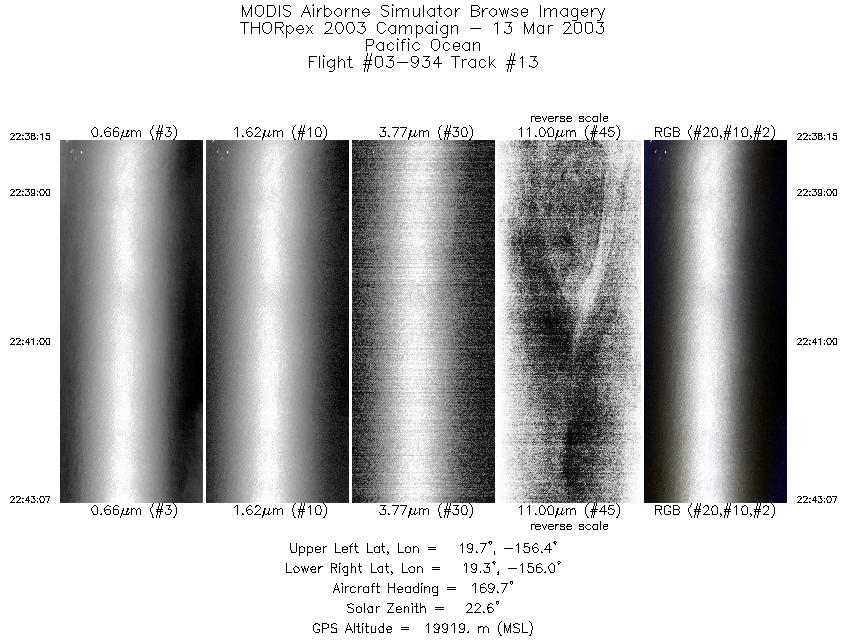
| 13 |
22:38 - 22:43 |
168.7 |
19.734 - 19.220 |
156.267 - 156.144 |
1818 |
19892 |
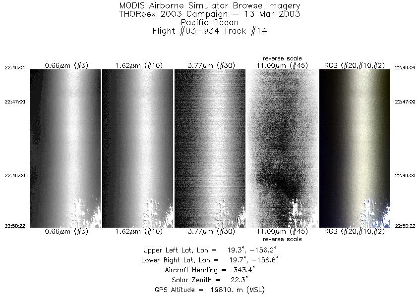
| 14 |
22:46 - 22:50 |
345.1 |
19.222 - 19.698 |
156.345 - 156.459 |
1603 |
19827 |
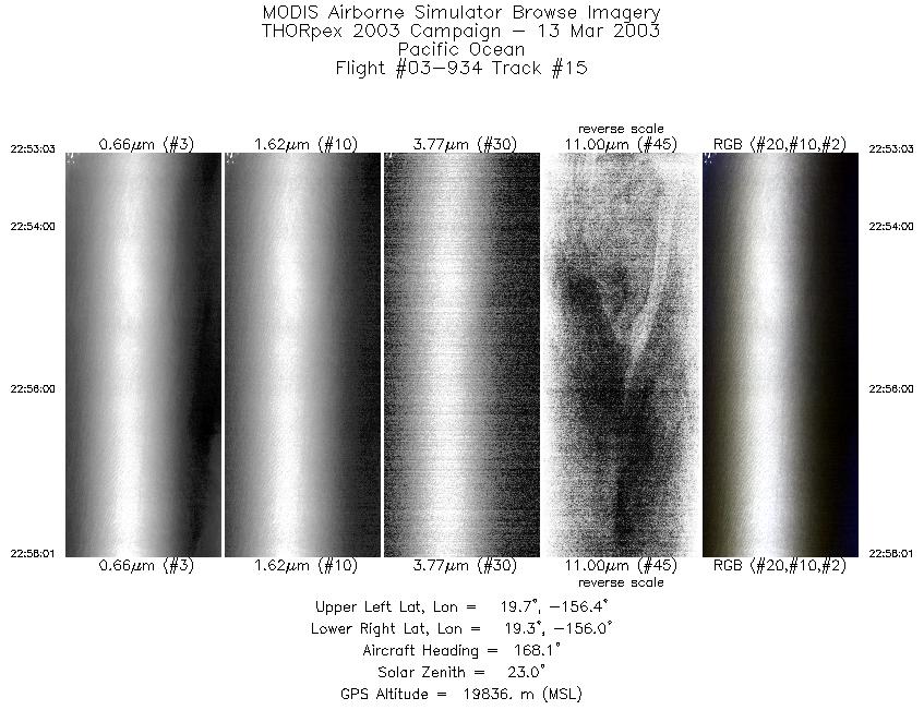
| 15 |
22:53 - 22:58 |
168.0 |
19.742 - 19.221 |
156.270 - 156.143 |
1855 |
19825 |
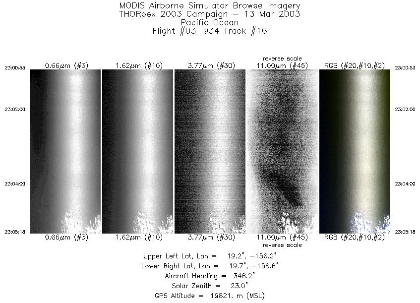
| 16 |
23:00 - 23:05 |
347.5 |
19.210 - 19.700 |
156.340 - 156.458 |
1655 |
19828 |
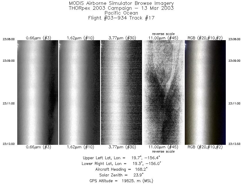
| 17 |
23:08 - 23:12 |
167.9 |
19.736 - 19.221 |
156.269 - 156.142 |
1825 |
19830 |
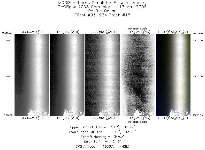
| 18 |
23:15 - 23:20 |
347.2 |
19.197 - 19.700 |
156.335 - 156.456 |
1705 |
19864 |
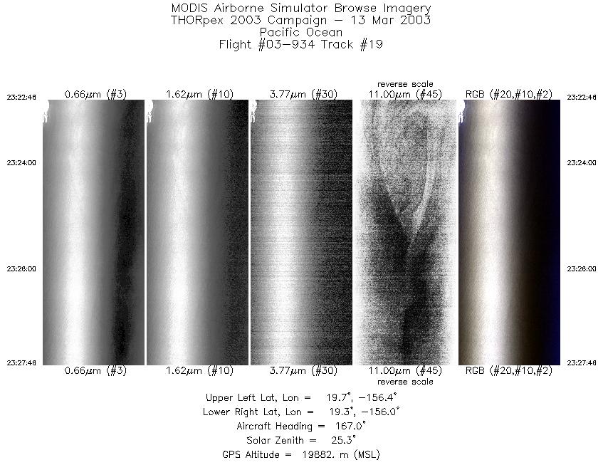
| 19 |
23:22 - 23:27 |
167.5 |
19.750 - 19.221 |
156.273 - 156.142 |
1867 |
19900 |
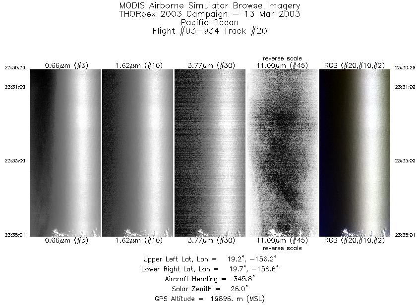
| 20 |
23:30 - 23:35 |
346.0 |
19.204 - 19.700 |
156.335 - 156.457 |
1693 |
19900 |
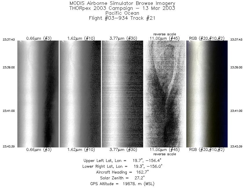
| 21 |
23:37 - 23:42 |
165.5 |
19.744 - 19.218 |
156.271 - 156.142 |
1846 |
19905 |
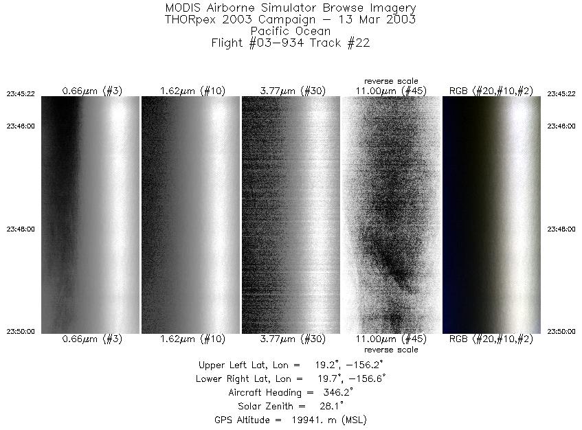
| 22 |
23:45 - 23:50 |
345.9 |
19.195 - 19.701 |
156.334 - 156.459 |
1734 |
19929 |
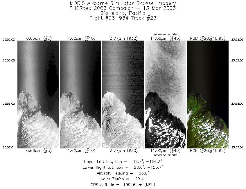
| 23 |
23:52 - 23:57 |
93.6 |
19.863 - 19.826 |
156.326 - 155.730 |
1862 |
19948 |
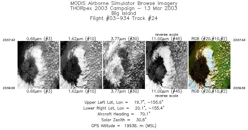
| 24 |
23:57 - 23:59 |
72.7 |
19.838 - 19.913 |
155.646 - 155.395 |
821 |
19934 |
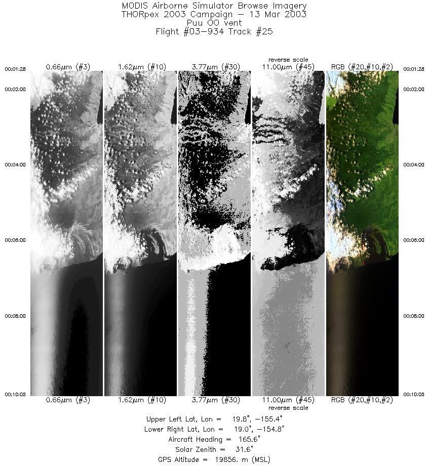
| 25 |
00:01 - 00:10 |
165.4 |
19.837 - 18.939 |
155.251 - 154.970 |
3219 |
19870 |
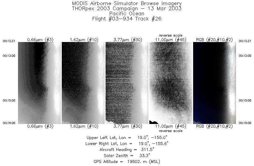
| 26 |
00:12 - 00:16 |
311.9 |
18.850 - 19.131 |
155.124 - 155.443 |
1368 |
19816 |
|


