


MODIS Airborne Simulator (MAS)
FLIGHT SUMMARY INFORMATION


|
Flight: 02-956 Date: 29 July 2002 Location: Gulf of Mexico / Florida / Atlantic Ocean Deployment: CRYSTAL-FACE Principal Investigators: Drs. Michael King & Steven Platnick (NASA GSFC) Additional Sensors: CoSSIR, CPL, CRS, Dropsondes, EDOP, JLH, MMS, MTP, RAMS, SSFR |
||||||||||||||||||||||||||||||||||||||||||||||||||||||||||||||||||||||||||||||||||||||||||||||||||||||||||||||||||||||||||||||||||||||||||||
|
Data Evaluation Overall quality is good TERRA Underflight @ 16:03 |
||||||||||||||||||||||||||||||||||||||||||||||||||||||||||||||||||||||||||||||||||||||||||||||||||||||||||||||||||||||||||||||||||||||||||||
|
Processing Information Level-1B Data in HDF format is available Flight Line Summary Spectral Band Configuration Spectral Response Function Table |
||||||||||||||||||||||||||||||||||||||||||||||||||||||||||||||||||||||||||||||||||||||||||||||||||||||||||||||||||||||||||||||||||||||||||||
|
Browse Imagery Flight Tracks: 16 Scanlines: 105514 |
||||||||||||||||||||||||||||||||||||||||||||||||||||||||||||||||||||||||||||||||||||||||||||||||||||||||||||||||||||||||||||||||||||||||||||
|
||||||||||||||||||||||||||||||||||||||||||||||||||||||||||||||||||||||||||||||||||||||||||||||||||||||||||||||||||||||||||||||||||||||||||||
|
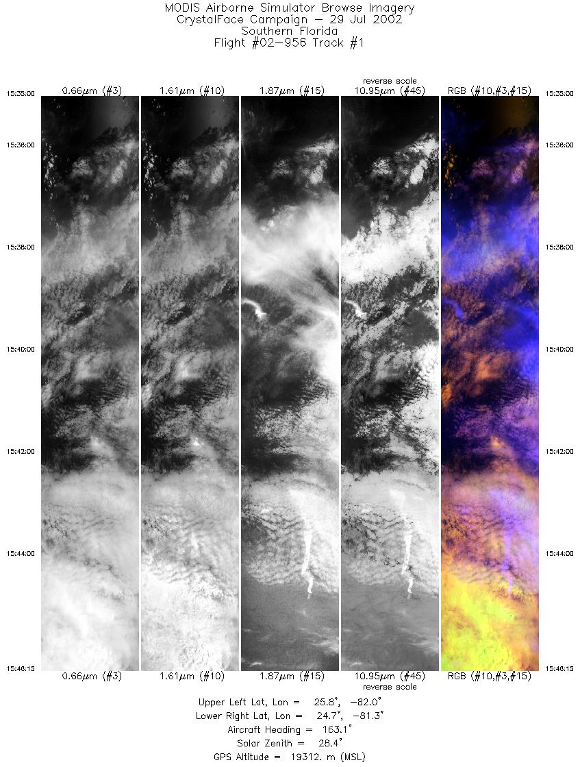
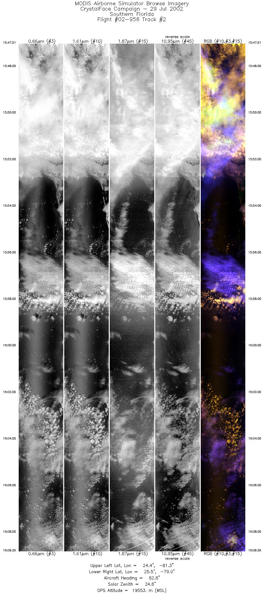
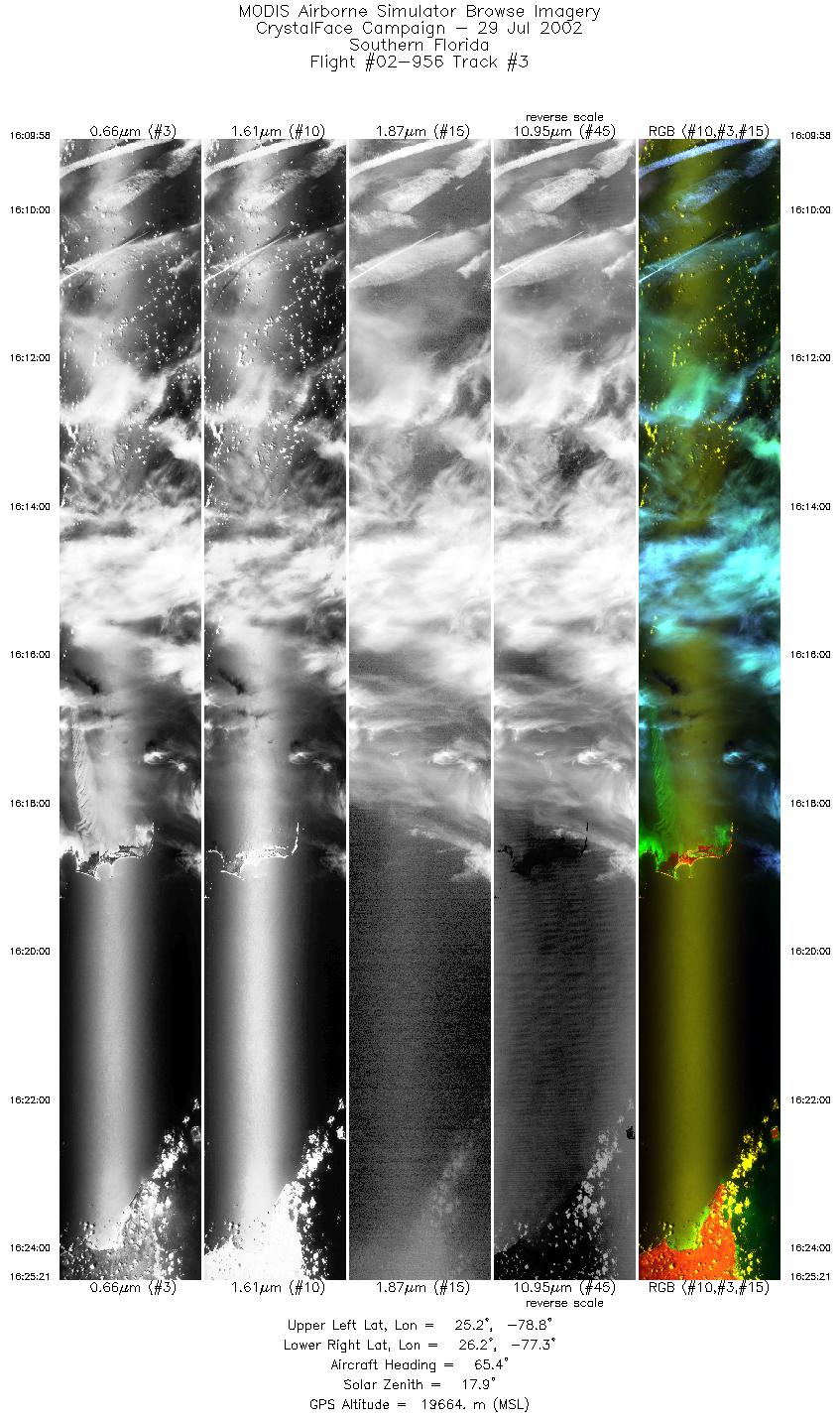
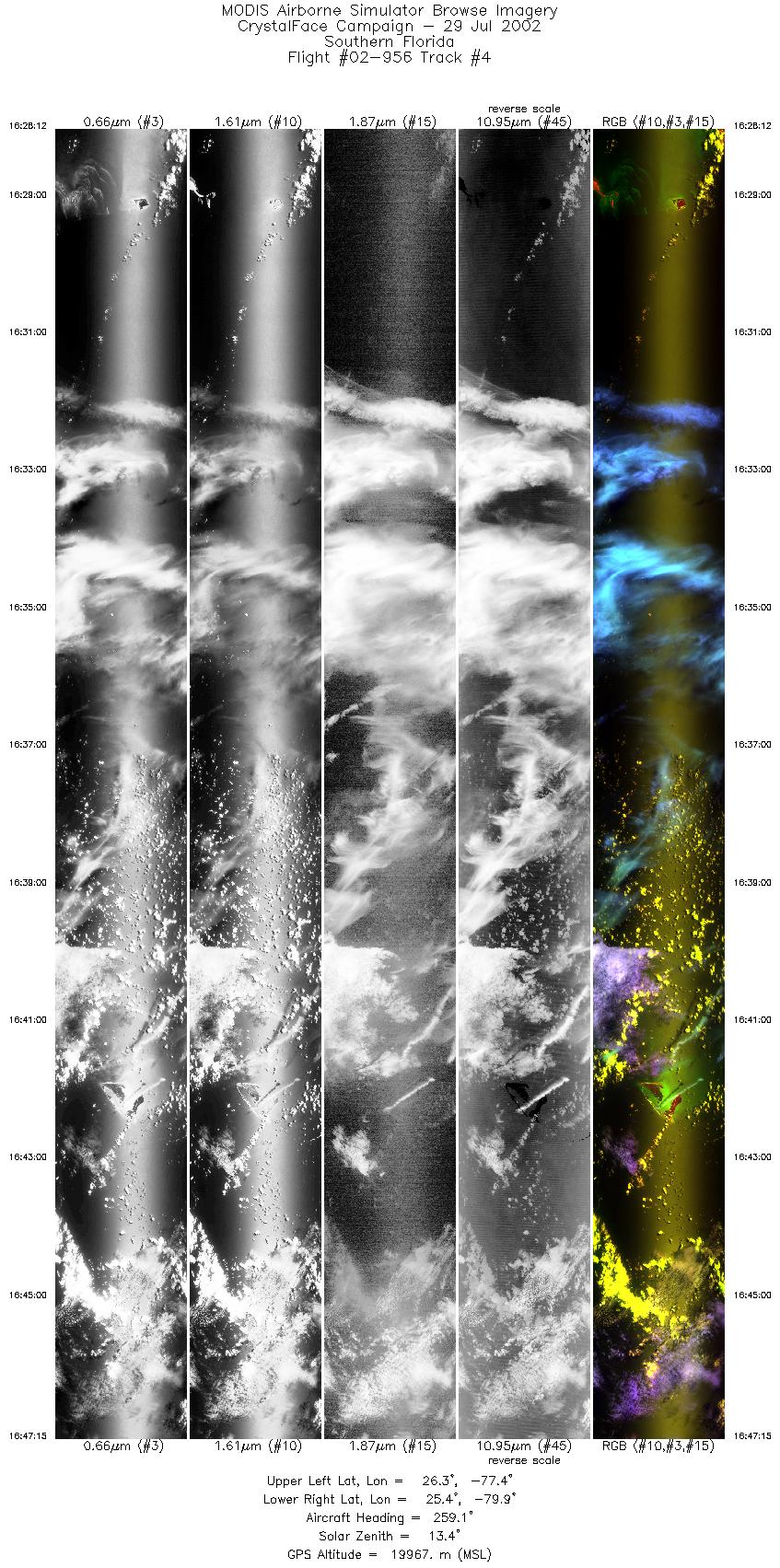
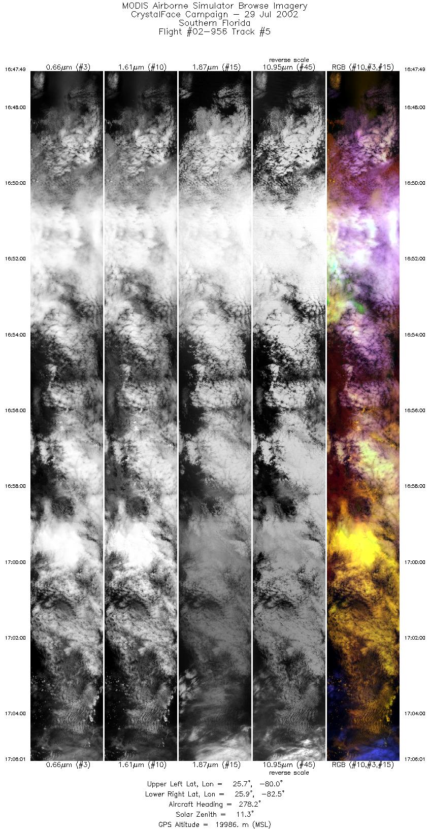
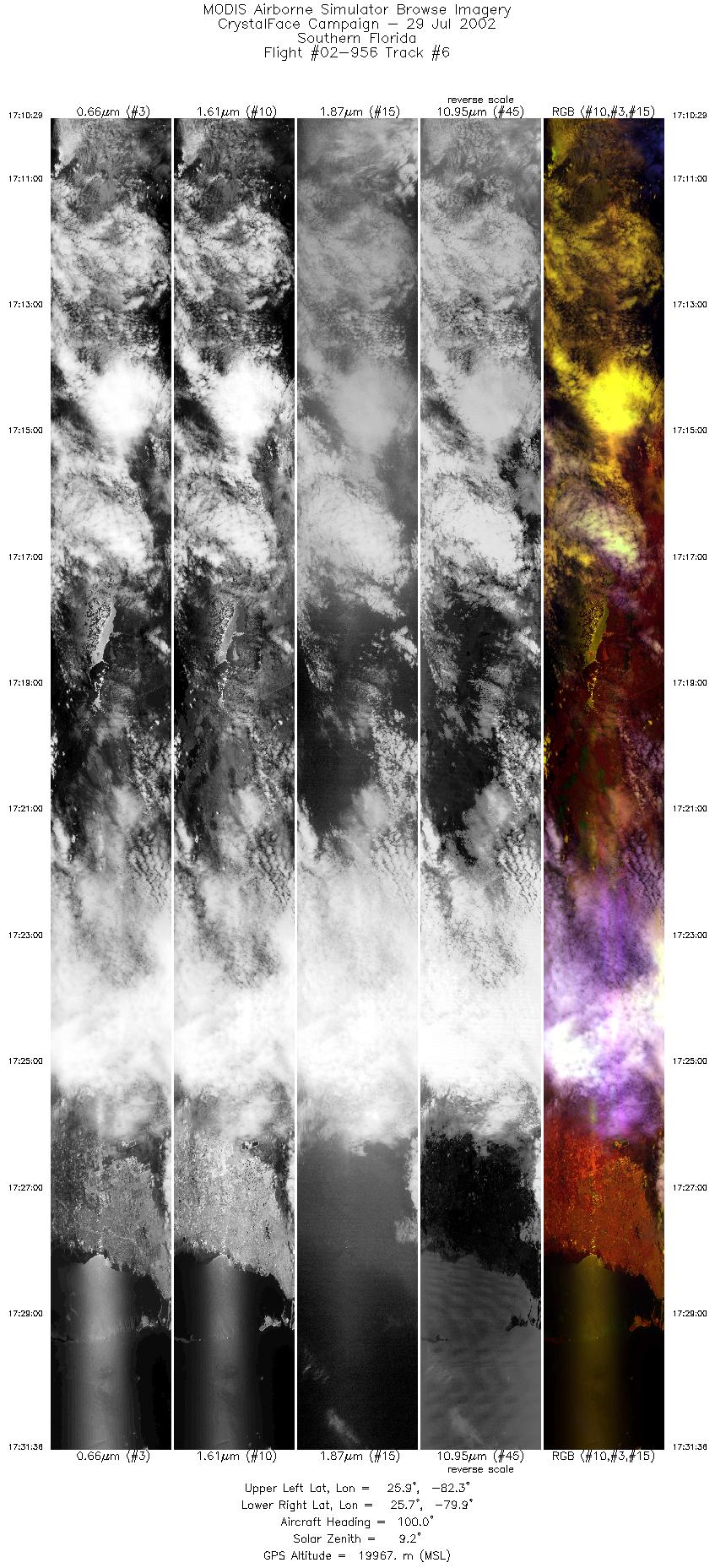
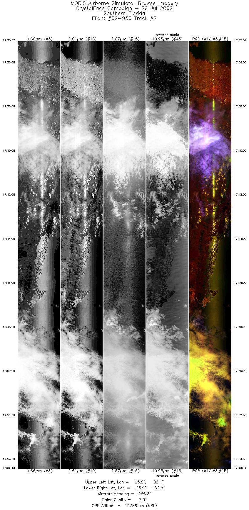
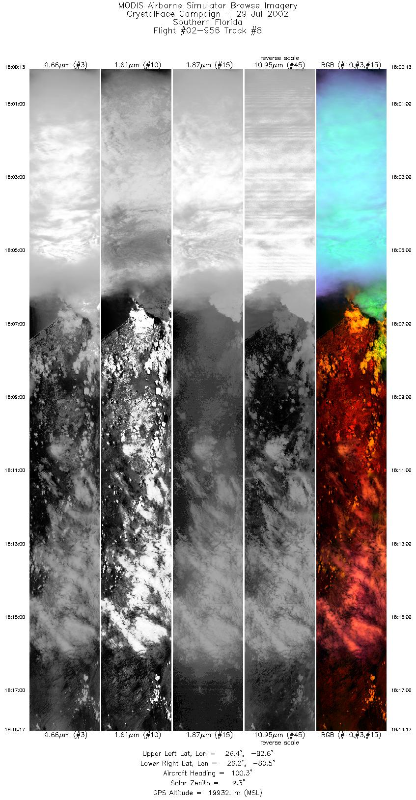
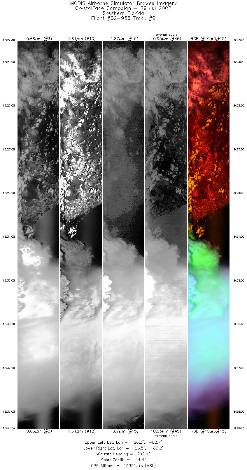
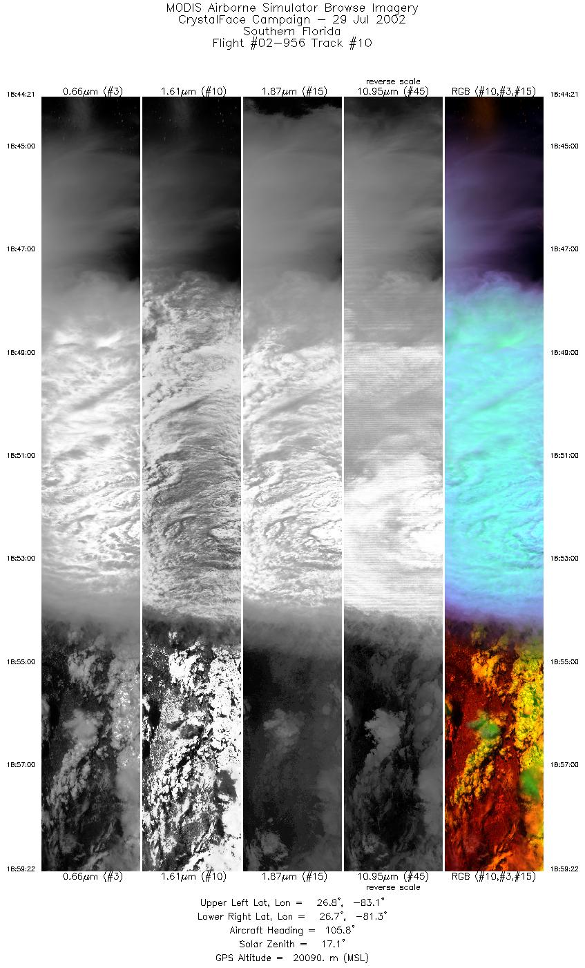
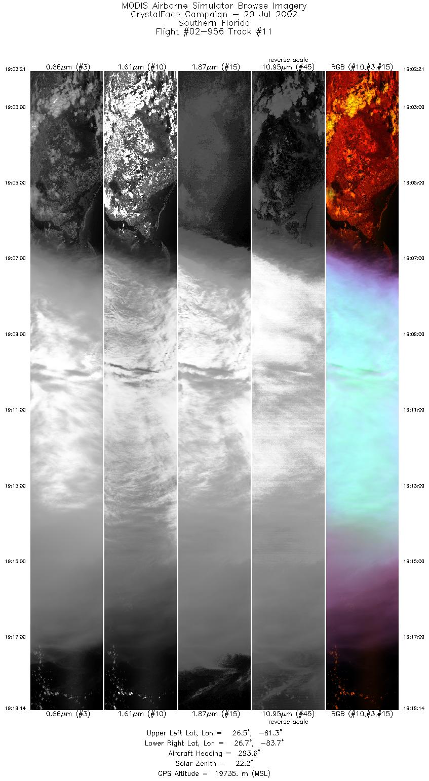
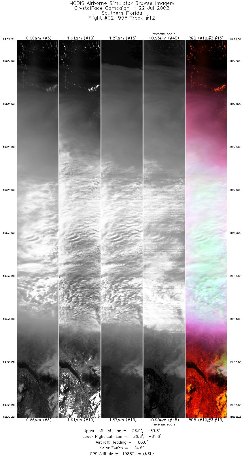
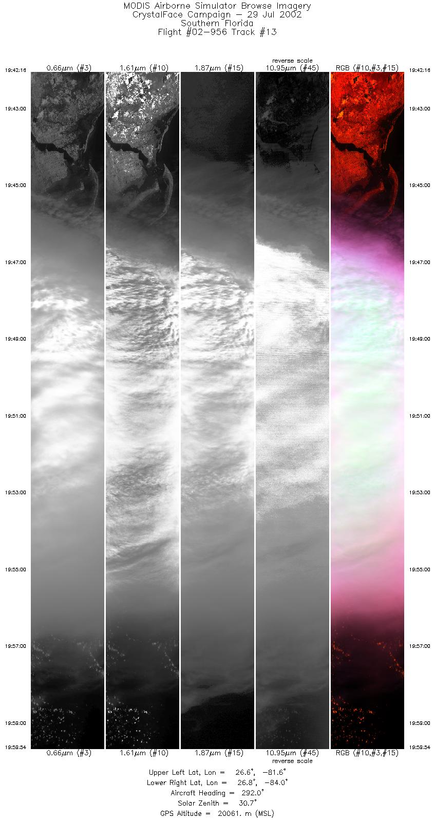
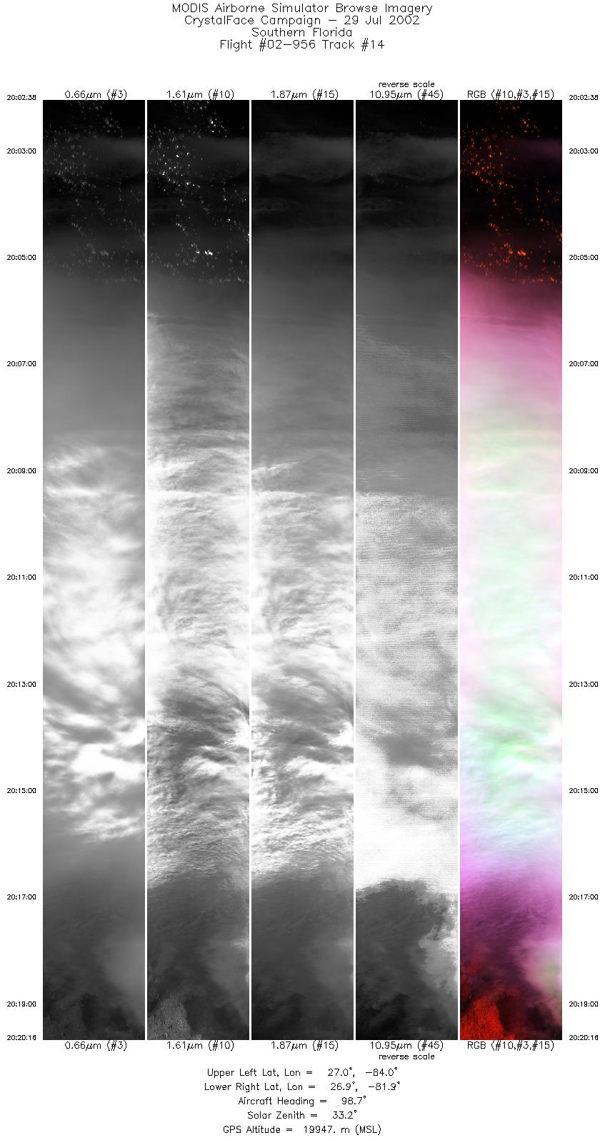
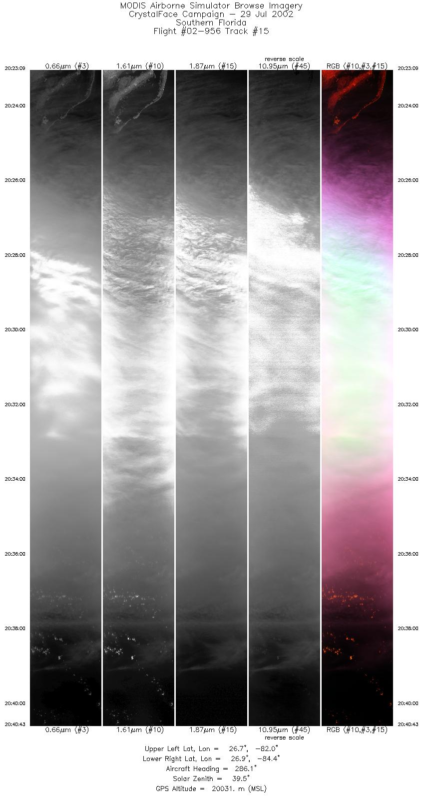
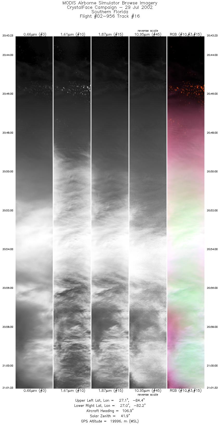
Flight Summary Report Mission Number: 11 Mission Scientists: M. King, P. Newman ER-2 Pilot: J. Barrilleaux Takeoff: 15:00 (UTC) Landing: 21:50 (UTC) Duration: 6:50 (h:mm) After climbing to altitude, the ER-2 proceeded to waypoint A (24° 30´ N, 81° 27´ W), where it was joined by the WB-57F at around 1543 UTC. Both aircraft then proceeded towards waypoint B (26° 02´ N, 77° 15´ W), a distance of 455 km, crossing the mid-point of this flight line at the time of the TERRA overpass that occurred at 1603 UTC. After passing waypoint B, the ER-2 proceeded WSW towards waypoint C (25° 32´ N, 79° 58´ W) where the ER-2 and WB-57F flew several flight tracks to waypoint D (25° 58´ N, 82° 01´ W). This flight line overflew the eastern and western ground sites on several different passes. The meteorology on Monday (July 28) was strongly determined by an upper-tropospheric low whose center was slowly tracking westward from NE of the Dominican Republic on Saturday, to a position over Key West early Monday, to a position immediately NE of Key West by Monday afternoon. Winds over the Everglades and Miami region slowly shifted from ENE to ESE by the time of the flight. The tropopause was approximatelylocated at about 170 hPa with a temperature of about -62°C. Under the influence of this low, mid and upper tropospheric clouds were seen to move northward. After completion of the TERRA underpass, the ER-2 began a flight leg across the two ground sites. Mid-level clouds were moving NW across the Tamiami trail at this time (~ 1700 UTC), but a large convective system began to develop NNW of the western ground site near Sanibel. The ER-2 was then offset to the NW to continue to follow this same system as it evolved. The winds continued to carry the outflow from this system WNW over the course of the afternoon. The ER-2 was again offset NW to continue to measure this same system. Satellite & Ground Site InformationTERRA overpass @ 1603 (UTC); VZA = 12.18° (relative to eastern site)
Western Site: PARSL, Everglades National Park, Gulf Coast Visitor's Center
|
||||||||||||||||||||||||||||||||||||||||||||||||||||||||||||||||||||||||||||||||||||||||||||||||||||||||||||||||||||||||||||||||||||||||||||

Flight 02-956


| Sample Imagery |
| Click image for full resolution |
|
Track #10 Southern Florida |


|
|
R: 1.64µm G: 0.66µm B: 1.90µm |
- NASA Official: Matt Fladeland
- Project Manager: James Jacobson
- Website Editor: Eric Fraim
- Last Updated: November 16, 2021


