


MODIS Airborne Simulator (MAS)
FLIGHT SUMMARY INFORMATION


|
Flight: 02-955 Date: 28 July 2002 Location: Gulf of Mexico / Florida / Atlantic Ocean Deployment: CRYSTAL-FACE Principal Investigators: Drs. Michael King & Steven Platnick (NASA GSFC) Additional Sensors: CoSSIR, CPL, CRS, Dropsondes, EDOP, JLH, MMS, MTP, RAMS, SSFR |
|||||||||||||||||||||||||||||||||||||||||||||||||||||||||||||||||||||||||||||||||||||||||||||||||||||||||||||||||||||||||||||||||||||||||||||||||||
|
Data Evaluation LN2 loss in Port 3 @ 22:36 AQUA Underflight @ 18:27 |
|||||||||||||||||||||||||||||||||||||||||||||||||||||||||||||||||||||||||||||||||||||||||||||||||||||||||||||||||||||||||||||||||||||||||||||||||||
|
Processing Information Level-1B Data in HDF format is available Flight Line Summary Spectral Band Configuration Spectral Response Function Table |
|||||||||||||||||||||||||||||||||||||||||||||||||||||||||||||||||||||||||||||||||||||||||||||||||||||||||||||||||||||||||||||||||||||||||||||||||||
|
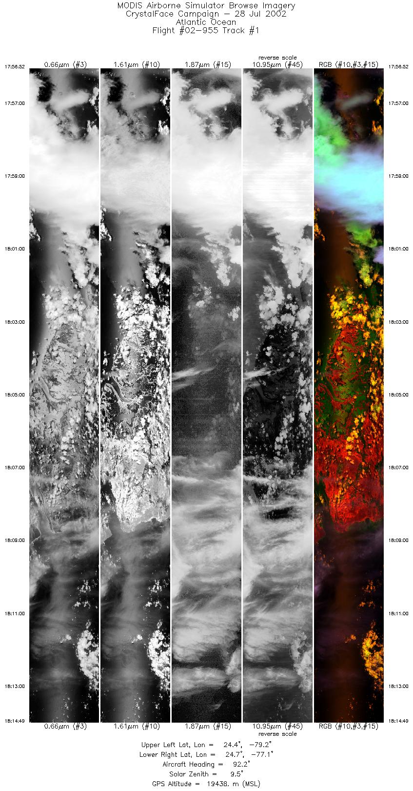
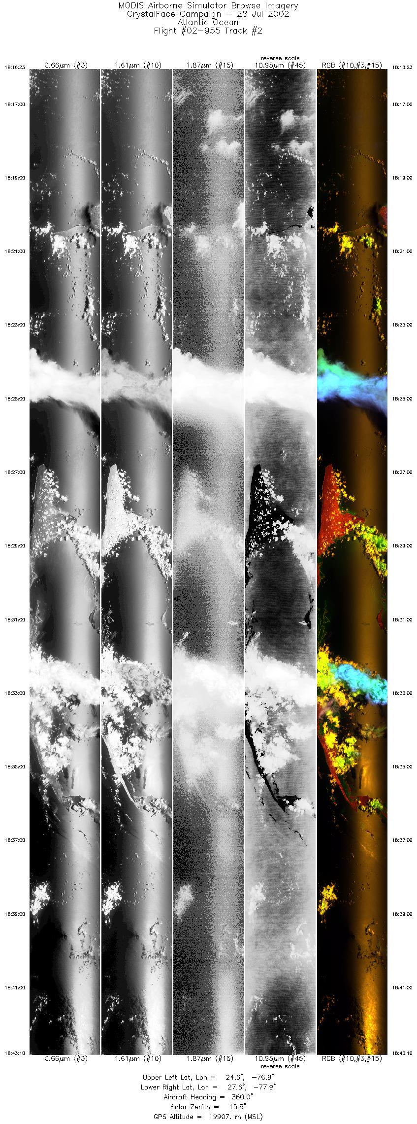
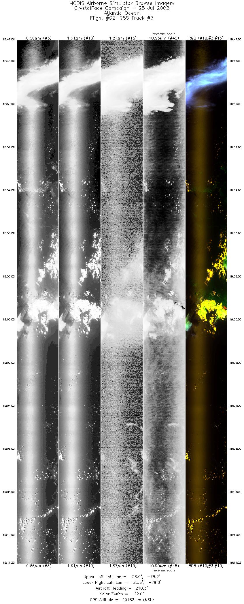
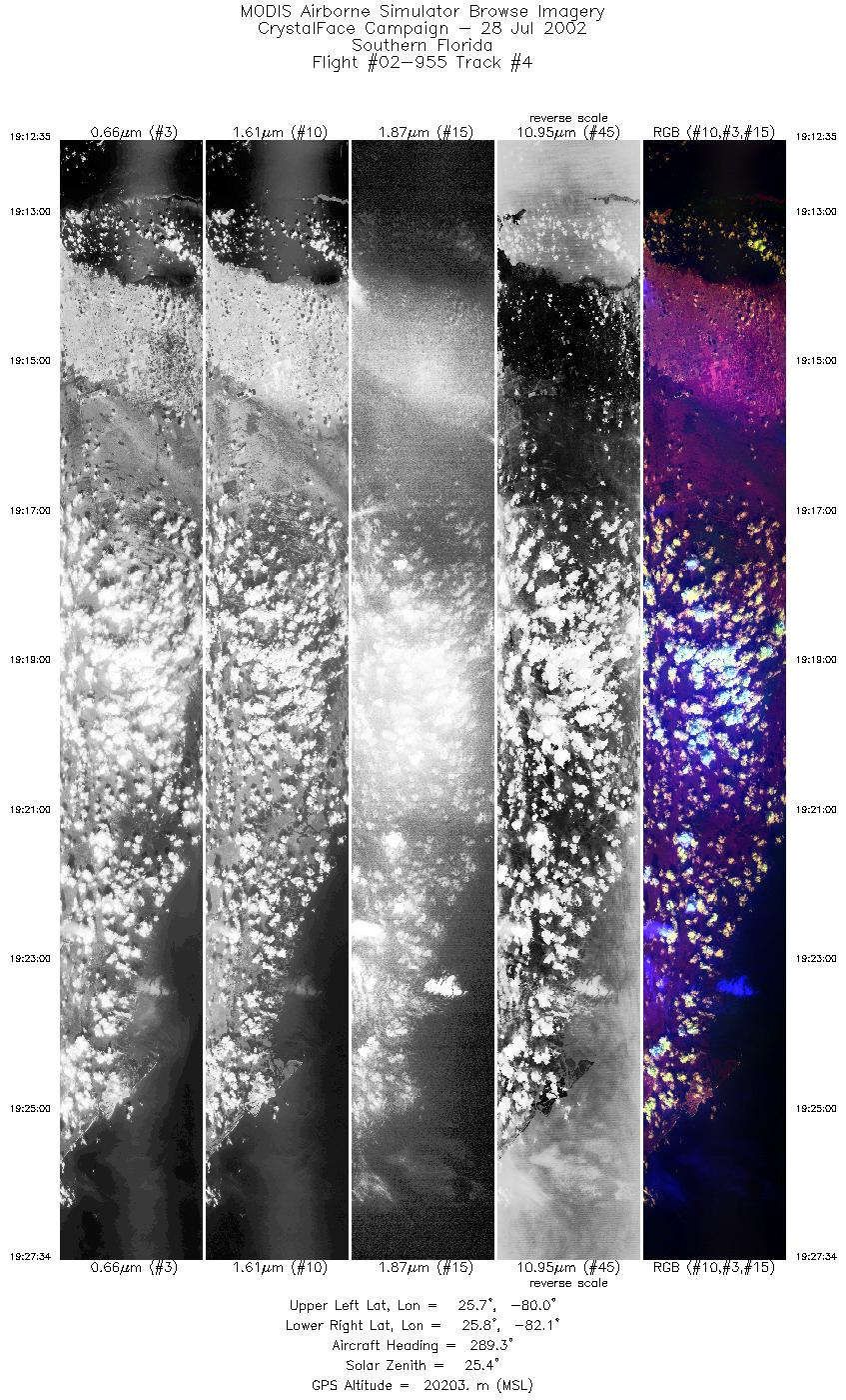
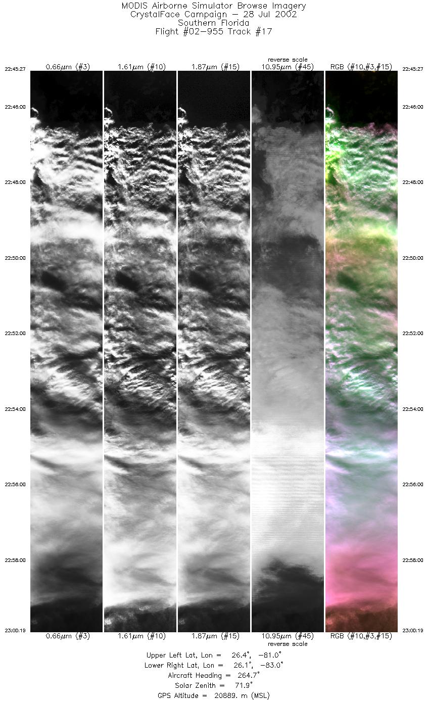
Browse Imagery Flight Tracks: 17 Scanlines: 90088 |
|||||||||||||||||||||||||||||||||||||||||||||||||||||||||||||||||||||||||||||||||||||||||||||||||||||||||||||||||||||||||||||||||||||||||||||||||||
|
|||||||||||||||||||||||||||||||||||||||||||||||||||||||||||||||||||||||||||||||||||||||||||||||||||||||||||||||||||||||||||||||||||||||||||||||||||
|
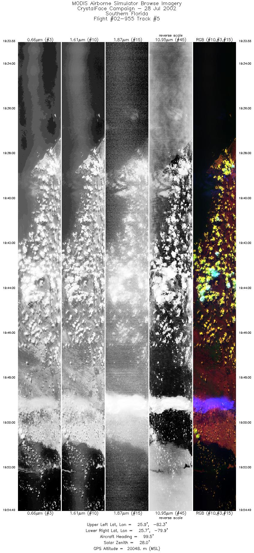
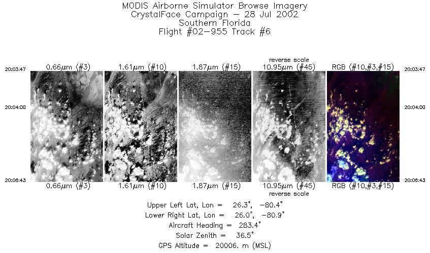
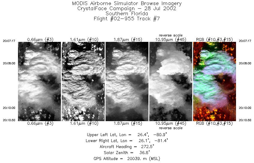
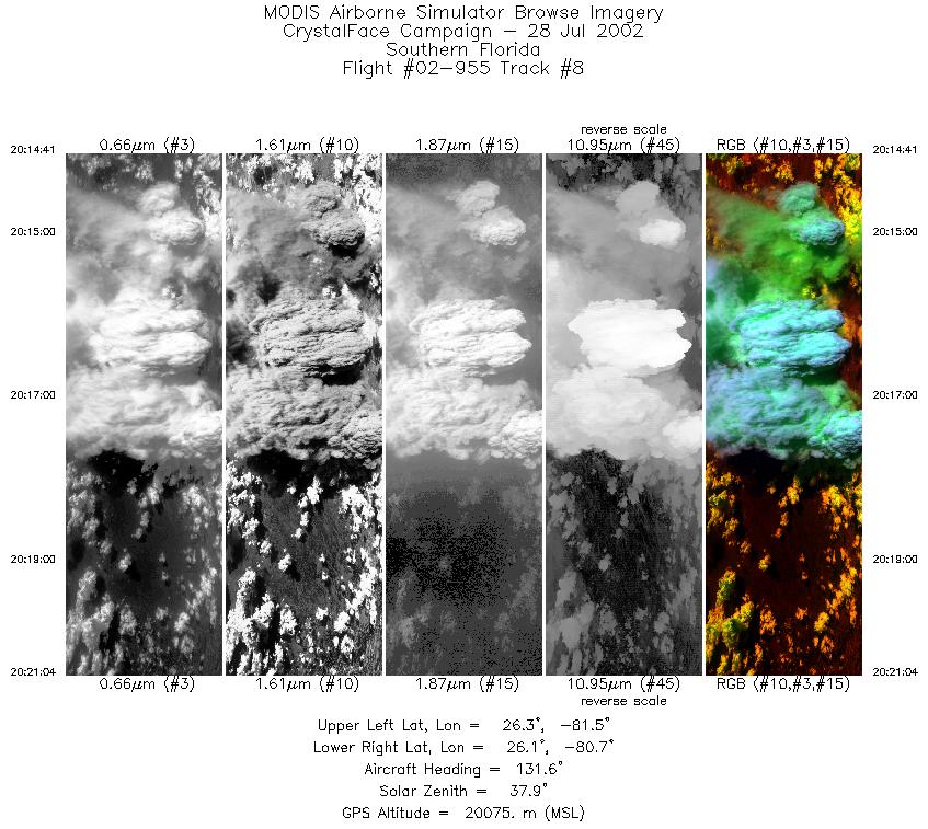
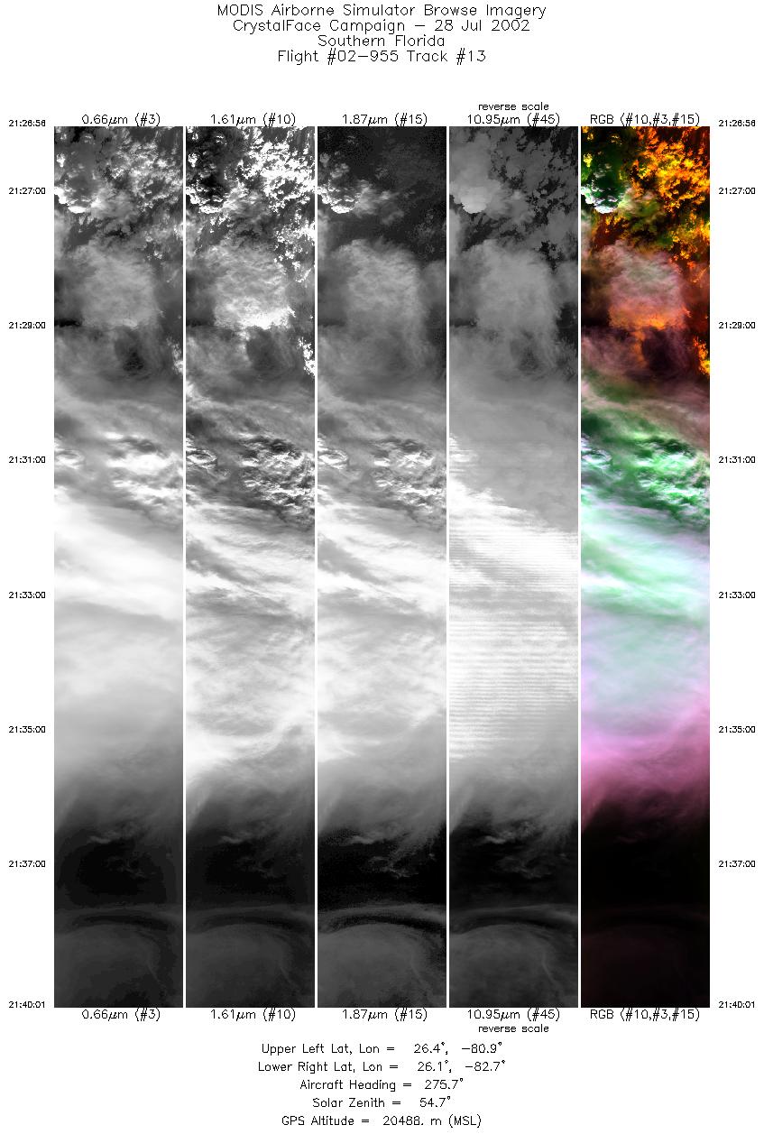
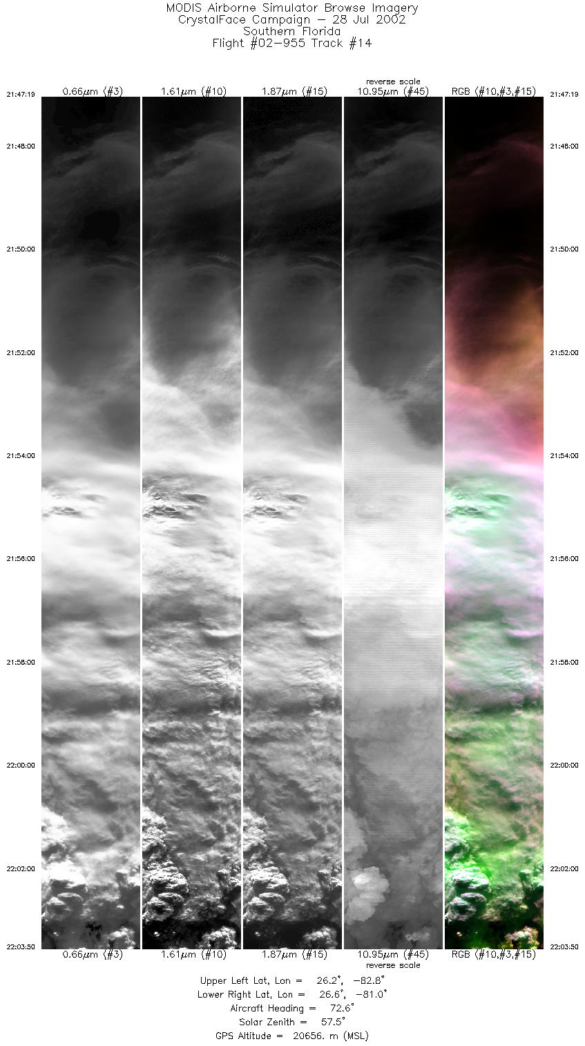
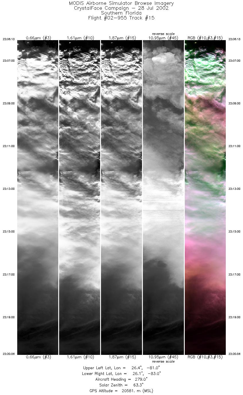
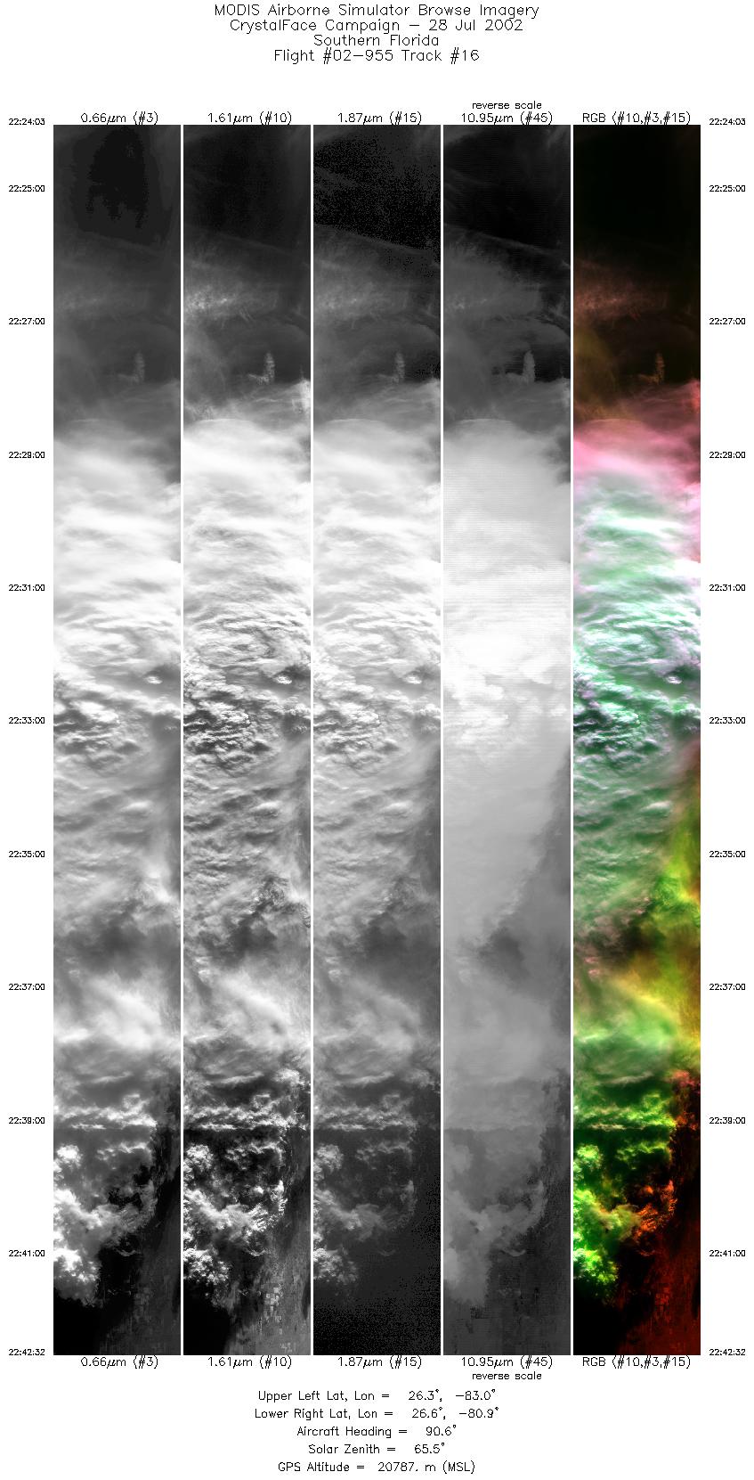
Flight Summary Report Mission Number: 10 Mission Scientists: M. King, P. Newman ER-2 Pilot: K. Broda Takeoff: 1730 (UTC) Landing: 2350 (UTC) Duration: 6:20 (h:mm) After climbing to altitude, the ER-2 proceeded to the first waypoint just east of Andros Island: (A) 24°30´ N, 77° 0´W. After arriving at (A), the ER-2 turned NNW towards (B) 27°42´ N, 77°45´ W and flew 200 nautical miles along this track. This A-B track followed along the AQUA satellite nadir track. AQUA overflew this track at approximately 1427 EDT (1827 UT). The ER-2 was supposed to maintain coordination with the Proteus, but that aircraft was grounded by an engine start motor failure. After arrival at (B), the ER-2 turned SW towards (C) 25°32´ N, 79°58´ W immediately off the east coast of Florida. The ER-2 then turned westward towards (D) 25°58´ N, 82°01´ W off of the Florida west coast. At 1843 UT, the ER-2 passed over the eastern ground site and at 1850 passed over the western ground site. After completing another pass over these sites, the ER-2 turned northward and made a pass at a convective system that was building up between the western ground site and Lake Okeechobee (east of Naples). At about 2000 UT, the ER-2 was briefly vectored off of this system to coordinate with the Twin Otter and the Citation on a system that was south of the western ground site over the Gulf. The ER-2 then returned north to continue working the system that was between Lake Okeechobee and the western ground site. The plane landed at 2350 UT. The environmental conditions included extraordinary incursions of CCN of presumably Saharan dust origin. The 1800 UT sonde showed relatively dry conditions throughout the troposphere with winds predominantly out of the ENE at 25-30 kts.at levels above 200 hPa. The anvils that developed in the late afternoon had cirrus blow-off that roughly followed this flow. The tropopause was located near approximately 150 hPa on this flight at a temperature near 67°C. Satellite & Ground Site InformationAQUA Overpass @ 1827 (UTC); VZA = 26.32° (relative to eastern site)
Western Site: PARSL, Everglades National Park, Gulf Coast Visitor's Center
|
|||||||||||||||||||||||||||||||||||||||||||||||||||||||||||||||||||||||||||||||||||||||||||||||||||||||||||||||||||||||||||||||||||||||||||||||||||

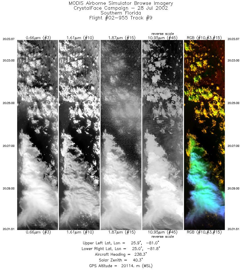
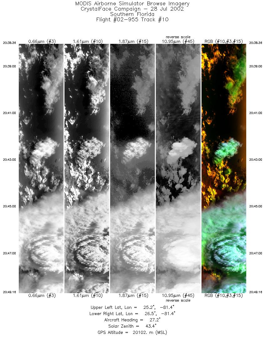
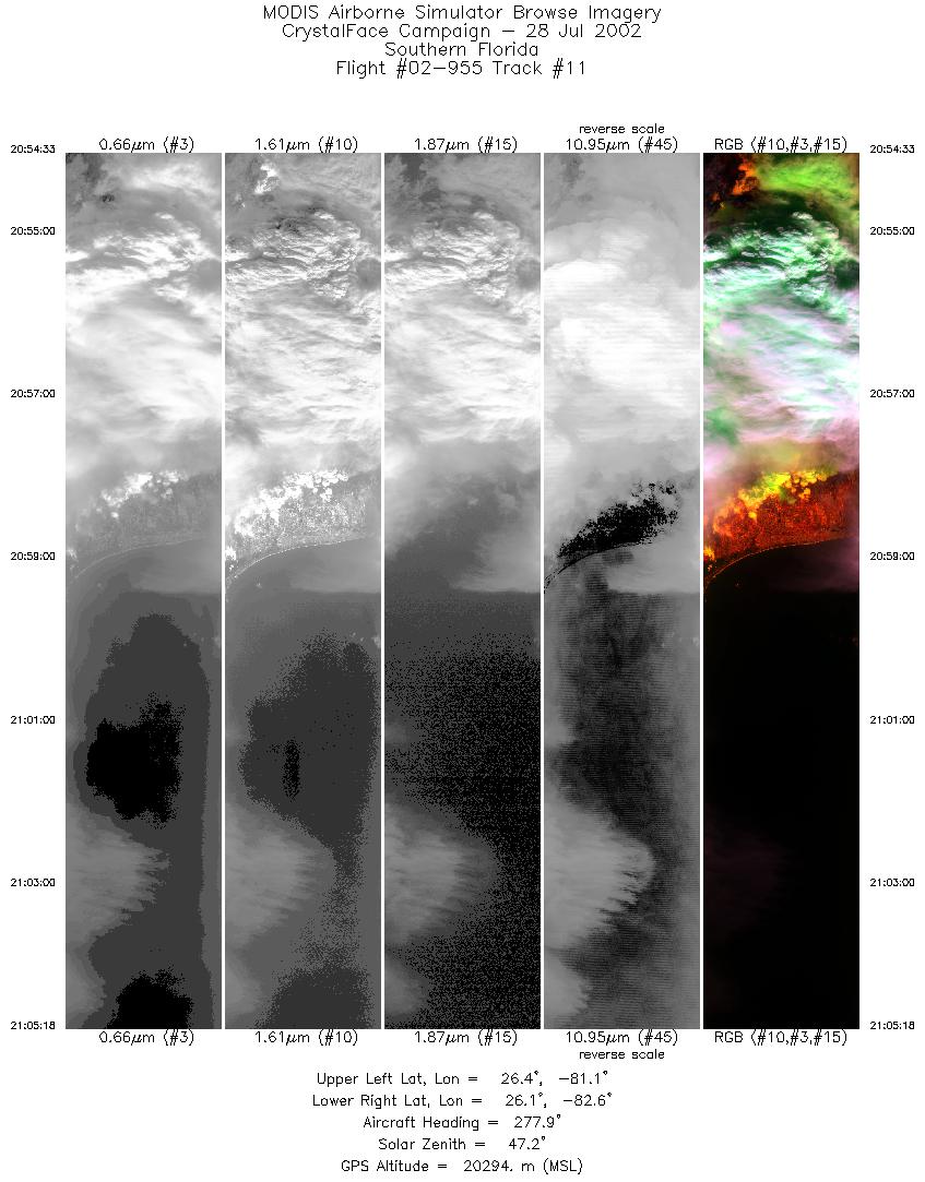
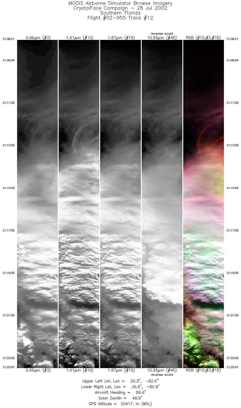
Flight 02-955


| Sample Imagery |
| Click image for full resolution |
|
Track #10 Gulf of Mexico / Atlantic Ocean |


|
|
R: 1.64µm G: 0.66µm B: 1.90µm |
|
Track #12 Southern Florida |

|
|
R: 1.64µm G: 0.66µm B: 1.90µm |
- NASA Official: Matt Fladeland
- Project Manager: James Jacobson
- Website Editor: Eric Fraim
- Last Updated: November 16, 2021


