


MODIS Airborne Simulator (MAS)
FLIGHT SUMMARY INFORMATION


|
Flight: 02-953 Date: 23 July 2002 Location: Gulf of Mexico / Florida / Atlantic Ocean Deployment: CRYSTAL-FACE Principal Investigators: Drs. Michael King & Steven Platnick (NASA GSFC) Additional Sensors: CoSSIR, CPL, CRS, Dropsondes, EDOP, JLH, MMS, MTP, RAMS, SSFR |
|||||||||||||||||||||||||||||||||||||||||||||||||||||||||||||||||||||||||||||||||||||||||||||||||||||||||||||||||||||||||||||||||||||||||||||||||||
|
Data Evaluation Overall quality is good AQUA Underflight @ 18:09 TERRA Underflight @ 16:39 TRMM Underflight @ 18:10 |
|||||||||||||||||||||||||||||||||||||||||||||||||||||||||||||||||||||||||||||||||||||||||||||||||||||||||||||||||||||||||||||||||||||||||||||||||||
|
Processing Information Level-1B Data in HDF format is available Flight Line Summary Spectral Band Configuration Spectral Response Function Table |
|||||||||||||||||||||||||||||||||||||||||||||||||||||||||||||||||||||||||||||||||||||||||||||||||||||||||||||||||||||||||||||||||||||||||||||||||||
|
Browse Imagery Flight Tracks: 17 Scanlines: 94158 |
|||||||||||||||||||||||||||||||||||||||||||||||||||||||||||||||||||||||||||||||||||||||||||||||||||||||||||||||||||||||||||||||||||||||||||||||||||
|
|||||||||||||||||||||||||||||||||||||||||||||||||||||||||||||||||||||||||||||||||||||||||||||||||||||||||||||||||||||||||||||||||||||||||||||||||||
|
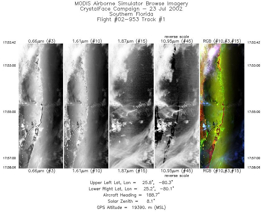
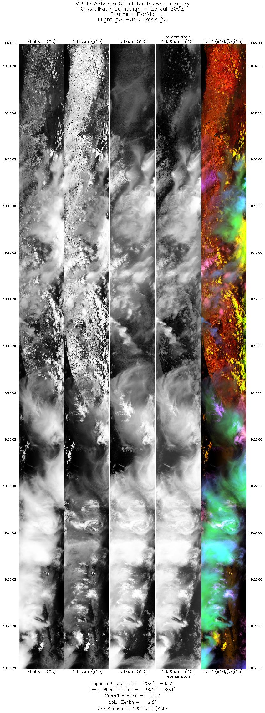
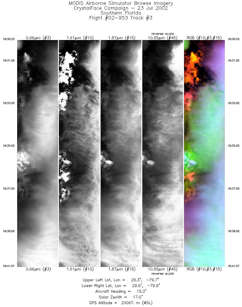
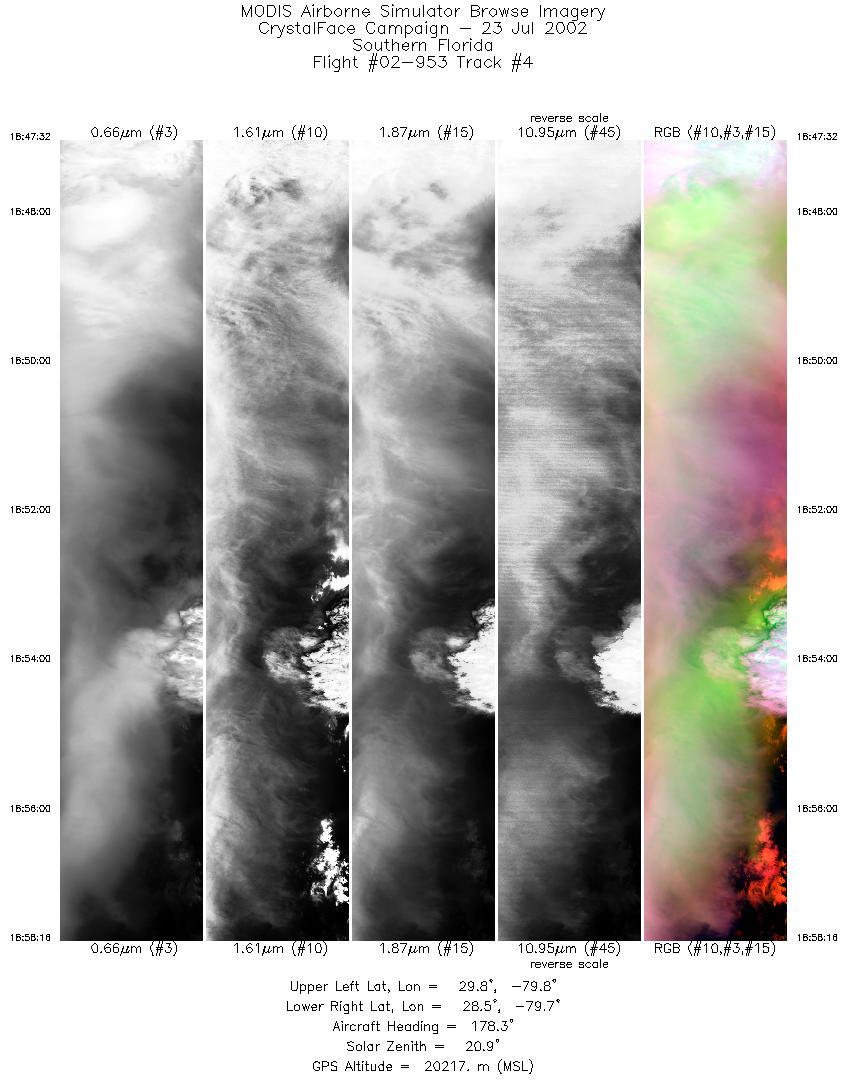
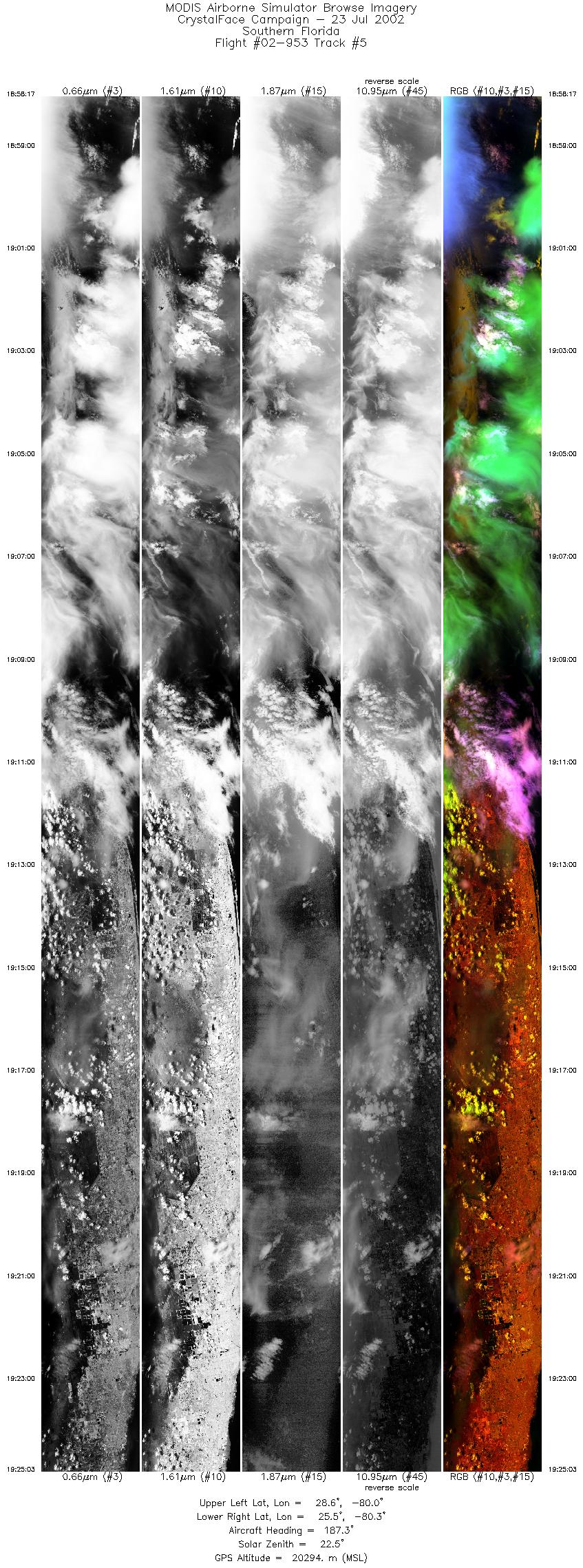
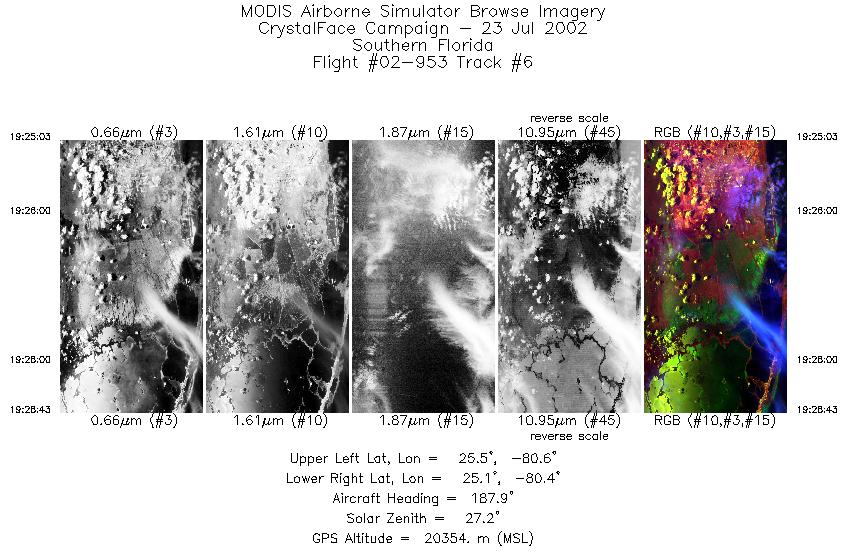
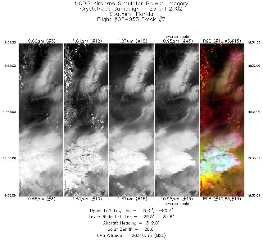
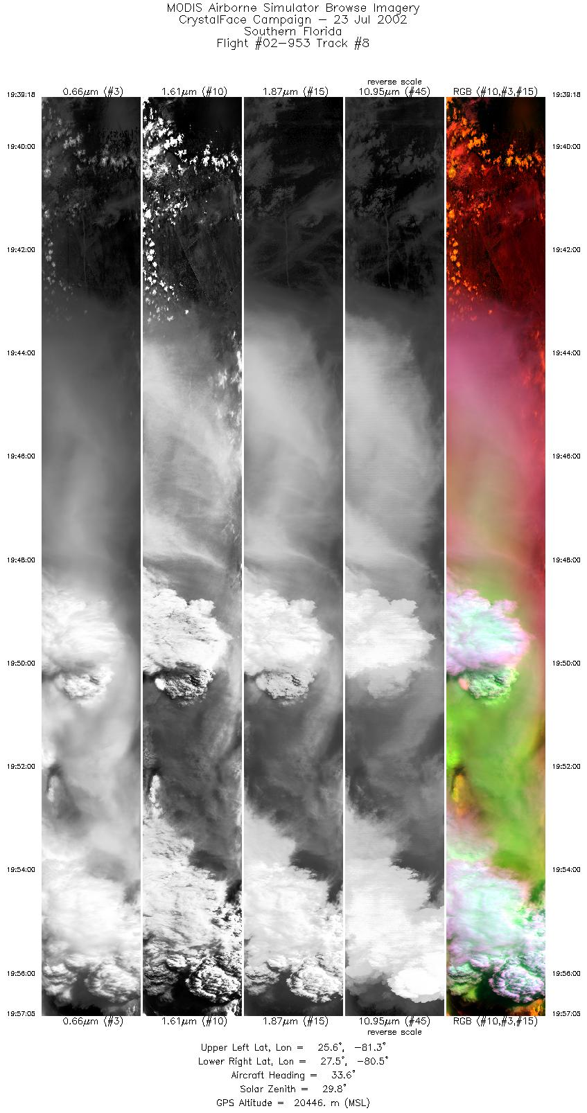
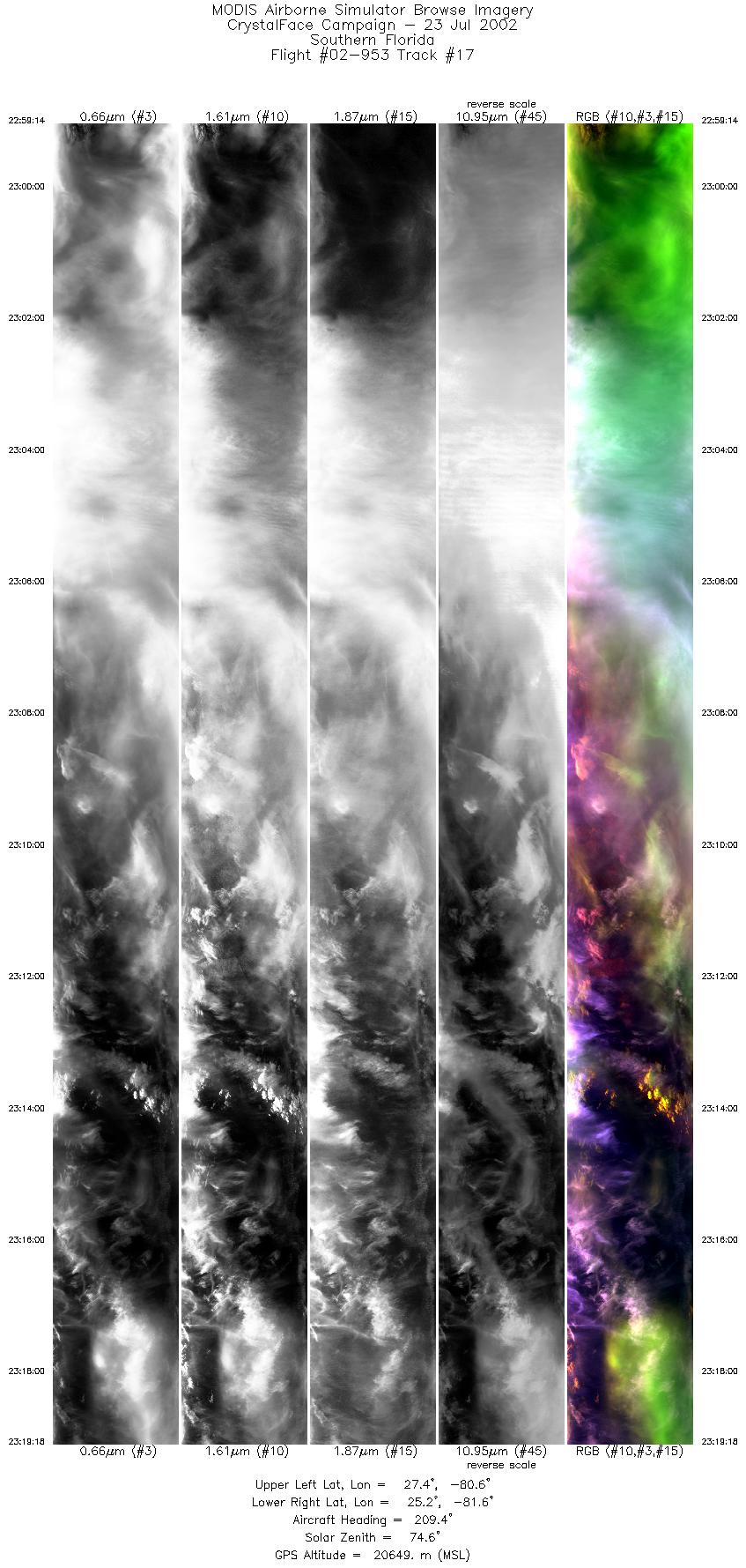
Flight Summary Report Mission Number: 8 Mission Scientists: S. Platnick, P. Newman ER-2 Pilot: K. Broda Takeoff: 1715 (UTC) Landing: 0025 (UTC) Duration: 7:10 (h:mm) This flight had 4 main objectives: 1) sampling for a TRMM overpass that was scheduled for 1810 UT that would overfly the South Florida region, 2) sampling of cirrus blow-off coming down from Atlantic maritime convection, and 3) coordination of an overflight of the eastern ground site at 1930 with WB-57F, Citation, and Proteus, and 4) sampling of developing Cb over the south Florida region. After climbing to altitude, the ER-2 proceeded to waypoint A (25° 08´ N, 805° 32´ W), and performed the coordination leg with the TRMM overpass. The plane continued on a heading towards the Atlantic maritime convection near waypoint B (29° 34´ N, 79° 25´ W). After returning to waypoint A, the ER-2 was redirected by NPOL to sample a growing Cb that was located near Okeechobee. The cirrus blow-off from this system moved southeastward. The orientation of the ER-2's flight track was parallel to this cirrus between waypoints D (25° 40´ N 81° 30´ W) and F (26° 54´ N 80° 42´ W). The ER-2 continued to sample the core and cirrus of this evolving system over the entire day until landing at 2025 EDT. Satellite & Ground Site Information
AQUA Overpass @ 1809 (UTC); VZA = 52.37° (relative to eastern site)
Western Site: PARSL, Everglades National Park, Gulf Coast Visitor's Center
|
|||||||||||||||||||||||||||||||||||||||||||||||||||||||||||||||||||||||||||||||||||||||||||||||||||||||||||||||||||||||||||||||||||||||||||||||||||

Flight 02-953


| Sample Imagery |
| Click image for full resolution |
|
Track #08 Florida peninsula |


|
|
R: 1.64µm G: 0.66µm B: 1.90µm |
|
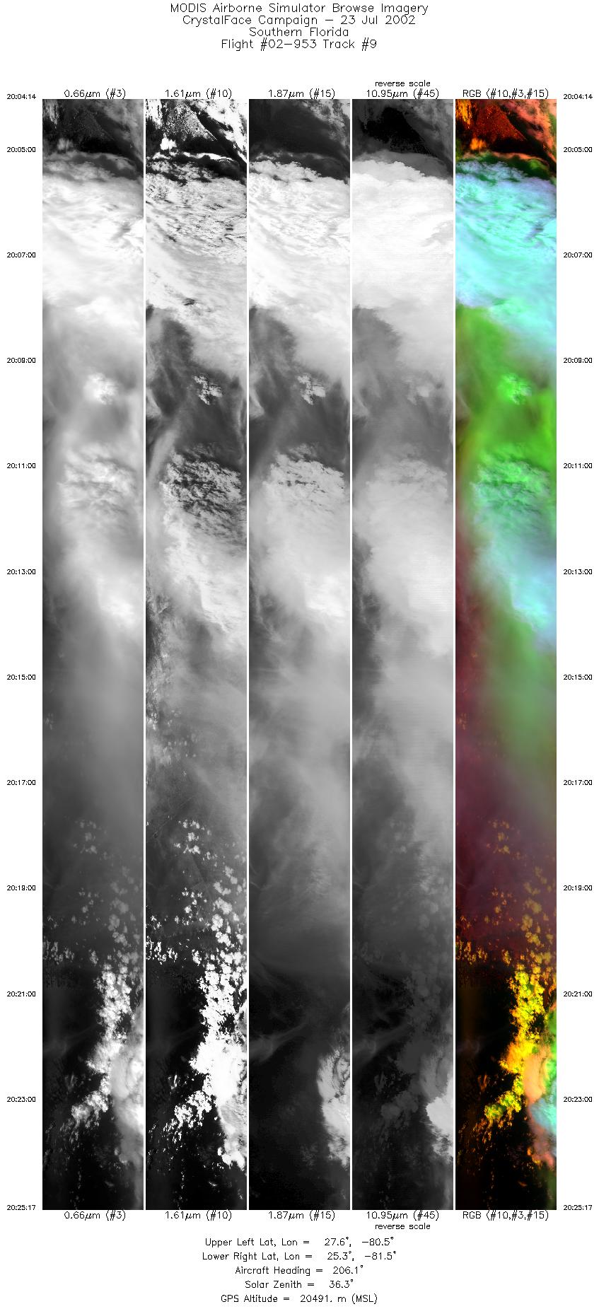
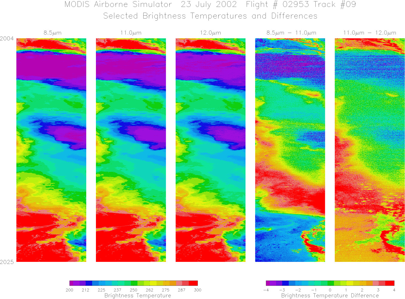
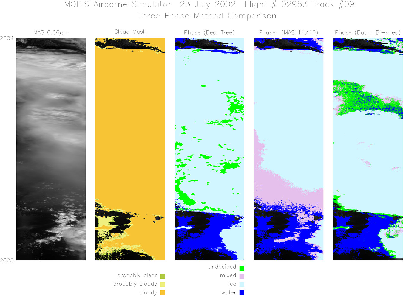
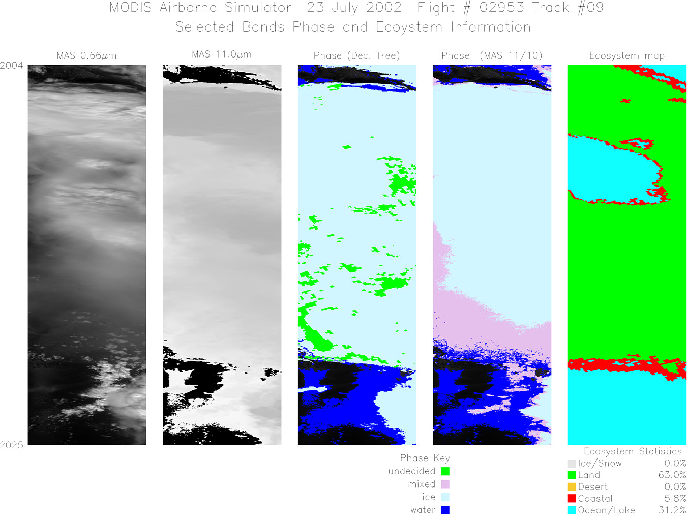
Track #09 Florida peninsula |

|
|
R: 1.64µm G: 0.66µm B: 1.90µm |
- NASA Official: Matt Fladeland
- Project Manager: James Jacobson
- Website Editor: Eric Fraim
- Last Updated: November 16, 2021


