


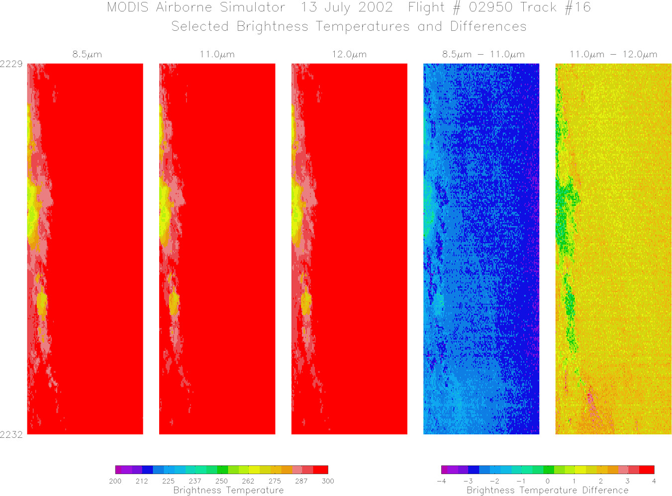
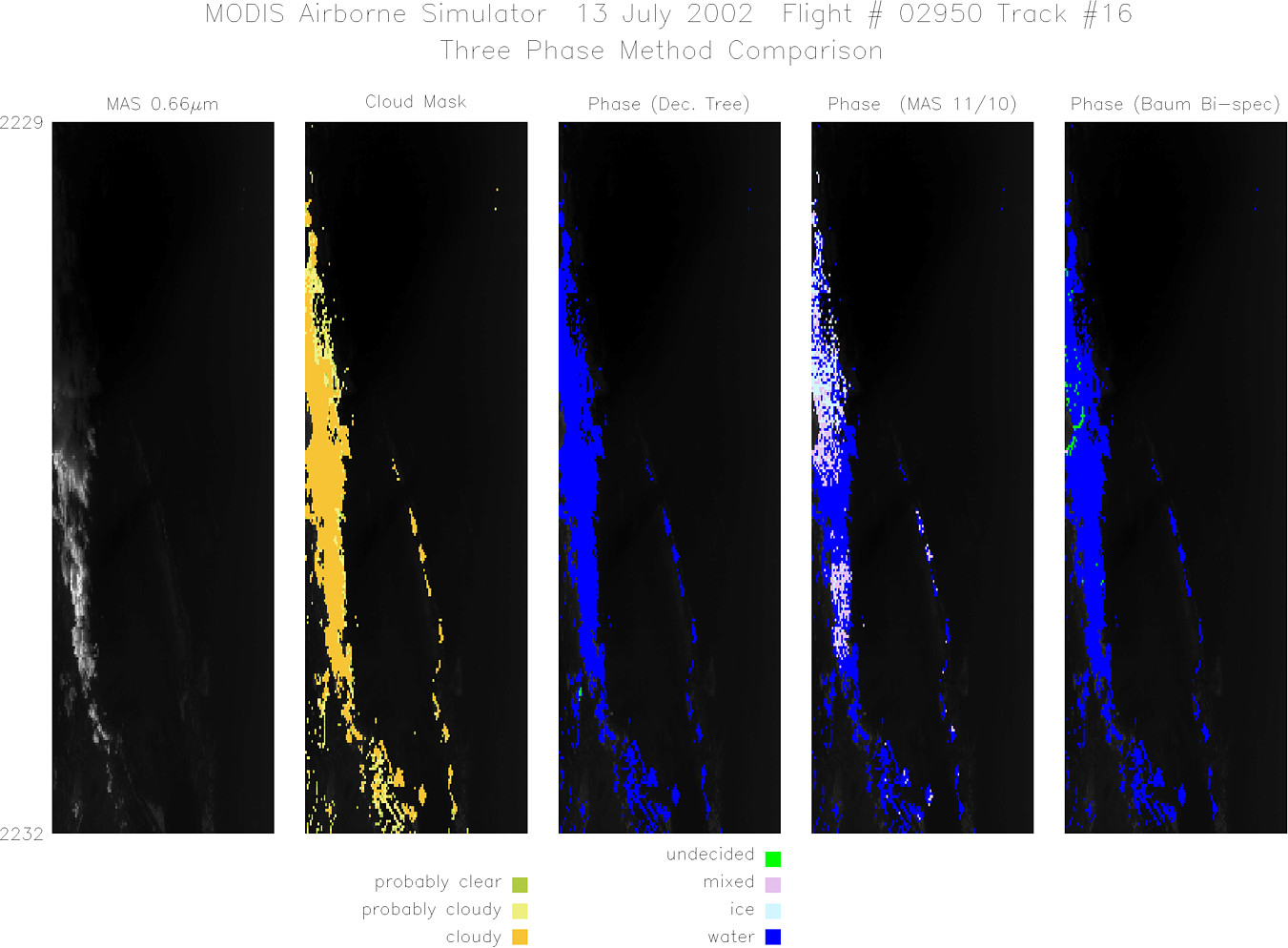
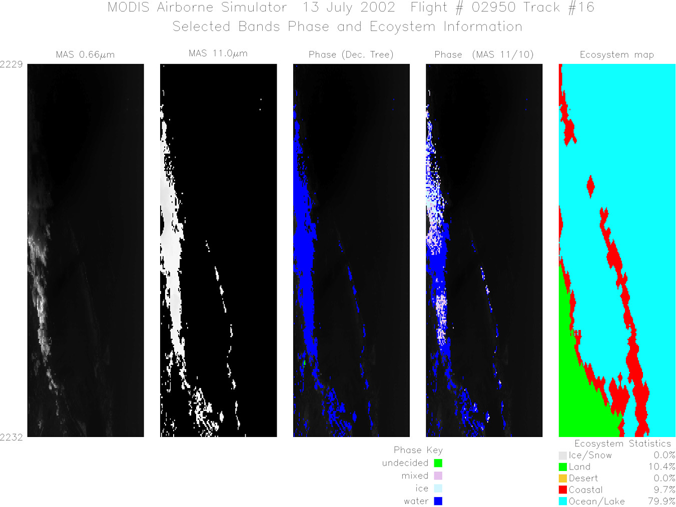
MODIS Airborne Simulator (MAS)
FLIGHT SUMMARY INFORMATION


|
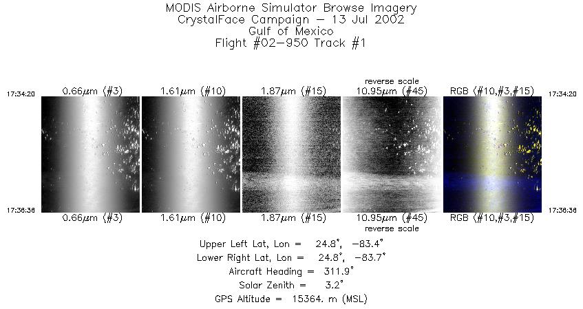
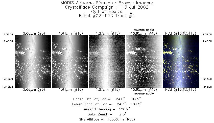
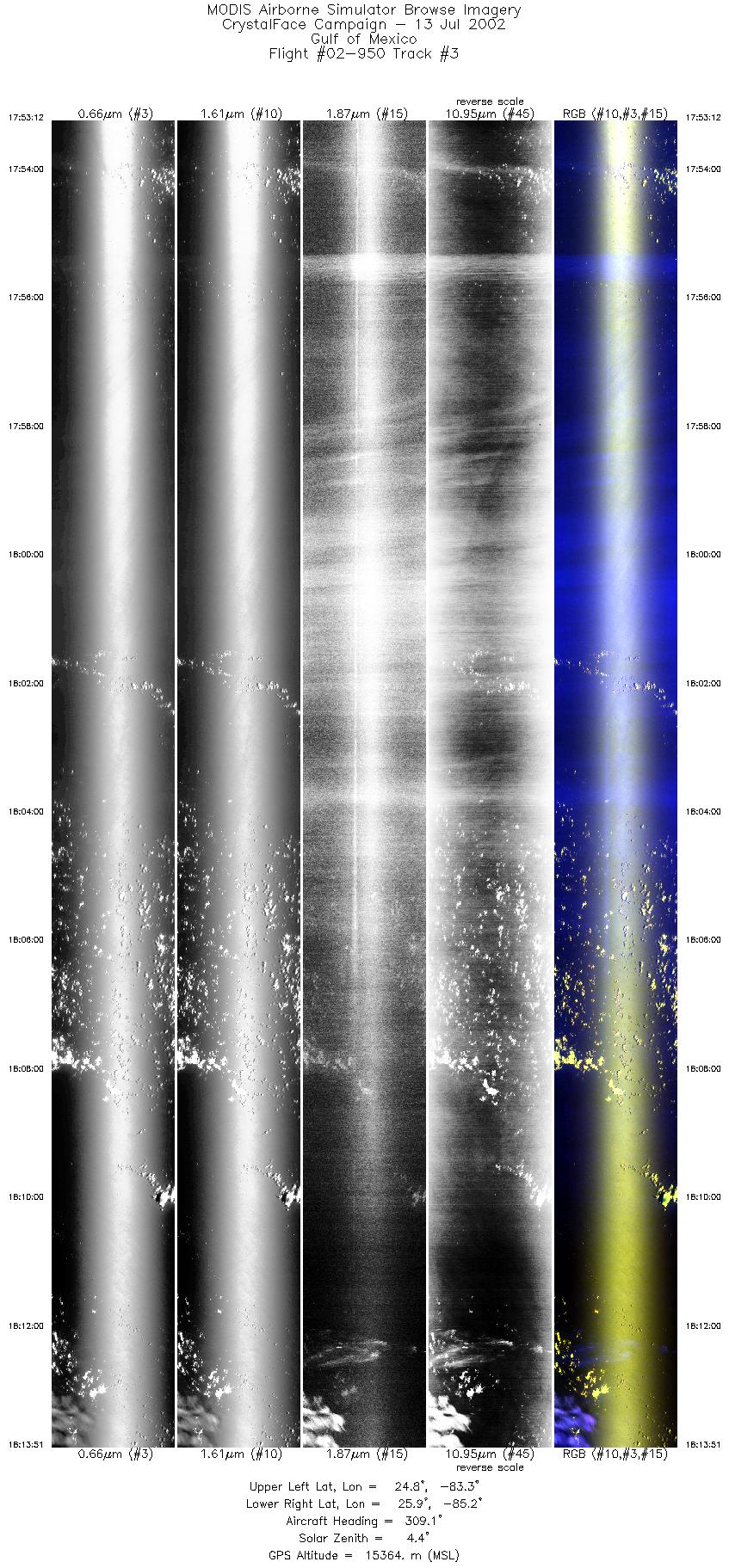
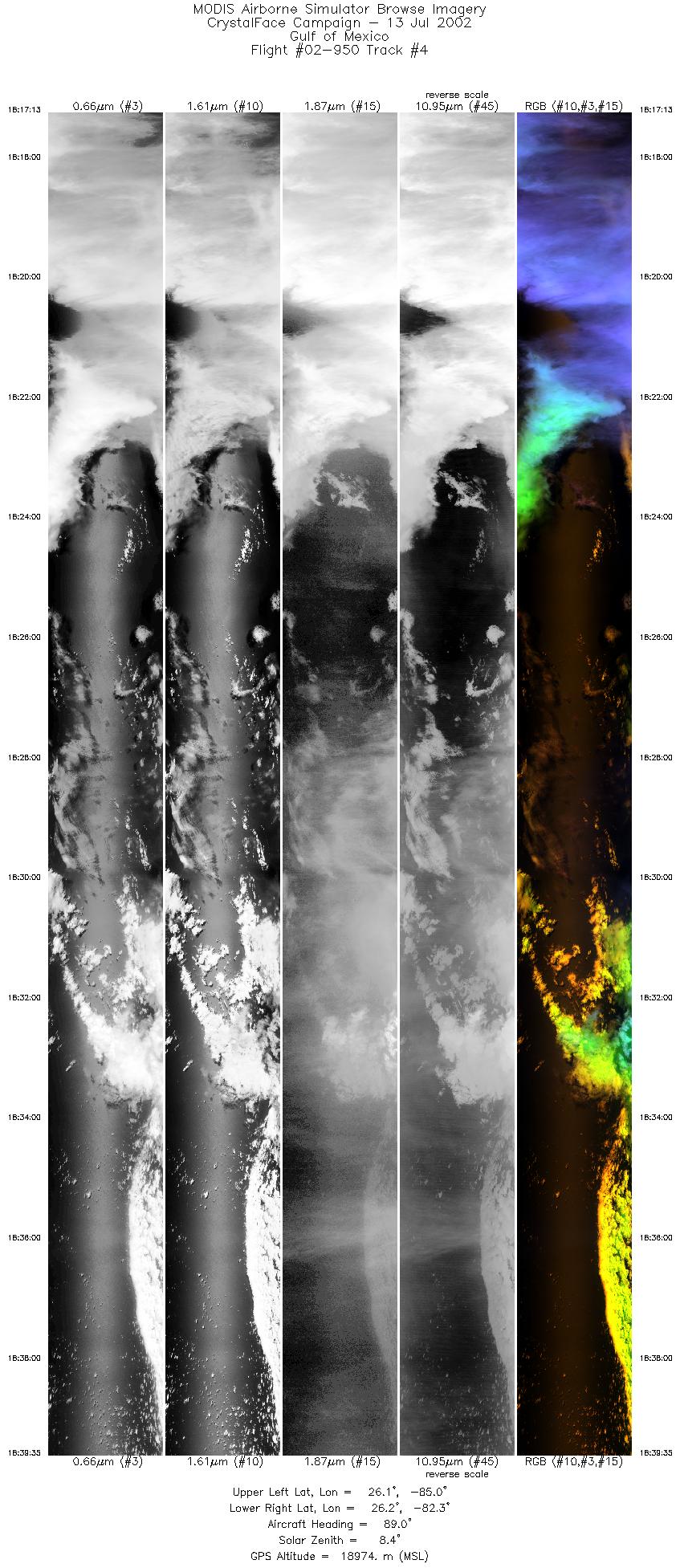
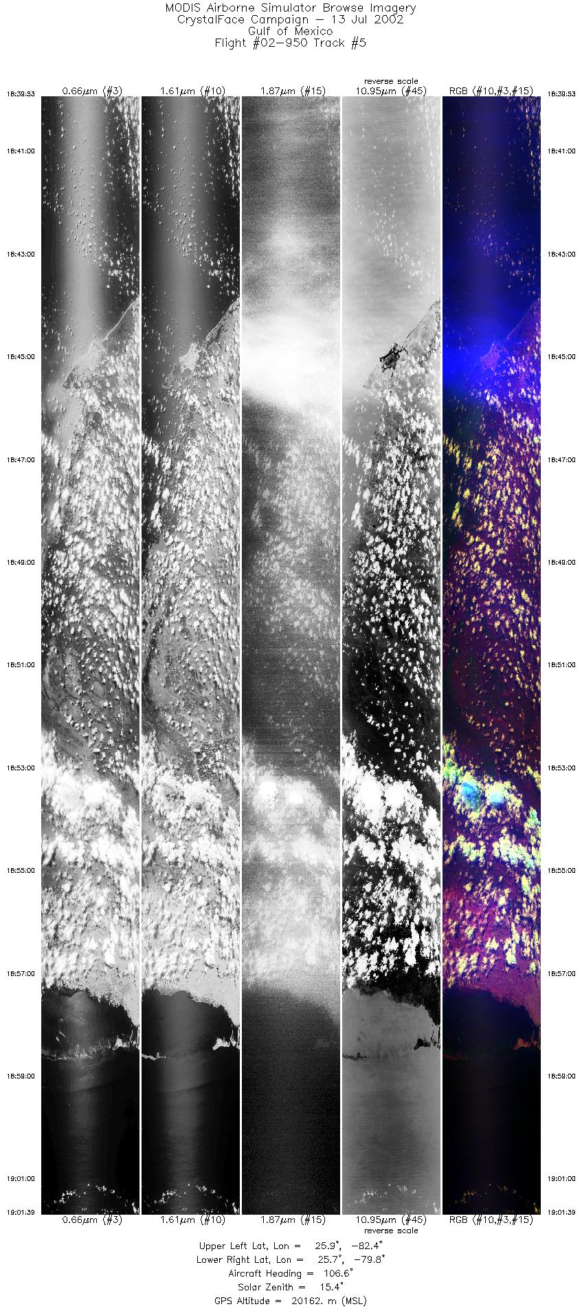
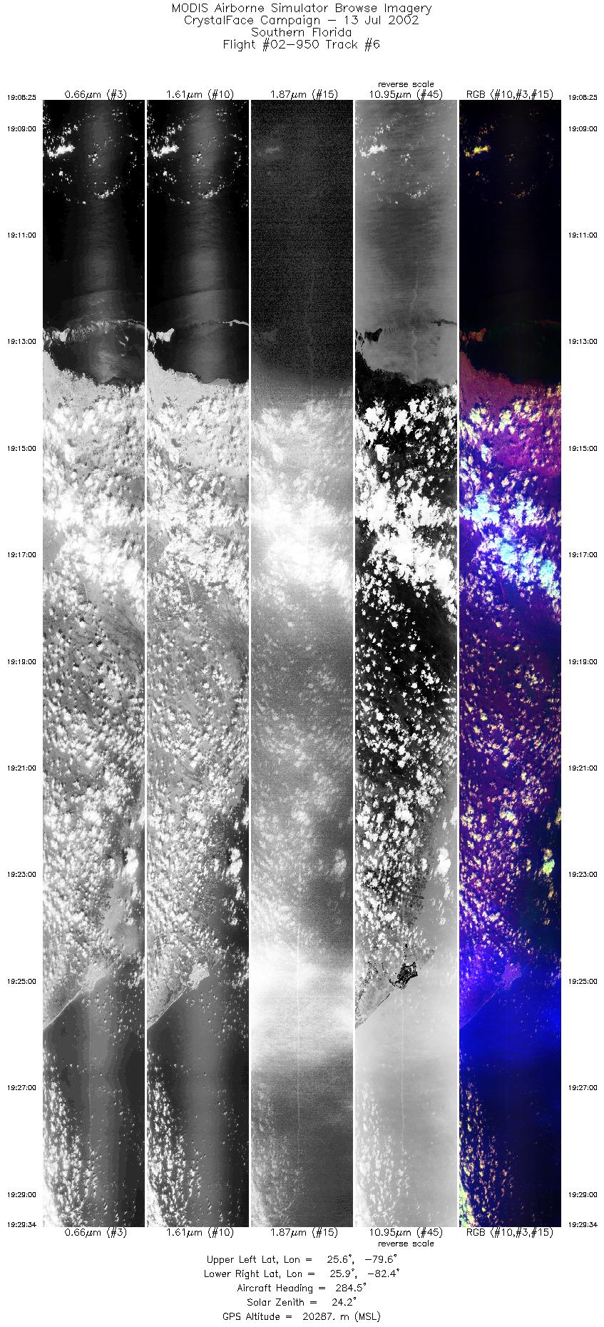
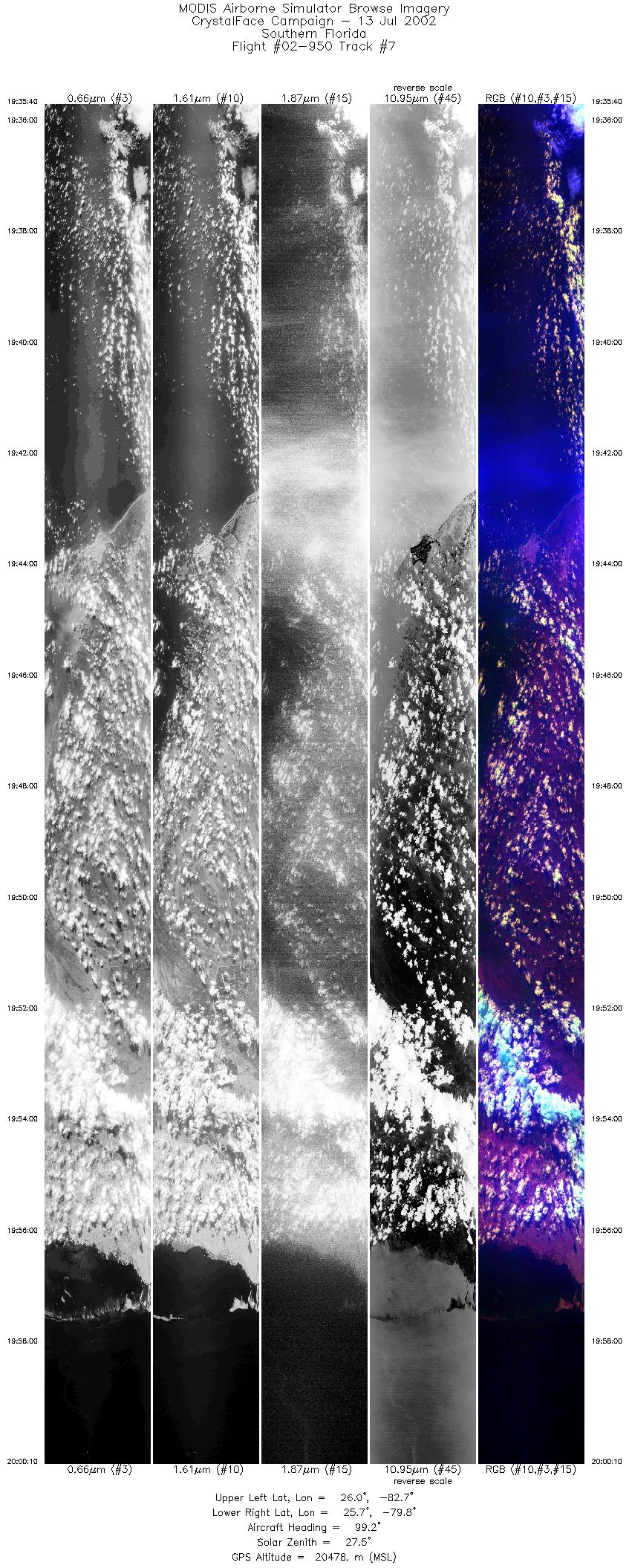
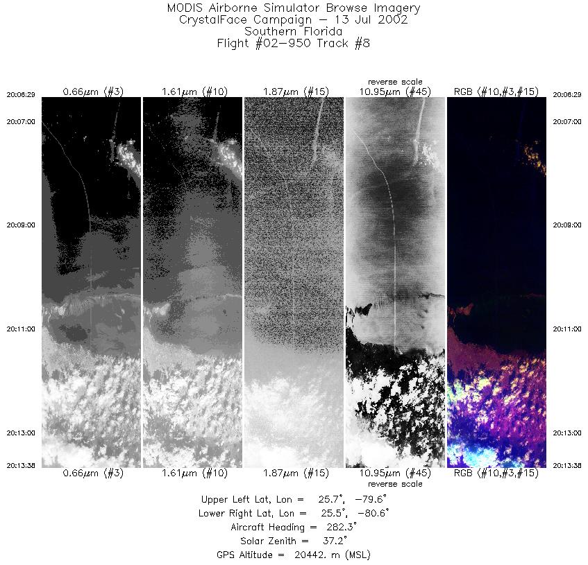
Flight: 02-950 Date: 13 July 2002 Location: Gulf of Mexico / Florida / Atlantic Ocean Deployment: CRYSTAL-FACE Principal Investigators: Drs. Michael King & Steven Platnick (NASA GSFC) Additional Sensors: CoSSIR, CPL, CRS, Dropsondes, EDOP, JLH, MMS, MTP, RAMS, SSFR |
||||||||||||||||||||||||||||||||||||||||||||||||||||||||||||||||||||||||||||||||||||||||||||||||||||||||||||||||||||||||||||||||||||||||||||
|
Data Evaluation Overall quality is good AQUA Underflight @ 19:10 TERRA Underflight @ 16:29 |
||||||||||||||||||||||||||||||||||||||||||||||||||||||||||||||||||||||||||||||||||||||||||||||||||||||||||||||||||||||||||||||||||||||||||||
|
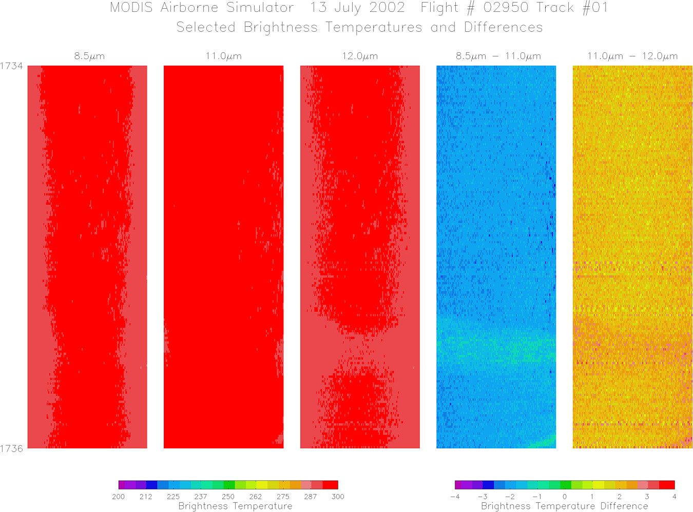
Processing Information Level-1B Data in HDF format is available Flight Line Summary Spectral Band Configuration Spectral Response Function Table |
||||||||||||||||||||||||||||||||||||||||||||||||||||||||||||||||||||||||||||||||||||||||||||||||||||||||||||||||||||||||||||||||||||||||||||
|
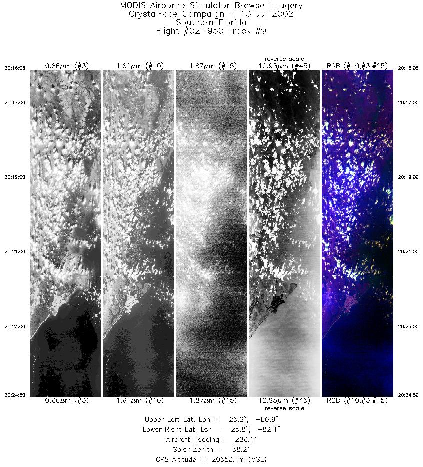
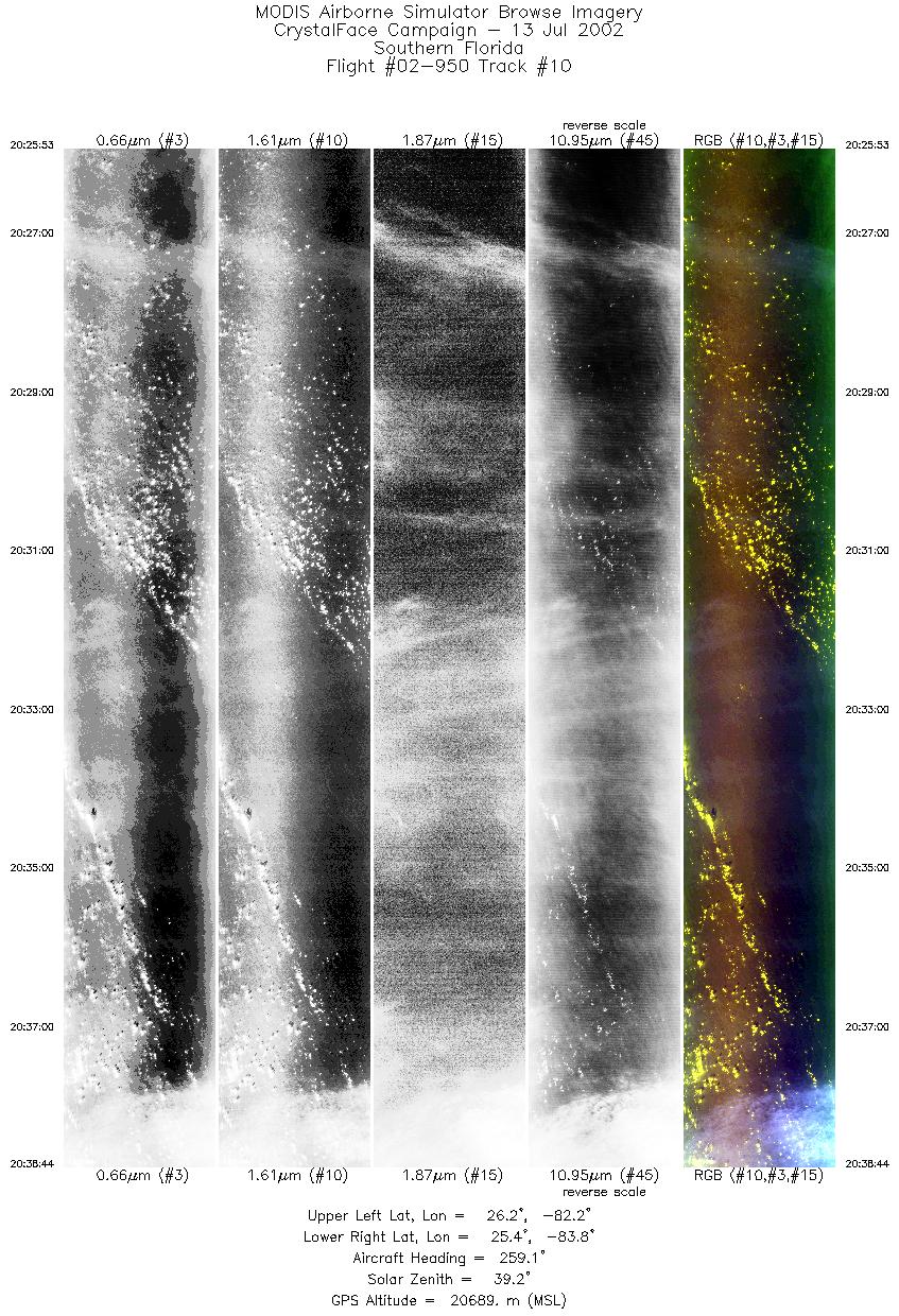
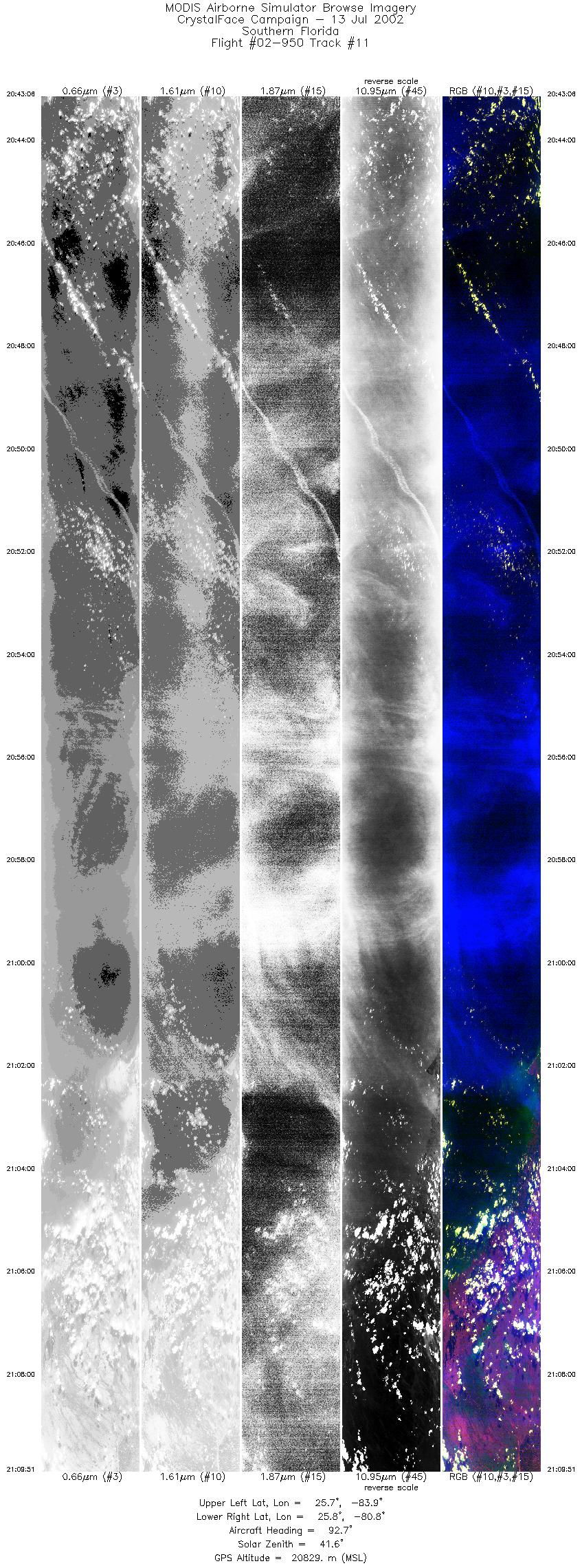
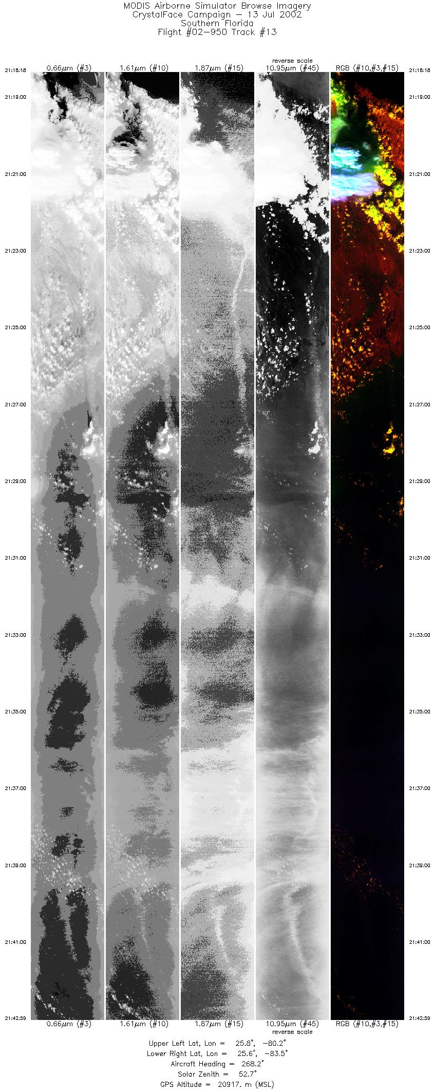
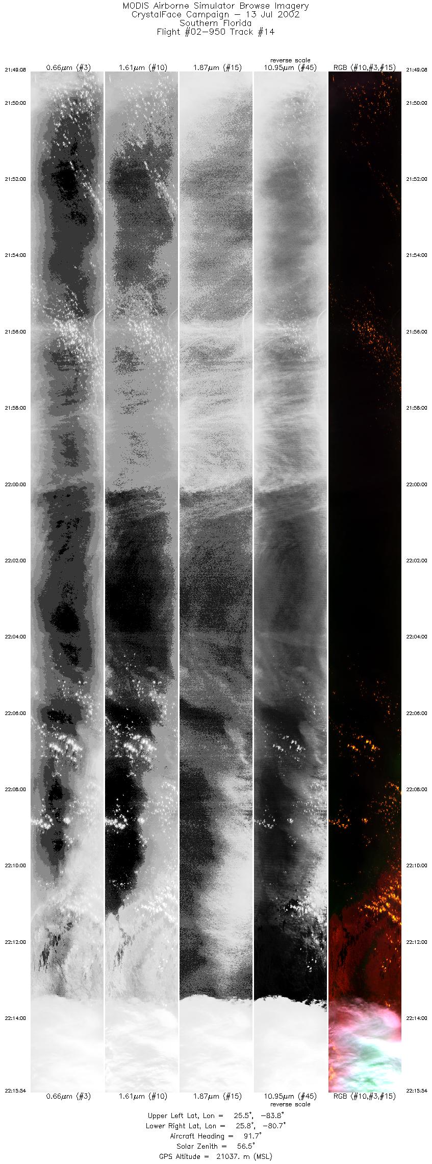
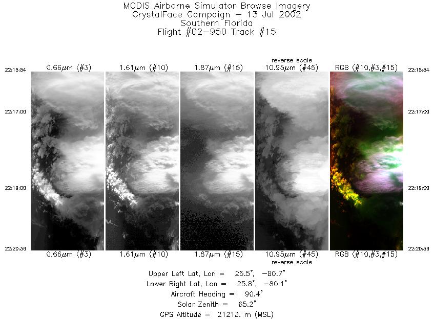
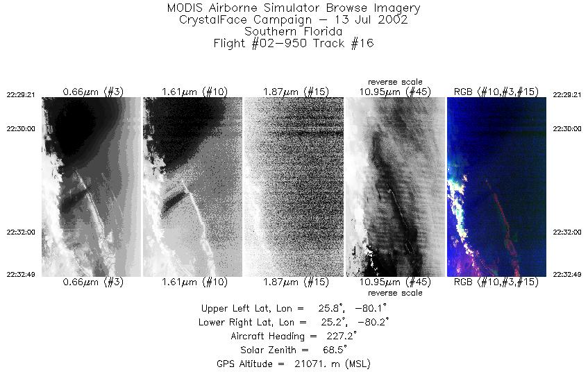
Browse Imagery Flight Tracks: 16 Scanlines: 87303 |
||||||||||||||||||||||||||||||||||||||||||||||||||||||||||||||||||||||||||||||||||||||||||||||||||||||||||||||||||||||||||||||||||||||||||||
|
||||||||||||||||||||||||||||||||||||||||||||||||||||||||||||||||||||||||||||||||||||||||||||||||||||||||||||||||||||||||||||||||||||||||||||
|
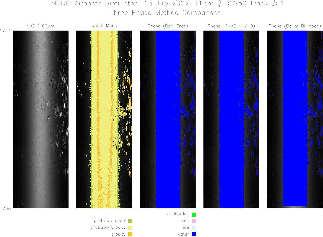
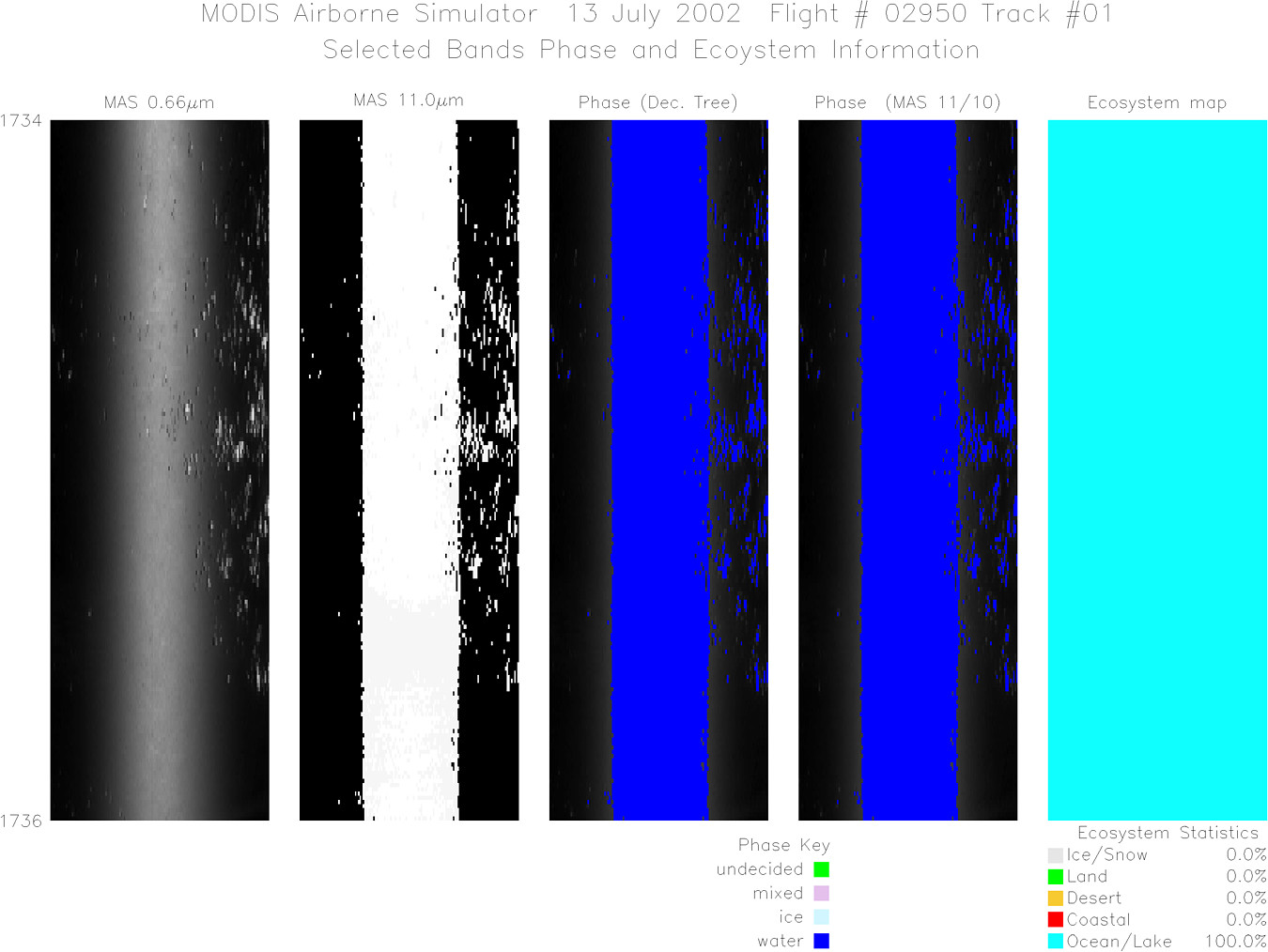
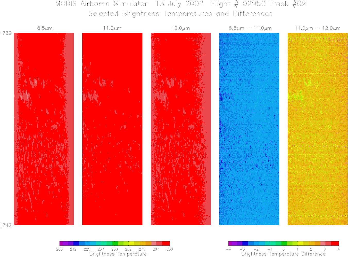
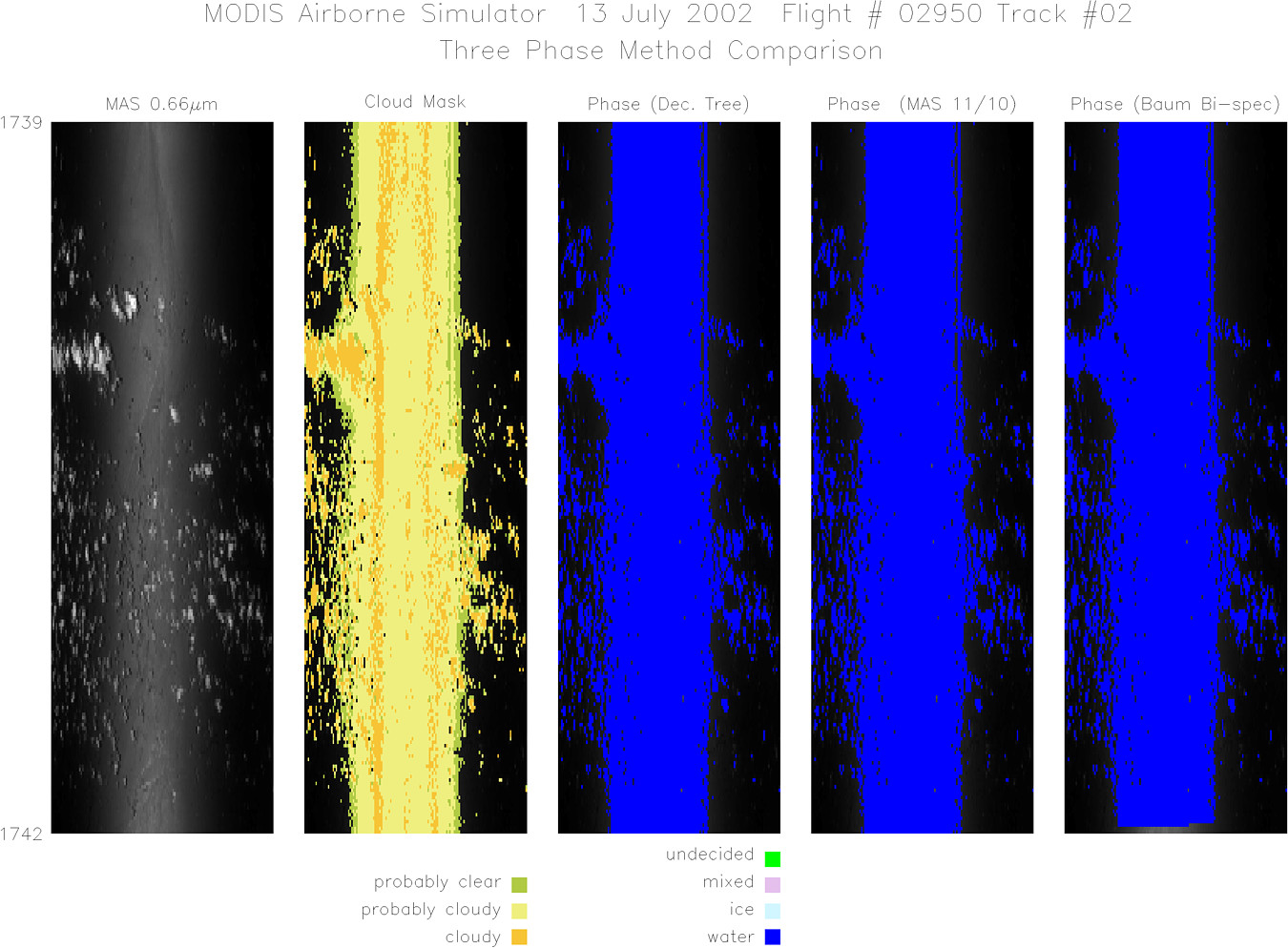
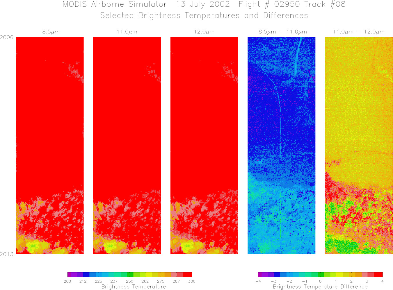
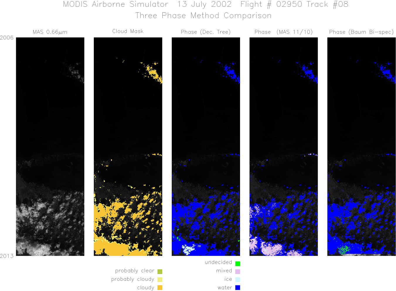
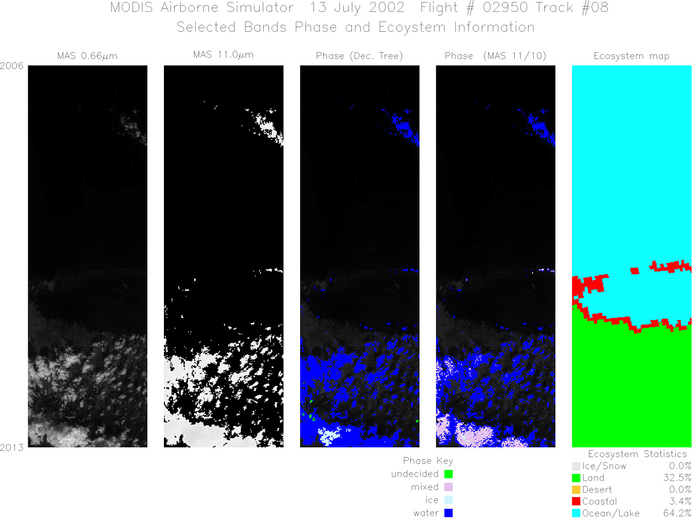
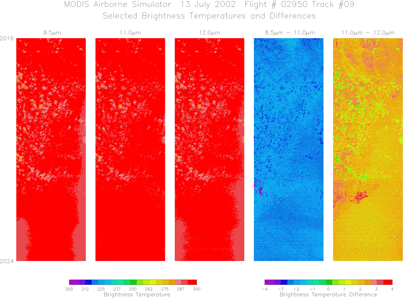
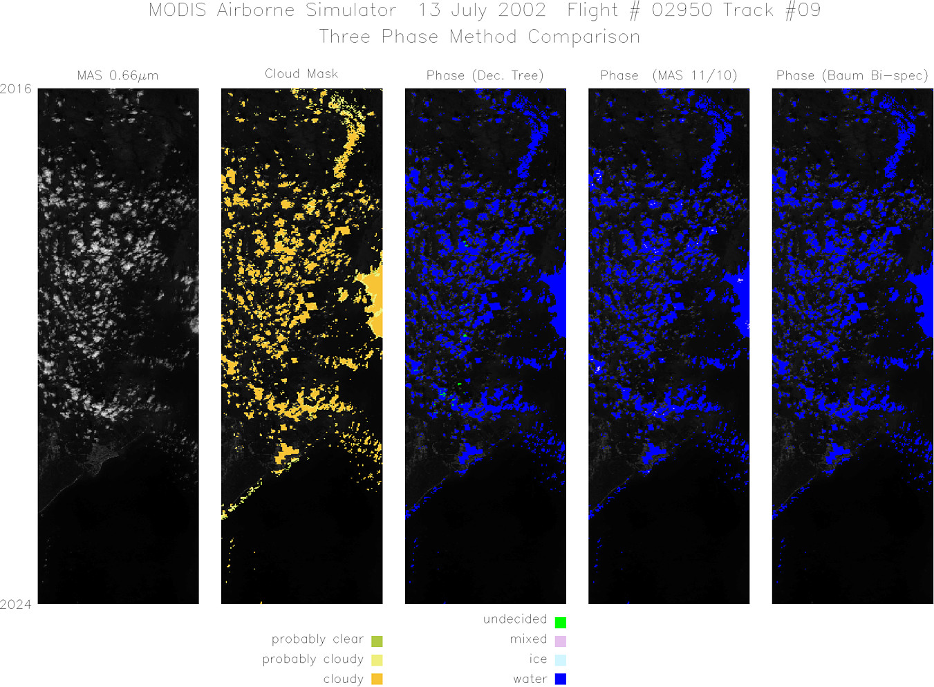
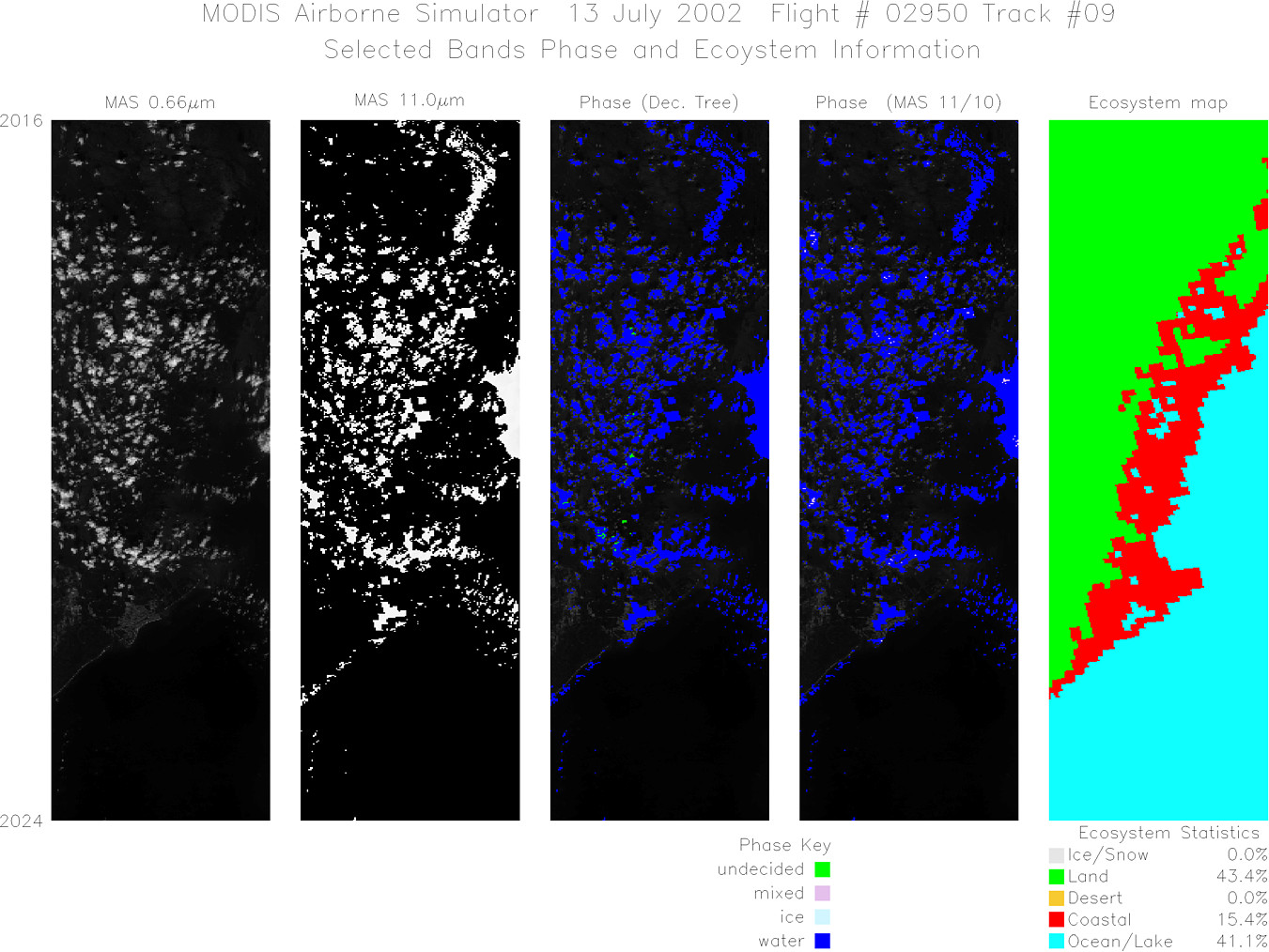
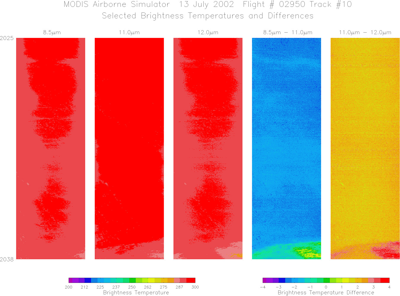
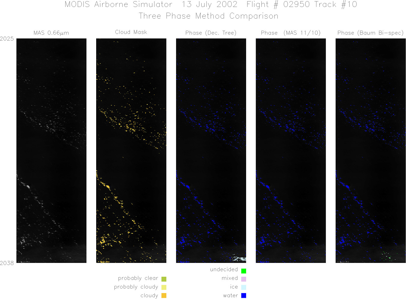
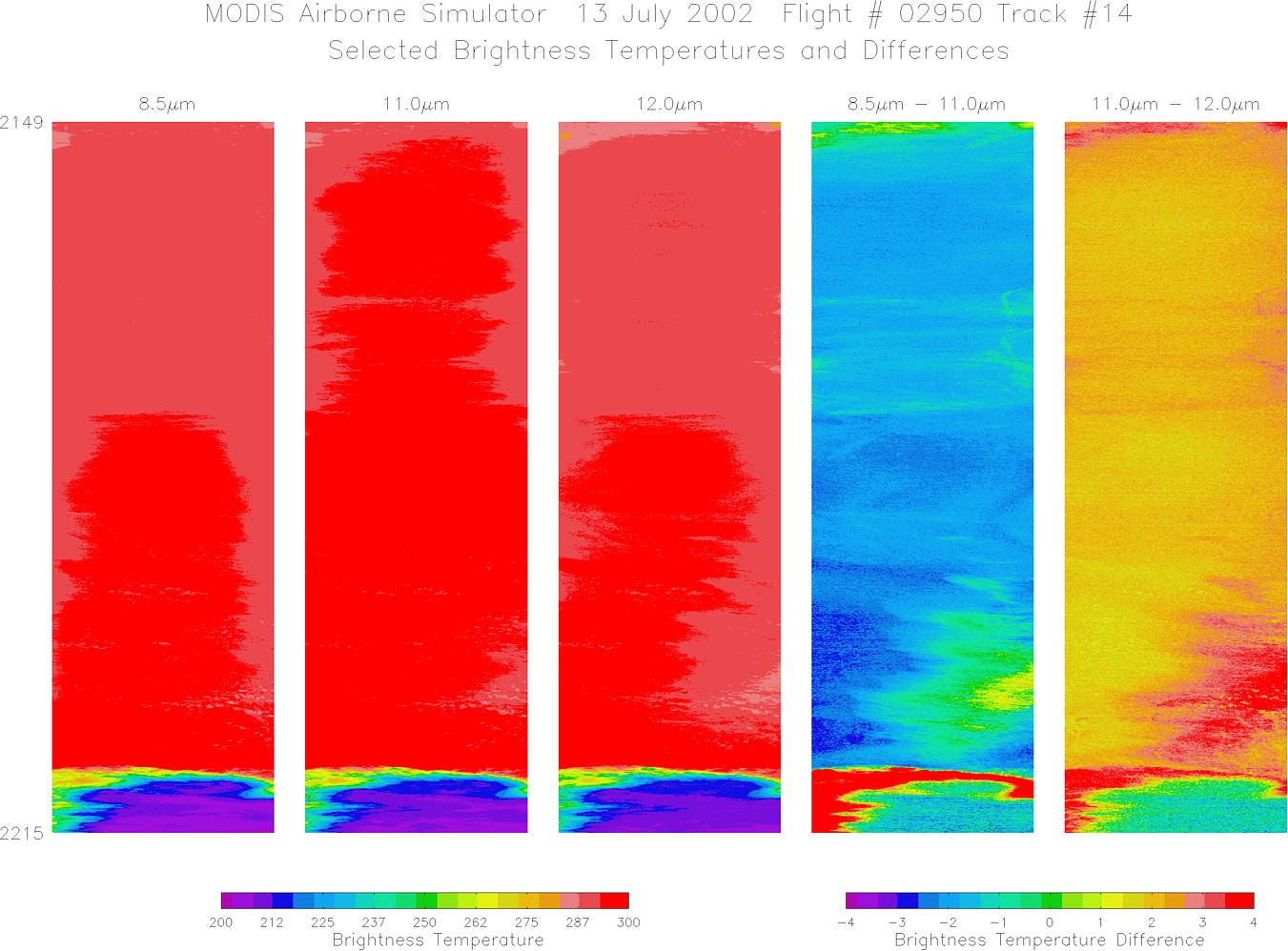
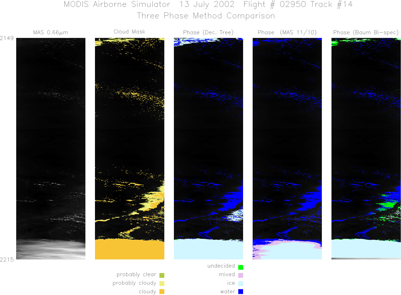
Flight Summary Report Mission Number: 5 Mission Scientists: S. Platnick, P. Newman ER-2 Pilot: K. Broda Takeoff: 1700 (UTC) Landing: 2315 (UTC) Duration: 6:15 (h:mm) Thin / sub-visual cirrus expected throughout the operating region. Southwest flow at lower levels expected to initiate convection over eastern part of the peninsula by mid afternoon. NE winds aloft expected to advect anvils to southwest. After climbing to altitude, the ER-2 proceeded to waypoint A1 (24° 40´ N, 83° 20´ W) for WB-57 wingtip flight at 50 kft, along a northwest heading. The beginning of the coordination included several circular orbits by the ER-2 as the WB-57 maneuvered into position. Aircraft were in clear air and level, straight flight for approximately 15-18 minutes of flight. The ER-2 then went to altitude heading to waypoint A2 (26° 00´ N, 83° 00´ W). The ER2 and WB-57 then began a series of east-west legs overflying both ground sites and extending out over the water (designated waypoints B (26° 04´ N, 82° 19´ W) and E (25° 31´ N, 79° 48´ W): same waypoints as flight on July 3). The aircraft attempted to stay coordinated by slight modification of leg lengths. Redirection from NPOL placed the ER-2 off the peninsula for several legs, and eventually over cells developing in the Miami area. The expected wide spread convection did not occur. Satellite & Ground Site Information
AQUA Overpass @ 1910 (UTC); VZA = 48° (relative to ER-2 track)
Western Site: PARSL, Everglades National Park, Gulf Coast Visitor's Center
|
||||||||||||||||||||||||||||||||||||||||||||||||||||||||||||||||||||||||||||||||||||||||||||||||||||||||||||||||||||||||||||||||||||||||||||

Flight 02-950


| Sample Imagery |
| Click image for full resolution |
|
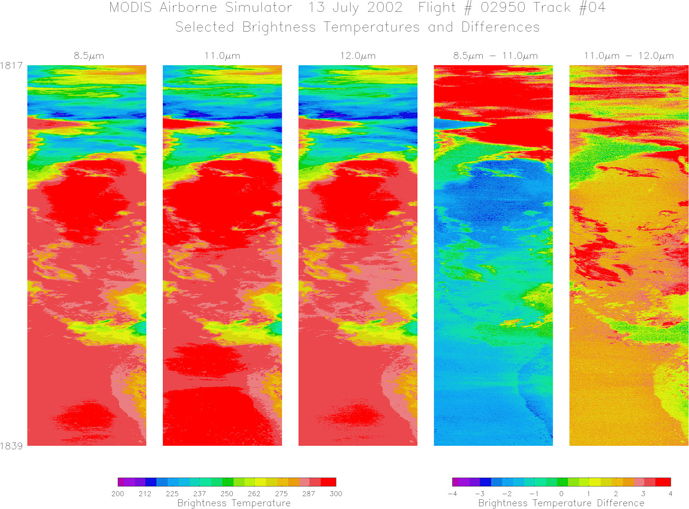
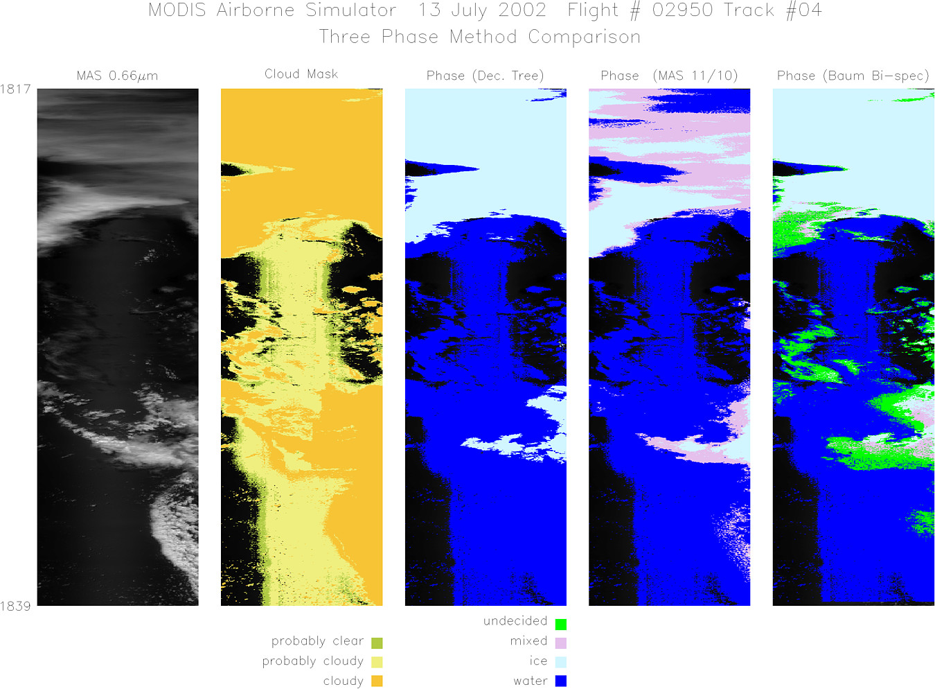
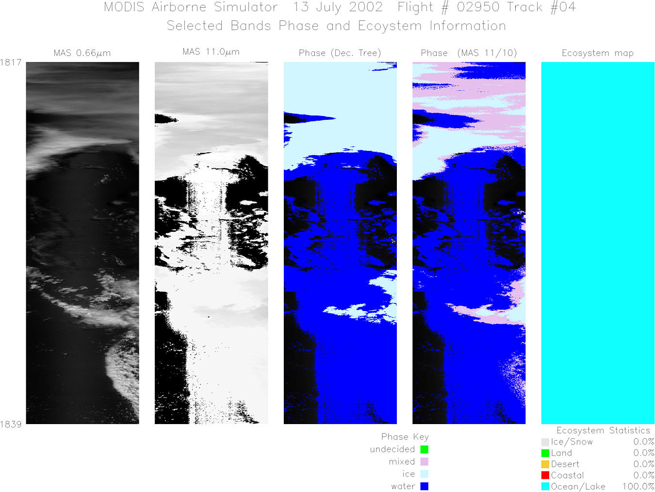
Track #04 Gulf of Mexico |


|
|
R: 1.64µm G: 0.66µm B: 1.90µm |
|
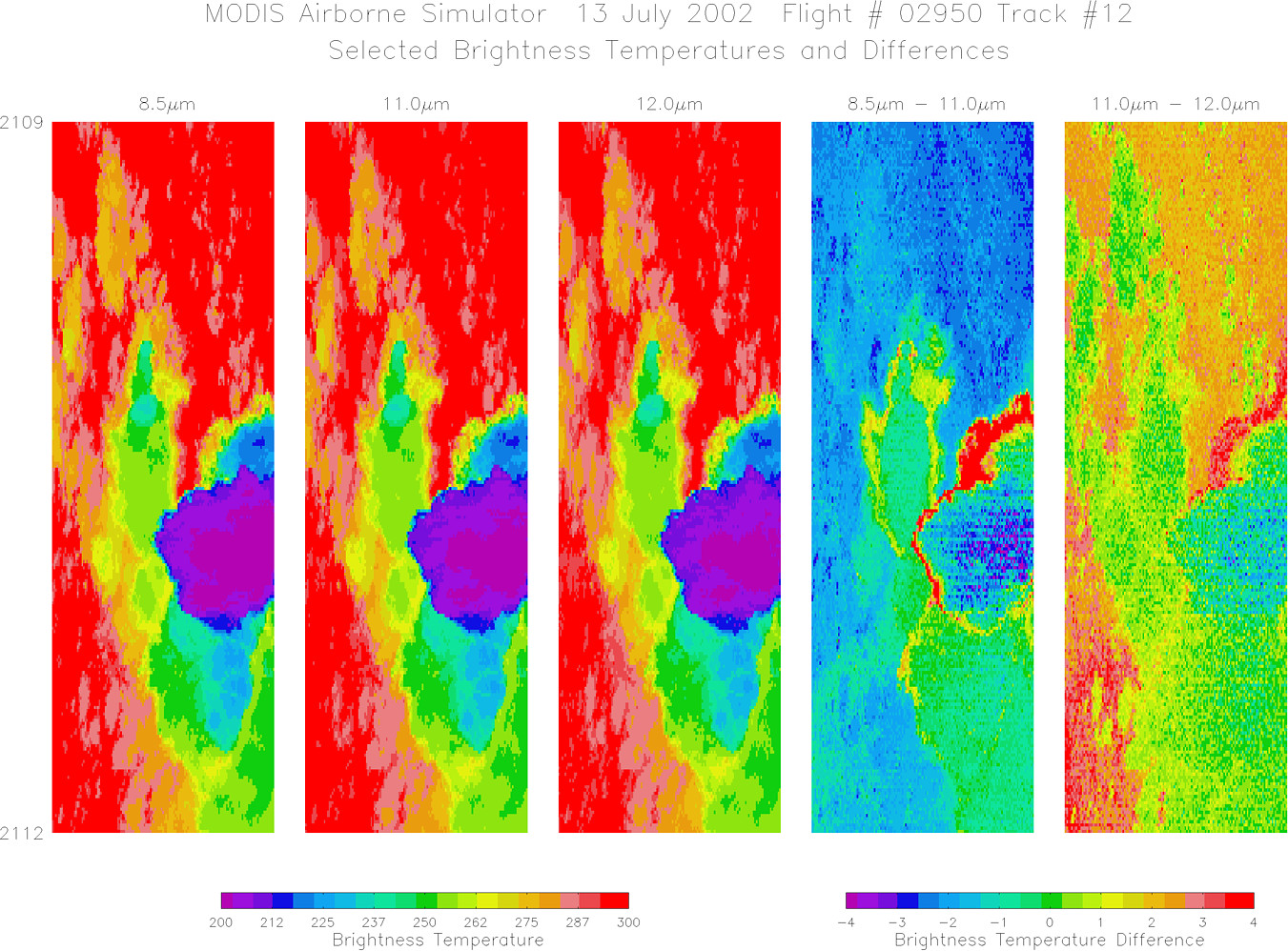
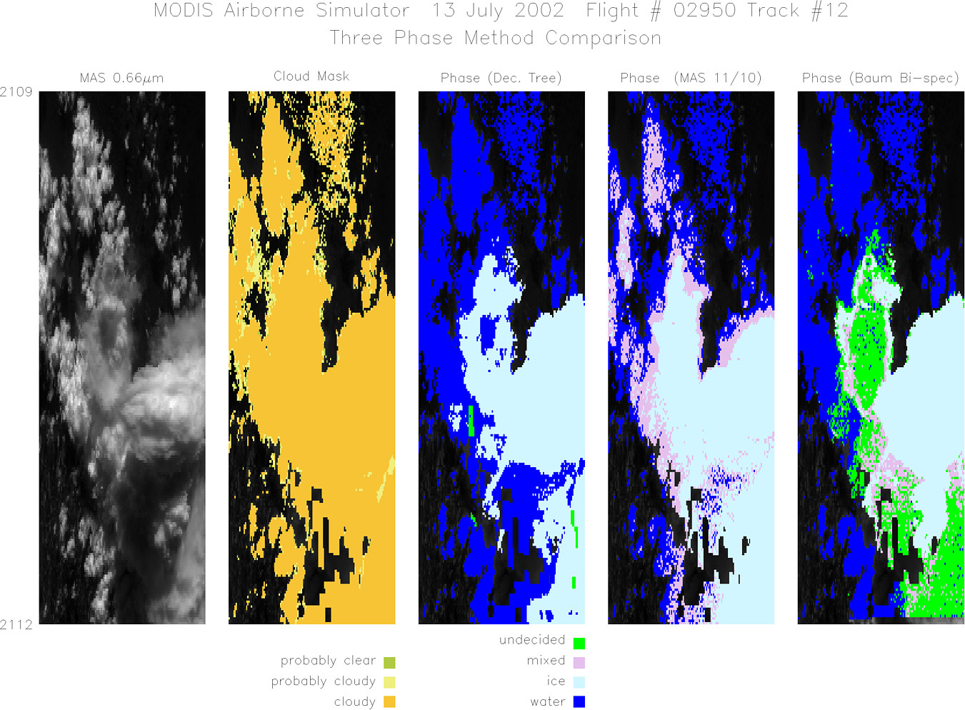
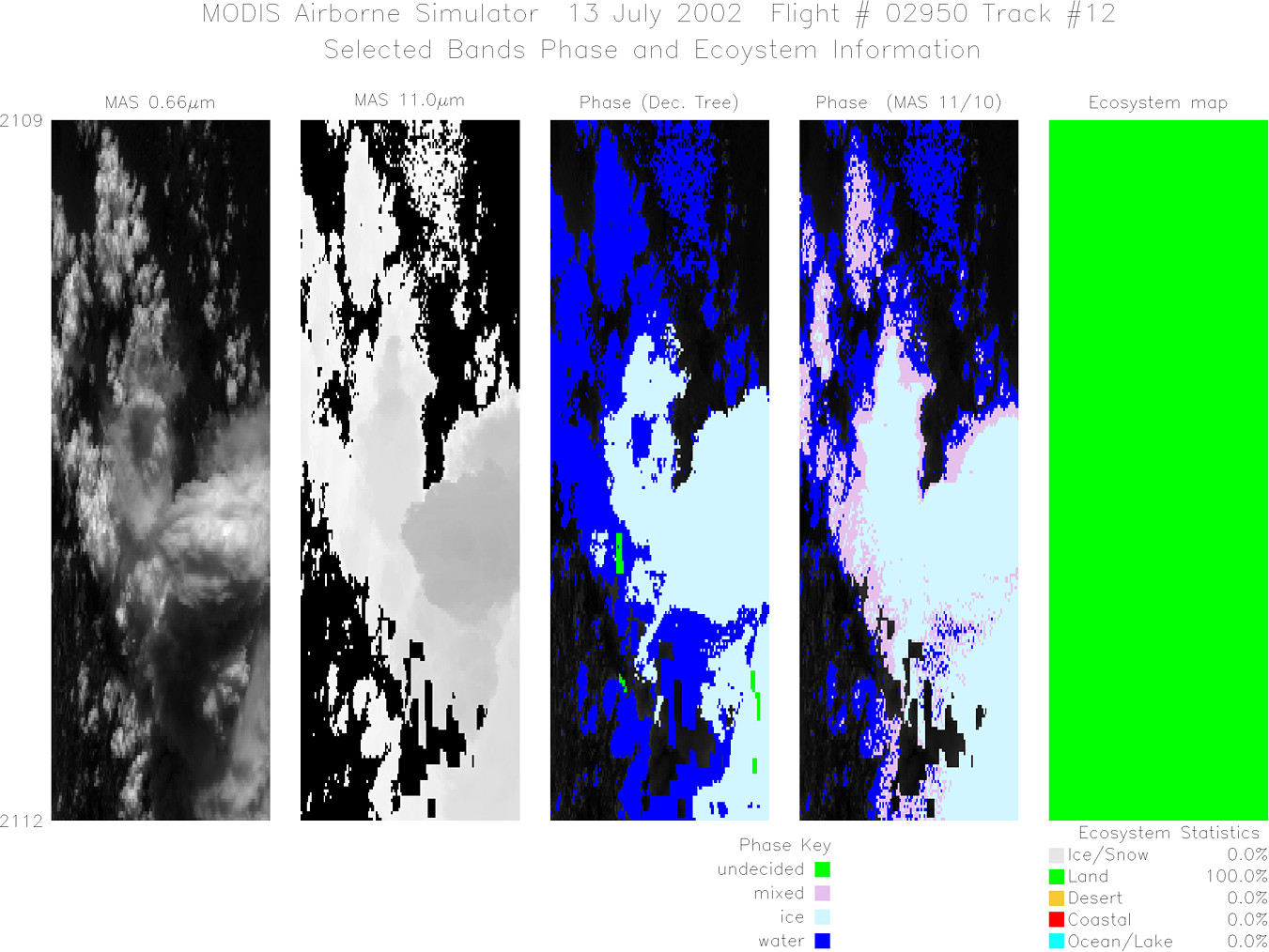
Track #12 Southern Florida |

|
|
R: 1.64µm G: 0.66µm B: 1.90µm |
|
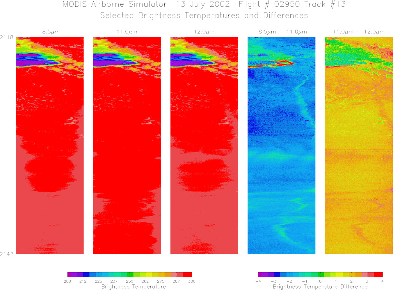
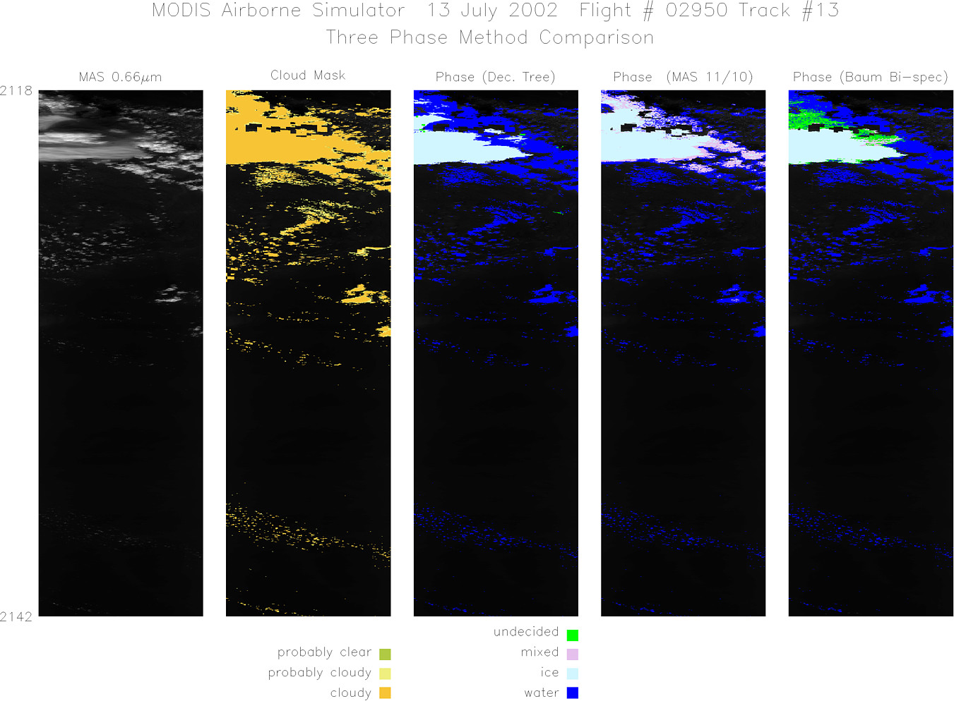
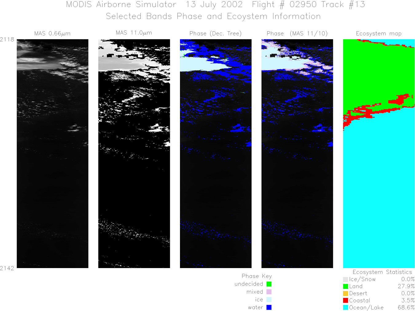
Track #13 Southern Florida (Proteus visible below) |

|
|
R: 1.64µm G: 0.66µm B: 1.90µm |
- NASA Official: Matt Fladeland
- Project Manager: James Jacobson
- Website Editor: Eric Fraim
- Last Updated: November 16, 2021


