


MODIS Airborne Simulator (MAS)
FLIGHT SUMMARY INFORMATION


|
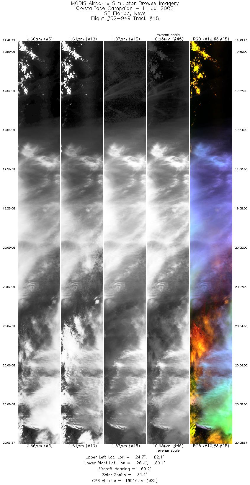
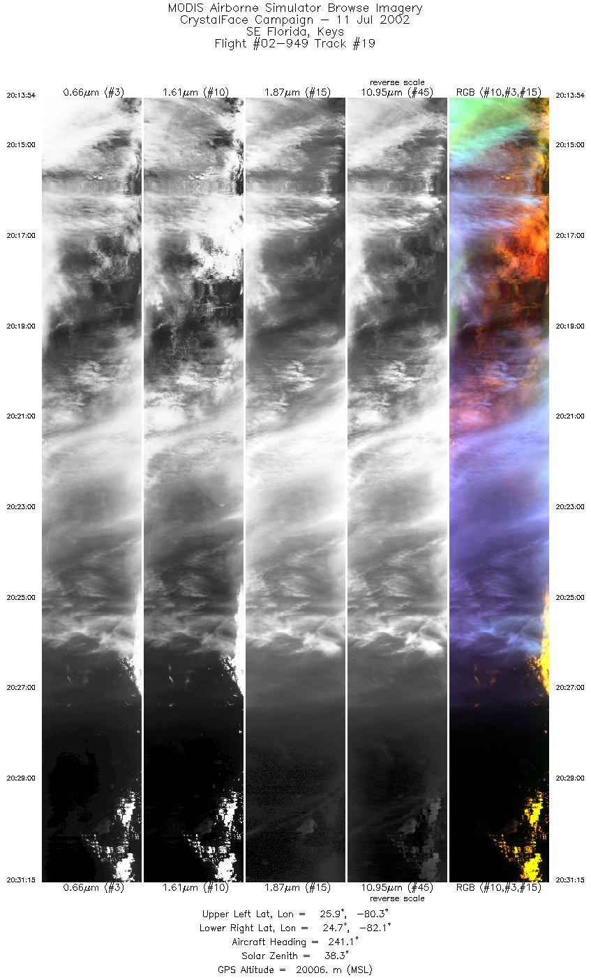
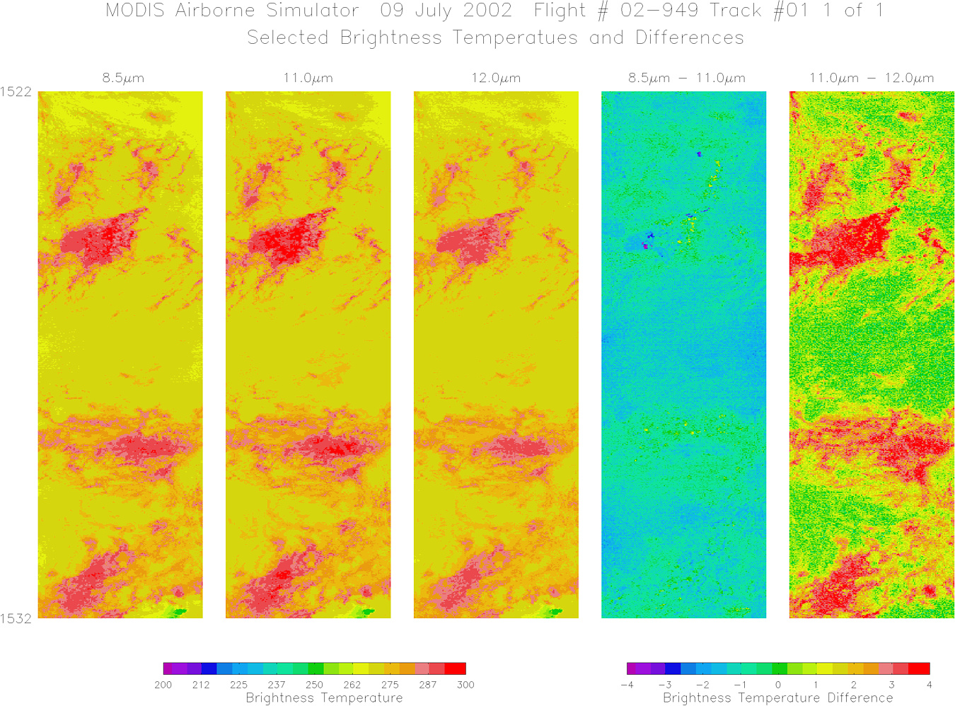
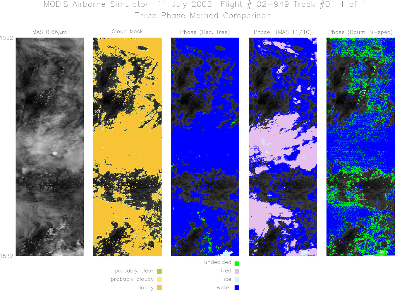
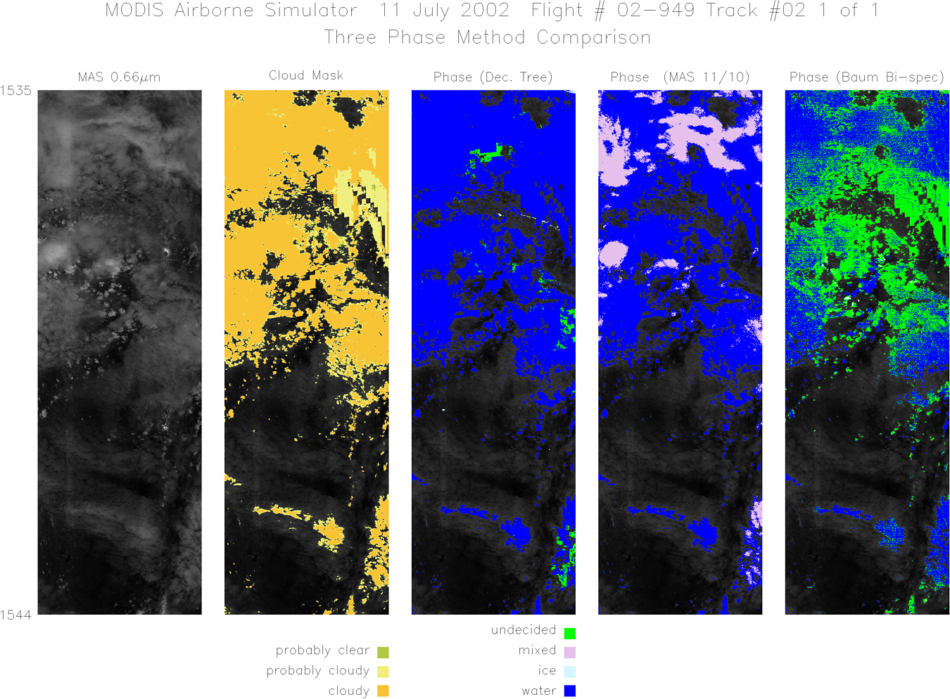
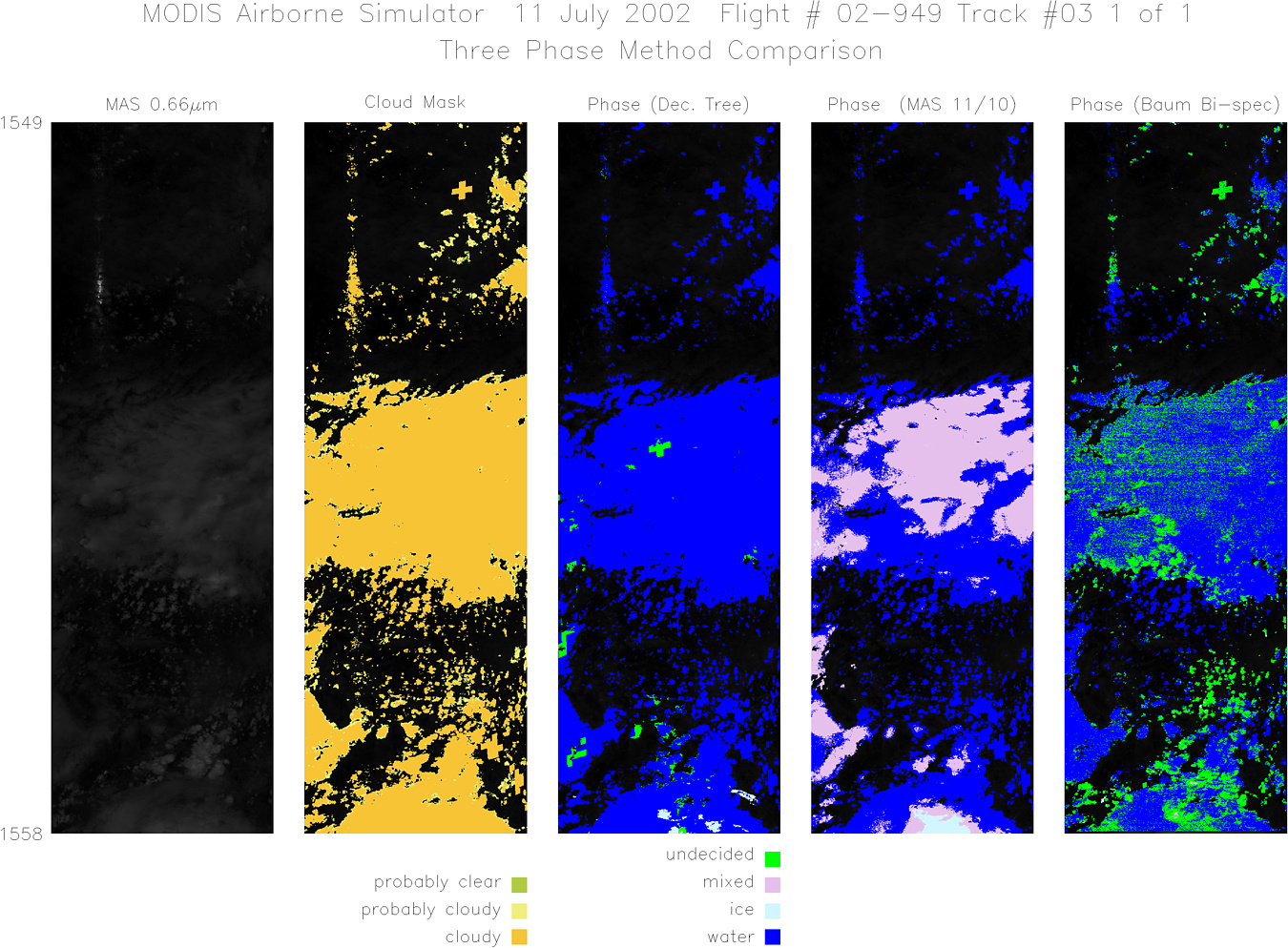
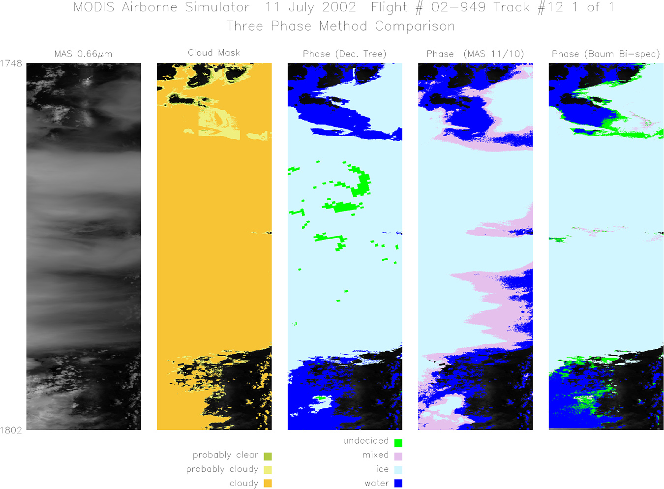
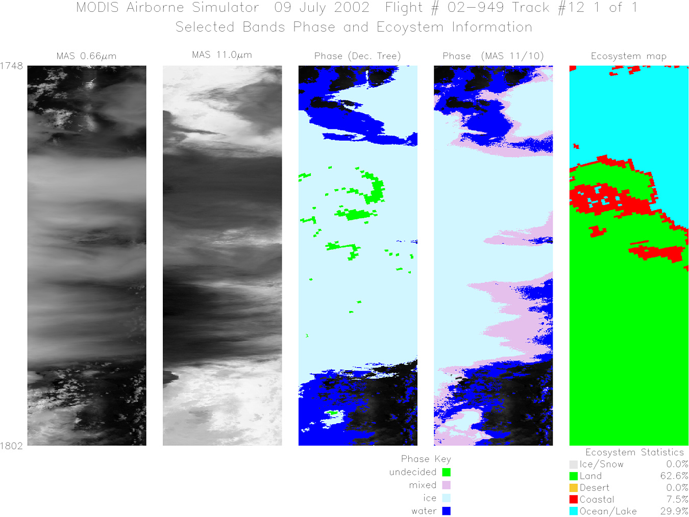
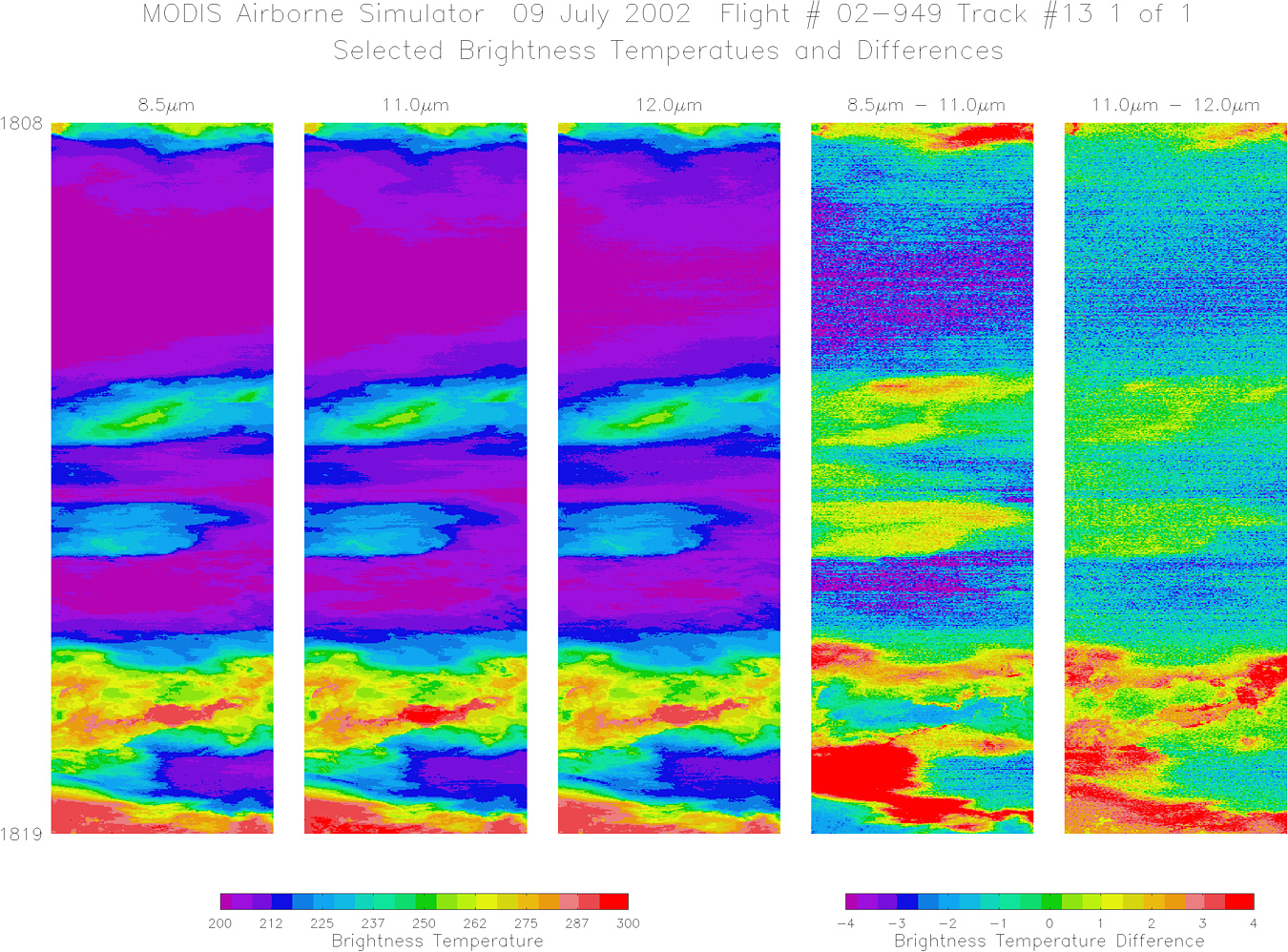
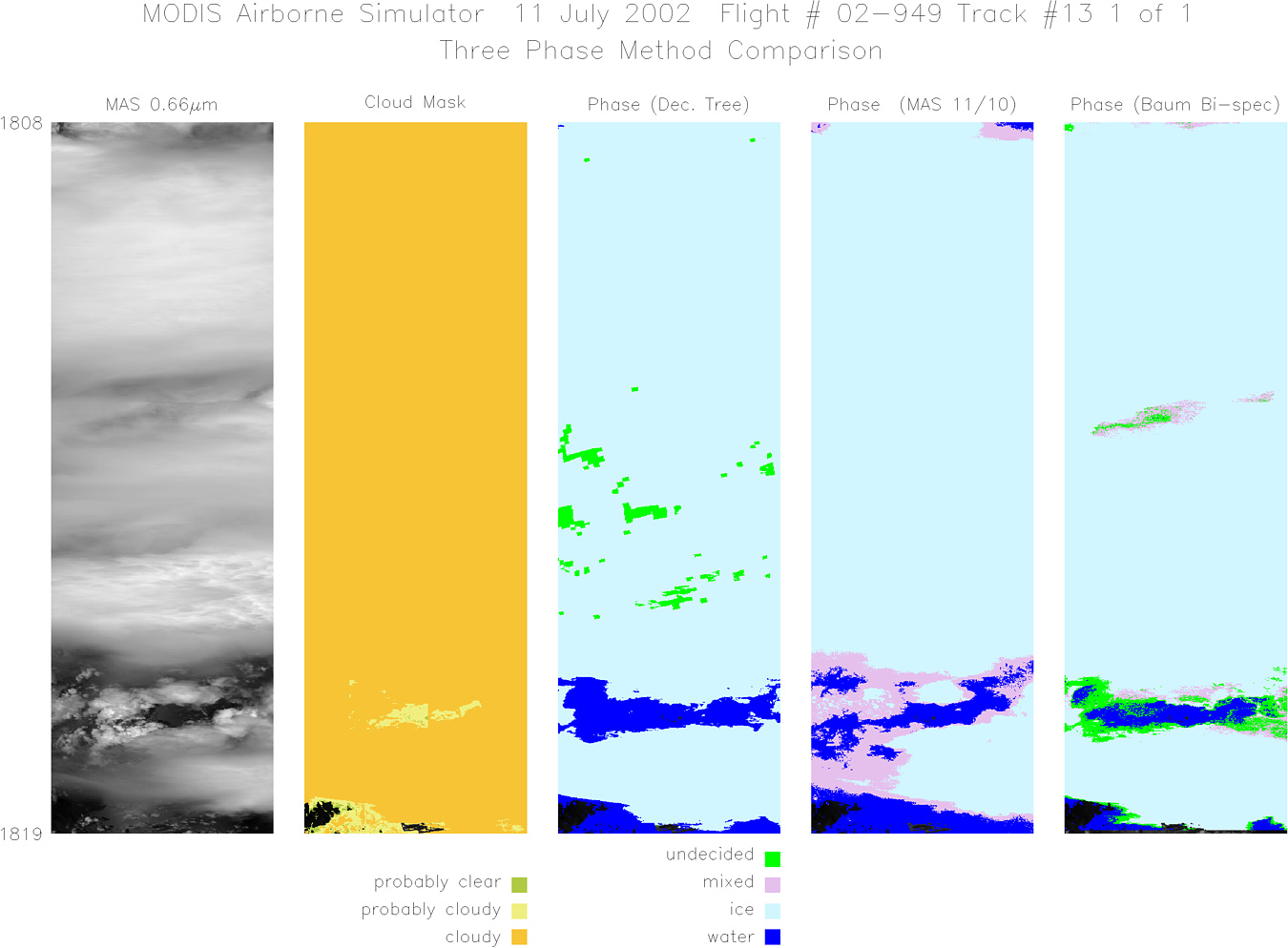
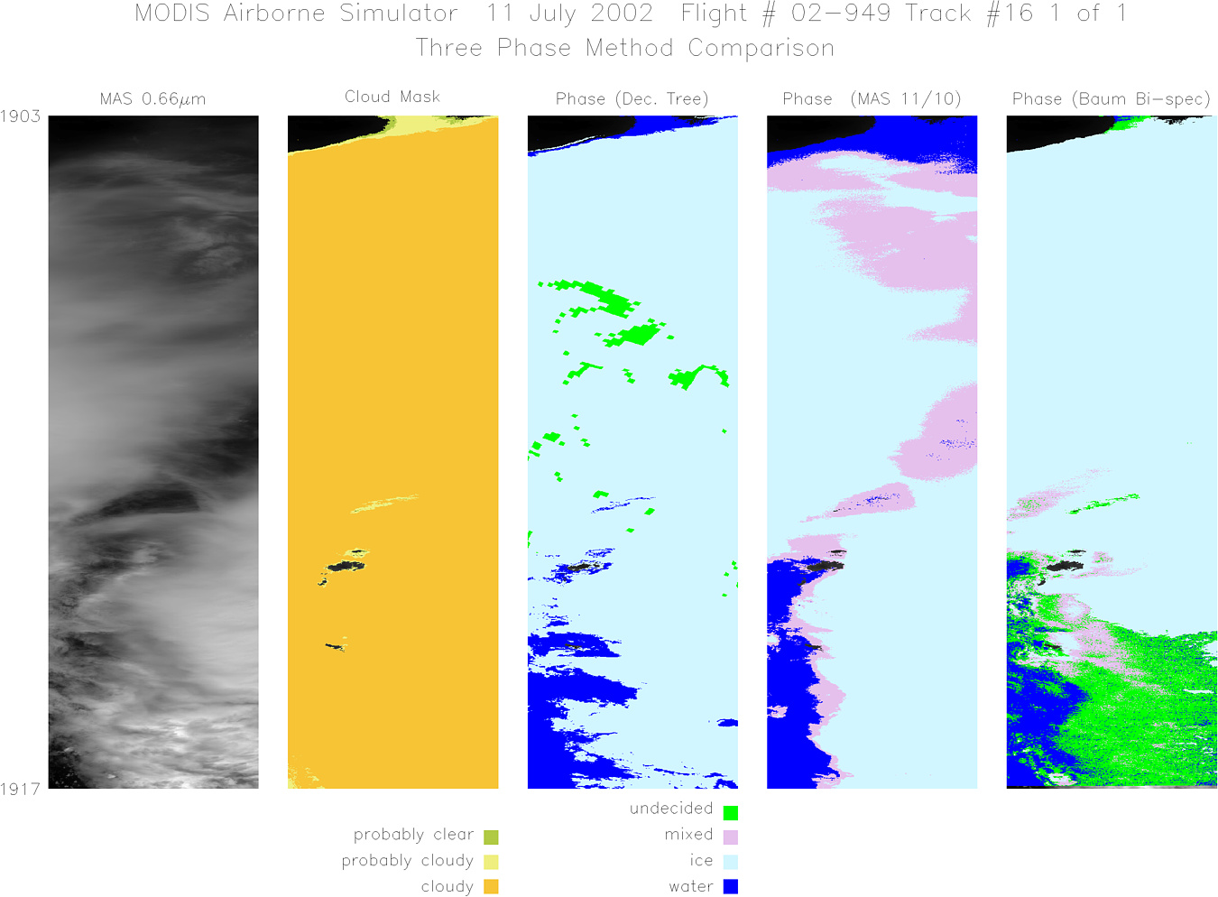
Flight: 02-949 Date: 11 July 2002 Location: Gulf of Mexico / Florida / Atlantic Ocean Deployment: CRYSTAL-FACE Principal Investigators: Drs. Michael King & Steven Platnick (NASA GSFC) Additional Sensors: CoSSIR, CPL, CRS, Dropsondes, EDOP, MMS, MTP, RAMS, SSFR |
|||||||||||||||||||||||||||||||||||||||||||||||||||||||||||||||||||||||||||||||||||||||||||||||||||||||||||||||||||||||||||||||||||||||||||||||||||||||||||||||||
|
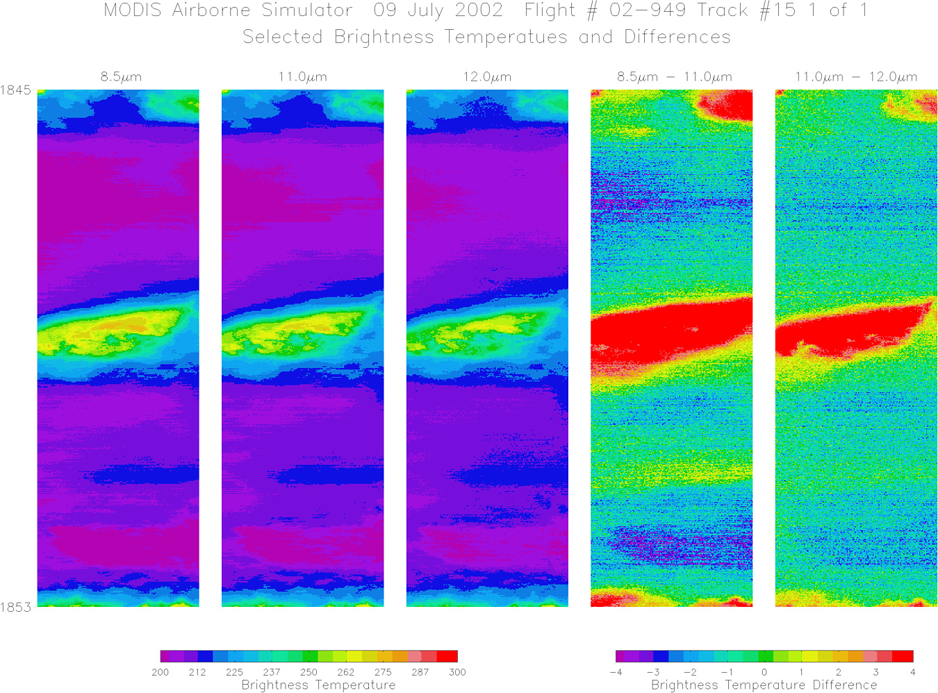
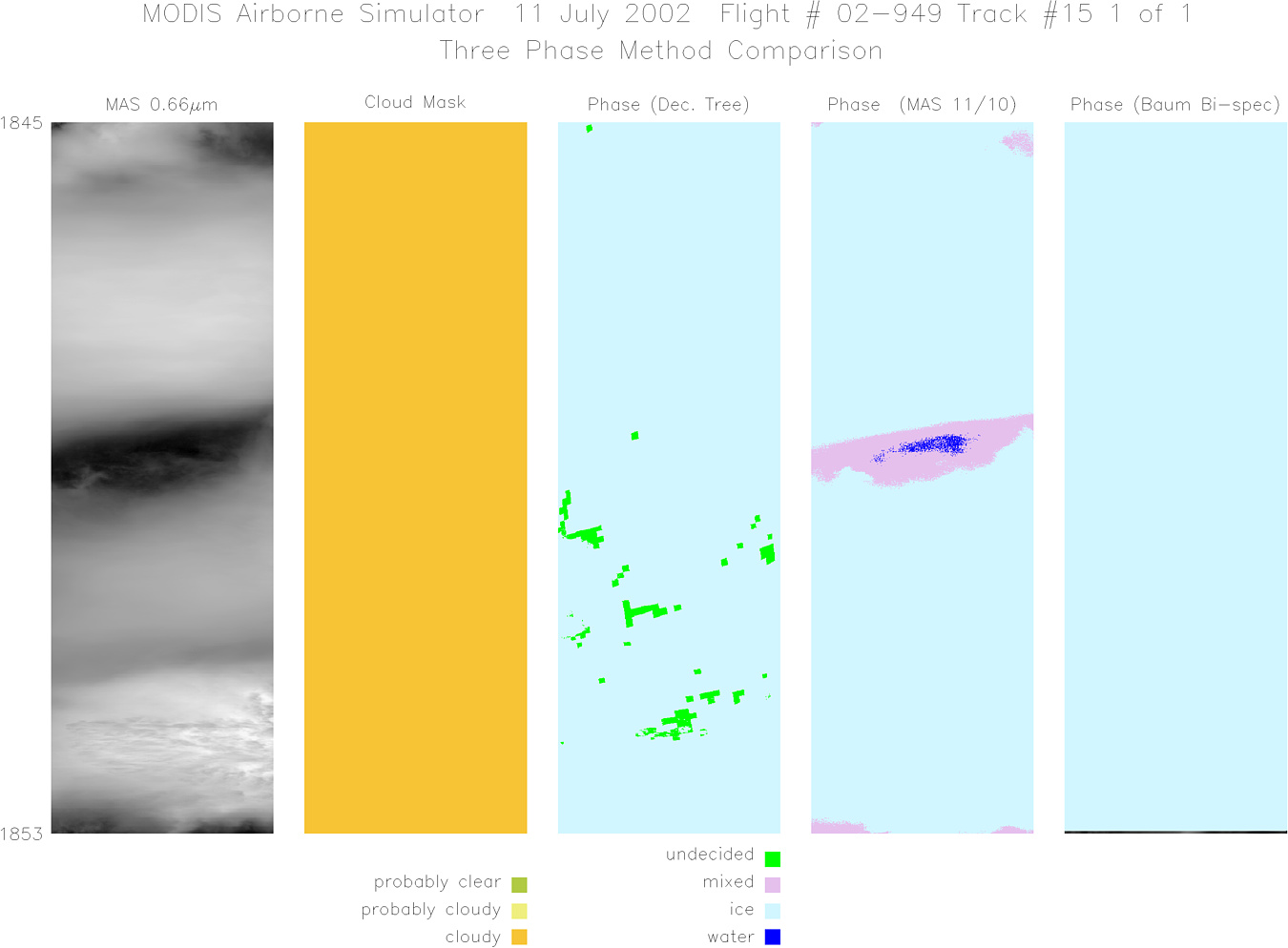
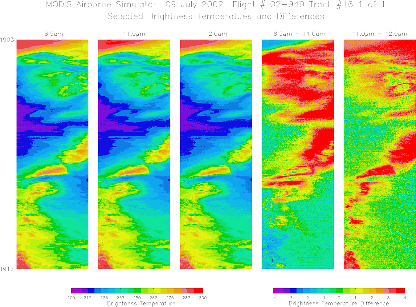
Data Evaluation Overall quality is good Numerous dropped scanlines towards the end of flight AQUA Underflight @ 19:22 TERRA Underflight @ 16:15 |
|||||||||||||||||||||||||||||||||||||||||||||||||||||||||||||||||||||||||||||||||||||||||||||||||||||||||||||||||||||||||||||||||||||||||||||||||||||||||||||||||
|
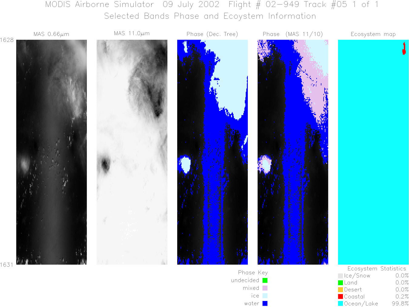
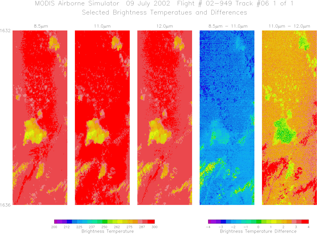
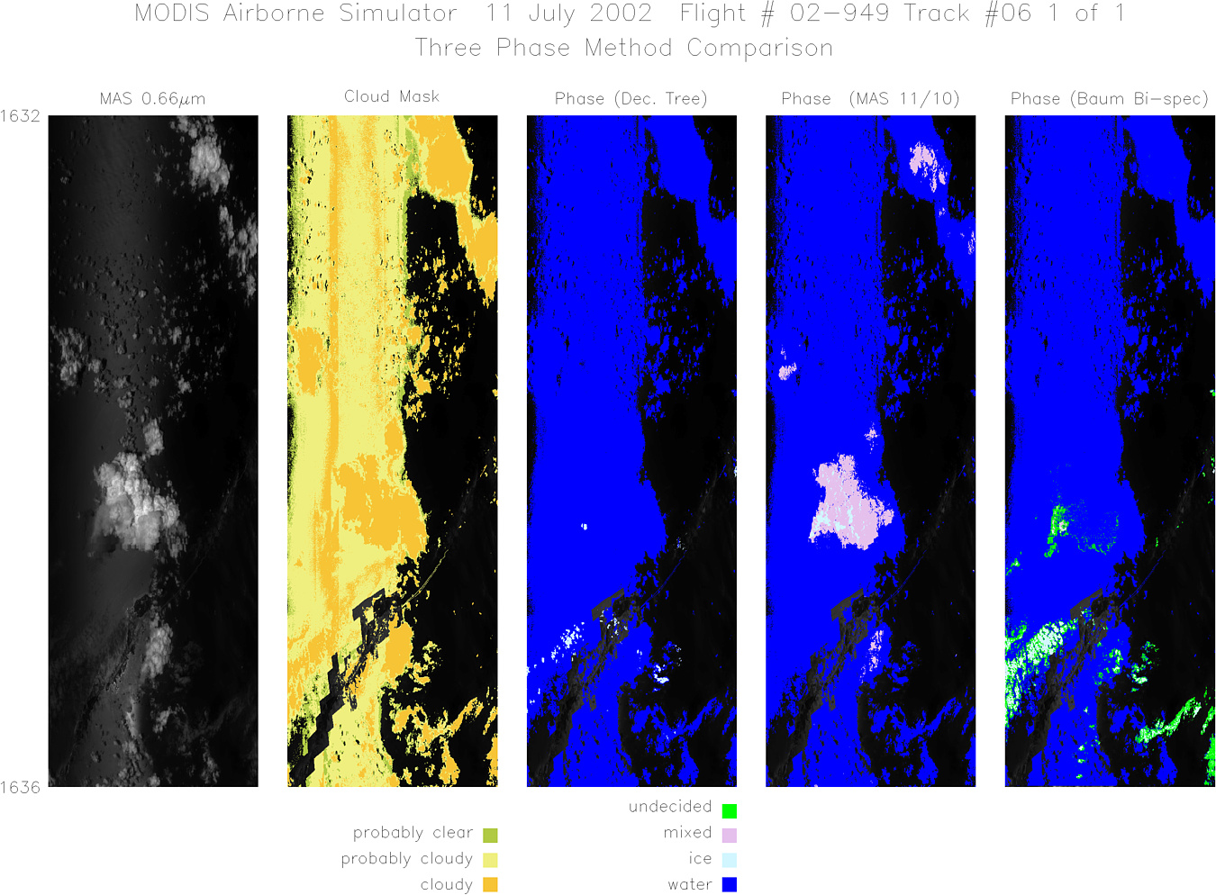
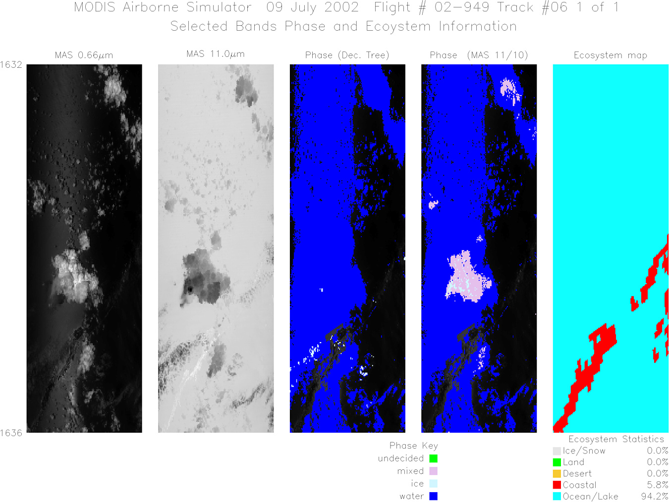
Processing Information Level-1B Data in HDF format is available Flight Line Summary Spectral Band Configuration Spectral Response Function Table |
|||||||||||||||||||||||||||||||||||||||||||||||||||||||||||||||||||||||||||||||||||||||||||||||||||||||||||||||||||||||||||||||||||||||||||||||||||||||||||||||||
|
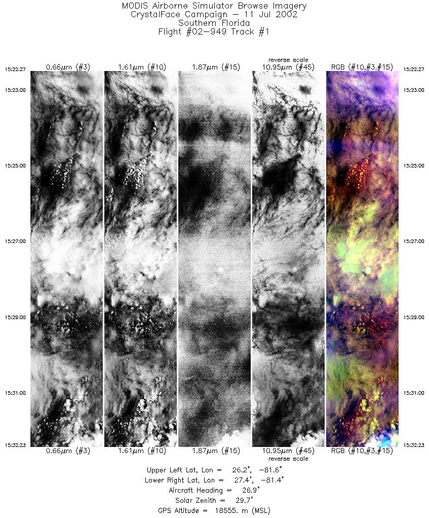
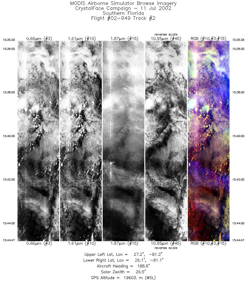
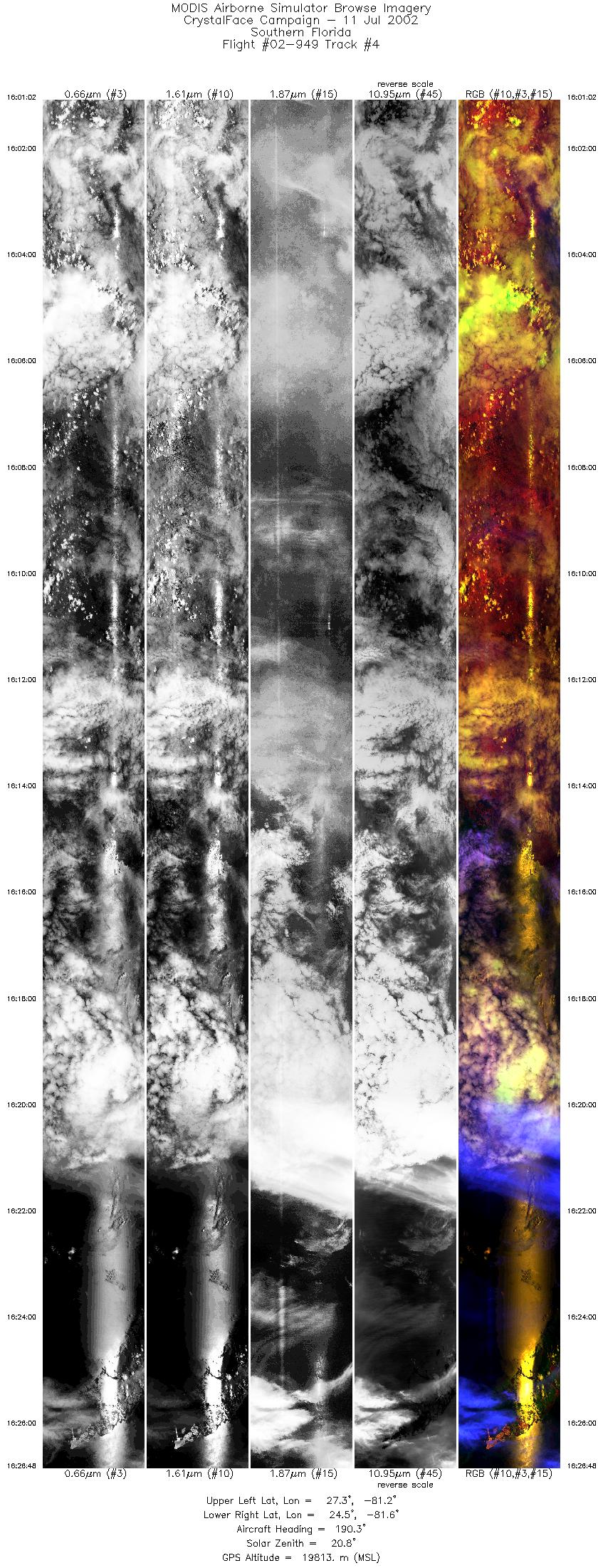
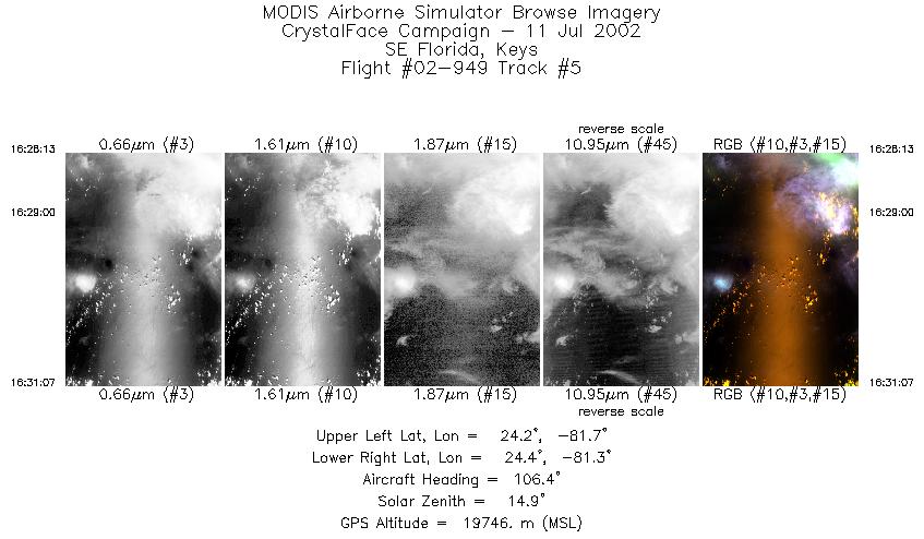
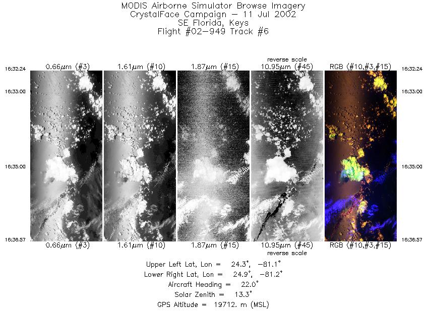
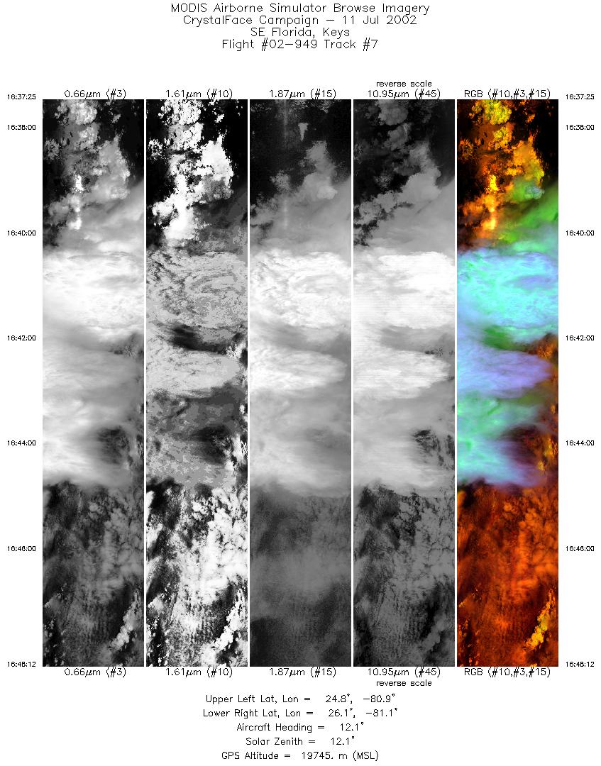
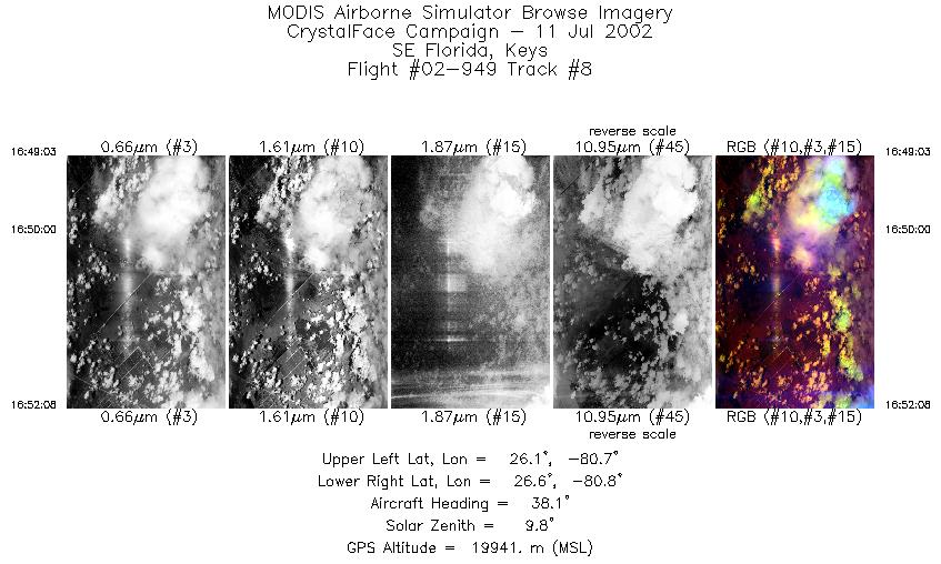
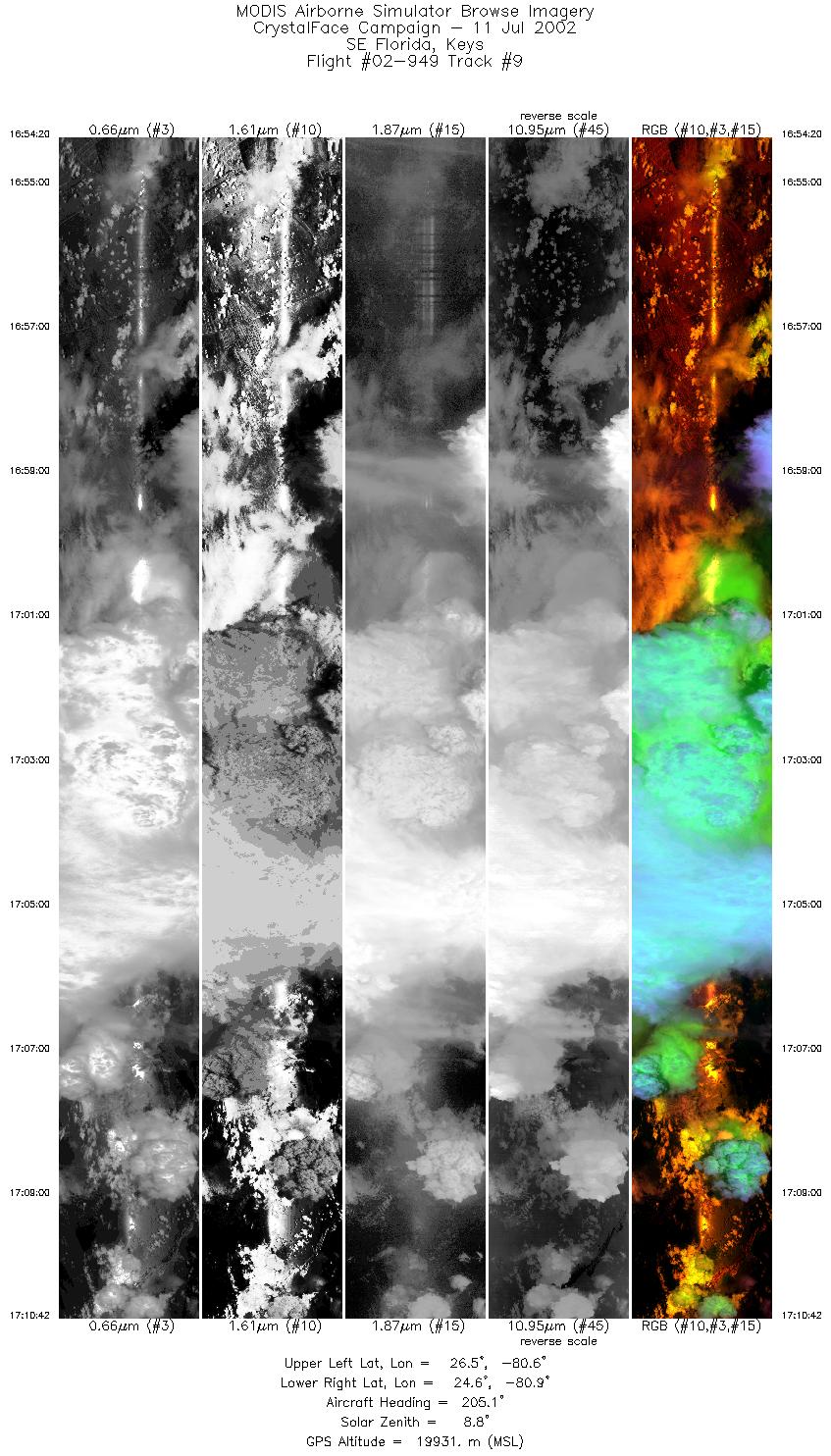
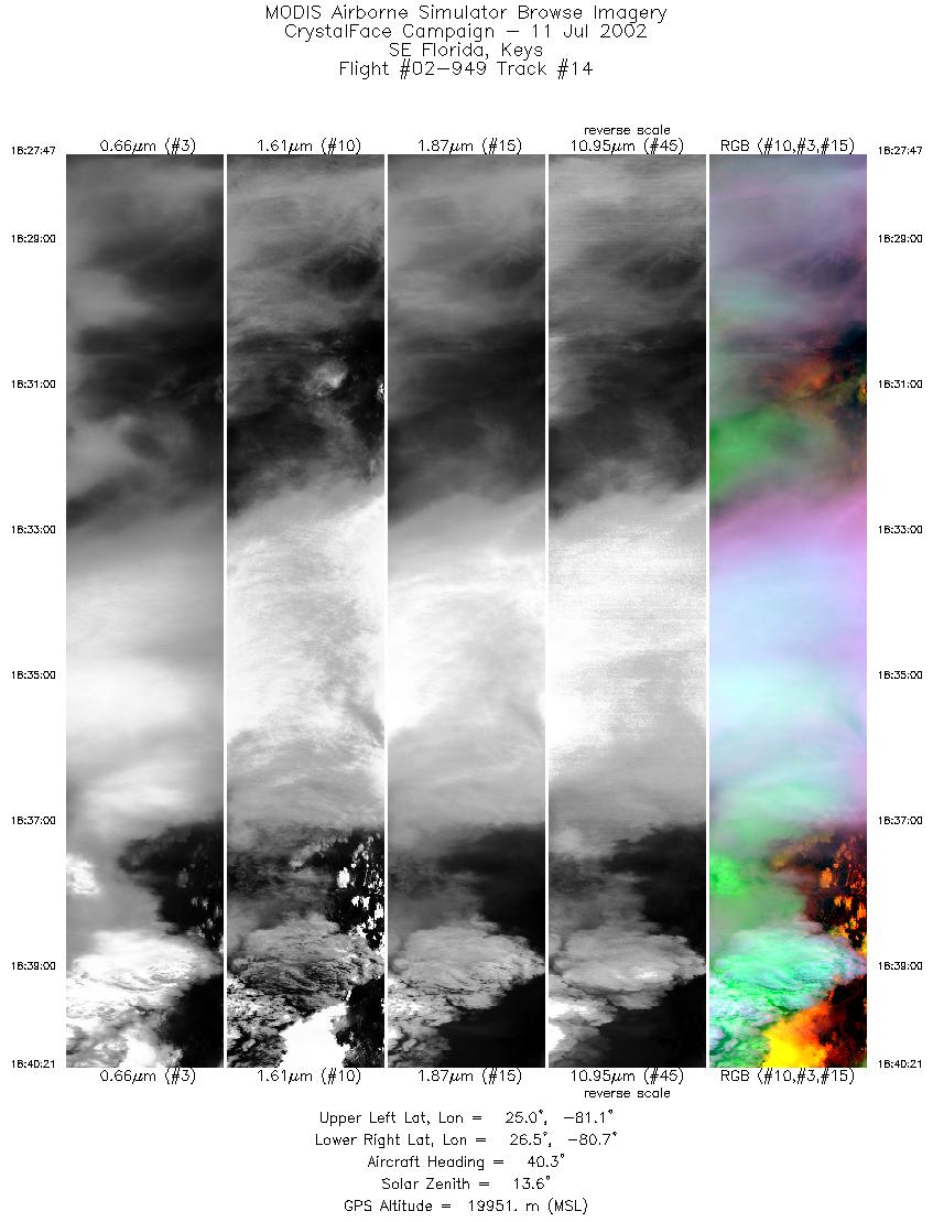
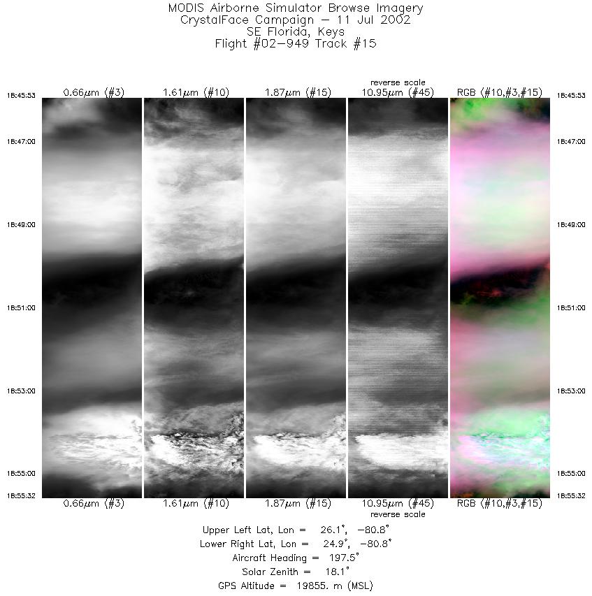
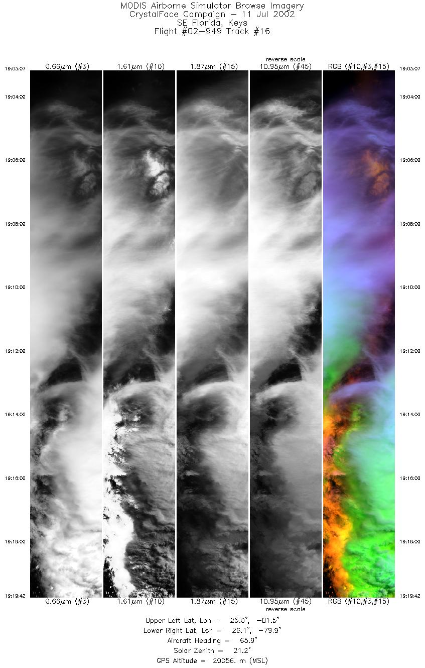
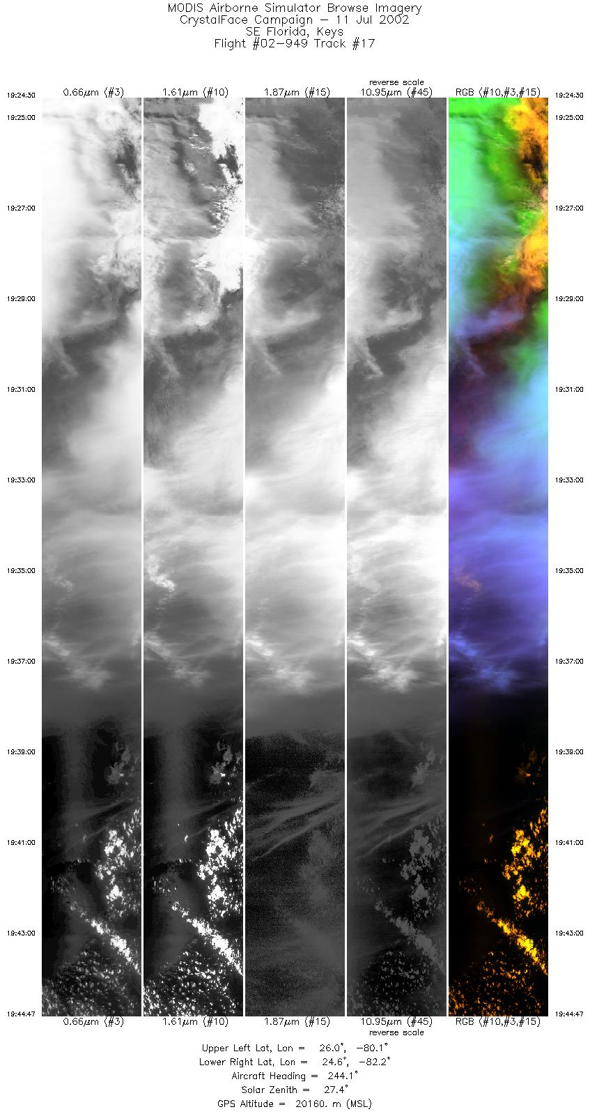
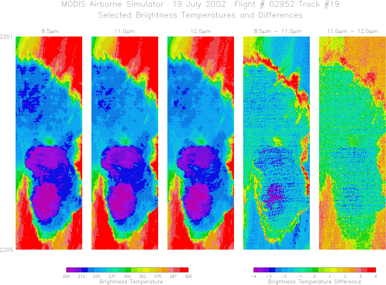
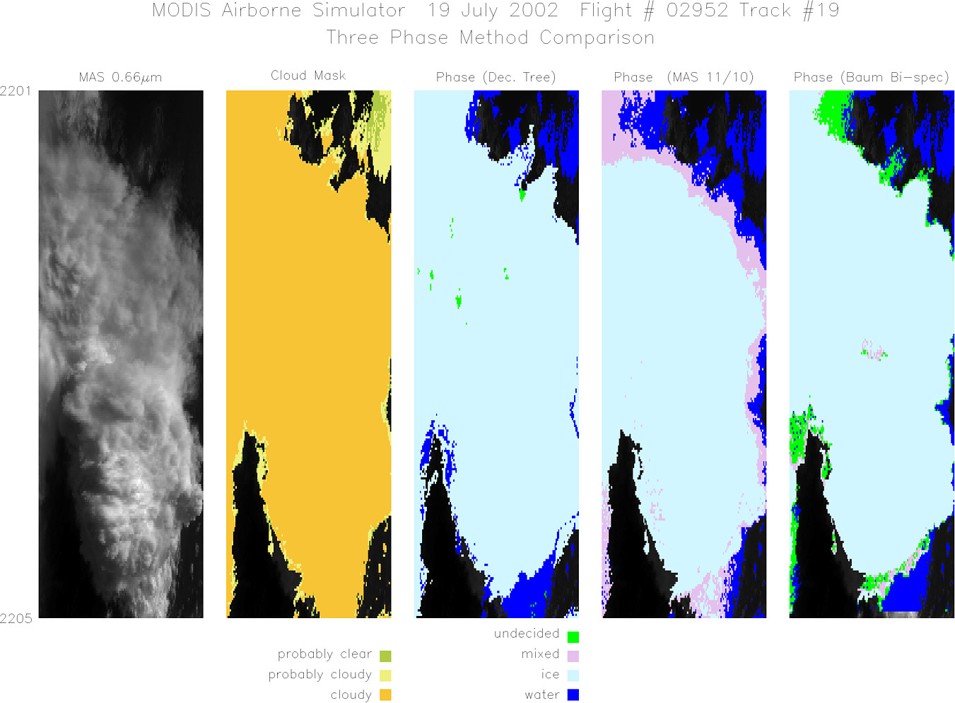
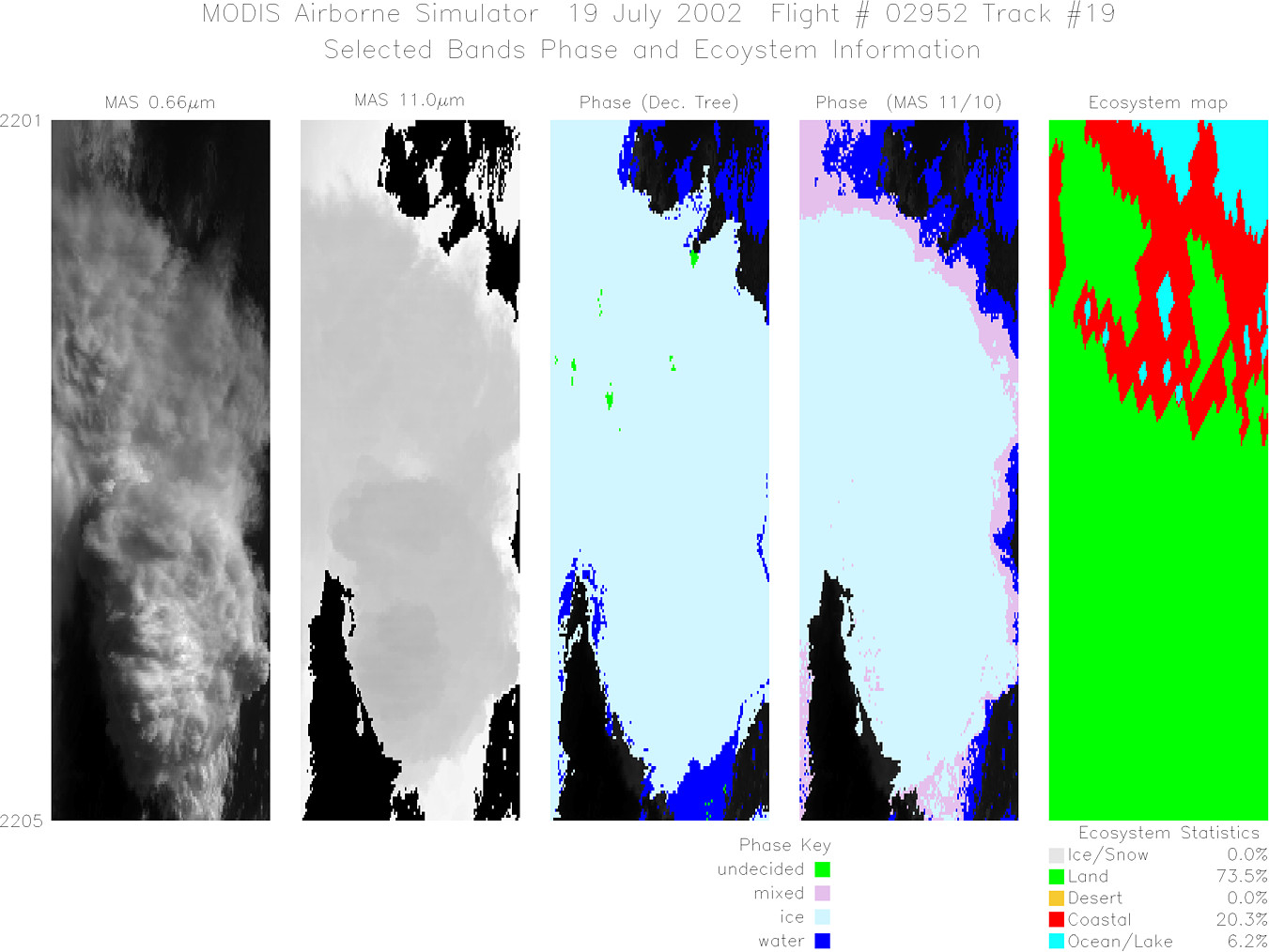
Browse Imagery Flight Tracks: 19 Scanlines: 92829 |
|||||||||||||||||||||||||||||||||||||||||||||||||||||||||||||||||||||||||||||||||||||||||||||||||||||||||||||||||||||||||||||||||||||||||||||||||||||||||||||||||
|
|||||||||||||||||||||||||||||||||||||||||||||||||||||||||||||||||||||||||||||||||||||||||||||||||||||||||||||||||||||||||||||||||||||||||||||||||||||||||||||||||
|
Flight Summary Report Mission Number: 4 Mission Scientists: S. Platnick, P. Newman ER-2 Pilot: K. Broda Takeoff: 1500 (UTC) Landing: 2120 (UTC) Duration: 6:20 (h:mm) Overfly western site along a southwest heading coincident with TERRA overpass (1615 UTC) along with WB-57, Citation, Proteus,Twin Otter, and P-3. Continue to overfly anvils/cores along western coast with direction from NPOL. Sea breeze expected over the western coast with relatively light NE winds aloft. After TERRA legs, ER-2 was directed to work along the central axis of the peninsula. Ended mission on series of southwest-northeast legs across Gulf of Mexico just north of the Florida Keys. The ER-2 flaps were non-functional during descent causing the landing to be fast & hard. Satellite & Ground Site Information
AQUA Overpass @ 1922 (UTC); VZA = 60° (relative to western site)
Western Site: PARSL, Everglades National Park, Gulf Coast Visitor's Center
|
|||||||||||||||||||||||||||||||||||||||||||||||||||||||||||||||||||||||||||||||||||||||||||||||||||||||||||||||||||||||||||||||||||||||||||||||||||||||||||||||||

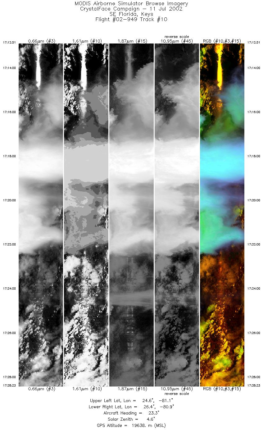
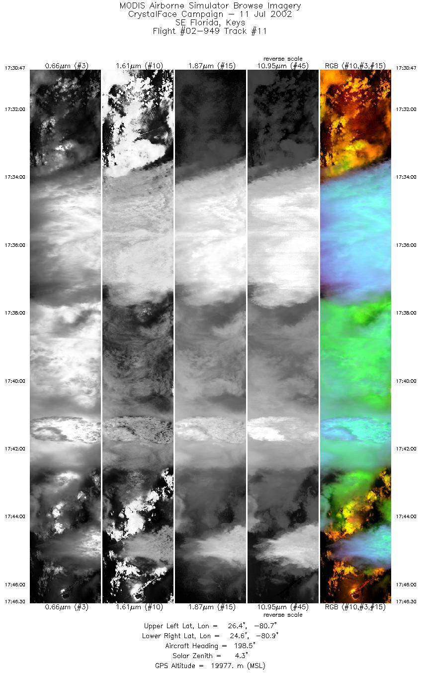
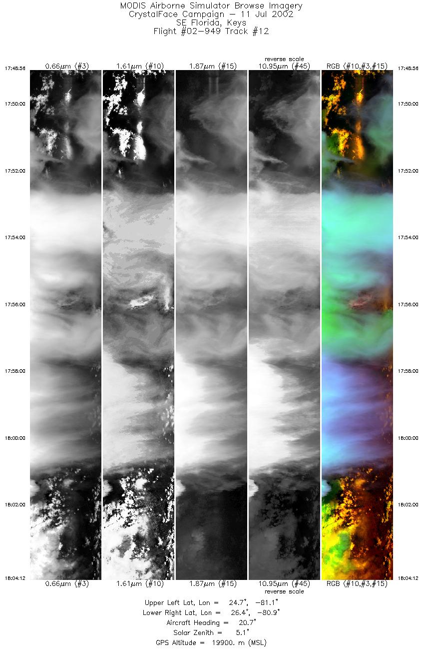
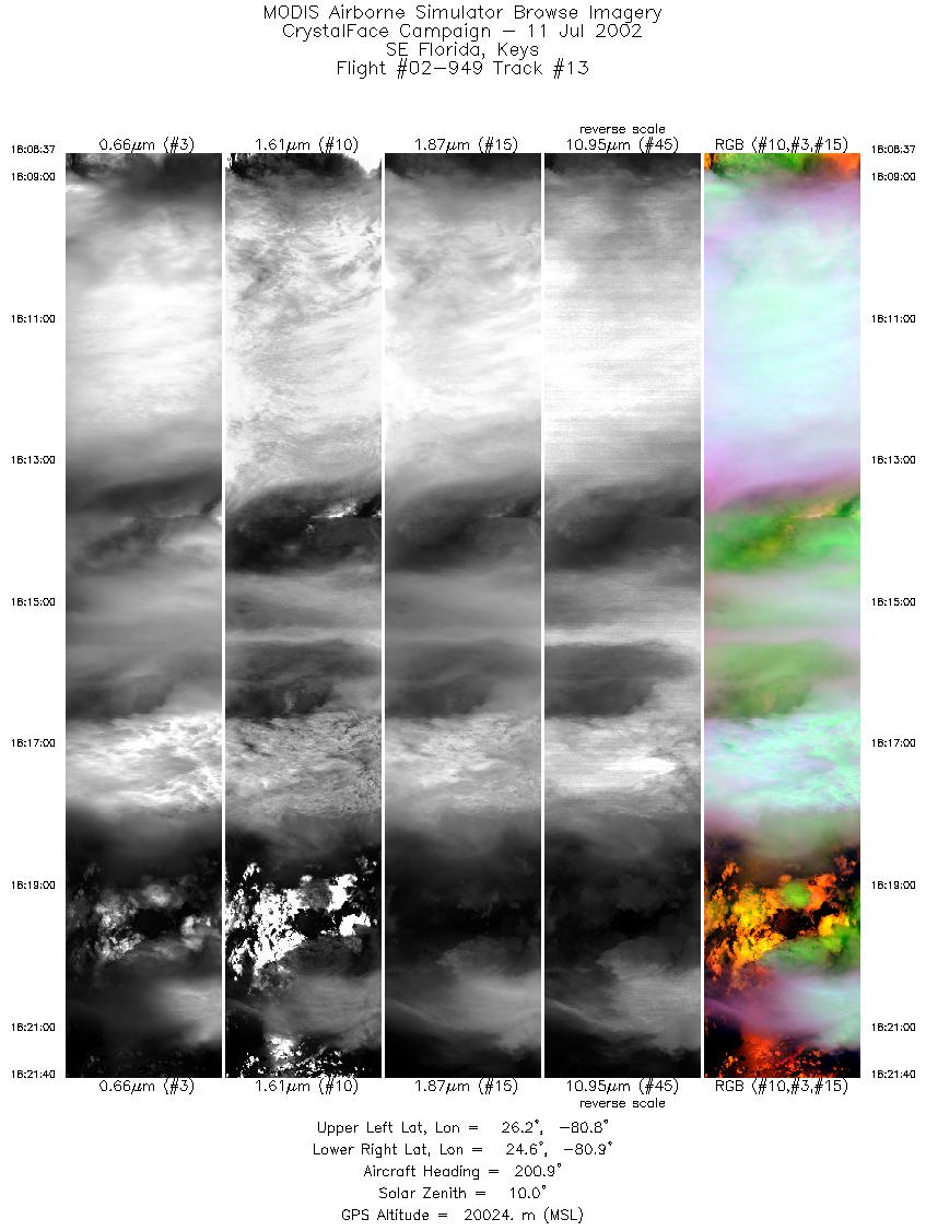
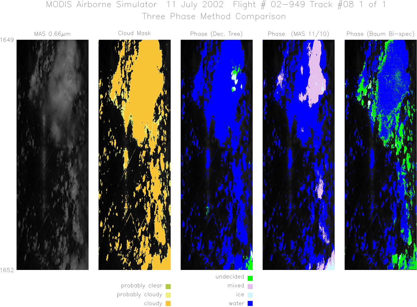
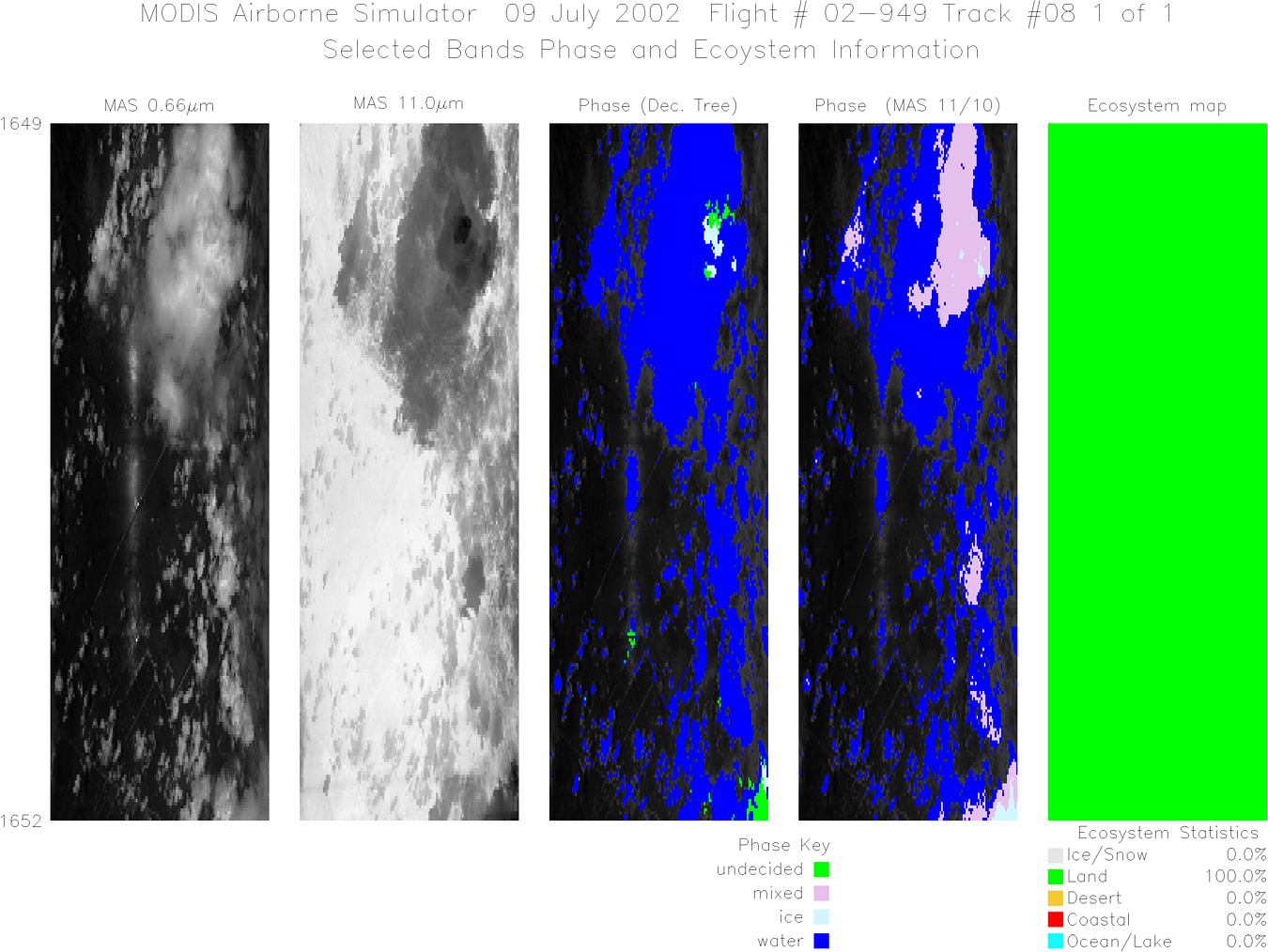
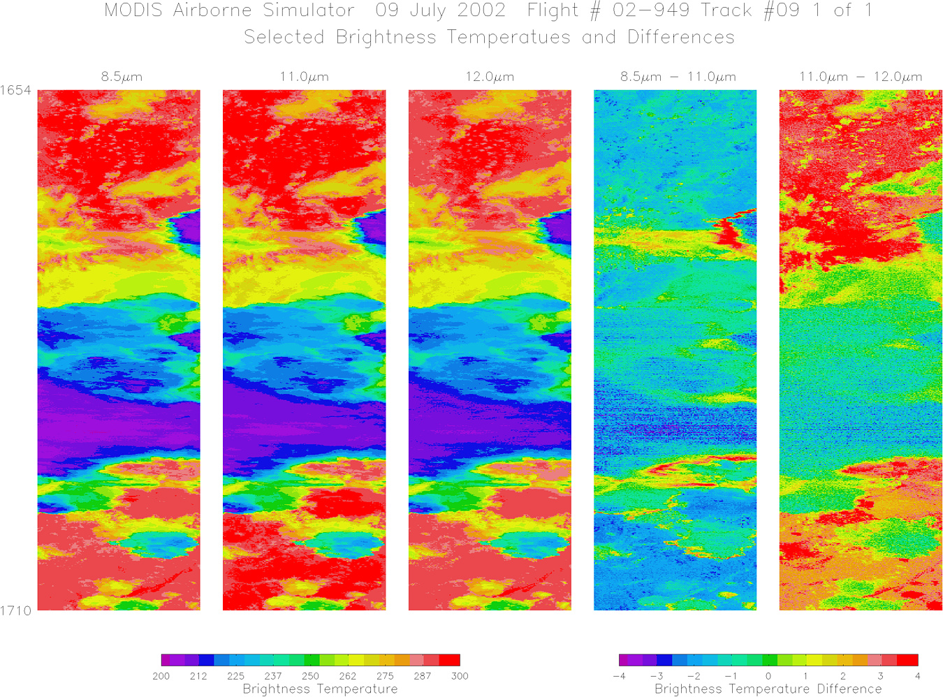
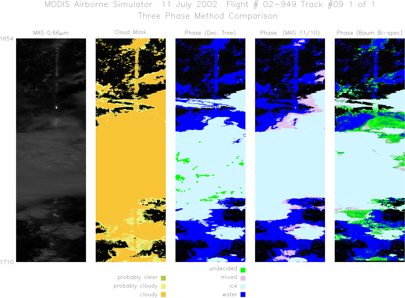
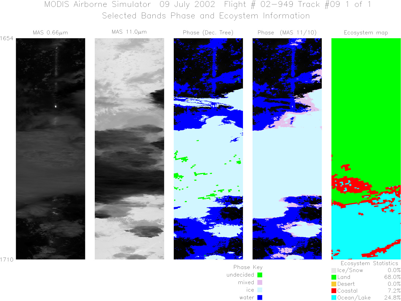
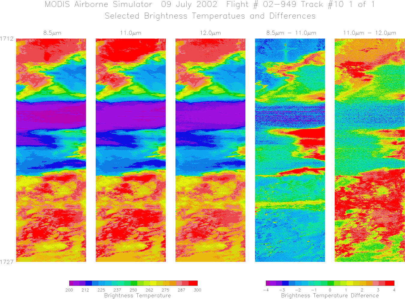
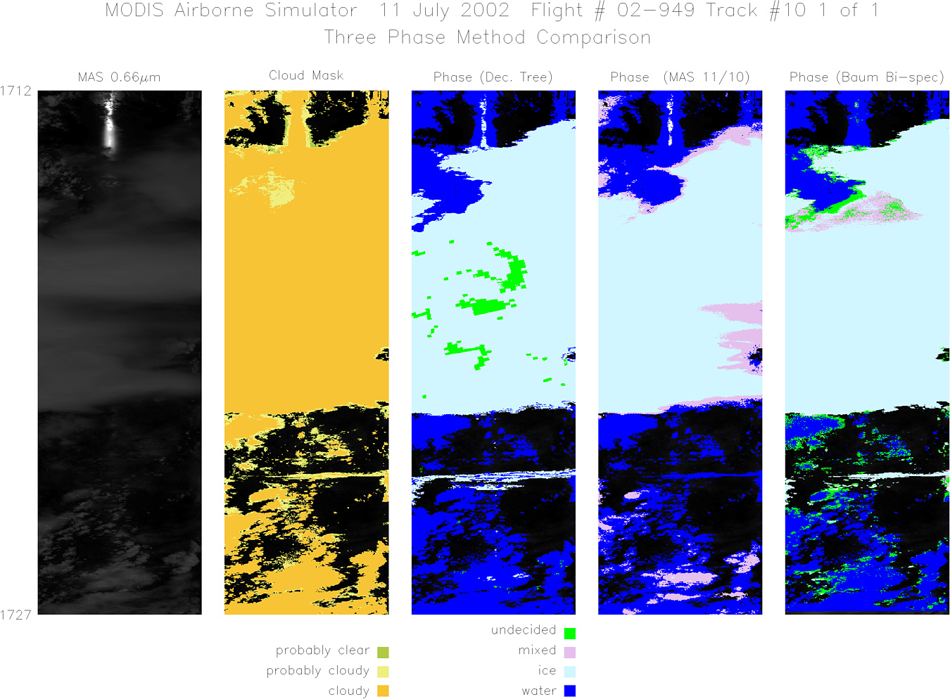
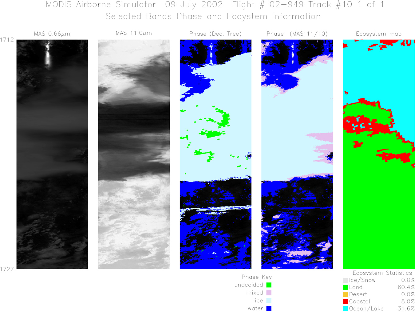
Flight 02-949


| Sample Imagery |
| Click image for full resolution |
|
Track #09 Southern Florida |


|
|
R: 1.64µm G: 0.66µm B: 1.90µm |
|
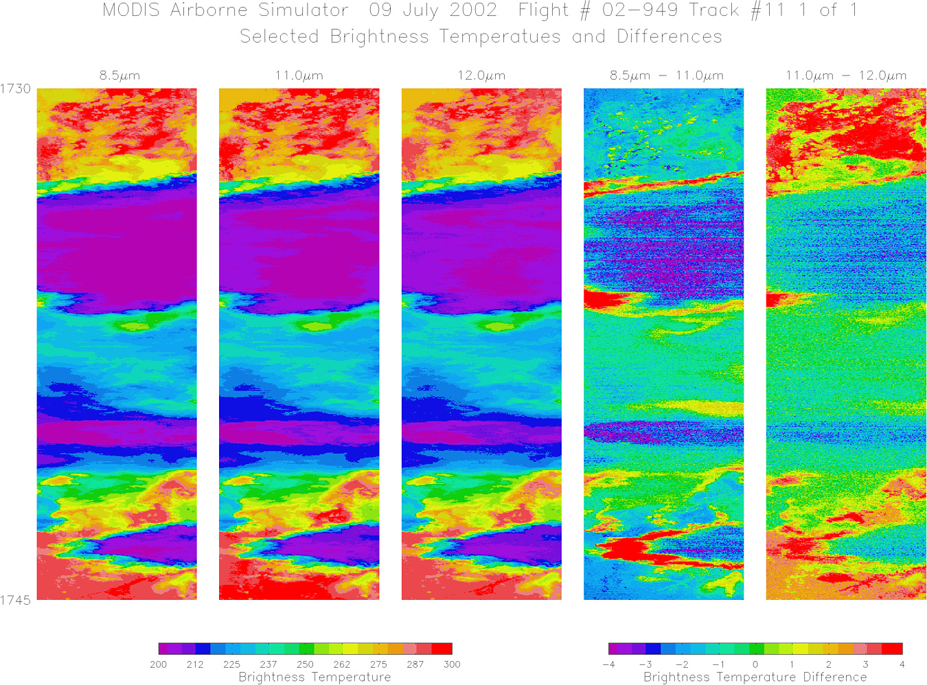
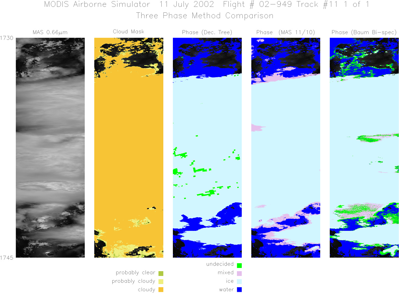
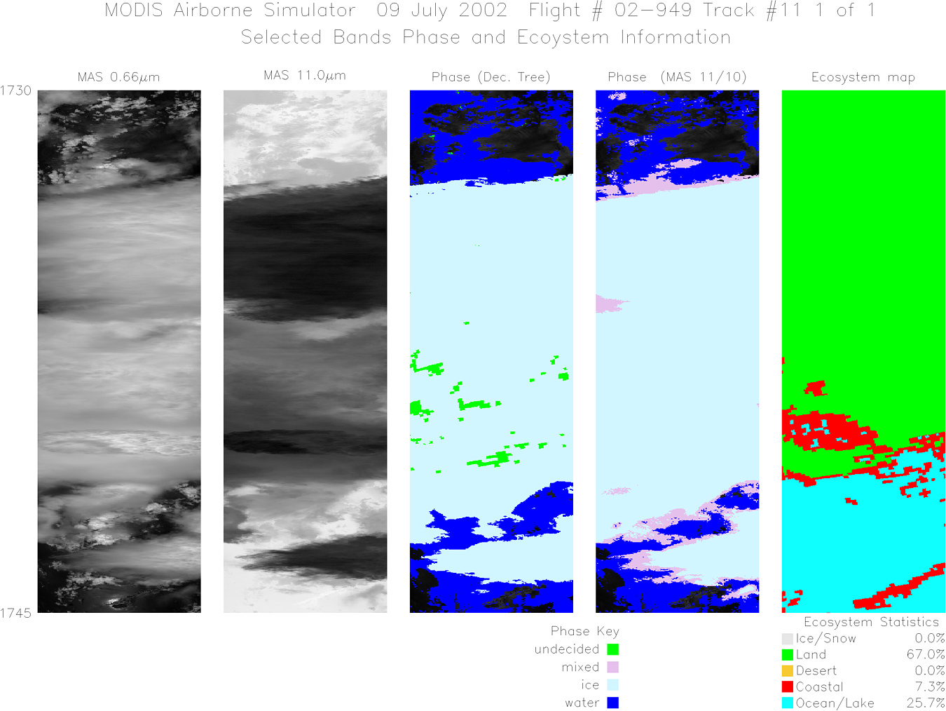
Track #11 Southern Florida |

|
|
R: 1.64µm G: 0.66µm B: 1.90µm |
- NASA Official: Matt Fladeland
- Project Manager: James Jacobson
- Website Editor: Eric Fraim
- Last Updated: November 16, 2021


