


MODIS Airborne Simulator (MAS)
FLIGHT SUMMARY INFORMATION


|
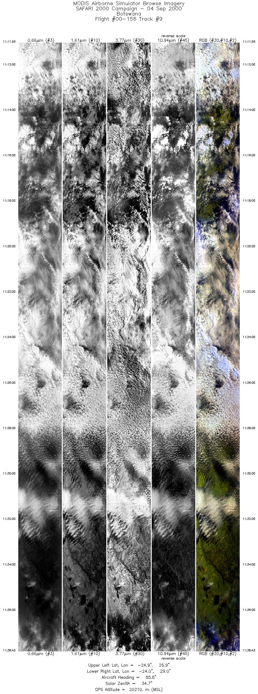
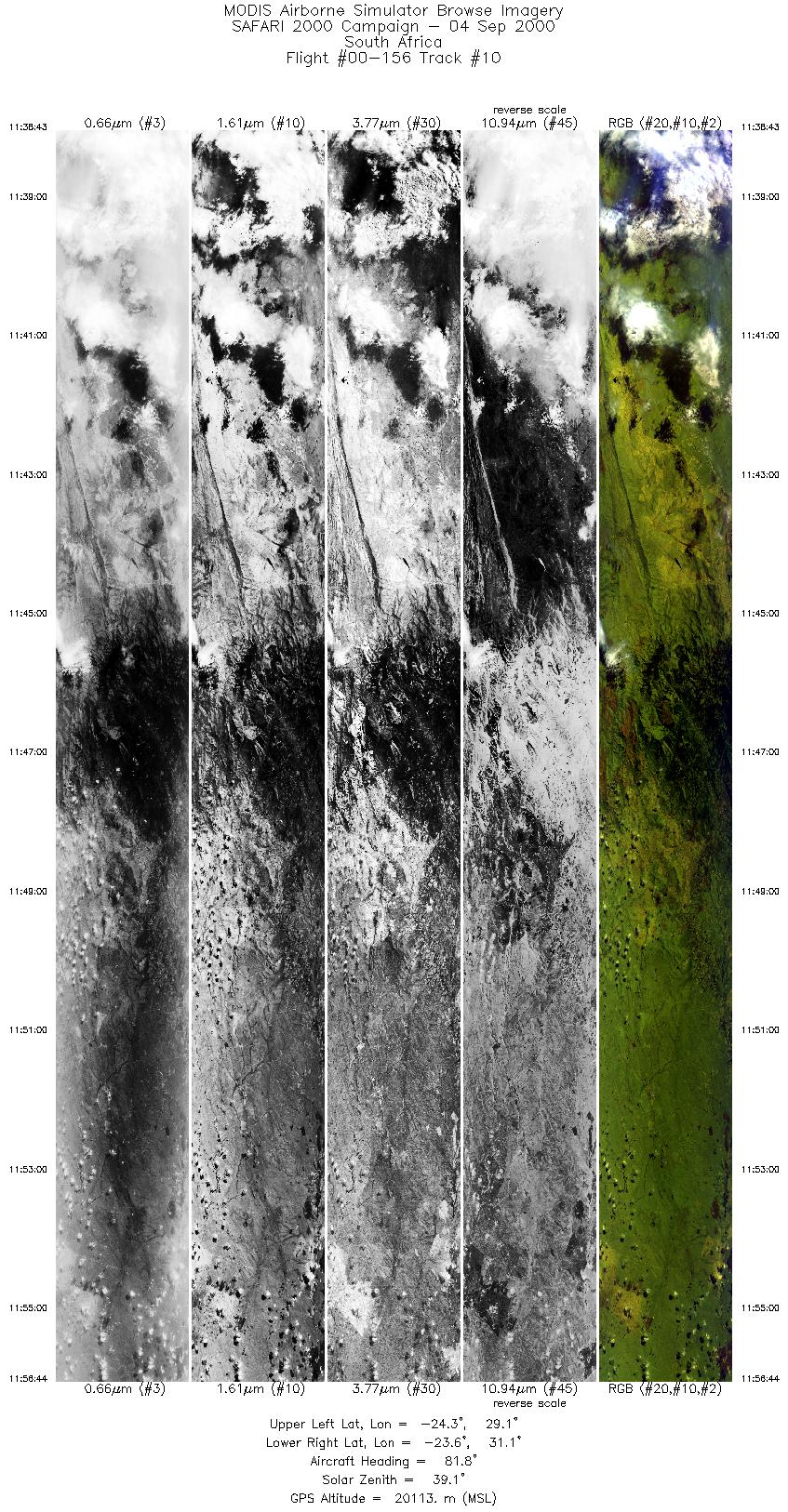
Flight: 00-156 Date: 4 September 2000 Location: Botswana Deployment: SAFARI Principal Investigator: Dr. Michael King (NASA GSFC) Flight Scientist: Dr. Chris Moeller (UW CIMSS) Additional Sensors: AirMISR, CLS, LAS, MOPITT-A, S-HIS, & SSFR Objective: To understand the key linkages between the physical, chemical and biological processes, including human activities, that comprise the southern African biogeophysical system. |
||||||||||||||||||||||||||||||||||||||||||||||||||||||||||||||||||||||||||||||||||||||||||||||||||
|
Data Evaluation Overall quality is good |
||||||||||||||||||||||||||||||||||||||||||||||||||||||||||||||||||||||||||||||||||||||||||||||||||
|
Processing Information Level-1B Data in HDF format is available Flight Line Summary Spectral Band Configuration Spectral Response Function Table |
||||||||||||||||||||||||||||||||||||||||||||||||||||||||||||||||||||||||||||||||||||||||||||||||||
|
Browse Imagery Flight Tracks: 10 Scanlines: 71166 |
||||||||||||||||||||||||||||||||||||||||||||||||||||||||||||||||||||||||||||||||||||||||||||||||||
|
||||||||||||||||||||||||||||||||||||||||||||||||||||||||||||||||||||||||||||||||||||||||||||||||||
|
Flight Summary Report Author: Chris Moeller Mission Scientist: Chris Moeller ER-2 Pilot: Ken Broda Takeoff: 0800 (UTC) Landing: 1240 (UTC) Duration: 4:40 (h:mm) Objective and Summary:
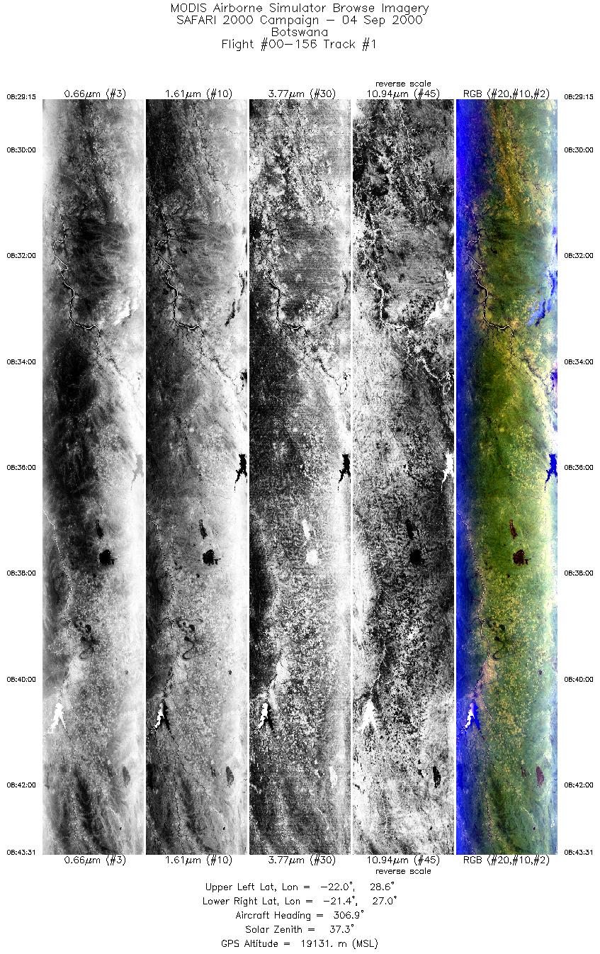
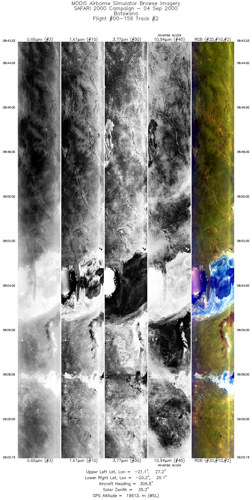
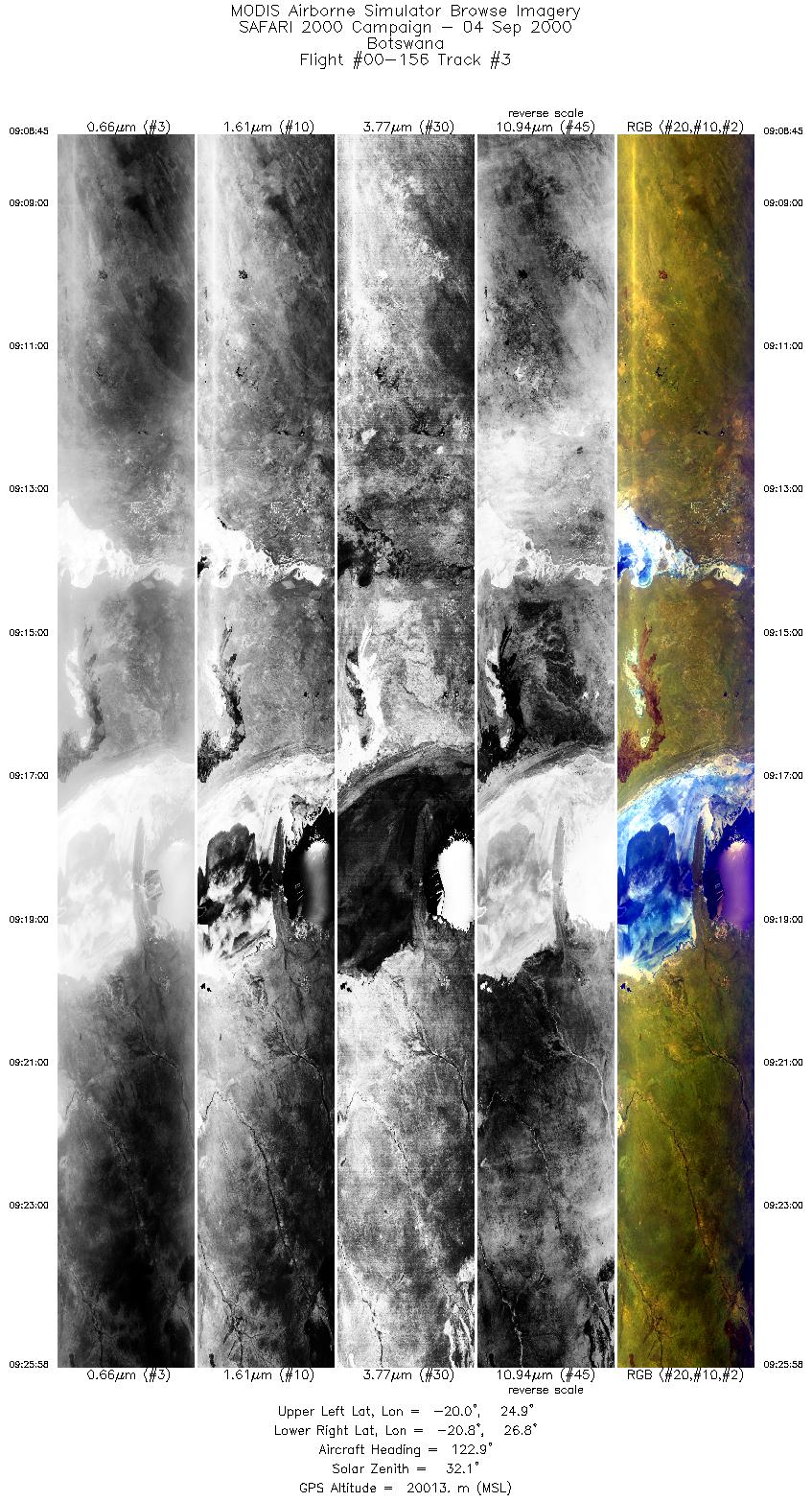
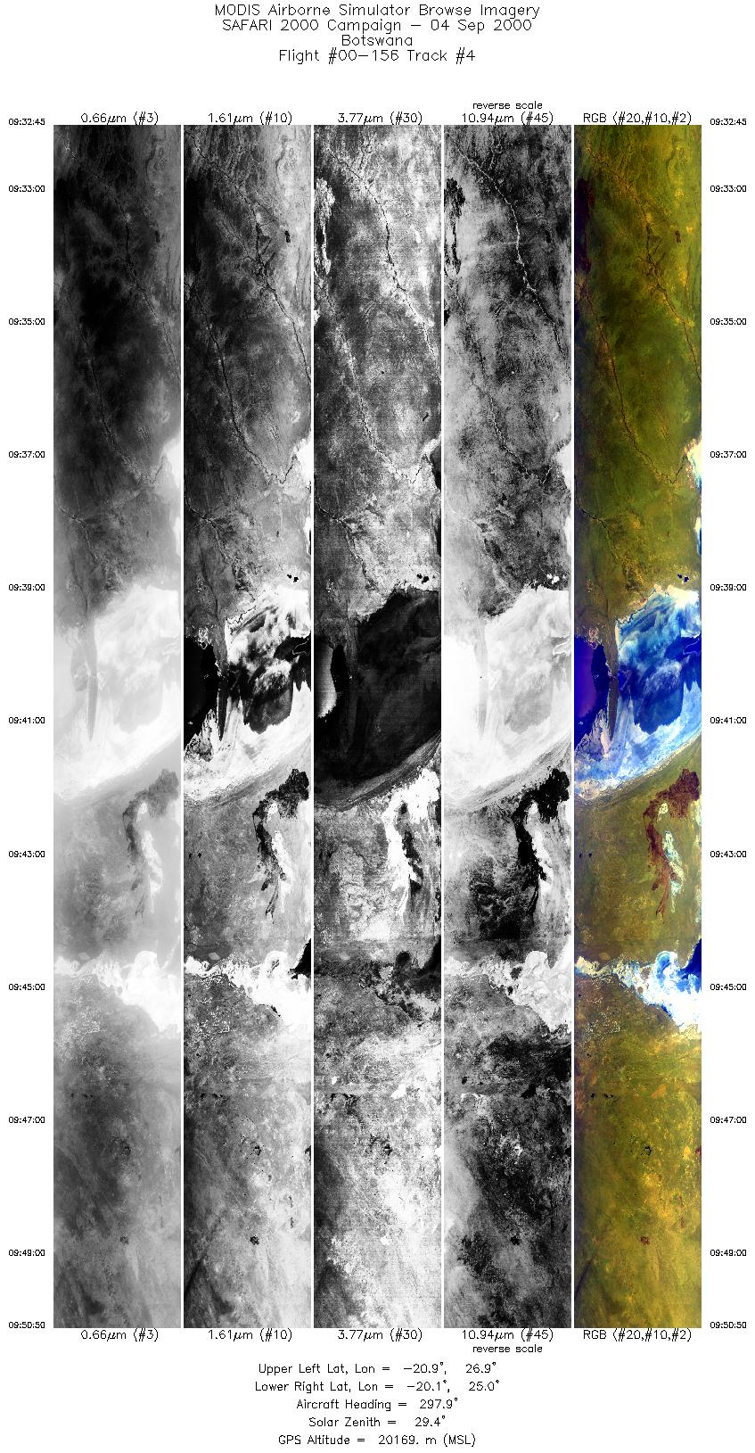
The ER-2 launch was delayed by about 10 minutes for local winds and commercial aircraft activity. It flew northwest from Pietersburg to line up on Sua Pan AirMISR line. Three lines were run (~0854, 0919, 0940 UTC). Skies were clear for all runs. Pilot noted very poor visibility on these runs. Anomalous performance of AirMISR indicated in the cockpit. Maun line was partly cloudy (alto cu) as was the TOMS line, which the ER-2 arrived at about 12 minutes after overpass due to delay in launch. Because of cloud cover, Tshane and Okwa River runs were skipped and ER-2 finished with Murchisan Lineament run which was partly cloudy in the western half and clear in the eastern half. Highlights:TOMS under flight (partly cloudy), AirMISR over Sua Pan. AERONET sites and features overflown during this mission:
N/A Meteorology:Cold front moving away to the east with Atlantic high ridging eastwards and starting to bulge out on the east coast. Cooler moist lower level air spreading northwards into the Mpumalanga and Northern province lowveld. A band of middle level cloud beneath an upper jet stream lies from central Namibia, through Botswana to the Gauteng and Mpumalanga highveld. Skies will be cloudy today along the eastern seaboard and adjacent interior and over the Mpumalanga lowveld. Low cloud will spread northwards into the lowveld of the Northern Province during the day. Partly cloudy over the central areas of Namibia, Botswana, Gauteng and the Mpumalanga highveld. Very isolated thundershowers are possible in these areas. Moist air from Zaire is spreading southwards and thundershowers are also expected over northwestern Zambia. ER-2 Science Instrument Payload Status
|
||||||||||||||||||||||||||||||||||||||||||||||||||||||||||||||||||||||||||||||||||||||||||||||||||

Flight 00-156


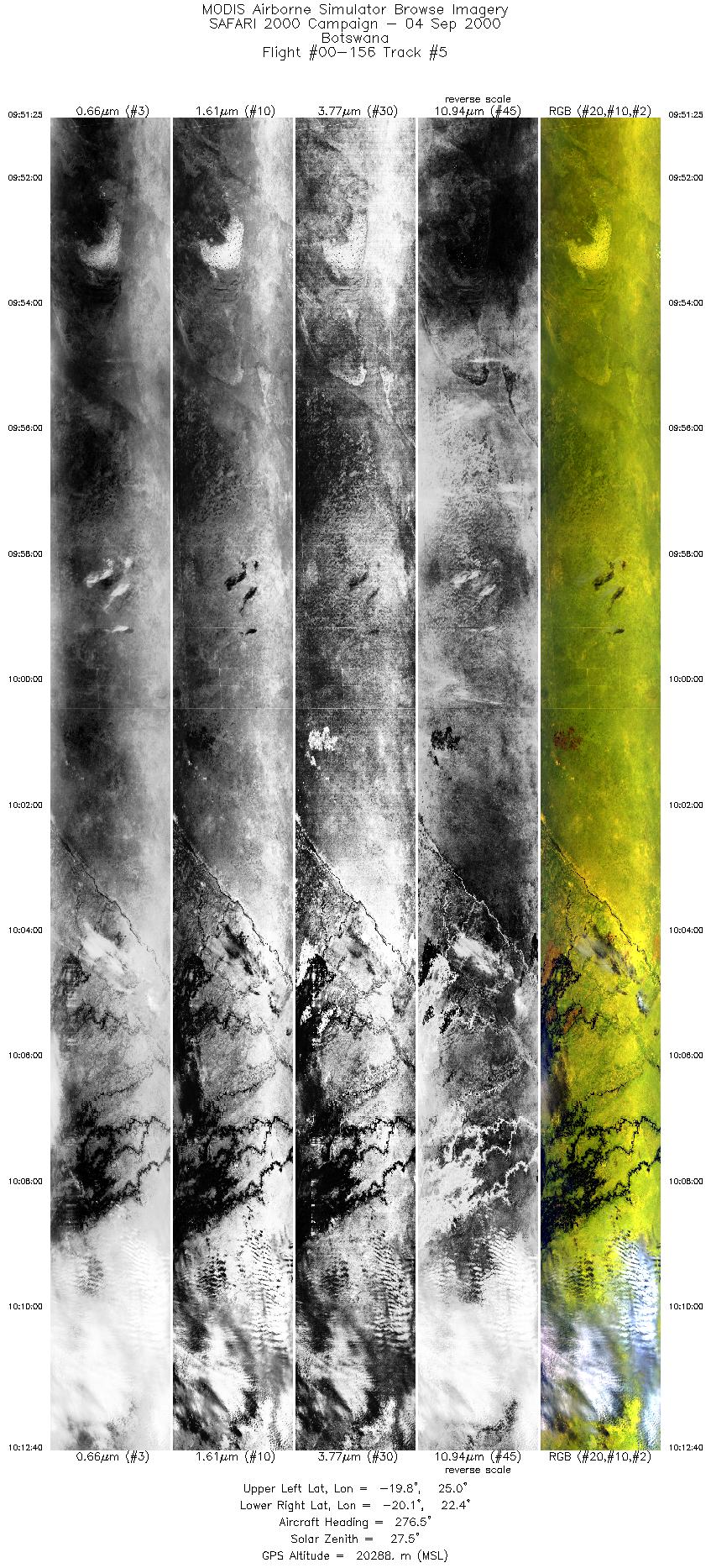
| Sample Imagery |
| Click image for full resolution |
|
Track #4 Botswana |


|
|
R: 2.15µm G: 0.91µm B: 0.55µm |
- NASA Official: Matt Fladeland
- Project Manager: James Jacobson
- Website Editor: Eric Fraim
- Last Updated: November 16, 2021


