


MODIS Airborne Simulator (MAS)
FLIGHT SUMMARY INFORMATION


|
Flight: 00-155 Date: 1 September 2000 Location: South Africa, Botswana, and Zambia (night) Deployment: SAFARI Principal Investigator: Dr. Michael King (NASA GSFC) Flight Scientist: Dr. Michael King (NASA GSFC) Additional Sensors: AirMISR, CLS, LAS, MOPITT-A, S-HIS, & SSFR Objective: To understand the key linkages between the physical, chemical and biological processes, including human activities, that comprise the southern African biogeophysical system. |
||||||||||||||||||||||||||||||||||||||||||||||||||||||||||||||||||||||||||||||||||||||||||||||||||||||||||||||||||||||||||||||||||||||||||||
|
Data Evaluation Overall quality is good |
||||||||||||||||||||||||||||||||||||||||||||||||||||||||||||||||||||||||||||||||||||||||||||||||||||||||||||||||||||||||||||||||||||||||||||
|
Processing Information Level-1B Data in HDF format is available Flight Line Summary Spectral Band Configuration Spectral Response Function Table |
||||||||||||||||||||||||||||||||||||||||||||||||||||||||||||||||||||||||||||||||||||||||||||||||||||||||||||||||||||||||||||||||||||||||||||
|
Browse Imagery Flight Tracks: 16 Scanlines: 96868 |
||||||||||||||||||||||||||||||||||||||||||||||||||||||||||||||||||||||||||||||||||||||||||||||||||||||||||||||||||||||||||||||||||||||||||||
|
||||||||||||||||||||||||||||||||||||||||||||||||||||||||||||||||||||||||||||||||||||||||||||||||||||||||||||||||||||||||||||||||||||||||||||
|
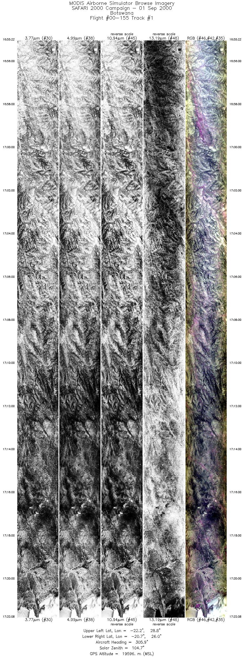
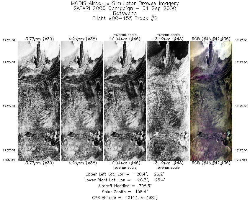
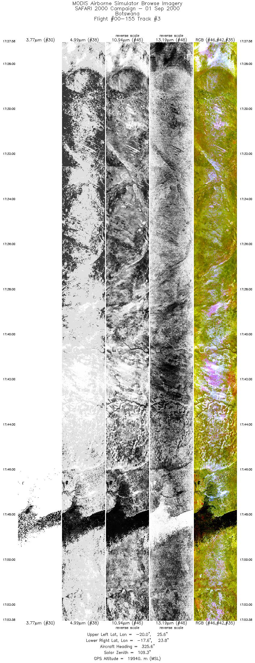
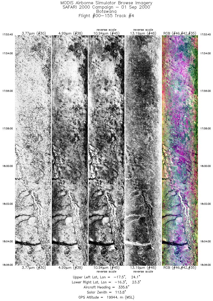
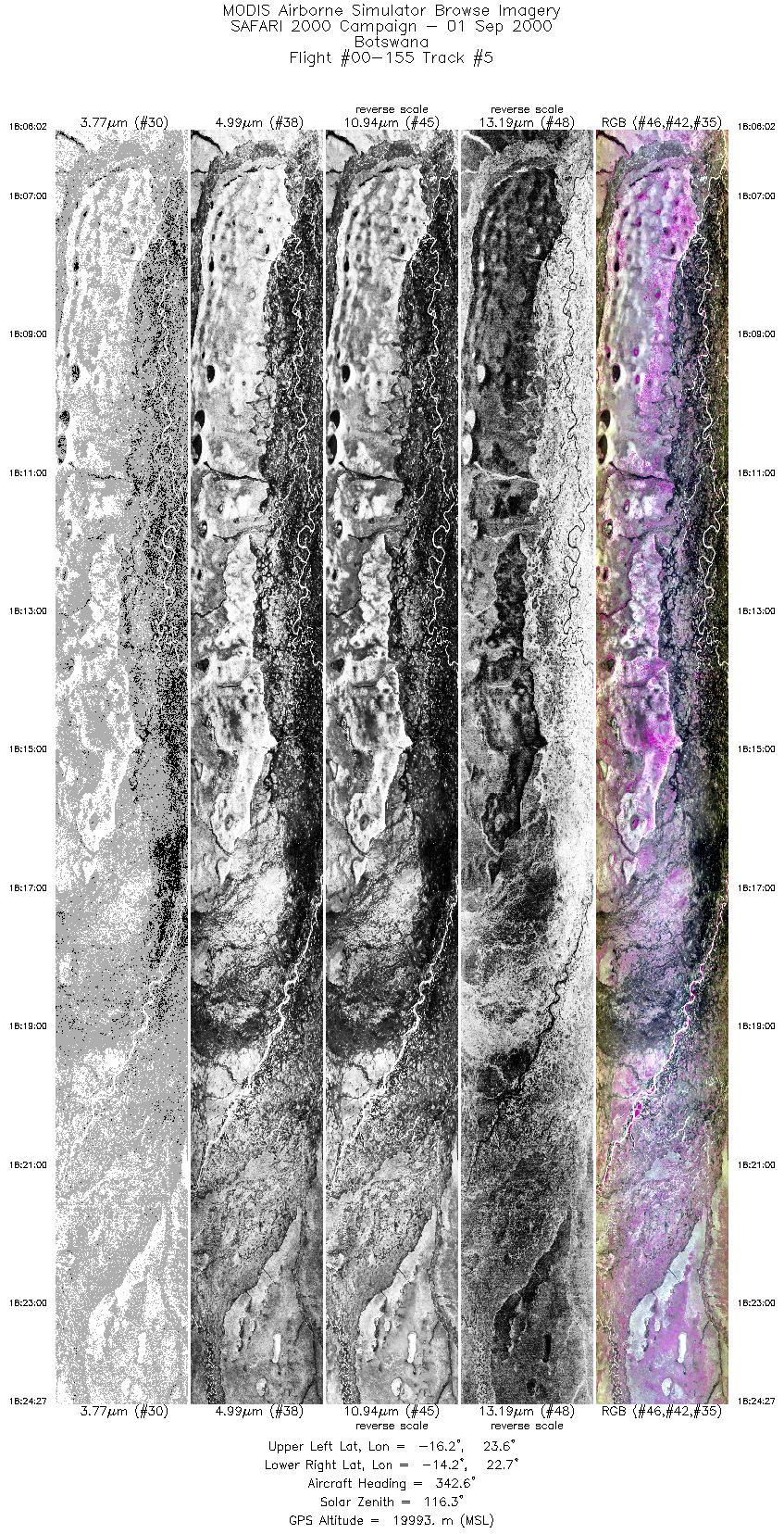
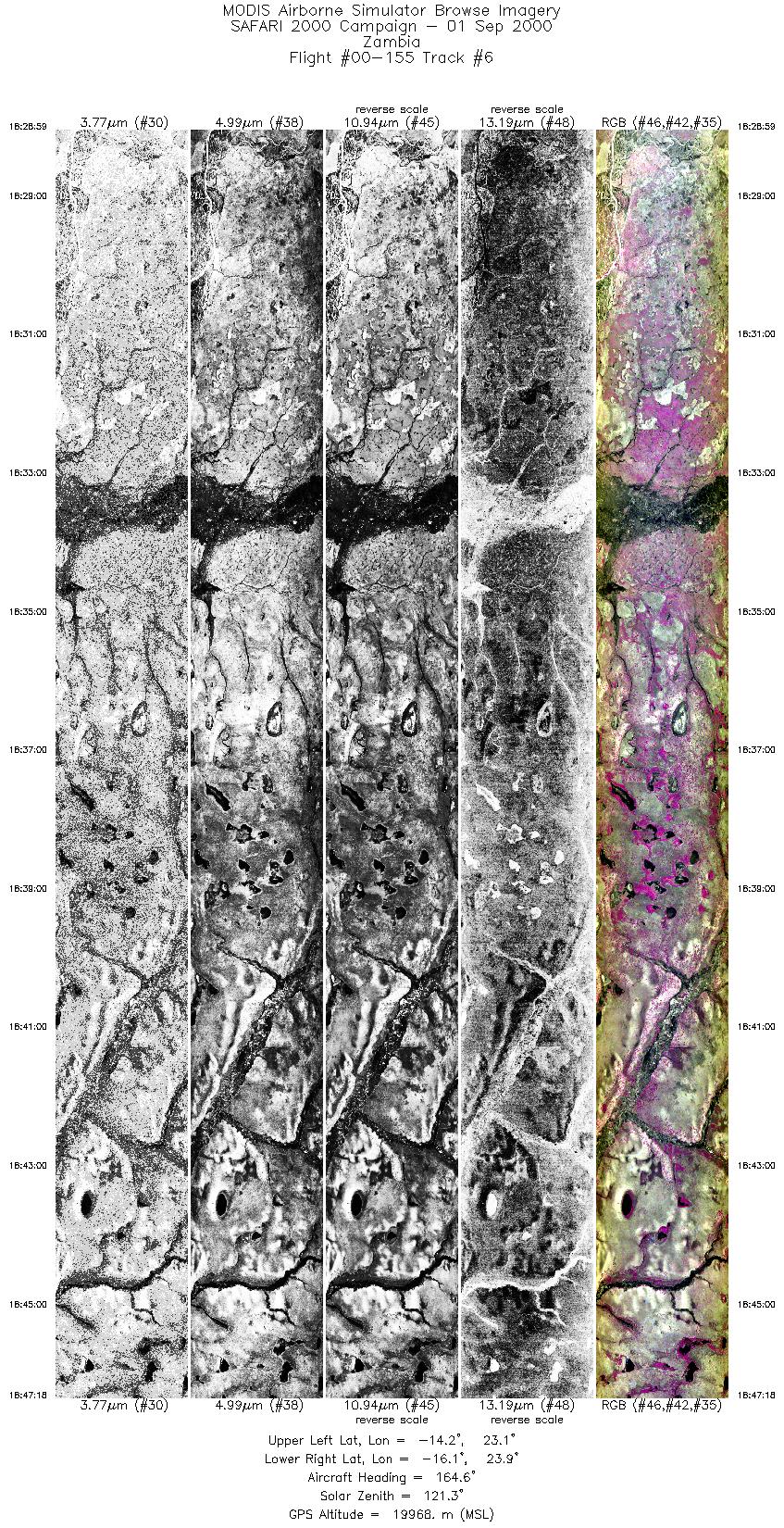
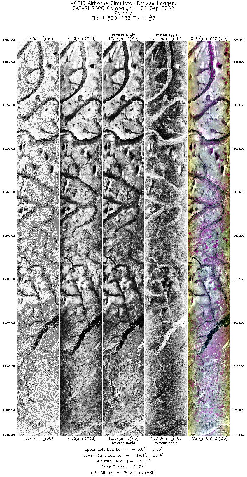
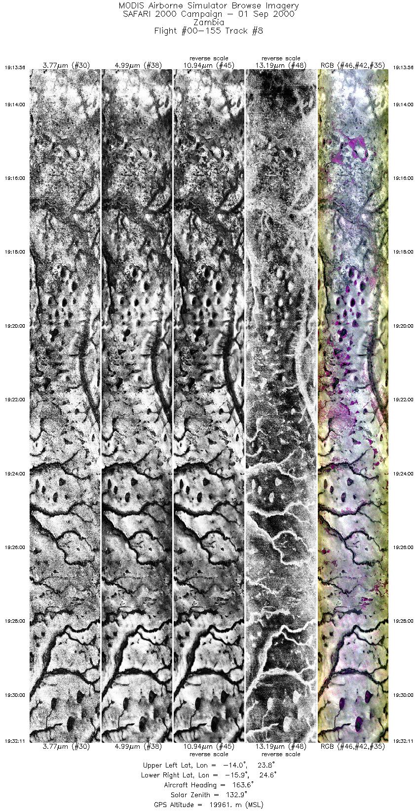
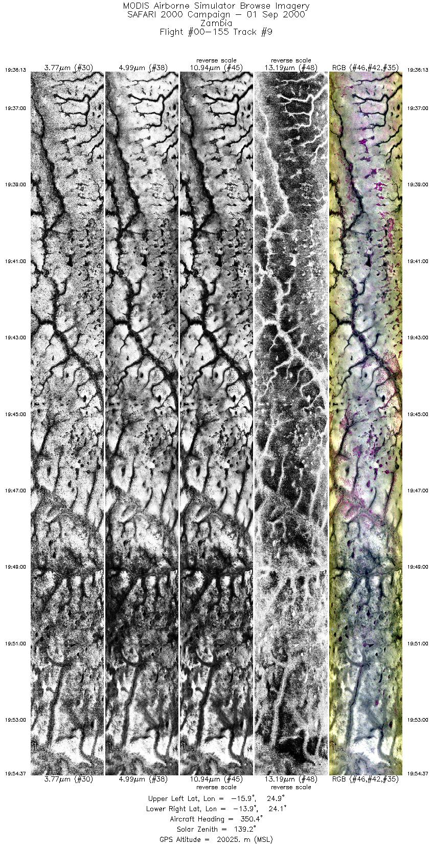
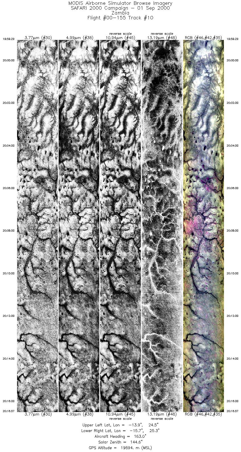
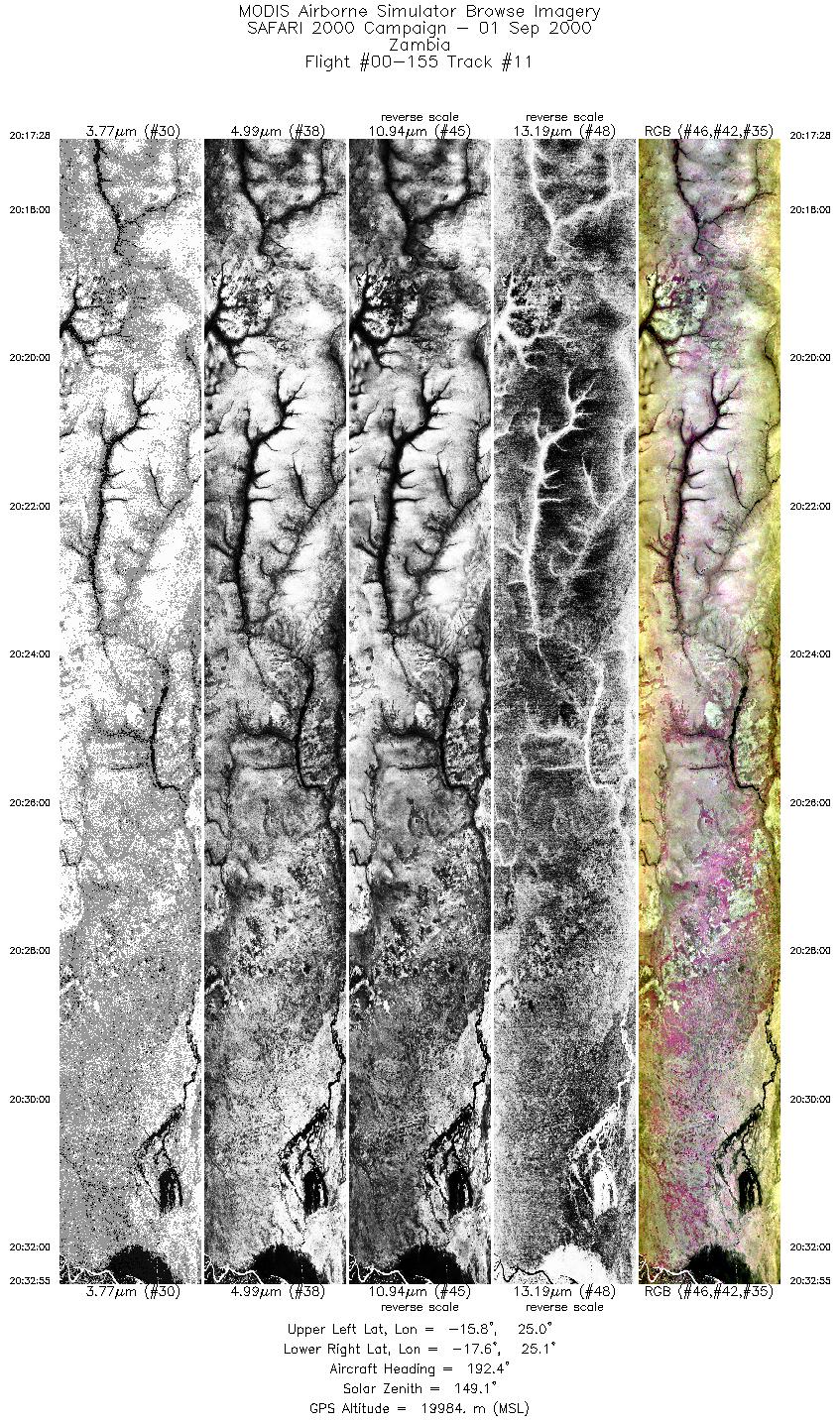
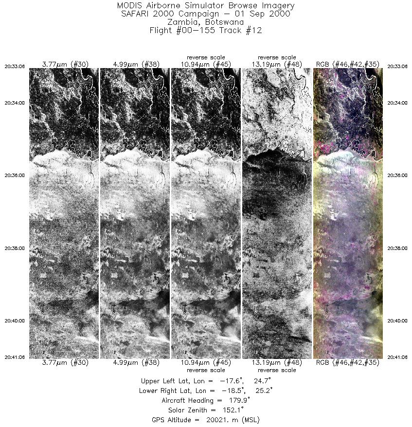
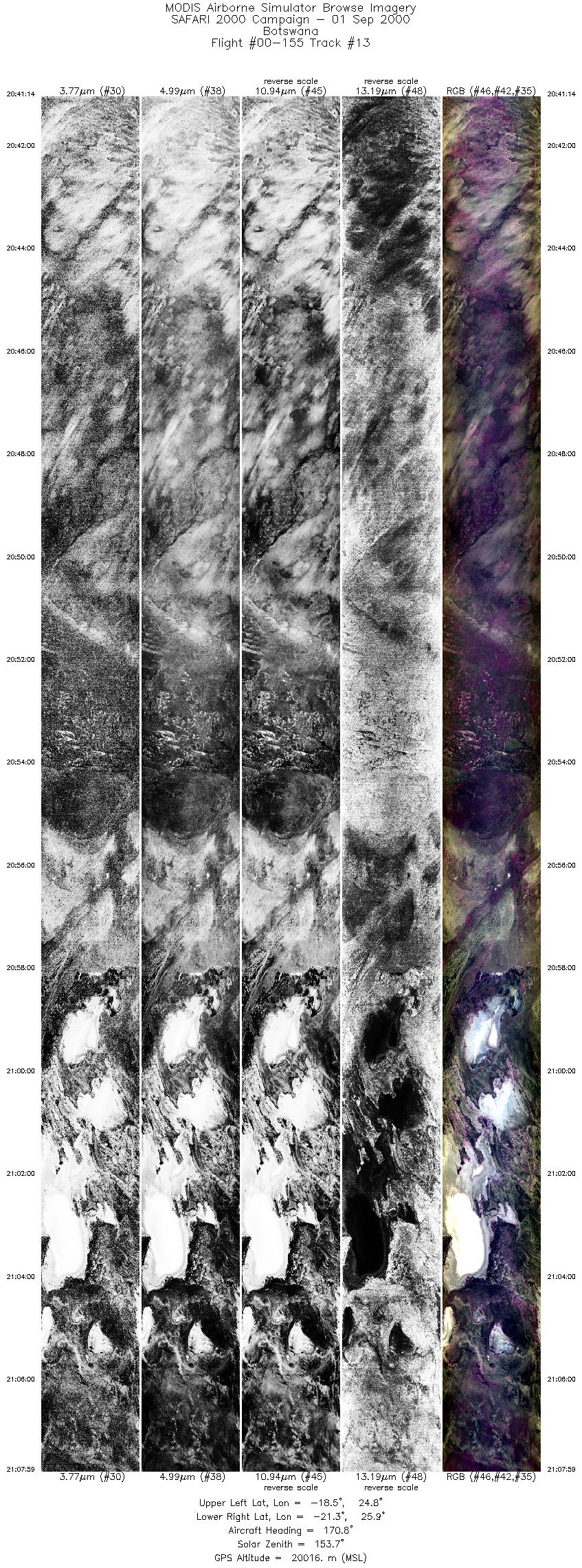
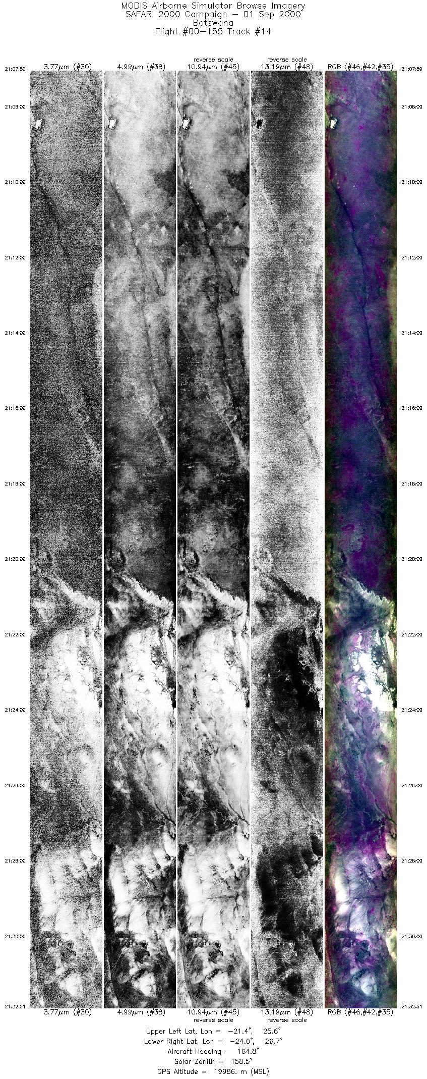
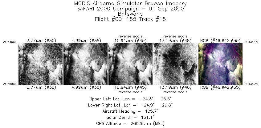
Flight Summary Report Author: Chris Moeller Mission Scientist: Chris Moeller ER-2 Pilot: Jim Barrilleaux Takeoff: 1630 (UTC) Landing: 2215 (UTC) Duration: 5:45 (h:mm) Objective and Summary:
The ER-2 flew northwest to Zambia in clear sky on transit to 18 minute leg (220 km) centered Mongu airport (15° 15´ S, 23° 09´ E) where MPL is operating. Over flew MPL at 0815 UTC providing collocated up and down looking lidar measurements. Mongu flight line aligned at 346° to parallel the Terra orbital track (21:15 UTC overpass). ER-2 proceeded to fly five additional parallel 18 minute legs east of Mongu line, spaced for contiguous MAS coverage (about 20 km separation) to map evening burning in Zambia. Many fires, some linear, some circular observed by pilot. ER-2 then flew around Zimbabwean air space to align on track parallel to Terra orbital track for transit back to base. Clear skies at 21:15 UTC for Terra overpass (22° 05´ S, 25° 58´ E; 1.3° view angle) and during entire flight. Highlights:N/A AERONET sites and features overflown during this mission:
The skies were cloud free and the visibility good. The pilot noted large fire at 17:47:10 UTC (18° 13´ S, 24° 19´ E). Meteorology:A cold front runs southeastwards from the Transkei coast with the south Atlantic high pressure cell ridging across the southern parts of the sub continent. A cell of high pressure is centered over the southern parts of Zimbabwe and is controlling the circulation over the northern provinces of South Africa where it remains hot and dry. Cloudy areas around the coast from the southwestern Cape to Durban. Cloudy areas over the southern and southwestern interior. Fog along the Namibian coast. Fine elsewhere with a high fire danger rating over the Northern Province. ER-2 Science Instrument Payload Status
|
||||||||||||||||||||||||||||||||||||||||||||||||||||||||||||||||||||||||||||||||||||||||||||||||||||||||||||||||||||||||||||||||||||||||||||

Flight 00-155


| Sample Imagery |
| Click image for full resolution |
|
Track #10 Zambia |


|
|
R: 11.99µm G: 8.54µm B: 4.54µm |
| Sample Imagery |
| Click image for full resolution |
|
Track #11 Zambia |

|
|
R: 11.99µm G: 8.54µm B: 4.54µm |
- NASA Official: Matt Fladeland
- Project Manager: James Jacobson
- Website Editor: Eric Fraim
- Last Updated: November 16, 2021


