


MODIS Airborne Simulator (MAS)
FLIGHT SUMMARY INFORMATION


|
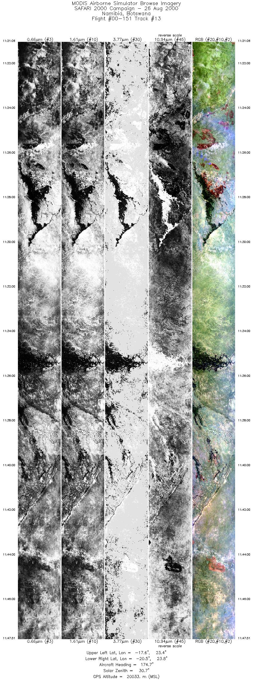
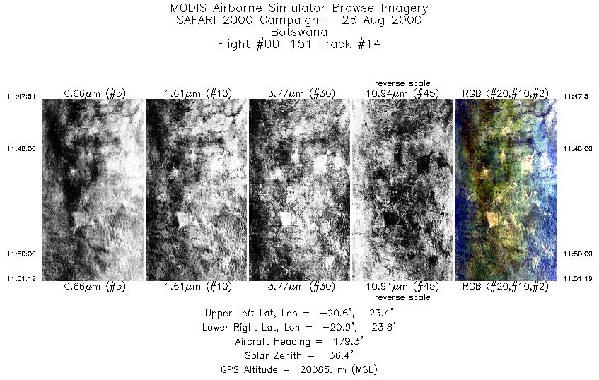
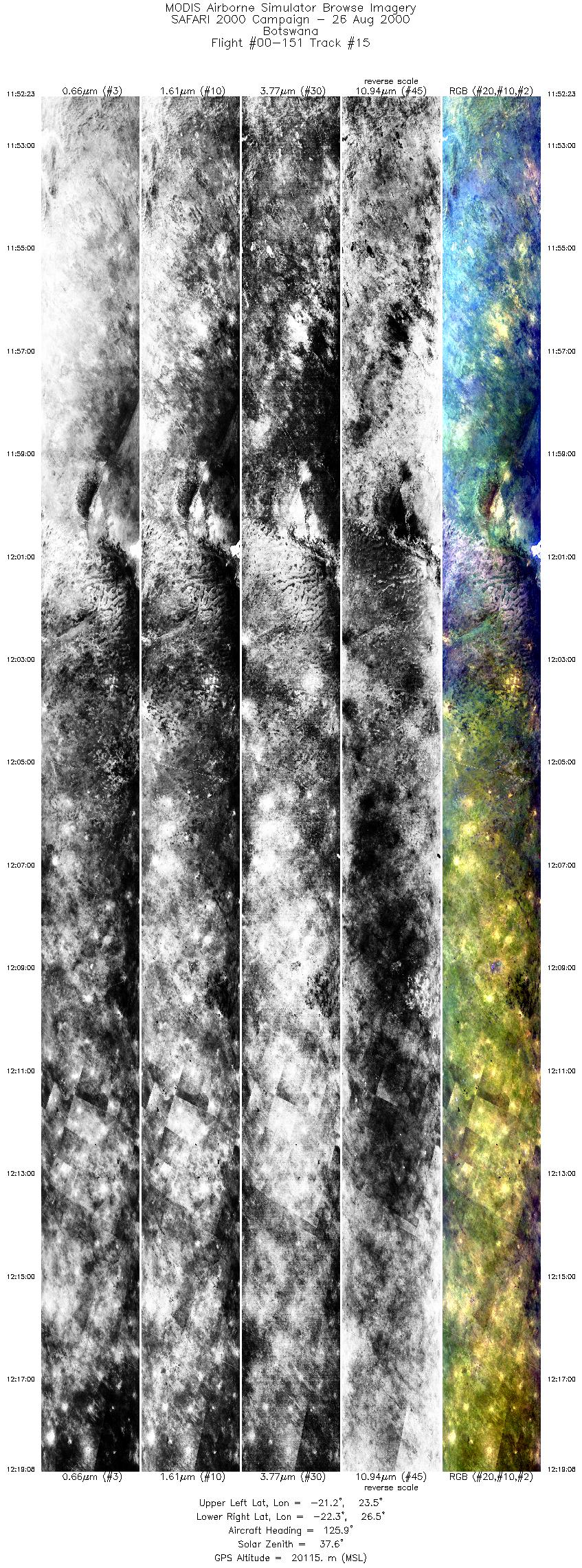
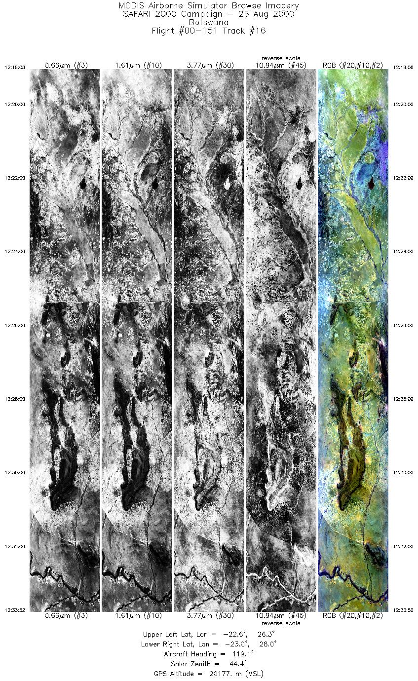
Flight: 00-151 Date: 25 August 2000 Location: South Africa, Botswana, and Zambia Deployment: SAFARI Principal Investigator: Dr. Michael King (NASA GSFC) Flight Scientist: Dr. Michael King (NASA GSFC) Additional Sensors: AirMISR, CLS, LAS, MOPITT-A, S-HIS, & SSFR Objective: To understand the key linkages between the physical, chemical and biological processes, including human activities, that comprise the southern African biogeophysical system. |
||||||||||||||||||||||||||||||||||||||||||||||||||||||||||||||||||||||||||||||||||||||||||||||||||||||||||||||||||||||||||||||||||||||||||||
|
Data Evaluation Overall quality is good |
||||||||||||||||||||||||||||||||||||||||||||||||||||||||||||||||||||||||||||||||||||||||||||||||||||||||||||||||||||||||||||||||||||||||||||
|
Processing Information Level-1B Data in HDF format is available Flight Line Summary Spectral Band Configuration Spectral Response Function Table |
||||||||||||||||||||||||||||||||||||||||||||||||||||||||||||||||||||||||||||||||||||||||||||||||||||||||||||||||||||||||||||||||||||||||||||
|
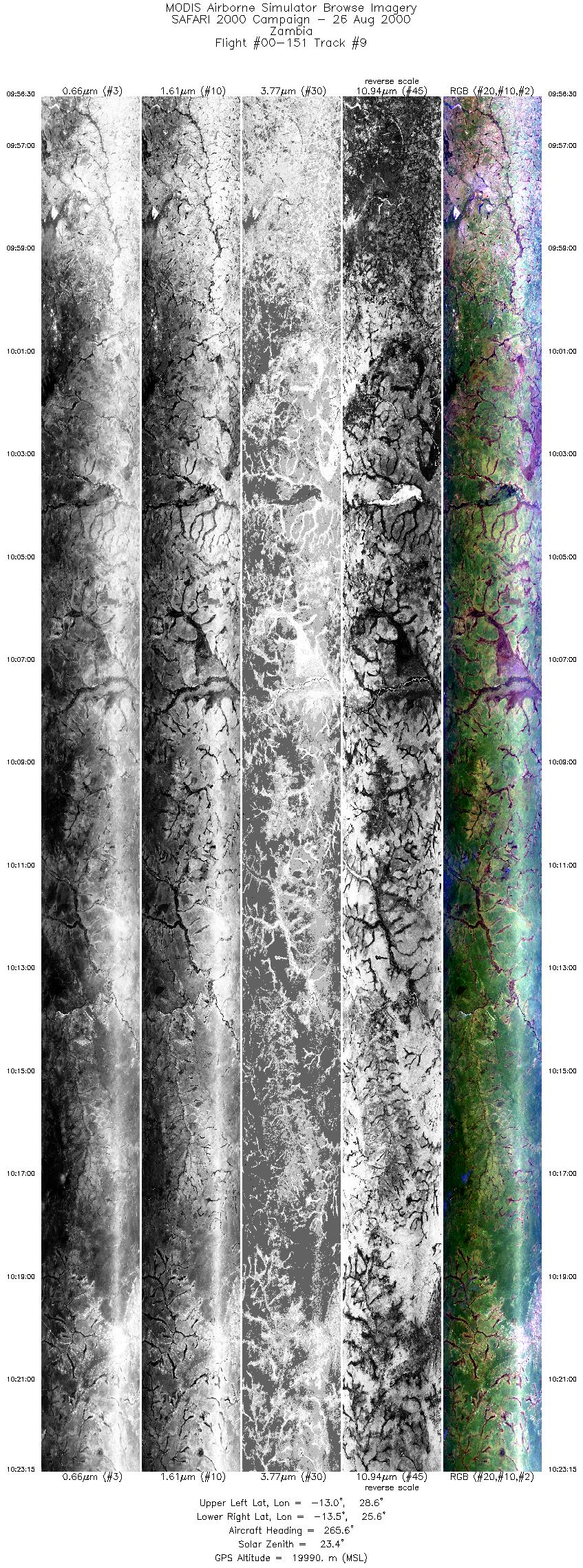
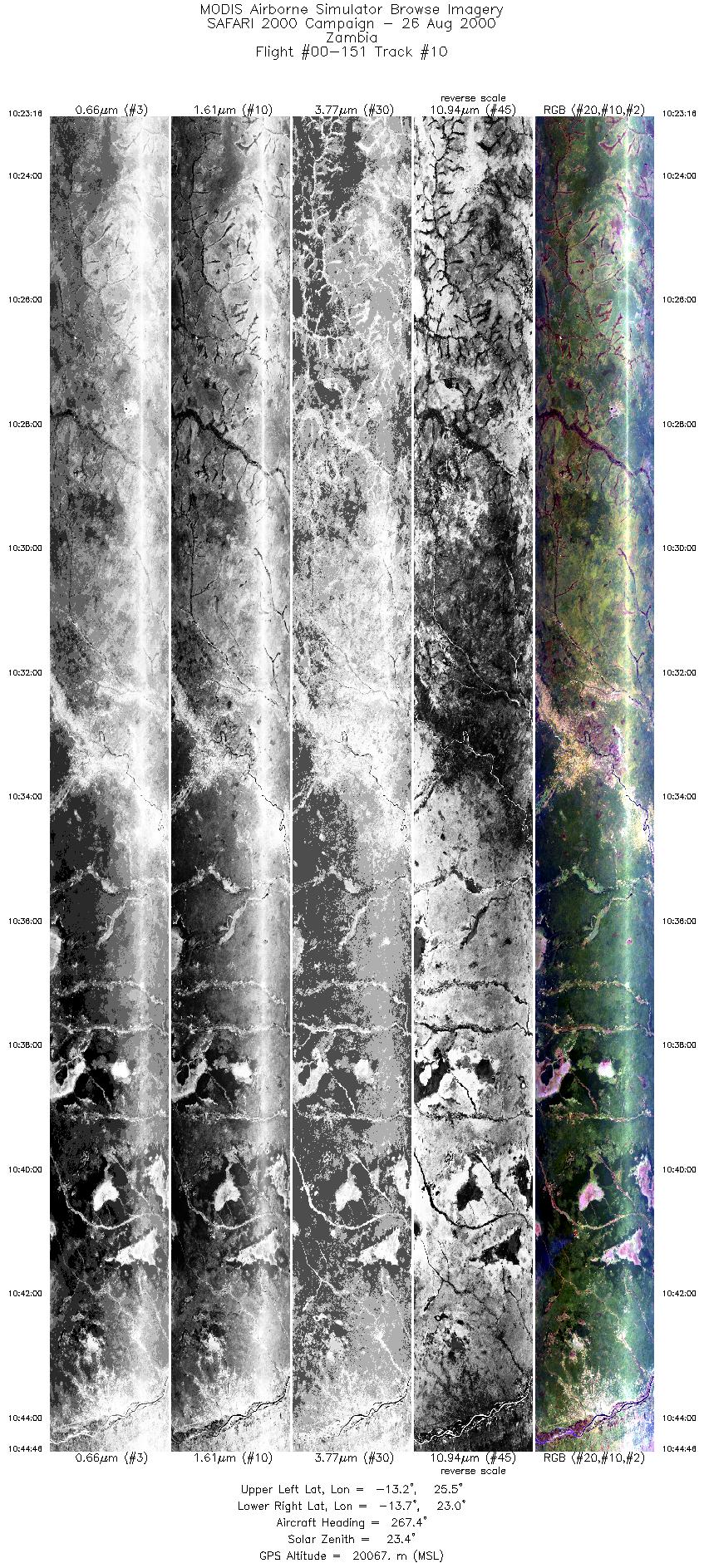
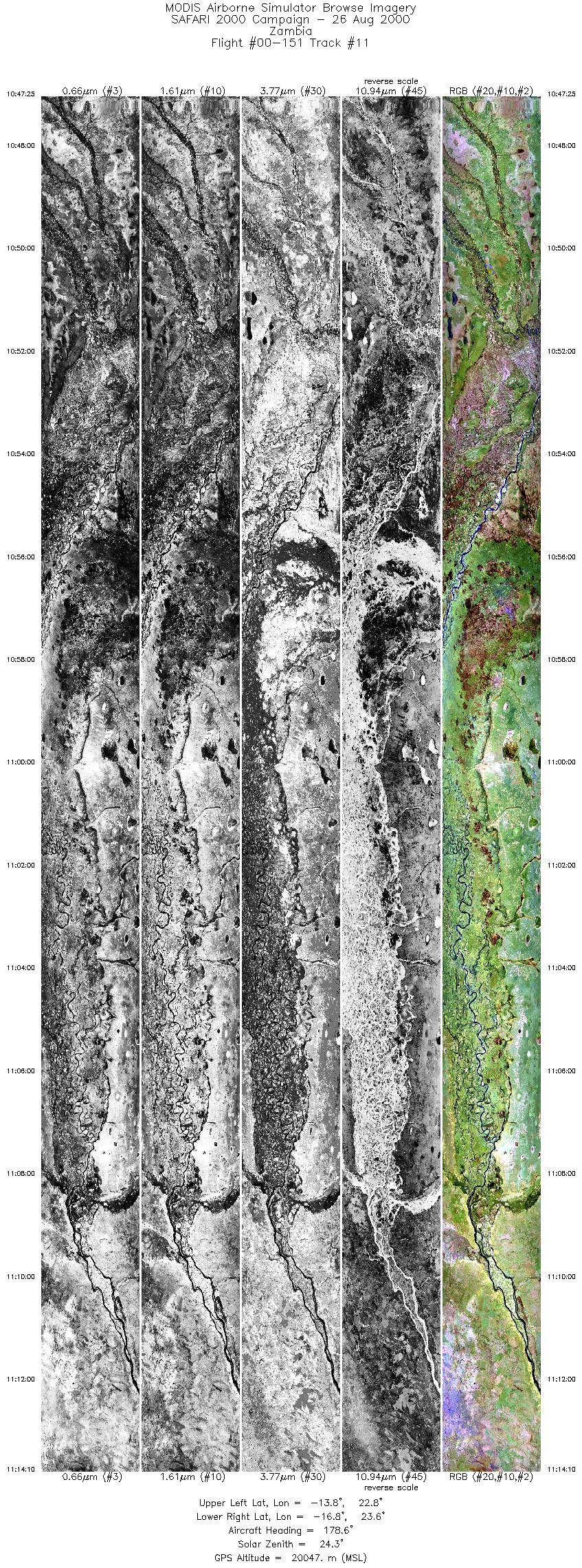
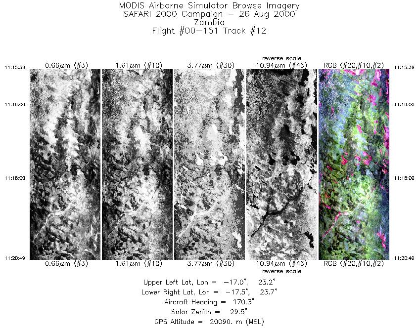
Browse Imagery Flight Tracks: 16 Scanlines: 106006 |
||||||||||||||||||||||||||||||||||||||||||||||||||||||||||||||||||||||||||||||||||||||||||||||||||||||||||||||||||||||||||||||||||||||||||||
|
||||||||||||||||||||||||||||||||||||||||||||||||||||||||||||||||||||||||||||||||||||||||||||||||||||||||||||||||||||||||||||||||||||||||||||
|
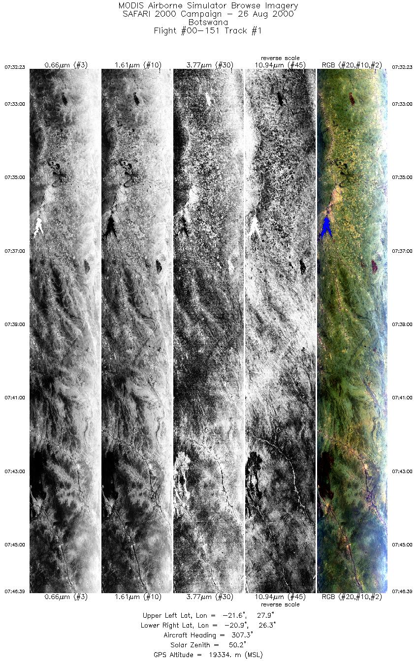
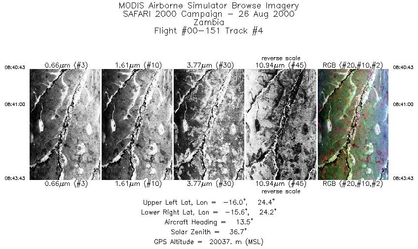
Flight Summary Report Author: Dr. Michael King Mission Scientist: Dr. Michael King ER-2 Pilot: Jim Barrilleaux Takeoff: 0700 (UTC) Landing: 1300 (UTC) Duration: 6:00 (h:mm) Objective and Summary:
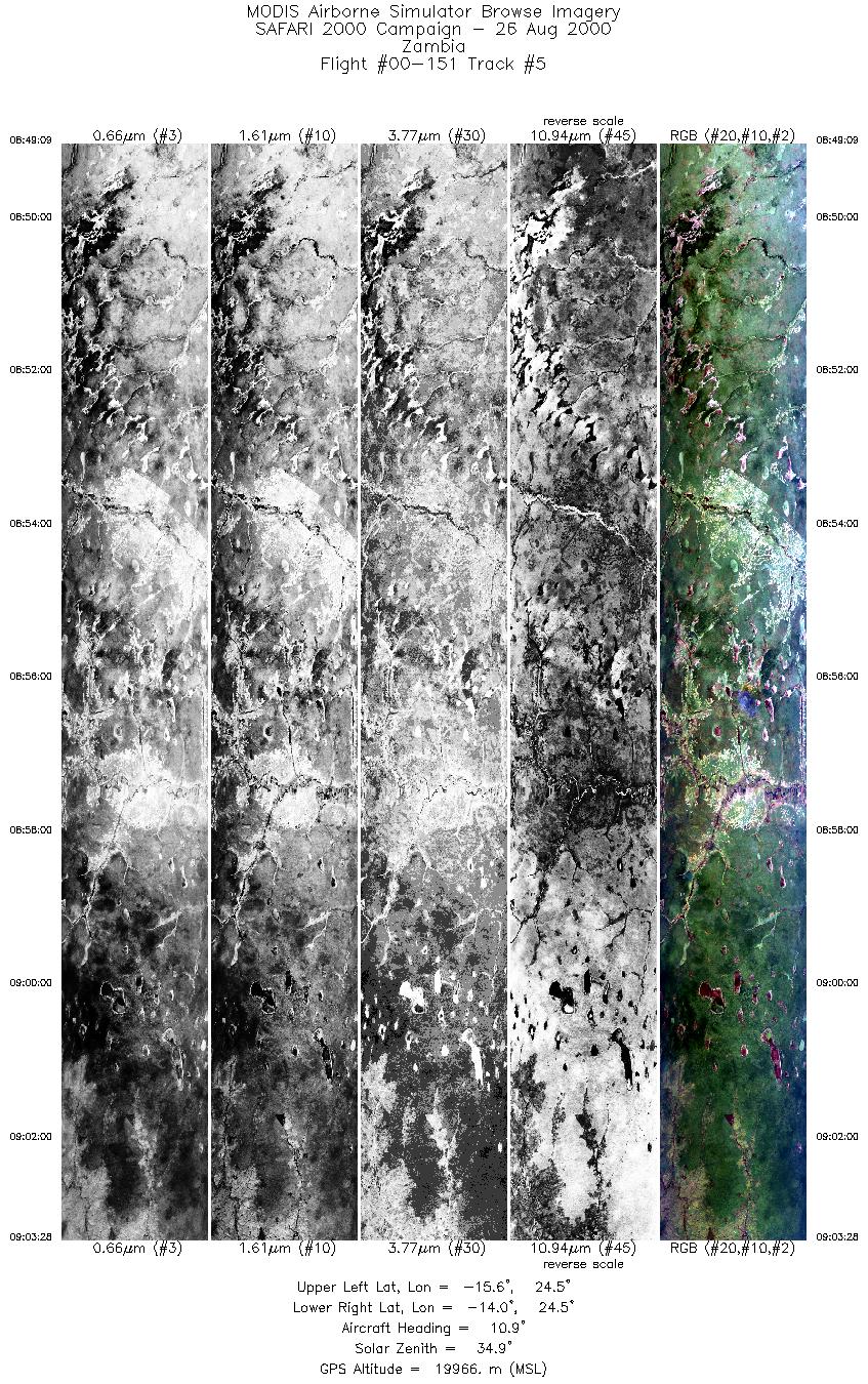
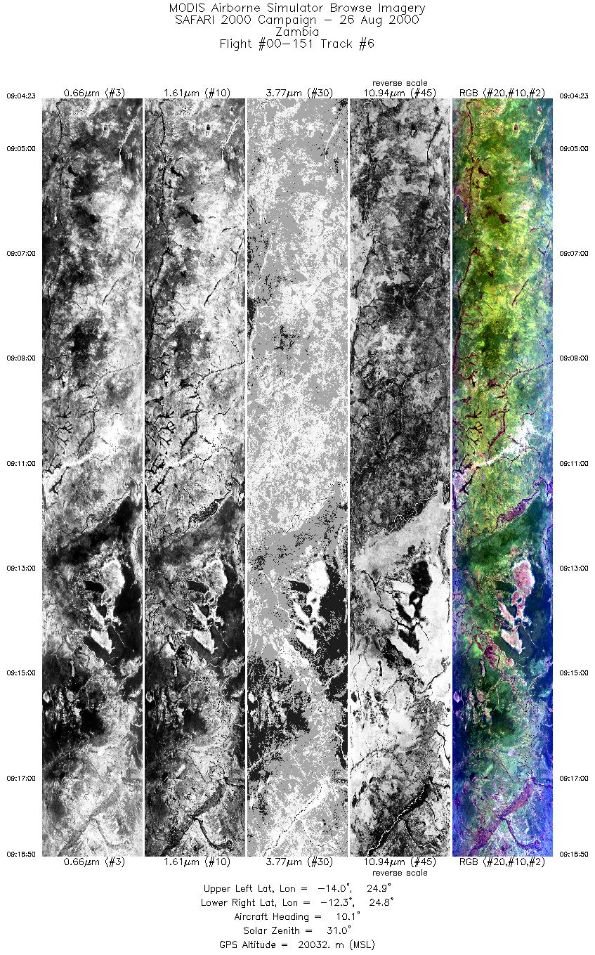
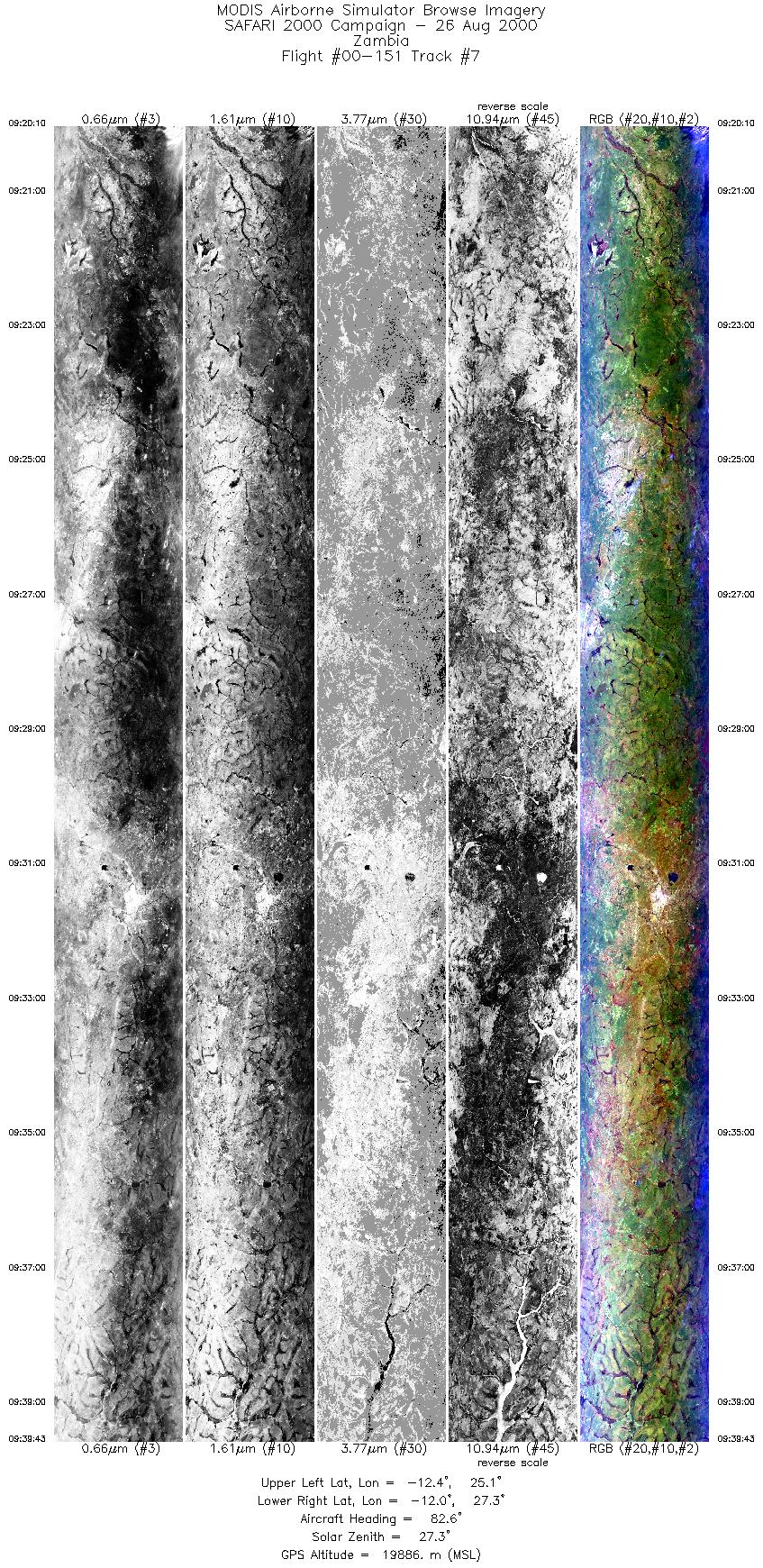
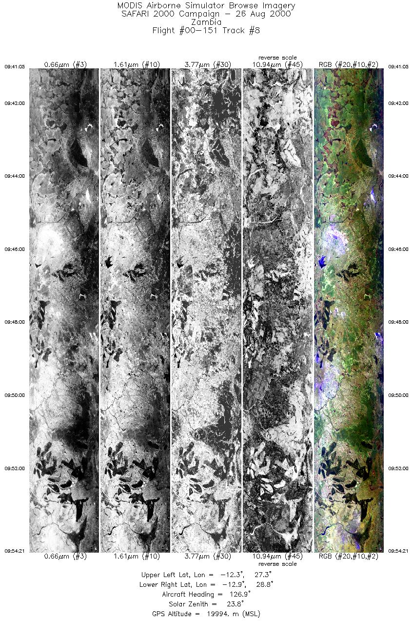
Terra passed over Kaoma at ~0856 UTC with an orbital inclination of 12.4°, coincident with the ER-2 overpass of the prescribed burn. The ER-2 then flew over the copper belts in northern Zambia before flying west along the Zambezi River and 3 AERONET sites at Zambezi, Mongu, and Senanga. The ER-2 then did a pass over the Maun Tower in Botswana. The RC-10 camera was turned on for flights over Francistown and Sowa Pan, Kaoma, the copper belts in northern Zambia, the Zambezi River from Zambezi through to the Caprivi Strip, and over Maun. Highlights:N/A AERONET sites and features overflown during this mission:
The skies were largely cloud free, but smoky over northern Zambia in particular. The skies were generally hazy over western Zambia and the Okavanga Delta but were less hazy than in northern Zambia. Meteorology:A ridge of high pressure ran from the Atlantic high to the west through the central regions of South Africa to the Indian Ocean high to the east. A weak easterly wave passed westwards across Zambia on Thursday and over the night, and moved into northern Namibia. The cloudy areas with fog patches over the eastern and northeastern parts of South Africa cleared during the course of the morning. Isolated thundershowers developed over the eastern highveld regions. Fine weather occurred over Zambia and western Botswana throughout the mission. ER-2 Science Instrument Payload Status
|
||||||||||||||||||||||||||||||||||||||||||||||||||||||||||||||||||||||||||||||||||||||||||||||||||||||||||||||||||||||||||||||||||||||||||||

Flight 00-151


| Sample Imagery |
| Click image for full resolution |
|
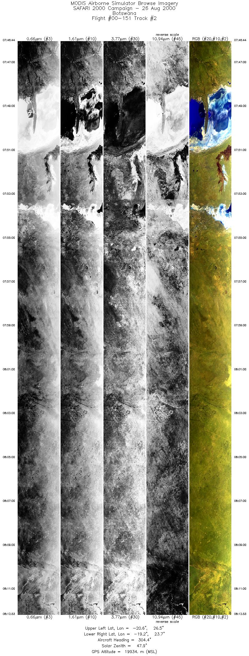
Track #2 Botswana |


|
|
R: 11.01µm G: 2.15µm B: 0.46µm |
| Sample Imagery |
| Click image for full resolution |
|
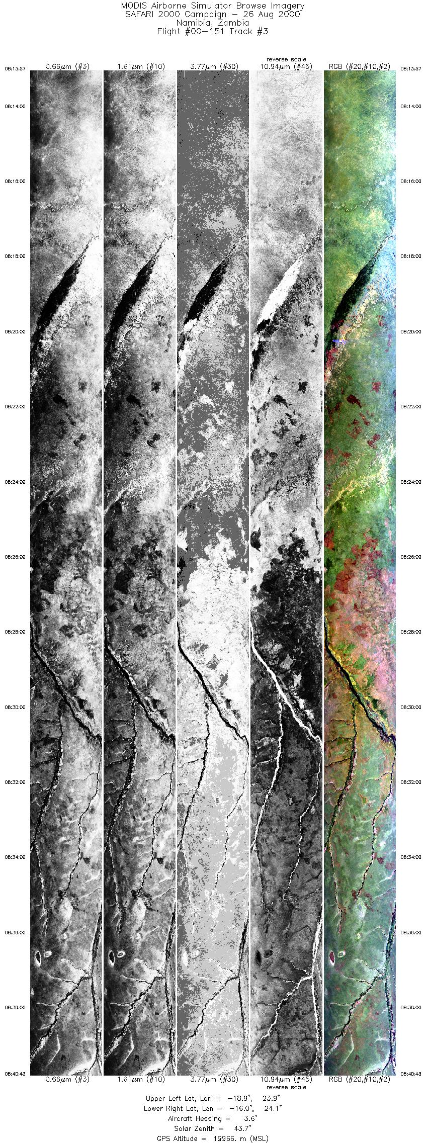
Track #3 Namibia & Zambia |

|
|
R: 11.01µm G: 1.64µm B: 0.55µm |
- NASA Official: Matt Fladeland
- Project Manager: James Jacobson
- Website Editor: Eric Fraim
- Last Updated: November 16, 2021


