


MODIS Airborne Simulator (MAS)
FLIGHT SUMMARY INFORMATION


|
Flight: 00-148 Date: 20 August 2000 Location: South Africa and Botswana Deployment: SAFARI Principal Investigator: Dr. Michael King (NASA GSFC) Flight Scientist: Dr. Michael King (NASA GSFC) Additional Sensors: AirMISR, CLS, LAS, MOPITT-A, S-HIS, & SSFR Objective: To understand the key linkages between the physical, chemical and biological processes, including human activities, that comprise the southern African biogeophysical system. |
||||||||||||||||||||||||||||||||||||||||||||||||||||||||||||||||||||||||||||||||||||||||||||||||||||||||||||||||||||||||||||||||||||||||||||
|
Data Evaluation Overall quality is good |
||||||||||||||||||||||||||||||||||||||||||||||||||||||||||||||||||||||||||||||||||||||||||||||||||||||||||||||||||||||||||||||||||||||||||||
|
Processing Information Level-1B Data in HDF format is available Flight Line Summary Spectral Band Configuration Spectral Response Function Table |
||||||||||||||||||||||||||||||||||||||||||||||||||||||||||||||||||||||||||||||||||||||||||||||||||||||||||||||||||||||||||||||||||||||||||||
|
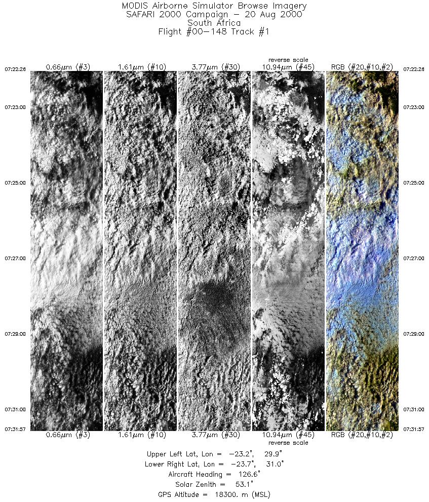
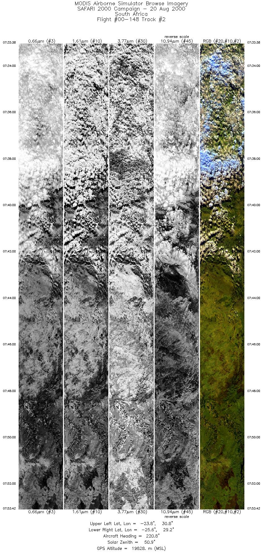
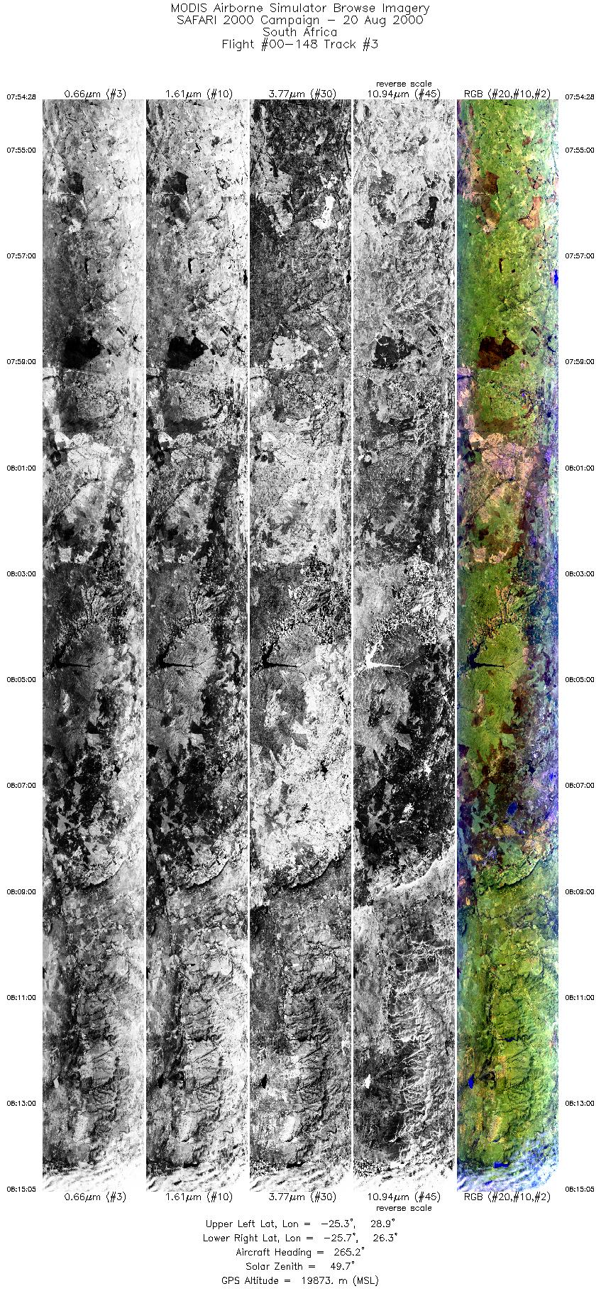
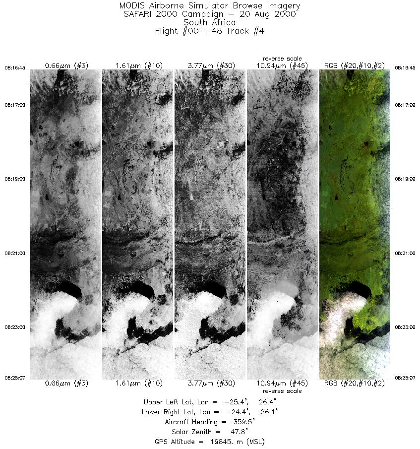
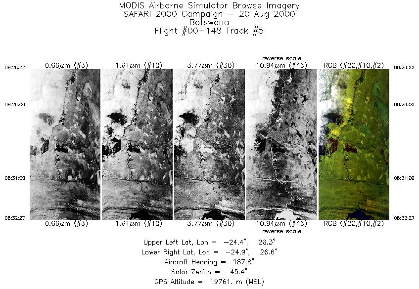
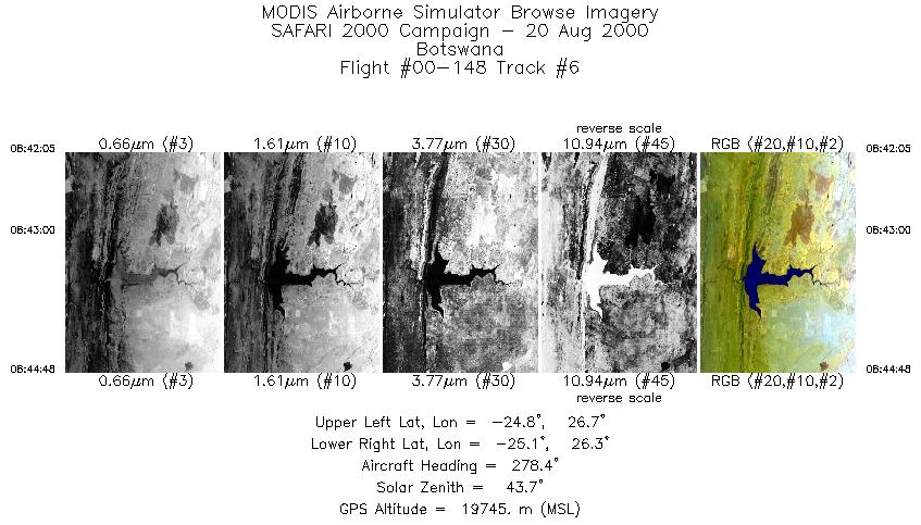
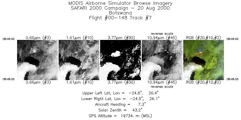
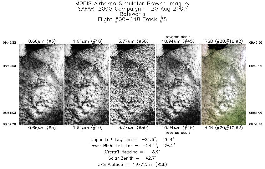
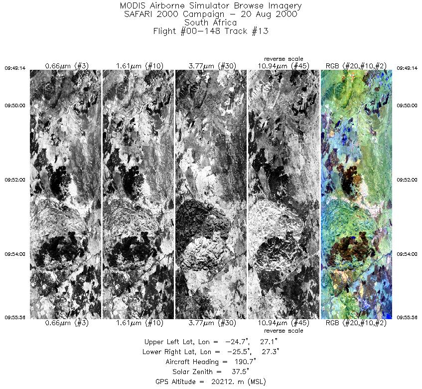
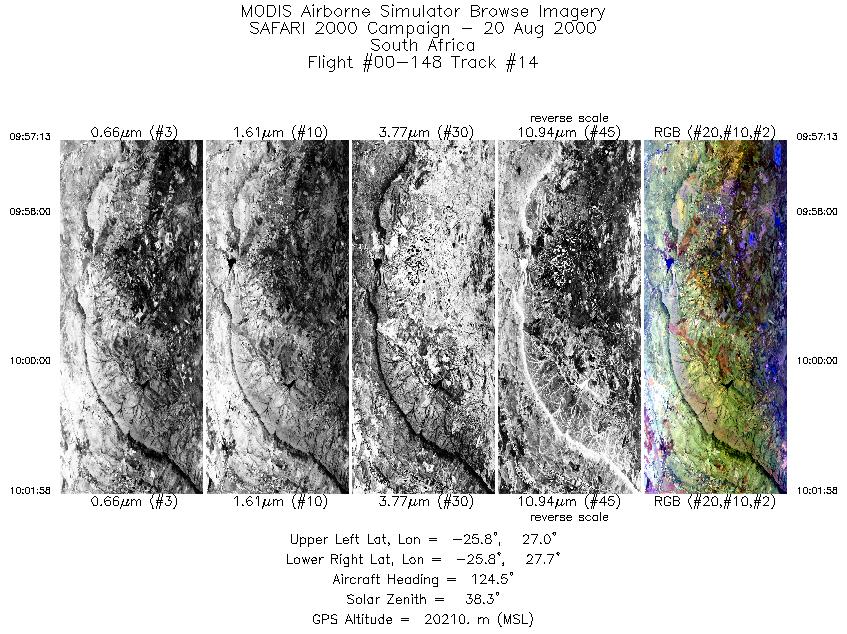
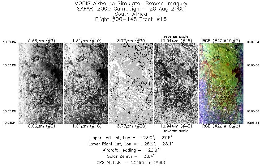
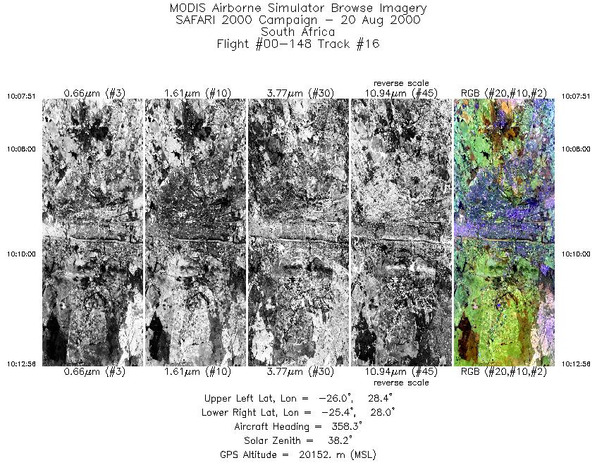
Browse Imagery Flight Tracks: 16 Scanlines: 53928 |
||||||||||||||||||||||||||||||||||||||||||||||||||||||||||||||||||||||||||||||||||||||||||||||||||||||||||||||||||||||||||||||||||||||||||||
|
||||||||||||||||||||||||||||||||||||||||||||||||||||||||||||||||||||||||||||||||||||||||||||||||||||||||||||||||||||||||||||||||||||||||||||
|
Flight Summary Report Author: Dr. Michael King Mission Scientist: Dr. Michael King ER-2 Pilot: Ken Broda Takeoff: 0705 (UTC) Landing: 1050 (UTC) Duration: 3:45 (h:mm) Objective and Summary:
The mission was coordinated with JRA and Terra over Madikwe at 0840 UTC, and with JRB over Selibe-Phikwe at 0923 UTC. The RC-10 camera was turned on over Rustenburg, Madikwe, Selibe-Phikwe, Pilansberg, and Waterkloof. Highlights:N/A AERONET sites and features overflown during this mission:
The ER-2 pilot reported cloudy skies over the early part of the flight up the Blyde River Canyon and over the escarpment, and some altocumulus clouds near Madikwe, but clear skies dominated the region throughout much of the rest of the flight. Meteorology:A high pressure cell was situated to the southeast of the subcontinent, extending a ridge northwestwards and causing an influx of low level moisture into the northeastern areas of South Africa and southeastern Zimbabwe. A low was centered over the southwestern Cape. This low, coupled with an upper-level trough to the west of the country, caused extensive cloud over the western parts of the country. Although it was generally subsident to the east, a band of middle level moisture was being trapped beneath an inversion at about 16000 ft. over eastern Namibia and the central and southeastern parts of Botswana. It was cloudy over the northern and eastern parts of the Northern Province in the morning, clearing partially during the afternoon. Partly cloudy over central and southeastern Botswana and Gauteng. The cloudy weather over the western areas spread across the southern areas and a few light showers resulted in these areas. ER-2 Science Instrument Payload Status
|
||||||||||||||||||||||||||||||||||||||||||||||||||||||||||||||||||||||||||||||||||||||||||||||||||||||||||||||||||||||||||||||||||||||||||||

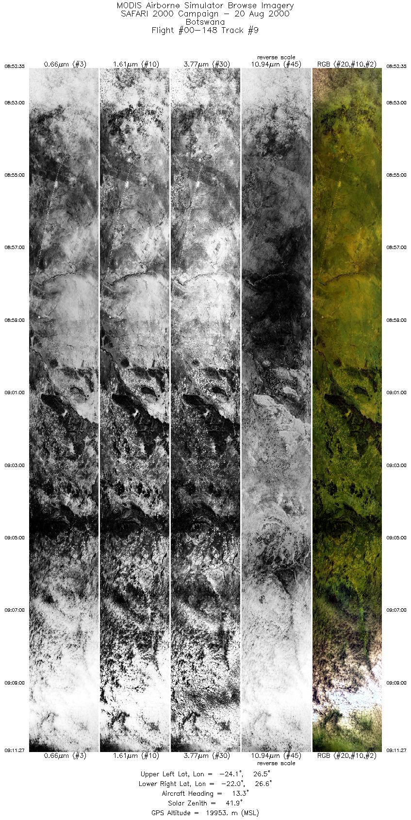
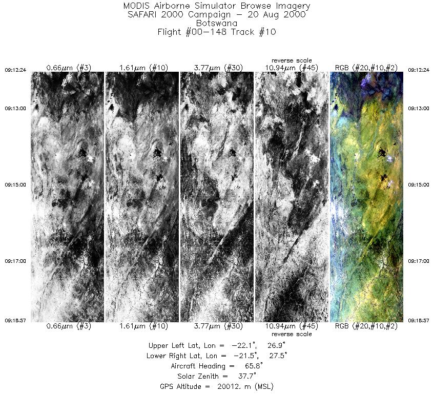
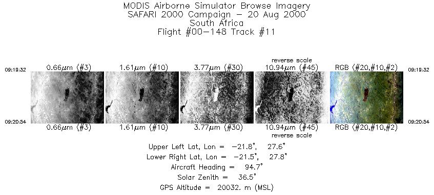
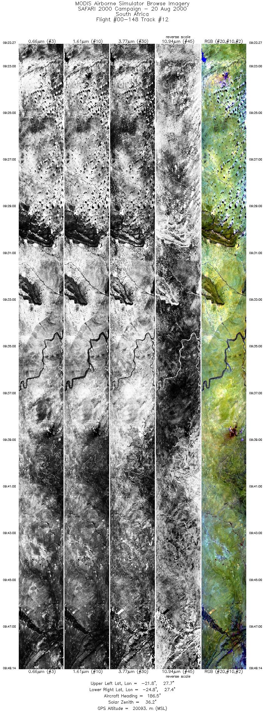
Flight 00-148


| Sample Imagery |
| Click image for full resolution |
|
Track #6 Botswana |


|
|
R: 11.01µm G: 2.15µm B: 0.46µm |
| Sample Imagery |
| Click image for full resolution |
|
Track #12 South Africa |

|
|
R: 11.01µm G: 2.15µm B: 0.46µm |
- NASA Official: Matt Fladeland
- Project Manager: James Jacobson
- Website Editor: Eric Fraim
- Last Updated: November 16, 2021


