


MODIS Airborne Simulator (MAS)
FLIGHT SUMMARY INFORMATION


|
Flight: 00-147 Date: 17 August 2000 Location: South Africa, Mozambique, and Indian Ocean Deployment: SAFARI Principal Investigator: Dr. Michael King (NASA GSFC) Flight Scientist: Dr. Michael King (NASA GSFC) Additional Sensors: AirMISR, CLS, LAS, MOPITT-A, S-HIS, & SSFR Objective: To understand the key linkages between the physical, chemical and biological processes, including human activities, that comprise the southern African biogeophysical system. |
||||||||||||||||||||||||||||||||||||||||||||||||||||||||||||||||||||||||||||||||||||||||||||||||||
|
Data Evaluation Overall quality is good Port 3 (bands 26-41; 3.04-5.44µm) removed for dewar nitrogen purge |
||||||||||||||||||||||||||||||||||||||||||||||||||||||||||||||||||||||||||||||||||||||||||||||||||
|
Processing Information Level-1B Data in HDF format is available Flight Line Summary Spectral Band Configuration Spectral Response Function Table |
||||||||||||||||||||||||||||||||||||||||||||||||||||||||||||||||||||||||||||||||||||||||||||||||||
|
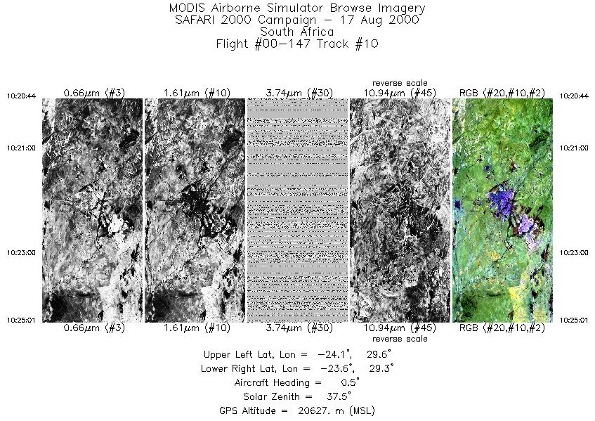
Browse Imagery Flight Tracks: 10 Scanlines: 66969 |
||||||||||||||||||||||||||||||||||||||||||||||||||||||||||||||||||||||||||||||||||||||||||||||||||
|
||||||||||||||||||||||||||||||||||||||||||||||||||||||||||||||||||||||||||||||||||||||||||||||||||
|
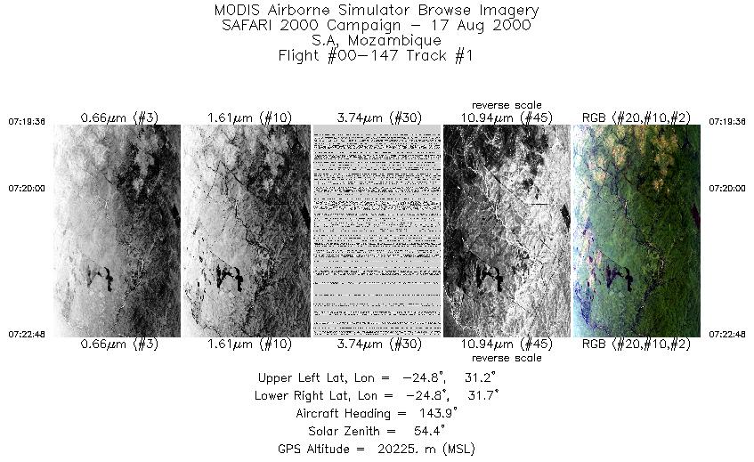
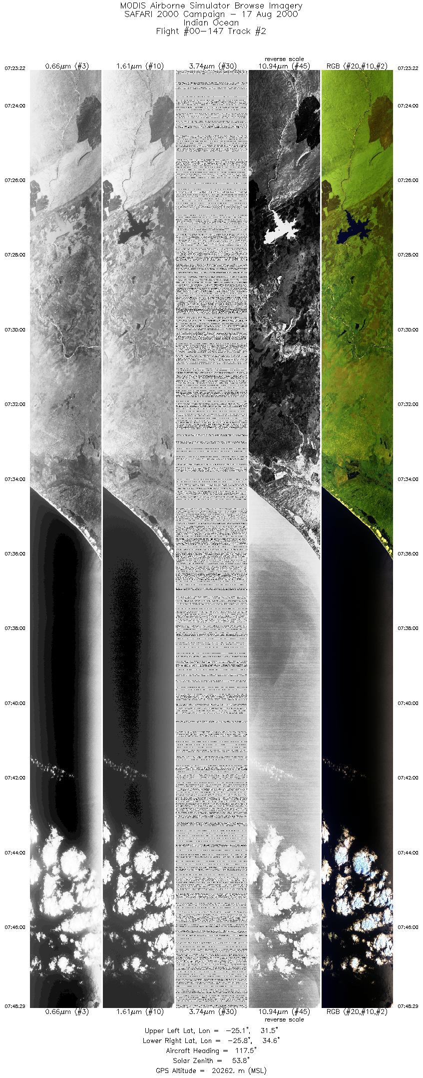
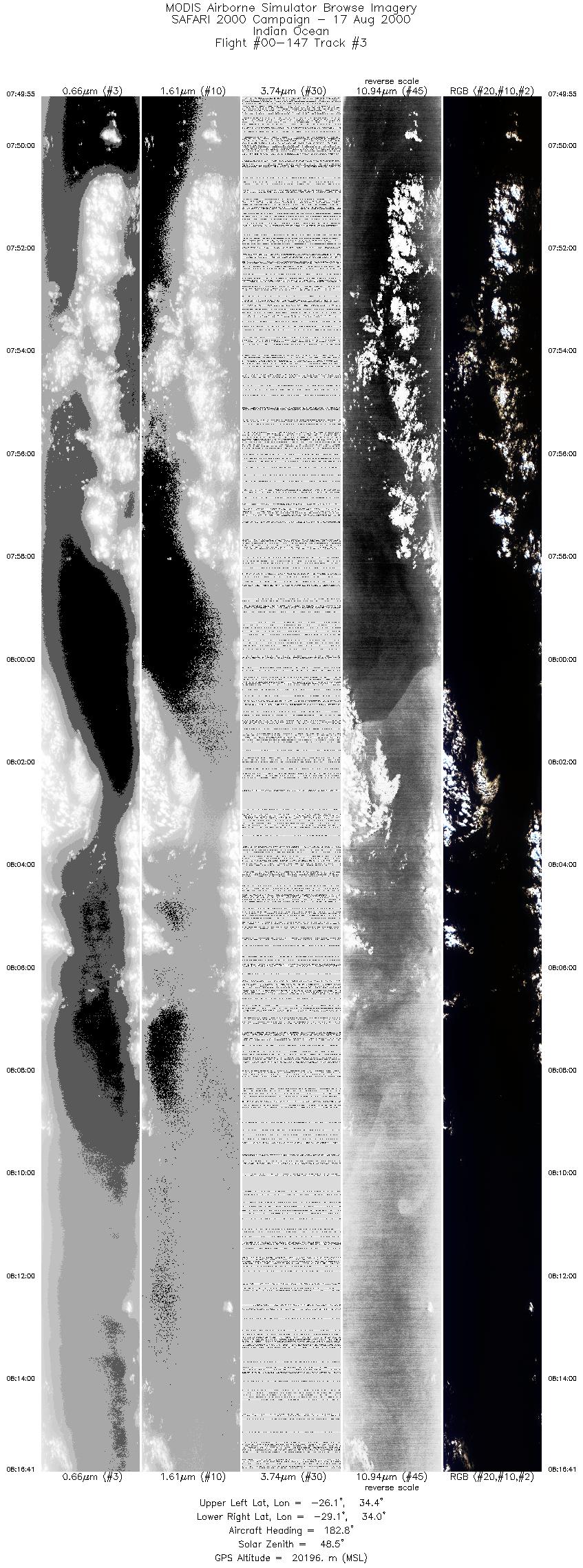
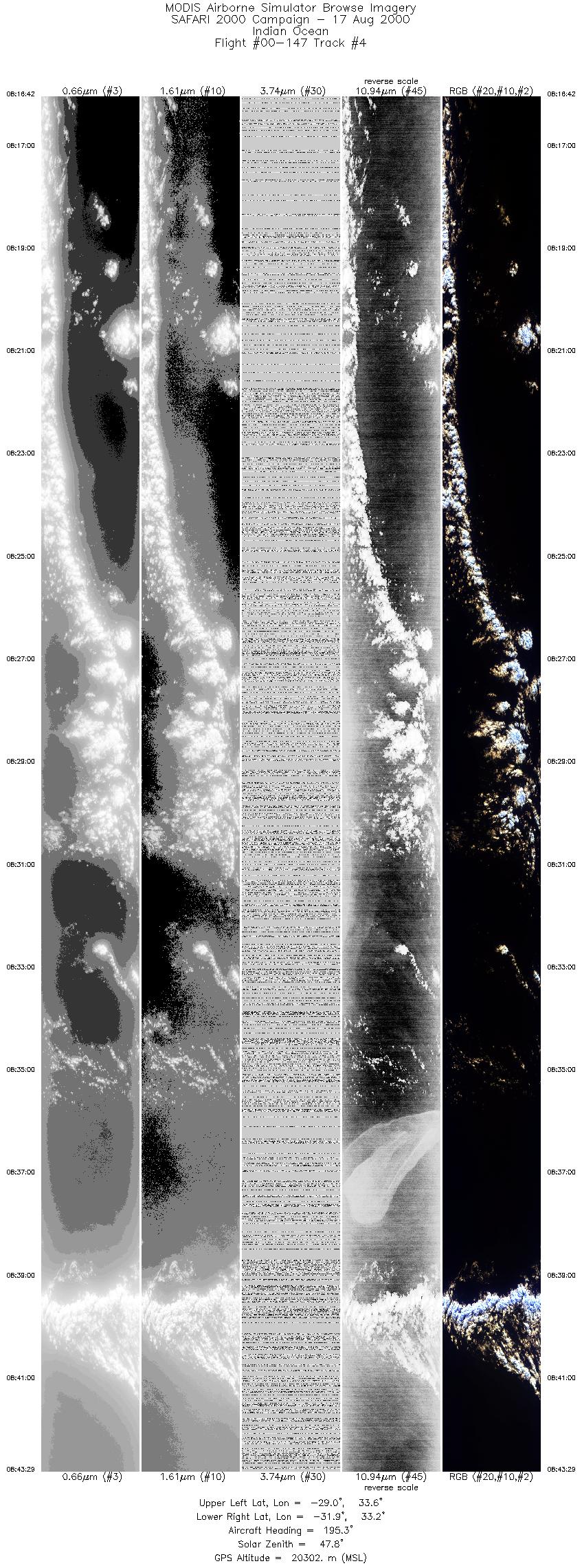
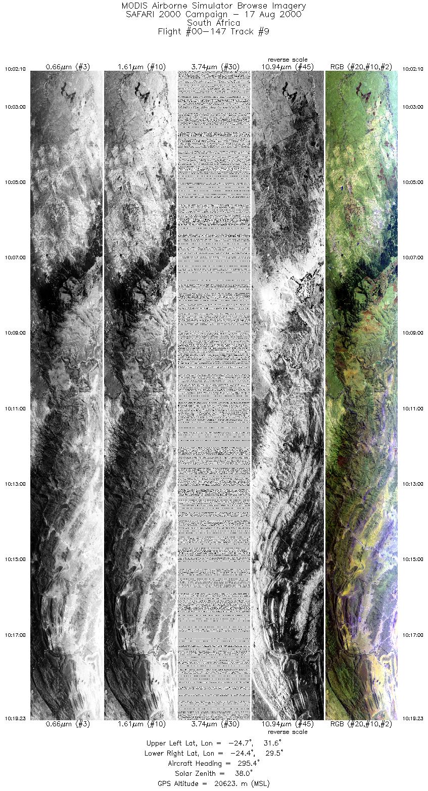
Flight Summary Report Author: Dr. Michael King Mission Scientist: Dr. Michael King ER-2 Pilot: Jim Barrilleaux Takeoff: 0645 (UTC) Landing: 1100 (UTC) Duration: 4:15 (h:mm) Objective and Summary:
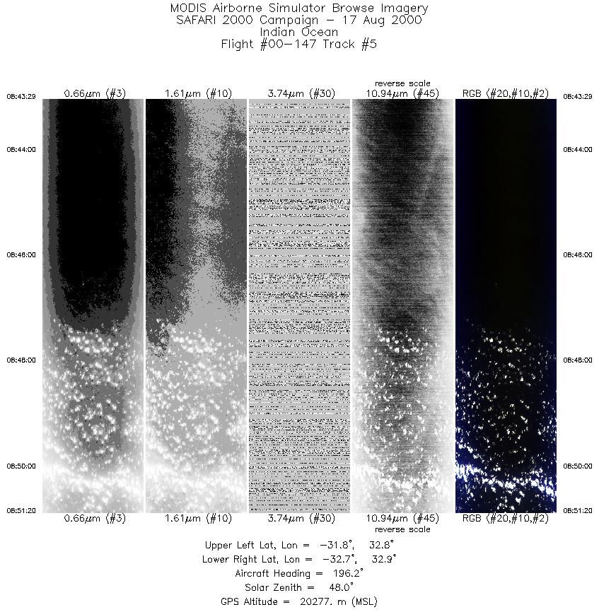
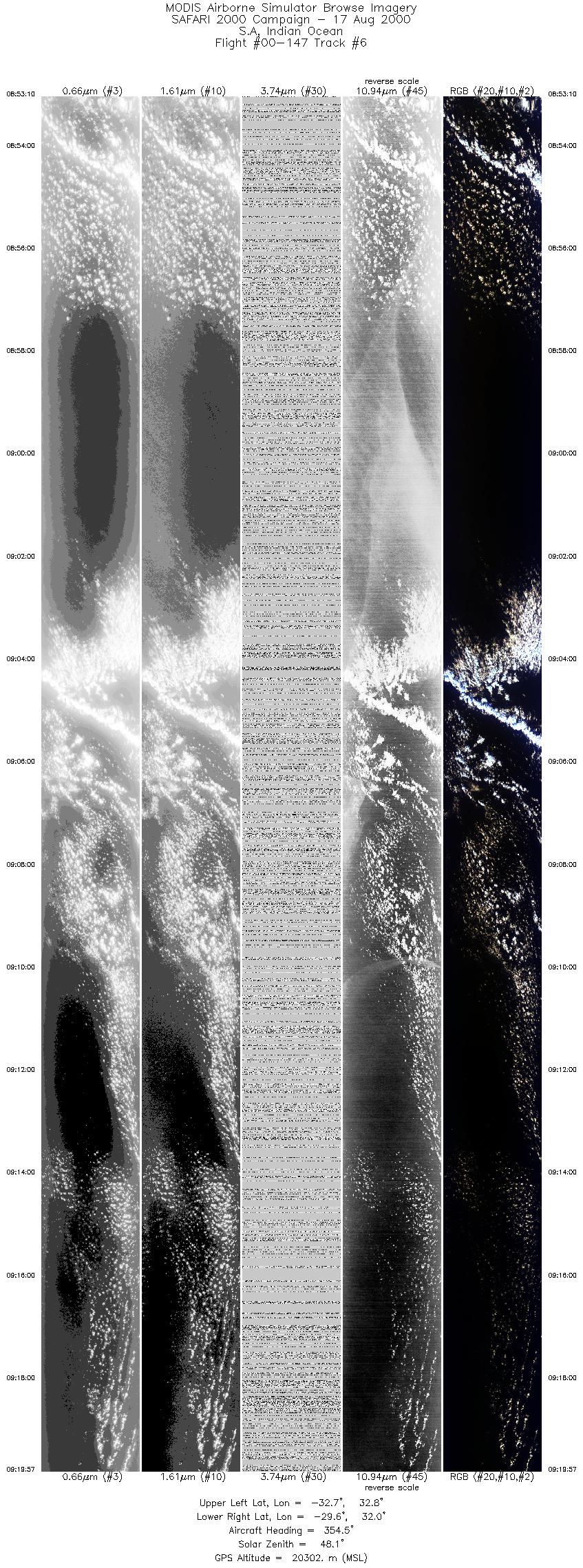
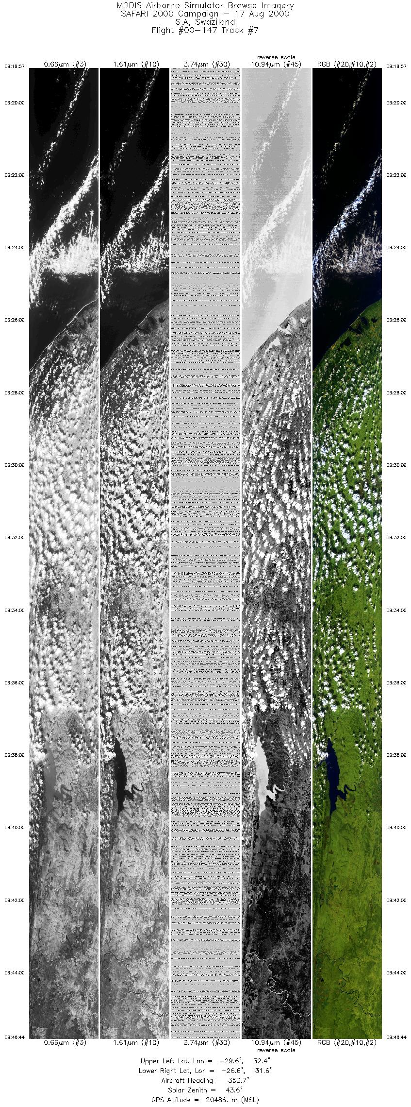
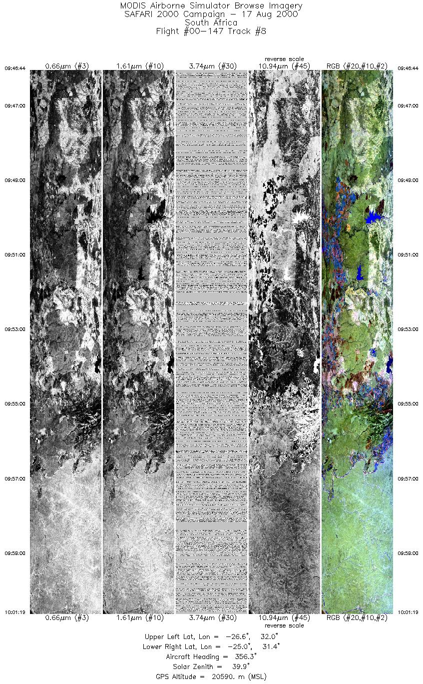
The ER-2 flew over surface sites at Skukuza (~0723 UTC), then over the Mozambique Channel off Maputo, turning SSW to underfly the TERRA satellite on a heading of 194.4° and an overpass time of ~0810 UTC. This flight track ran for 744 km from 26° 10´ S, 34° 35´ E to 32° 40´ S, 32° 45´ E. After this long flight line, the ER-2 turned approximately north and flew directly over the lowveld, crossing Swaziland and Skukuza (~1001 UTC), before turning for home. The return leg overflew the escarpment southwest of Blyde River Canyon. Cloudy skies occurred over part of the Mozambique Channel flight line, but skies were clear for the TERRA overpass and for approximately 125 km. The mission was coordinated with JRB and TERRA at ~0810 UTC, where JRB measured CO at 17 levels in the lower atmosphere for intercomparison with MOPITT (and MOPITT-A). The RC-10 camera was turned on for flights over the lowveld of Kruger National Park and Swaziland, but not during the offshore flight lines. Highlights:N/A AERONET sites and features overflown during this mission:
The ER-2 pilot reported 20% low cloud cover during the TERRA overpass at ~0810 UTC, but 50% for most of the TERRA ground track. On the return over the lowveld the visibility was quite good, with only about 5-8 modest veld fires being observed. Meteorology:A cold front was moving away to the southeast with a ridge from the south Atlantic high south of the country, causing an onshore flow along the southern and southeastern coastal regions. A high pressure cell aloft has moved off the east coast. The weather was generally fine over South Africa with the exception of cloudy areas along the southern and southeastern coastal areas where a few light showers occurred.
|
||||||||||||||||||||||||||||||||||||||||||||||||||||||||||||||||||||||||||||||||||||||||||||||||||


Flight 00-147


| Sample Imagery |
| Click image for full resolution |
|
Track #2 Mozambique |


|
|
R: 2.15µm G: 1.64µm B: 0.55µm |
- NASA Official: Matt Fladeland
- Project Manager: James Jacobson
- Website Editor: Eric Fraim
- Last Updated: November 16, 2021


