


MODIS Airborne Simulator (MAS)
CAMPAIGN SUMMARY INFORMATION
|
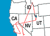
Geoscience Laser Altimeter System Validation Experiment Dates: October 16 - October 18 2003 Location: Western USA & Pacific Ocean Principal Investigators: Dr. Jim Spinhirne (NASA GSFC) Additional Sensors: CPL & MASTER Objective: To validate the newly-launched GLAS instrument aboard the ICESat Satellite. |
||||||||||||||||||||||||||||||||||||
|
Processing Information Flights Processed: 3 of 7 (see note below) Total Flight Tracks: Total Scanlines: Level-1B Version: #1 Calibration Type: Final Calibration Version: GLAS 1.0 Temperature Adjustment: None Status: Level-1B Data in HDF format is available. |
||||||||||||||||||||||||||||||||||||
|
Notice MAS was on the ER-2 for only 3 of the 7 GLAS missions. The MASTER instrument flew for all 7 ER-2 missions; links to the MASTER data are below. |
||||||||||||||||||||||||||||||||||||
|
Spectral Information Spectral Band Configuration Spectral Response Function Table |
||||||||||||||||||||||||||||||||||||
|
Level-1B Data Distribution Level 1 / Atmosphere Archive and Distribution System (LAADS) NASA Distributive Active Archive Centers (DAACs) |
||||||||||||||||||||||||||||||||||||
|
||||||||||||||||||||||||||||||||||||
|
Related Web Sites Official GLAS Home Page CPL Home Page MASTER Home Page NASA Airborne Science Program |
||||||||||||||||||||||||||||||||||||
 Flight: 04-605
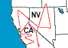 Flight: 04-606
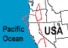 Flight: 04-607
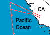 Flight: 04-608-00
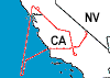 Flight: 04-609-00
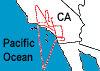 Flight: 04-610-00
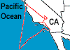 Flight: 04-612-00
GLAS


| Sample Imagery |
| Click image for full resolution |
|
Flight: 04-605, Track #11 Central Nevada |


|
|
R: 10.51µm G: 8.54µm B: 4.54µm |
- NASA Official: Matt Fladeland
- Project Manager: James Jacobson
- Website Editor: Eric Fraim
- Last Updated: March 21, 2024


