Flight: 99-091-00
Date: June 30, 1999
Aircraft: ER-2
Deployment: DFRC June 1999
Flight Location: Monterey Bay, CA
Principal Investigator: Conel (JPL), Marchand (Penn State)
Additional Sensors: RC-10, AirMisr, MAS50
|
Data Evaluation
N/A
|
Processing Information
Level-1B Data in HDF format is available
Flight Line Summary
Spectral Band Configuration
Spectral Response Function Table
Spectral Response Function (text)
|
Browse Imagery
Flight Tracks: 11
Scanlines: 38067
|
Browse Imagery Table
|
Click a Flight Track number to view a quicklook image
Lat/Lon ranges are for the BEG-END scanline nadir pixels
|
Flight
Track |
Time Span
(UTC) |
Heading
(Deg) |
Lat Range
(Deg N) |
Lon Range
(Deg W) |
Length
(Scanlines) |
Altitude
(Meters) |
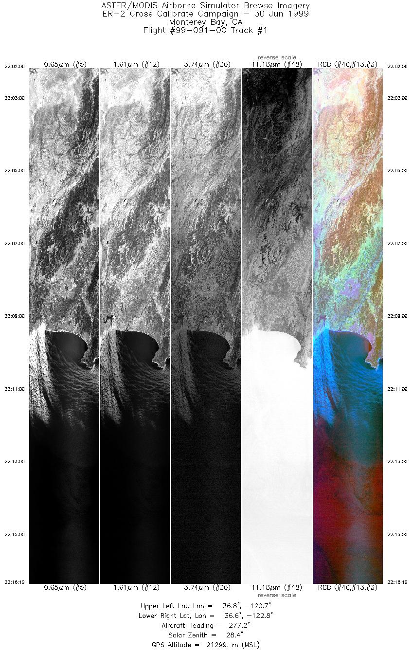
| 1 |
22:02 - 22:16 |
276.0 |
36.653 - 36.742 |
120.762 - 122.814 |
5302 |
21299 |
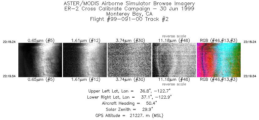
| 2 |
22:18 - 22:19 |
50.2 |
36.892 - 37.001 |
122.880 - 122.727 |
562 |
21227 |
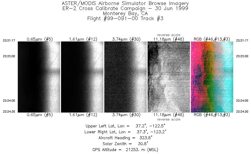
| 3 |
22:21 - 22:24 |
322.7 |
37.138 - 37.422 |
122.721 - 123.026 |
1203 |
21253 |
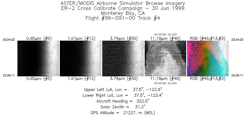
| 4 |
22:24 - 22:26 |
322.5 |
37.425 - 37.572 |
123.031 - 123.189 |
618 |
21227 |
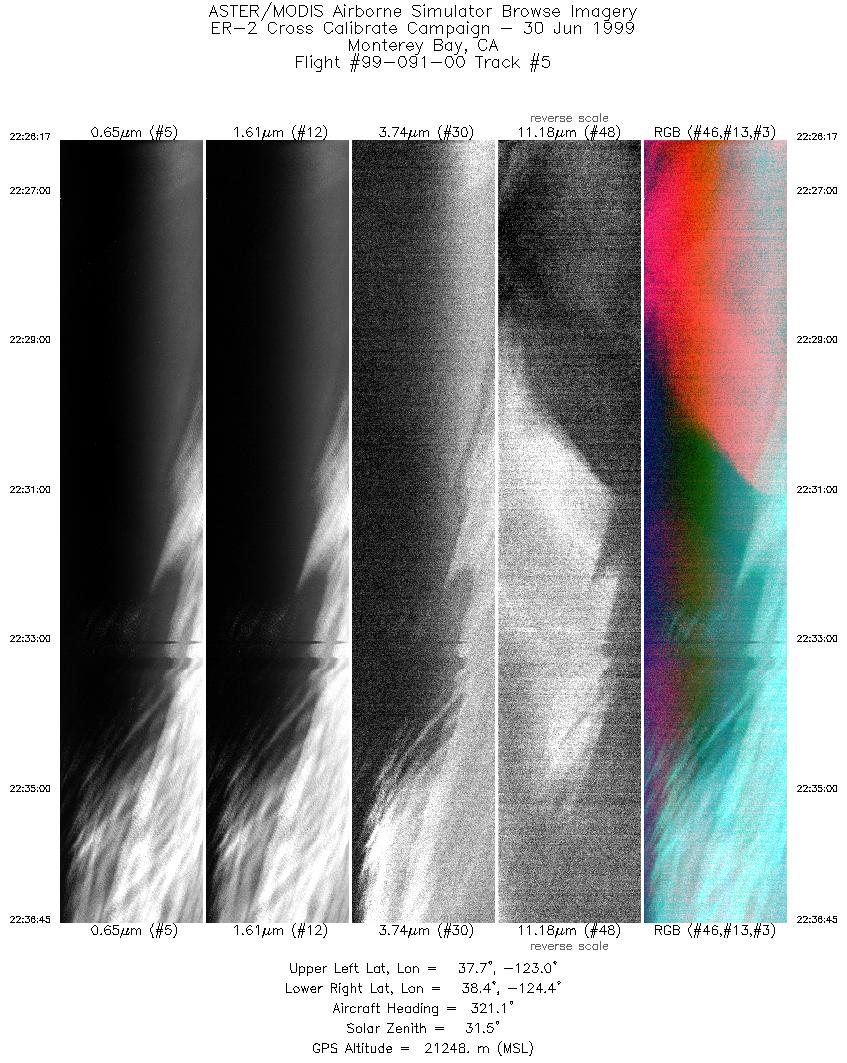
| 5 |
22:26 - 22:36 |
320.1 |
37.580 - 38.489 |
123.195 - 124.241 |
3917 |
21248 |
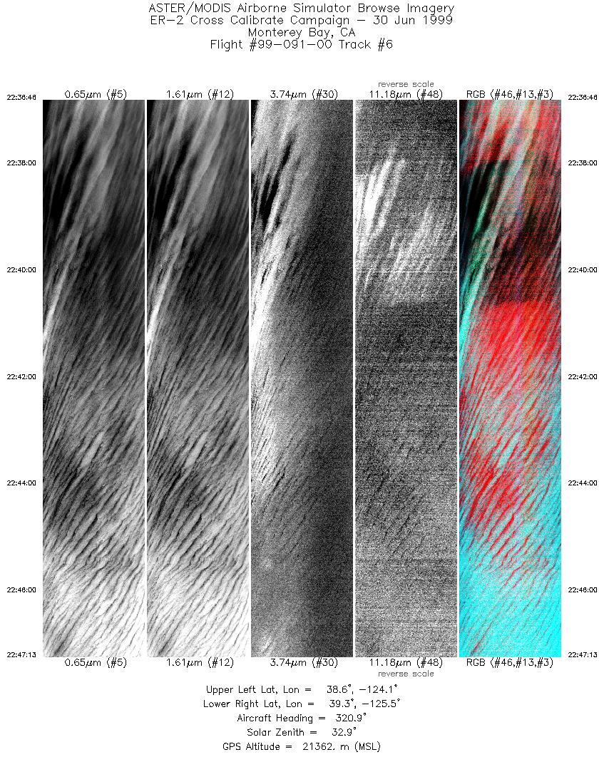
| 6 |
22:36 - 22:47 |
320.4 |
38.488 - 39.405 |
124.244 - 125.321 |
3912 |
21362 |
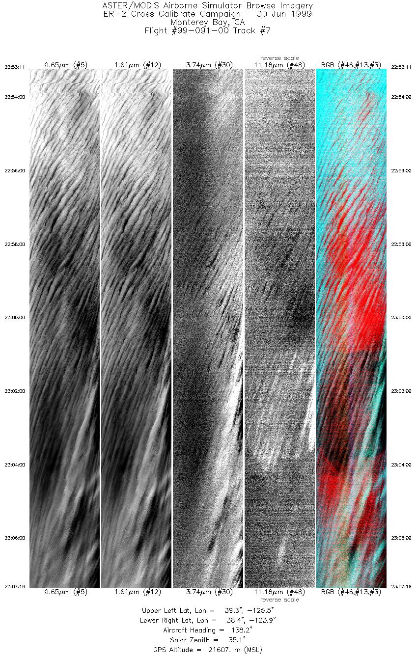
| 7 |
22:53 - 23:07 |
137.6 |
39.456 - 38.290 |
125.362 - 124.031 |
5291 |
21607 |
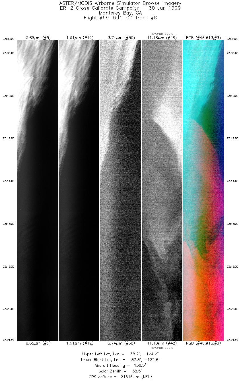
| 8 |
23:07 - 23:21 |
137.1 |
38.286 - 37.154 |
124.029 - 122.726 |
5285 |
21816 |
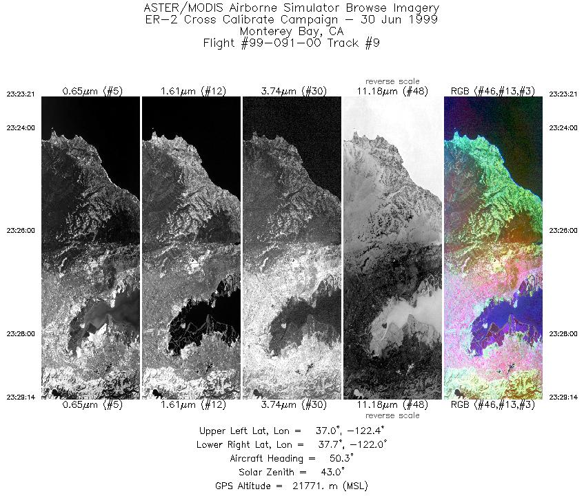
| 9 |
23:23 - 23:29 |
53.5 |
37.170 - 37.575 |
122.520 - 121.898 |
2203 |
21771 |
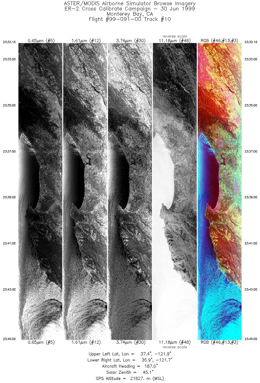
| 10 |
23:32 - 23:45 |
188.2 |
37.402 - 35.967 |
121.656 - 121.951 |
4831 |
21827 |
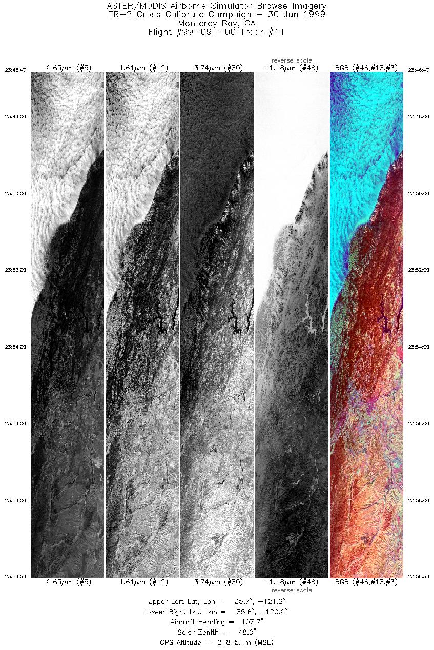
| 11 |
23:46 - 23:59 |
107.1 |
35.874 - 35.471 |
121.809 - 120.097 |
4943 |
21815 |
|


