Flight: 99-006-10
Date: September 22, 1999
Aircraft: DOE B-200 Kingair
Deployment: B200 Autumn 1999
Flight Location: Houston, TX
Principal Investigator: Quatrochi (MSFC)
Additional Sensors: RC-30 (CIR)
|
Data Evaluation
In many flights during the 99-006 deployment, a minor pixel offset occured in channels 20-22. In addition, some flights (for example 99-006-08 and 99-006-14) contain banding in channel 22. This banding was a result of the analog offset in channel 22 being fixed at a value of 1024, meaning the digital to analog converter did not move through the entire signal range.
|
Processing Information
Level-1B Data in HDF format is available
Flight Line Summary
Spectral Band Configuration
Spectral Response Function Table
Spectral Response Function (text)
|
Browse Imagery
Flight Tracks: 20
Scanlines: 74465
|
Browse Imagery Table
|
Click a Flight Track number to view a quicklook image
Lat/Lon ranges are for the BEG-END scanline nadir pixels
|
Flight
Track |
Time Span
(UTC) |
Heading
(Deg) |
Lat Range
(Deg N) |
Lon Range
(Deg W) |
Length
(Scanlines) |
Altitude
(Meters) |
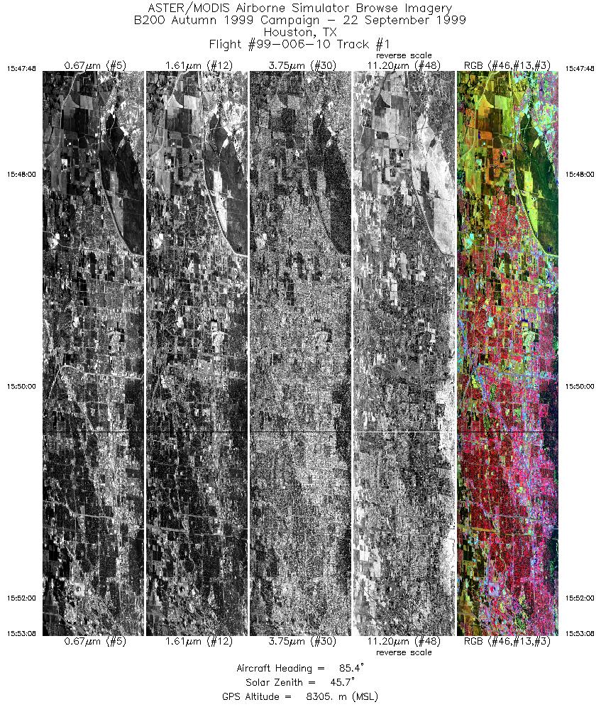
| 1 |
15:47 - 15:53 |
85.4 |
29.700 - 29.700 |
95.769 - 95.376 |
3980 |
8311 |
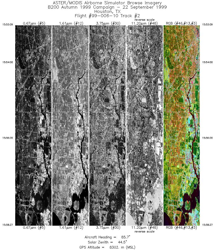
| 2 |
15:53 - 15:58 |
85.6 |
29.700 - 29.700 |
95.375 - 94.993 |
3956 |
8307 |
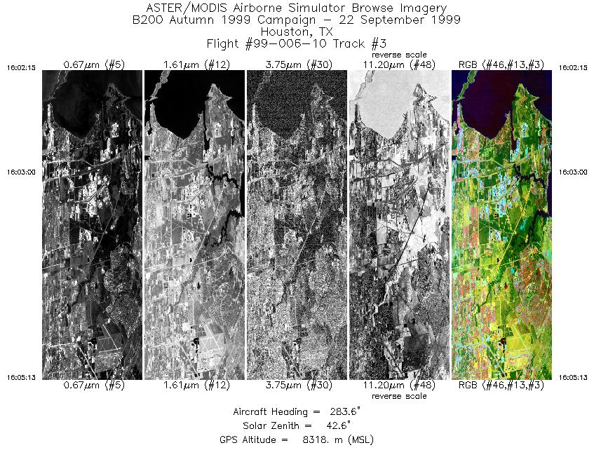
| 3 |
16:02 - 16:05 |
279.3 |
29.621 - 29.625 |
94.969 - 95.185 |
2213 |
8323 |
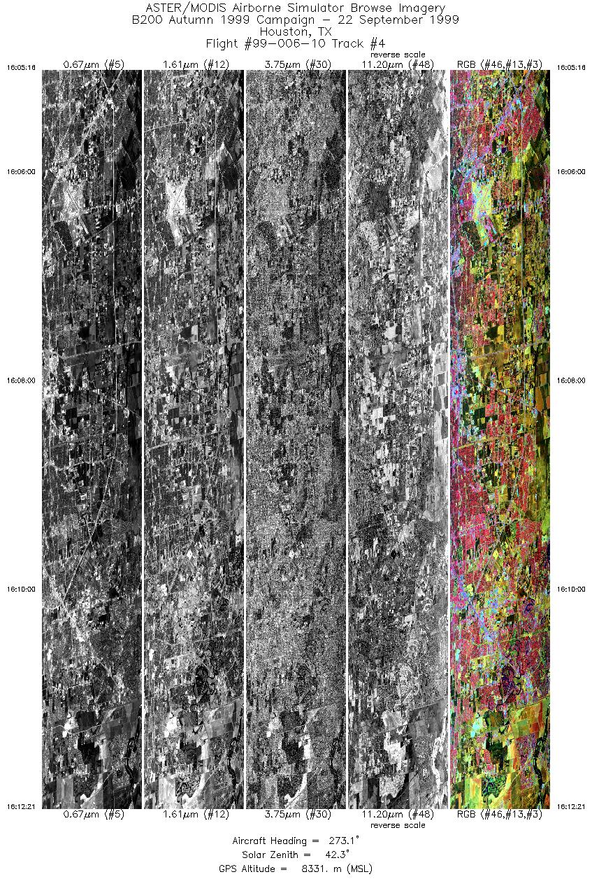
| 4 |
16:05 - 16:12 |
275.4 |
29.625 - 29.625 |
95.188 - 95.708 |
5286 |
8339 |
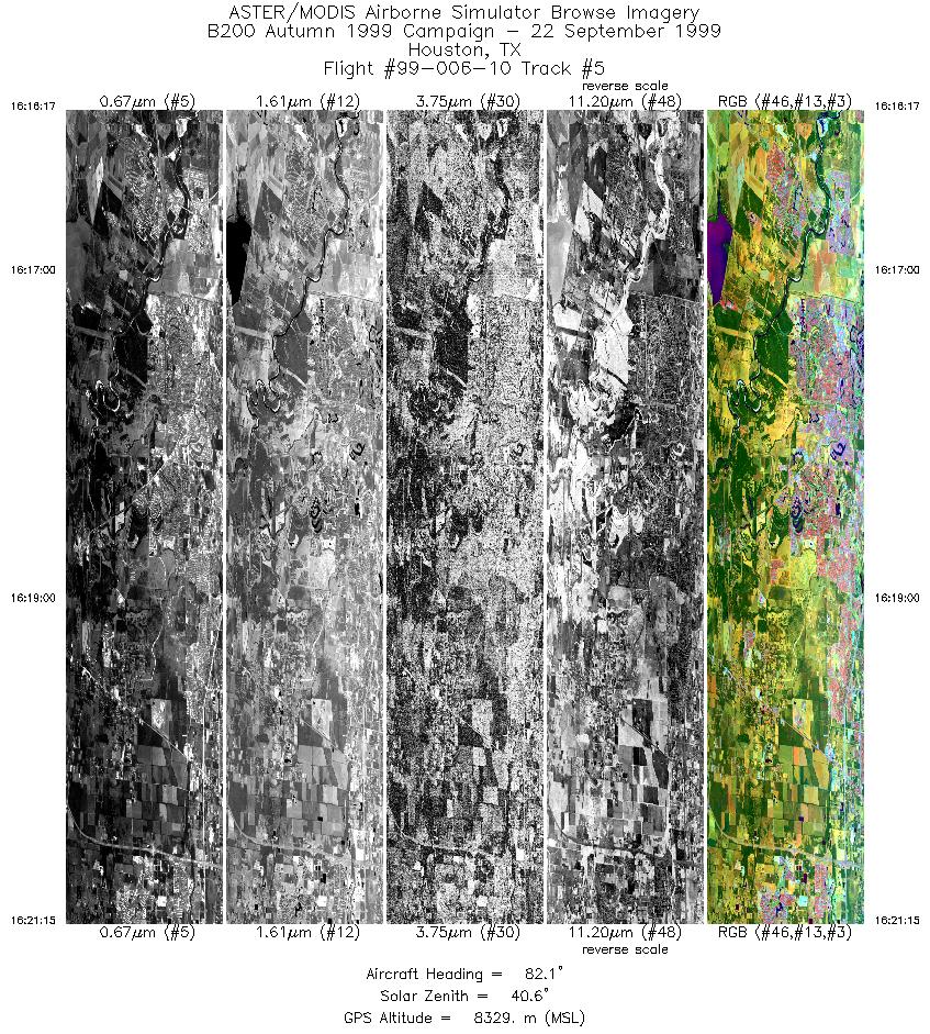
| 5 |
16:16 - 16:21 |
84.4 |
29.549 - 29.550 |
95.718 - 95.353 |
3707 |
8304 |
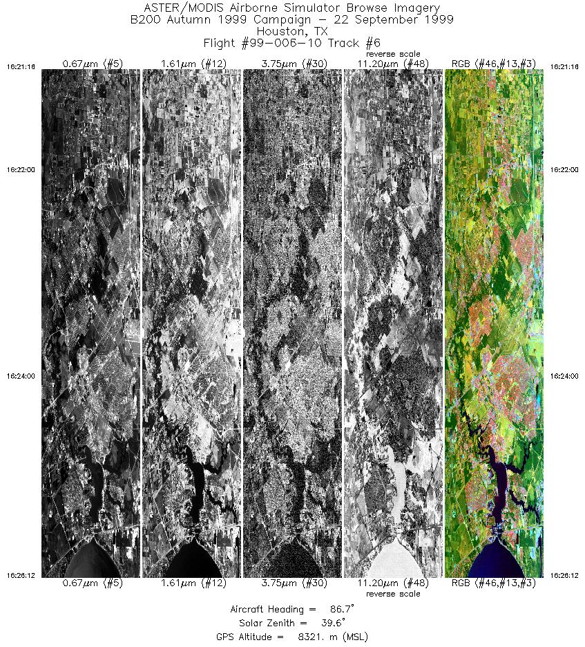
| 6 |
16:21 - 16:26 |
86.5 |
29.550 - 29.550 |
95.352 - 94.991 |
3682 |
8323 |
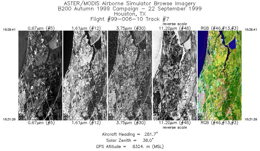
| 7 |
16:29 - 16:31 |
277.8 |
29.473 - 29.475 |
94.949 - 95.091 |
1467 |
8325 |
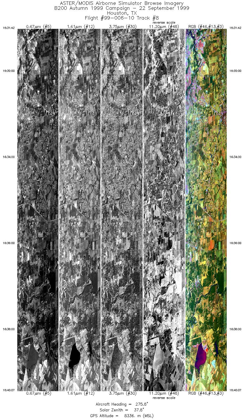
| 8 |
16:31 - 16:40 |
277.4 |
29.475 - 29.475 |
95.095 - 95.708 |
6280 |
8338 |
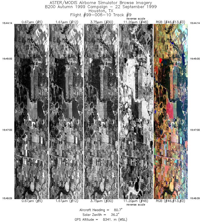
| 9 |
16:44 - 16:49 |
82.6 |
29.400 - 29.400 |
95.707 - 95.340 |
3668 |
8345 |
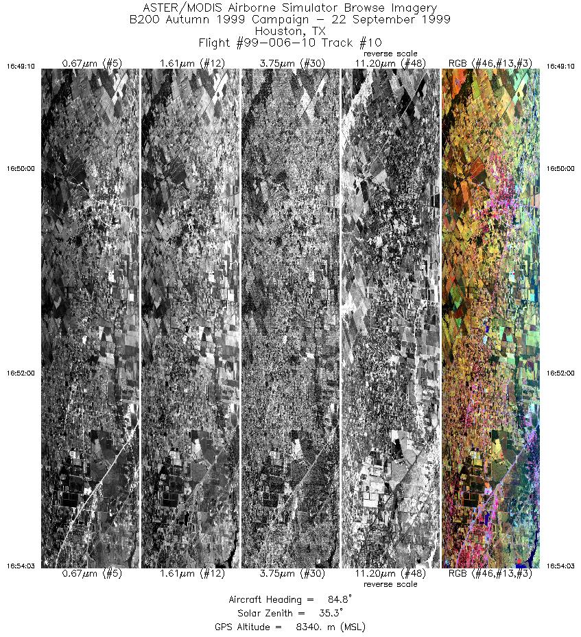
| 10 |
16:49 - 16:54 |
85.2 |
29.400 - 29.400 |
95.338 - 94.977 |
3644 |
8339 |
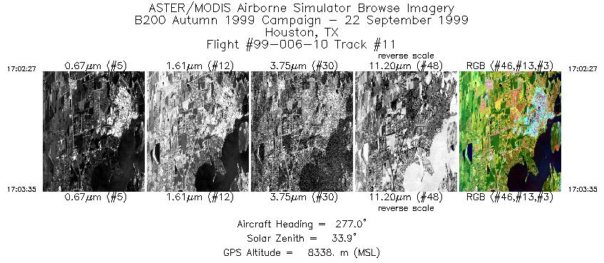
| 11 |
17:02 - 17:03 |
277.5 |
29.776 - 29.775 |
94.979 - 95.062 |
847 |
8337 |
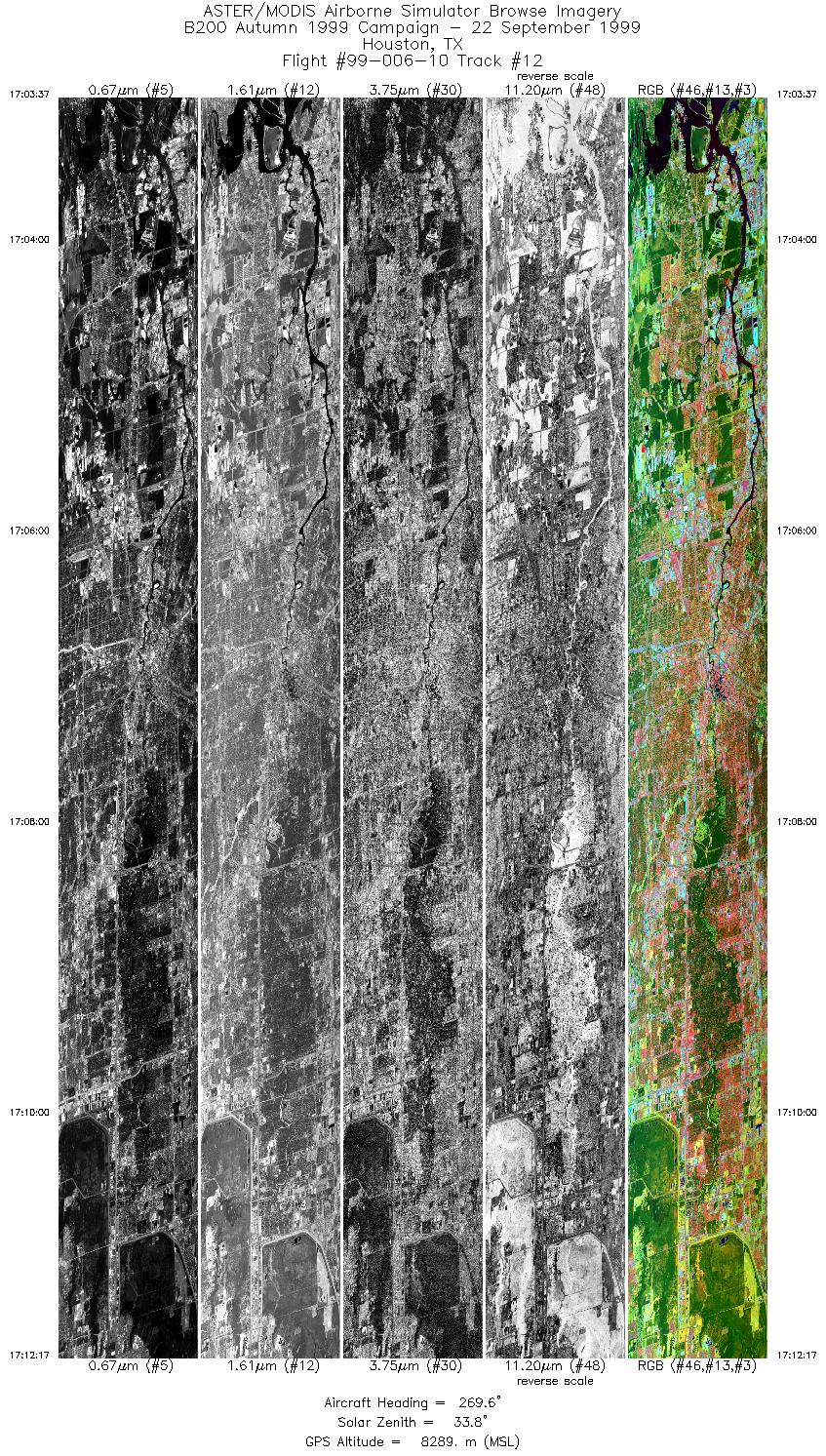
| 12 |
17:03 - 17:12 |
270.1 |
29.775 - 29.775 |
95.065 - 95.707 |
6466 |
8288 |
| 13 |
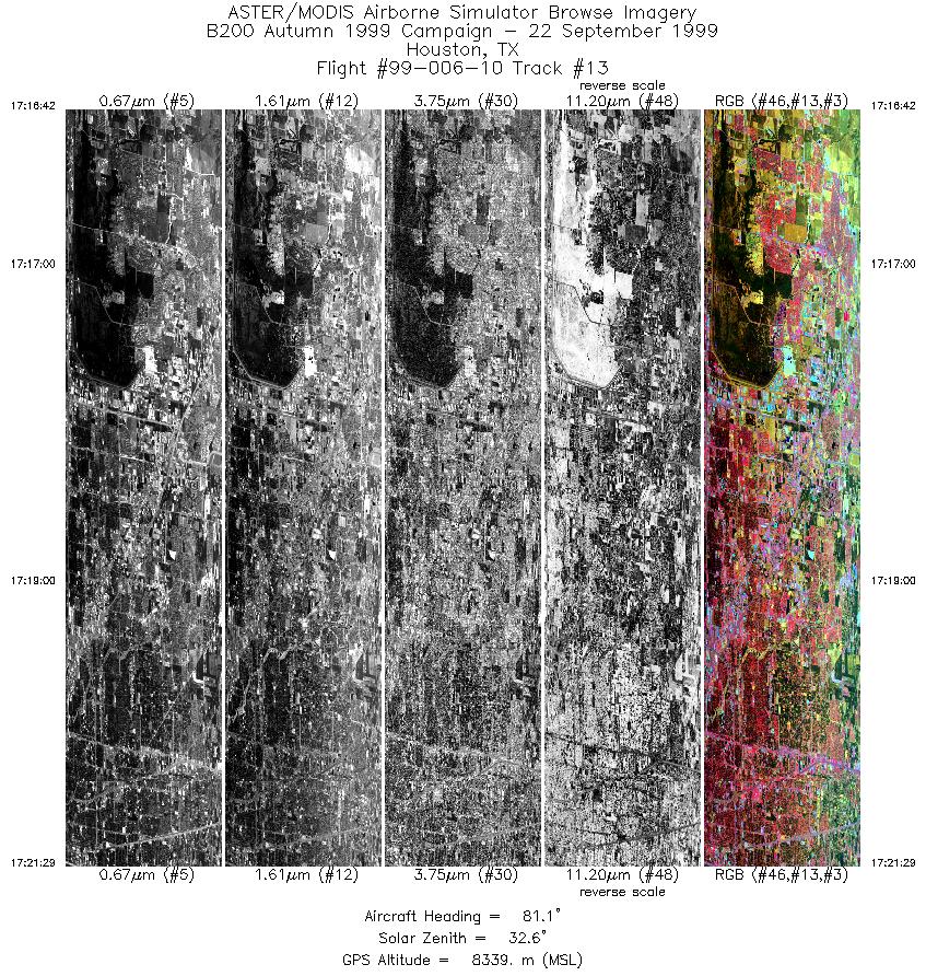
17:16 - 17:21 |
81.9 |
29.849 - 29.850 |
95.703 - 95.347 |
3461 |
8356 |
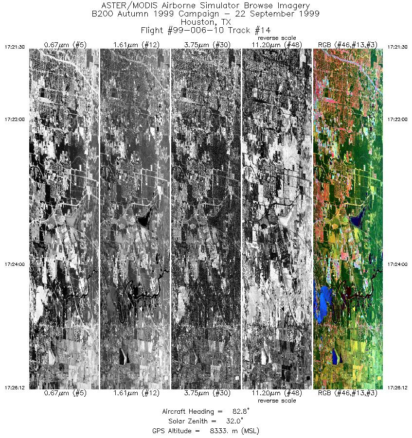
| 14 |
17:21 - 17:26 |
83.6 |
29.850 - 29.850 |
95.345 - 94.993 |
3508 |
8336 |
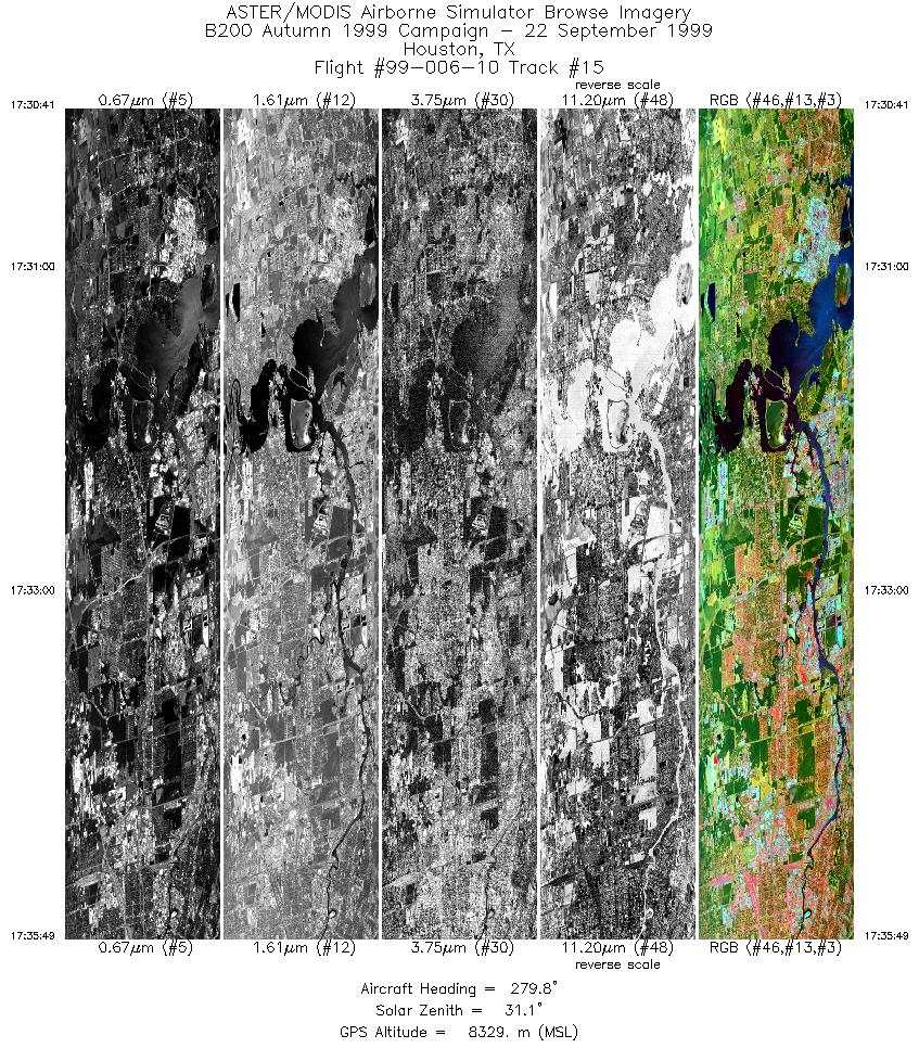
| 15 |
17:30 - 17:35 |
278.9 |
29.775 - 29.775 |
94.947 - 95.326 |
3831 |
8330 |
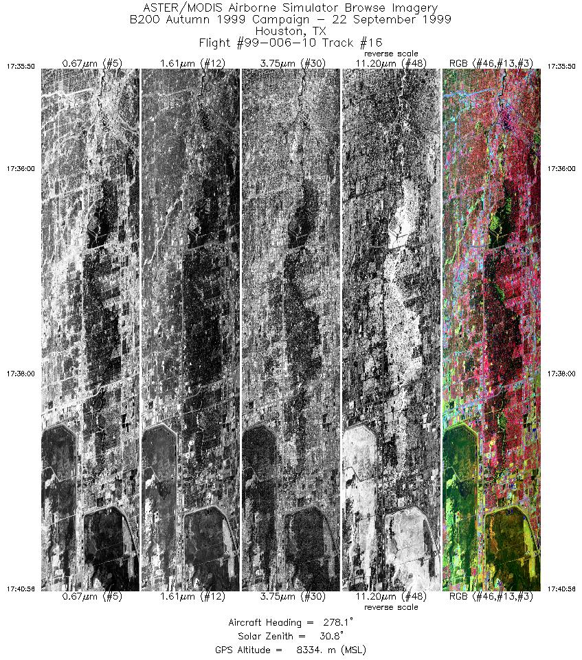
| 16 |
17:35 - 17:40 |
278.2 |
29.775 - 29.775 |
95.327 - 95.705 |
3805 |
8335 |
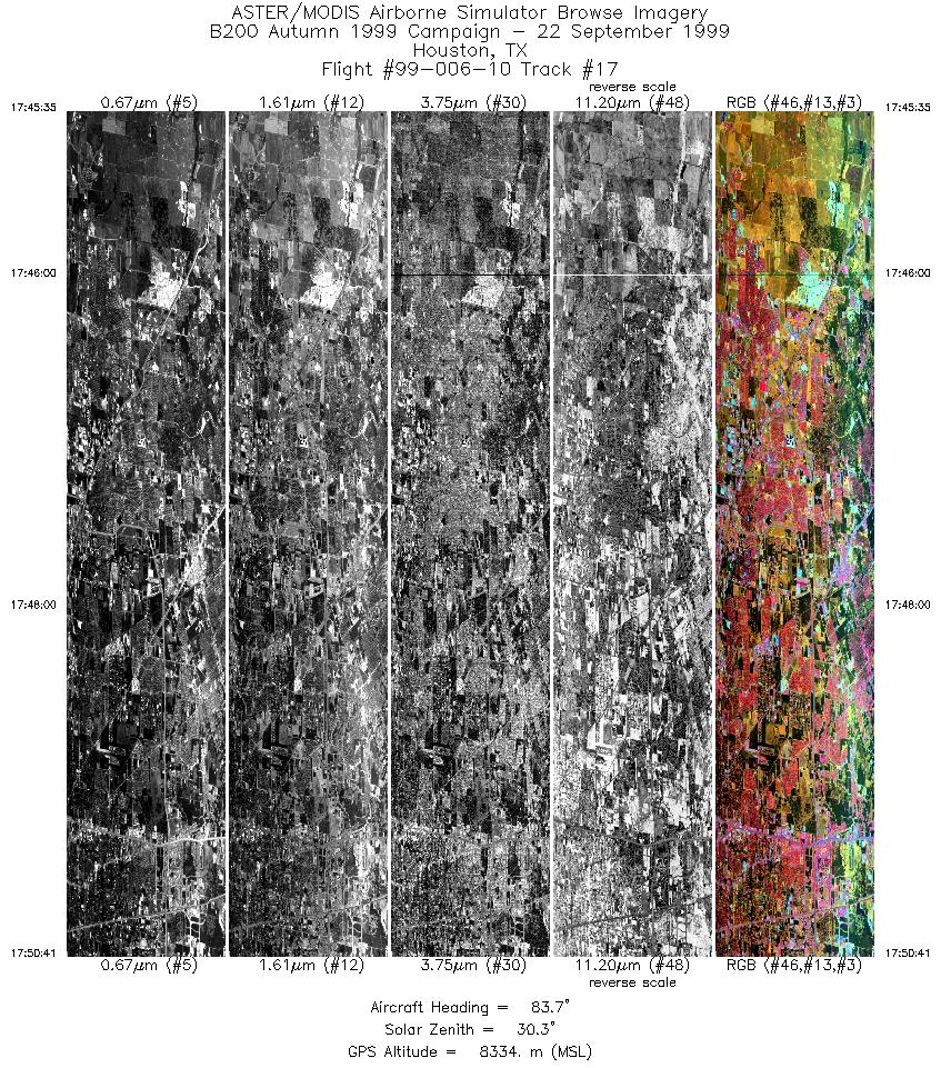
| 17 |
17:45 - 17:50 |
83.6 |
29.925 - 29.925 |
95.745 - 95.357 |
3806 |
8338 |
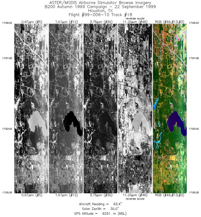
| 18 |
17:50 - 17:55 |
83.5 |
29.925 - 29.925 |
95.356 - 94.987 |
3582 |
8331 |
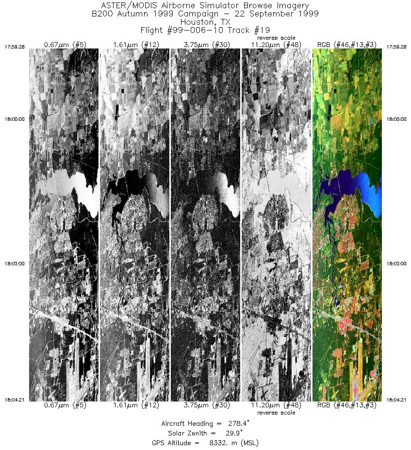
| 19 |
17:59 - 18:04 |
277.9 |
30.000 - 30.000 |
94.993 - 95.351 |
3644 |
8330 |
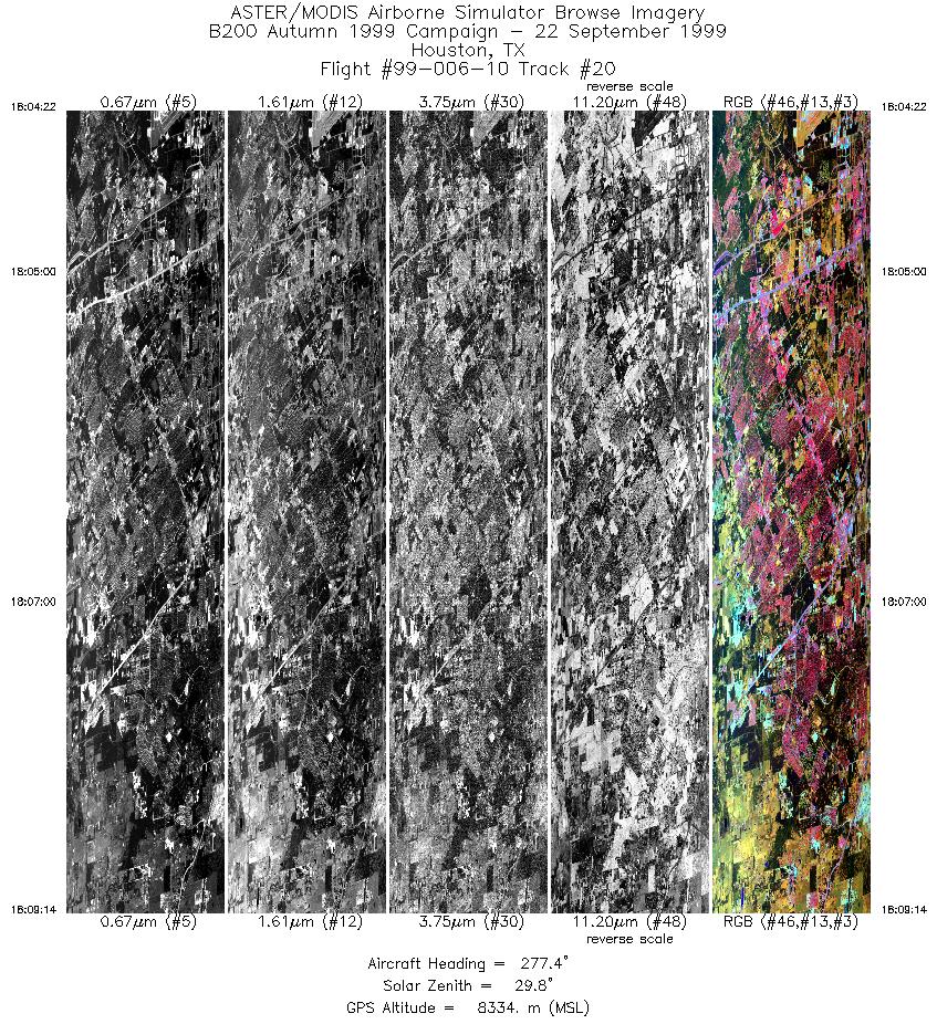
| 20 |
18:04 - 18:09 |
278.2 |
30.000 - 30.000 |
95.352 - 95.708 |
3632 |
8335 |
|


