Flight: 99-003-06
Date: May 4, 1999
Aircraft: DOE B-200 Kingair
Deployment: Baja 1999
Flight Location: Puertecitos, Baja Mexico
Principal Investigator: Stock (JPL)
Additional Sensors: RC-30 (CIR)
|
Data Evaluation
N/A
|
Processing Information
Level-1B Data in HDF format is available
Flight Line Summary
Spectral Band Configuration
Spectral Response Function Table
Spectral Response Function (text)
|
Browse Imagery
Flight Tracks: 15
Scanlines: 72697
|
Browse Imagery Table
|
Click a Flight Track number to view a quicklook image
Lat/Lon ranges are for the BEG-END scanline nadir pixels
|
Flight
Track |
Time Span
(UTC) |
Heading
(Deg) |
Lat Range
(Deg N) |
Lon Range
(Deg W) |
Length
(Scanlines) |
Altitude
(Meters) |
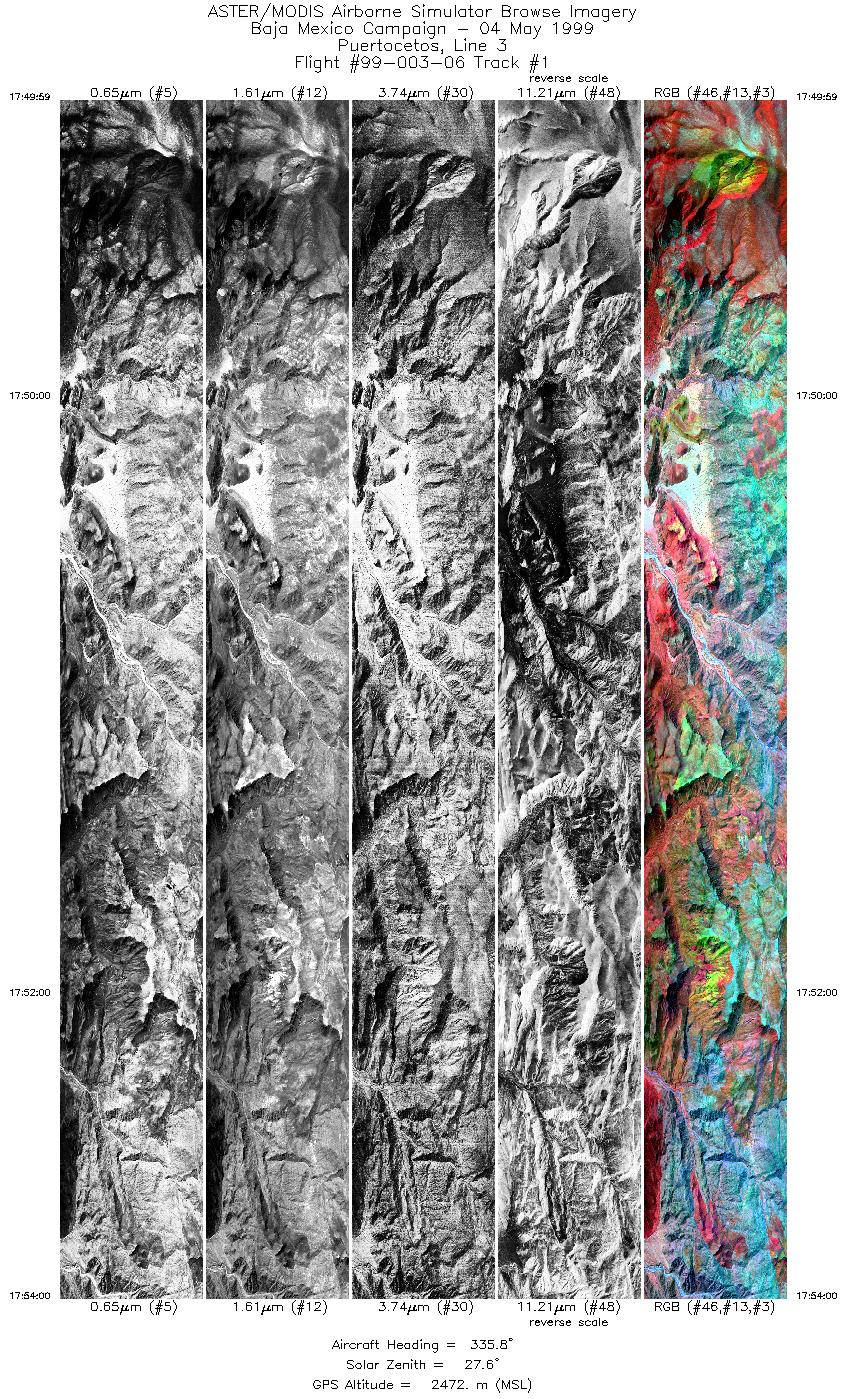
| 1 |
17:49 - 17:54 |
335.5 |
29.617 - 29.805 |
114.452 - 114.534 |
5996 |
2472 |
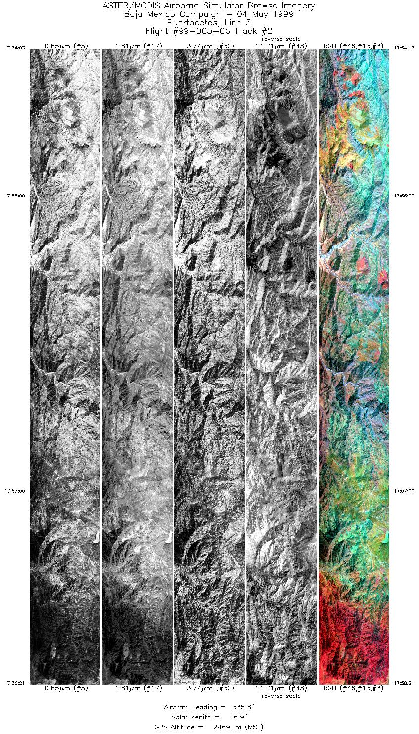
| 2 |
17:54 - 17:58 |
335.6 |
29.807 - 30.010 |
114.534 - 114.623 |
6418 |
2469 |
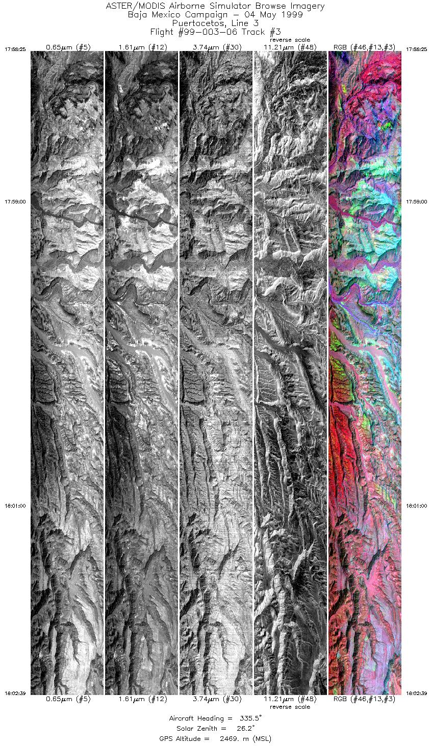
| 3 |
17:58 - 18:02 |
335.9 |
30.014 - 30.220 |
114.625 - 114.714 |
6318 |
2469 |
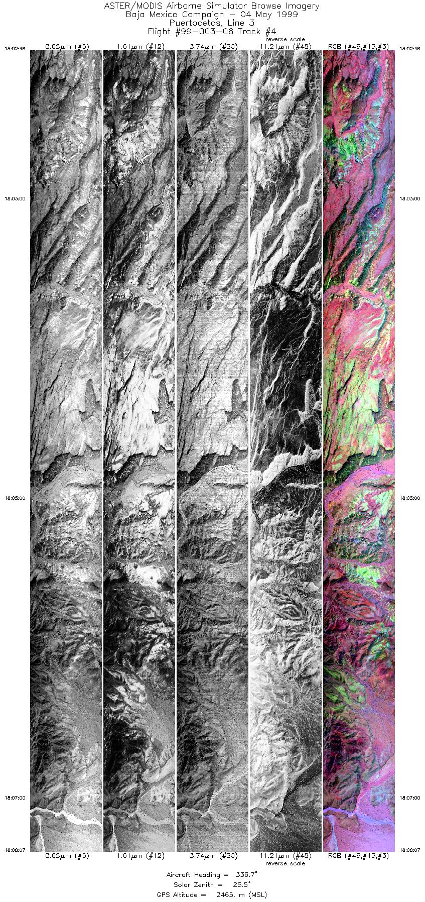
| 4 |
18:02 - 18:08 |
337.6 |
30.224 - 30.505 |
114.716 - 114.838 |
7985 |
2465 |
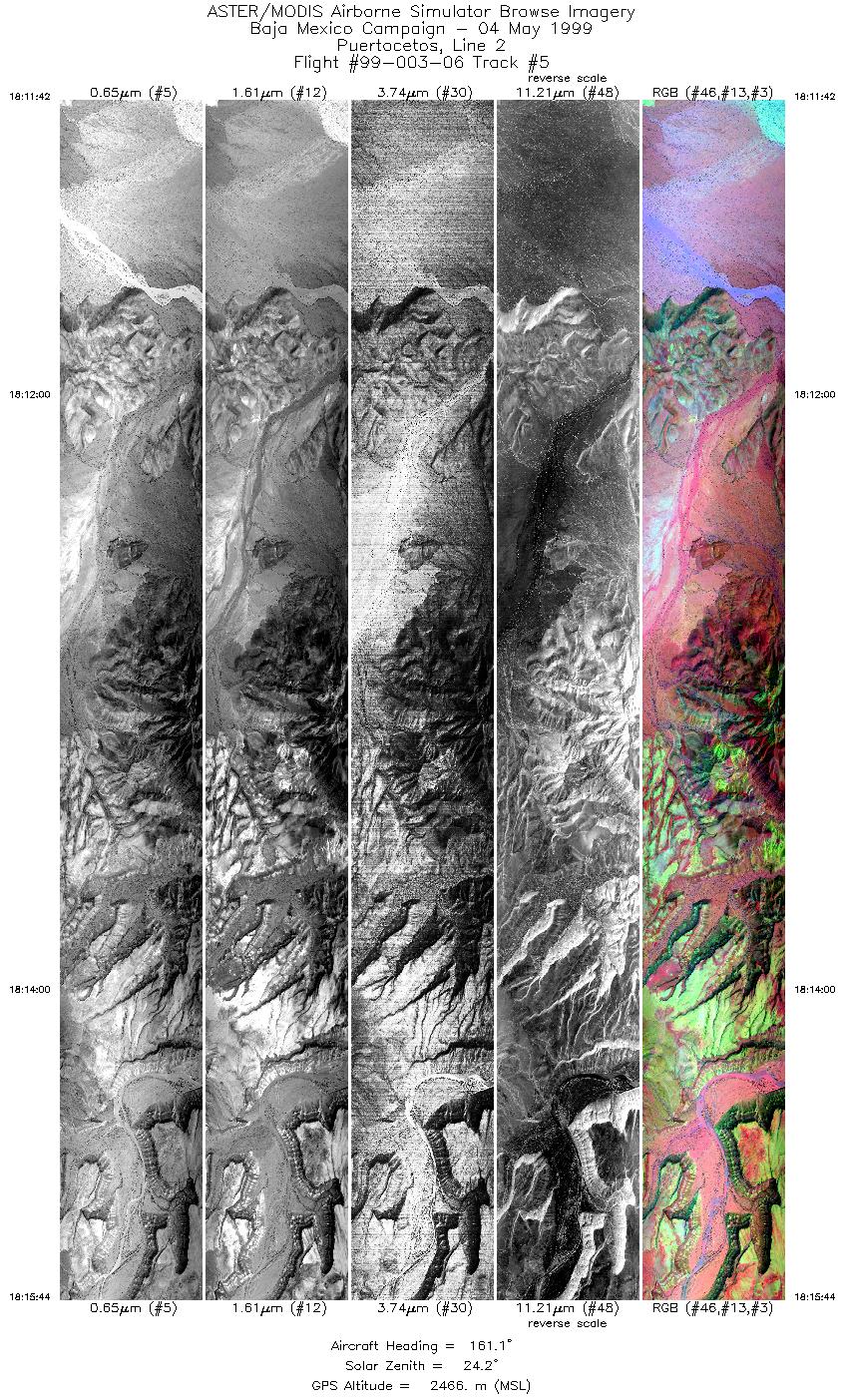
| 5 |
18:11 - 18:15 |
161.1 |
30.523 - 30.329 |
114.869 - 114.785 |
6018 |
2466 |
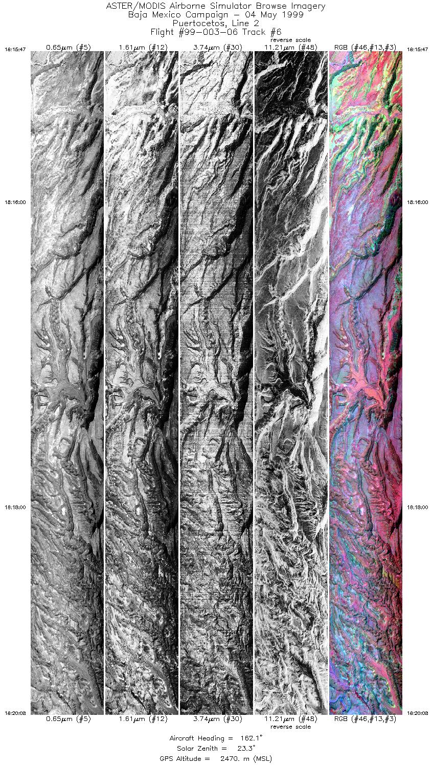
| 6 |
18:15 - 18:20 |
162.9 |
30.326 - 30.106 |
114.784 - 114.688 |
6491 |
2470 |
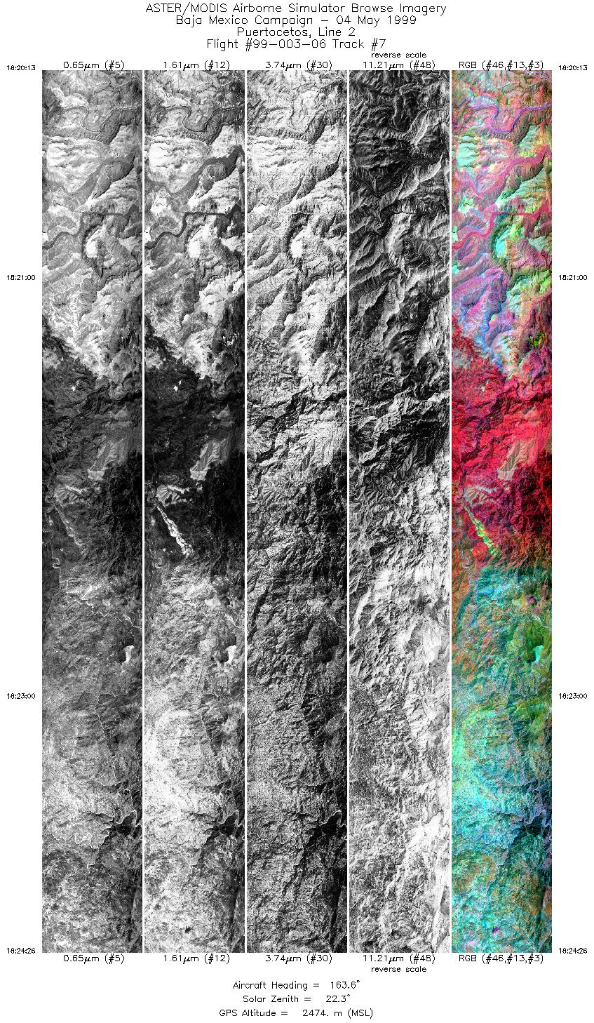
| 7 |
18:20 - 18:24 |
163.3 |
30.098 - 29.885 |
114.685 - 114.593 |
6292 |
2474 |
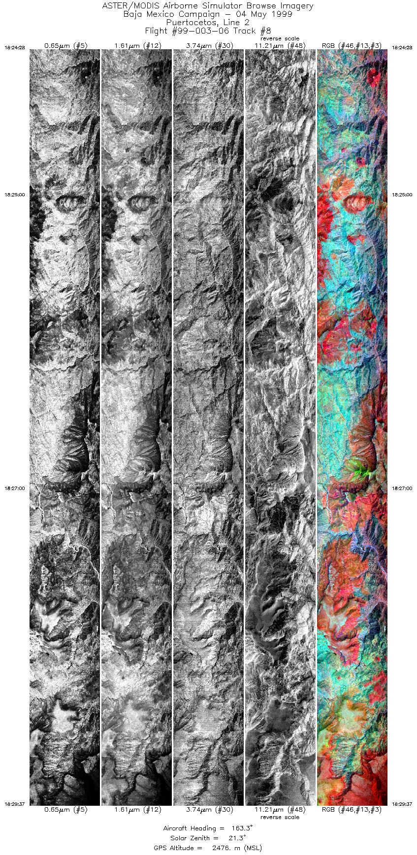
| 8 |
18:24 - 18:29 |
164.3 |
29.885 - 29.624 |
114.593 - 114.480 |
7684 |
2476 |
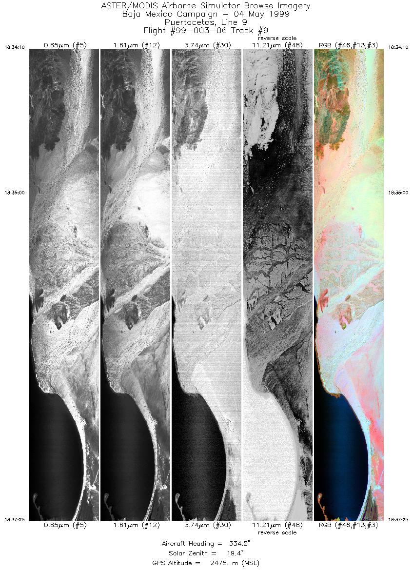
| 9 |
18:34 - 18:37 |
336.3 |
29.658 - 29.809 |
114.326 - 114.392 |
4849 |
2475 |
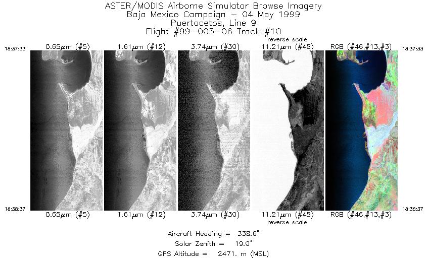
| 10 |
18:37 - 18:38 |
337.7 |
29.815 - 29.866 |
114.394 - 114.417 |
1592 |
2471 |
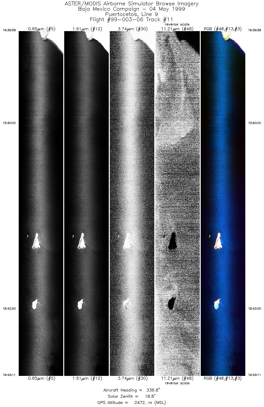
| 11 |
18:39 - 18:43 |
336.4 |
29.905 - 30.087 |
114.434 - 114.511 |
5546 |
2472 |
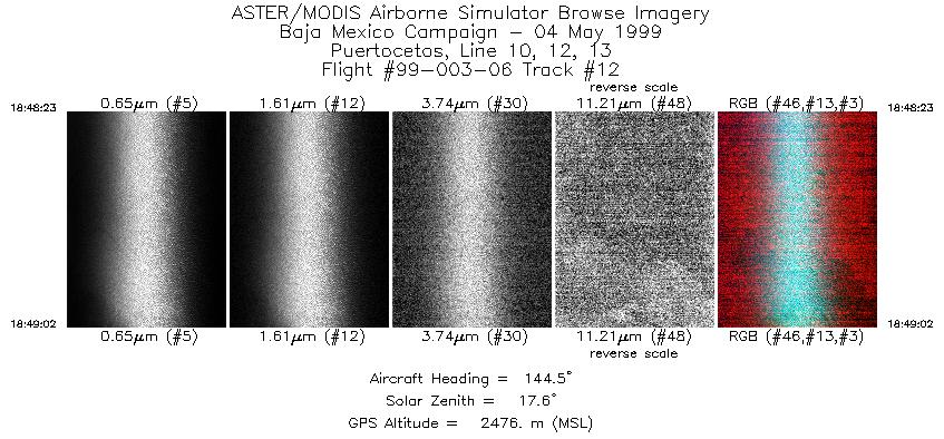
| 12 |
18:48 - 18:49 |
144.0 |
30.016 - 29.989 |
114.444 - 114.420 |
970 |
2476 |
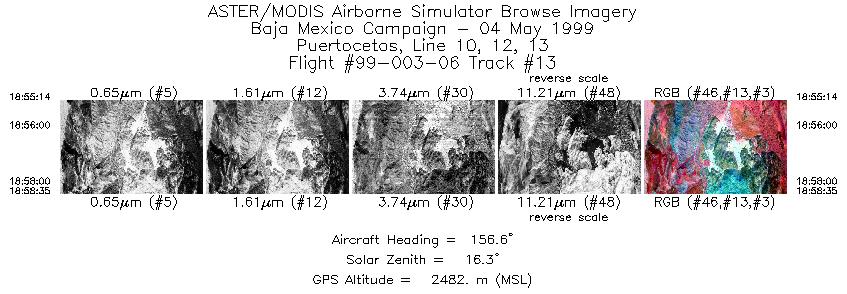
| 13 |
18:55 - 18:58 |
243.2 |
29.686 - 29.686 |
114.317 - 114.267 |
5022 |
2480 |
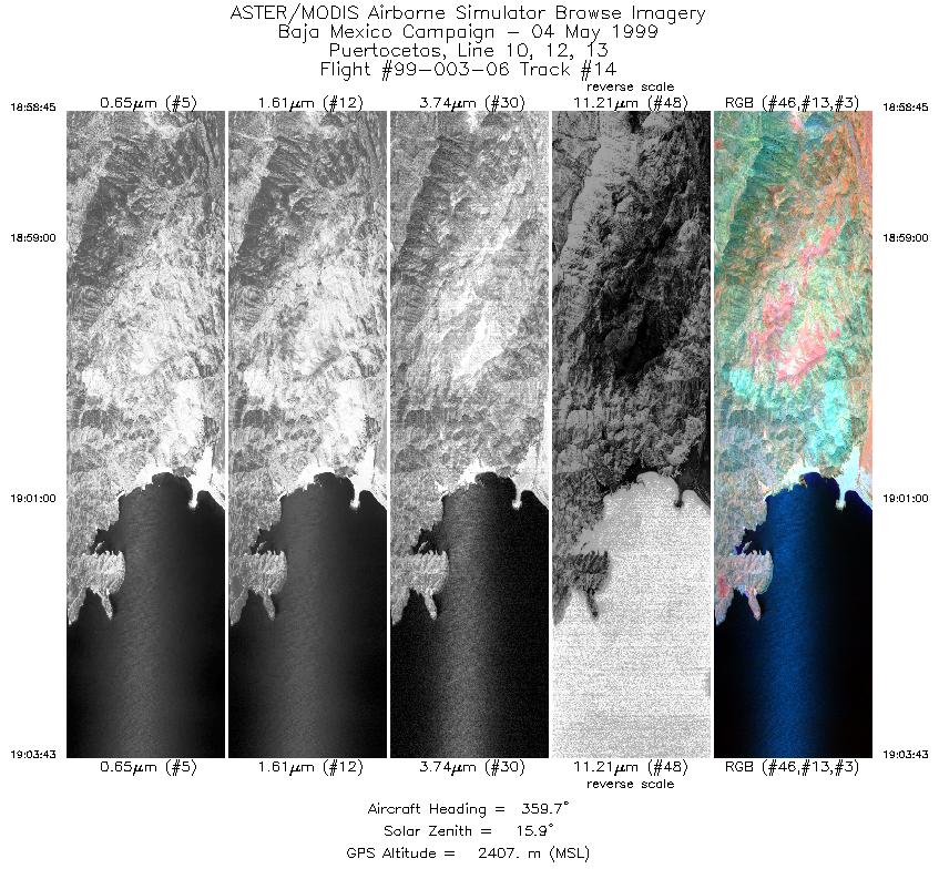
| 14 |
18:58 - 19:00 |
346.7 |
29.702 - 29.774 |
114.275 - 114.303 |
2923 |
2407 |
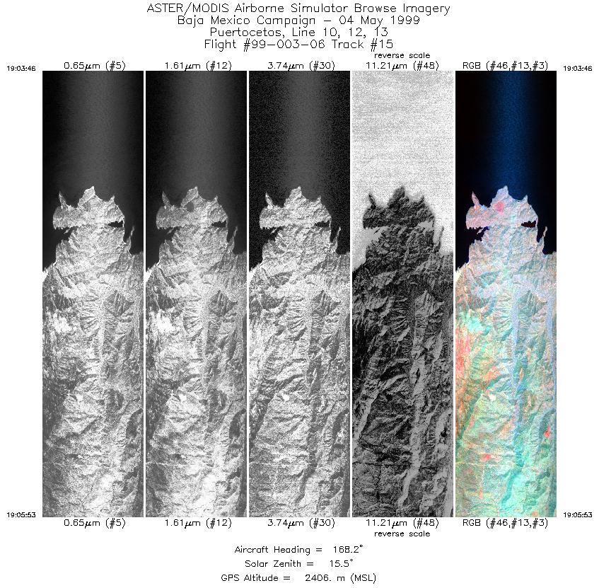
| 15 |
19:03 - 19:05 |
167.9 |
29.801 - 29.693 |
114.293 - 114.246 |
3158 |
2406 |
|


