Flight: 99-003-05
Date: May 3, 1999
Aircraft: DOE B-200 Kingair
Deployment: Baja 1999
Flight Location: Tres Virgenes, Baja Mexico
Principal Investigator: Stock (JPL)
Additional Sensors:
|
Data Evaluation
N/A
|
Processing Information
Level-1B Data in HDF format is available
Flight Line Summary
Spectral Band Configuration
Spectral Response Function Table
Spectral Response Function (text)
|
Browse Imagery
Flight Tracks: 34
Scanlines: 192551
|
Browse Imagery Table
|
Click a Flight Track number to view a quicklook image
Lat/Lon ranges are for the BEG-END scanline nadir pixels
|
Flight
Track |
Time Span
(UTC) |
Heading
(Deg) |
Lat Range
(Deg N) |
Lon Range
(Deg W) |
Length
(Scanlines) |
Altitude
(Meters) |
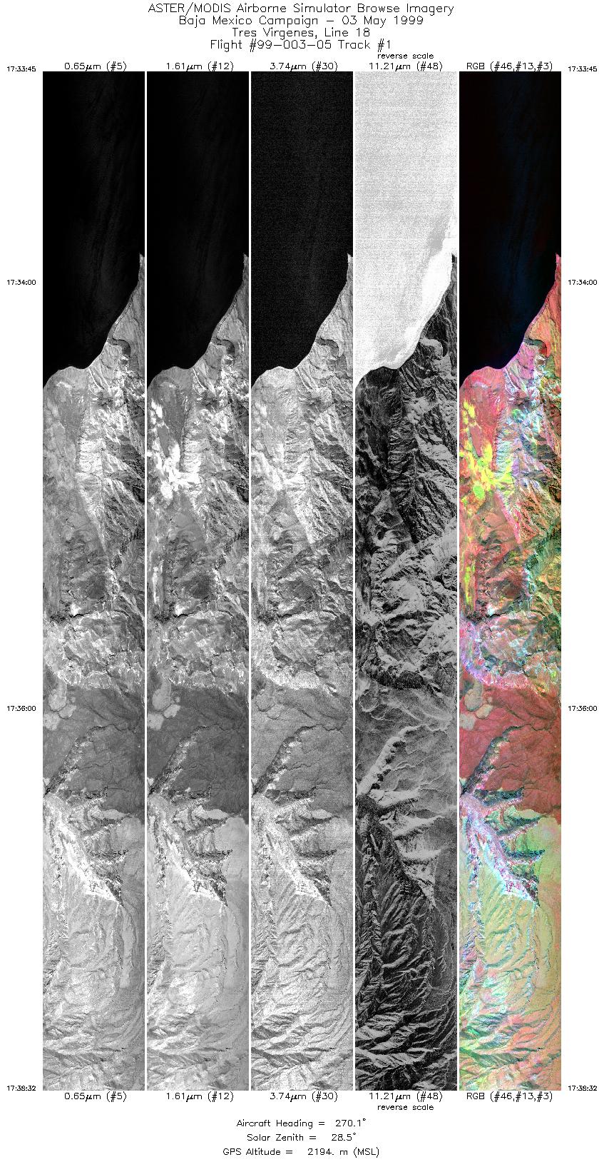
| 1 |
17:33 - 17:38 |
270.0 |
27.533 - 27.533 |
112.287 - 112.525 |
7143 |
2194 |
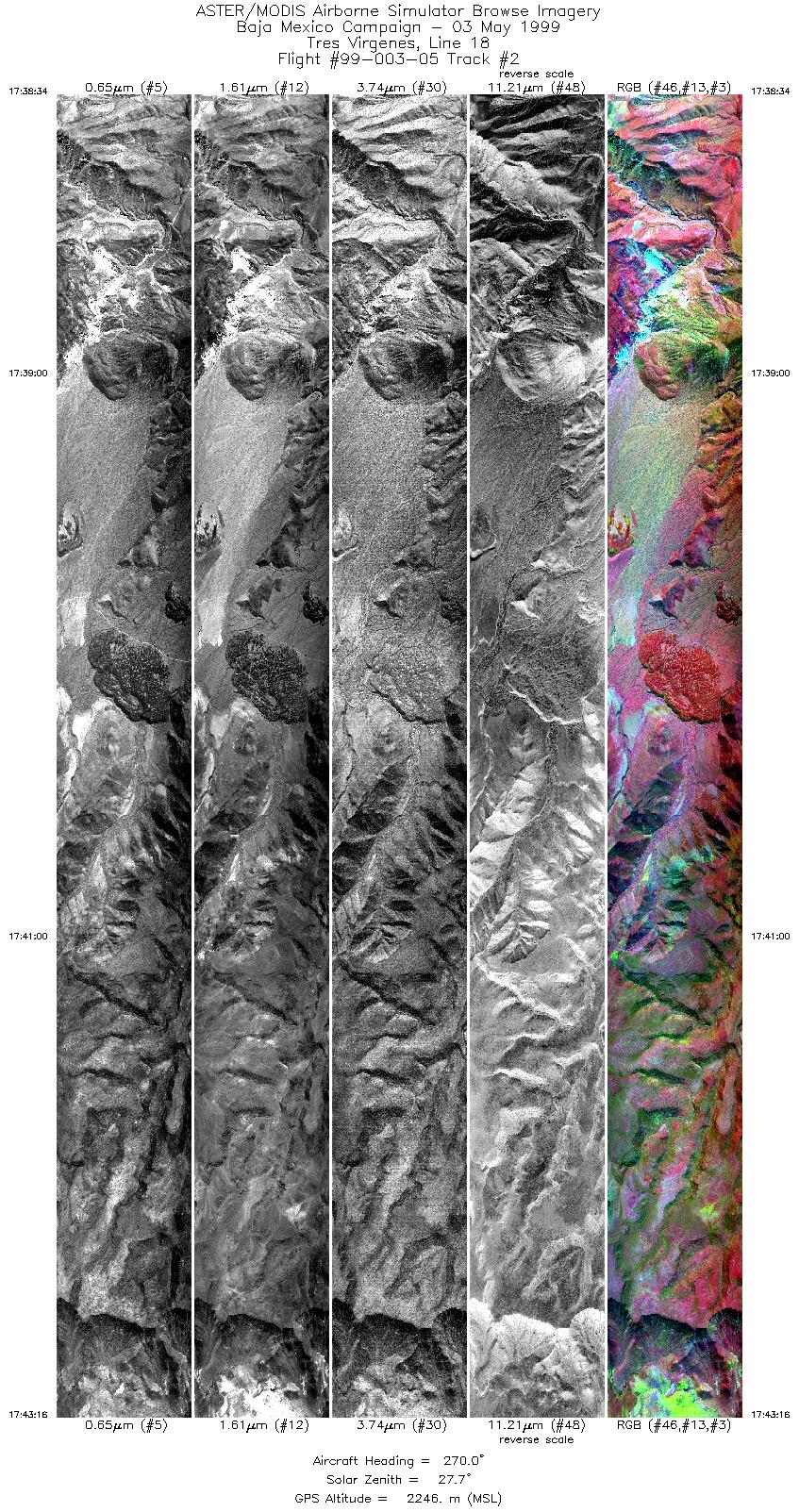
| 2 |
17:38 - 17:43 |
270.0 |
27.533 - 27.533 |
112.528 - 112.761 |
7018 |
2246 |
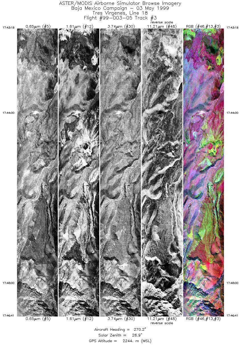
| 3 |
17:43 - 17:46 |
270.1 |
27.533 - 27.533 |
112.761 - 112.922 |
5052 |
2244 |
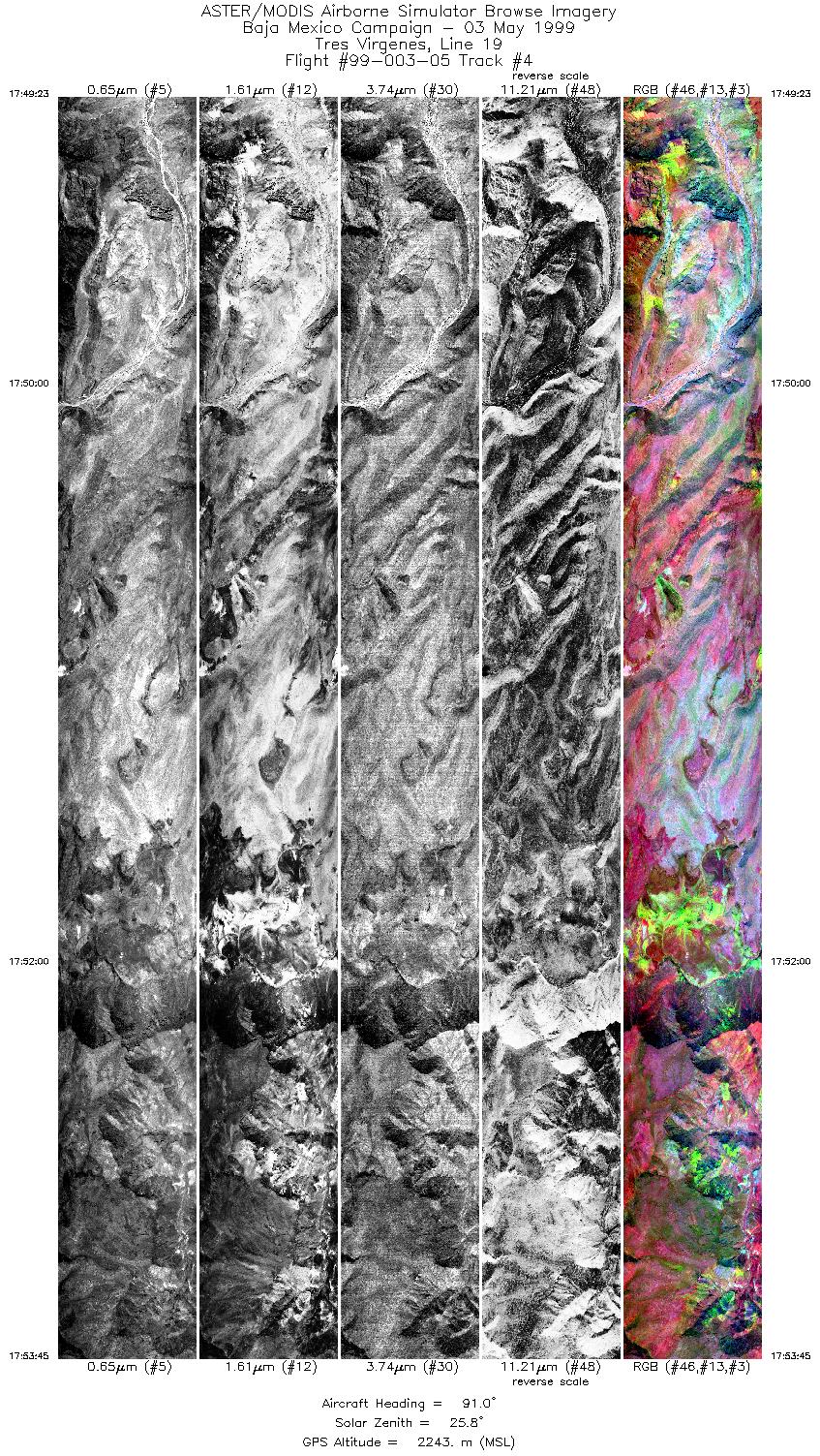
| 4 |
17:49 - 17:53 |
90.1 |
27.550 - 27.550 |
112.914 - 112.682 |
6518 |
2243 |
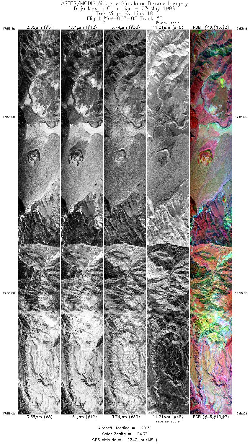
| 5 |
17:53 - 17:58 |
90.1 |
27.550 - 27.550 |
112.681 - 112.454 |
6518 |
2240 |
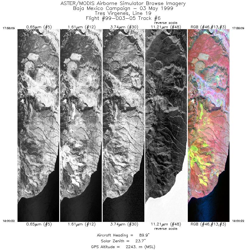
| 6 |
17:58 - 18:00 |
90.0 |
27.550 - 27.550 |
112.455 - 112.342 |
3310 |
2243 |
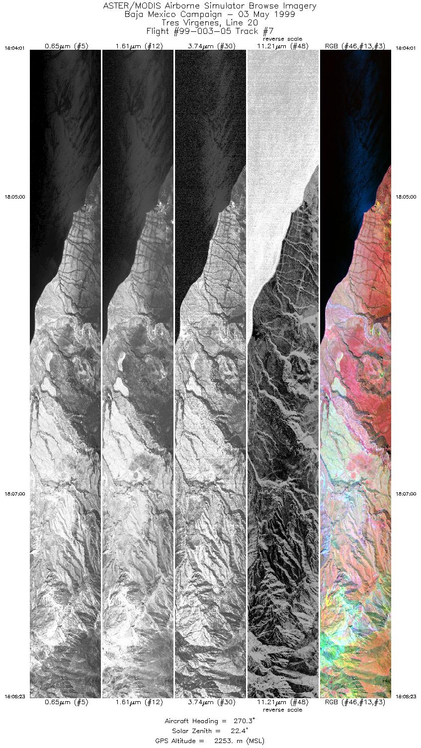
| 7 |
18:04 - 18:08 |
270.0 |
27.567 - 27.567 |
112.317 - 112.534 |
6516 |
2253 |
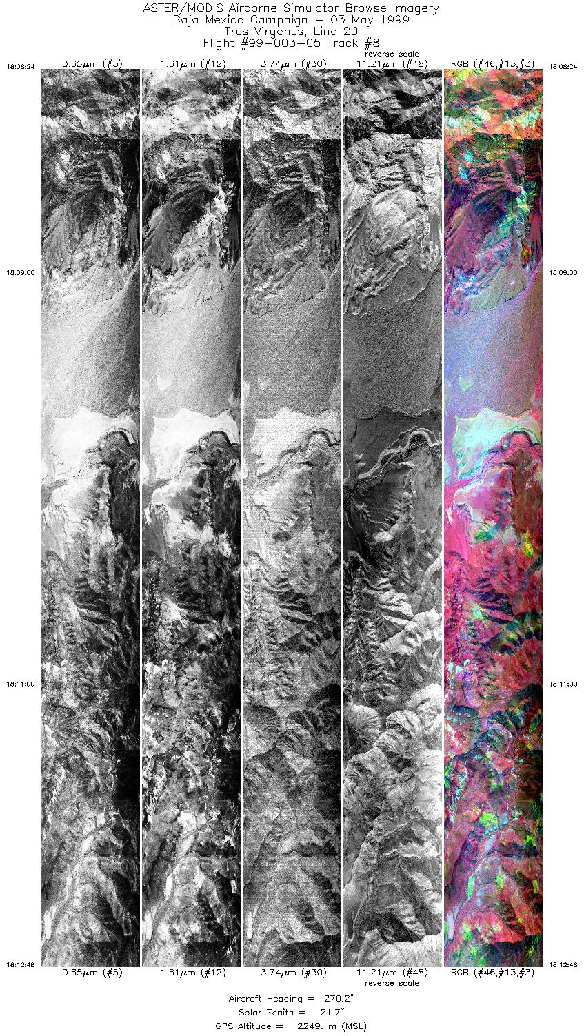
| 8 |
18:08 - 18:12 |
270.1 |
27.567 - 27.567 |
112.536 - 112.750 |
6517 |
2249 |
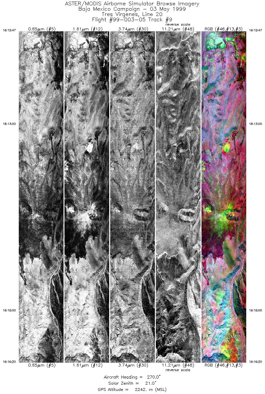
| 9 |
18:12 - 18:16 |
270.0 |
27.567 - 27.567 |
112.751 - 112.919 |
5298 |
2242 |
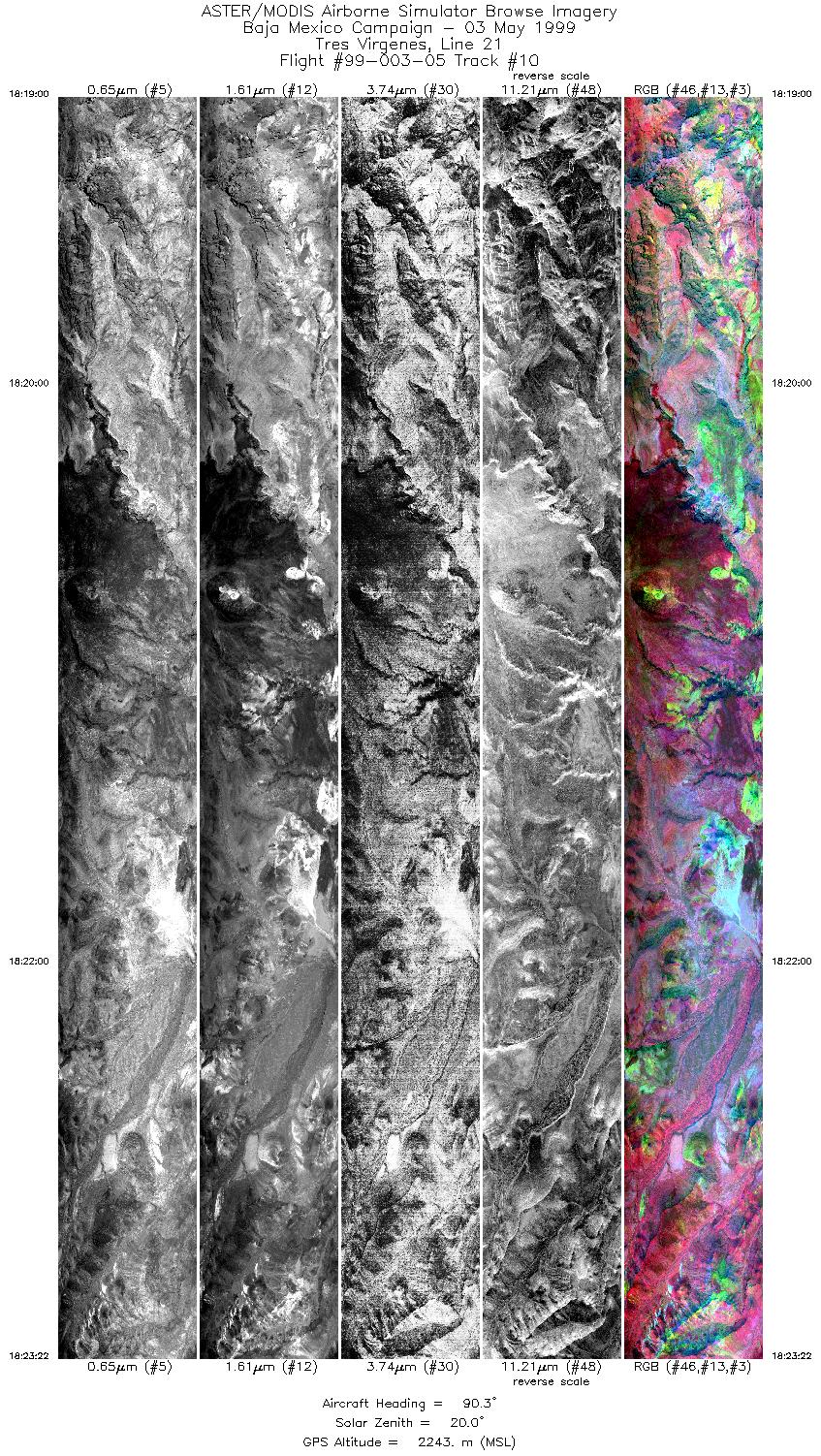
| 10 |
18:19 - 18:23 |
90.2 |
27.584 - 27.583 |
112.931 - 112.702 |
6515 |
2243 |
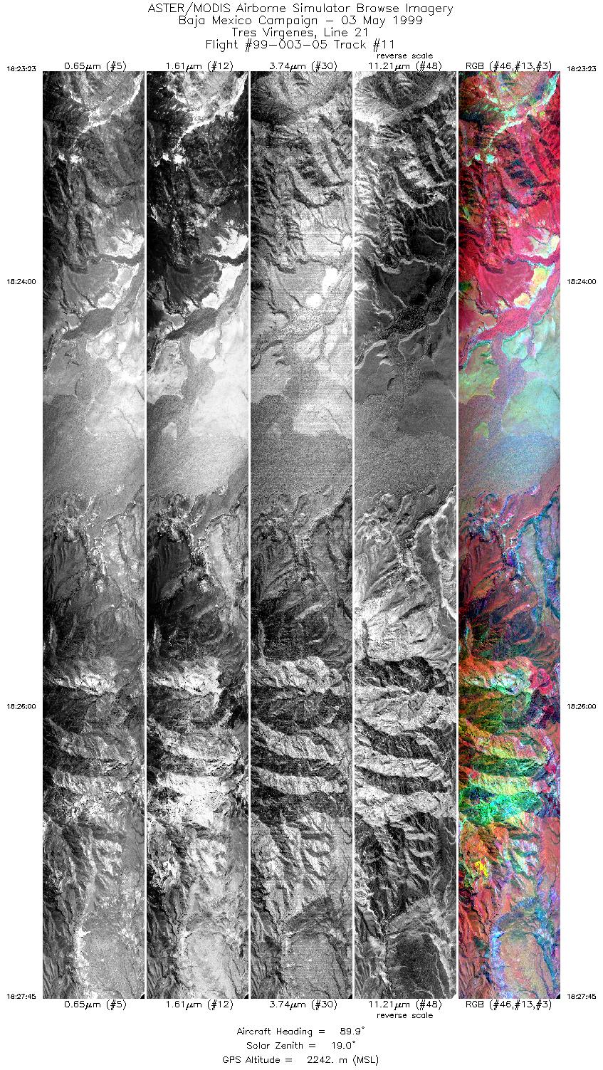
| 11 |
18:23 - 18:27 |
89.9 |
27.583 - 27.583 |
112.700 - 112.468 |
6516 |
2242 |
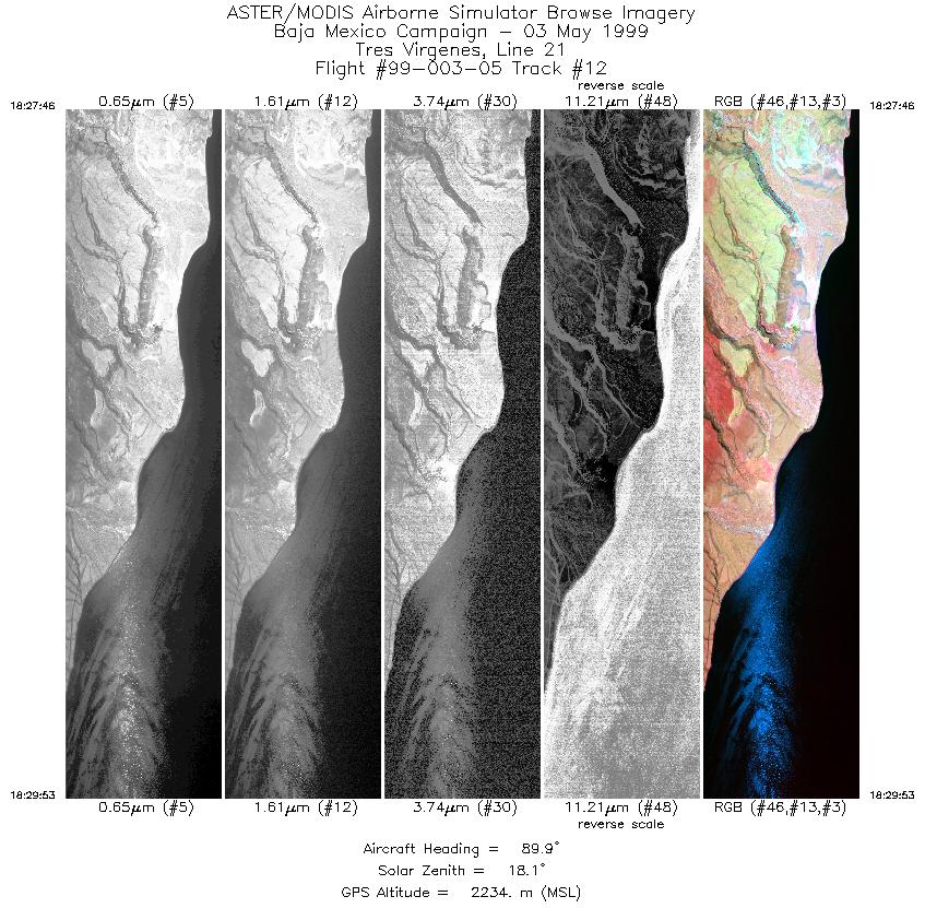
| 12 |
18:27 - 18:29 |
90.1 |
27.583 - 27.583 |
112.468 - 112.360 |
3158 |
2234 |
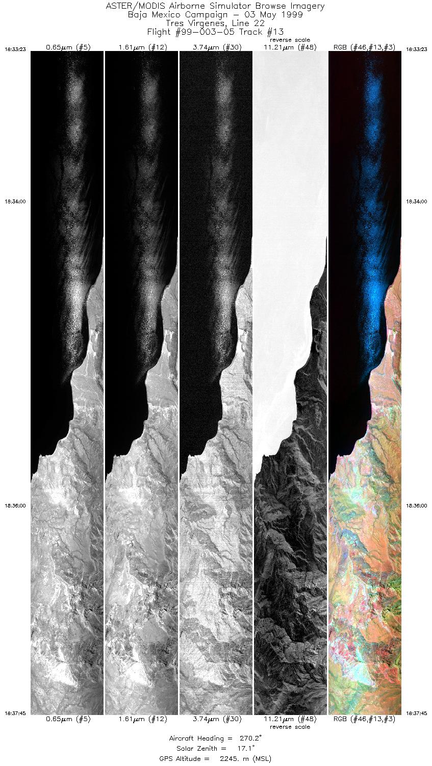
| 13 |
18:33 - 18:37 |
270.1 |
27.600 - 27.600 |
112.342 - 112.561 |
6515 |
2245 |
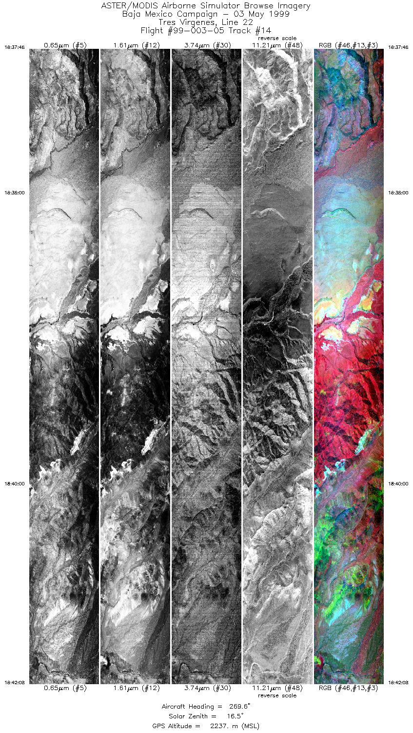
| 14 |
18:37 - 18:42 |
269.9 |
27.600 - 27.600 |
112.562 - 112.778 |
6515 |
2237 |
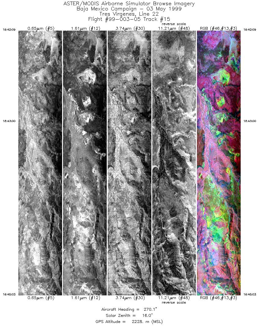
| 15 |
18:42 - 18:45 |
270.0 |
27.600 - 27.600 |
112.778 - 112.919 |
4326 |
2228 |
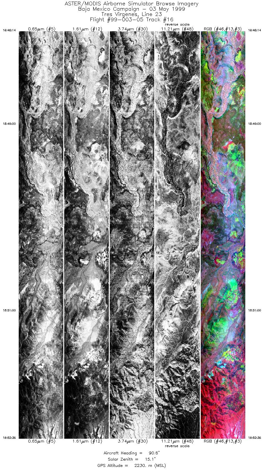
| 16 |
18:48 - 18:52 |
90.1 |
27.617 - 27.617 |
112.900 - 112.670 |
6515 |
2230 |
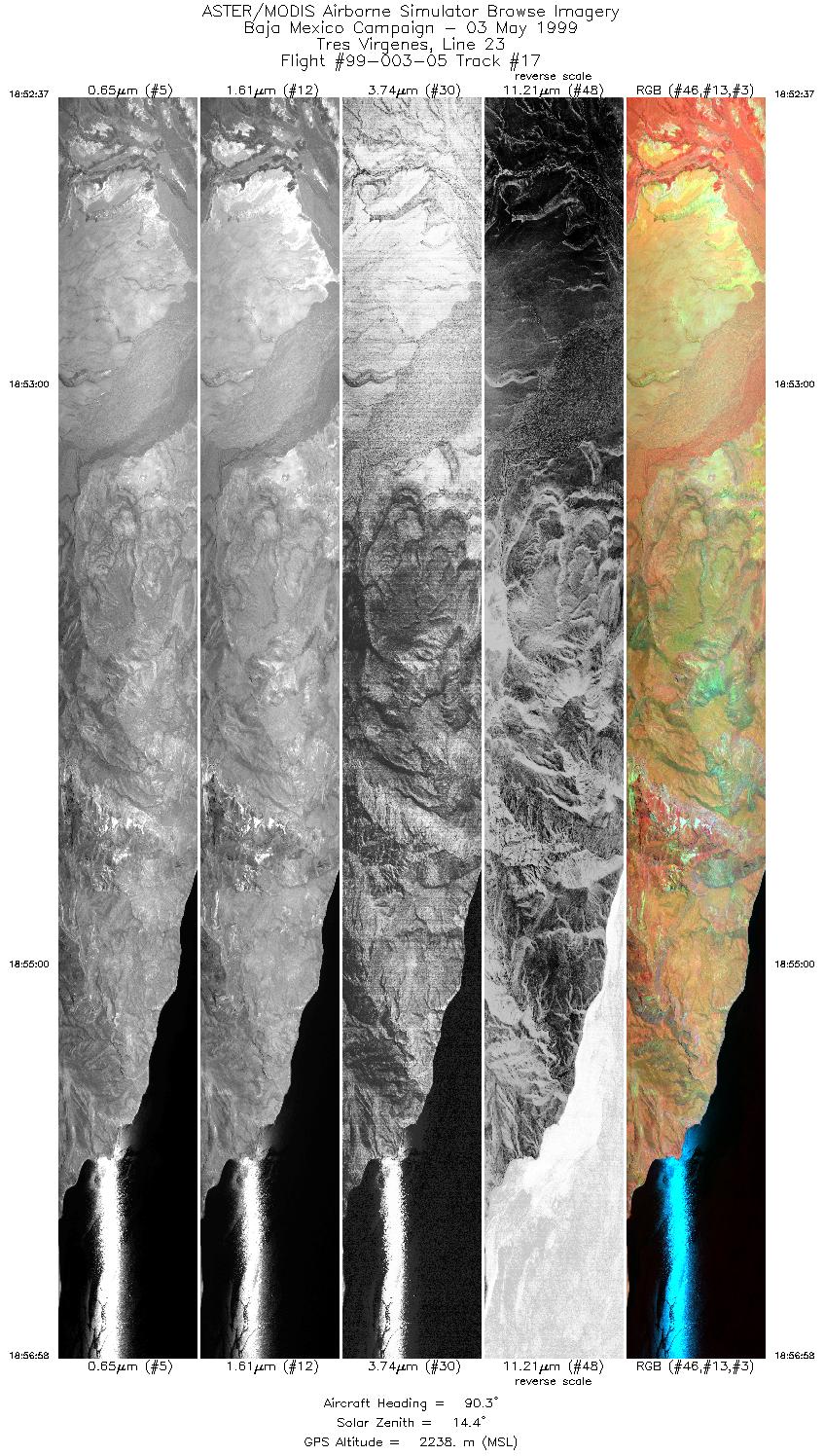
| 17 |
18:52 - 18:56 |
90.0 |
27.617 - 27.617 |
112.669 - 112.438 |
6490 |
2238 |
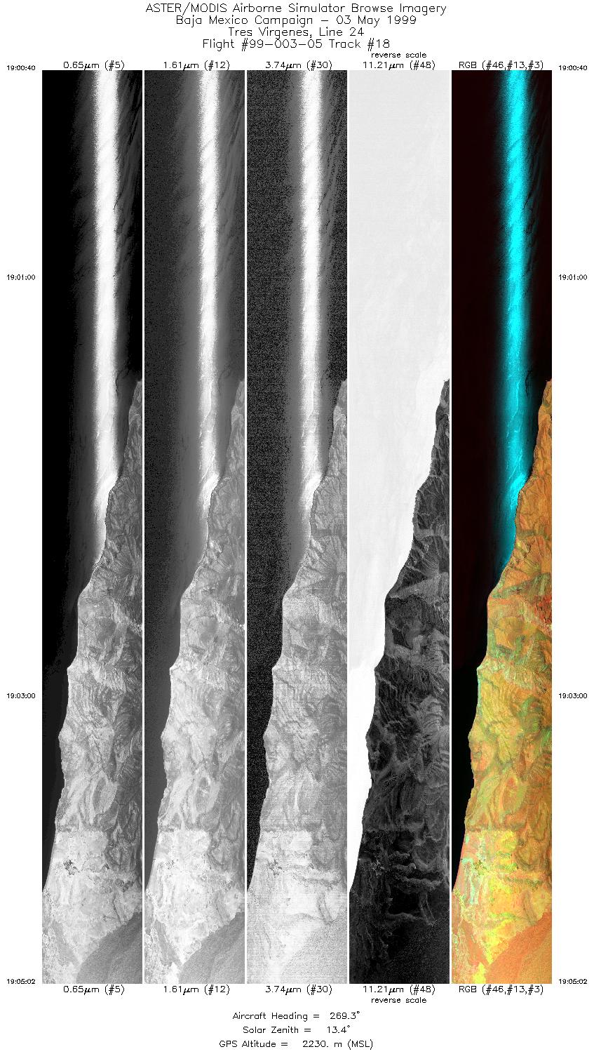
| 18 |
19:00 - 19:05 |
269.8 |
27.633 - 27.633 |
112.407 - 112.620 |
6515 |
2230 |
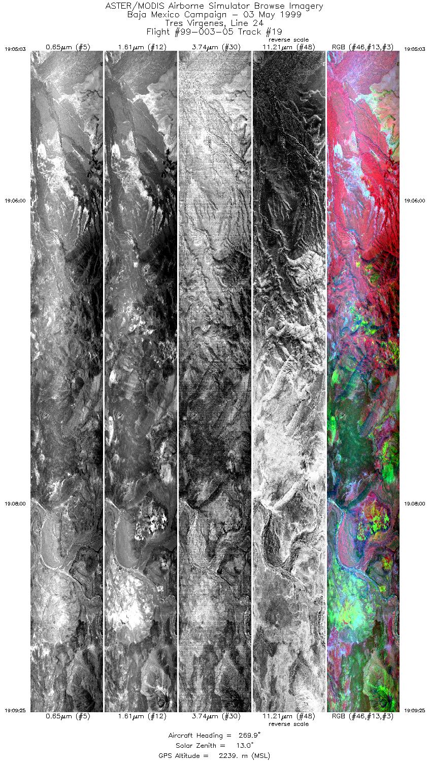
| 19 |
19:05 - 19:09 |
270.0 |
27.633 - 27.633 |
112.621 - 112.832 |
6514 |
2239 |
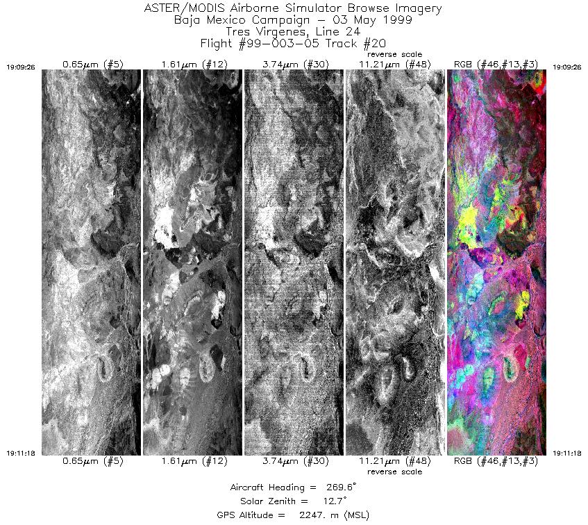
| 20 |
19:09 - 19:11 |
269.7 |
27.633 - 27.633 |
112.832 - 112.919 |
2785 |
2247 |
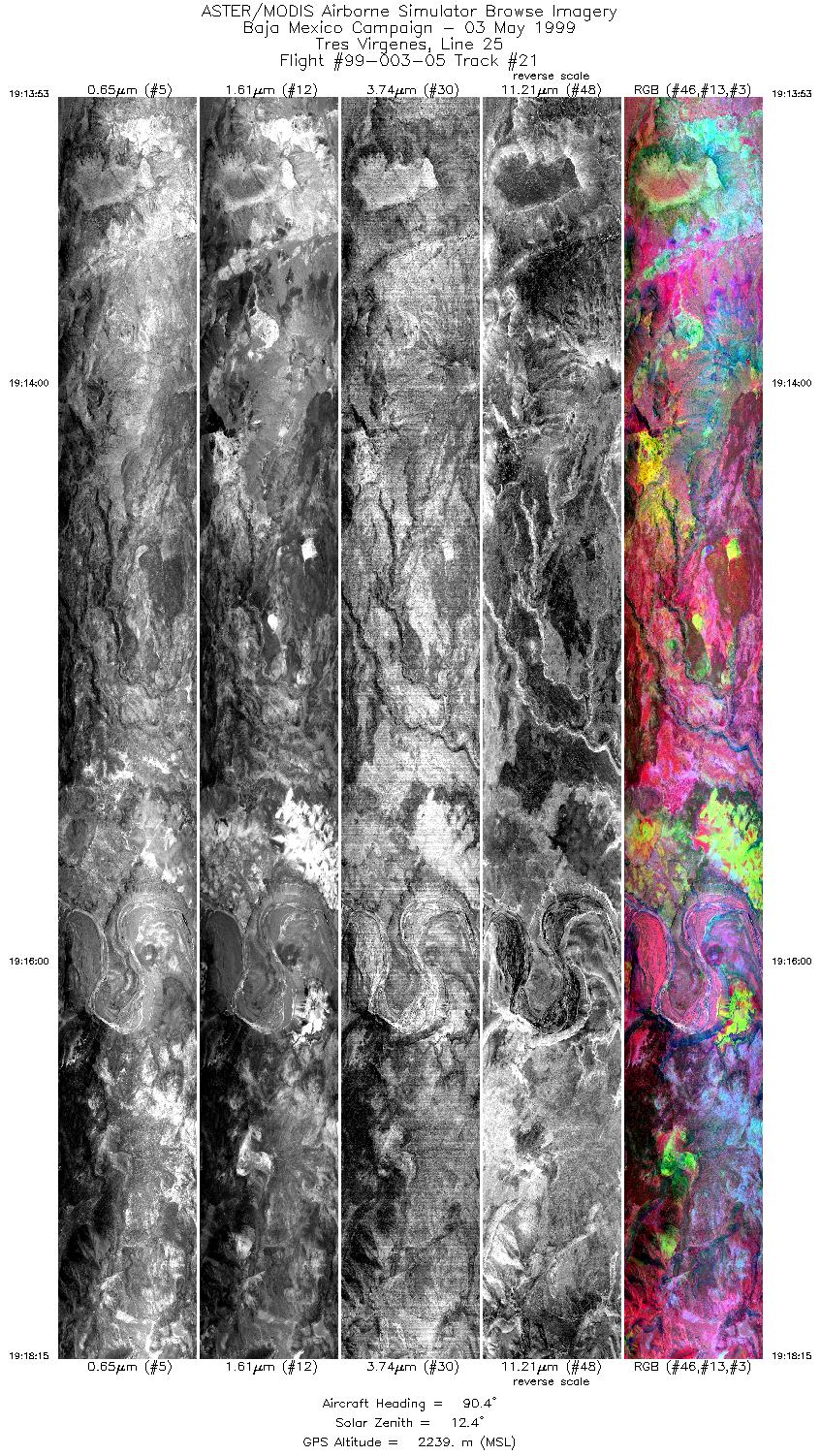
| 21 |
19:13 - 19:18 |
90.0 |
27.650 - 27.650 |
112.933 - 112.705 |
6514 |
2239 |
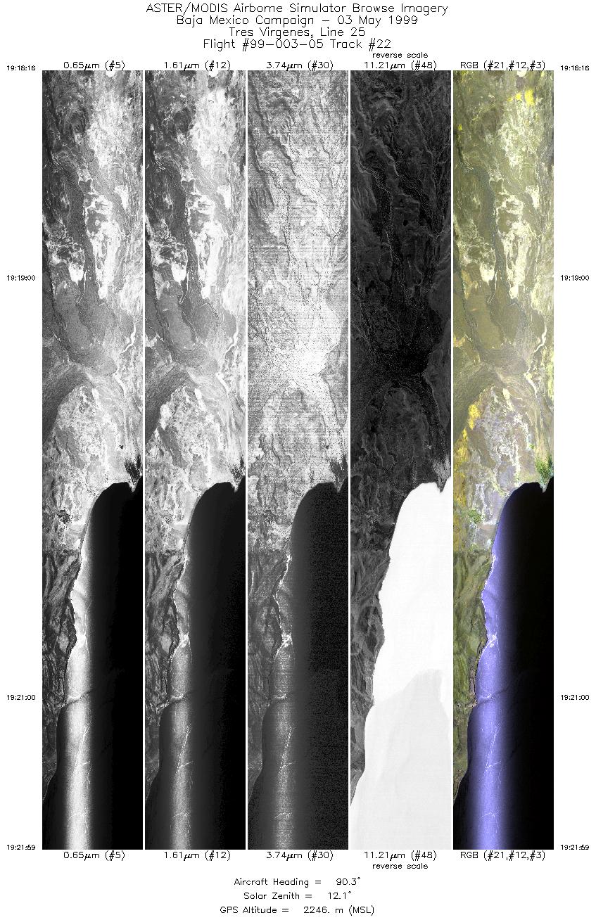
| 22 |
19:18 - 19:21 |
90.1 |
27.650 - 27.650 |
112.703 - 112.510 |
5544 |
2246 |
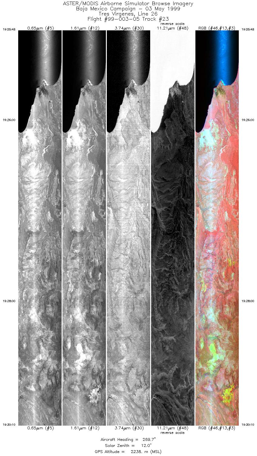
| 23 |
19:25 - 19:30 |
269.9 |
27.667 - 27.667 |
112.571 - 112.784 |
6512 |
2238 |
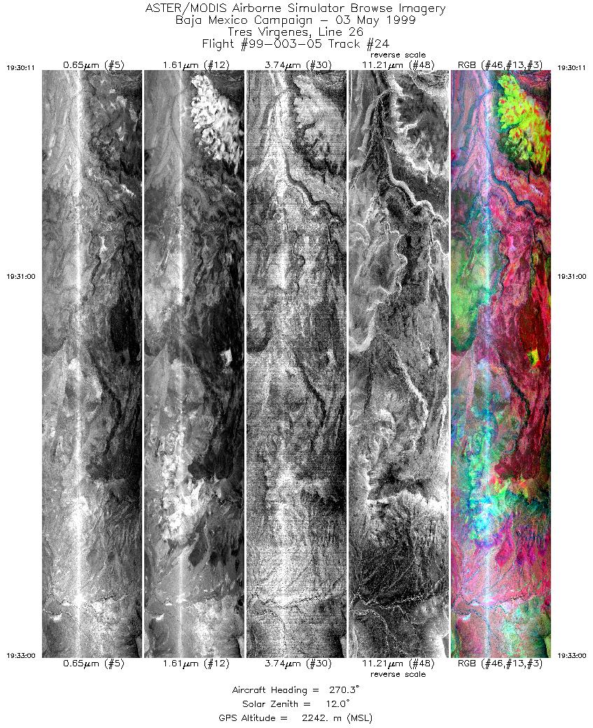
| 24 |
19:30 - 19:33 |
270.0 |
27.667 - 27.667 |
112.785 - 112.920 |
4201 |
2242 |
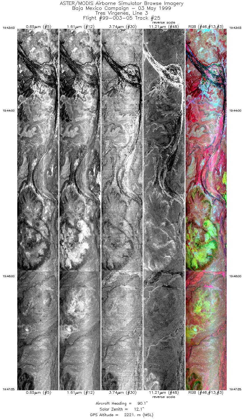
| 25 |
19:43 - 19:47 |
90.0 |
27.283 - 27.283 |
112.932 - 112.702 |
6512 |
2221 |
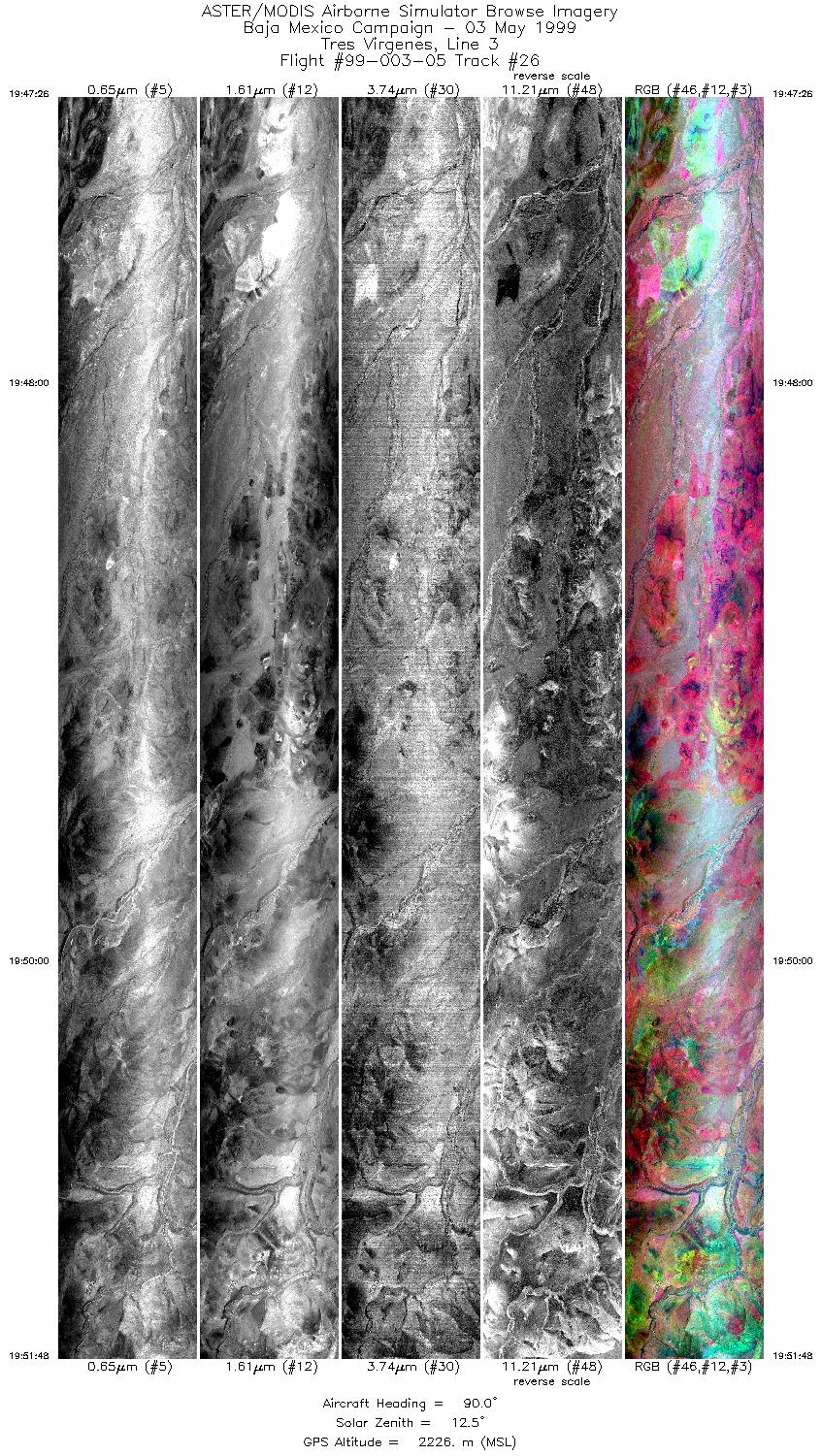
| 26 |
19:47 - 19:51 |
90.0 |
27.283 - 27.283 |
112.701 - 112.475 |
6512 |
2226 |
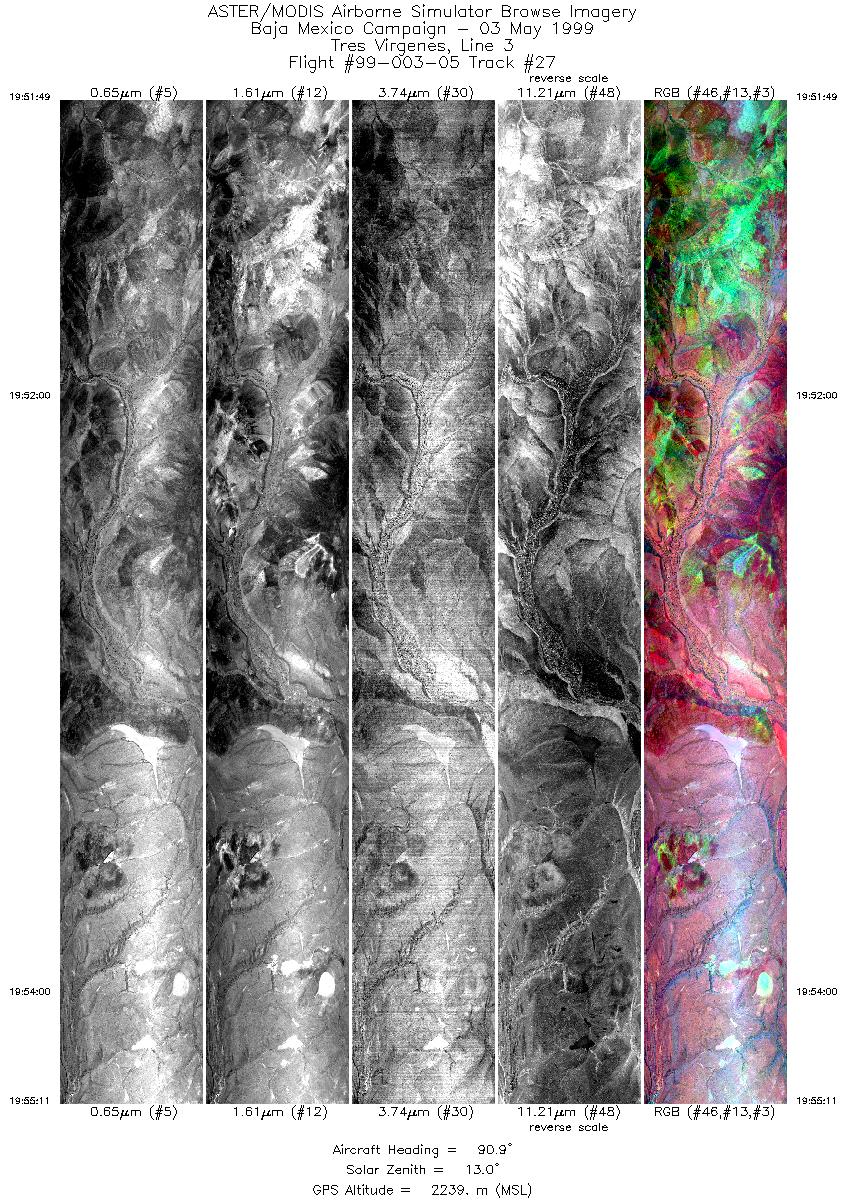
| 27 |
19:51 - 19:55 |
89.9 |
27.283 - 27.283 |
112.475 - 112.298 |
5020 |
2239 |
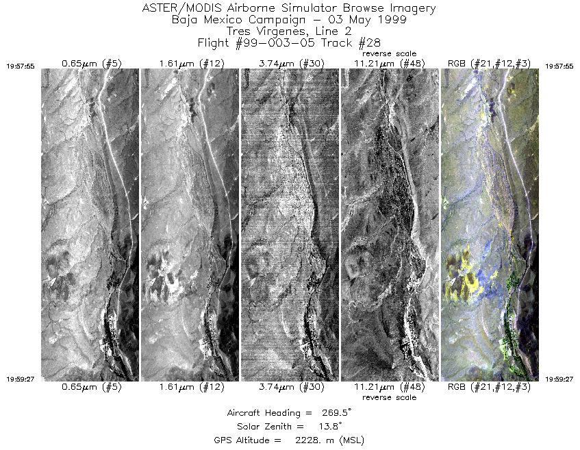
| 28 |
19:57 - 19:59 |
269.7 |
27.267 - 27.267 |
112.288 - 112.364 |
2287 |
2228 |
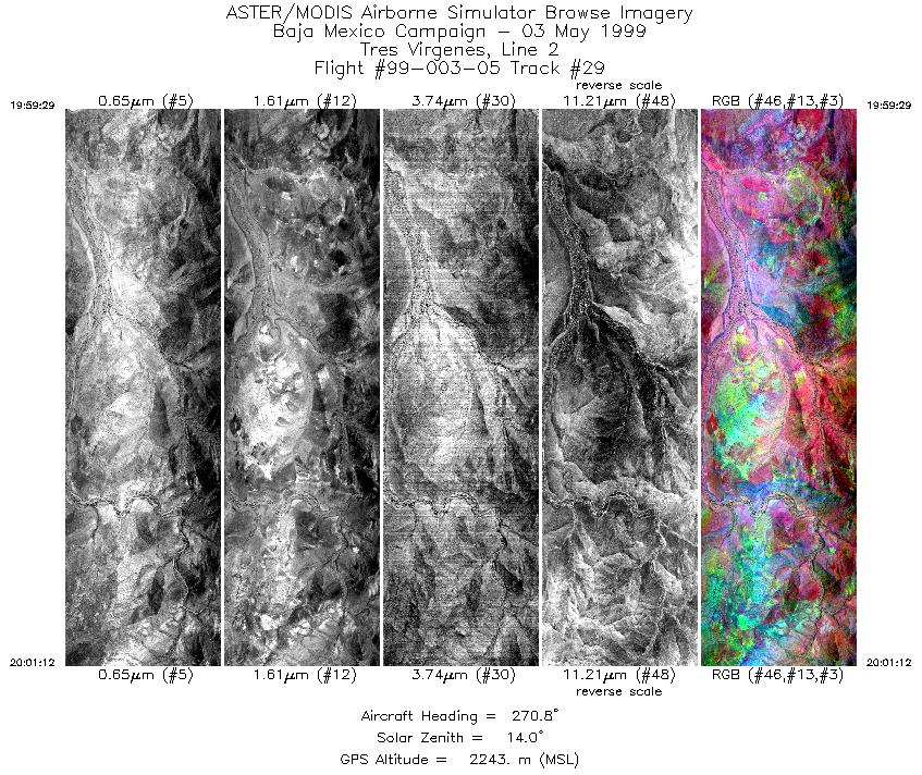
| 29 |
19:59 - 20:01 |
269.9 |
27.267 - 27.267 |
112.365 - 112.454 |
2561 |
2243 |
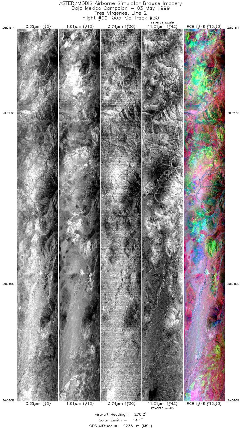
| 30 |
20:01 - 20:05 |
270.1 |
27.267 - 27.267 |
112.456 - 112.672 |
6512 |
2235 |
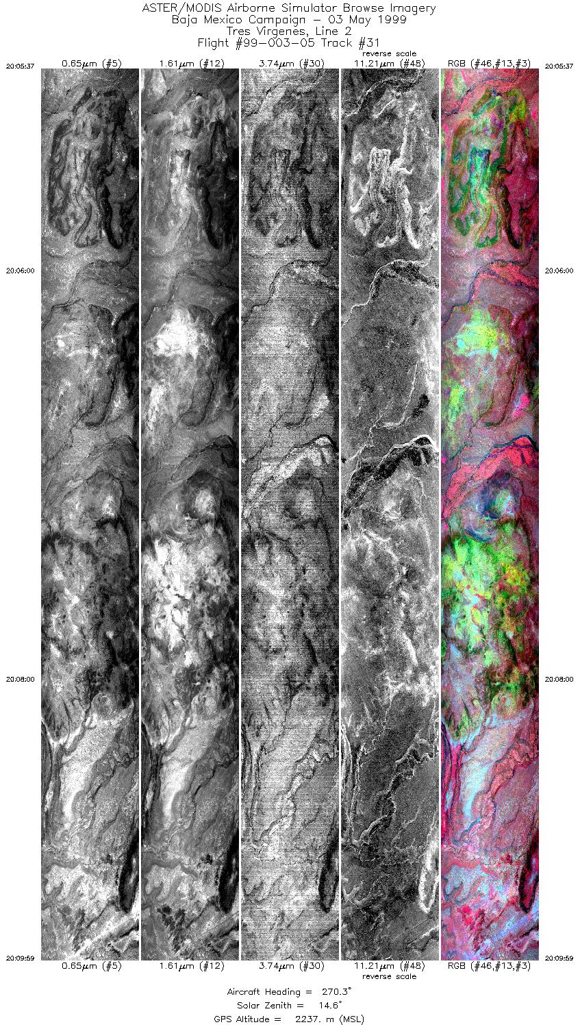
| 31 |
20:05 - 20:09 |
269.9 |
27.267 - 27.267 |
112.673 - 112.889 |
6511 |
2237 |
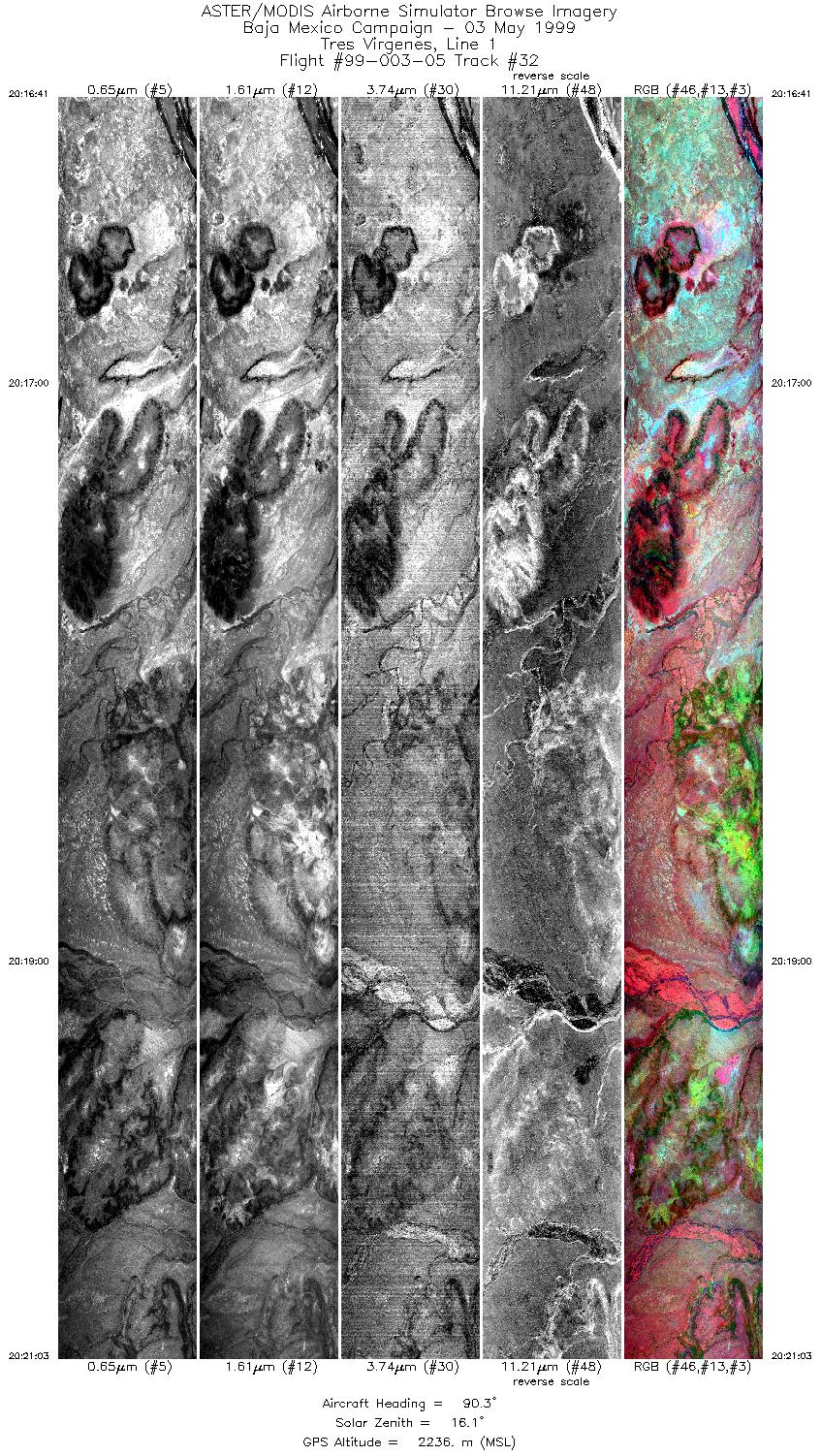
| 32 |
20:16 - 20:21 |
89.9 |
27.250 - 27.250 |
112.932 - 112.702 |
6510 |
2236 |
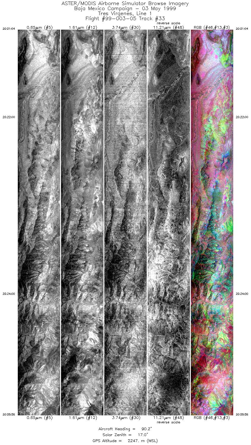
| 33 |
20:21 - 20:25 |
90.1 |
27.250 - 27.250 |
112.701 - 112.471 |
6510 |
2247 |
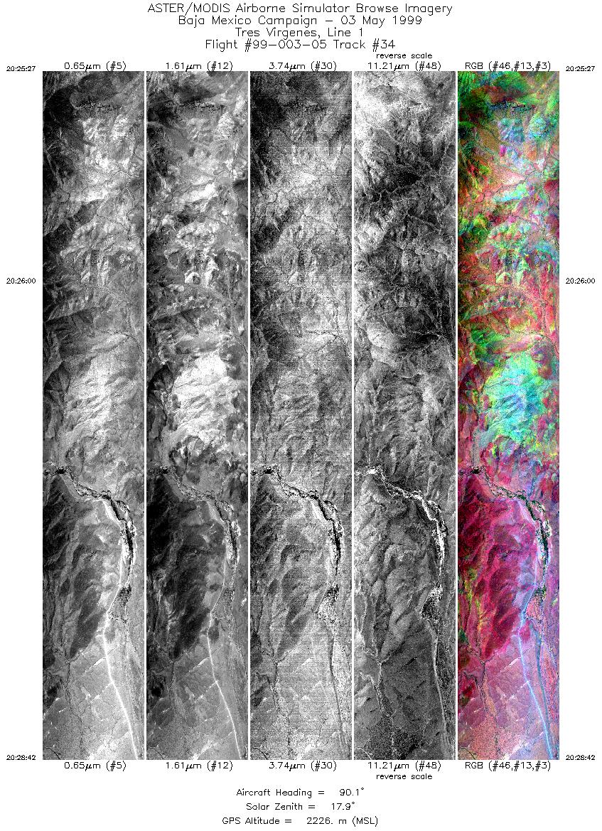
| 34 |
20:25 - 20:28 |
90.1 |
27.250 - 27.250 |
112.471 - 112.299 |
4846 |
2240 |
|


